After setting multiple record high temperatures during the heatwave last week followed by a pleasantly cooler weekend, this week our temperatures will stay mostly above normal with some chances for rain mixed in as the remnants of Hurricane Kay pass across the Rockies. The week will end warm and mostly dry with that same trend continuing through the upcoming weekend. Let’s take a look at the weather week ahead for the Front Range.
This week’s highlights include:
- A ridge of high pressure will keep things quiet and warm Monday and Tuesday, but it will be smoky
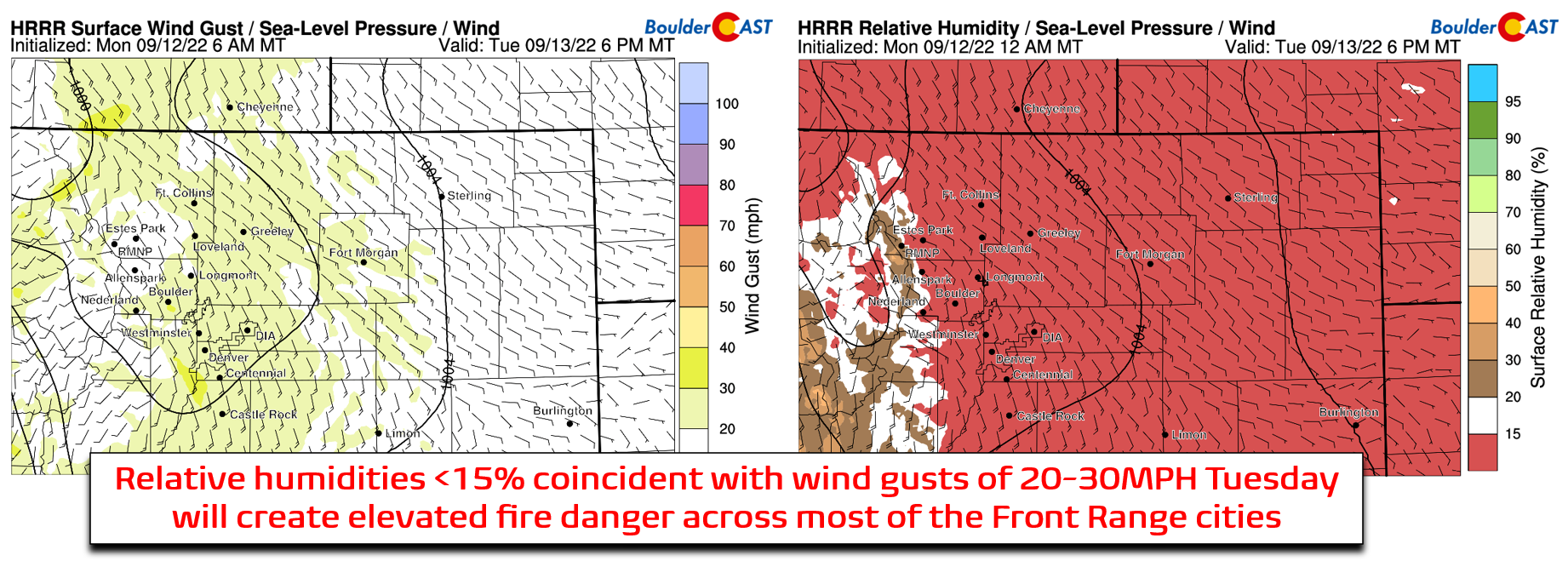
- Use caution on Tuesday as fire danger will be elevated with gusty winds of 20 to 30 MPH in the afternoon and evening
- The moist leftovers of Hurricane Kay will get swept across the Rockies Wednesday and Thursday leading to a chance of rain
- Temperatures stay in the 80s to end the week and through the weekend, with mostly dry weather
- A deep trough will develop across the West Coast over the weekend — its impacts next week for the Front Range are uncertain
DISCLAIMER: This weekly outlook forecast is created Monday morning and covers the entire upcoming week. Accuracy will decrease as the week progresses as this post is NOT updated. To receive daily updated forecasts from our team, among many other perks, subscribe to BoulderCAST Premium.
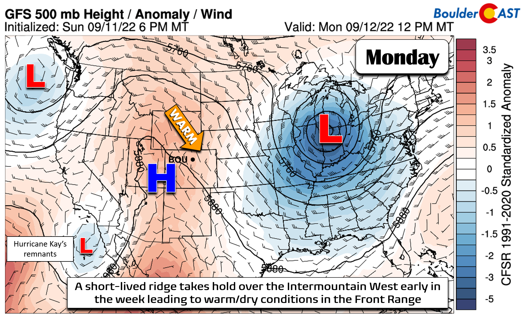
A
ridge of high pressure will be situated across the Intermountain West early in the week allowing for a warm-up of our temperatures back above normal. This ridge won’t be nearly as strong as the heatwave-spawning one last week, but it will still allow for temperatures to rise well into the 80s across the Denver Metro area.
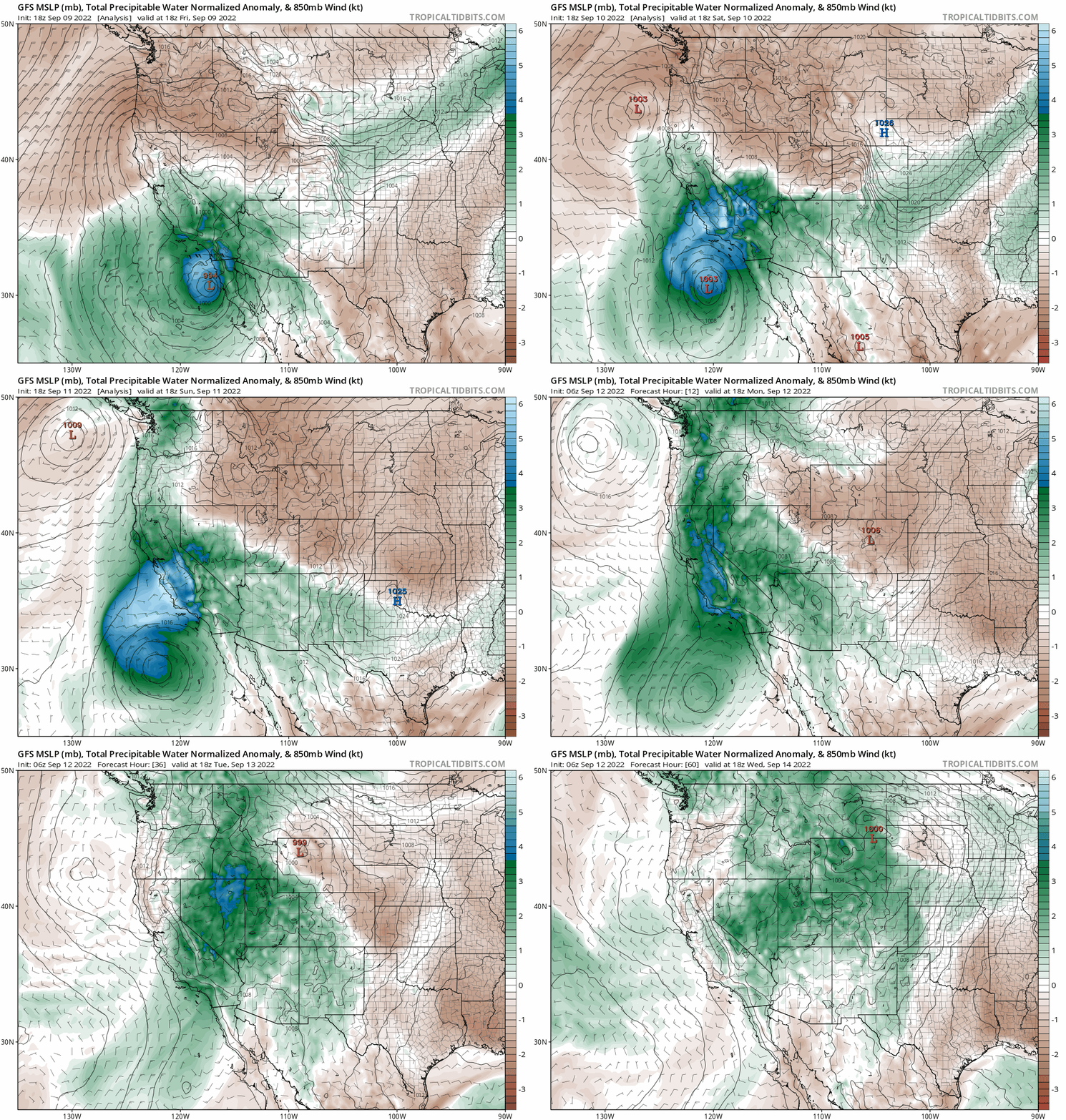
Elsewhere across the nation, a strong cut-off low is located near Chicago this morning and another weaker trough is coming ashore into the Pacific Northwest. (Former) Hurricane Kay’s moisture-rich remnants remain offshore of Baja California — eventually this moisture pool will be a factor in our forecast later this week.
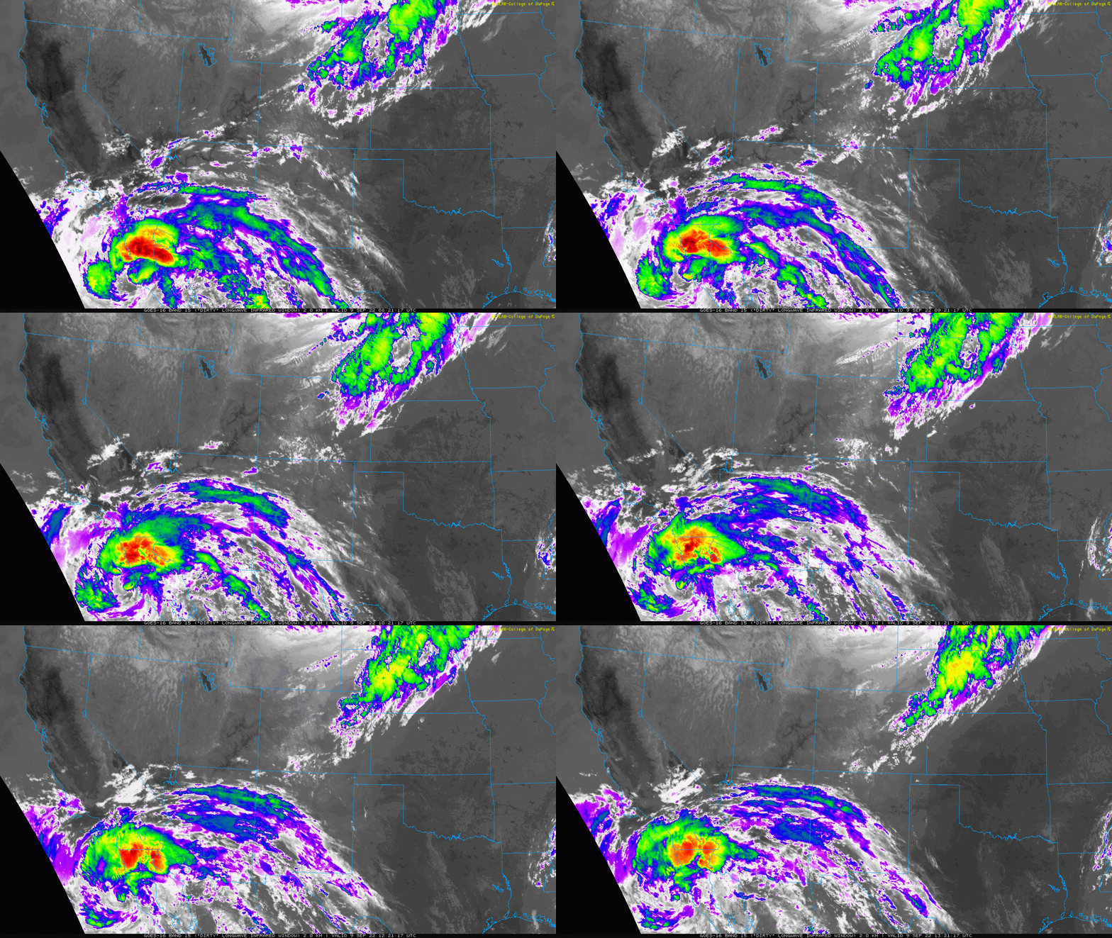
Infrared satellite animation from Friday (Sep 9, 2022) showing a rare happening: Tropical Storm Kay was directly impacting southern California with heavy rain!
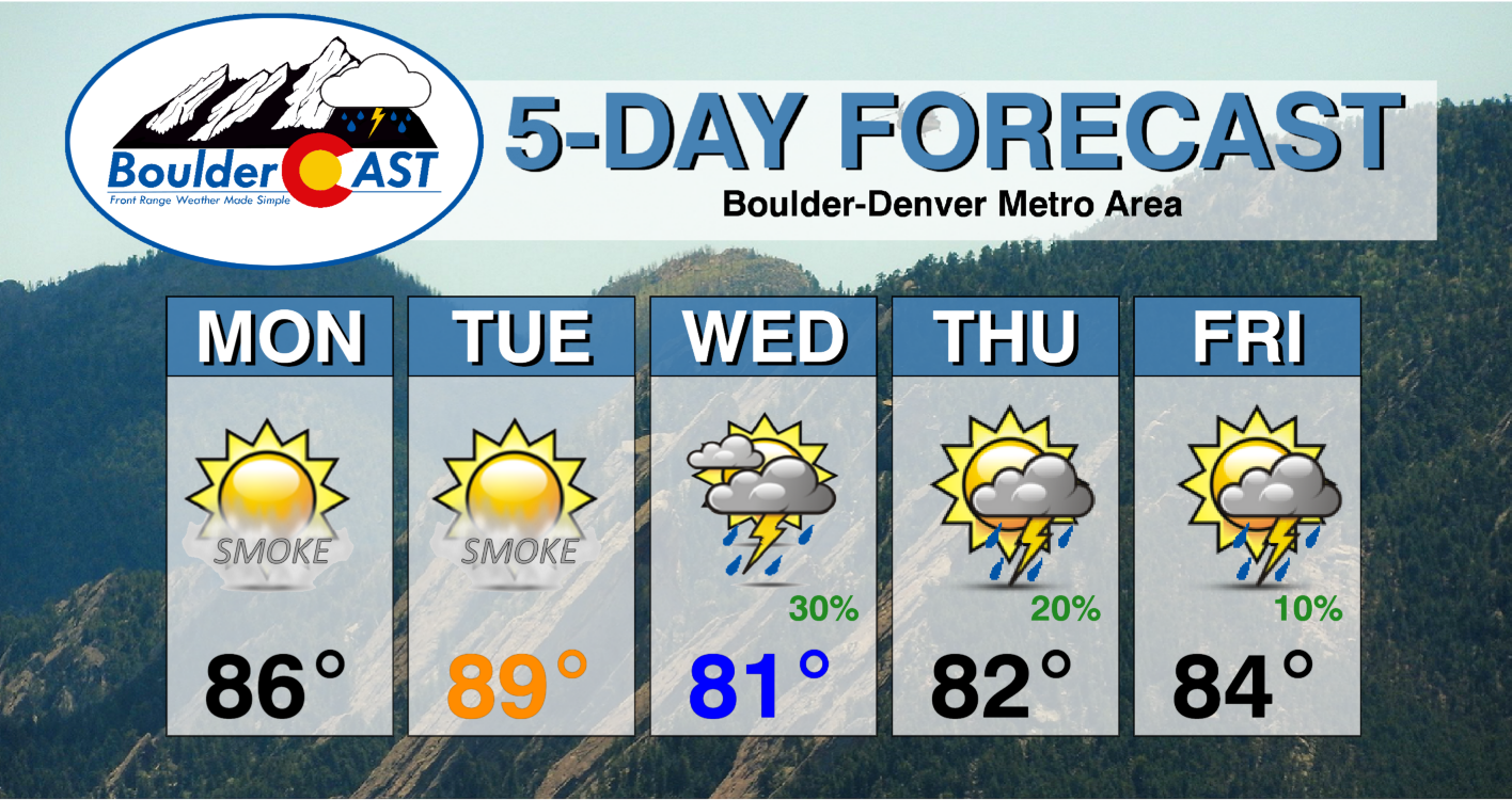
Highs on Monday will be in the middle 80s alongside abundant sunshine, with upper 80s but more clouds expected on Tuesday. Both days will be dry on the lowlands.
The main concern for Tuesday will be the increased fire danger. The risk looks highest for the Palmer Divide, but it will also be elevated across the entire Boulder-Denver area as well. Winds gusting 20 to 30 MPH are just marginal for Red Flag Warnings to be issued. Regardless of any official warnings, be careful and aware of the fire danger on Tuesday!
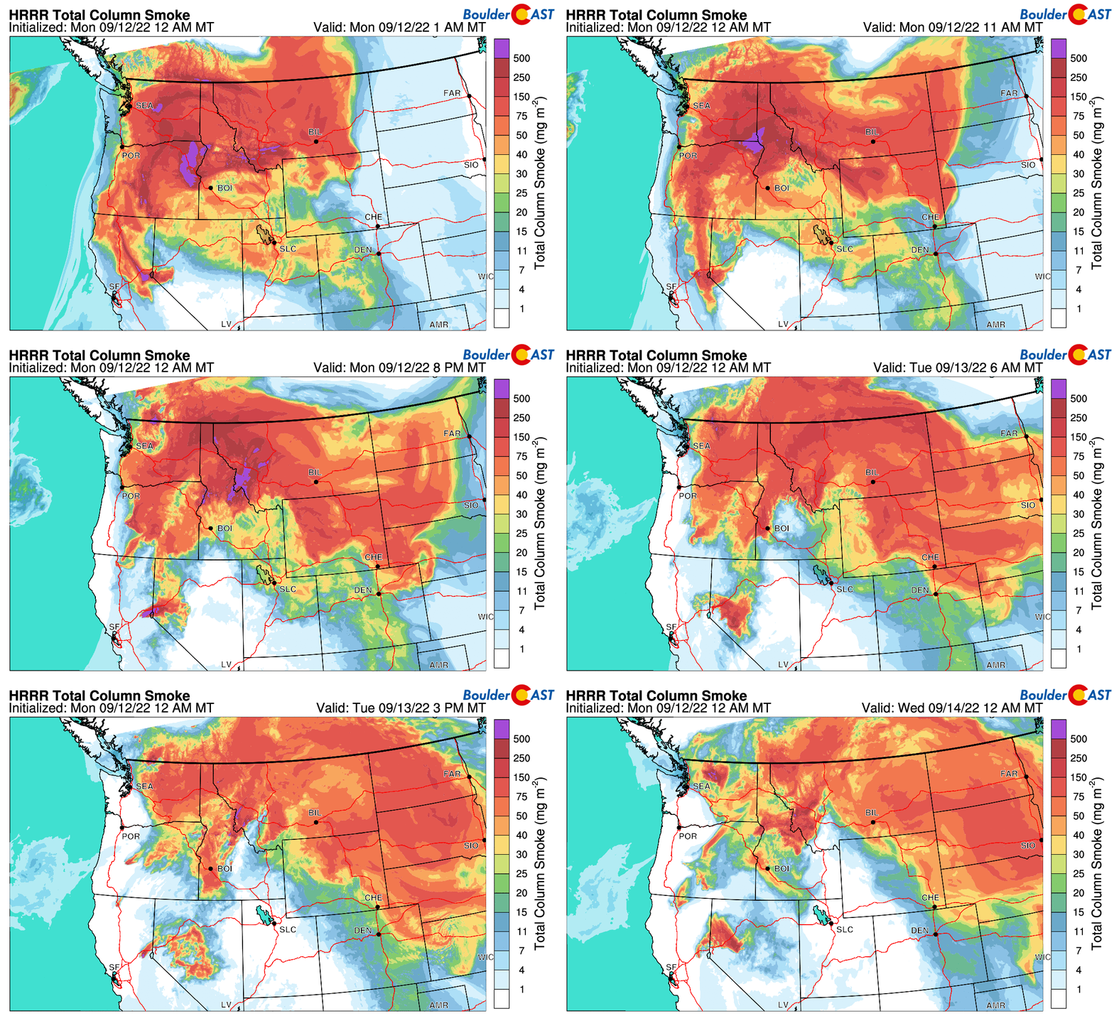
With the large-scale atmospheric flow coming to Colorado from the northwest initially, wildfire smoke will be on the rise Monday into Tuesday after the brief reprieve we had this past weekend. All of the biggest fires are burning in Washington, Oregon, California and Idaho right now — directly upstream for the time being. Smoke is forecast to increase across the Front Range late Monday afternoon and stick around until Tuesday night.
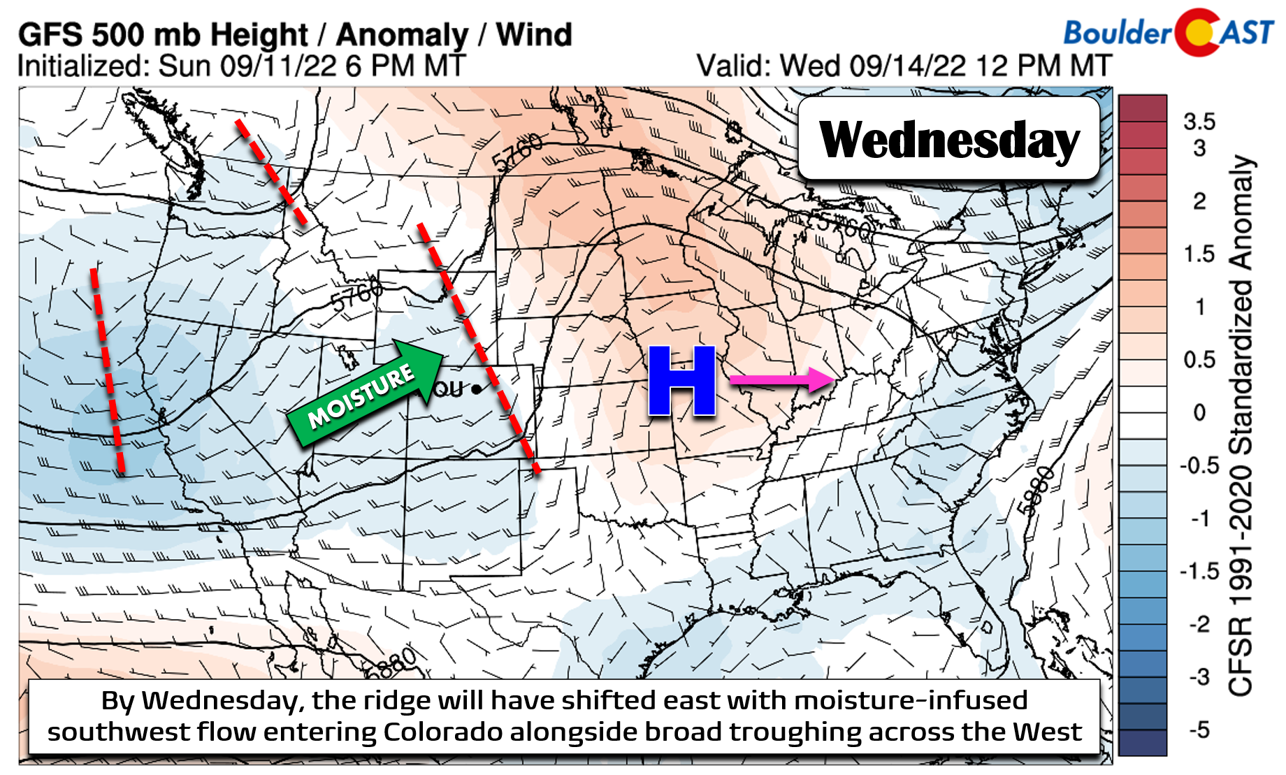
It’s not until late Tuesday and Wednesday that we start to see the ridge break down and a broad trough develop across the West. There will be several embedded shortwaves in the mix adding occasional fuel for storms. This trough will largely stick around the rest of the week.
The remnant moisture from Hurricane Kay will get swept across the Four Corners and northern Rockies in the process. This shift to southwest flow will also help to clear out the smoke with cleaner air expected Wednesday and beyond! As you can see the in GFS moisture anomaly forecast animation below, Hurricane Kay died offshore from San Diego. The residual pool of tropical moisture will get picked up and brought across our region Tuesday evening through Wednesday leading to an uptick in rainfall chances, but first only in the Mountains. The High Country can expect isolated to scattered storms late in the day Tuesday, with dry weather persisting around Denver (but increasing clouds).
Wednesday could (should?) be the wettest day of the week with mostly cloudy skies expected, a climax in moisture, and a shortwave disturbance stalled across the area. However, the thicker clouds could inhibit storm formation, especially across the lower elevations. Right now expect a cooler day (lower 80s) with a chance of afternoon/evening thunderstorms. Storms could produce brief heavy rain in the higher terrain.
Late in the week, the pattern over Colorado stays rather stagnant with southwest flow persisting across the area. This will keep temperatures near or above normal across the Front Range, with highs generally sticking in the 80s. There will be some moisture around but it will be decreasing each day with just isolated to widely scattered storm chances Thursday and Friday. The upcoming weekend looks mostly dry and warm in the 80’s to near 90 degrees as drier air moves in.
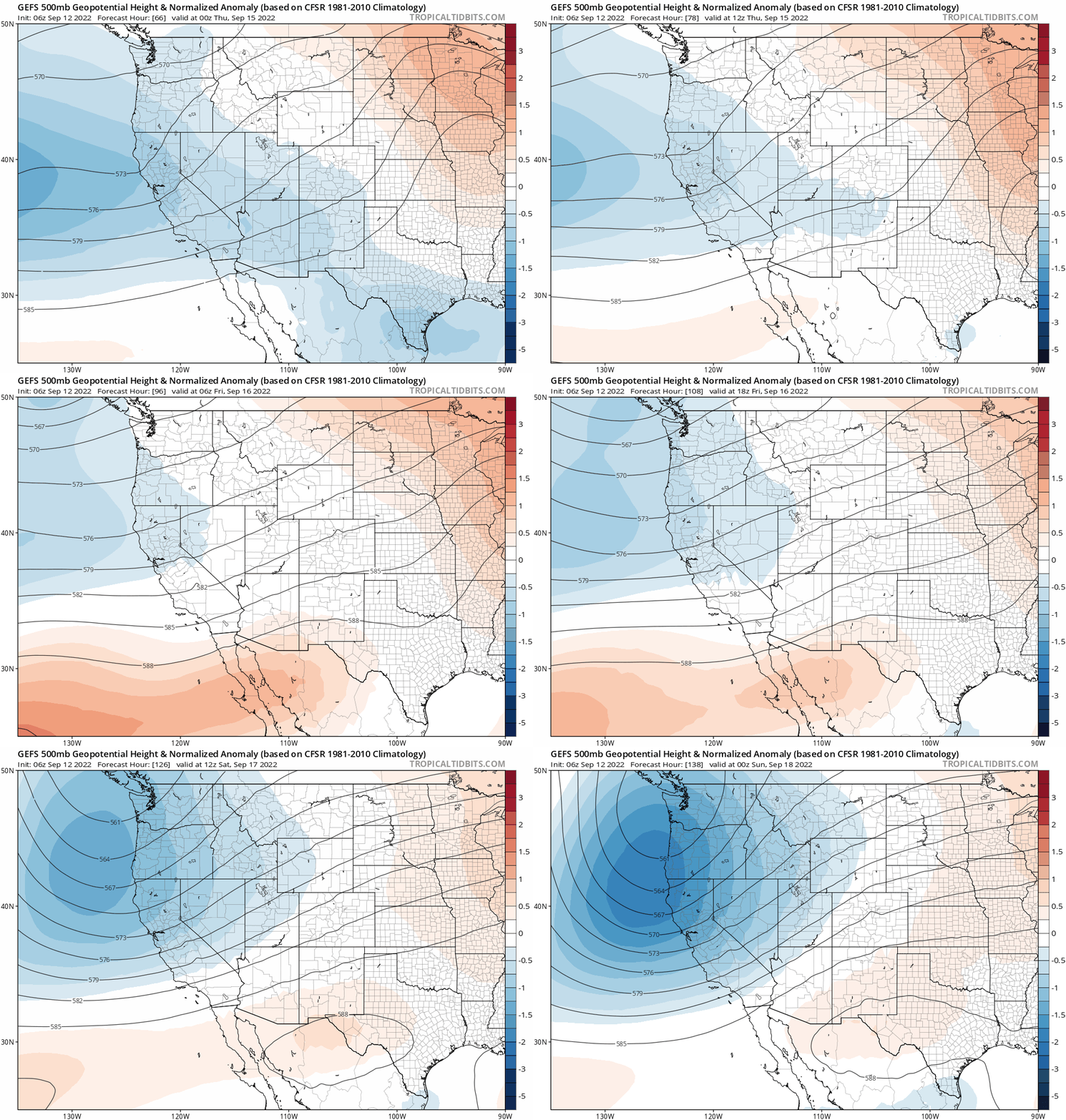
We will be keeping an eye on a deep trough that is projected to develop over the West Coast this weekend (see the animation below). Any impacts from this system would not reach our area until sometime around Tuesday-Wednesday of next week. The Euro model is showing a more unsettled situation for us with the trough digging as far south as Colorado, while the GFS keeps it a little further north.
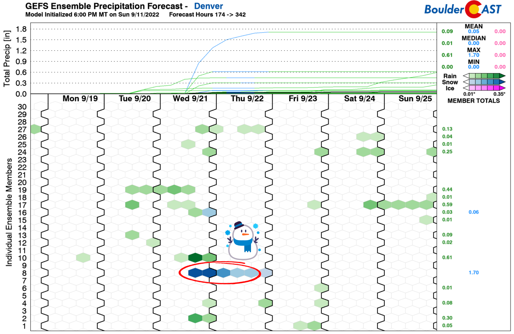
Nonetheless, it’s certainly something we will be watching as the week progresses — especially since there is one rogue GFS ensemble run that produces a foot of snow in Denver with that trough next week (see below).
Wow! It’s hard to believe we’ve gotten to the “snowstorm” time of year already, but here we are. I guess it’s about time for our annual “First Snowfall Contest” to begin. Check back in the coming days for more information on that! ❄️
Enjoy!
Forecast Specifics:
Monday: Sunny and warm with high temperatures in the middle 80s on the Plains with lower 70s in the Foothills. Skies will be hazy from smoke, especially towards sunset.
Tuesday: Sunshine early, then mostly cloudy but dry. Smoke will be around as well. Highs in the upper 80s on the Plains with middle 70s in the Foothills.
Wednesday: Mostly cloudy through the day with a chance of rain and thunderstorms. Some sun is possible in the afternoon/evening. Highs reach the lower 80s on the Plains with lower 70s in the Foothills.
Thursday: Morning sun, then increasing clouds with a slight chance of late-day showers and storms. Temperatures in the lower 80s on the Plains with lower 70s in the Foothills.
Friday: Morning sun, then some clouds with a very slight chance of late-day showers and storms. Highs reach the low to middle 80s on the Plains with lower 70s in the Foothills.
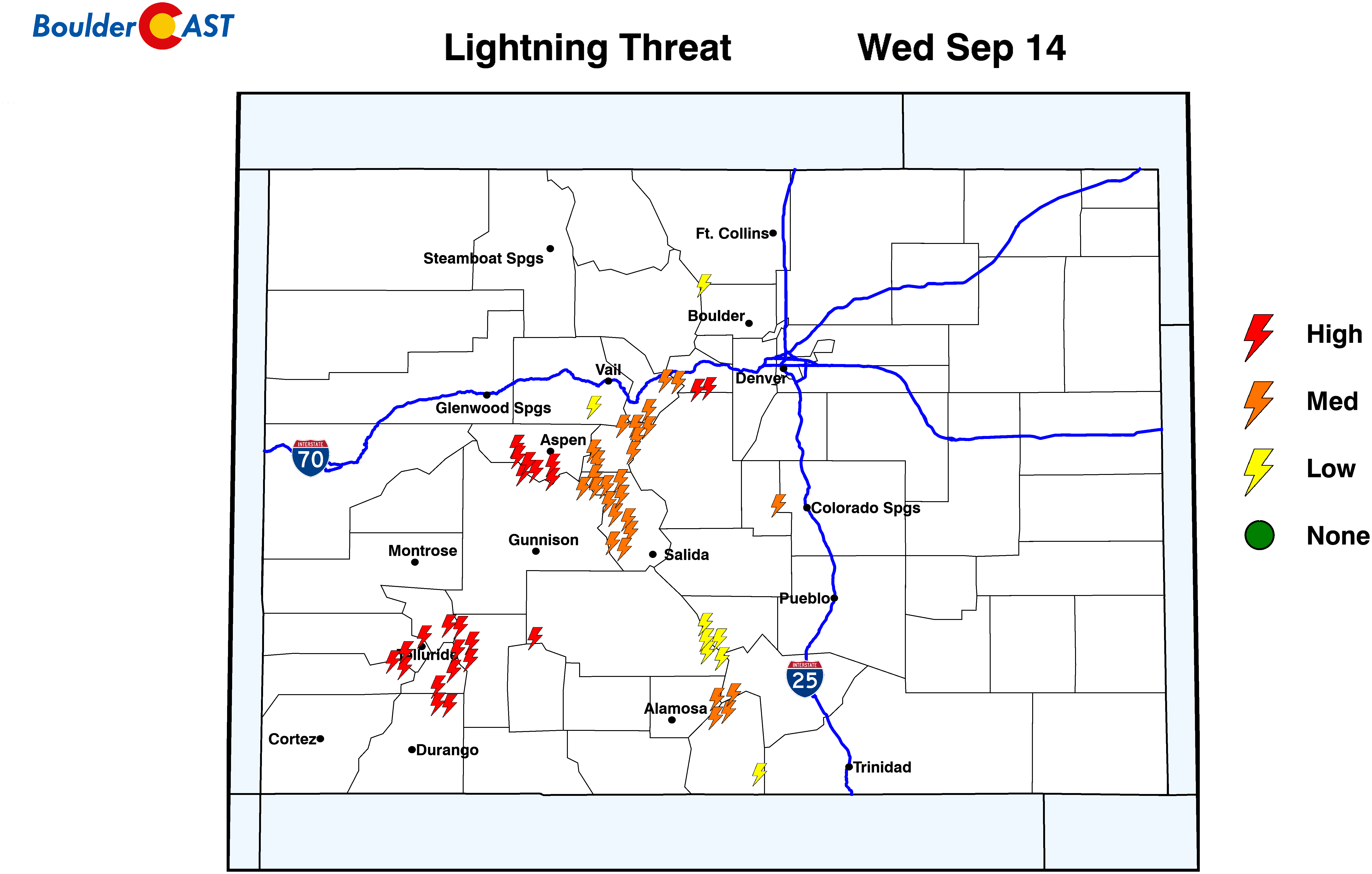
High Country: The Mountains will be dry on Monday with sunshine (except in far southwest Colorado where isolated storms develop late). Tuesday and beyond there will be a chance of rain each afternoon/evening statewide as moisture increases in the southwest flow. Southwest winds will increase as well. Plan ahead for developing storms each day if you are heading up the Mountains!
Help support our team of Front Range weather bloggers by joining BoulderCAST Premium. We talk Boulder and Denver weather every single day. Sign up now to get access to our daily forecast discussions each morning, complete six-day skiing and hiking forecasts powered by machine learning, first-class access to all our Colorado-centric high-resolution weather graphics, bonus storm updates and much more! Or not, we just appreciate your readership!
Spread the word, share the BoulderCAST forecast!





You must be logged in to post a comment.