The extreme heatwave unfolding across the West continues in full-force for one more day in Colorado. Unfortunately, the hottest temperatures thus far still lie ahead on Thursday alongside elevated fire danger. The end is in sight though — two cold fronts bring a taste of autumn this weekend. We discuss how hot it will get Thursday, the timing of the big changes, and just how chilly it will be this weekend.
We discuss Boulder and Denver weather every single day on BoulderCAST Premium. Sign up today to get access to our daily forecast discussions every morning, complete six-day skiing and hiking forecasts powered by machine learning, access to all our Front Range specific weather models (including smoke forecasts), additional storm updates and much more!

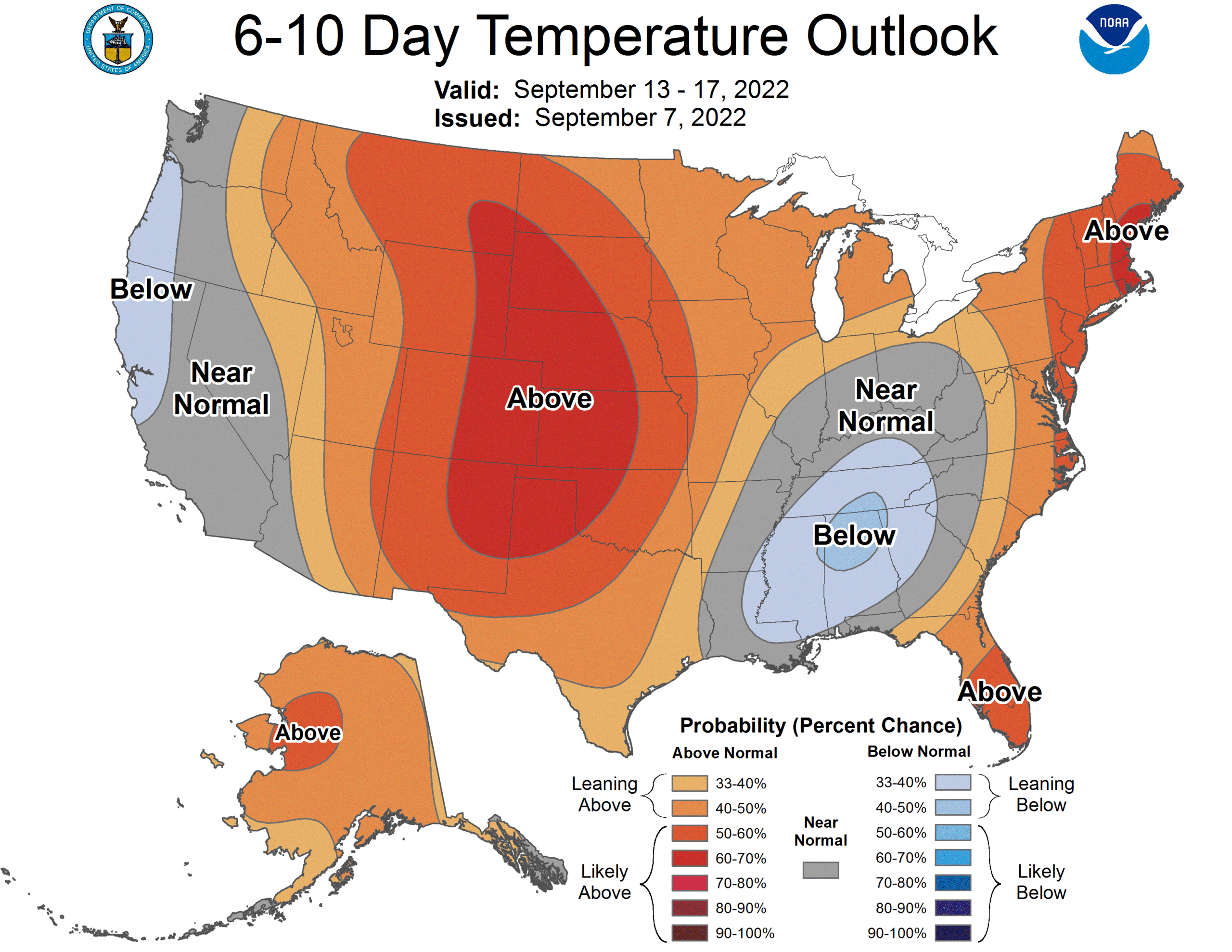
Thursday to be one of the hottest September days ever in Denver?
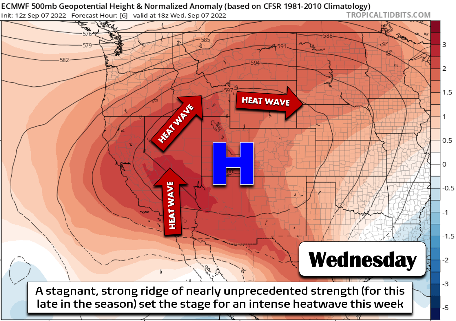
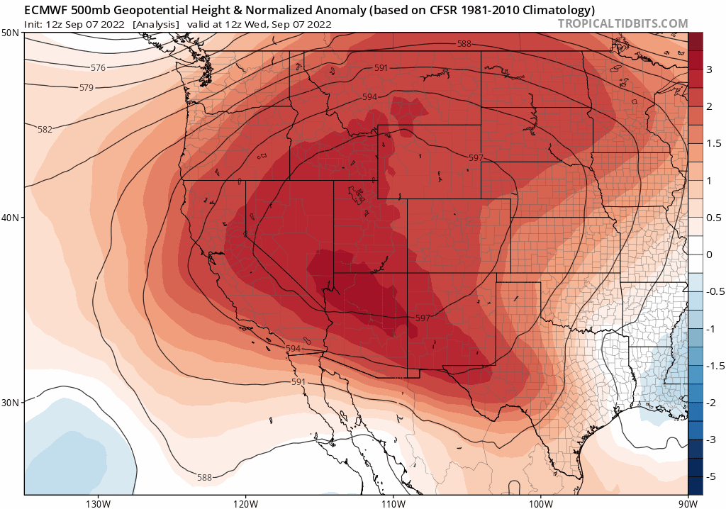
The weather headliner this week across the nation has been the intense late-season heatwave impacting nearly the entire western United States, including our great state of Colorado. The heatwave was well-predicted many days in advance, with the blueprint for extreme heat being carefully drawn-out by Mother Nature. A stagnant ridge of high pressure, one with nearly unprecedented strength and persistence for this late in the summer season, has lingered over Utah since last weekend. Packed with dry air and southerly flow, this ridge has continued to pump the warmth northward into the western United States, while at the same time helping to generate its own heat from consecutive days of cloud-free, unobstructed solar heating.
The result has been catastrophic for the West. Almost all of California has soared above 100° many days this week, with unlucky areas roasting at 115° or even higher. Numerous ALL-TIME temperature records have been forged in this heat— not just the hottest for a specific date or even for the month of September, but the highest temperatures in recorded history for some locations.
Truly incredible heat in California today with many cities setting new ALL-TIME record highs. Not just for the date or for September, but for any time of year in recorded history 😲 #CAWx pic.twitter.com/QYFPLE44gG
— BoulderCAST Weather (@BoulderCAST) September 6, 2022
Here in Colorado, it thankfully hasn’t been quite that hot as the most favorable setup for extreme heat was further west all week long. Even still, the duration and magnitude of the ongoing heatwave in the Denver area is substantial for September. If it wasn’t for the freak early-season snowstorm preceded by 100-degree temperatures which slammed the area two years ago, we would have obliterated four consecutive daily record highs this week. Instead, we have to settle for just two. We really shouldn’t be approaching 100 degrees this late in the season…
🌡️ Record highs WILL be shattered the next 2 to 3 days in #Boulder!
DATE: FCST/OBS | RECORD (YEAR)
❌Mon 9/5: 95°F | 99° (2020)
❌Tue 9/6: 96°F | 99° (2020)
—-
✅Wed 9/7: 96°F | 93° (1959)
✅Thu 9/8: 98°F | 93° (1959)
❓Fri 9/9: 95°F** | 95° (2021)#COwx— BoulderCAST Weather (@BoulderCAST) September 7, 2022
Even worse, the stagnant air underneath the ridge has piled up the smoke from dozens of large wildfires burning across the Pacific Northwest, the northern Rockies, and California. We’ve somehow managed to dodge the smoke most of the summer in the Front Range. That was not the case this week with declining air quality and poor visibility across our area. It’s easy to see the clockwise rotation of the smoke around the huge high pressure in the forecast animation below. Ironically, smoke being sourced in northern California’s fires made the 3000-mile-long trek around the ridge and re-entered southern California from the east!

Unfortunately, as toasty as it has been of late, the absolute hottest day of the entire heatwave still likely lies ahead for Thursday. Change is coming though — something we already promised in our weekly outlook at the beginning of the week. The ginormous ridge of high pressure is about to come under siege from three different attackers:
- An autumn trough dropping out of central Canada
- A retrograding low pressure void along the Gulf Coast
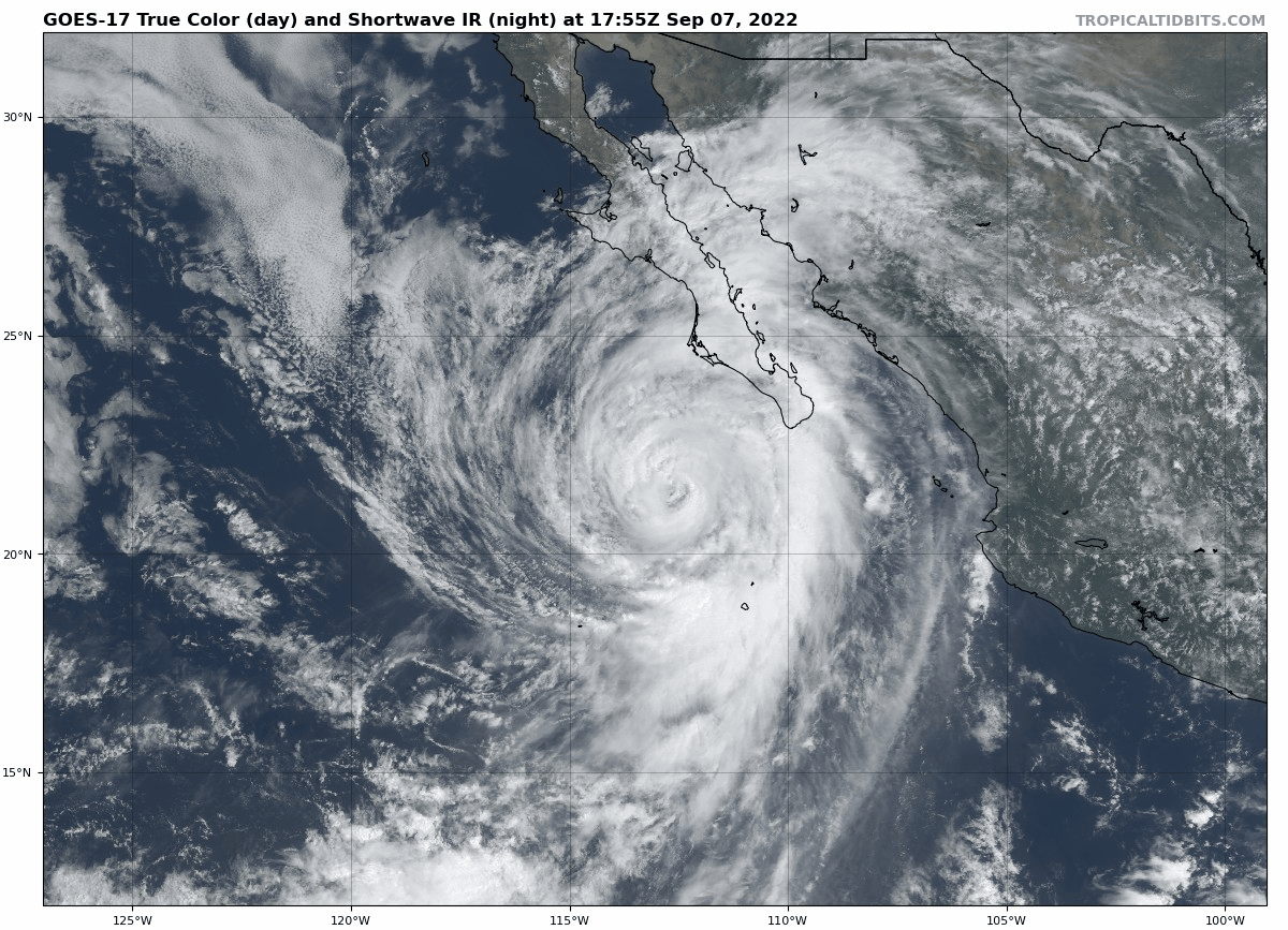
- Hurricane Kay moving up along Baja California.
As a result, the ridge will essentially collapse on itself sometime Thursday night.
By the way, Hurricane Kay is currently a beautiful Category 2 storm in the eastern Pacific Ocean. The remnant moisture from this tropical cyclone could become a player for Colorado during the early to middle part of next week — more on this in the coming days!
Thursday will be a day of transition as our heatwave savior (i.e. the trough dropping out of Canada) makes its approach. Mid-level winds will increase and with deep mixing expected, fire weather concerns will ramp up during the afternoon and evening with gusts up to 30 MPH from the west-southwest out across the Plains.
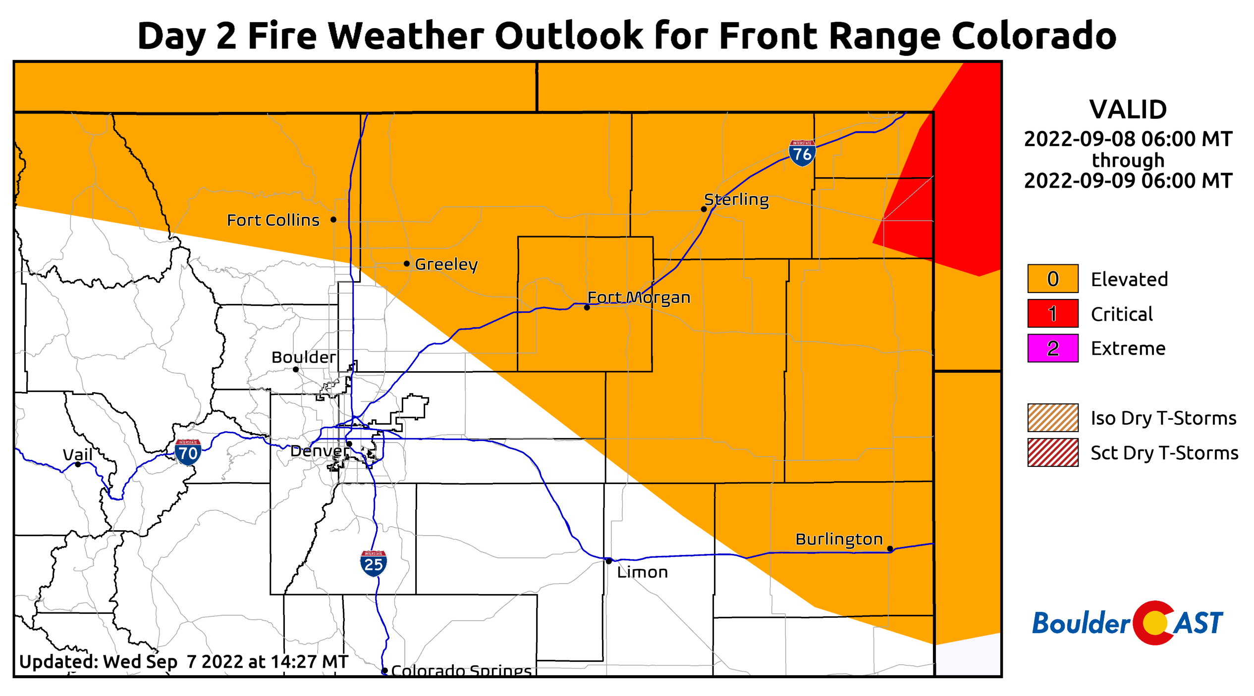
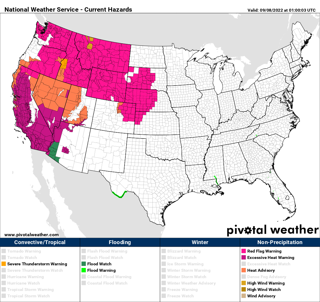
In retrospect, one benefit of being trapped under this ridge for so long has been the light winds it offers — these have kept fire concerns in-check despite the dry vegetation and desert-like humidity levels we’ve endured for weeks. Red Flag Warnings have been issued for areas northeast of Denver for Thursday. In fact, a huge portion of the northern Rockies is under these warnings, including the entire states of Wyoming, Montana, and Idaho. Winds won’t be as strong in the immediate Denver Metro area, but fire danger will still be elevated on Thursday.
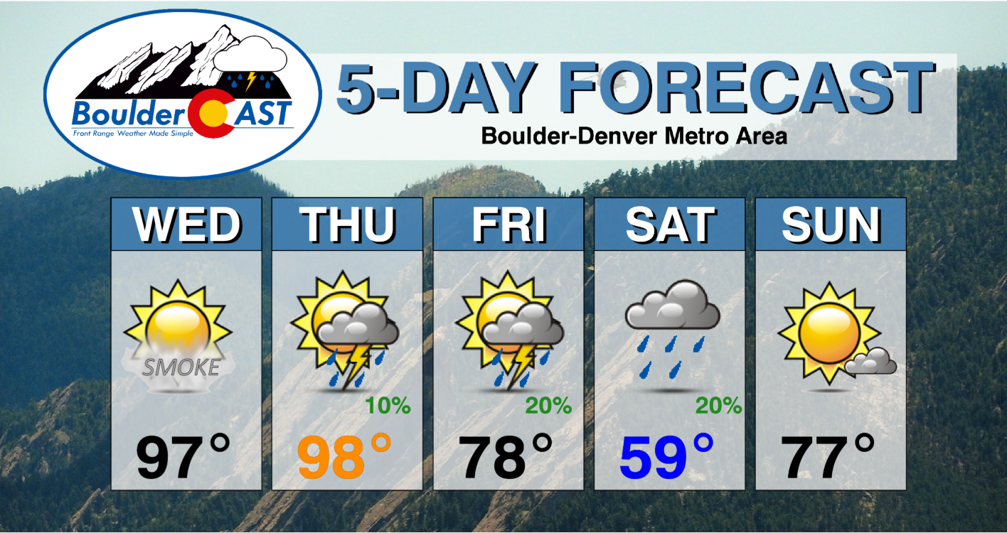
As for temperatures, the pre-frontal increase in winds should allow for our hottest day yet. Almost everyone will reach the upper 90s on Thursday, with usual hot spots like Denver International Airport, Greeley and Longmont poised to reach the century mark. This would be the latest 100-degree day on record for most cities that manage to hit that fiery target. Right now our forecast calls for a high of 97°F in Boulder, but it could be a degree or two higher.
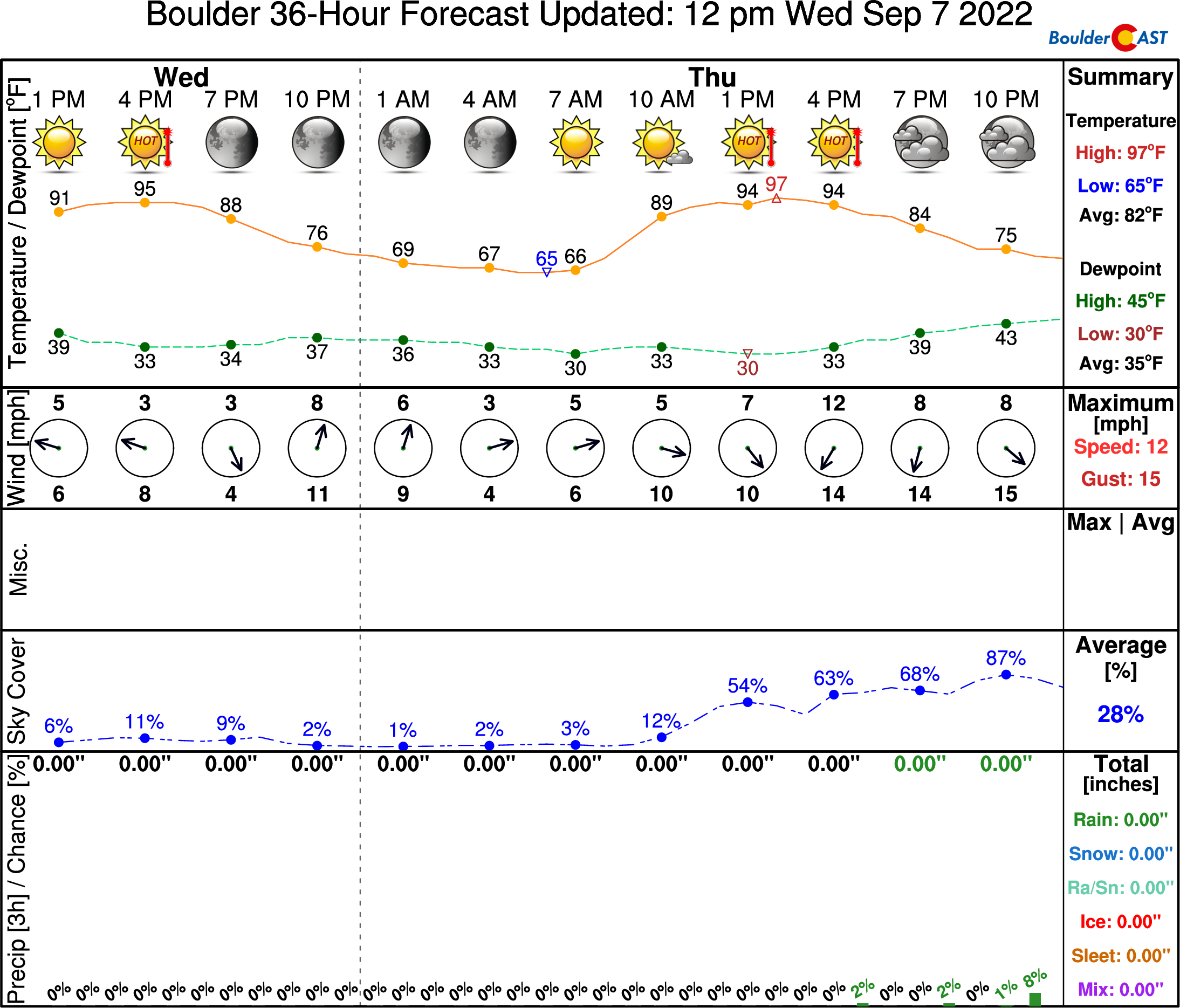
As we roast in the heat on Thursday, the initial cold front will be working its way southward through Wyoming during the day. It looks to reach the Front Range after sunset Thursday night. Clouds and dare we say rain will return to the forecast in the evening alongside this front, though the chance still looks somewhat limited in our area (10-20% or so). Showers and a few convective storms will be possible anytime Thursday afternoon into the late evening hours.

Friday will see sunshine still, but with markedly cooler temperatures. Look for highs topping out in the upper 70s to near 80 — some 20 degrees colder than Thursday and finally below normal for this time of year!
Winter Autumn is coming!
The first true taste of autumn comes on Saturday as a secondary, even stronger cold front is projected to reach northeast Colorado during the morning hours. This one is the real deal — packed with decent upslope and near-freezing 700mb temperatures reaching as far south as the Wyoming-Colorado border area — the latter being something we haven’t seen since late May!

With upslope socked in, we should have a better chance of drizzle/rain showers through the day with low clouds and chilly temperatures abound. You won’t believe it, but most weather models are showing high temperatures staying in the 50s on Saturday — a far cry from our tango with the century mark two days prior! Though we may see some areas reach the 60s in the morning just ahead of the front. It’s the Saturday morning front that will finally kick out most of the accumulated smoke across the West and bring cleaner air to the Front Range. Fingers cross that does indeed pan out!
The much-needed “pumpkin spice latte weather” won’t last long — temperatures will jump nearly 20 degrees for Sunday returning close to seasonal values in the upper 70s.
Looking even further ahead, an eerily similar ridge looks to quickly develop in the wake of the autumn trough seeding the return of persistently hot weather for us much of next week (see below). However, as mentioned earlier, we will need to keep a watchful eye on the leftover moisture from Hurricane Kay. Though uncertain, there is some model support this moisture will get swept across Colorado in the Tuesday/Wednesday timeframe of next week. Stay tuned and enjoy the seasonal roller-coaster ride the next few days!
Get BoulderCAST updates delivered to your inbox:
Enjoy our content? Give it a share!


You must be logged in to post a comment.