We’ve gotten many inquiries this summer about our newly added smoke forecast products. We thought it would be useful to share this information as the questions that have been asked are recurring and universal.
If you have additional questions, please post in the comments.
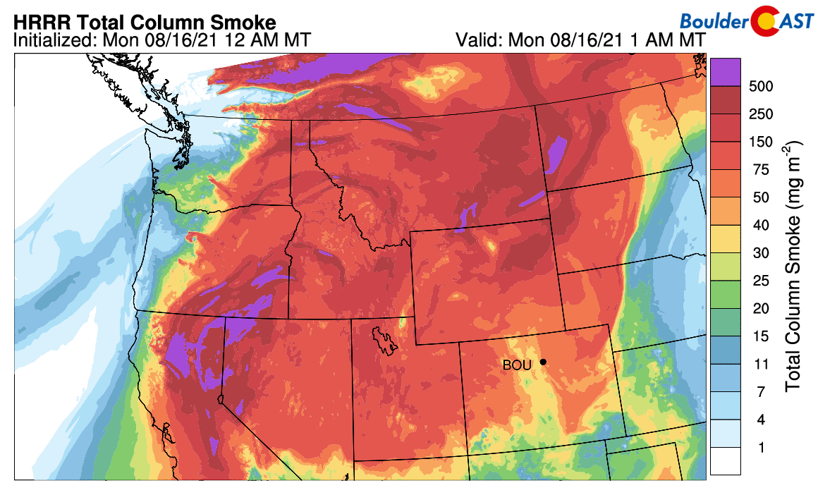
What is Total Column Smoke?
This is the total amount of smoke throughout the entire depth of the atmosphere. This is a similar quantity to precipitable water which is the amount of water molecules through the entire depth of the atmosphere. Total smoke sums up the smoke at the surface all the way through the stratosphere. This is useful for seeing the overall picture of where the smoke is located and is moving as this quantity is mostly conserved.
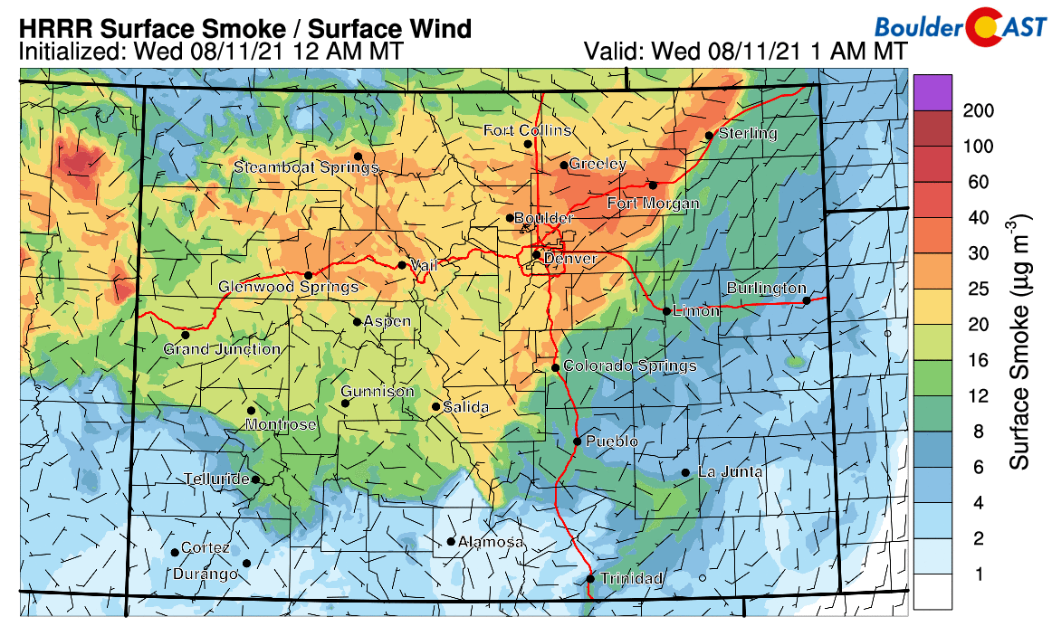
What is Ground-Level Smoke?
This is the smoke concentration present at ground-level and is what you will be breathing under normal circumstances on the ground. This is great for seeing the health impacts, but doesn’t give a complete picture because as soon as the air rises or sinks near ground-level (which is happening all the time!), the ground-level smoke concentration could spike or decline quickly.
Will the Mountains be more or less smoky than the Plains?
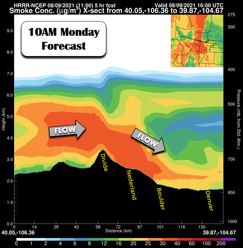
In terms of being able to go up into the Mountains to escape the smoke, that may sometimes work or it could be worse up there. It just depends on the situation across the region. A lot of the smoke from distant wildfires tends to be elevated in the atmosphere, so going up into the Mountains could be worse. However, generally in the summer the sun’s energy churns the atmosphere quite well so the smoke is usually well-mixed and it’s more or less the same at all elevations. There’s also situations where the smoke arrives to Boulder with a cold front which could mean a shallow layer of thick smoke only on the Plains. Sorry for the round-about answer, but in this case it truly depends! Your best bet to tell if smoke will be worse or better in the Mountains or Plains is to check the ground-level smoke forecast. That product does take into account the terrain.
What is the difference between the two smoke models, the HRRR and the FireWork, and which is better?
The HRRR is a high-resolution regional model from NOAA, while the FireWork is a lower-resolution model from Environment & Climate Change Canada. Both have unique inputs, as well as math and physics implementations. Just like other parameters such as snowfall and wind speeds, two models will rarely agree 100% on any forecast, and that includes smoke aerosols.
We usually place stronger emphasis on the HRRR since it is a higher resolution and is more familiar to American forecasters. However, FireWork is a great tool to utilize as well to get another perspective since it also predicts out to 72 hours, while the HRRR is just 48 hours for now.
- HRRR: https://www.esrl.noaa.
gov/gsd/learn/handouts/HRRR- Smoke-Fact-Sheet-7-23-2019.pdf - FireWork: https://
weather.gc.ca/firework/index_ e.html
Why are there only short-term (<72 hour) forecasts for smoke concentration?
Only in the last 10 years or so has it become practical and computationally possible to predict aerosol concentrations through atmospheric dispersion models run on supercomputers. These models are coupled with the standard models, like the HRRR, GFS and CMC. Right now these aerosol models are not very accurate beyond about 2 to 3 days. It turns out forecasting tiny particulates is not an easy task. Though there has been some success predicting a little further out with model ensembles like the GEFS-CHEM (~5 days). We may look into adding this product to our site in the future, but as with any ensemble, it’s a big undertaking as it’s roughly 25x the amount of data to process compared to normal single-run models!
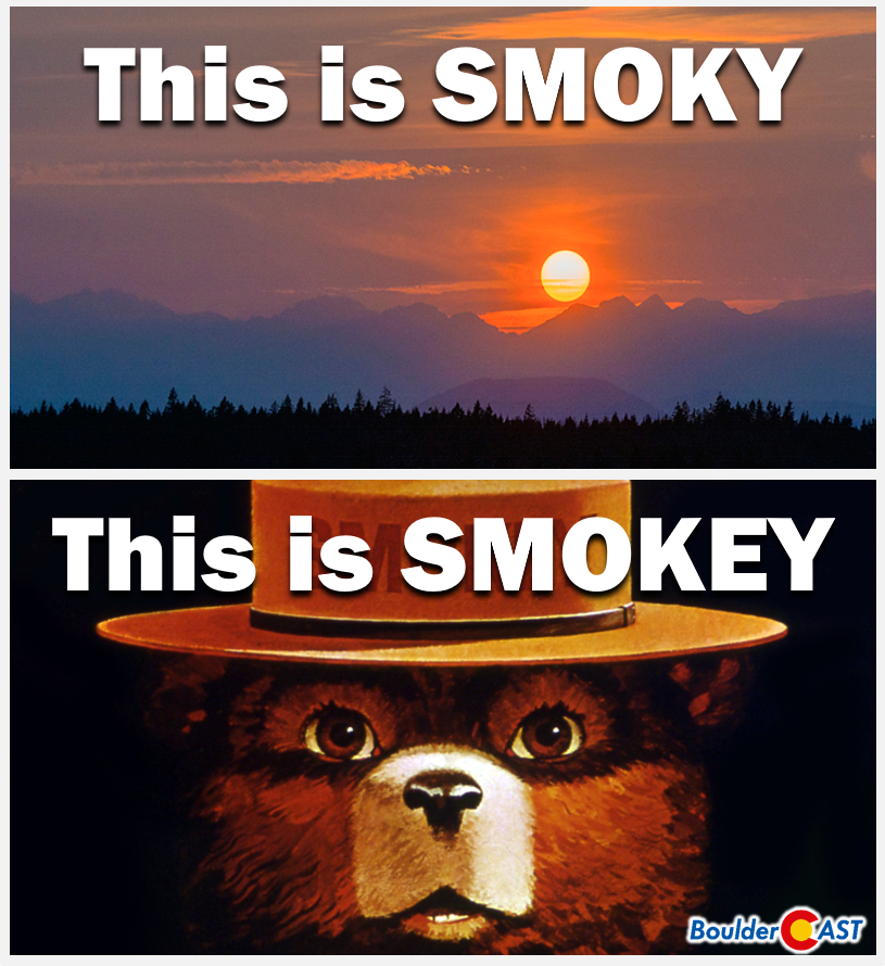
What is the correct word to describe a hazy day: “smoky” or “smokey”?
🤦♂️


You must be logged in to post a comment.