The Front Range will unfortunately see a continuation of unseasonably warm and bone dry weather this week. With a strong ridge of high pressure parked over the region, temperatures will remain summer-like in the lower 80s for the most part. While a couple of weak cold fronts may bring slight temperature drops, there will not be any precipitation. Wildfire smoke from neighboring states will intermittently affect our air quality. We also look ahead to a pattern shift next week which should bring welcomed changes. Read on for all the details.
This week’s highlights include:
- Staying High & Dry: Front Range Colorado will remain warm and dry with temperatures around 80 degrees due to a persistent high-pressure ridge.
- Baby Cold Fronts: Two weak cold fronts will pass this week, bringing slight temperature drops but no precipitation.
- Wildfire Smoke: Smoke from wildfires in Utah, Wyoming, and Idaho will affect air quality in the Denver Metro area at times.
- Change on the Horizon? A pattern shift is expected next week, likely bringing cooler temperatures and frost, with any precipitation yet to be determined.
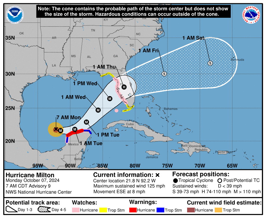
- Major Hurricane Milton: A strong hurricane will intensify in the Gulf of Mexico this week before making a devastating landfall near Tampa, Florida Wednesday evening.
DISCLAIMER: This weekly outlook forecast is created Monday morning and covers the entire upcoming week. Accuracy will decrease as the week progresses as this post is NOT updated. To receive daily updated forecasts from our team, among many other perks, subscribe to BoulderCAST Premium.

Go Premium, get all the perks.
Daily Forecast Updates
Get our daily forecast discussion every morning delivered to your inbox.
All Our Model Data
Access to all our Colorado-centric high-resolution weather model graphics. Seriously — every one!
Ski & Hiking Forecasts
6-day forecasts for all the Colorado ski resorts, plus more than 120 hiking trails, including every 14er.
Smoke Forecasts
Wildfire smoke concentration predictions up to 72 hours into the future.
Exclusive Content
Weekend outlooks every Thursday, bonus storm updates, historical data and much more!
No Advertisements
Enjoy ad-free viewing on the entire site.
Staying excruciatingly warm & dry in Colorado
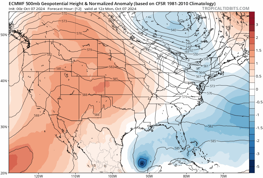
Little to no excitement is expected once again in Colorado weather this week as we remain in a seemingly never-ending late-summer holding pattern. We’ll continue to see a strong mid-level ridge of high pressure parked directly over Colorado for at least the next 7 to 10 days keeping us warm and dry here in the Front Range. Despite having some characteristics of autumn, this current pattern certainly feels a lot like early September, rather than October. The Euro model’s 500mb height forecast through Sunday is shown in the animation below. While the pattern across the Great Lakes and Northeast is quite active and transient, back to the west in the southern Rockies, things are completely unchanging with the reddish hues staying the course the entire week — representation of the incessant above normal heights beneath our stationary ridge.
The only “weather” we really have going on this week comes in the form of one or two weak cold fronts associated to meager weather systems along the Canadian Border and into the Great Lakes. The first is moving through now early Monday morning. A secondary, likely stronger front is scheduled to arrive Thursday night or early Friday.
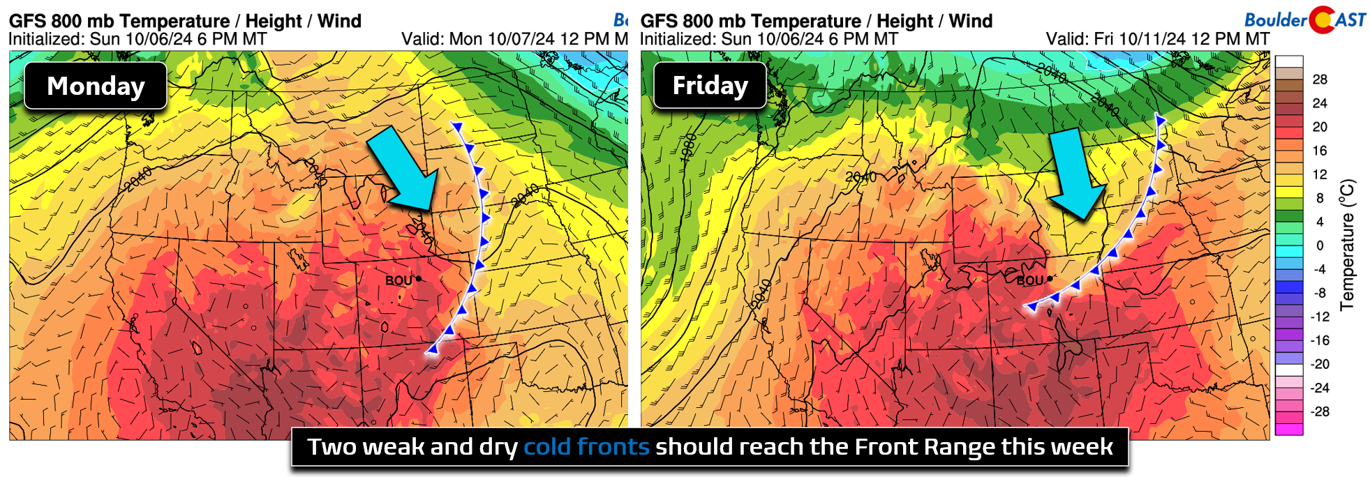
This late-week front is more uncertain, with some model solutions indicating its cooler aimass could mostly bypass our area. However, models have generally underestimated the magnitude of frontal impacts here lately so we are more keen to lean cooler. Obviously, since it doesn’t ever rain or snow here, neither front will be accompanied by any precipitation — we’ll just see a slight drop in our temperatures.
Models and Colorado forecasters alike have been getting ANNIHILATED by the cooling coming behind the dry backdoor fronts the last couple weeks. Today didn't get anywhere near 80 degrees and this past Thursday we didn't get out of the 60s! #COwx #GetFronted
— BoulderCAST Weather 🏔️❄️ (@BoulderCAST) October 6, 2024
These fronts will usher in periodic surges of north and/or northwesterly flow to the Front Range. In addition to their cooling effect, these winds will be blowing in from areas where large autumn wildfires are still burning, mainly across Utah, Wyoming and Idaho. With this, we will continue to see intermittent influxes of wildfire smoke to the Denver Metro area. Please stop calling 9-1-1 when you smell smoke — the source fires are all more than 300 miles away!
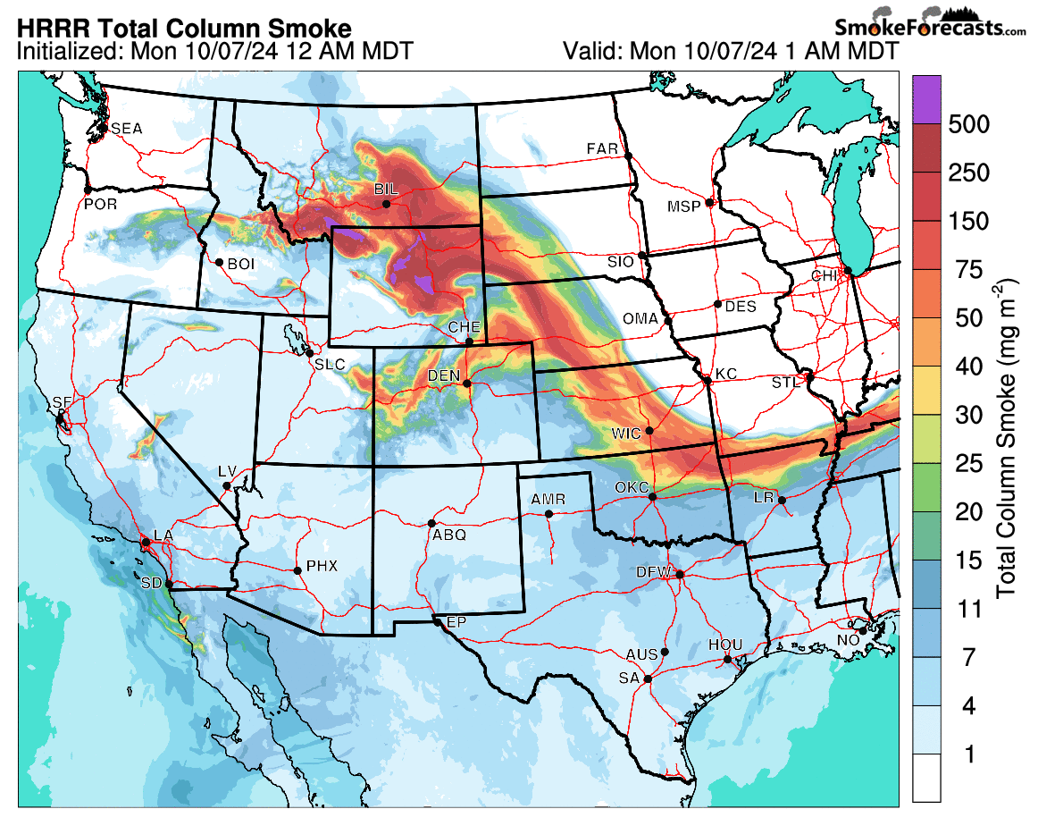
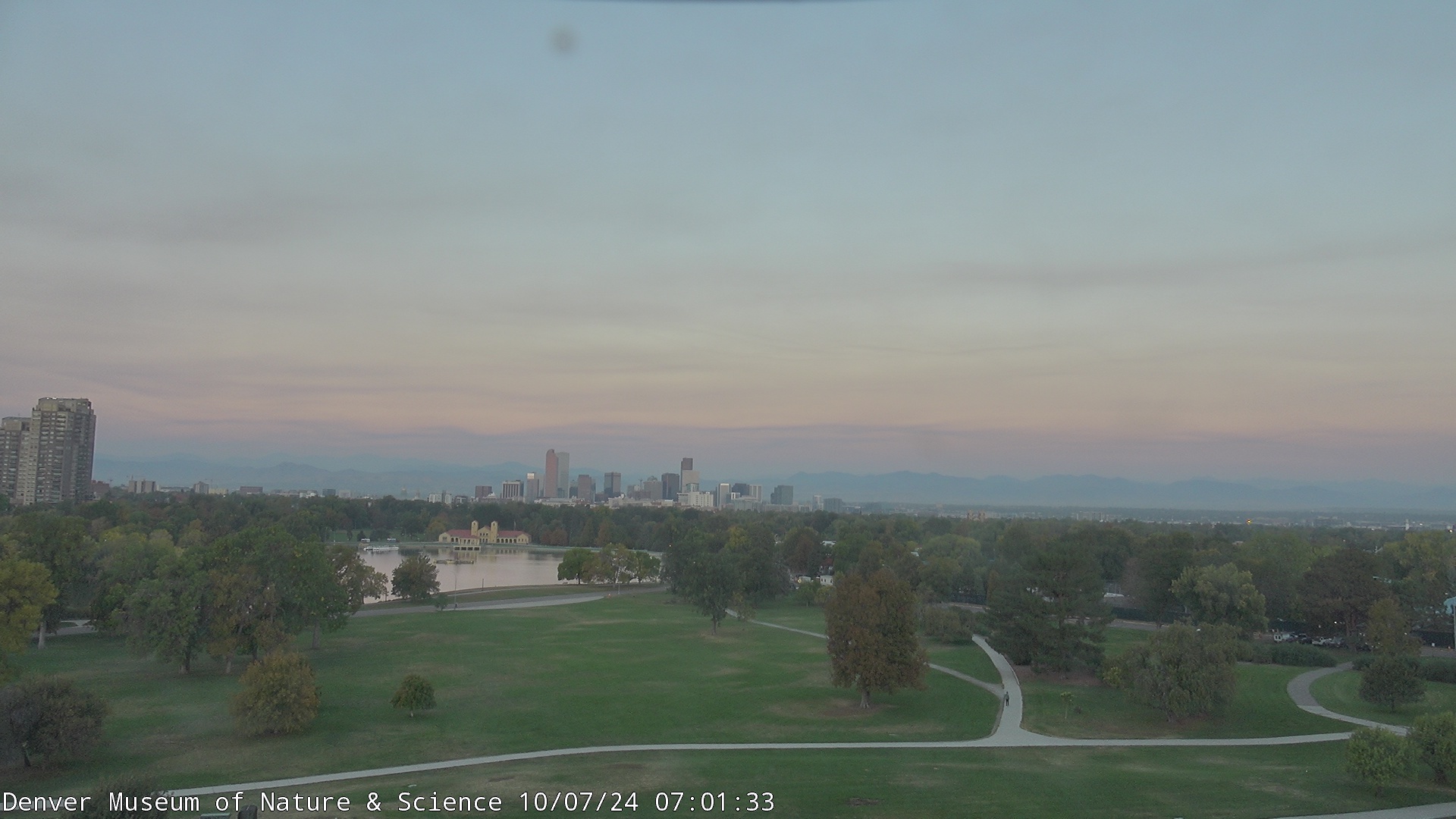
There is some smoke around already early on this Monday morning, but it is expected to partially clear out through the day Monday. All of the wispy brown visible in the sky as the sun comes up over Denver Monday morning is smoke!
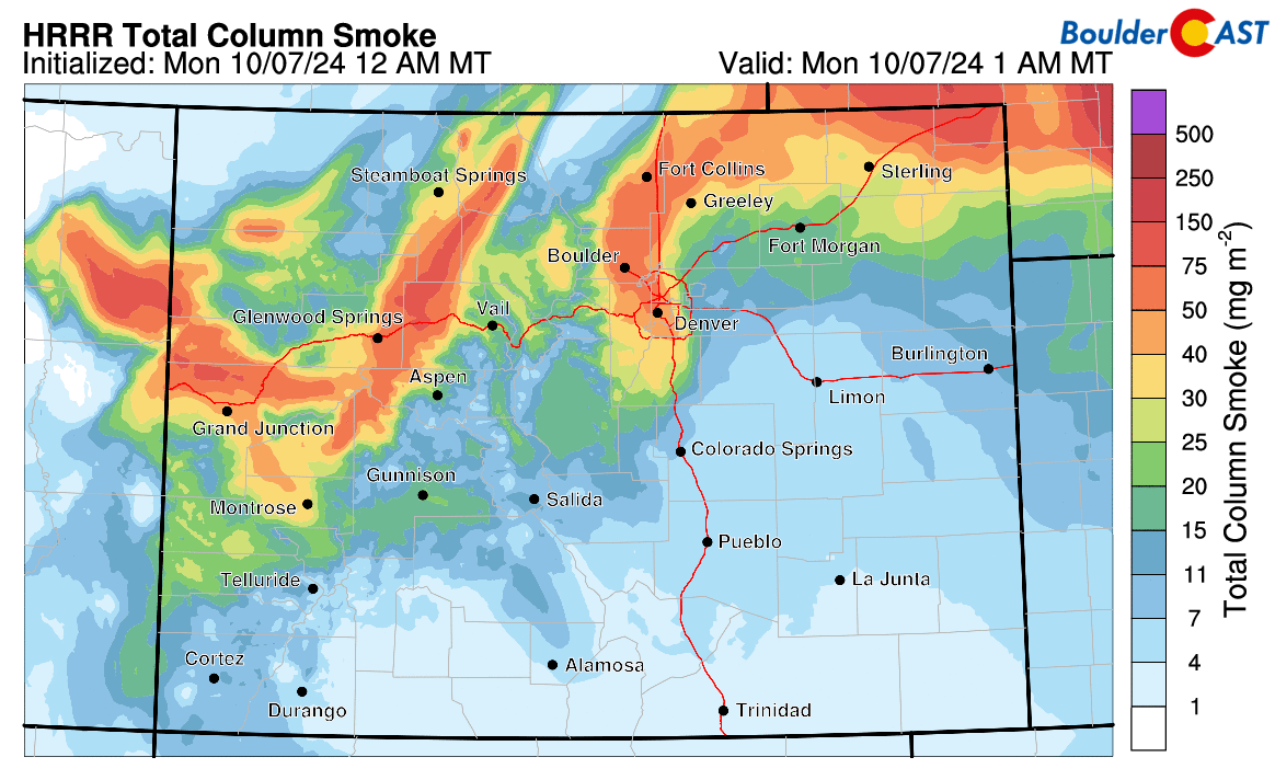
An even thicker wall of smoke is on-track to arrive to our area Monday evening from the north and northeast. This smoke will be some of the thickest we’ve seen in months, or at least several weeks, and may warrant closing up your windows. The worst of the smoke should begin to clear out Tuesday morning into afternoon. Here’s a closer look at the total smoke forecast for Colorado through Tuesday evening:
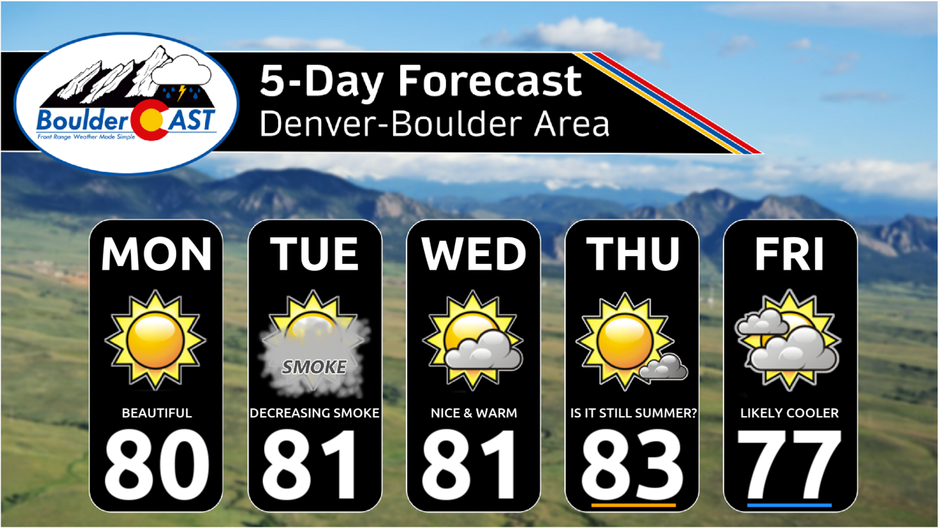
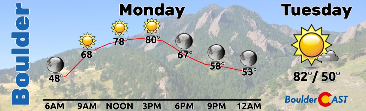
For Monday, expect high temperatures in the lower 80s with sunny skies and light winds (and some smoke). Tuesday will be almost identical but with more clouds around and probably higher concentrations of smoke and worse air quality.
Our temperatures will fluctuate very little this week, generally staying within a few ticks of 80 degrees. Friday will see more clouds around and should be cooler if the aforementioned late-week cold front indeed pans out.
We continue to be asked when this excruciatingly warm and dry pattern will finally break down for the Front Range. We’ve been saying sometime between October 15th and 20th for a while now, and this projection still looks about right. Around the middle of NEXT week, there is strong ensemble support for a definite flattening of the existing ridge with more of a zonal flow returning to Colorado (below left). Some ensemble suites, like the GFS below on the right, even indicate hints of weak long-wave troughing over our area.
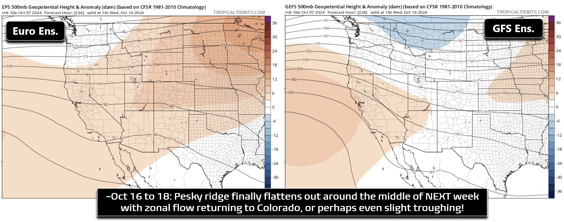
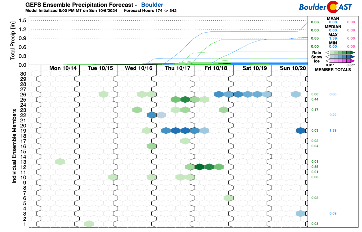
While this pattern shift likely won’t translate into significant changes in our weather, and may not actually produce much precipitation at all, our temperatures should turn cooler, at least closer to normal and possibly colder than that if the troughier outcomes pan out. There are even a couple outlier model runs that spawn early season snowstorms for us next week. That is extremely unlikely, but the pattern shift will at least make this dubious scenario possible — unlike right now where it’s challenging to even optimistically forecast the existence of any clouds. In reality, next week will probably be mostly dry but with temperatures eventually turning cooler into the 60s and 70s by late week. Winds will be on the increase leading to an uptick in fire danger, especially in the higher terrain.
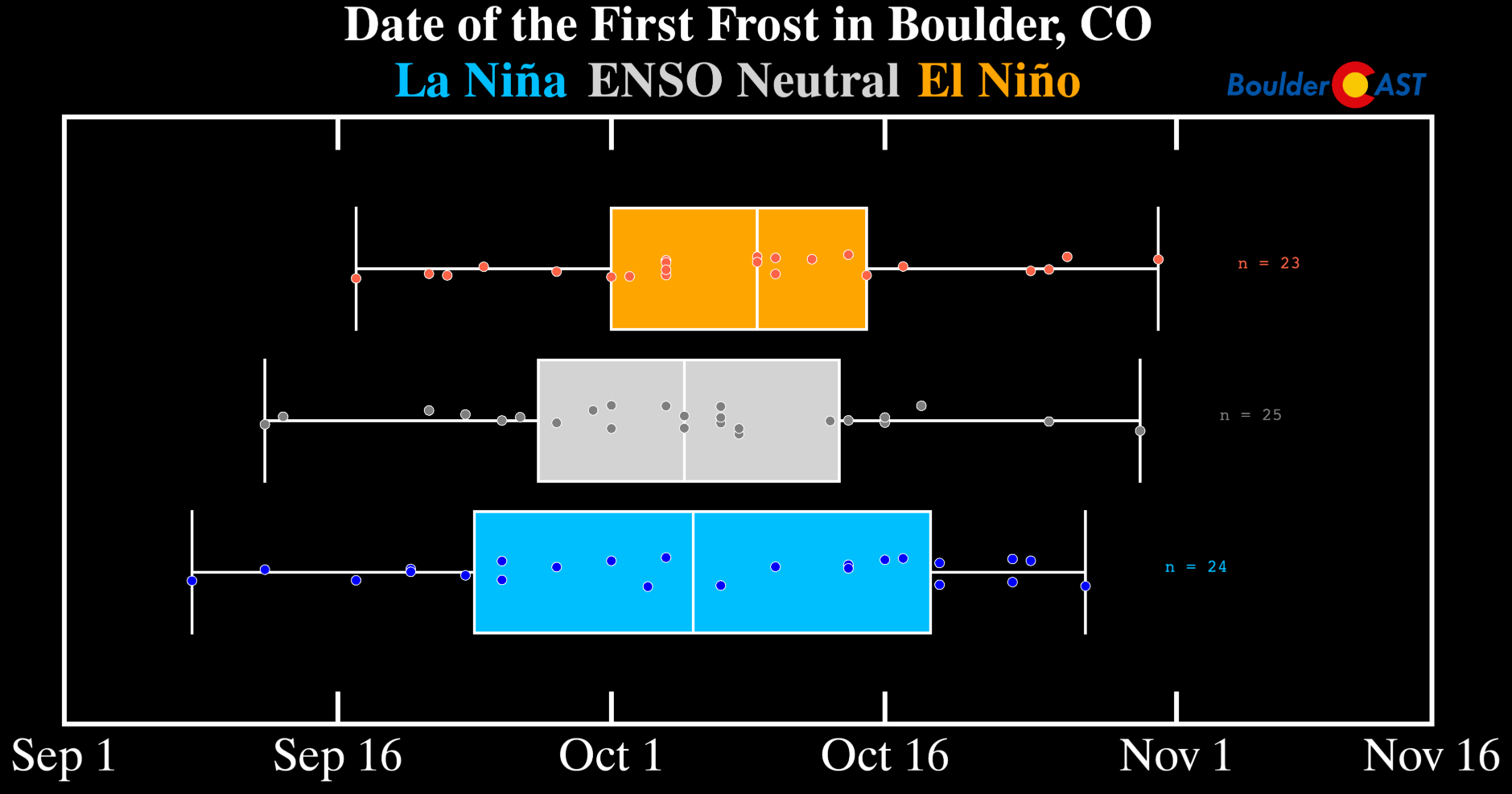
Despite how unseasonably warm it is this week, we’re getting to the point in autumn where we will not be able to stave off frost as the nights grow increasingly longer. The median date of Boulder’s typical first frost is October 6th, so we’re already past that. This ongoing warm pattern has delayed this timing so far. However, it doesn’t take much to get us down into the middle 30s to produce frost this time of year. Even a weak cold front, followed up by clear skies, can do the trick. Friday’s cold front doesn’t look quite cold enough to get us there (but can’t fully rule out frost yet), but certainly the pattern next week should produce at least some frost in the Metro area. Plan now for at least a partial end to the growing season for sensitive plants sometime next week.
Major Hurricane to Hit Florida
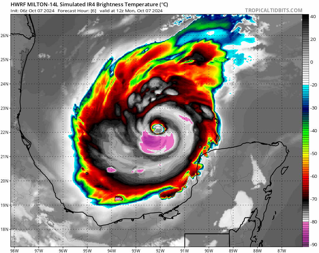
The more interesting weather this week is found well south of Colorado in the Giant Warm Bathtub, also known as the Gulf of Mexico, where Hurricane Milton continues to intensify at breakneck pace. Milton is now a Category 3 major hurricane with 125 MPH sustained winds and sits just northwest of the Yucatán Peninsula.
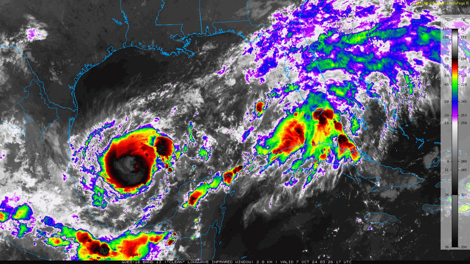
Milton is expected to continue to rapidly intensify in the coming days, possibly peaking at Category 5 level, before making a landfall along the western coast of Florida Wednesday evening. Fortunately, there is decent model support showing the Milton may weaken before landfall, falling back to a Category 3 or 4 storm. However, as warm as the Gulf is right now, this cannot be counted upon. There is also some chance the eye of the storm will make a landfall in the Mexican Yucatán Monday night which could weaken it right off the bat here. Nonetheless, the eventual track is pretty well locked in at this point. Hurricane Watches are already posted in western Florida and mandatory evacuations are looming.
Enjoy what will be yet another warm and quiet week in Colorado weather and let’s all hope Milton goes easy on Florida later this week…
Forecast Specifics:
Monday: Lots of sunshine and warm with areas of light smoke. Highs in the lower 80s on the Plains with upper 60s in the Foothills.
Tuesday: Thick morning smoke will lessen through the day. Otherwise, partly cloudy and warm. Temperatures top out around 80 degrees on the Plains with upper 60s in the Foothills.
Wednesday: Partly to mostly sunny and continued warm. High temperatures once again reach the lower 80s on the Plains with upper 60s in the Foothills.
Thursday: Potentially the warmest day of the week under mostly sunny skies. Highs in the low to middle 80s on the Plains with lower 70s in the Foothills.
Friday: Likely cooler following the passage of an overnight or morning dry cool front. Highs will likely be in the 70s on the Plains with 60s in the Foothills.
Weekend: Staying warm and dry with temperatures in the 80s Saturday and then perhaps a tad cooler in the 70s Sunday behind another dry cold front.
Get BoulderCAST updates delivered to your inbox:
DISCLAIMER: This weekly outlook forecast is created Monday morning and covers the entire upcoming week. Accuracy will decrease as the week progresses as this post is NOT updated. To receive daily updated forecasts from our team, among many other perks, subscribe to BoulderCAST Premium.
Go Premium, get all the perks.
Daily Forecast Updates
Get our daily forecast discussion every morning delivered to your inbox.
All Our Model Data
Access to all our Colorado-centric high-resolution weather model graphics. Seriously — every one!
Ski & Hiking Forecasts
6-day forecasts for all the Colorado ski resorts, plus more than 120 hiking trails, including every 14er.
Smoke Forecasts
Wildfire smoke concentration predictions up to 72 hours into the future.
Exclusive Content
Weekend outlooks every Thursday, bonus storm updates, historical data and much more!
No Advertisements
Enjoy ad-free viewing on the entire site.
Enjoy our content? Give it a share!


You must be logged in to post a comment.