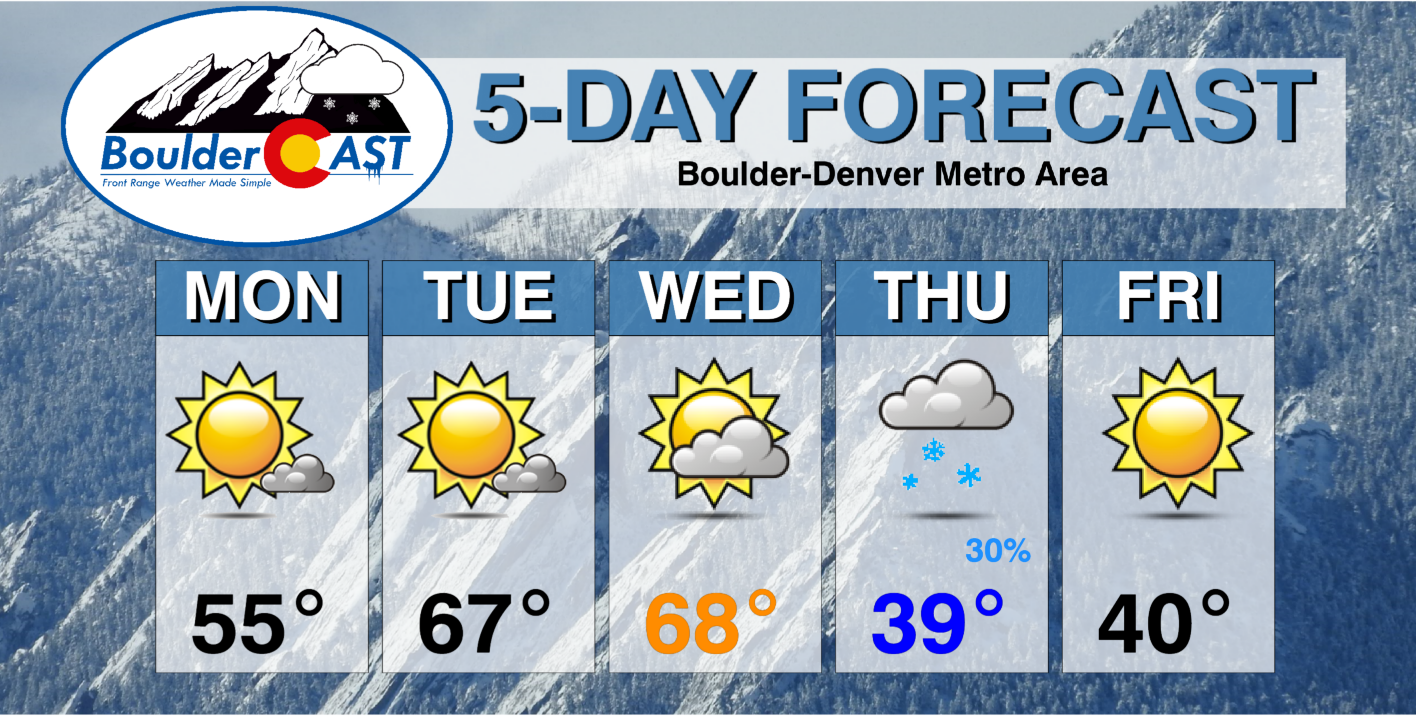
This week’s weather across the Front Range will be almost a carbon copy of last week. That is, dry and mild conditions holding through Wednesday before much colder temperatures and snow arrive on Thursday. At this time, the snow potential appears minor at best as a huge winter storm system takes an unfavorable track directly over our area. The bigger story will be the cold temperatures it ushers in and just how long they stick around afterwards. Read on for all the details.
This week’s highlights include:
- Warm temperatures through midweek with southwest flow present over Colorado
- Highs in the 50s Monday, but 60s to near 70 degrees Tuesday and Wednesday
- A strong winter storm system will impact the area on Thursday with Mountain snow confirmed and possibly light snow for the lower elevations as well
- The track of the storm is not favorable for Denver Metro — early indication is for little to no snow accumulations
- The cold air behind the storm sticks around for a prolonged period, with below normal temperatures expected to last one to two weeks
DISCLAIMER: This weekly outlook forecast is created Monday morning and covers the entire upcoming week. Accuracy will decrease as the week progresses as this post is NOT updated. To receive daily updated forecasts from our team, among many other perks, subscribe to BoulderCAST Premium.

Warm through midweek
Today’s large-scale weather pattern across the nation is shockingly similar to the one just a week ago on last Monday: a ridge is present over the Southeast producing record warm temperatures along the Eastern Seaboard while a trough is entering the Pacific Northwest leading to record cold and a dabble of lower elevation snowfall around Seattle. In between these two huge weather systems, the end result across Colorado the next few days will be increasingly strong and warm southwest flow to start the week.
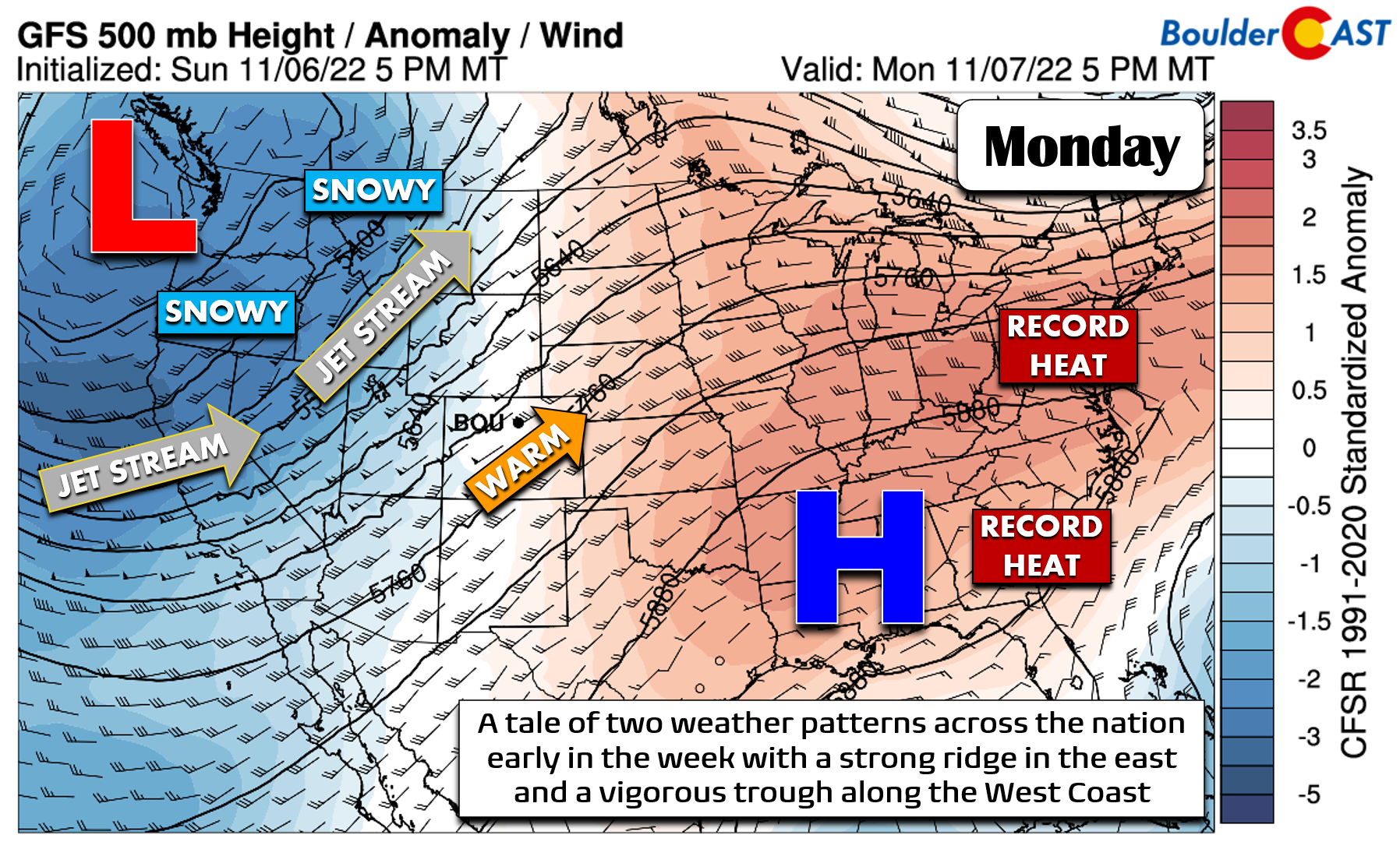
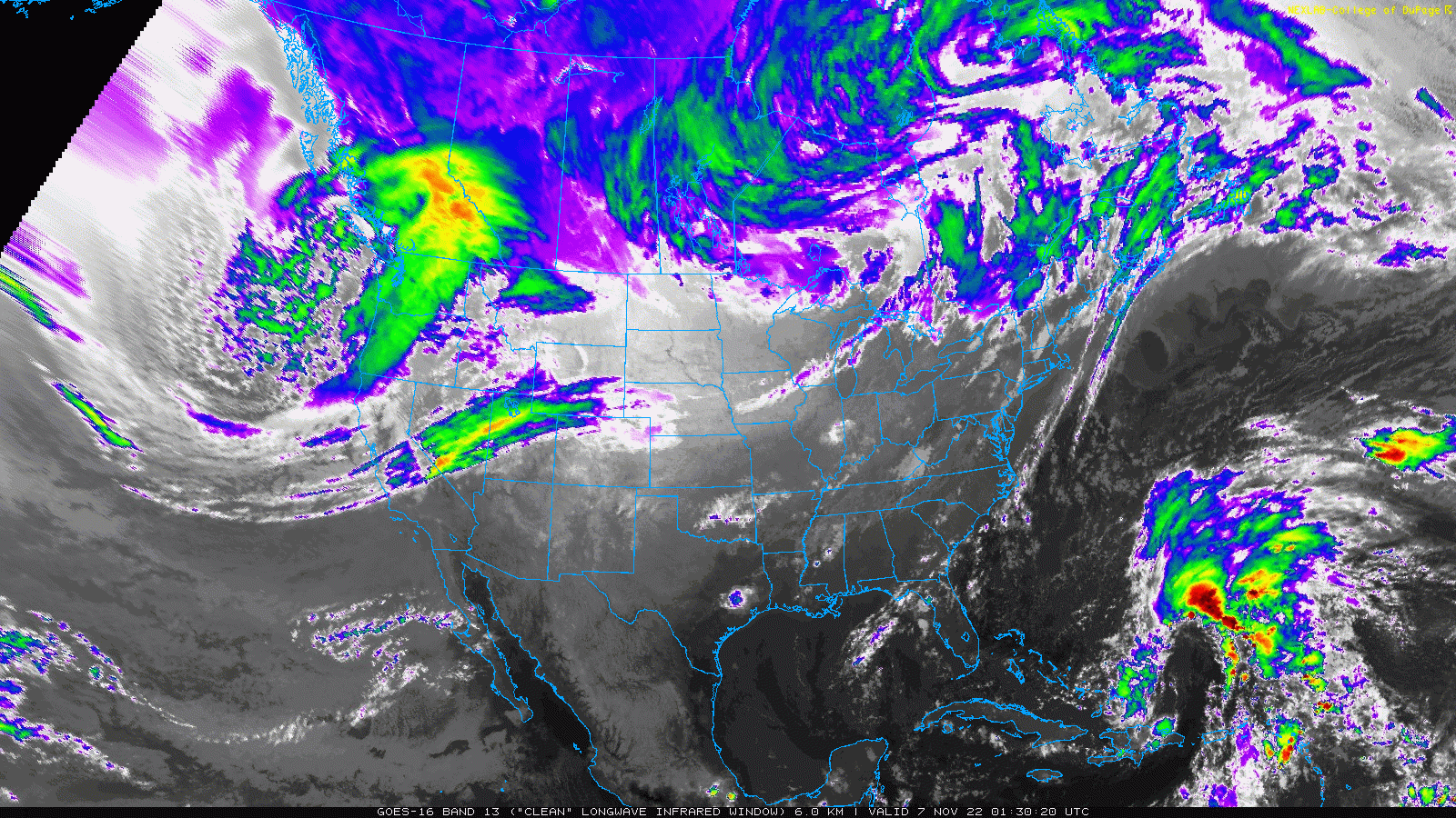
Monday morning’s GOES-East infrared satellite animation below tells the same story, though with a more colorful palette. The cut-off low pressure entering the Pacific Northwest is absolutely massive! Sublime and mostly clear conditions exist across the entire state of Colorado as of Monday morning.
Initially on Monday our high temperatures in Boulder will be near normal in the middle 50s under mostly sunny skies.
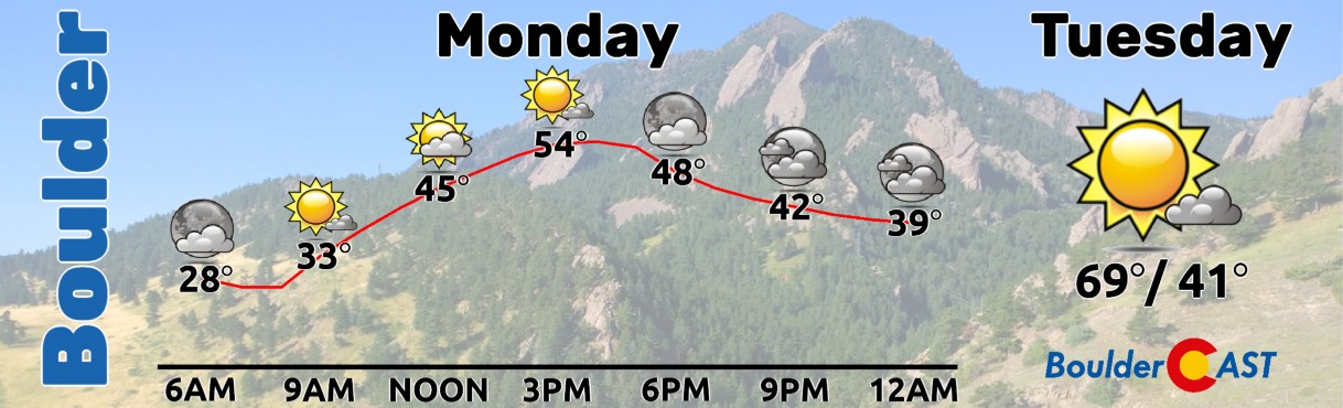
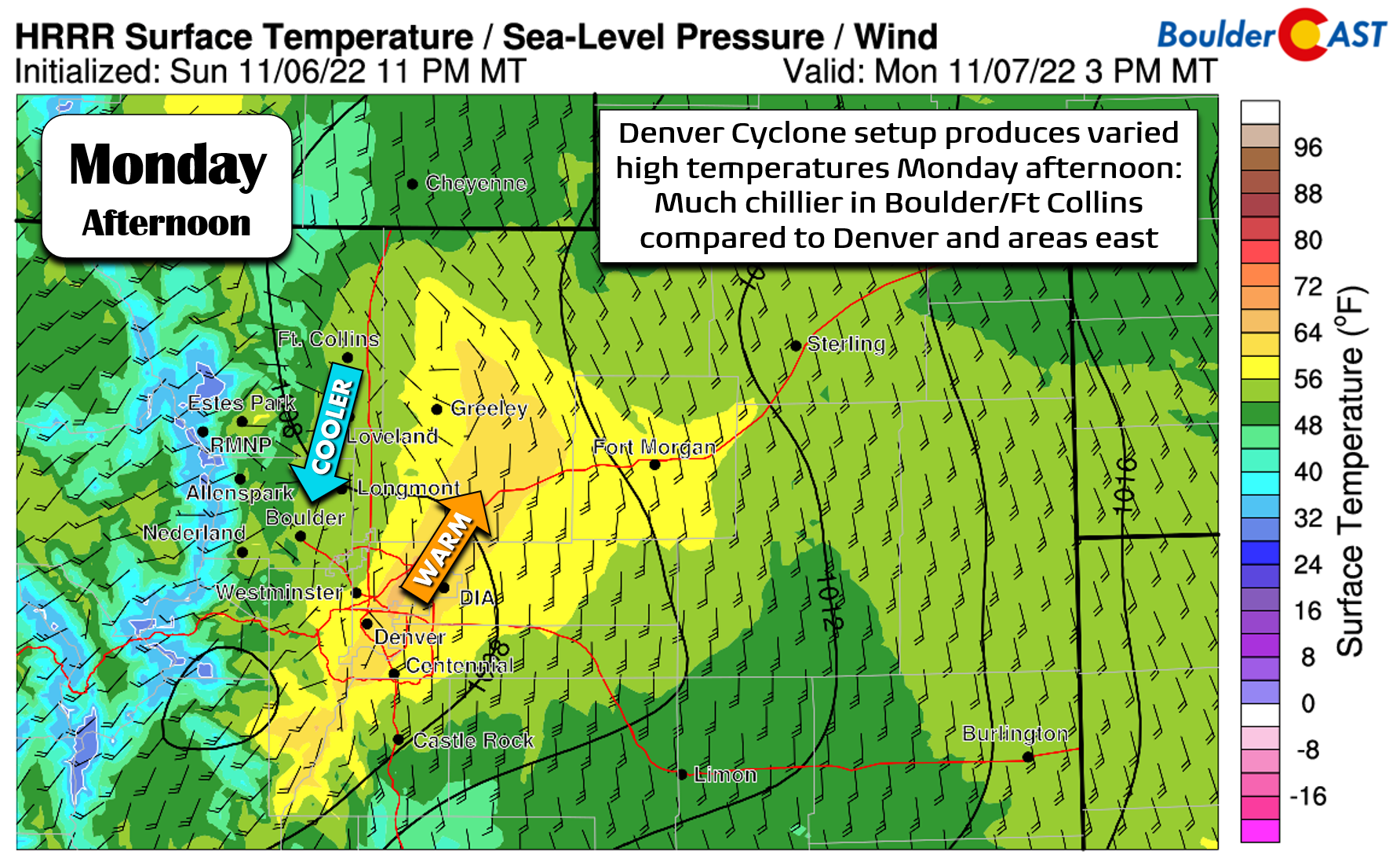
However, the temperature forecast on Monday is a bit tricky overall due to a warm front draped across the area and a Denver Cyclone setup developing through the day. This will keep temperatures notably cooler in the Boulder area (middle 50s) and warmer in Denver (low to middle 60s). The forecast graphic below showing surface winds and temperatures can help guide expectations for your exact location on Monday as it will be a mixbag out there for sure! A similar setup will exist on Tuesday but the temperature spread should be less pronounced across the Metro area.
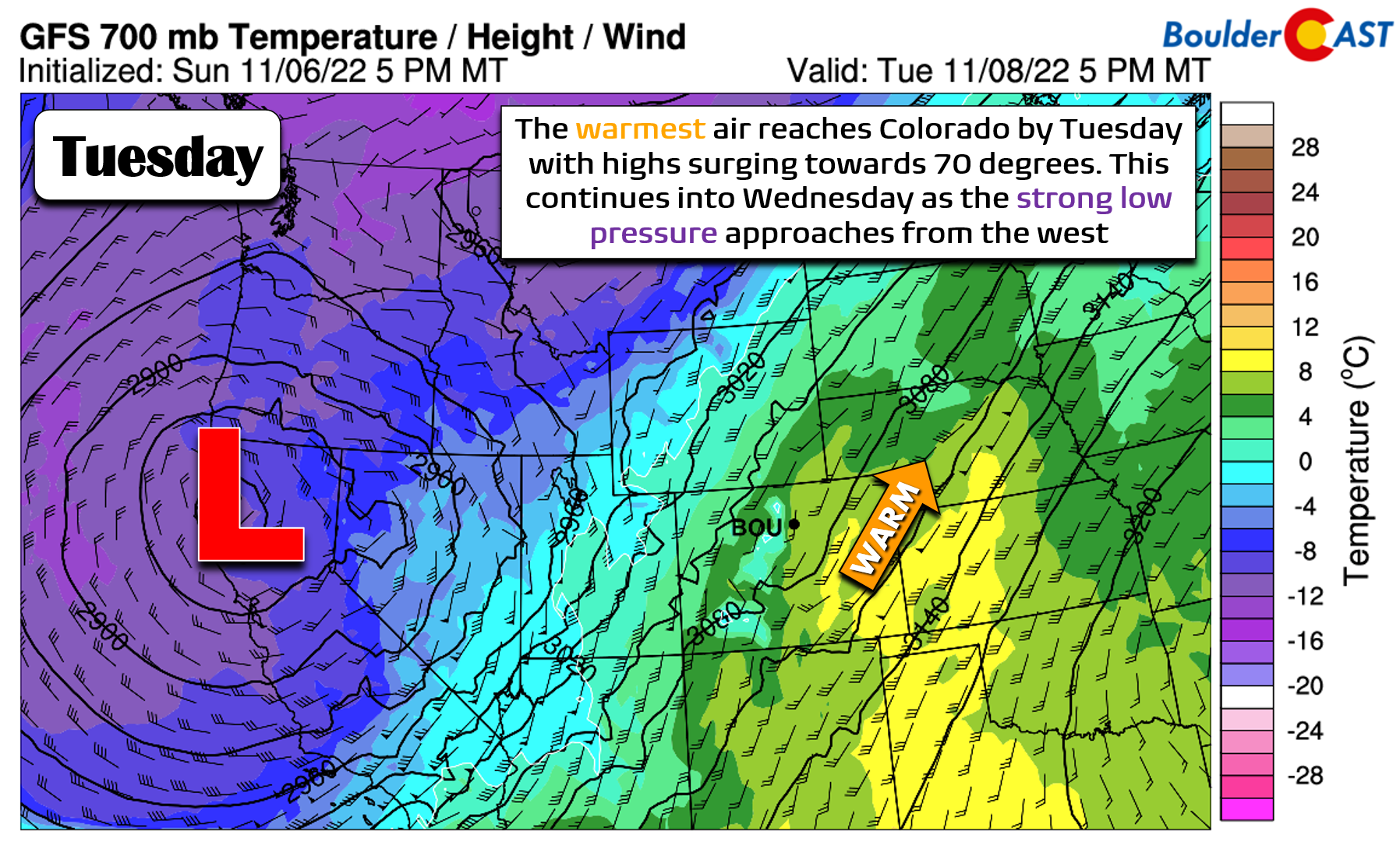
As the jet stream approaches and southwest flow intensifies, a warmer airmass will overspread the entire state leading to a quick uptick in our temperatures Tuesday and Wednesday soaring towards 70 degrees. Both days will be dry and tranquil.
Snow arrives for the third Thursday in a row?
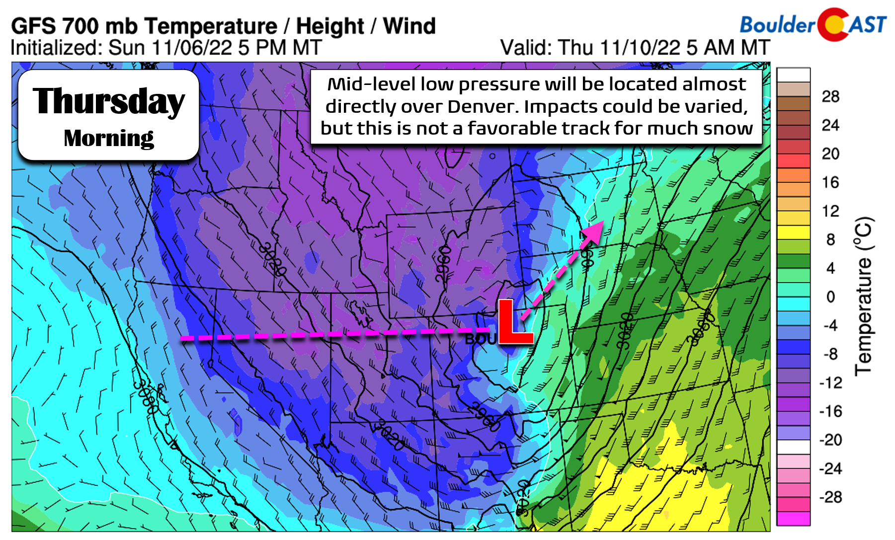
As the week progresses, the vigorous low pressure in the Pacific Northwest will dive south into California and then make its way eastward across the Rockies. Models have been bouncing around on its exact track for a few days but are now starting to paint a clearer picture. The European model’s 500mb height anomaly forecast animation is shown below through the week. Notice the low pressure weakens as it moves across Utah before reintensifying east of the Rockies in Nebraska/South Dakota.
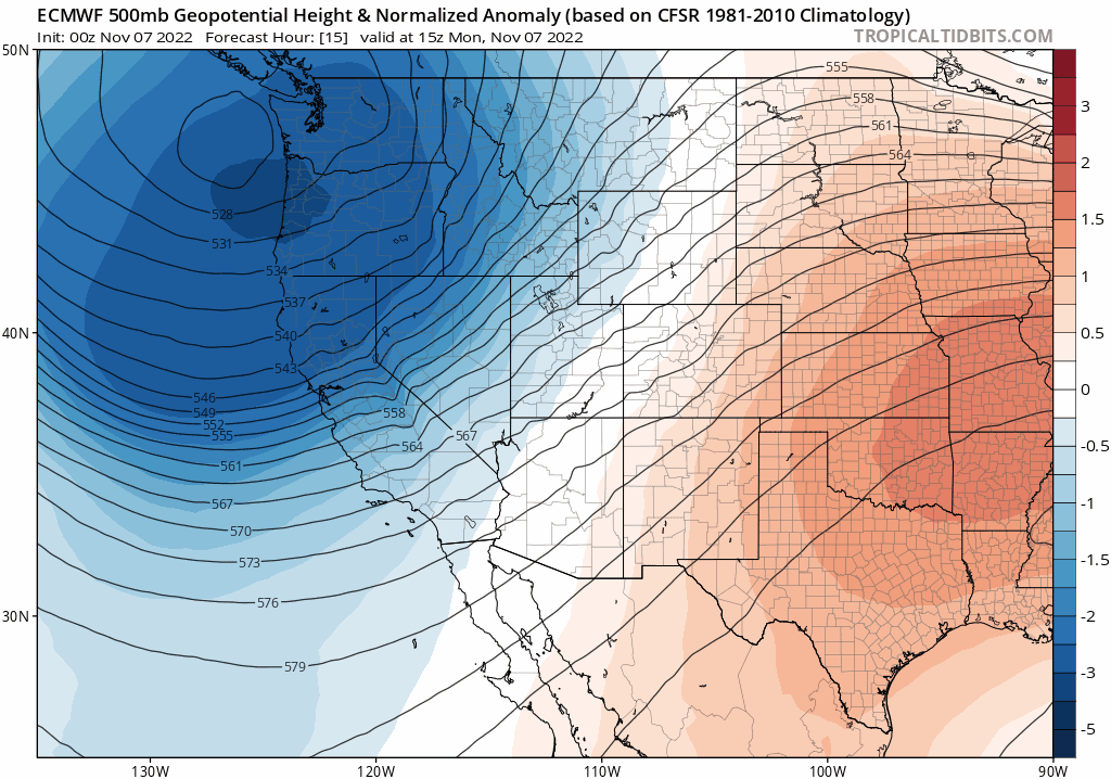
The track of the broader storm brings it almost directly over Denver by Thursday morning. The overall impacts of this positioning could be varied, especially if the storm eventually tracks just a tad further north or south since this would turn up the dial on either downslope or upslope in our area.
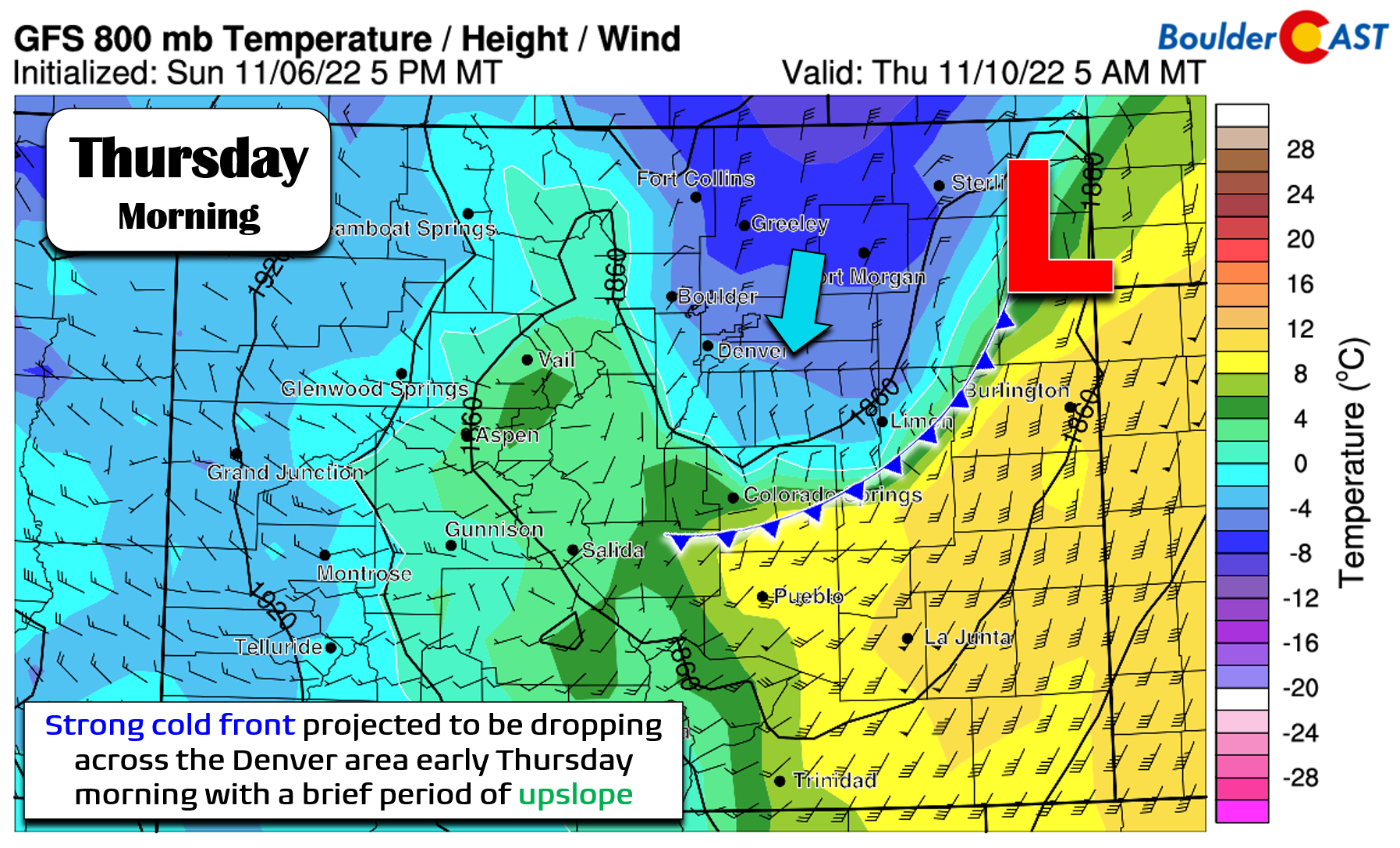
Right now it looks like there may be a brief period of upslope forcing early Thursday morning as the surface low intensifies across northeast Colorado. This upslope would be short-lived, though. As the low pulls away into Nebraska, dry downslope would kick in rapidly by Thursday afternoon across the Front Range killing off the precipitation.
Given that the low pressure is still three days away, and that the track will be critical for this system as it moves directly over the Denver area, take these late-week forecast highlights somewhat with a grain of salt for now:
- Expect a strong cold front to blow through around midnight Wednesday night — temperatures fall towards freezing by sunrise Thursday
- A brief surge of upslope and forcing could produce a period of light snow early Thursday morning across the area, but this remains questionable
- A rapid shift to downslope will cut off any snow potential by Thursday afternoon with clearing skies by evening
- Under all current model scenarios, potential snow accumulations across the Denver Metro area are less than 2″, with the most likely outcome being less than 1″ or even nothing at all
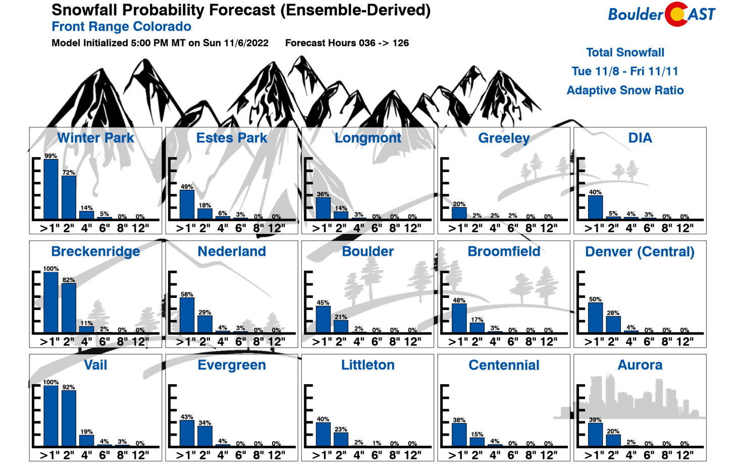
That final point there is reiterated by our updated Snowfall Probabilities for the late-week period with less than 50% odds that any city is able to crack 1″ of snow on Thursday. Unless we see a drastic shift in the models soon taking the low pressure further south, the snow chance this week will be a very minor one for our area.
The bigger story with this system will be the unseasonably cold temperatures it unleashes across most of the nation Thursday and beyond. Unlike the last two snow events, there’s no quick warm-up waiting in the wings for the Front Range. Once that cold front moves through Wednesday night, temperatures will remain below normal for the foreseeable future with highs in the 40s every day and lows well into the 20s every night.
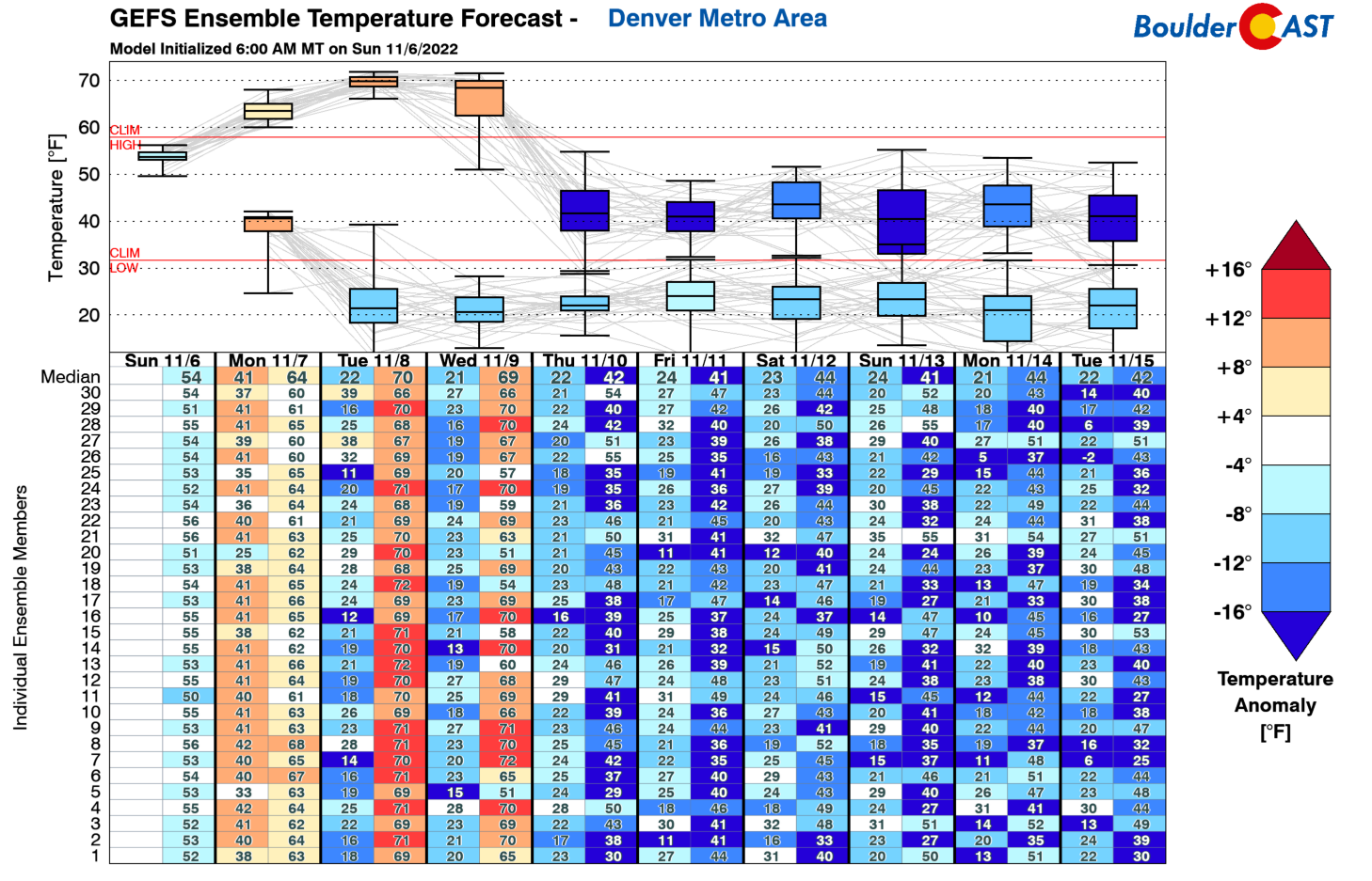
In fact, longer-range ensemble guidance keeps temperatures below normal across the Front Range for about 10 straight days, with things only starting to warm back up slightly around November 21st or so. The Climate Prediction Center (CPC) outlook for November 12-16 is definitely chilly in eastern Colorado:
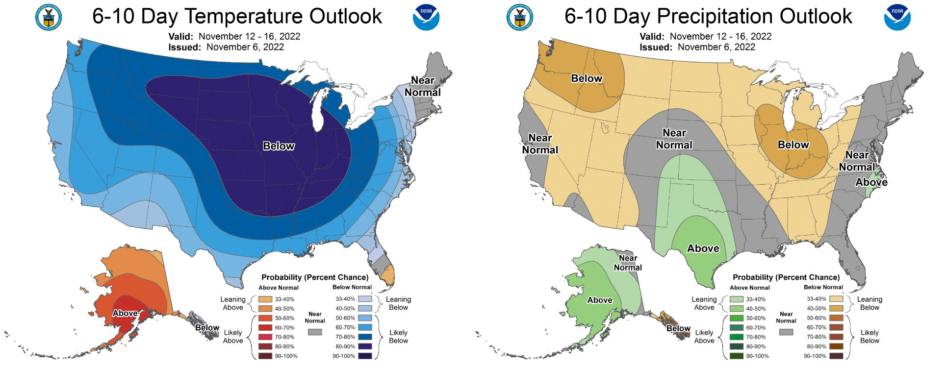
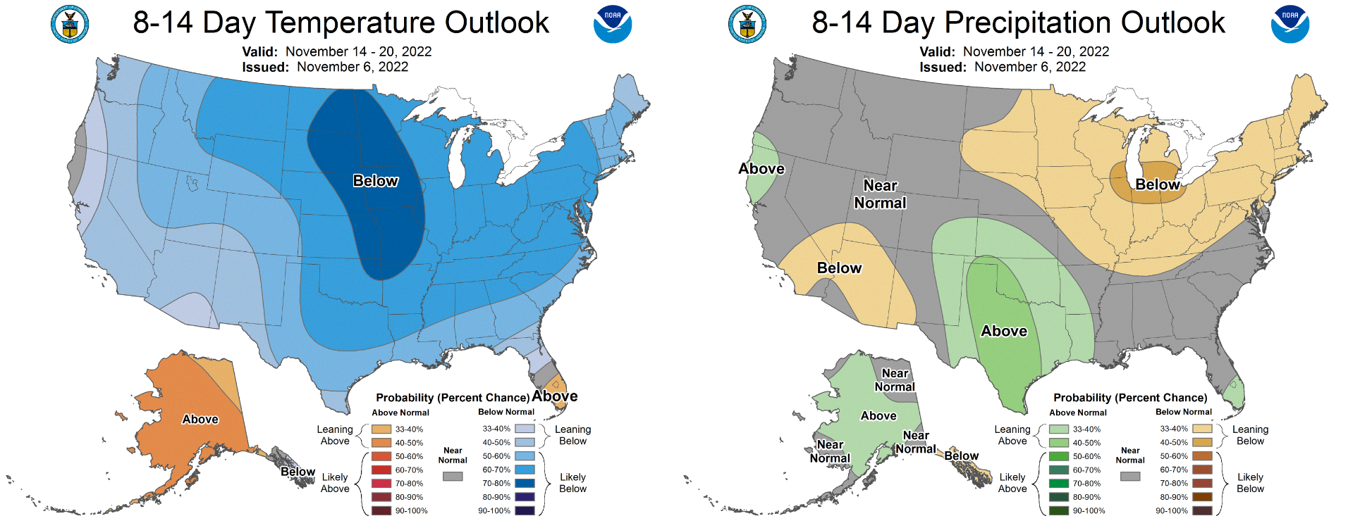
Things become less clear-cut obviously moving out to the November 14-20 period, but we don’t see many signs of any warmer weather (or even seasonal temperatures) returning either. Neither does the CPC:
For those of you staying hopeful that cooler autumn weather would finally arrive and actually stick around — you have your wish. Enjoy!
Forecast Specifics:
Monday: Mostly sunny and seasonal with highs in the middle 50s across the Plains and lower 40s in the Foothills. It will be warmer in the lower 60s near Denver.
Tuesday: Some morning cloud cover, then sunny and warm with temperatures rising into the middle to upper 60s on the Plains and into the middle 50s in the Foothills.
Wednesday: Partly cloudy and continued warm with highs topping out in the upper 60s on the Plains and in the middle 50s in the Foothills.
Thursday: Overcast and much colder with a slight chance of light snow in the morning. 1″ or less of accumulation is expected. Some clearing is possible by afternoon. Highs only in the upper 30s on the Plains with lower 30s in the Foothills.
Friday: Sunny but staying cold with highs near 40 degrees on the Plains and upper 20s in the Foothills.
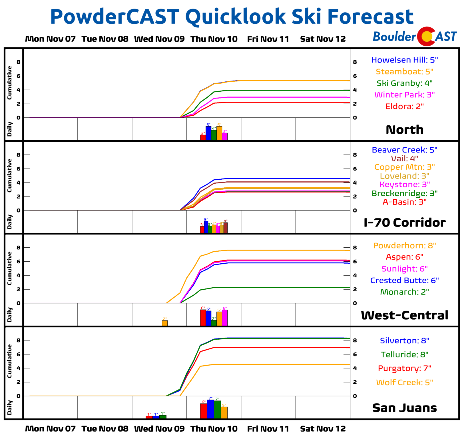
High Country: The Mountains are dry and windy Monday through Wednesday. Wednesday evening snow begins to spread into the western part of the state, overtaking all mountain ranges Wednesday night as the big storm of the week moves through. Orographic snow will continue through the day Thursday into Thursday evening, favoring northwest flow areas. Snow amounts of 4-10″ will be common across the state and ski resorts from this event. Friday will be dry but cold in the Mountains.
Help support our team of Front Range weather bloggers by joining BoulderCAST Premium. We talk Boulder and Denver weather every single day. Sign up now to get access to our daily forecast discussions each morning, complete six-day skiing and hiking forecasts powered by machine learning, first-class access to all our Colorado-centric high-resolution weather graphics, bonus storm updates and much more! Or not, we just appreciate your readership!
Spread the word, share the BoulderCAST forecast!


You must be logged in to post a comment.