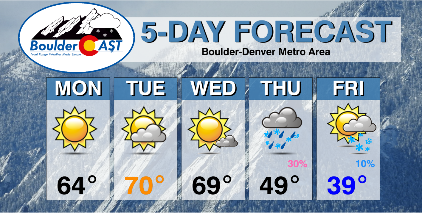
Warm temperatures will be the story through midweek in the 60s to near 70 degrees with a ridge of high pressure slowly sliding eastward, including picture-perfect conditions for Halloween evening festivities. However, the pattern shifts much colder and potentially snowy late Thursday into Friday. There remains considerable model uncertainty right now but there are definitely good chances for snow later in the week. Stay tuned and read on for more details.
This week’s highlights include:
- Warm with above average temperatures through midweek to end October and start November
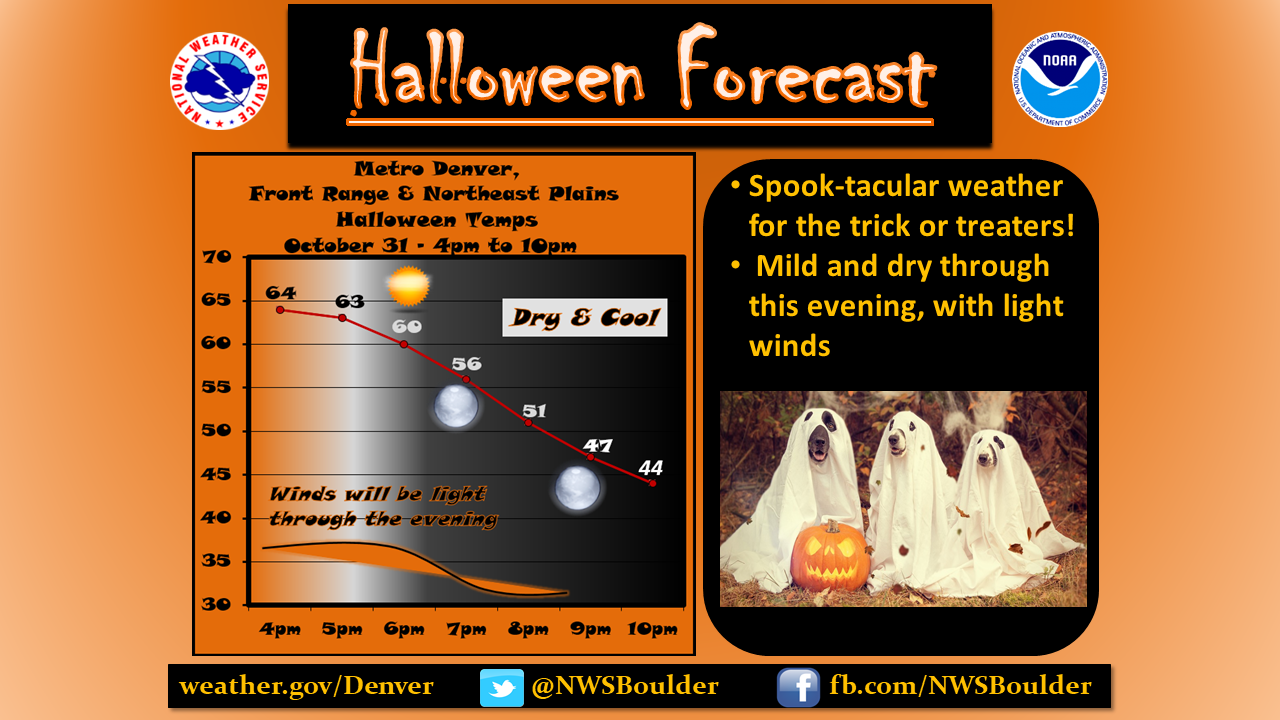
- Clear skies, mild, and dry for Halloween evening
- The pattern drastically changes Thursday and Friday with a cold front and storm system moving in
- Snow probabilities are high enough to take a look at our next snow chance
- Uncertainty remains for late-week system so stay tuned!
DISCLAIMER: This weekly outlook forecast is created Monday morning and covers the entire upcoming week. Accuracy will decrease as the week progresses as this post is NOT updated. To receive daily updated forecasts from our team, among many other perks, subscribe to BoulderCAST Premium.

Warm through midweek
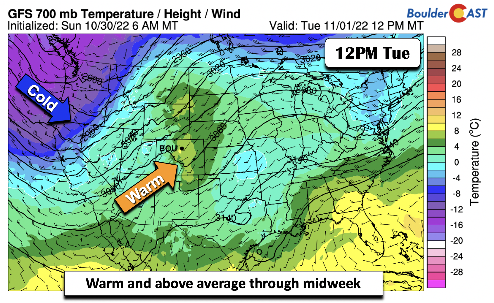
The week ahead starts out above average with a ridge of high pressure in place over the area on Monday. In the days to follow, that ridge will slide eastward and a strong trough of low pressure will start to move onshore across the Pacific Northwest. A pleasant downslope warming trend will ensue into midweek under southwest flow, though clouds will increase toward Wednesday as the system out West moves closer.
Highs in the 60s will be the norm, perhaps briefly 70 on Tuesday and/or Wednesday.
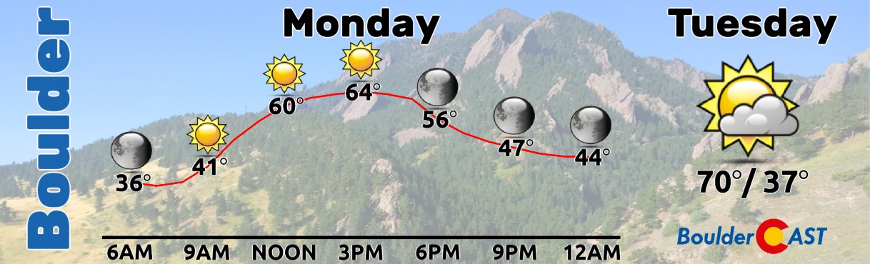
The tricker-treaters can expect clear skies Monday evening with temperatures falling from near 60° at sunset into the upper 40s by 9PM.
Watching a potential late-week snow event
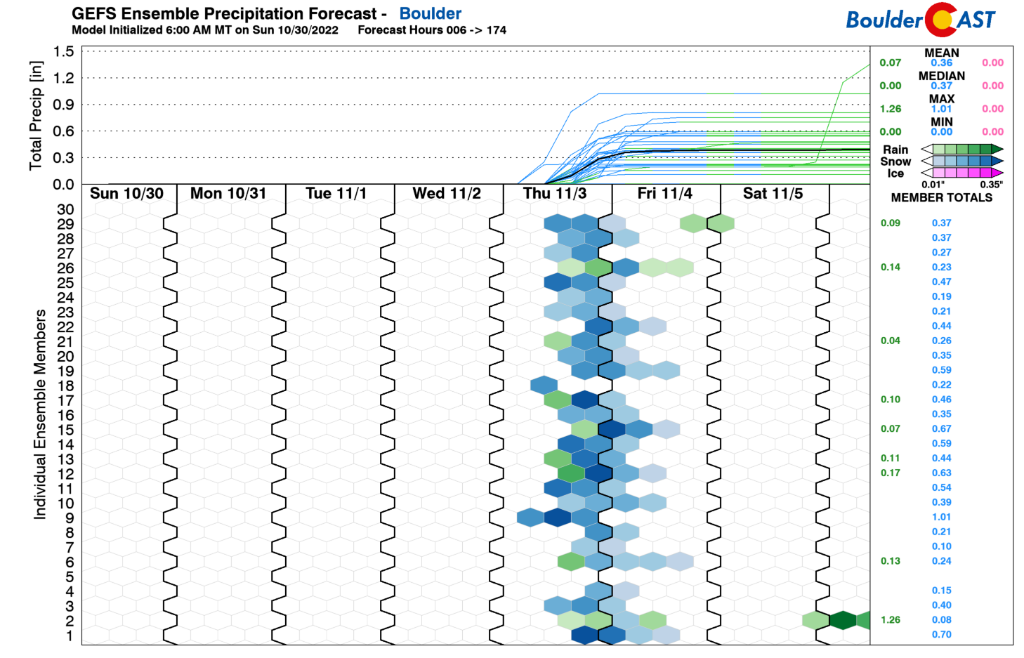
All things change come late in the week as the aforementioned storm system is set to impact Colorado. How exactly that will happen remains to be seen. The GEFS ensemble precipitation plumes are indicating a good probability of seeing some snow late Thursday into Friday:
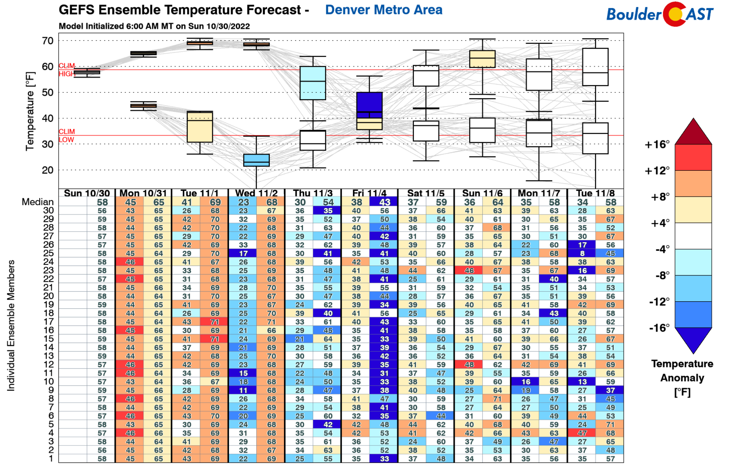
As you can also see from the GEFS temperature plot below, we’ll start out warm this week as previously mentioned, but the bottom drops out come Thu/Fri behind a strong cold front and the associated storm system out West moving into the Four Corners area. We will discuss the details of this system now and provide our “best guess” forecast based on current model trends. This is still four days out, some things will likely changing in the coming days, at least a little but perhaps a lot!
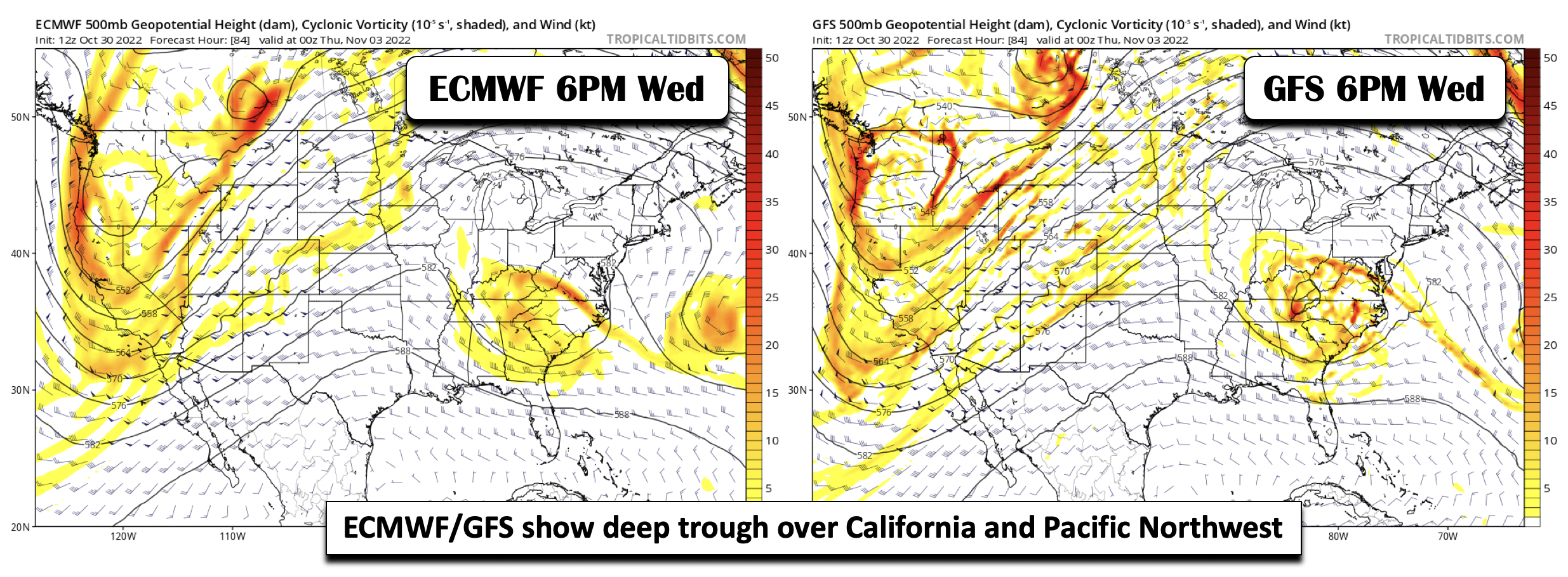
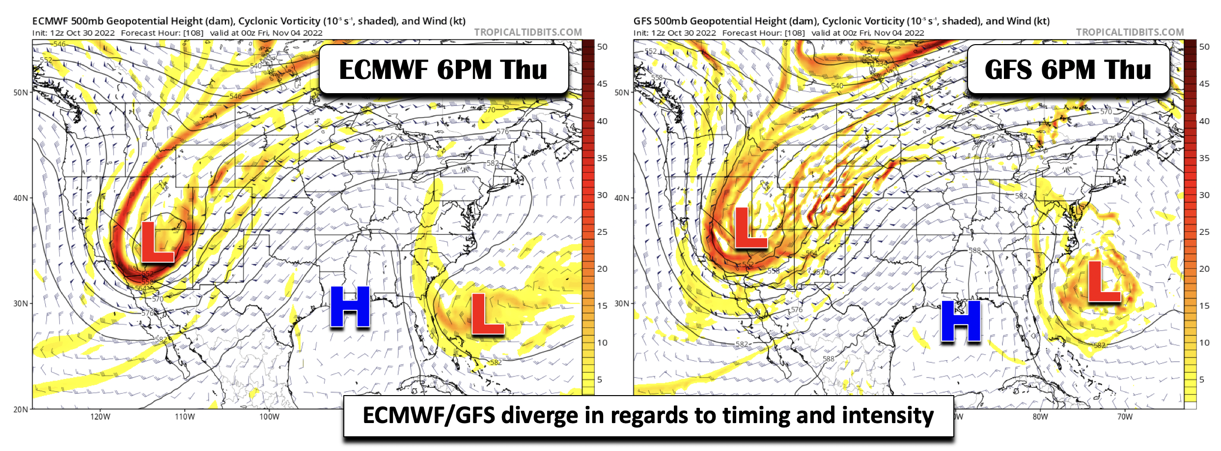
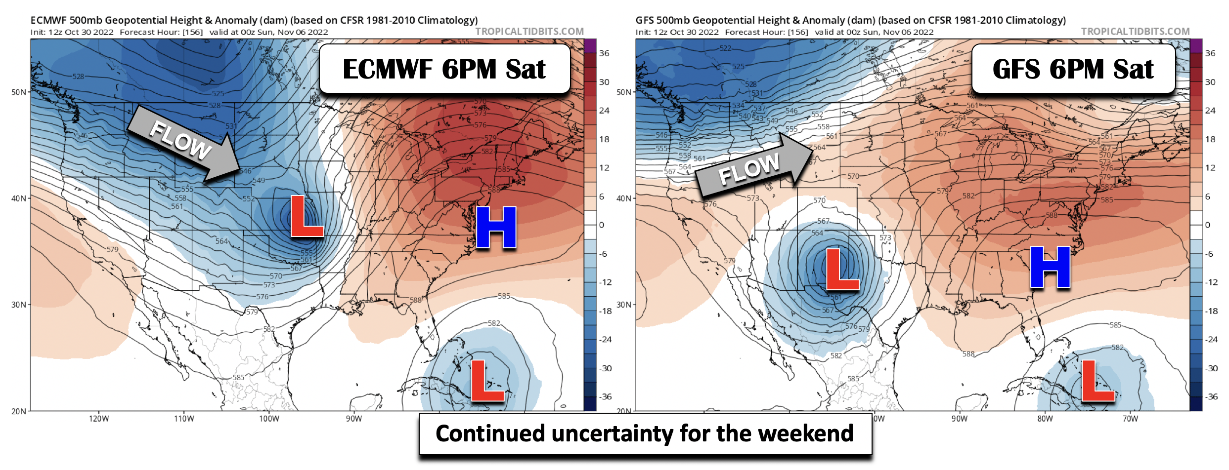
The next several plots will be a comparison of models to give you a sense of the potential track and strength of the late-week system and, from there, Boulder and Denver’s snowfall chances. By Wednesday evening, the ECMWF (left) and GFS (right) show a deep trough moving onshore across California and the Pacific Northwest. Subtle differences remain in terms of the overall pattern and southward penetration of the trough, but all in all, these two models are not that different. We remain in warm southwest flow at this time.
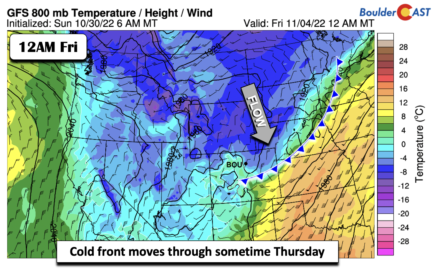
Come Thursday, models diverge much more substantially, with the ECMWF a tad faster and showing more of a closed circulation over northern Arizona. The GFS has the system a tad weaker and over southern Nevada. We remain in southwest flow but the location of the trough will be key in terms of upslope flow and the depth of the cold air. Nevertheless, strong energy will be moving in at this time for lift and precipitation across the state.
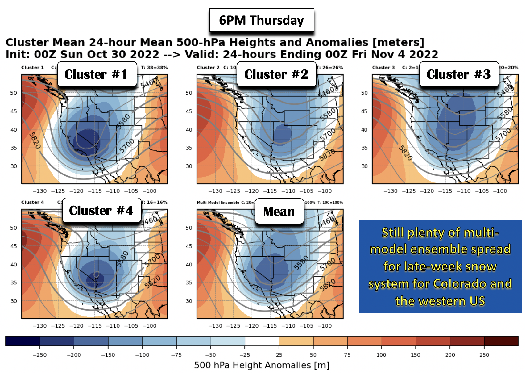
An inspection of four ensemble clusters — derived from the ECMWF, GFS, CMC ensembles — also shows this uncertainty Thursday night, with some models showing a trough that does not close off and also in terms of its location — some over southern California with others near Utah/Nevada.
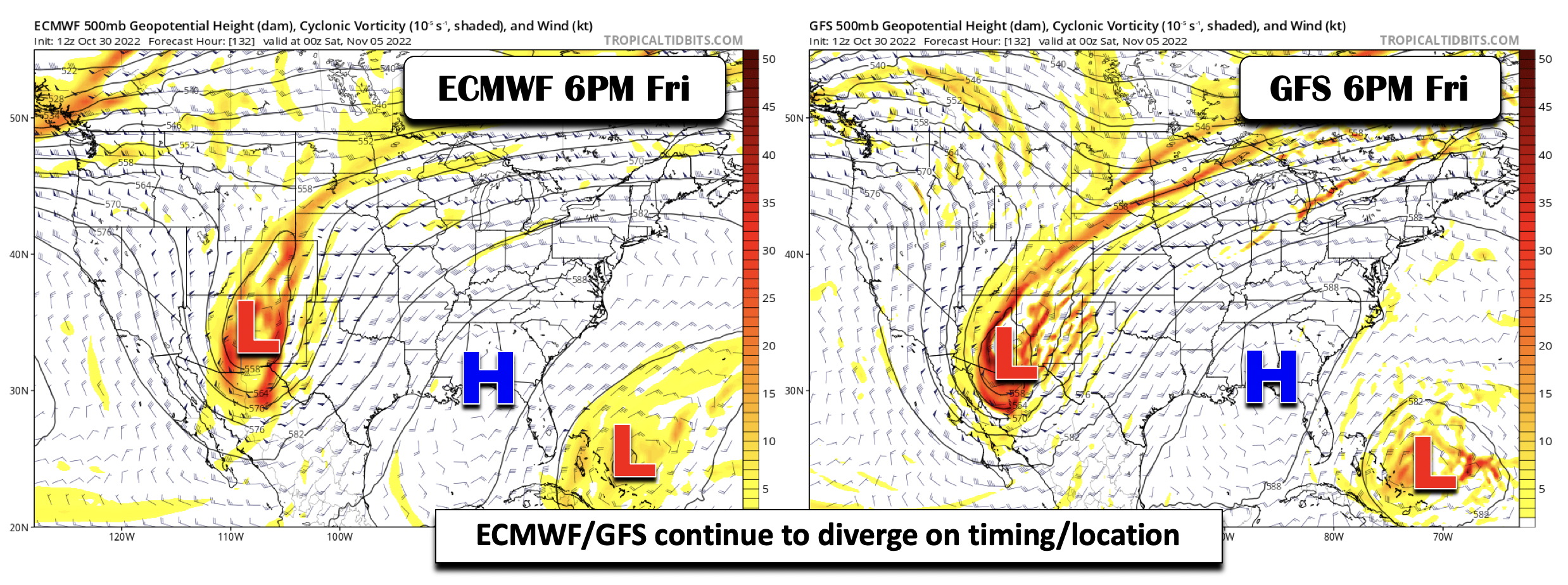
By late Friday, the model spread increases further, with the Euro closed-off in New Mexico and the GFS closed-off near the Mexico border. The Euro would favor more snow given its further north track, but it’s hard to say given the uncertainty and pattern.
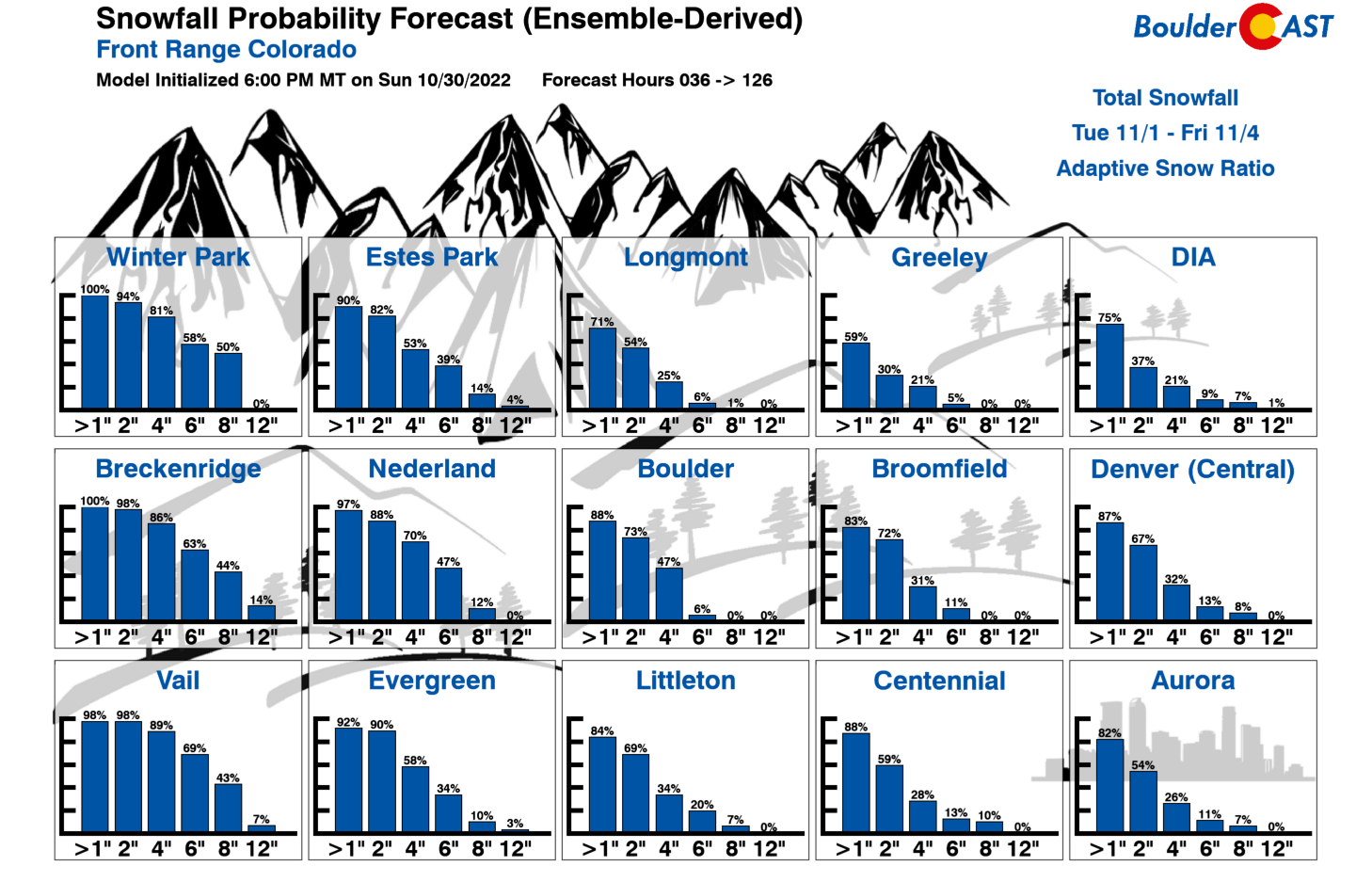
A look at the Snowfall Probabilities do show a good chance of seeing a few inches of snow on the Front Range, with the best chances over the Mountains at this moment.
If the storm tracks just right, that is closer to the Four Corners and becomes closed off as some models would suggest, it would increase our snowfall chances. On the other hand, the forecast is more certain in terms of the cold weather on the way, with nearly all guidance showing temperatures likely falling into the 40s Thursday and even colder come Friday.
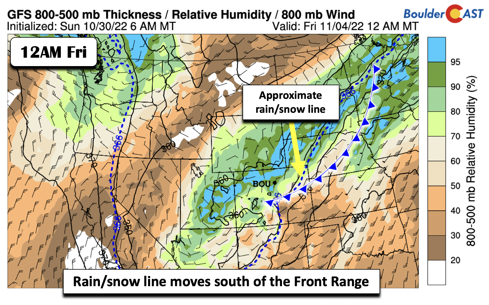
The approximate rain/snow line (dashed blue line below) looks to move south of the area as well Thursday night. This with upslope and moist flow, would also support snow, if the precipitation is still ongoing that is.
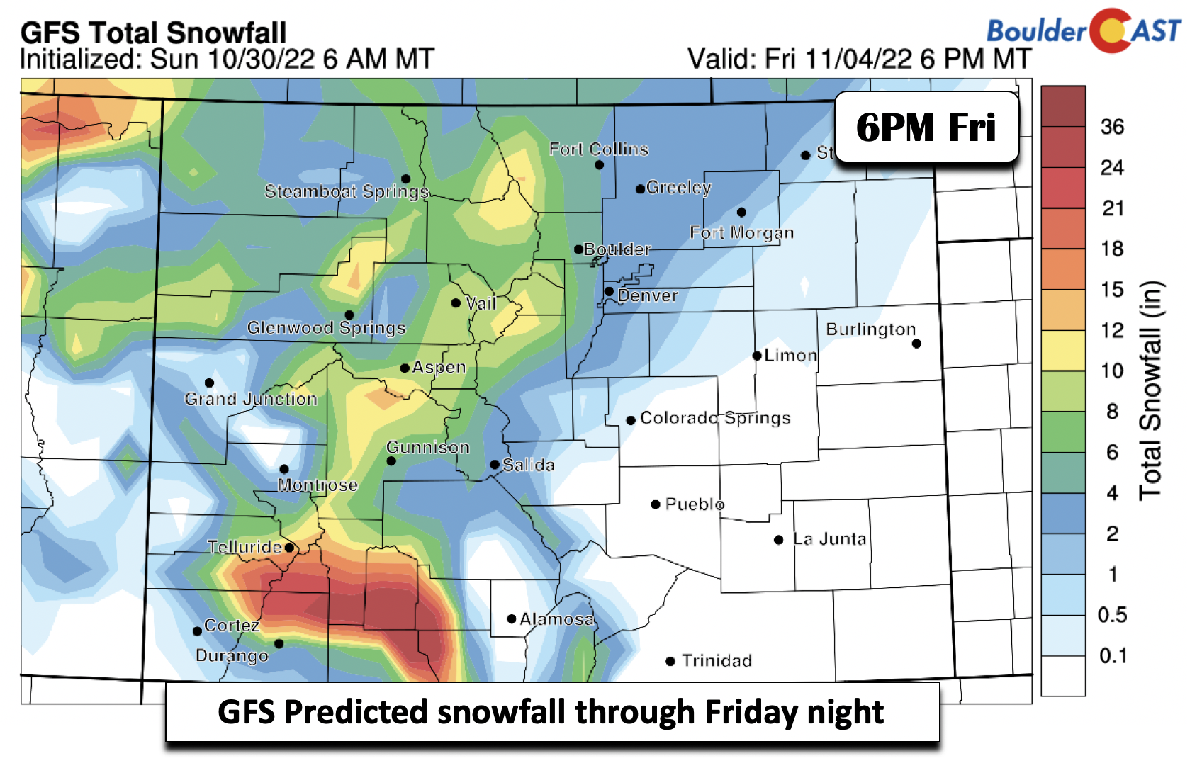
The GFS deterministic model is a tad more bullish than our in-house snowfall probabilities, showing some 3-6″ across the Front Range, highest in Boulder and the Foothills. It certainly bears watching for now.
Here’s the high-level recap of the week:
- We stay warm through Wednesday.
- Clouds increase Thursday and a cold front moves through sometime during the day. Highs will likely not get out of the 40s, with temperatures dropping close to freezing at night.
- A good probability of snow Thursday night into Friday, but amounts are highly uncertain so far, dependent upon duration of upslope and overall track of the main storm system.
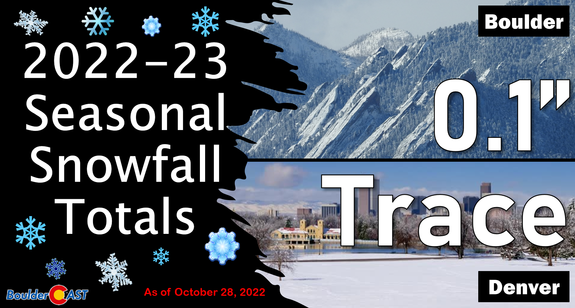
- Boulder already had its first accumulating snow last week, but Denver may join the club later this week, too!
- Highs will remain well below normal Friday in the upper 30s to lower 40s.
- Stay tuned as we get closer…
The upcoming weekend also looks uncertain, with the Euro/GFS mixed on the evolution of the system as it tracks east. The Euro is faster and brings a secondary cold surge into the state Sat/Sun, while the GFS is slow to exit the system and keeps ridging over the northwest into Sunday.
That’s all for now. Happy Halloween from the BoulderCAST team!
![]()
Forecast Specifics:
Monday: Sunny and mild with highs in the middle 60s on the Plains and middle 50s in the Foothills.
Tuesday: Partly cloudy and quite warm reaching into the lower 70s on the Plains and upper 50s in the Foothills.
Wednesday: Mostly sunny with breezy winds at times. Temperatures stay warm in the upper 60s for the Plains and middle 50s on the Foothills.
Thursday: Mostly cloudy and colder with temperatures only in the 40s, dropping into the 30s. A good threat of rain changing to snow in the late-day period and overnight, but amounts remain uncertain (perhaps a couple inches in things come together)
Friday: Partly sunny with a slight chance of lingering morning snow. Otherwise, cold with highs near 40 degrees on the Plains and lower 30s in the Foothills.
High Country: The Mountains are dry through most of Wednesday. It will be breezy at times from the southwest Tuesday night into Wednesday night. A strong storm system will warrant a good chance of snow to the Mountains Thursday morning into midday Friday, along with continued gusty winds at times on the highest mountain peaks. Southwest flow will favor the San Juans more so than the northern Mountains and/or Front Range peaks.
Help support our team of Front Range weather bloggers by joining BoulderCAST Premium. We talk Boulder and Denver weather every single day. Sign up now to get access to our daily forecast discussions each morning, complete six-day skiing and hiking forecasts powered by machine learning, first-class access to all our Colorado-centric high-resolution weather graphics, bonus storm updates and much more! Or not, we just appreciate your readership!
Spread the word, share the BoulderCAST forecast!


You must be logged in to post a comment.