After widespread snow and unseasonably cold weather on Monday, things quiet down for the midweek period with a nice warm-up headed to the Front Range. A secondary storm system will reach the area Thursday into Friday with Mountain snowfall ramping up again along with another chance of snow in the Denver area to close out the month of March. Read on for all the details.
This week’s highlights include:
- Winter weather Monday morning is creating a slick A.M. commute for many, but snow will taper off quickly through the morning leaving behind very cold temperatures
- Tuesday and Wednesday will be rather quiet across all of Colorado as a ridge of high pressure transitions across the Rockies
- Temperatures warm up nicely as the week progresses getting back into the 50s by Wednesday with spring-like 60s taking hold by Thursday
- Yet another Pacific storm reaches Colorado Thursday into Friday with a return of Mountain snowfall and a chance of rain/snow for the Denver Metro area, too
DISCLAIMER: This weekly outlook forecast is created Monday morning and covers the entire upcoming week. Accuracy will decrease as the week progresses as this post is NOT updated. To receive daily updated forecasts from our team, among many other perks, subscribe to BoulderCAST Premium.
Daily Forecast Updates
Get our daily forecast discussion every morning delivered to your inbox.
All Our Model Data
Access to all our Colorado-centric high-resolution weather model graphics. Seriously — every one!
Ski & Hiking Forecasts
6-day forecasts for all the Colorado ski resorts, plus more than 120 hiking trails, including every 14er.
Smoke Forecasts
Wildfire smoke concentration predictions up to 72 hours into the future.
Exclusive Content
Weekend outlooks every Thursday, bonus storm updates, historical data and much more!
No Advertisements
Enjoy ad-free viewing on the entire site.
Snow Monday, then warming up
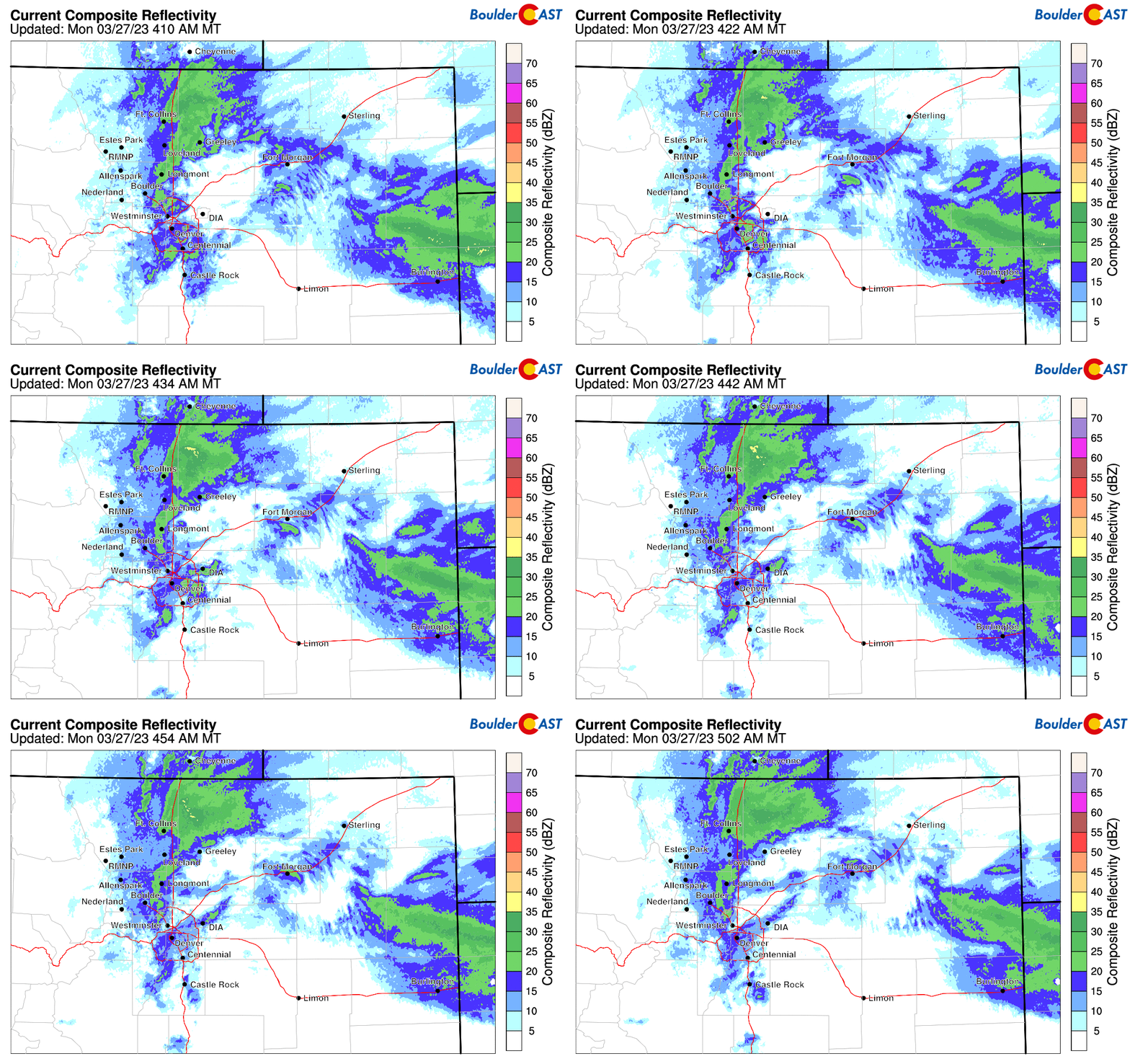
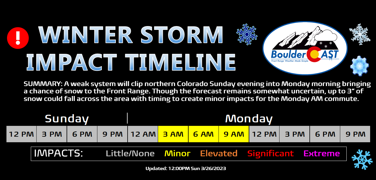
Are you tired of winter yet?! Snowflakes are flying across nearly all of northeast Colorado on this Monday morning, with the most intense snowfall occurring across the northern Front Range from Boulder to Fort Collins where rates have peaked near 1″ per hour overnight. Despite some lingering uncertainty, the tricky forecast we outlined yesterday seems to be performing well with most of the Denver Metro area likely to pick up a dusting to 3″ of snow from this wintry event.
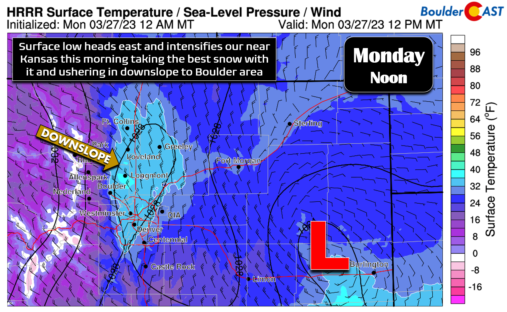
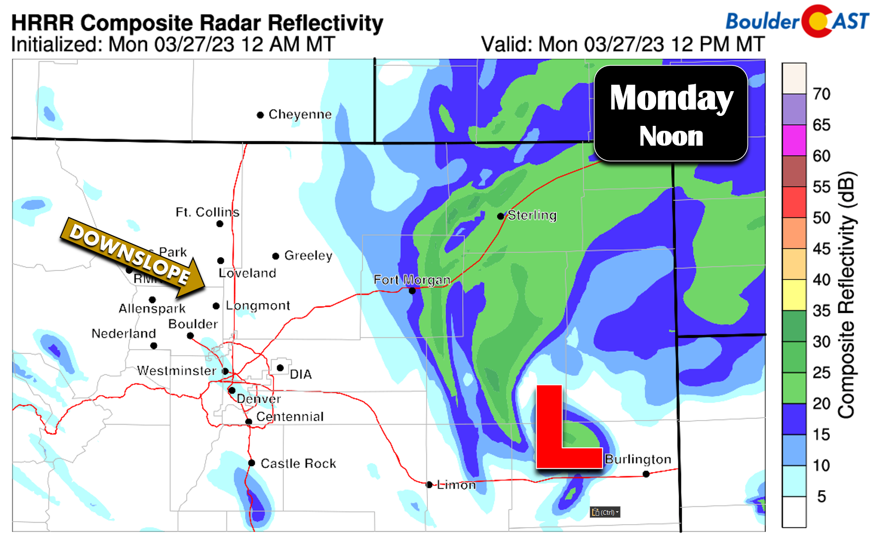
The heavier snow will rapidly shift east through the morning as surface low pressure strengthens east of Denver. This will usher in dreaded downslope to the area from the northwest helping to taper off the snowfall here. As of writing, this is already happening in Boulder.
The HRRR model shows things quickly winding down from west to east Monday morning for the Denver area but with snowfall continuing across far northeast Colorado well into the afternoon and early evening.
Roadways are looking slushy to snowy in many areas this Monday morning. Expect some minor travel issues early on, but things will quickly melt off as snow comes to an end and the late-March sun begins to do its thing (even through the cloud cover).
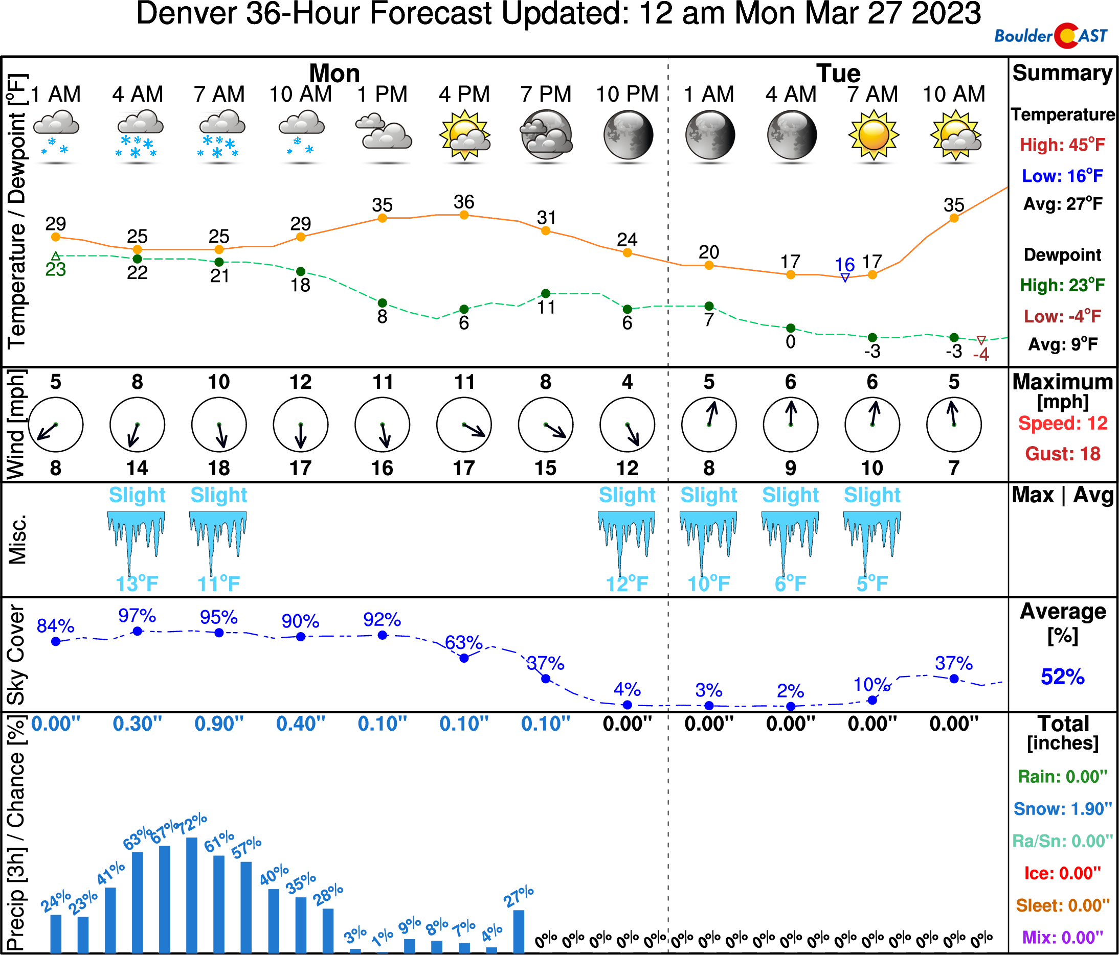
There could be a few popcorn instability snow showers redeveloping during the afternoon rolling down off the higher terrain, but for the most part we will be dry and partly to mostly cloudy for the rest of our Monday with temperatures remaining cold in the middle 30s.
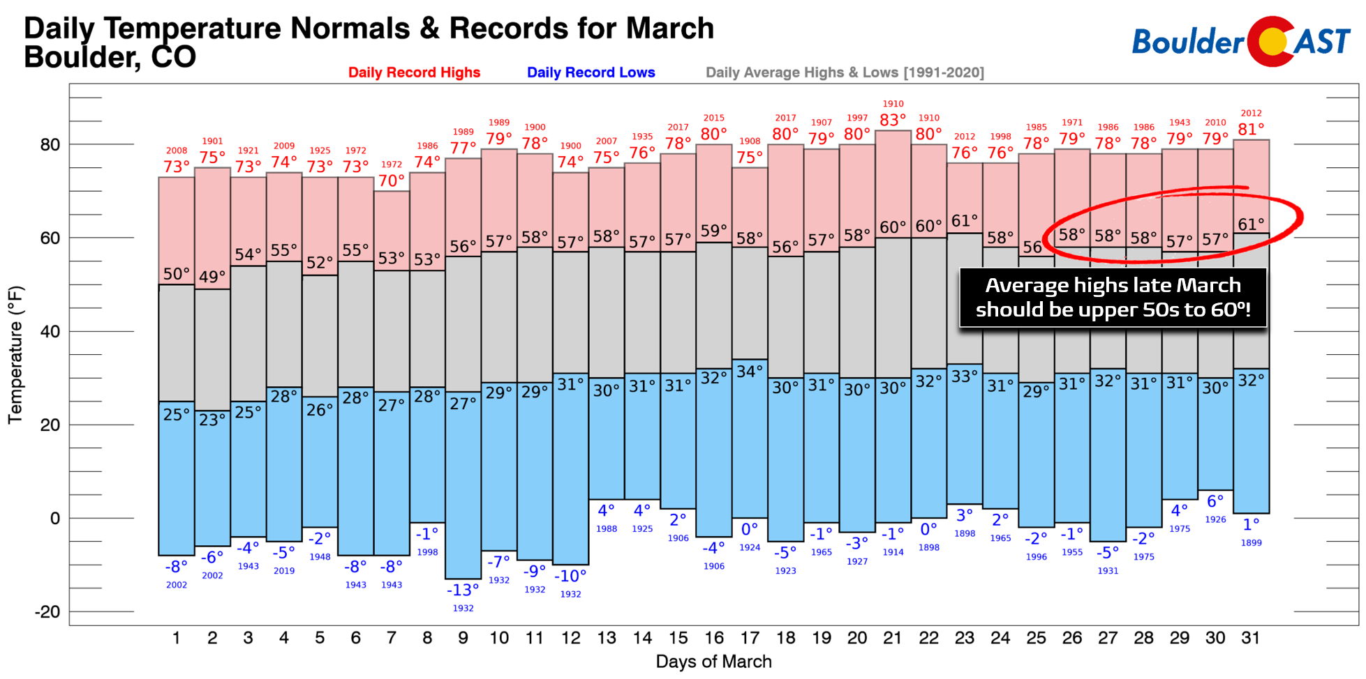
For some context, climatology indicates we should be touching 60 degrees almost every day this time of year — which has barely happened at all this month! As skies quickly clear late this evening temperatures will plummet into the teens (with single digits in outlying areas) by sunrise Tuesday. Don’t worry, it will be getting notably warmer as the week goes on…
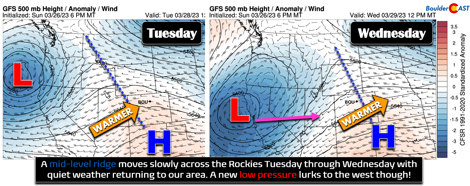
For Tuesday and Wednesday a ridge of high pressure will move into the Rockies from the west turning things quiet and much warmer for the Front Range. Unlike the ridges we’ve had over the past month or more, this one will take its time moving across the Intermountain West lending to a slower warm-up but a longer-lasting period of tranquil weather. We’re looking for highs to reach the upper 40s on Tuesday (some 50s in Denver) and then widespread 50s by Wednesday. This is still colder than normal but definitely is more seasonal then we’ve had of late.
As we point out in the graphic above, there will be another strong system coming ashore along the West Coast around the midweek timeframe bringing more rain and heavy snow to California — they certainly do not need any more of that right now! This closed-low will head towards Colorado on Thursday turning flow across the state southwesterly and in the process pumping in a plume of moisture which only really reaches the Mountains. Snowfall would favor southwestern and western Colorado again late week which best intercepts the southwest flow.
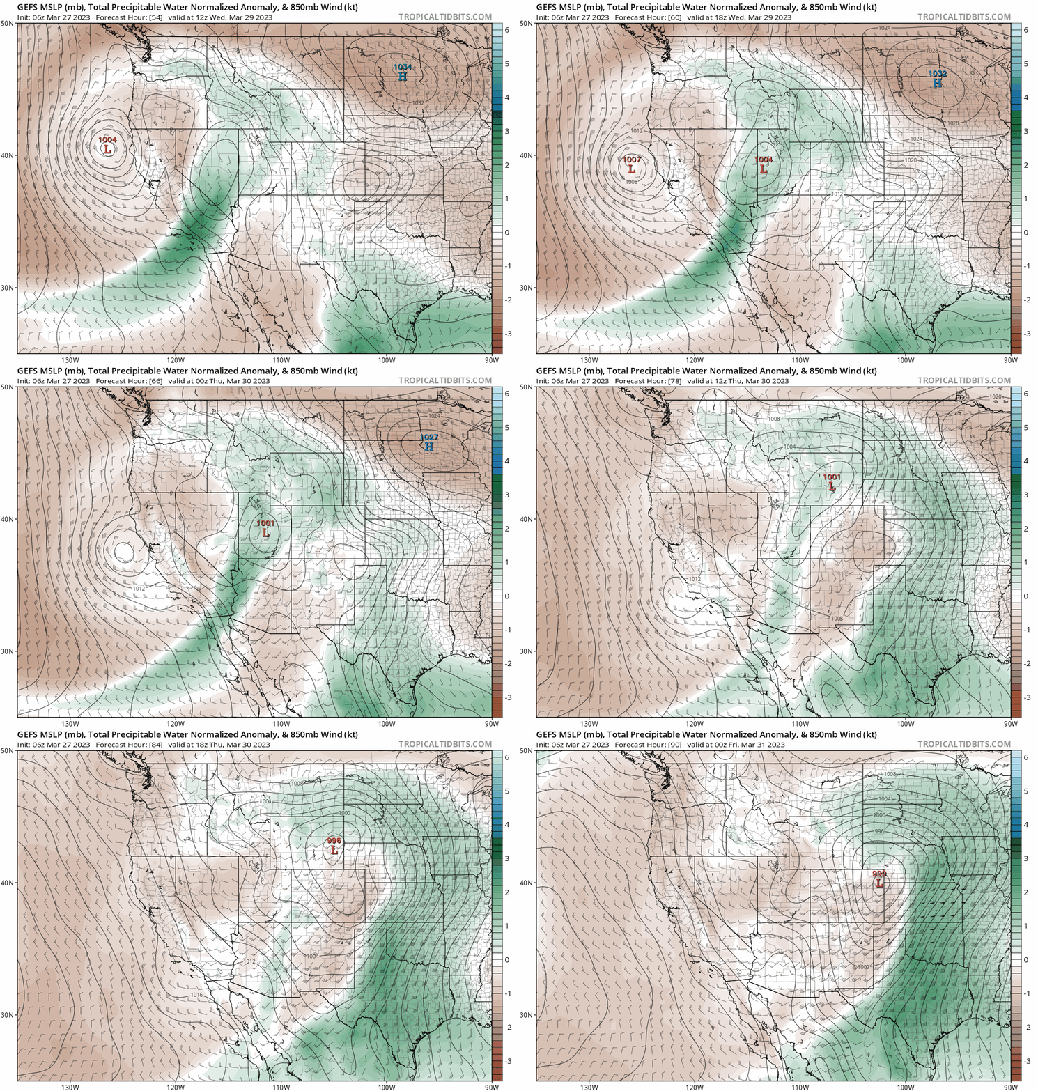
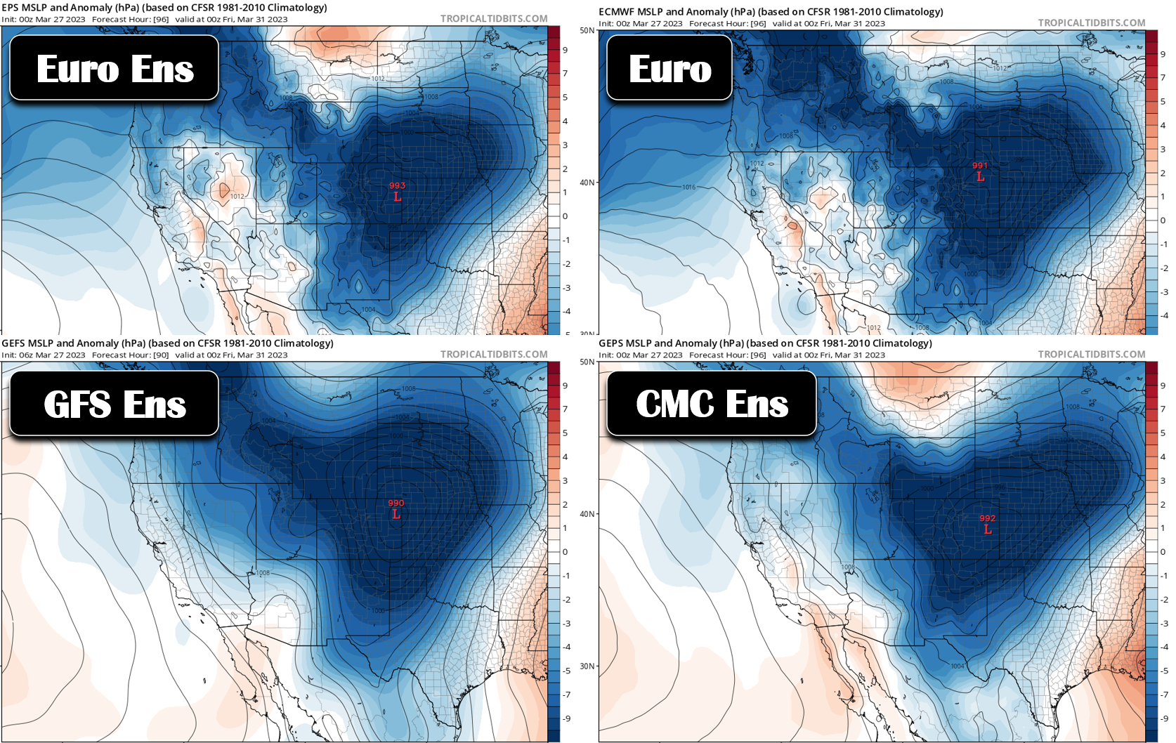
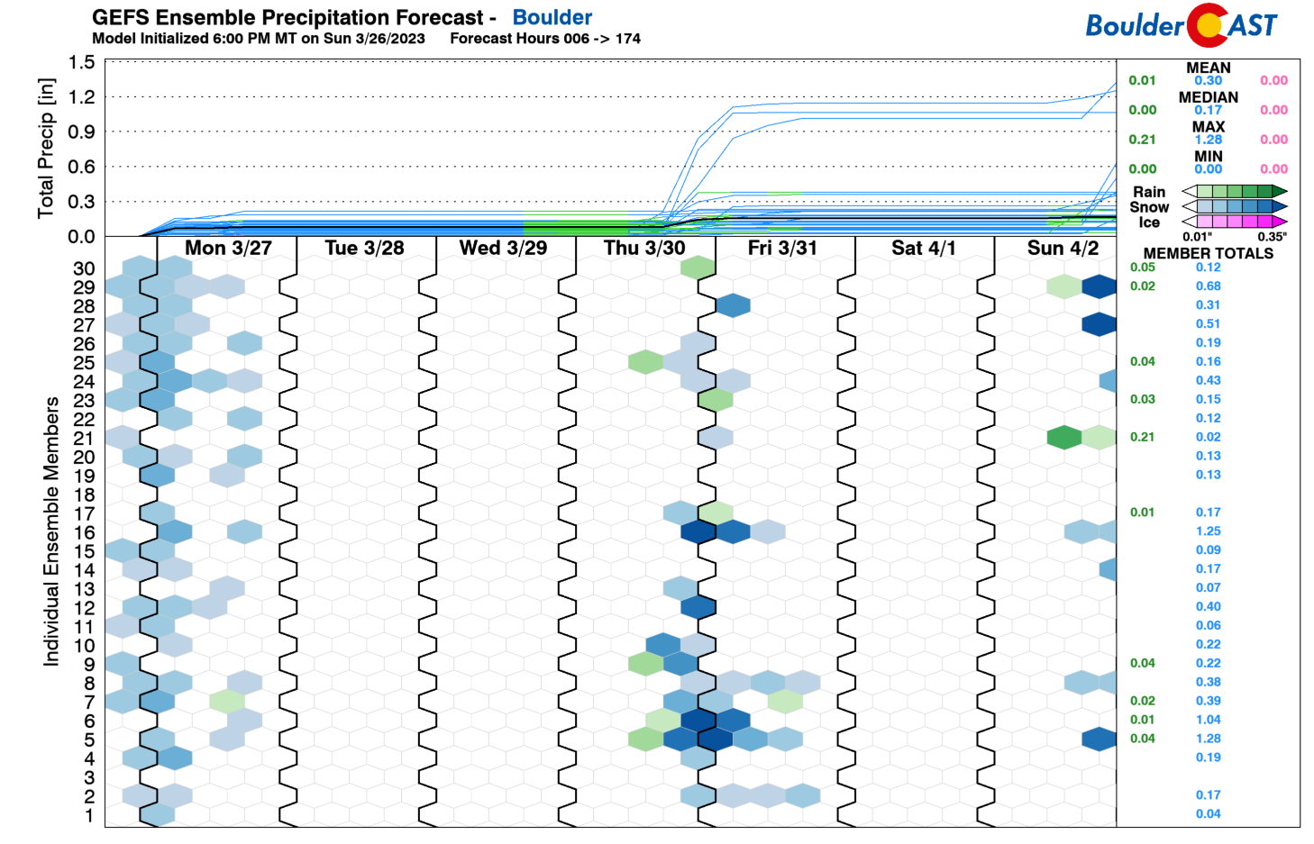
This West Coast system weakens rapidly before transitioning its energy to a new low forming out across the High Plains. Though still four days away, model ensembles show some agreement that this low pressure will pop-up across northeast or east-central Colorado — a favorable position for Front Range upslope. The Euro modeling suite is a bit further south than the GFS suite at the moment and thus in a more fruitful position for us. As a result, the Euro produces another 0.25″ or more of liquid for the Denver area Thursday night into early Friday, some of which would be snow again. The GFS, which is further north, is overall drier for us.
Some snow will return to the Mountains during this time Thursday. To the east, we will see a significant warm-up into the 60s for Thursday with gusty winds possible, especially across southeast and far eastern Colorado. There will likely be high fire danger this day in the windy areas. The late-week precipitation chance bears watching for now, but nothing more. The system itself is still way out over the Pacific Ocean as of writing with a track that will surely change between now and Thursday evening!
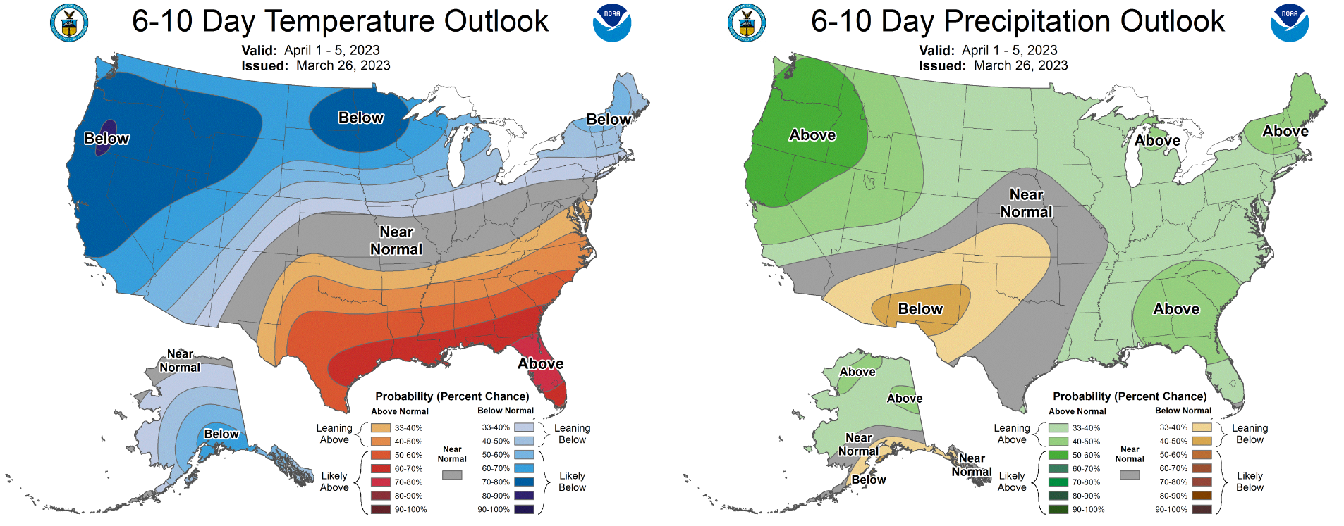
The week will end slightly cooler on Friday as the secondary system exits the area leaving behind a cooler airmass. Highs probably will fall back into the upper 40s to lower 50s with sunny skies. The upcoming weekend looks dry and cooler than normal for the first few days of April.
Forecast Specifics:
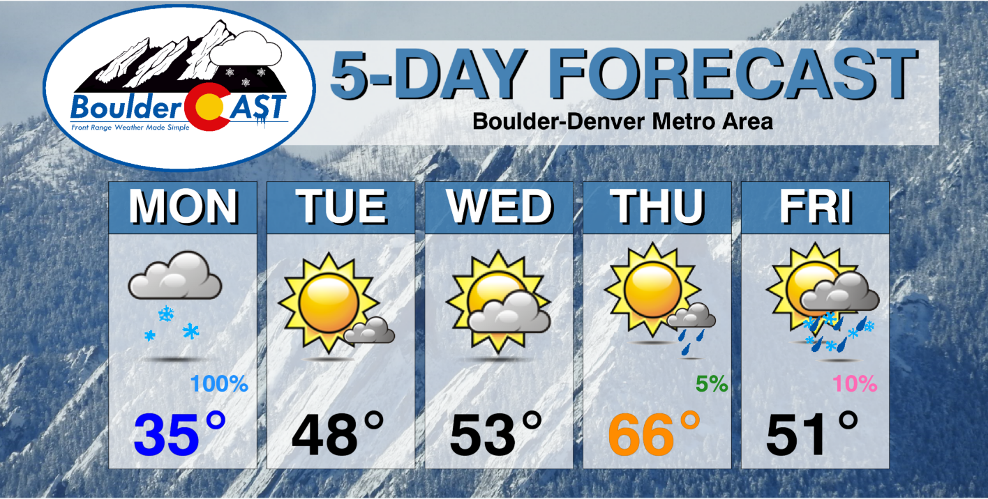
Monday: Widespread light snowfall tapers off from west to east quickly during the morning hours, then partly to mostly cloudy the rest of the day with just a slight chance of isolated snow showers redeveloping during the afternoon. Gusty northwest winds at times creating drifting snow and bitter cold (for late March) wind chills. Temperatures stay unseasonably cold in the 30s across the Plains with 20s in the Foothills.
Tuesday: Mostly sunny but still chilly with highs reaching the upper 40s on the Plains and upper 30s in the Foothills.
Wednesday: Partly cloudy and slightly warmer with temperatures in the middle 50s across the Plains and in the lower 40s in the Foothills.
Thursday: A warm, spring-like day with partly to mostly sunny skies and breezy southwest winds. Fire danger will be elevated. Temperatures top out in the middle 60s on the Plains and in the lower 50s in the Foothills. There is a slight chance of rain showers developing late in the day, but these would likely hold off until the evening or overnight period.
Friday: Cooler with a slight chance of rain/snow showers early in the day. Then partly cloudy with highs in the 40s to lower 50s on the Plains and in the upper 30s in the Foothills.
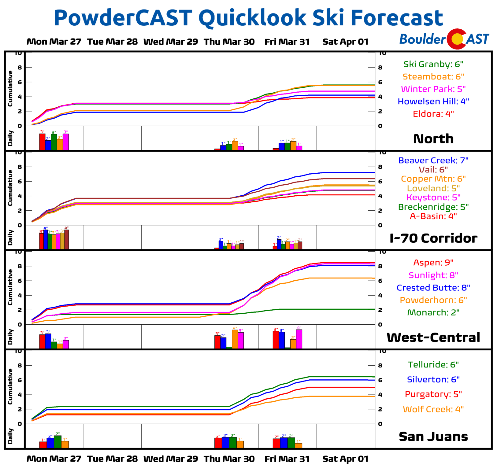
PowderCAST: Light snow will taper off in the Mountains early Monday as one system exits to the east with just light accumulation possible (less than 3″). Tuesday and Wednesday will be dry statewide as a ridge of high pressure passes overhead. By Thursday though another system will be knocking on the door with moist southwest flow returning again, transitioning to northwest flow as it passes. This will spread light to moderate snow back into the Mountains much of the day Thursday and Friday. Southern Colorado will be favored late-week with most resorts down that way seeing 2-6″ of additional snow.
DISCLAIMER: This weekly outlook forecast is created Monday morning and covers the entire upcoming week. Accuracy will decrease as the week progresses as this post is NOT updated. To receive daily updated forecasts from our team, among many other perks, subscribe to BoulderCAST Premium.
Daily Forecast Updates
Get our daily forecast discussion every morning delivered to your inbox.
All Our Model Data
Access to all our Colorado-centric high-resolution weather model graphics. Seriously — every one!
Ski & Hiking Forecasts
6-day forecasts for all the Colorado ski resorts, plus more than 120 hiking trails, including every 14er.
Smoke Forecasts
Wildfire smoke concentration predictions up to 72 hours into the future.
Exclusive Content
Weekend outlooks every Thursday, bonus storm updates, historical data and much more!
No Advertisements
Enjoy ad-free viewing on the entire site.
Spread the word, share the BoulderCAST forecast!




You must be logged in to post a comment.