
As if last week’s record‑smashing heatwave wasn’t enough, the atmosphere has decided to double down this week. After a brief cooldown, we’re gearing up for another round of exceptional warmth—with Colorado’s snowpack plunging to levels more typical of early summer than March. In today’s update, we break down the new records already in the books, the alarming snowpack decline, and what to expect as a second pulse of historic warmth takes aim at the Front Range.
This week’s highlights include:
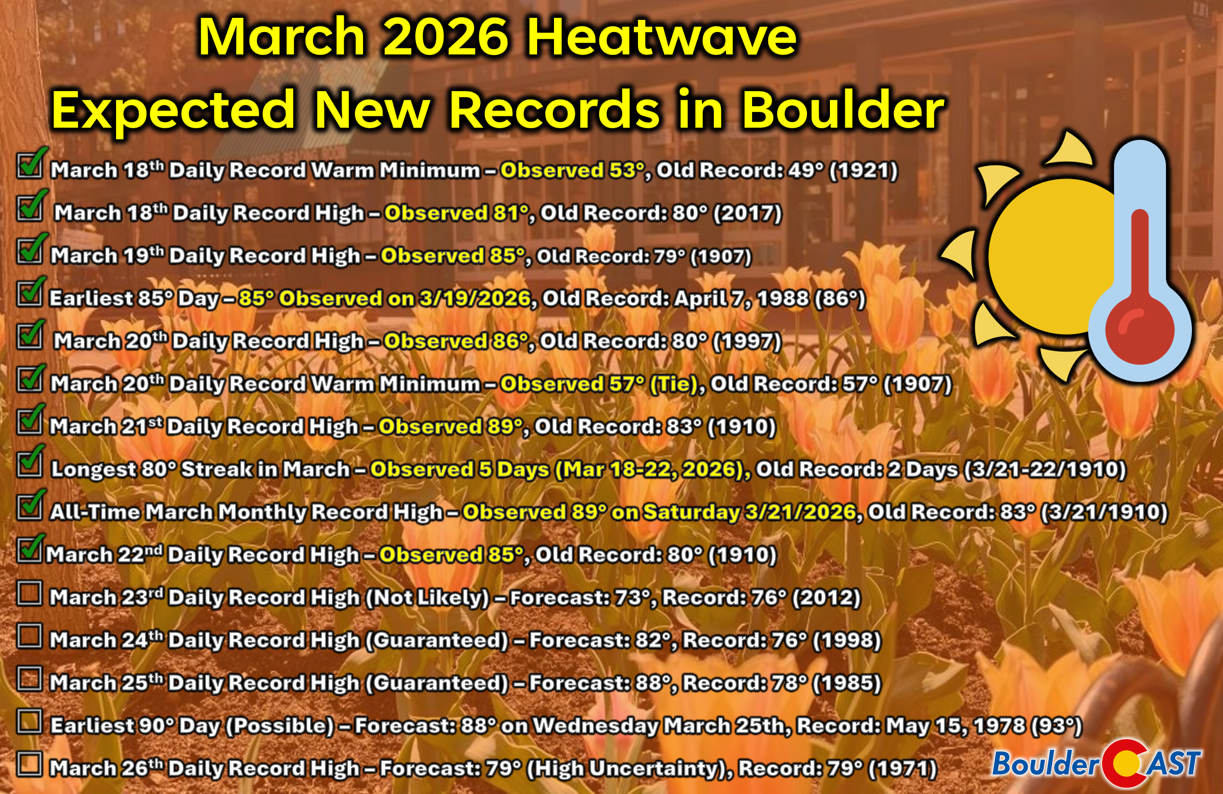
- 🔥 Last week’s historic March heatwave shattered all-time records across Boulder (89°) and Denver (86°), with Boulder breaking its monthly record three days in a row and setting new daily records five days in a row.
- 📉 Snowpack has collapsed Westwide, with most basins now at all‑time lows for late March — including the South Platte, which just dropped below its historic minimum.
- 🏔️ Snow is melting at every elevation, even atop Colorado’s highest peaks, leaving High Country landscapes looking more like early June than March.
- ♻️ Heatwave Part 2 begins this week, fueled by the same super‑heated airmass that cooked Colorado last week.
- 🌡️ Tuesday and Wednesday will be the hottest, with widespread 80s and a shot at upper 80s to near 90° again; multiple daily and monthly records are guaranteed to fall.
- 🌬️ A cold front arrives Thursday, but the timing is uncertain — highs could range anywhere from the upper 60s to the 80s depending on when it hits.
- 🌦️ Isolated showers or a storm possible with the front, followed by light upslope precipitation; moisture is limited, so totals will be meager.
- 🧊 Friday turns cooler and seasonal, with highs in the 50s and lingering morning showers clearing to partly cloudy skies.
DISCLAIMER: This weekly outlook forecast is created Monday morning and covers the entire upcoming week. Accuracy will decrease as the week progresses as this post is NOT updated. To receive daily updated forecasts from our team, among many other perks, subscribe to BoulderCAST Premium.

Go Premium, get all the perks.
Daily Forecast Updates
Get our daily forecast discussion every morning delivered to your inbox.
All Our Model Data
Access to all our Colorado-centric high-resolution weather model graphics. Seriously — every one!
Ski & Hiking Forecasts
6-day forecasts for all the Colorado ski resorts, plus more than 120 hiking trails, including every 14er.
Smoke Forecasts
Wildfire smoke concentration predictions up to 72 hours into the future.
Exclusive Content
Weekend outlooks every Thursday, bonus storm updates, historical data and much more!
No Advertisements
Enjoy ad-free viewing on the entire site.
Recapping the historic March heatwave (so far)
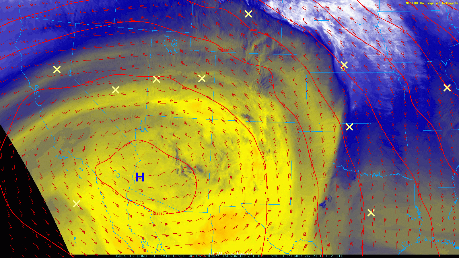
The exceptionally strong, near‑stationary ridge of high pressure responsible for last week’s historic, prolonged warmth across the western United States has finally weakened and slipped southwest. But not before it rewrote the March record books across Colorado in a way that will stand out for many years to come.
A view of the upper-level ridge last week during its peak intensity (around Friday March 20).
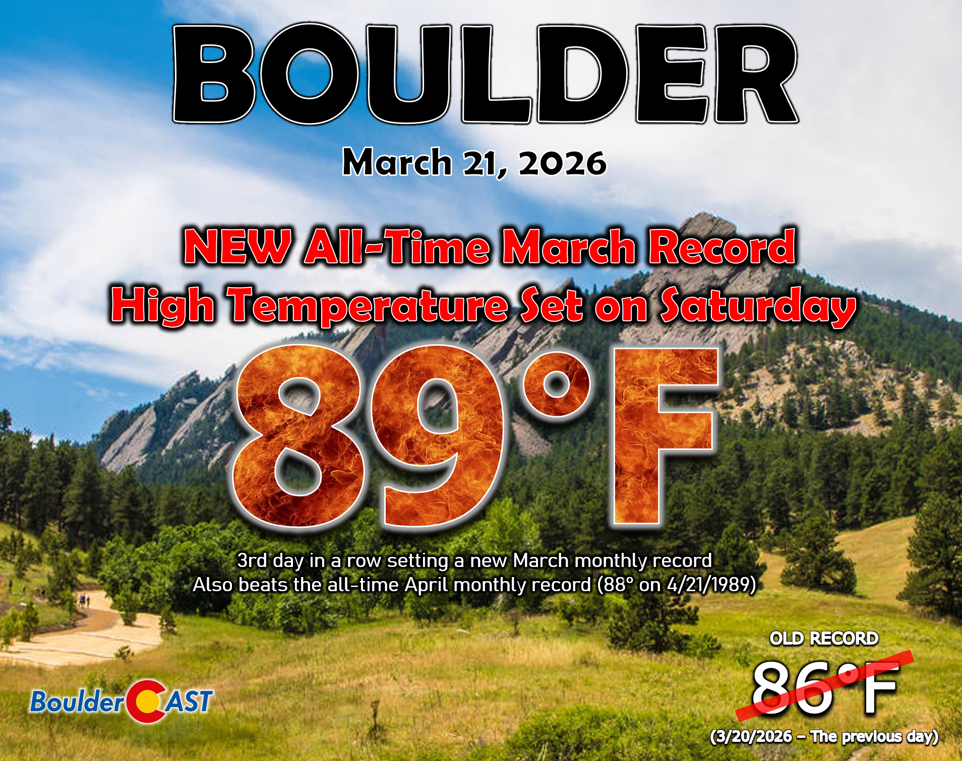
Boulder (89°) and Denver (86°) both set new monthly March temperature records on Saturday—the peak of the heatwave. For Boulder, it was the third straight day establishing a new March monthly record. Prior to last week, the warmest March temperature ever recorded here was 83° back in 1910. We didn’t just break that—we obliterated it by six full degrees. Even more astounding, Boulder’s 89° reading also bested our April monthly temperature record as well, a clear sign of just how unprecedented this warming event was.
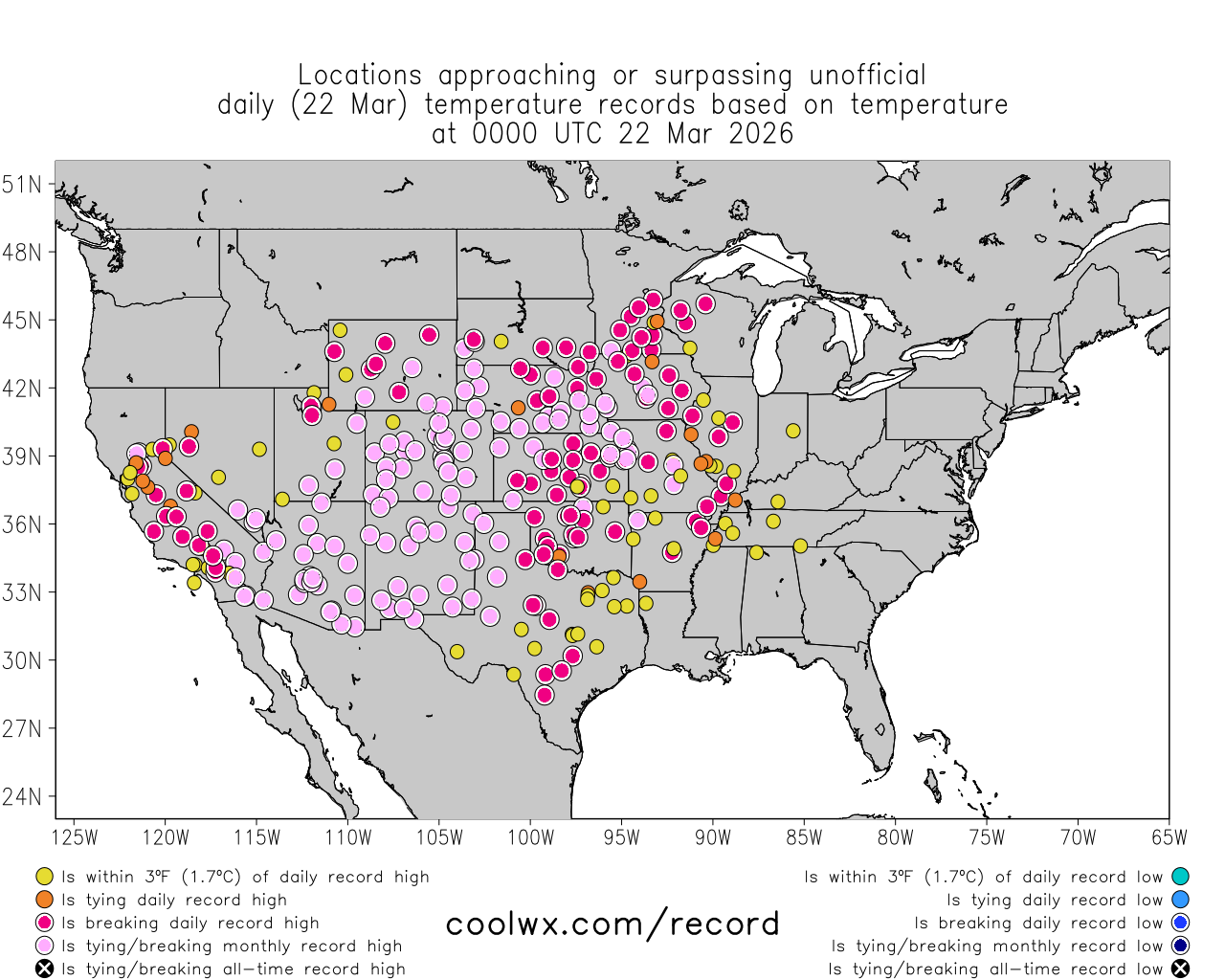
At one point early Saturday afternoon, multiple entire states across the western U.S. we sitting at all-time March record temperatures, including Winterhaven CA setting a new national March record high reaching a roasting 112°F. We’re extremely lucky this pattern occurred in March and not in the heart of summer. We shudder to think how high temperatures could have reached if this same pattern had unfolded in July or August. 140°F in Death Valley, a new world record temperature, may have been possible.
Below you’ll find a full breakdown of every temperature record broken so far in Boulder, plus the additional records likely to fall this week. Yes—if you haven’t heard—Heatwave Part 2 is about to commence. More on that shortly.
A rapid, alarming decline of western snowpack
Mountain snowpack across the West has taken a dramatic hit. Most basins are now sitting at all‑time lows for late March, a dire situation driven by a staggeringly warm and dry winter, but compounded by the several days of summer‑like heat last week under totally clear skies.
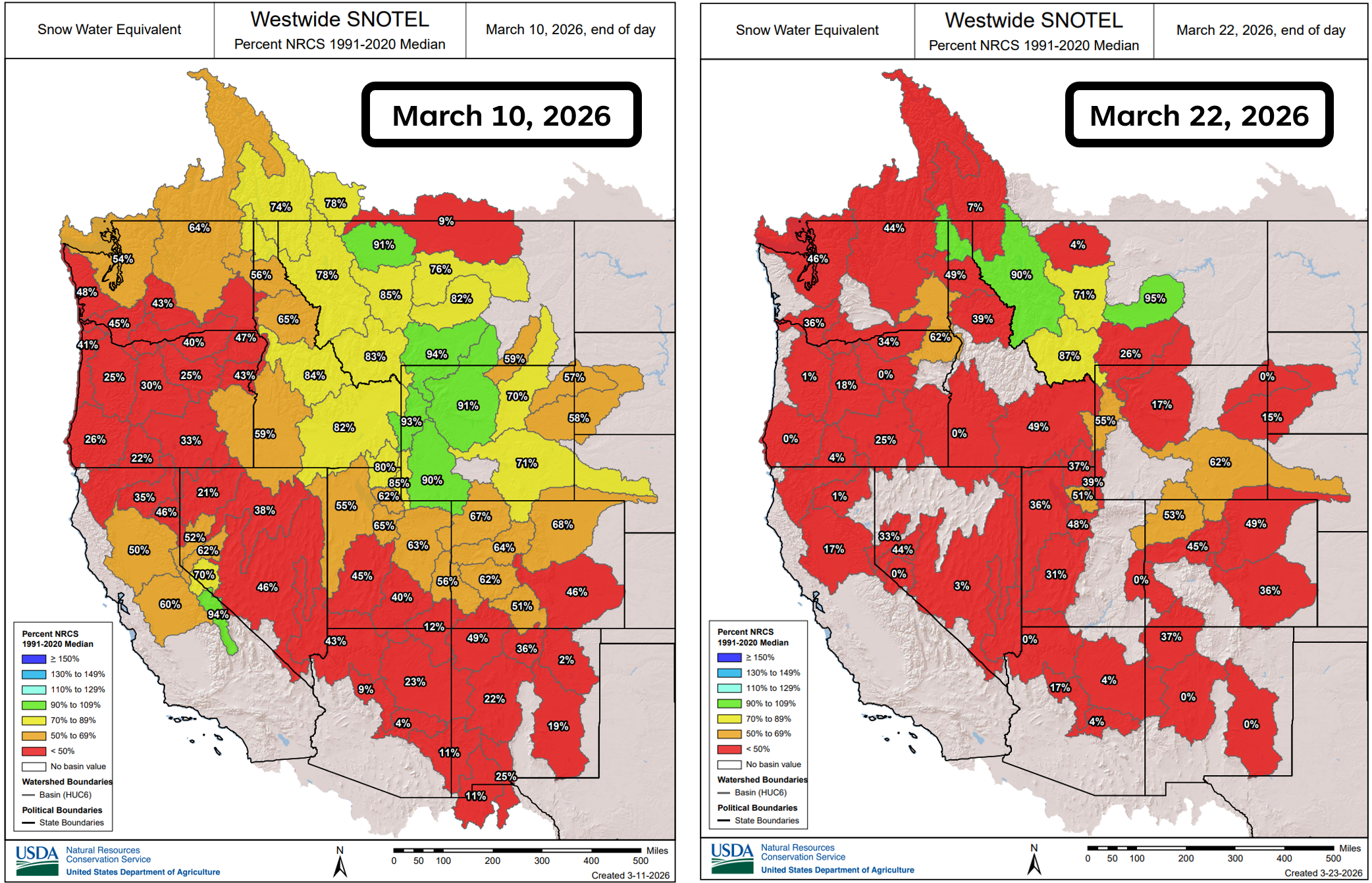
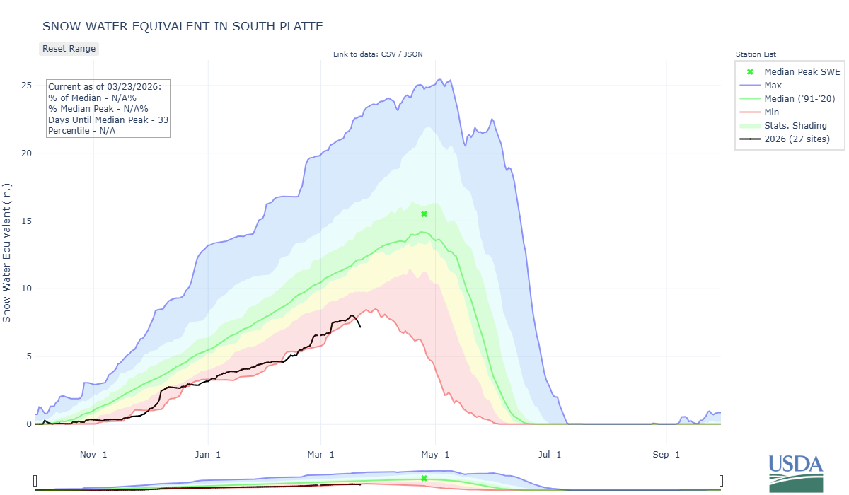
The South Platte Basin—the one that feeds into Boulder and Denver—has fallen from “very low” to the lowest on record, with the 2026 water‑year trace line now dipping below the historic minimum dating back to the early 1980s. If that isn’t a bright red warning sign about our water supply and wildfire risk heading into spring and early summer, we don’t know what is!
While Boulder was pushing 90° on Saturday, temperatures in the alpine tundra just west of town were soaring in the mid‑40s—warm enough to melt snow at every elevation, including Colorado’s highest peaks.
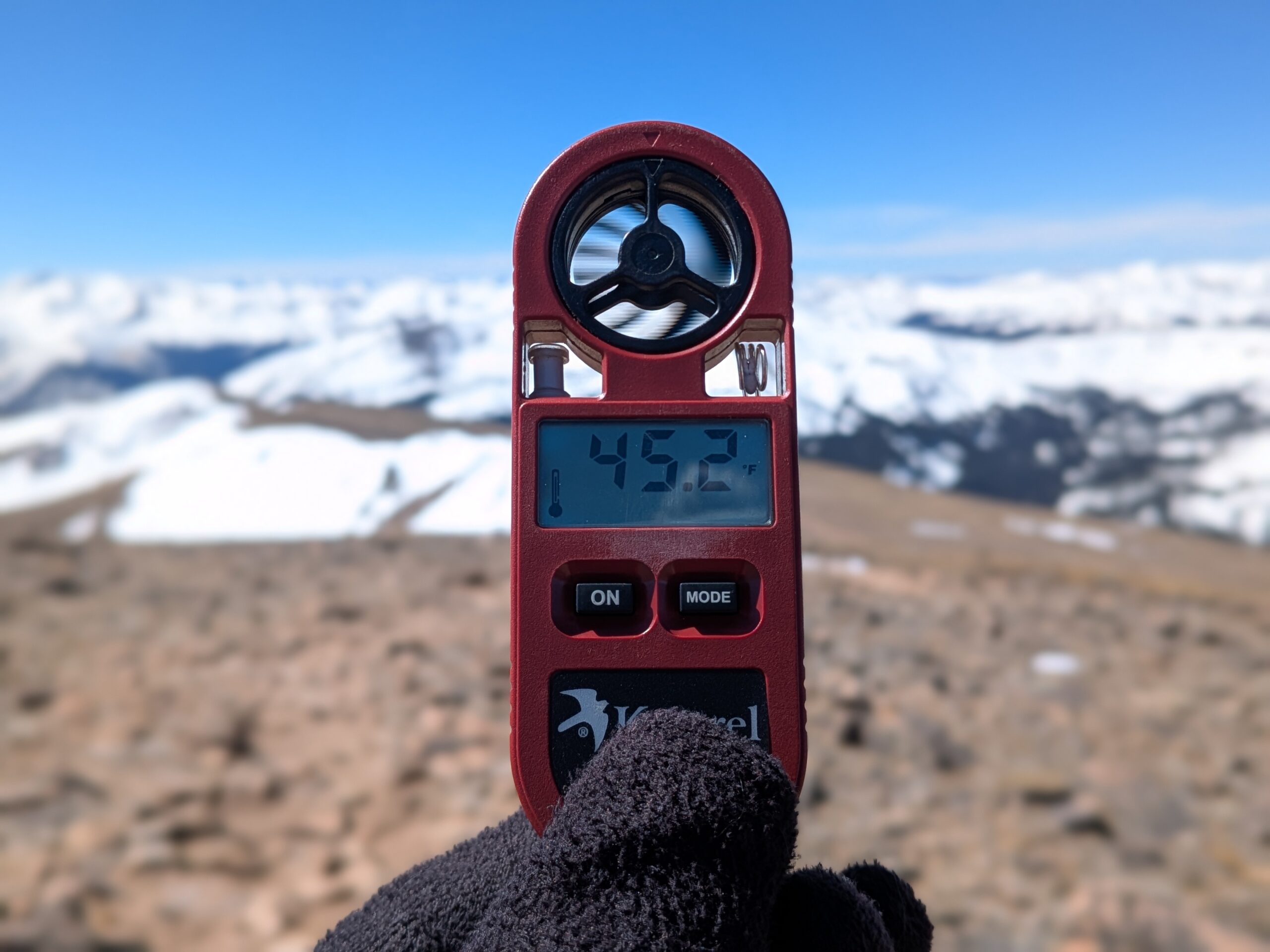
Temperatures at 13,000 feet were in the middle 40s on Saturday, while Boulder and Denver soared towards 90°.
The view across the upper South Platte Basin southwest of Boulder looks more like early June than mid‑March. For those who spend significant time in the High Country like we do, the lack of snow cover right now is genuinely jarring.
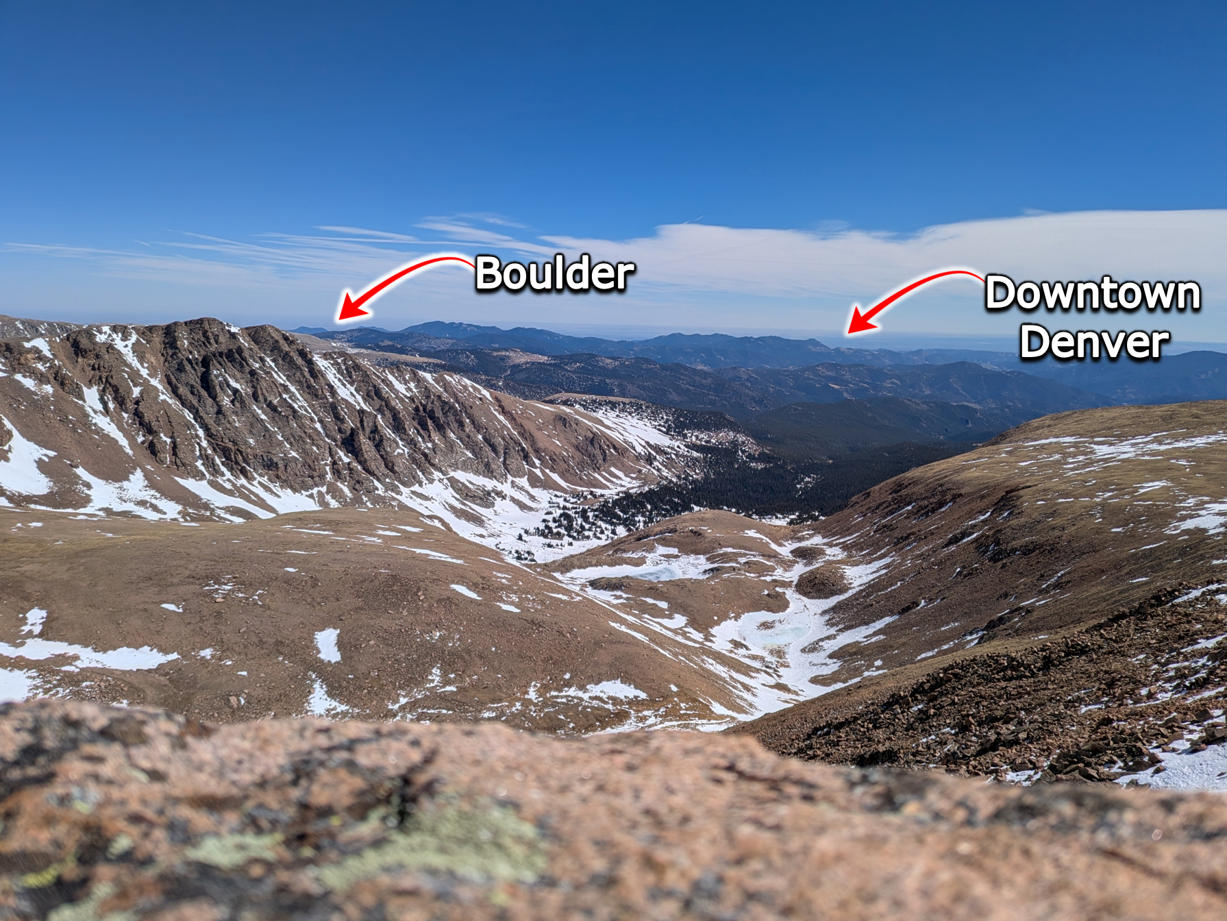
View from the upper South Platte Basin on Saturday March 21, 2026.
And unfortunately, this week’s forecast will take the situation from bad to worse.
This week: More exceptional warmth, snowpack decline
Sunday’s cold front delivered a brief and welcome cooldown, with highs dropping into the low to mid 60s across the Metro area. Still above normal, but nearly 30° cooler than Saturday’s blowtorch.
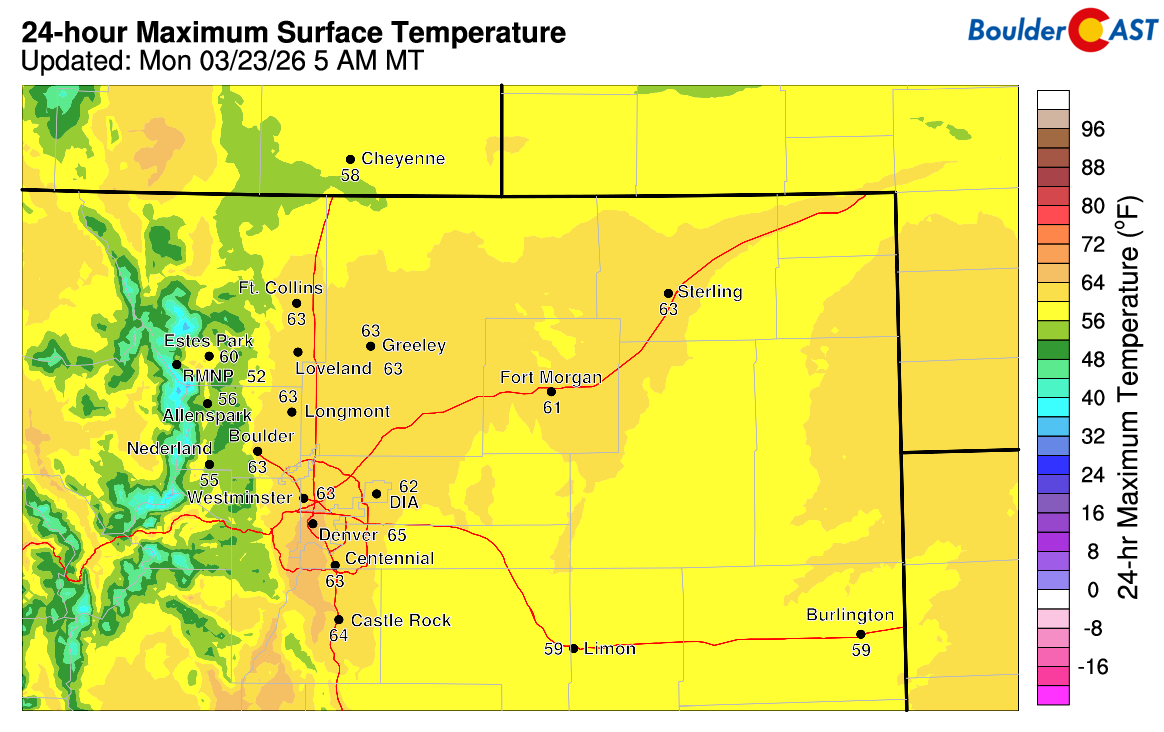
Sunday’s daytime high temperatures. 60s?!?
That cooldown, however, was only a brief pause in the heat—not a pattern shift.
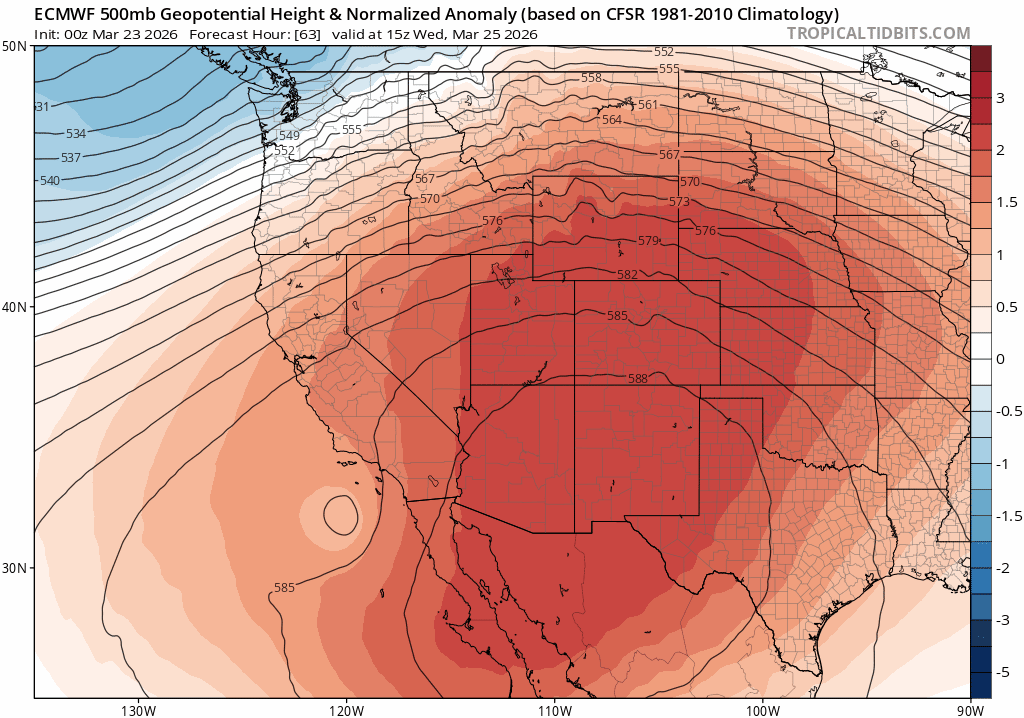
Another strong ridge will rebuild over the southern Rockies early this week:
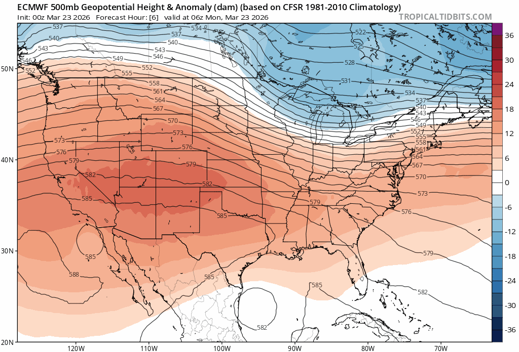
The 500mb height anomaly forecast animation from the Euro shows a strong ridge rebuilding over the southern Rockies this week, seeding the return of extreme warmth.
While this ridge won’t reach the unprecedented intensity of last week’s monster, the key detail is the airmass itself: it’ll be the same air that was super‑heated to record levels just days ago. So even with a slightly weaker ridge, temperatures will surge again—20 to 30° above normal—producing another multi‑day stretch of exceptional warmth in the West.
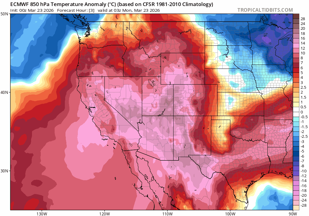
Hot air cooked up during last week’s heatwave never went away. It was only briefly suppressed south and west. It will return this week.
Monday: Warming back up
On Monday highs will rebound into the low to mid 70s with lots of cloud cover. Boulder’s daily record of 76° may survive thanks largely to those clouds, but we’ll still be within striking distance.
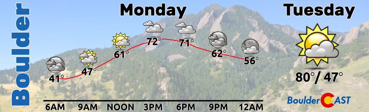
Tuesday & Wednesday: Peak Heat, Fire Danger Rises
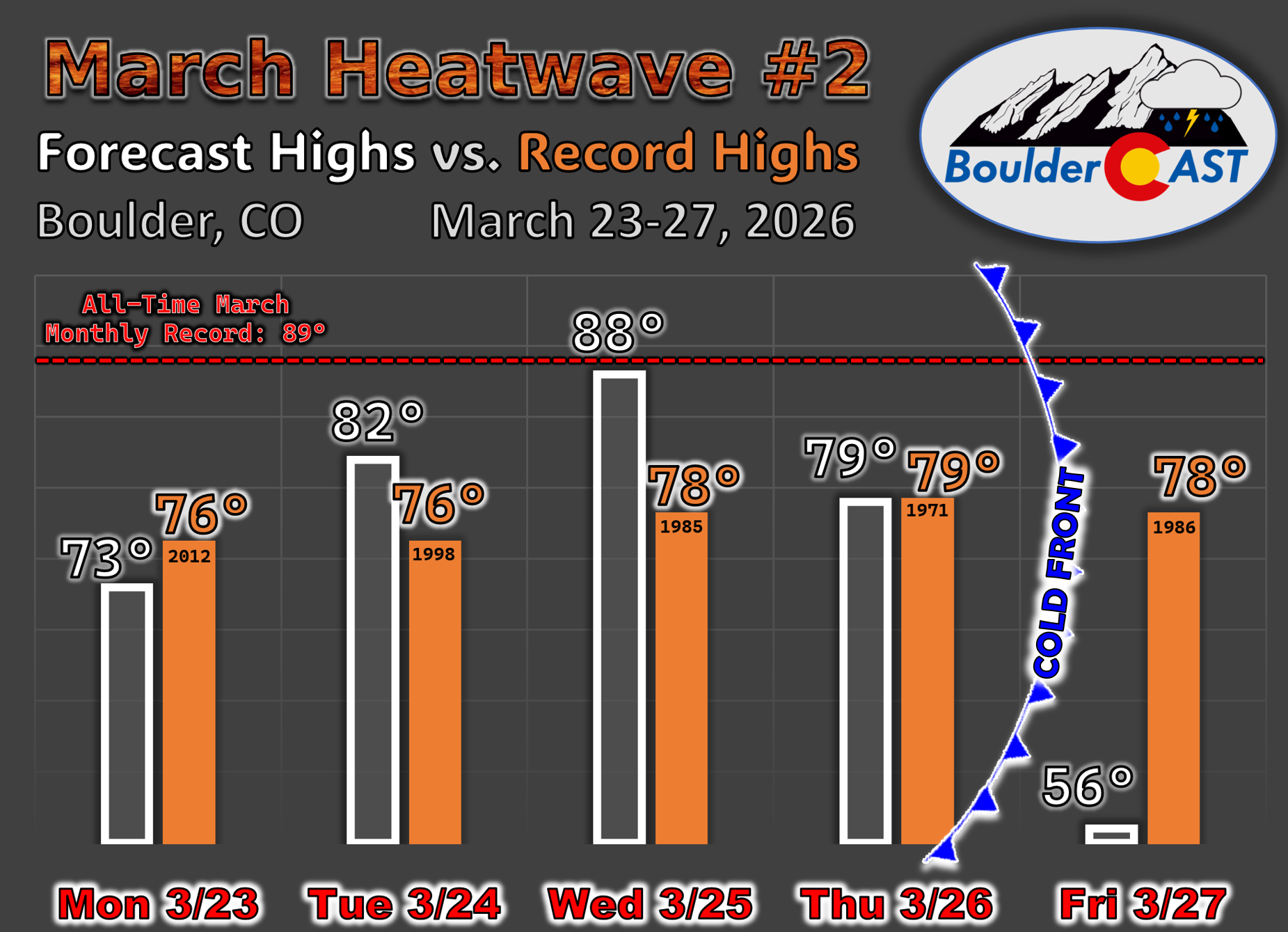
The heatwave will peak Tuesday and Wednesday across Colorado, with highs in the 80’s both days, and even upper 80s on Wednesday. There is some chance that we could touch 90° on Wednesday, with those freshly minted March monthly record highs being challenged once again:
- Denver’s monthly record set on Saturday of 86° stands to be broken
- Boulder’s March record of 89° set on Saturday will be a close one.
Daily temperature records on Tuesday and Wednesday are essentially guaranteed to be obliterated, in some cases by more than 10 degrees.
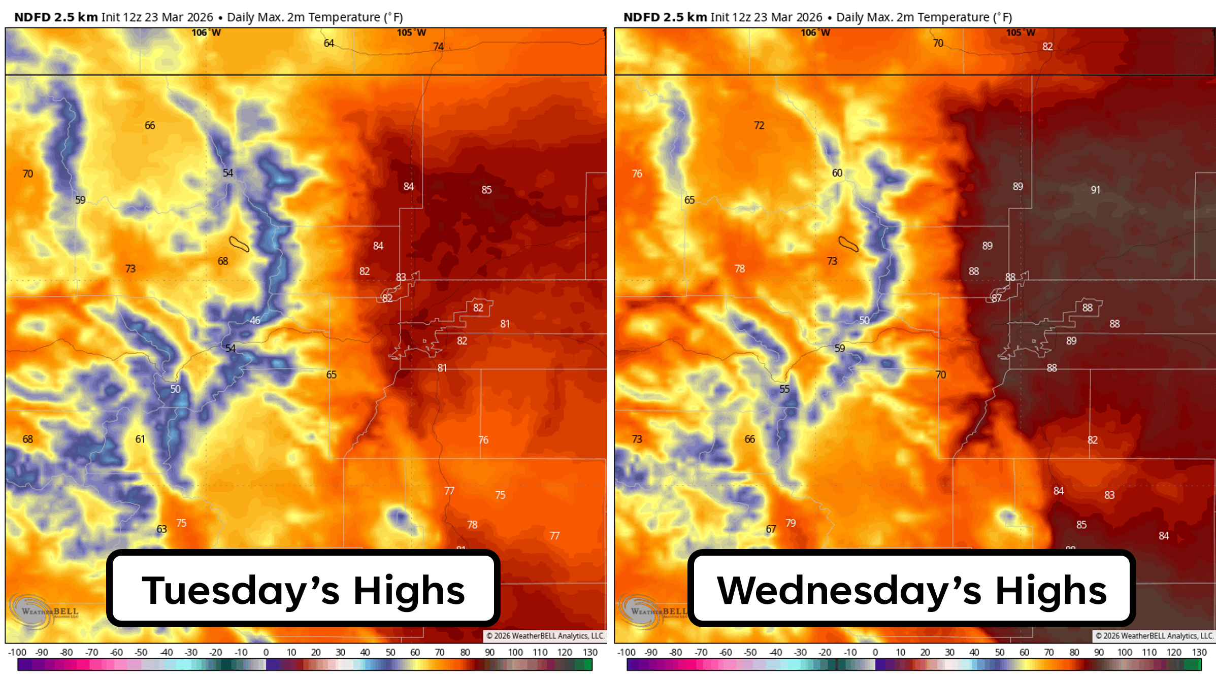
Wednesday will also feature gusty winds developing, perhaps over 30 MPH in some areas. Fire danger will increase and we probably will see Red Flag Warnings for some or all of the region, though humidity won’t be as low as last week.
Thursday: The Wild Card
The end of this week’s heatwave will come on Thursday. The ridge will begin to flatten out somewhat and northwest flow eventually taking over by Friday.
Late-week 500mb height forecast showing the ridge flattening out as system ridges along the Canadian Border.
This will allow for a cold front to move in from the north and northeast tied to a system in the Dakotas. The exact timing of Thursday’s frontal boundary will play a large role in our high temperature. If it’s in the morning, like the GFS model is projecting (shown below), we may see highs only in the 60s to lower 70s. If it’s the late-afternoon hours like the Euro model is forecasting, we’ll have another day with highs somewhere in the 80s. Right now Thursday’s temperatures are uncertain given this front, but recent trends have been toward a slower frontal passage, so we’re leaning warmer—somewhere between 74° and 84°. We’ll have to also watch that timing for fire danger. If the front doesn’t come through until late in the day, gusty winds during the afternoon will breed another round of near-critical fire danger.
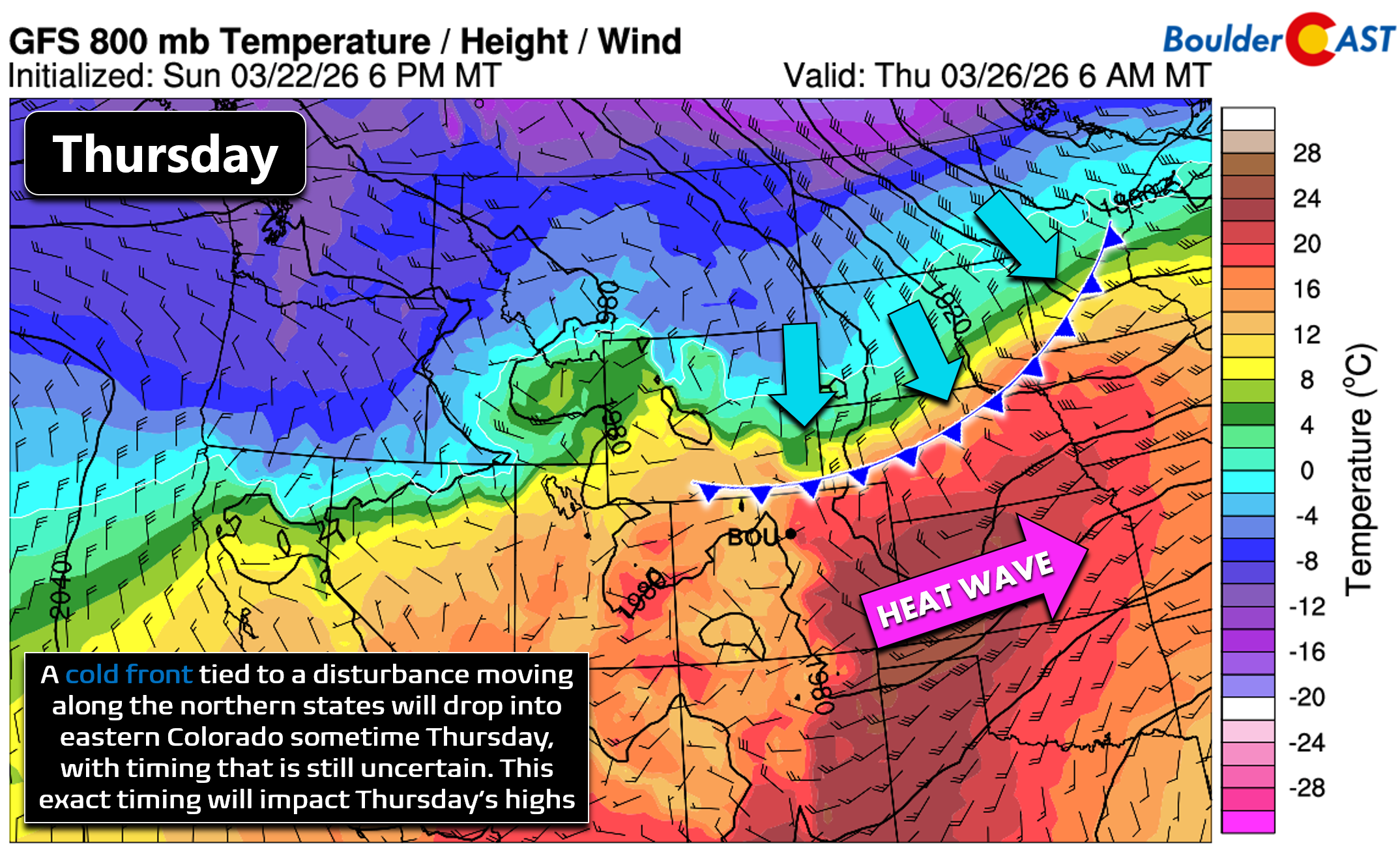
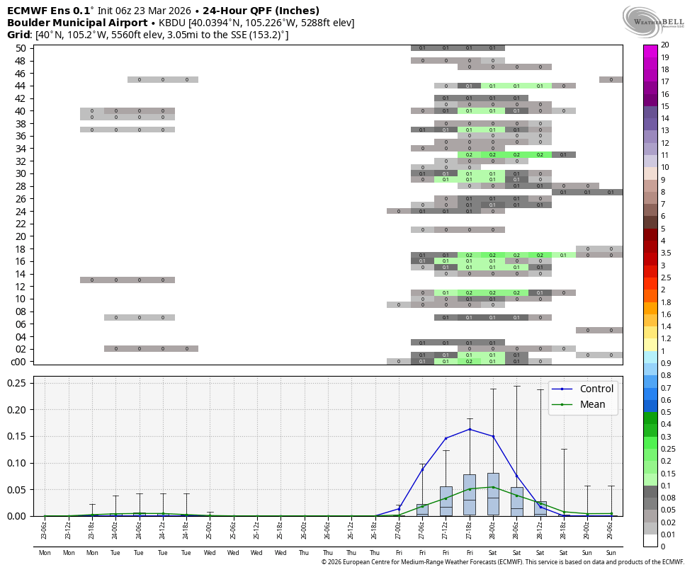
The front may spark isolated showers or a rumble of thunder, followed by light upslope precipitation. Moisture is limited, so totals will be meager—likely just a trace to a few hundredths of an inch. Any snow would be confined to the higher Foothills.
Friday: Cooler and seasonal
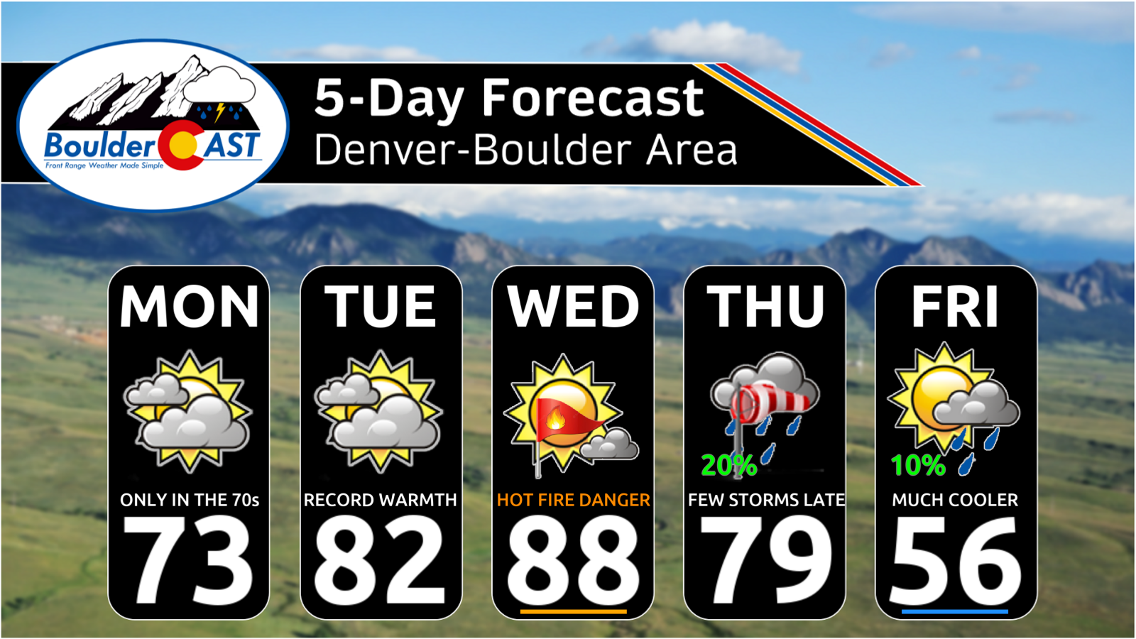
We’ll end the week on a chilly, more seasonal note with highs only in the 50s with any lingering morning showers clearing up to partly cloudy skies. For the second week in a row, our five-day forecast is pretty wild for March:
As for the record highs up for grabs this week, Tuesday and Wednesday are essentially guaranteed to break those existing daily records in Boulder. Monday and Thursday are possible, but not overwhelmingly likely.
The weekend ahead will be quiet and dry with highs returning to the 60s and 70s as the ridge rebuilds.
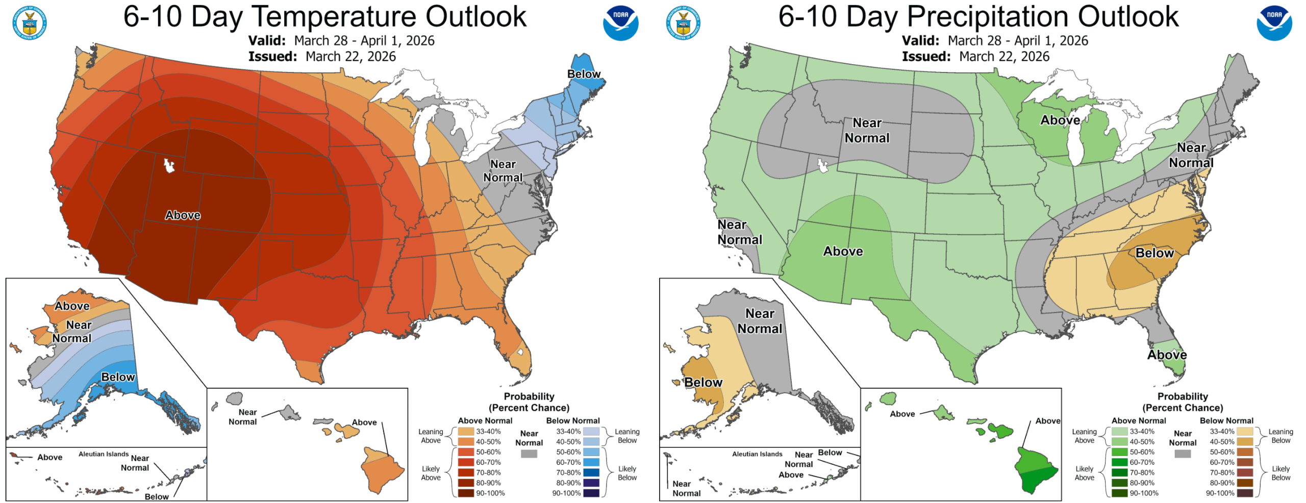
Fortunately it looks like a stormier pattern will take hold around the middle of next week as we transition into early April. The Mountains should see some snow, with cooler temperatures and perhaps some precipitation (i.e. rain) chances east of the Divide as well. To be clear though, there’s nothing in the pipeline to produce as much rain/snow as our state needs right now.
Bottom Line
Front Range Colorado just lived through a historic March heatwave—and another round of exceptional warmth is about to begin, with more records likely to fall Tuesday and Wednesday. Snowpack losses are accelerating rapidly, and the impacts on water supply and wildfire risk will extend through the months ahead. With no real hope of change in sight, water restrictions will cascade across the Metro area and the broader West. We’ve already seen these go into effect in many Denver suburbs. More will follow soon.
Enjoy the first full week of spring!
![]()
Forecast Specifics:
Monday: Partly to mostly cloudy and warm with highs in the lower 70s on the Plains with upper 50s in the Foothills.
Tuesday: Partly to mostly cloudy with record highs guaranteed in the lower 80s for the Plains with near 70 in the Foothills. It will be breezy.
Wednesday: Hot and breezy with record highs in the upper 80s to near 90 degrees. Gusty winds could develop during the day breeding near-critical fire danger in some areas. Highs in the middle 70s in the Foothills.
Thursday: A day of transition with a breezy winds and a cold front blowing in sometime during the day. Temperatures are uncertain due to this frontal boundary, ranging from middle 60s to middle 80s. A few showers may accompany the front later in the day into the overnight, with snow in the higher Foothills.
Friday: Possibly a few lingering showers or low clouds in the morning, then partly cloudy and cool with highs in the middle 50s on the Plains and middle 40s in the Foothills.
Weekend: Warming up with highs in the 60s to 70s. Dry.
DISCLAIMER: This weekly outlook forecast is created Monday morning and covers the entire upcoming week. Accuracy will decrease as the week progresses as this post is NOT updated. To receive daily updated forecasts from our team, among many other perks, subscribe to BoulderCAST Premium.
Go Premium, get all the perks.
Daily Forecast Updates
Get our daily forecast discussion every morning delivered to your inbox.
All Our Model Data
Access to all our Colorado-centric high-resolution weather model graphics. Seriously — every one!
Ski & Hiking Forecasts
6-day forecasts for all the Colorado ski resorts, plus more than 120 hiking trails, including every 14er.
Smoke Forecasts
Wildfire smoke concentration predictions up to 72 hours into the future.
Exclusive Content
Weekend outlooks every Thursday, bonus storm updates, historical data and much more!
No Advertisements
Enjoy ad-free viewing on the entire site.
Enjoy our content? Give it a share!


You must be logged in to post a comment.