


This week several large wildfires will continue to slowly grow across Colorado as smoke remains stubbornly locked over the Front Range, and a heat dome building for the upcoming weekend will be downright punishing. But there is light at the end of the hot and smoky tunnel — the now-delayed 2026 monsoon will make its triumphant return next week. Read on for all the details.
This week’s highlights include:
🔥 Wildfire activity remains rampant across Colorado, with only the Snyder Fire nearing full containment after burning 30,000+ acres.
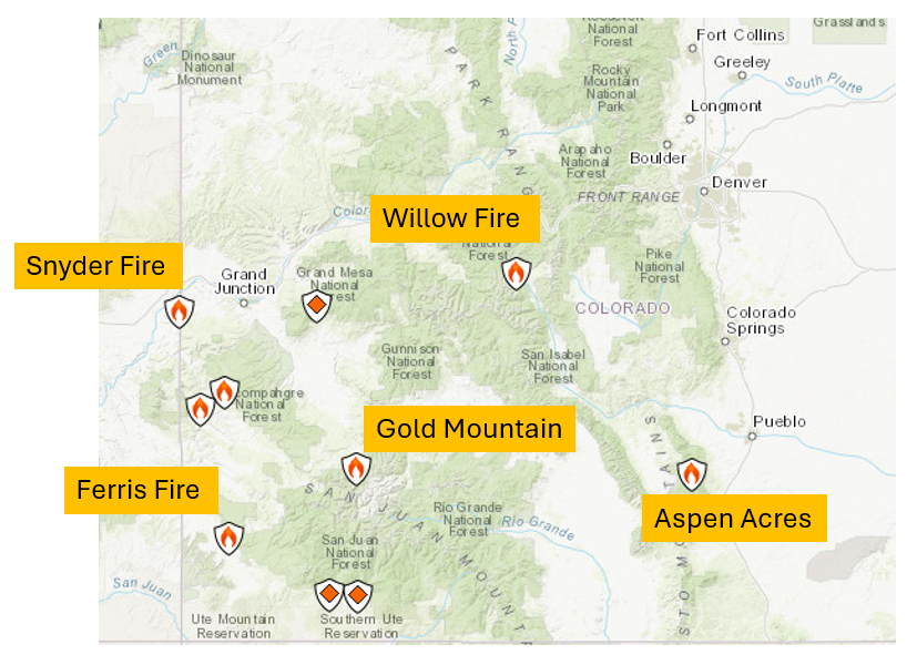
📍 Top active fires include Aspen Acres (89k acres), Ferris (47k), Gold Mountain (27k), Willow (4k), and Snyder (30k).
🌫️ Smoke persists along the Front Range, driven by trapping easterly low‑level flow and westerly mid‑level transport from the fires; Air quality will be an issue all week.
⛈️ Storm chances increase midweek, especially Tuesday through Thursday, as the ridge shifts away and a weak front boosts lift and moisture.
🌡️ Significant heatwave likely for the weekend, with highs near 100°F possible Saturday–Wednesday under a strengthening ridge.
📈 CPC highlights a strong dry heat dome centered over Colorado/Wyoming, reducing rain chances across the Front Range during the heatwave.
🌵 Monsoon moisture arrives next week, about 10 days behind schedule, initially targeting CA/NV before rotating into Colorado.
🌧️ Daily storms will return with that monsoon flow, offering more meaningful/soaking rainfall — but only after a long, intense stretch of heat ahead.
DISCLAIMER: This weekly outlook forecast is created Monday morning and covers the entire upcoming week. Accuracy will decrease as the week progresses as this post is NOT updated. To receive daily updated forecasts from our team, among many other perks, subscribe to BoulderCAST Premium.

Go Premium, get all the perks.
Daily Forecast Updates
Get our daily forecast discussion every morning delivered to your inbox.
All Our Model Data
Access to all our Colorado-centric high-resolution weather model graphics. Seriously — every one!
Ski & Hiking Forecasts
6-day forecasts for all the Colorado ski resorts, plus more than 120 hiking trails, including every 14er.
Smoke Forecasts
Wildfire smoke concentration predictions up to 72 hours into the future.
Exclusive Content
Weekend outlooks every Thursday, bonus storm updates, historical data and much more!
No Advertisements
Enjoy ad-free viewing on the entire site.
An Update on the Colorado Fires
Colorado’s fire season remains in full swing, and while there are pockets of improvement, the broader picture is still concerning. The Snyder Fire, straddling the Utah–Colorado border, is now nearly fully contained — a welcome development — but not before burning 30,000+ acres of rugged canyon country and claiming the lives of three firefighters.
Below is the latest snapshot of the five most consequential fires currently impacting the state, with acreage totals continuing to slowly climb for most incidents, now totally more 200,00 acres statewide. The map is courtesy of InciWeb.
- Aspen Acres — 89,054 acres, 14% contained
- Snyder Fire — 30,202 acres, 95% contained
- Ferris Fire — 47,780 acres, 21% contained
- Gold Mountain Fire — 27,698 acres, 3% contained
- Willow Fire — 4,142 acres, 1% contained
The Aspen Acres Fire remains the largest and most stubborn of the group. First detected on June 29, it ignited roughly 10 miles northwest of Rye in the San Isabel National Forest, southwest of Pueblo. Steep terrain, heavy fuels, and persistent hot/dry conditions have slowed containment progress. More favorable conditions over this past weekend has helped.
Smoke: A Daily Fixture Along the Front Range
Smoke has been a near‑constant companion across the Front Range through the holiday weekend — including a brief big spike as fireworks boomed Saturday night — and unfortunately, it’s not leaving anytime soon.
The latest smoke forecast keeps a steady plume drifting eastward into the I‑25 corridor early in the week. A combination of trapping easterly low‑level flow and developing westerly mid‑level flow later this week will continue funneling smoke into eastern Colorado. Eventually the smoke may end up being shunted mostly south of Denver by mid to late week, but it won’t be completely gone.
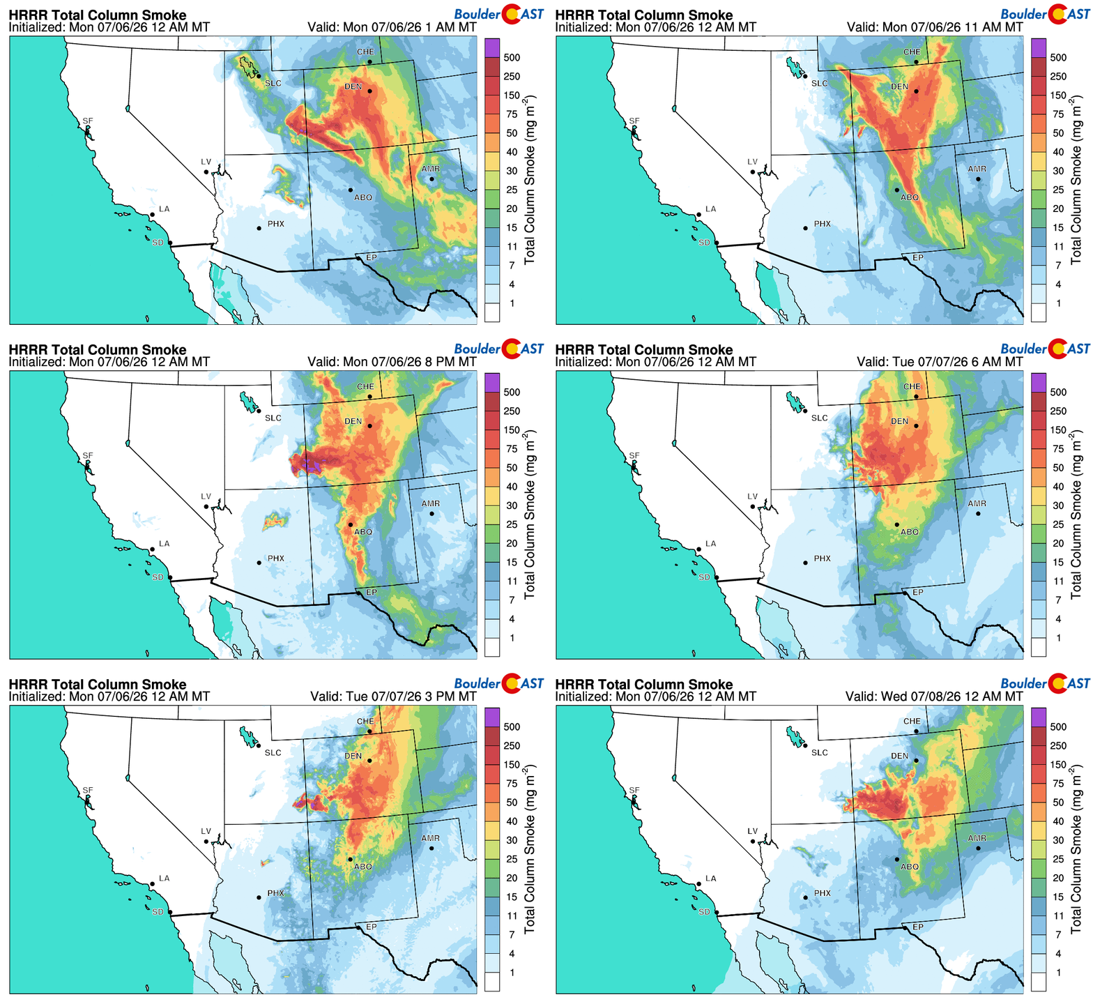
Expect Air Quality Alerts to be a near‑daily occurrence this week, especially during the morning and afternoon hours when mixing is limited and sunlight will be churning out ozone.
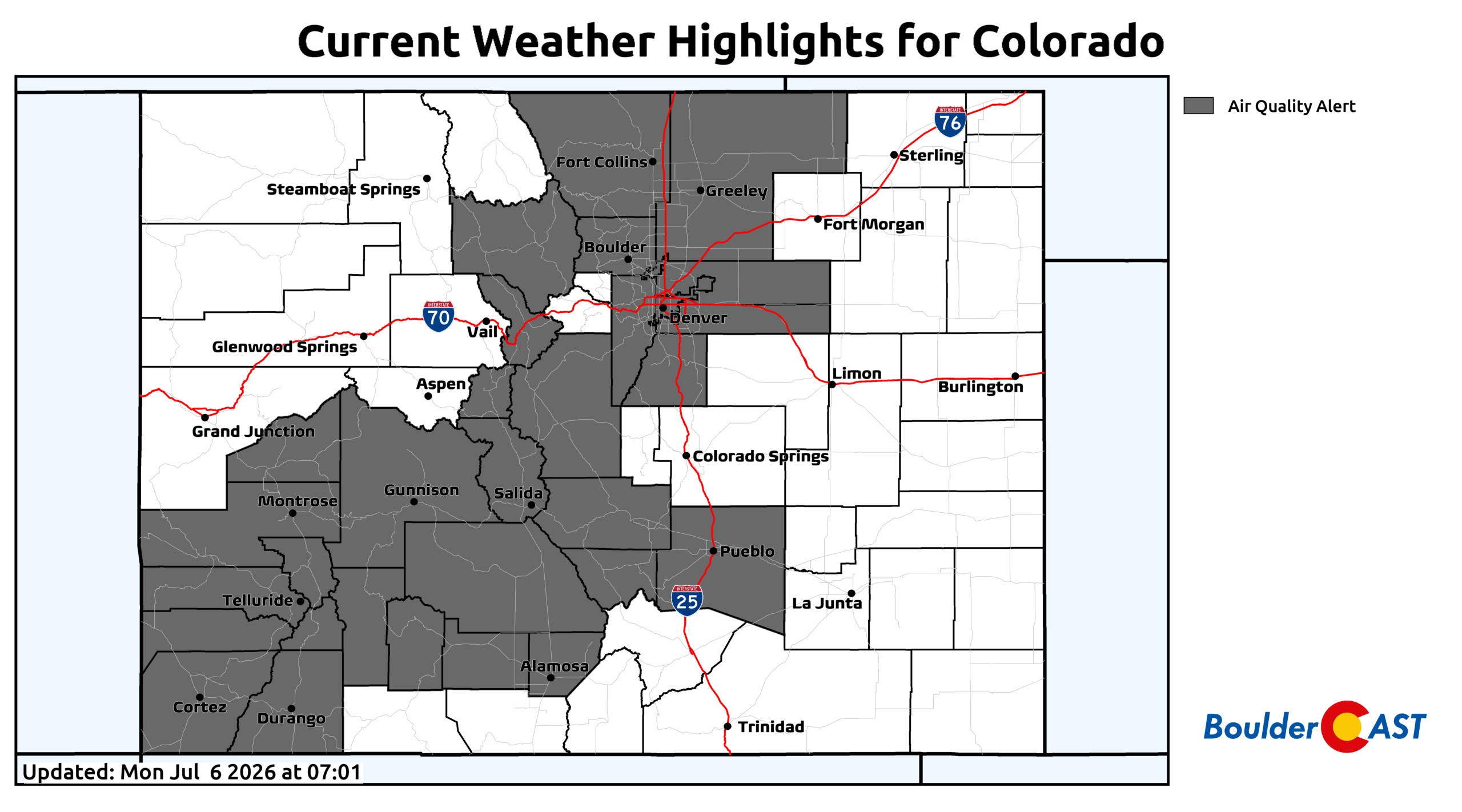
Lots of Air Quality Alerts across Colorado on Monday
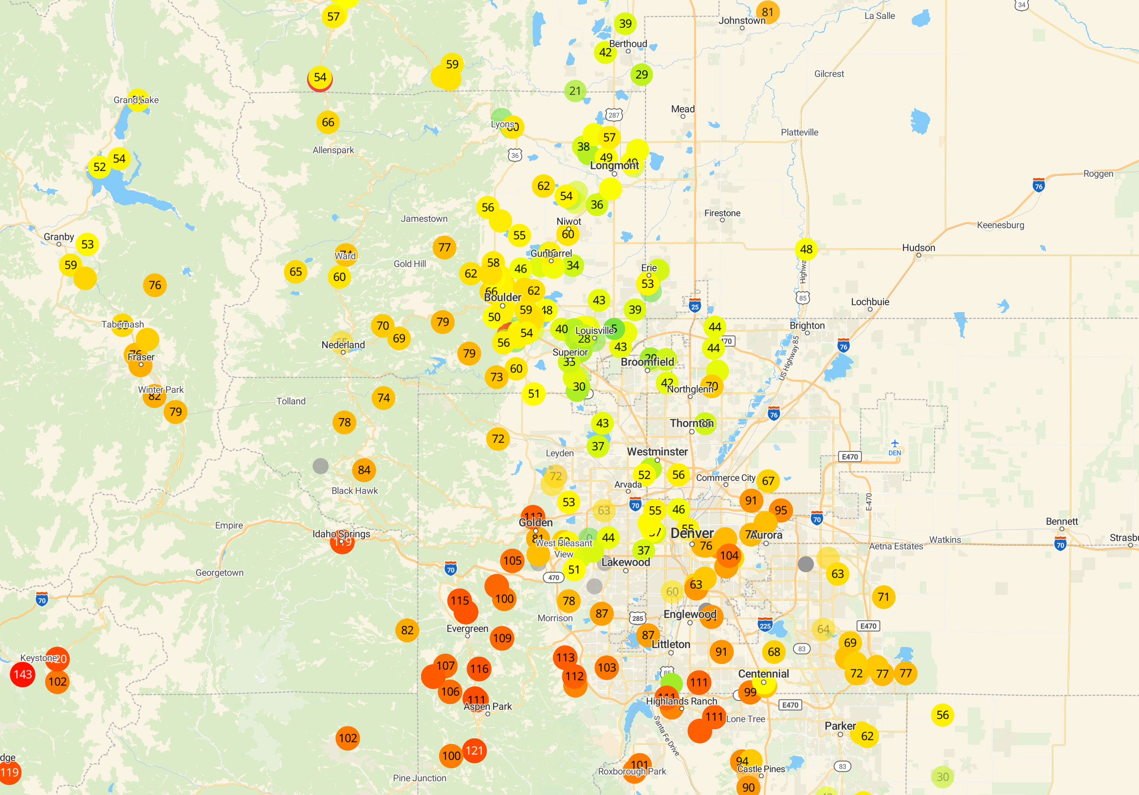
PM2.5 AQIs as of Monday morning | PurpleAir
Storm Chances Increase Midweek
We finally see a bump in convective potential this week, but the timing is focused squarely on Tuesday through Thursday. Ensemble guidance highlights this window as the period with the highest confidence in measurable rainfall.
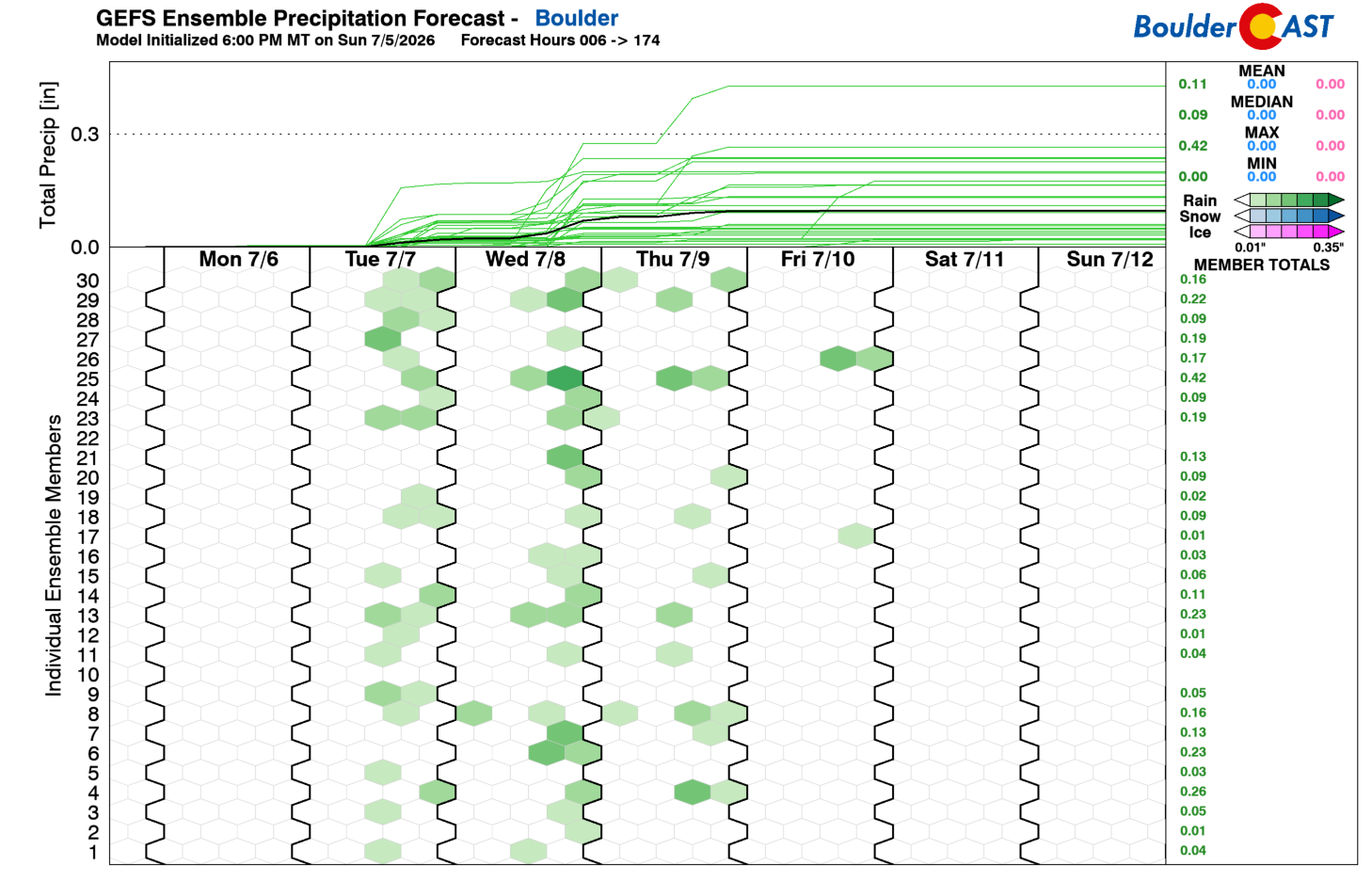
The contributors to the midweek storm chances include:
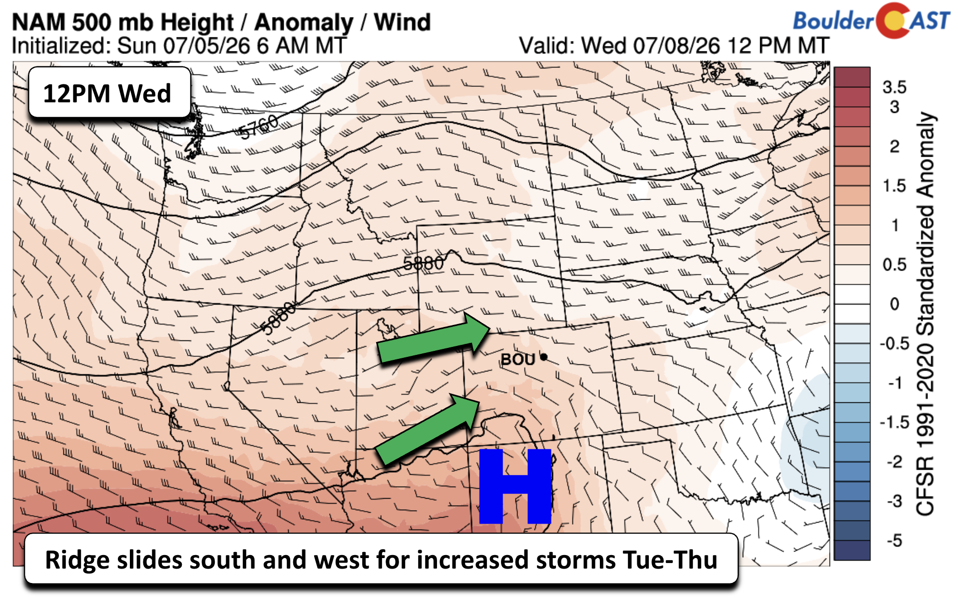
- The ridge overhead Monday slides south and west, loosening its grip.
- Higher mid‑level moisture begins to creep eastward into Colorado.
- A weak cold front approaches Wednesday into Thursday, adding additional lift.
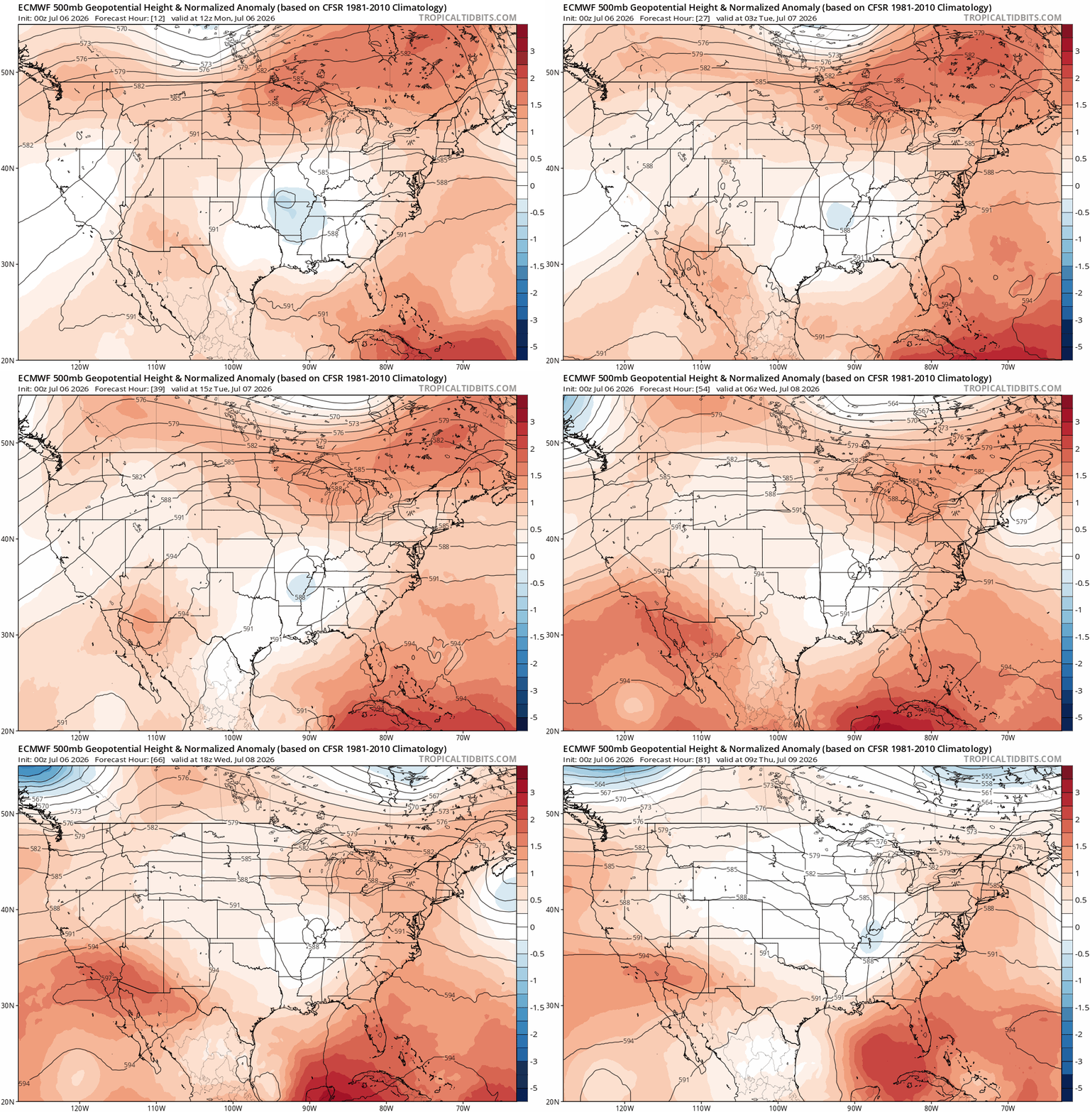
Euro 500mb height anomaly forecast for the week. The early week ridge over Colorado flattens and retreats southwest as the week goes on.
This combination should support scattered storms — though it’s worth noting that lightning without wetting rain could still pose new fire‑start concerns in the High Country.
Monday: Mostly Dry, Hot
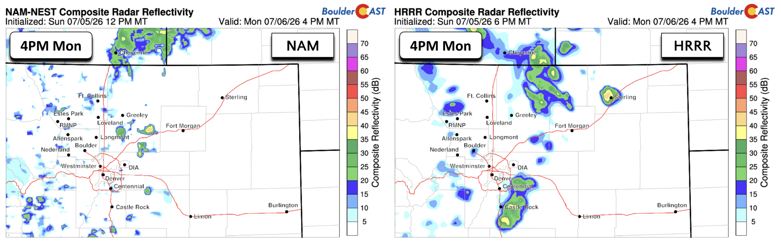
The HRRR and NAM models both show minimal forcing and very limited storm coverage Monday. Any showers will be isolated and weak, producing gusty winds and brief sprinkles. Highs climb into the mid‑90s, solidifying a hot start to the week.
Midweek: A Tad Cooler, More Storms
As moisture increases and the front approaches, highs dip into the middle 80s to lower 90s — still warm, but noticeably less intense than Monday.
Heat Builds Again Into the Weekend
Storm chances will fade Friday as the ridge re‑strengthens eastward, drying us out and warming the low‑level airmass significantly.
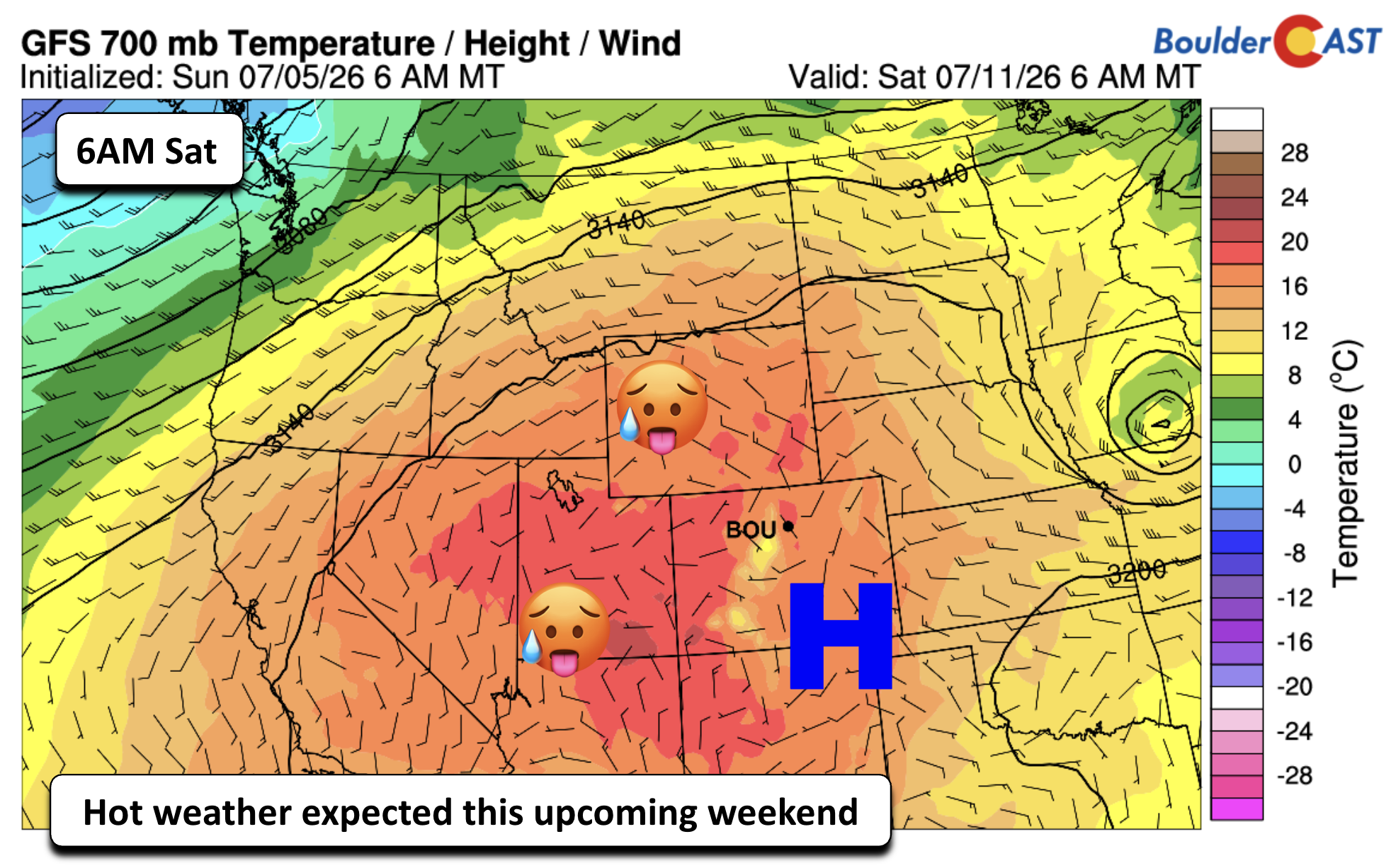
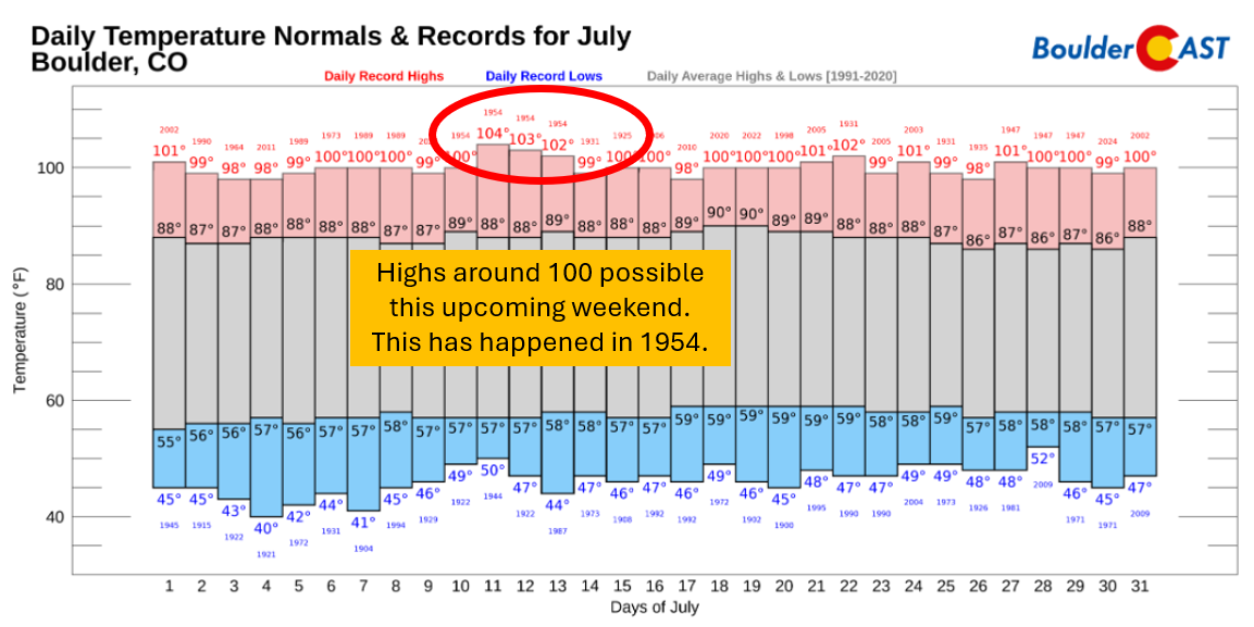
Guidance is increasingly aligned on a MAJOR heat spike this weekend. so much so that we could see highs around the century mark for several days. Saturday through Wednesday look particularly brutal.
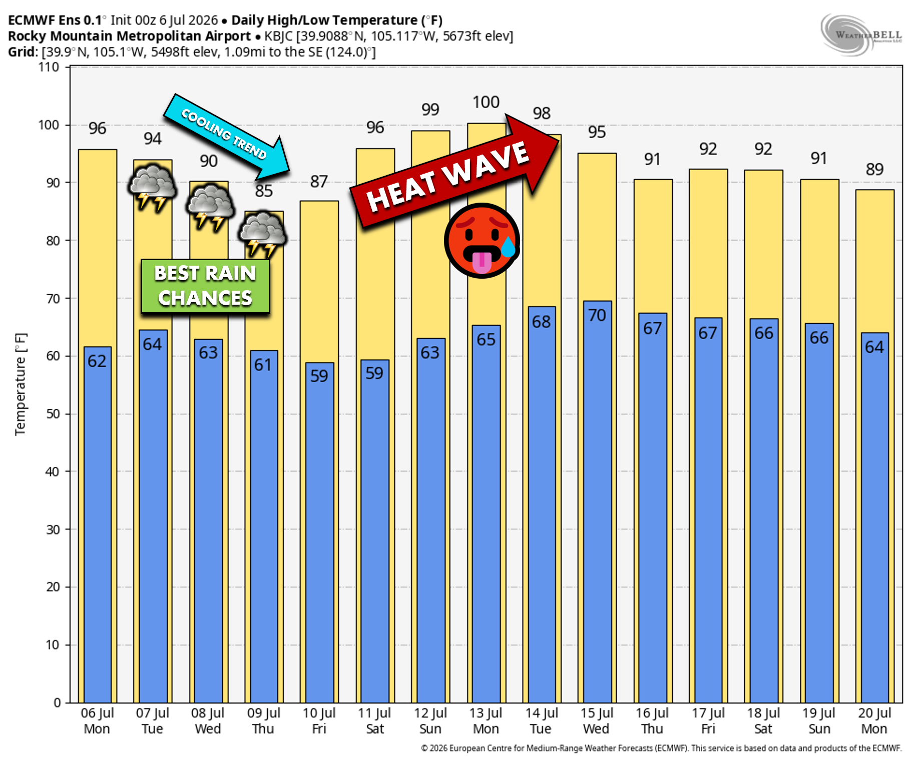
Boulder’s daily records for July show that this stretch of hot weather has been seen before in the middle of the month, most notably back in 1954, when the city reached values of 102 to 104°F on three consecutive days. Whether we get that hot remains to be seen, and frankly seems unlikely, but we could end up just shy of records which would still have the same heat stress impacts on our local community.
NOAA’s Climate Prediction Center continues to highlight Colorado and Wyoming as the core of the upcoming heat dome, with strong confidence in above‑normal temperatures into early next week.

Rain chances will be minimal across eastern Colorado and the Central Plains during this period.

A Silver Lining: Monsoon Moisture on the Horizon
One beneficial side effect of the weekend heat will be persistent southerly flow into the Desert Southwest. This pattern is expected to last long enough to pull substantial subtropical moisture northward — signaling the likely arrival of the 2026 American Southwest Monsoon, roughly 10 days later than average.
Monsoon Evolution
- Early next week: Moisture initially targets California and Nevada.
- Midweek next week: Moisture rotates eastward into Colorado.
- Result: A return to daily thunderstorms with potential for meaningful rainfall!
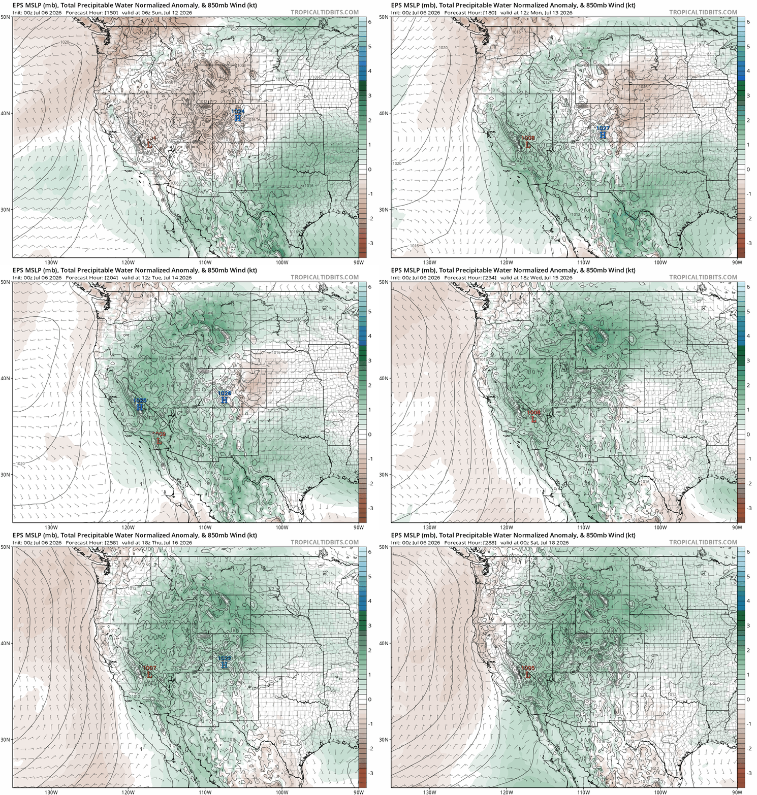
Monsoon moisture begins to surge northward into the Southwest over the weekend, eventually rotating around the heat dome into Colorado by the middle of next week.
Fire‑weather relief is still on track for the middle to end of the month, but we’ve got a long, hot stretch to push through before the monsoon truly kicks in. As this heatwave expands, expect continued fire growth and elevated ignition potential across the Four Corners, along with all that smoke starting to pool beneath the dominant ridge. More to come in the days ahead.
Forecast Specifics:
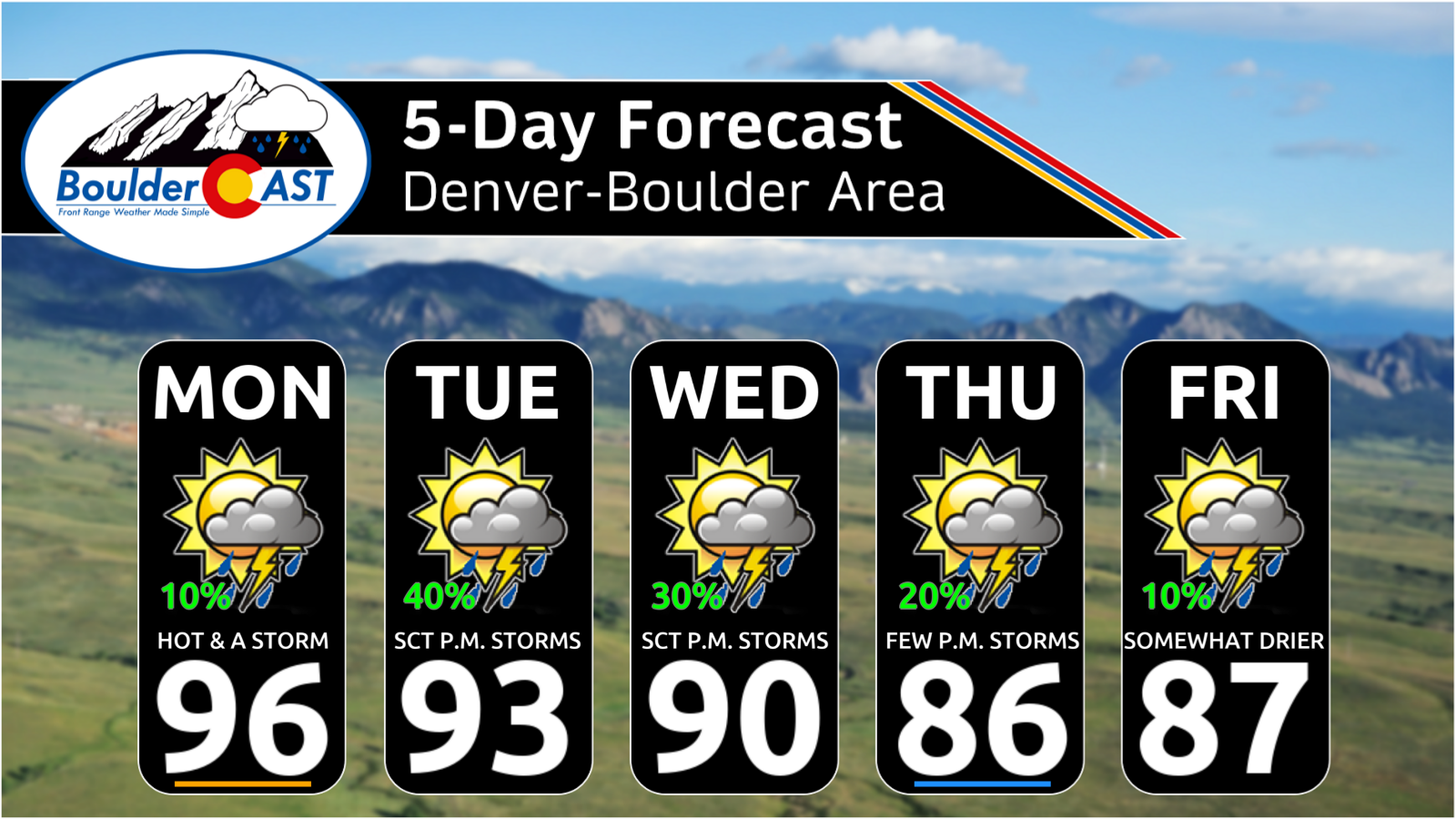
Monday: Hot and mainly dry with just an isolated 10% chance of a storm in the afternoon and early evening. Highs in the middle 90s for the Plains and middle 80s in the Foothills.
Tuesday to Thursday: Increased chances for late-day thunderstorms, with around 30% chances each day. Temperatures will be lower in the middle 80s to lower 90s for the Plains and middle 70s to near 80 in the Foothills.
Friday: Highs in the upper 80s for the Plains and middle 70s in the Foothills under a slight chance of storms, mainly east of Denver.
Saturday/Sunday: Trending drier with highs possibly near the century mark on the Plains and near the upper 80s in the Foothills. Plan for a significant multi-day heatwave!
DISCLAIMER: This weekly outlook forecast is created Monday morning and covers the entire upcoming week. Accuracy will decrease as the week progresses as this post is NOT updated. To receive daily updated forecasts from our team, among many other perks, subscribe to BoulderCAST Premium.
Go Premium, get all the perks.
Daily Forecast Updates
Get our daily forecast discussion every morning delivered to your inbox.
All Our Model Data
Access to all our Colorado-centric high-resolution weather model graphics. Seriously — every one!
Ski & Hiking Forecasts
6-day forecasts for all the Colorado ski resorts, plus more than 120 hiking trails, including every 14er.
Smoke Forecasts
Wildfire smoke concentration predictions up to 72 hours into the future.
Exclusive Content
Weekend outlooks every Thursday, bonus storm updates, historical data and much more!
No Advertisements
Enjoy ad-free viewing on the entire site.
Enjoy our content? Give it a share!












You must be logged in to post a comment.