After a hot and dry Monday, the rest of the week ahead will see cooler and stormy conditions unfold across the Front Range, the the focus centered on another damaging hail outbreak on the Fourth of July holiday. Much cooler weather arrives Wednesday with at least one cold-related historical record up for grabs. The Southwest monsoon remains delayed with little hope of it arriving anytime soon. Let’s take a look at yet another active week in Colorado weather!
This week’s highlights include:
- Hot and mostly dry Monday as we give it another go at 90 degrees
- A significant severe weather outbreak will unfold Tuesday for the entire area with large hail up to 2″ in diameter, plus a few tornadoes to the east
- Much cooler, gloomy and showery on Wednesday behind a Canadian cold front — at least one cold record may be challenged!
- Storms stick around somewhat late-week as temperatures climb back towards normal

DISCLAIMER: This weekly outlook forecast is created Monday morning and covers the entire upcoming week. Accuracy will decrease as the week progresses as this post is NOT updated. To receive daily updated forecasts from our team, among many other perks, subscribe to BoulderCAST Premium.

Go Premium, get all the perks.
Daily Forecast Updates
Get our daily forecast discussion every morning delivered to your inbox.
All Our Model Data
Access to all our Colorado-centric high-resolution weather model graphics. Seriously — every one!
Ski & Hiking Forecasts
6-day forecasts for all the Colorado ski resorts, plus more than 120 hiking trails, including every 14er.
Smoke Forecasts
Wildfire smoke concentration predictions up to 72 hours into the future.
Exclusive Content
Weekend outlooks every Thursday, bonus storm updates, historical data and much more!
No Advertisements
Enjoy ad-free viewing on the entire site.
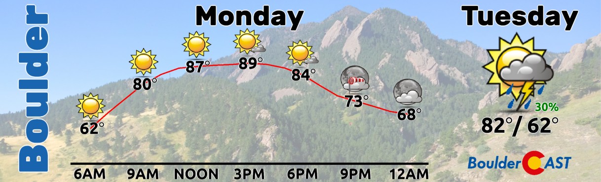
Almost hot on Monday
The mostly dry weather that unfolded over the pseudo-holiday weekend will continue into our wannabe-holiday Monday as a weak ridge of high pressure over the Southwest nudges ever-so-slightly further eastward to encompass Colorado. The ridge axis on Monday will extend northeastward from Arizona into the Great Lakes, directly over Denver. This ridge will aid in large-scale sinking motion across the Front Range. However, off the northwest is our next weather system which will move in Tuesday and Wednesday bringing big changes. More on that in a moment.

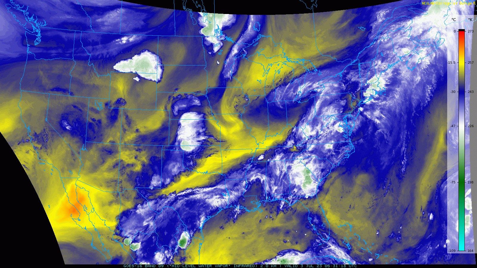
At the same time as the ridge slides in Monday, we also have a widespread influx of dry air moving into the area from the northwest, visualized in Monday morning’s GOES-East mid-level water vapor animation below. The dry air and clockwise flow of the atmosphere under the ridge are evident, both helping to inhibit most storm activity Monday afternoon and evening. Most, but not all.
700mb temperatures across the Front Range are forecast to be about 2°C higher Monday than on Sunday which will translate into surface temperatures some 3-5°F warmer. This will bring the Denver Metro area in the ballpark of 90° for Monday with just a small chance of seeing a weak shower from late afternoon into the evening. Most of what develops will not reach the ground, evaporating in the hot and dry air.
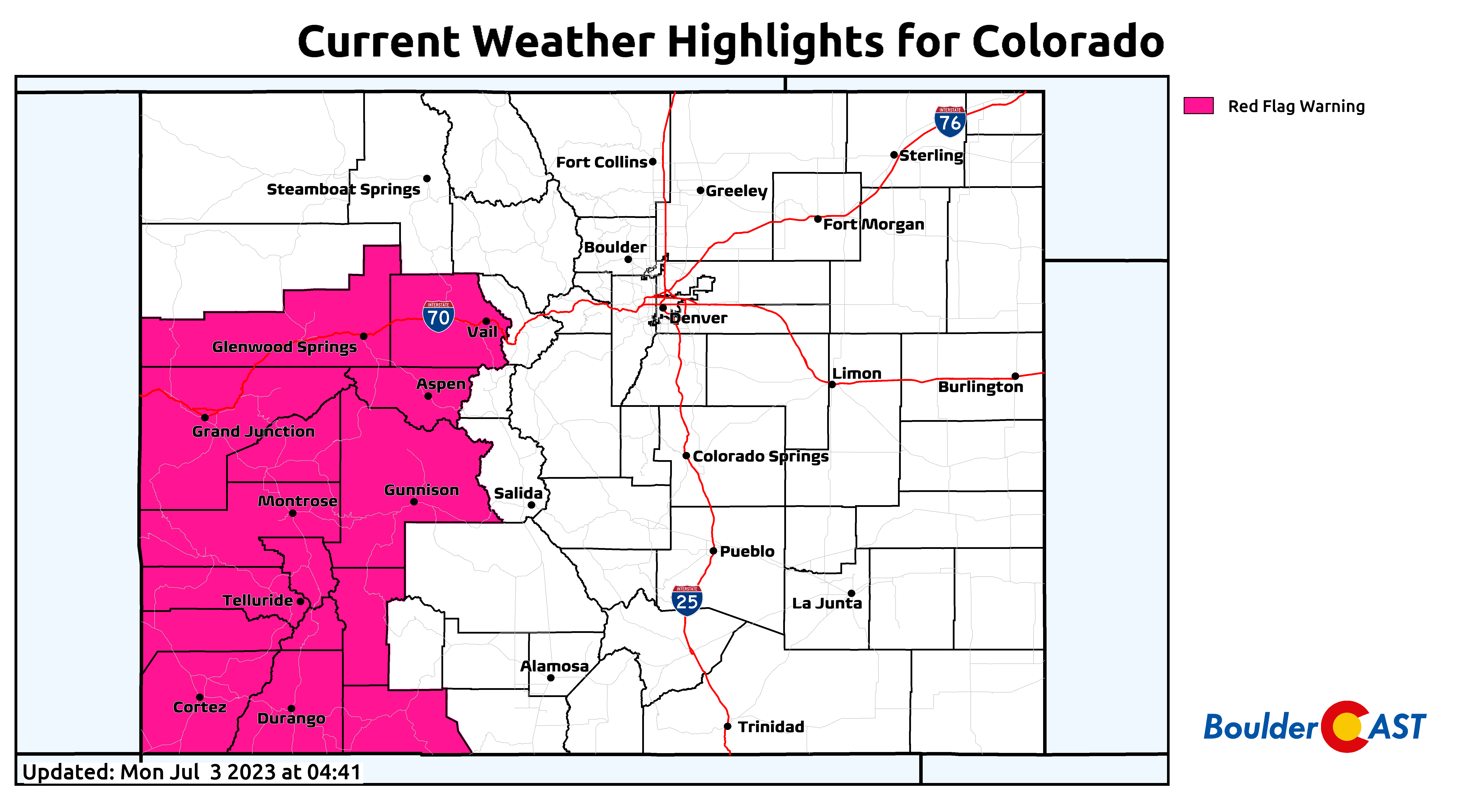
Across the Western Slope, Monday will be wrought with elevated fire danger. Red Flag Warnings are in effect to the west where Mother Nature hasn’t been as generous with rainfall of late.
Damaging hail for the Fourth of July
By Tuesday, the aforementioned trough will be getting even closer to us from the northwest. A weak cold front is progged to drop into northeast Colorado during the early morning hours Tuesday before sunrise. This will usher in a wave of upslope to the area and somewhat cooler temperatures. However, this front is rather weak and is just the tip of the iceberg — the true Canadian cold front will still be north across Montana at this time. The upslope and moisture content behind the first front will help set the stage for another severe weather outbreak across the Centennial State Tuesday afternoon into the evening.
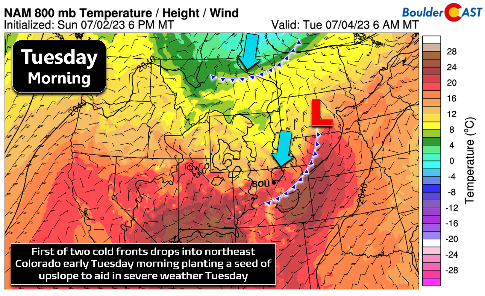
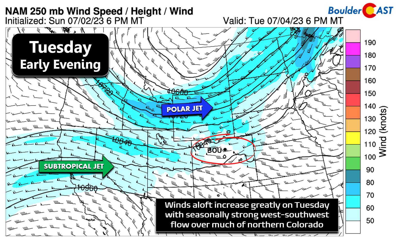
At the same time upslope develops at the surface, an unseasonably strong jet streak will be rushing in around the base of the trough and into Colorado. While the strongest winds will remain up across Wyoming, northern Colorado will land in a favorable location for low-level upslope and strong west winds aloft to overlap — a portion of the recipe needed for severe weather.
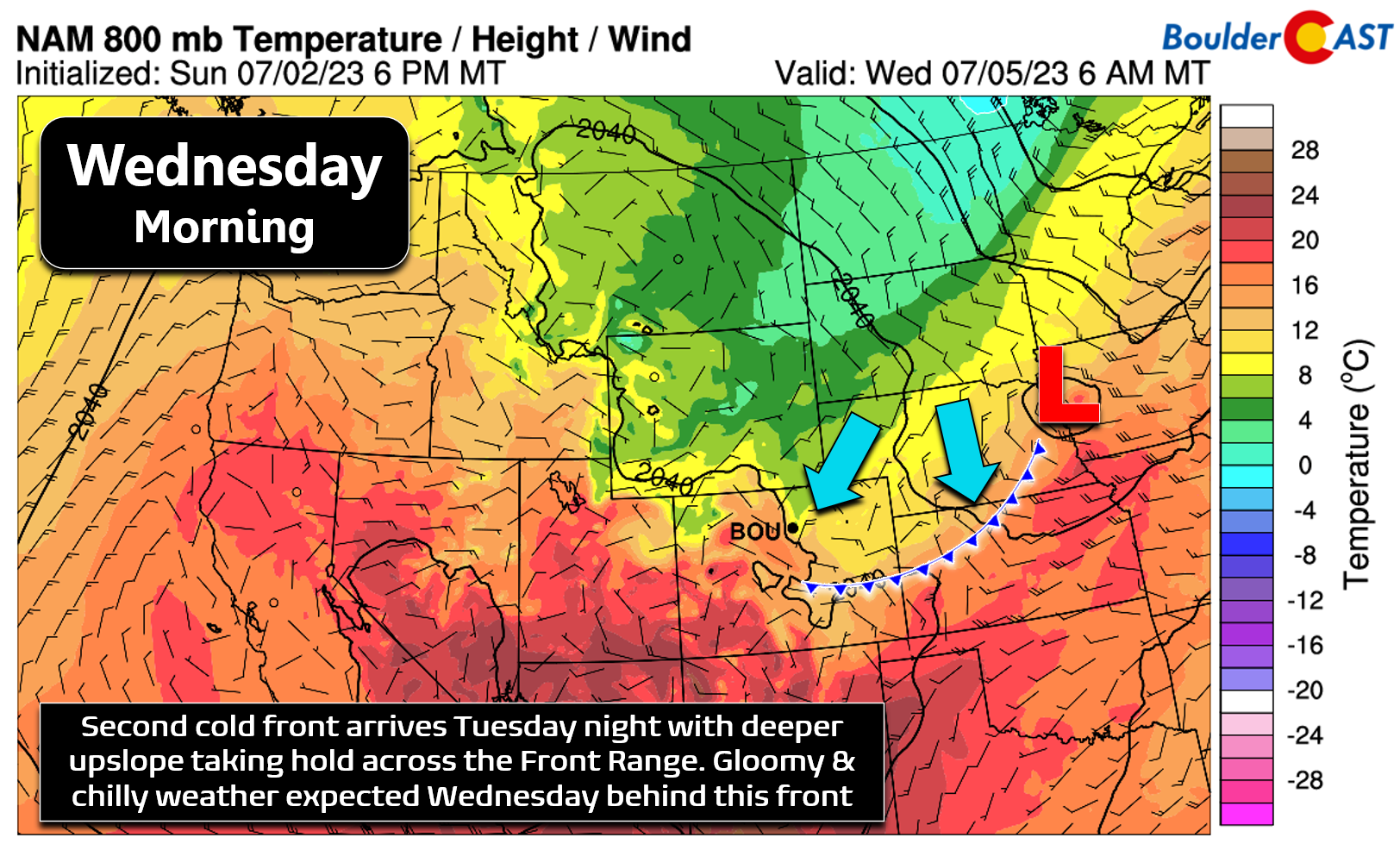
The other part of the recipe will be fulfilled with ~1500 J/kg of CAPE (instability) forecast for eastern Colorado Tuesday afternoon into the early evening. The NAM model shown below currently predicts due-easterly 10 MPH winds in Denver just above the surface (green wind barbs) with roughly 45 MPH winds from the due west in the middle atmosphere (red wind barbs).
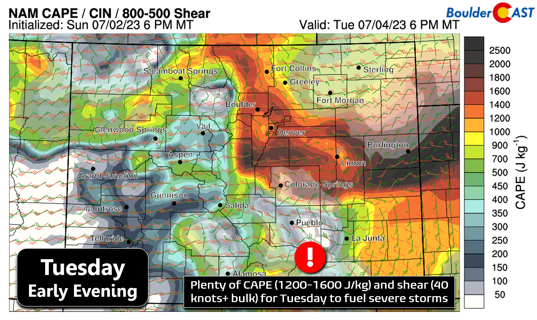
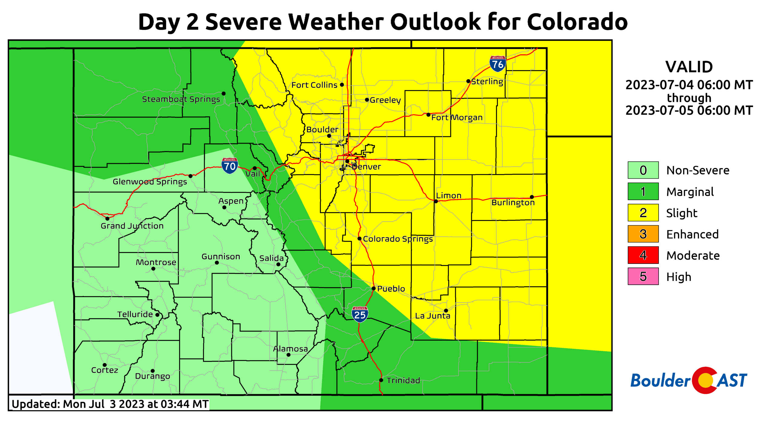
While not ideal for tornadoes in our immediate area, this shear setup will aid in the development of supercell thunderstorms Tuesday that will be capable of very large hail up to 2.5″ in diameter. The Storm Prediction Center (SPC) has a strikingly broad Slight Risk outlook for much of Colorado already in place for Tuesday, along with a Marginal Risk stretching west towards Utah through the higher terrain. This broad brush type of severe outlook in our area and across the Mountains, especially for Day 2, is very rarely issued by the SPC which speaks to the potential impactfulness of Tuesday’s storms. Definitely keep an eye out for severe weather popping on Tuesday as all signs are pointing to another fairly widespread supercell-fest in eastern Colorado during the afternoon and evening. Storms will linger into the late evening and overnight as well, potentially throwing a wrench in any celebratory fireworks and/or drone displays as the sun sets Tuesday evening.
Highs on Tuesday will be a tad cooler in the middle 80s with any outdoor activities after noon at risk of turning wet!
Chilly & gloomy on Wednesday
Late Tuesday night into Wednesday morning the stronger Canadian cold front will move into the Front Range, bringing a cool/moist airmass to the party. This is likely to produce low clouds for the area for Wednesday morning, with skies eventually clearing out somewhat by afternoon. Instability will be much lower due to the cooler temperatures/clouds and thus storms should be more scattered in nature and non-severe. Still there is a fairly decent risk of wet weather again, especially across the higher terrain. Overall Wednesday will feel much cooler with highs struggling to reach even 70 degrees with periods of rain showers. Interestingly, the record low maximum temperature in Boulder for July 5th is 69°F which will be challenged on Wednesday, speaking to just how unseasonably cold the attendant airmass will be!
Drying out somewhat late week, staying cool
By Thursday and Friday, drier northwest flow will begin to reestablish itself over Colorado with a weak ridge of high pressure to our south over New Mexico. This setup will favor reduced storm chances and slightly cooler than normal temperatures across the Front Range, though we do expect things to get back into the 80s to close out the week. Look for just isolated to scattered garden variety storms Thursday and Friday.
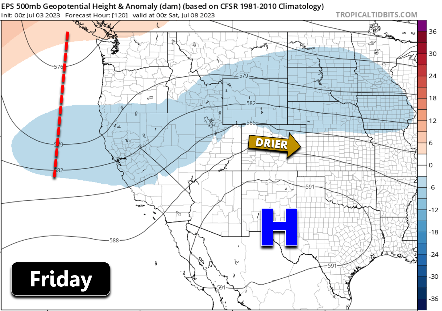
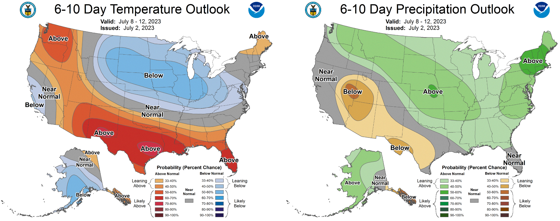
This large-scale pattern will continue to support near normal to below normal temperatures through the upcoming weekend into early next week. There’s very little hope of the monsoon developing anytime soon — it’s already late to the party and will be delayed further. We’ll dive into the “Case of the Missing Monsoon” in a post later this week so do check back.
Enjoy the weather this week and Happy Fourth of July!
Forecast Specifics:
Monday: Morning sun with increasing clouds during the afternoon/evening. A weak late-day shower is possible, mainly in and near the Foothills. High temperatures soar into the lower 90s across the Plains with upper 70s in the Foothills.
Tuesday (Independence Day): Mostly sunny in the morning but with increasing clouds by afternoon. Conditions will be ripe for the development of supercell thunderstorms during the afternoon and evening. The main risk is large hail up to 2″ in diameter, but isolated tornadoes will be possible east of Denver. Highs reach the middle 80s on the Plains with middle 70s in the Foothills. Storms will be scattered well into the evening and could impact 4th of July activities.
Wednesday: Much cooler and gloomy behind a cold front. Expect low clouds in the morning with some sunshine developing by the afternoon. Showers and storms will be possible during the afternoon and evening, but not severe ones. Highs will struggle to reach 70 degrees on the Plains with lower 60s in the Foothills.
Thursday: Mostly sunny early, then scattered afternoon and evening thunderstorms. Highs reach the lower 80s on the Plains with lower 70s in the Foothills.
Friday: Mostly sunny and seasonal with isolated to widely scattered late-day thunderstorms. Temperatures will be warmer in the upper 80s on the Plains with middle 70s in the Foothills.
DISCLAIMER: This weekly outlook forecast is created Monday morning and covers the entire upcoming week. Accuracy will decrease as the week progresses as this post is NOT updated. To receive daily updated forecasts from our team, among many other perks, subscribe to BoulderCAST Premium.
Go Premium, get all the perks.
Daily Forecast Updates
Get our daily forecast discussion every morning delivered to your inbox.
All Our Model Data
Access to all our Colorado-centric high-resolution weather model graphics. Seriously — every one!
Ski & Hiking Forecasts
6-day forecasts for all the Colorado ski resorts, plus more than 120 hiking trails, including every 14er.
Smoke Forecasts
Wildfire smoke concentration predictions up to 72 hours into the future.
Exclusive Content
Weekend outlooks every Thursday, bonus storm updates, historical data and much more!
No Advertisements
Enjoy ad-free viewing on the entire site.
Get BoulderCAST updates delivered to your inbox:
Enjoy our content? Give it a share!


You must be logged in to post a comment.