This was undoubtedly a wild week in Front Range weather — but one which resulted in multiple good outcomes. The extreme severe weather outbreak planned for midweek got partially busted by low clouds and fog which may have ultimately saved it from becoming the costliest hailstorm in state history. Further, the deluge of rain that dumped to close out the week will go a long way towards eradicating much of the ongoing drought in the eastern half of the state. Let’s take a look back at this crazy week in Colorado weather!
Tuesday Evening
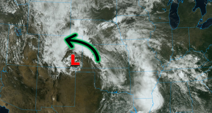
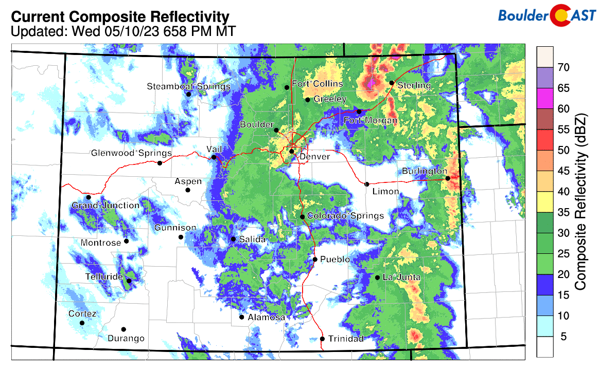
Things kicked off Tuesday evening as slow-moving supercell thunderstorms developed north of Denver in eastern Boulder County dropping a localized 1 to 2″ of rainfall while also causing significant storm damage and accumulating hail near Erie.

These storms blew up and “surfed” along a wall of moisture blasting westward into the Front Range which was spawned by severe thunderstorms earlier Tuesday afternoon in Kansas, some 300 miles to the east. Interestingly, short-range models only gave us about a 12-hour notice on these storms, coming to an overwhelming consensus that there would in fact be a few fireworks to watch out for late Tuesday evening. A lot of finer details had to come together just right for the explosion of storms Tuesday night, and with the short notice, some residents may have been caught off guard by local weather forecasts, including our own!
The city of Boulder was largely spared for the rain/hail on Tuesday, but boy the several-hour-long lightning show was something to behold! It was truly giving off some strong monsoon vibes!
Last night’s #lightning show was spectacular. Can’t remember the last time I’ve seen so much lightning. I hope the folks northeast of #boulder made it through the large hail. @BoulderCAST #thunderstorm @NOAA @NikonUSA pic.twitter.com/LEpQnqUj9P
— Matt Benjamin (@MBforBoulder) May 10, 2023
Quite the show last night. First storm was pushing out east during sunset. Second storm was over Erie around 10pm- as predicted by our local meteorologists 👏
📸 from Thornton. @BoulderCAST @CReppWx @9NEWSWeather #coxw #9wx #thunderstorms #Erie #Boulder #Colorado pic.twitter.com/AerWUZj26W
— Tim Ranglos (@Tim_Ranglos) May 11, 2023
Storms on Tuesday evening put down plenty of 1 to 2″ hailstones between Longmont and Erie.
Tuesday’s late night explosion was just a small appetizer for the main course of severe weather which was promised to arrive on Wednesday…
Hail in Erie / Lafayette CO from tonight’s storm #BoulderHail #BoulderCounty #cowx pic.twitter.com/Oa9TrUb01K
— KristinMiller (@KristinMiller) May 10, 2023
Wednesday afternoon
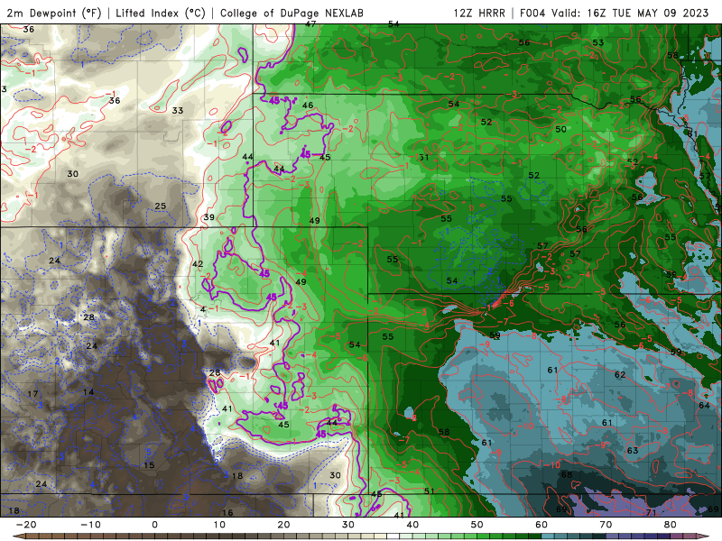
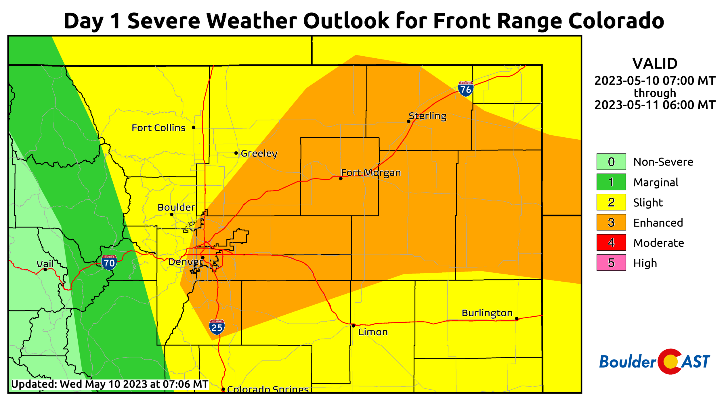
Wednesday was predicted to have one of the most explosive atmospheres for severe weather across the Front Range in years, possibly even a decade or more. Because of our elevation, lack of moisture, local topography, and centralized positioning in the North American continent, getting these type of conditions to actually materialize is very tricky here. Wednesday was a prime example of why these “opportunities” are so few and far between for the Front Range…things have to go just perfectly!
Thanks to the prior night’s storms and copious moisture arriving from the east….low clouds, fog and drizzle rapidly formed in the morning hours Wednesday. This immediately put a lid on the Denver Metro area keeping the threat of severe weather developing locally rather low as upslope flow ensued and temperatures struggled to reach even 50 degrees at the surface — what a gloomy day it was!
The gloom is real this afternoon, but hey at least we warmed up to 52°F! #COwx pic.twitter.com/ezAJrSxgHa
— BoulderCAST Weather (@BoulderCAST) May 10, 2023
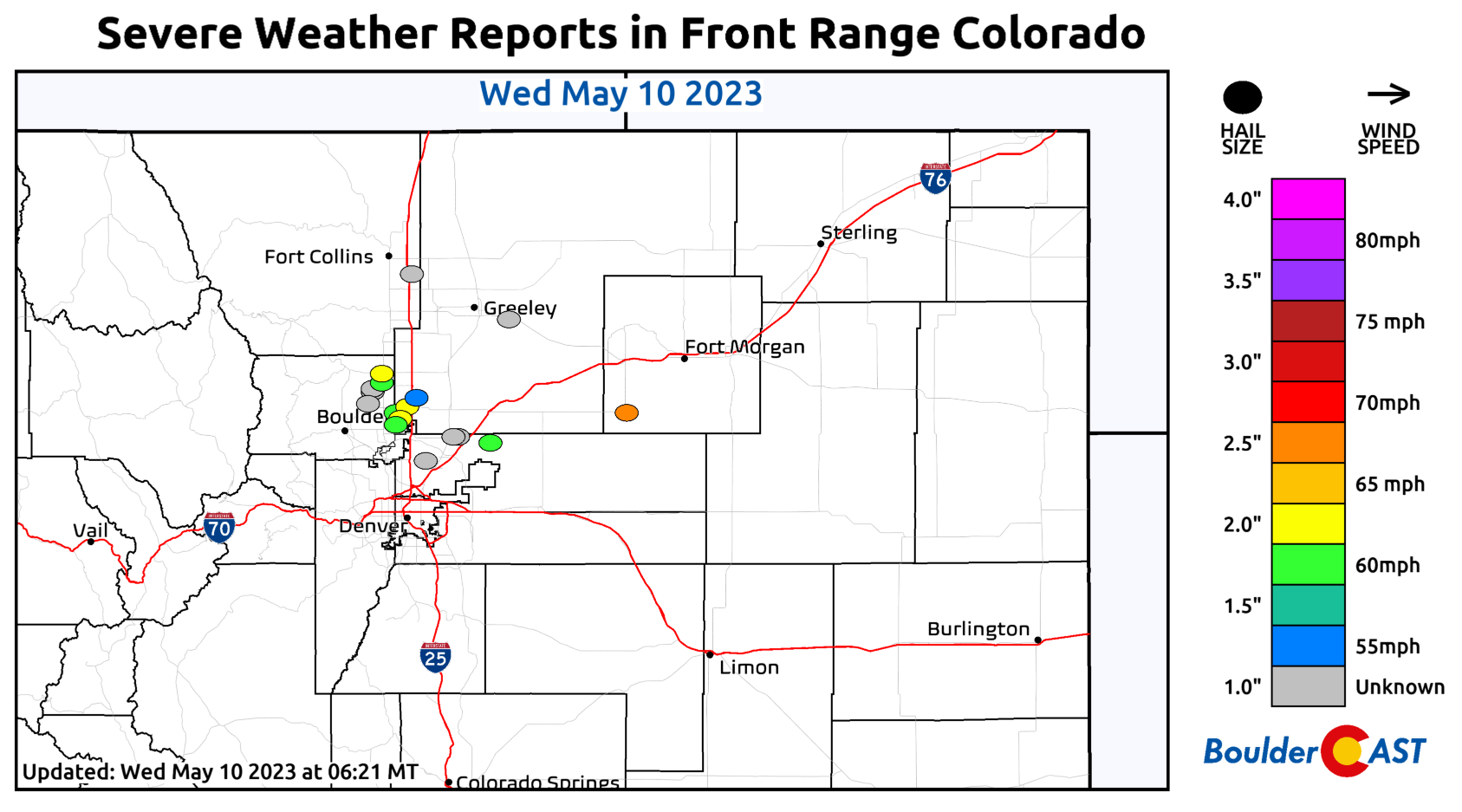
However, the sun was partially shining over the Palmer Divide which was all Mother Nature needed to get things going. This led to numerous supercells firing and moving into the southern and southeastern Metro area, despite temperatures only in the 50s and overcast skies in these areas. Plowable, damaging hail was reported in Parker, Aurora, Centennial, and elsewhere on the Plains of eastern Colorado.

Severe reports from Tuesday show a plethora of large hail, including plenty of golf balls on the southeast side, all the way up to baseballs and softballs out east. There were also a few cells that put down weak tornadoes east of Fort Morgan.
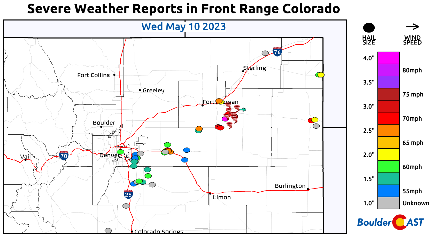
Some of the scenes coming out of the southeastern burbs of Denver were a bit surreal as hail accumulated like snow and damaged homes:
Hail from Castle Pines. pic.twitter.com/zZVwSrh8f4
— Nope (@justreading83) May 10, 2023
Can confirm extensive mild to moderate damage to exterior vinyl siding that will require an insurance claim and a fair bit of work to take care of due to golf ball+ size hail at our place in SE Aurora this afternoon. Hopefully no damage to solar panels. #COwx #Denver #weather pic.twitter.com/yvdLuLCqkz
— Josh Larson (@coloradowx) May 10, 2023
Given what could have went down on Wednesday in the extremely rare hail-primed atmospheric setup, we feel that a bulk of the Denver Metro area really dodged a bullet! Wednesday truly could have been one of the costliest hail events in Colorado history had it more directly hit the populated Metro as all signs were pointing towards beforehand. Boulder in particular was spared but that of course was somewhat anticipated…
The pesky stratus clouds should clear out of most of the area by midday, but areas in/near the lower Foothills including Boulder may be stubborn. There is some chance it hurts the severe potential. Storms will be igniting in the higher terrain though so it may not matter #COWx pic.twitter.com/UB3jm4Bkfj
— BoulderCAST Weather (@BoulderCAST) May 10, 2023
Wednesday evening
As the evening wore on, instability waned and the severe threat was completely diminished with just good old fashioned raindrops taking over across much of eastern Colorado.
Thursday morning
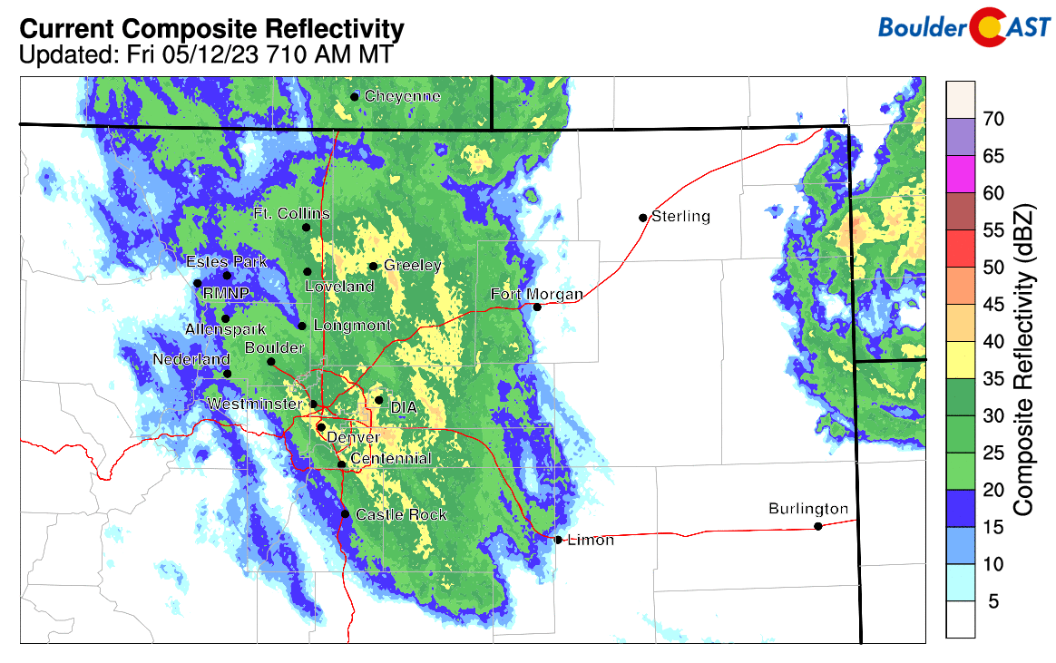
By early Thursday, the upper-low pressure was located east of Pueblo. Widespread moderate precipitation continued to funnel into the Denver Metro area from the southeast. Flooding rainfall was already occurring to the south near Colorado Springs where rain was pounding through the overnight.

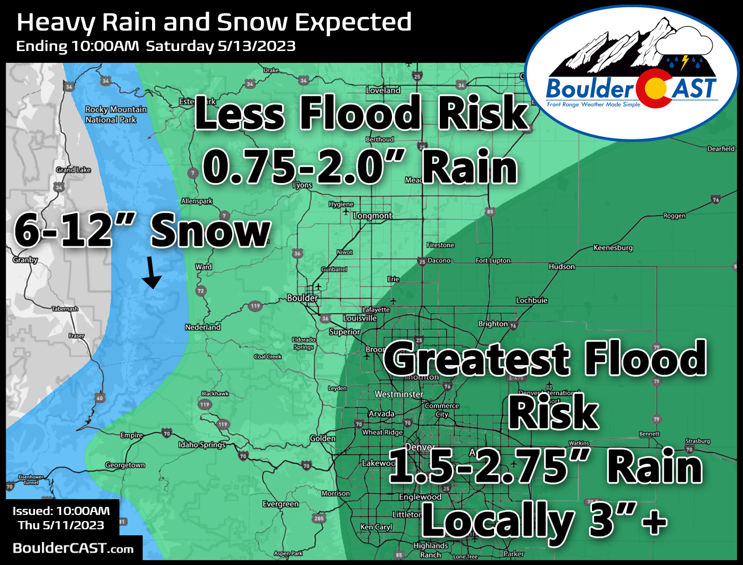
Sometime Thursday morning it became quite clear this was going to be a REALLY BIG rain event for the Front Range and broad flooding was a real risk. After 1 to 3″ of rain had already fallen, we issued the following forecast map predicting additional rainfall totals for the rest of the week. Most of the flooding that occurred was contained in the area we denoted as the “greatest risk”.
Thursday early afternoon
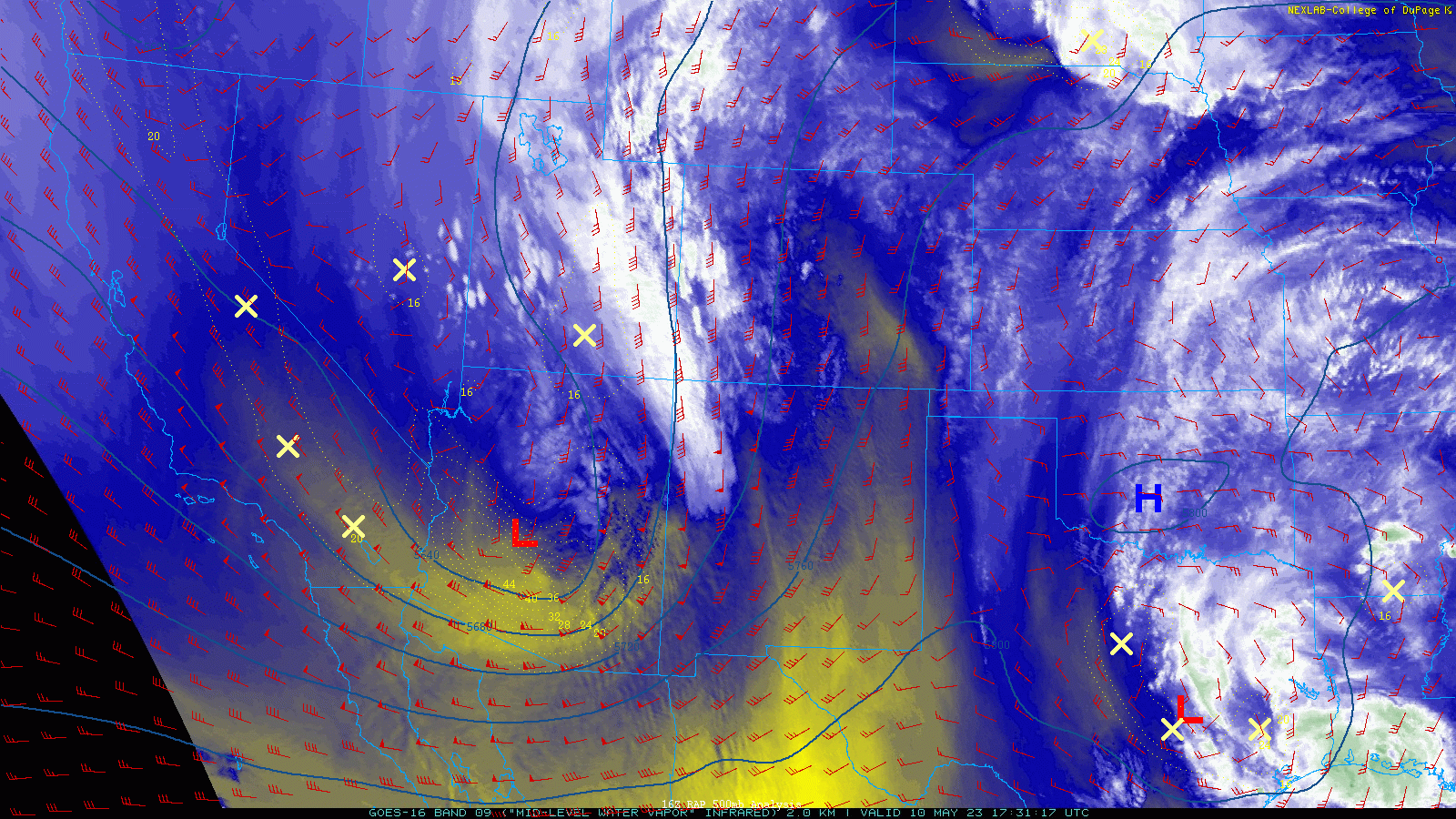
By Thursday afternoon, the pipeline of Gulf of Mexico moisture continued to flow into northeast Colorado. Widespread moderate rainfall was occurring up and down the Front Range, while lots of thunderstorms were roaring to the east towards Nebraska and Kansas. A few of those cells ended up putting down brief tornadoes! The stalled-out low pressure had barely moved at this point, having slid just a handful of miles eastward from Pueblo.
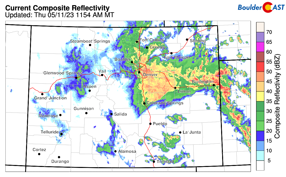
There was a brief decrease in precipitation intensity across the Metro area Thursday afternoon and early evening as somewhat of a dry slot infiltrated the area from the east. However, it quickly redeveloped during the evening with the continuous shield of precipitation returning to the entire area from Pueblo to Cheyenne.

Flooding became an issue on Thursday with rainfall not letting up in the slightest throughout the day. Creeks and streams overflowed their banks. Vulnerable roadways were washed out. Parking lots and underpasses disappeared. Overall, though, it wasn’t too bad. The long duration, somewhat gentle rainfall made this areal flood event much less destructive and concerning than a flash flood.
The heavy rainfall has caused road damage in Cherry Creek State Park. There are closures in place shown on the attached map. All park entrances and the dog park are still open. pic.twitter.com/uX5ilhzvPy
— CPW NE Region (@CPW_NE) May 11, 2023
Street flooding at York & Brighton Blvd. Be careful! So many flooded streets tonight. #cowx @CBSNewsColorado pic.twitter.com/2Z7eAaDJXM
— Mark Neitro (@CBS4Mark) May 12, 2023
Friday
On Friday we awoke to another morning of — you guessed it — light to moderate rainfall across the entire region! What is this — Seattle?
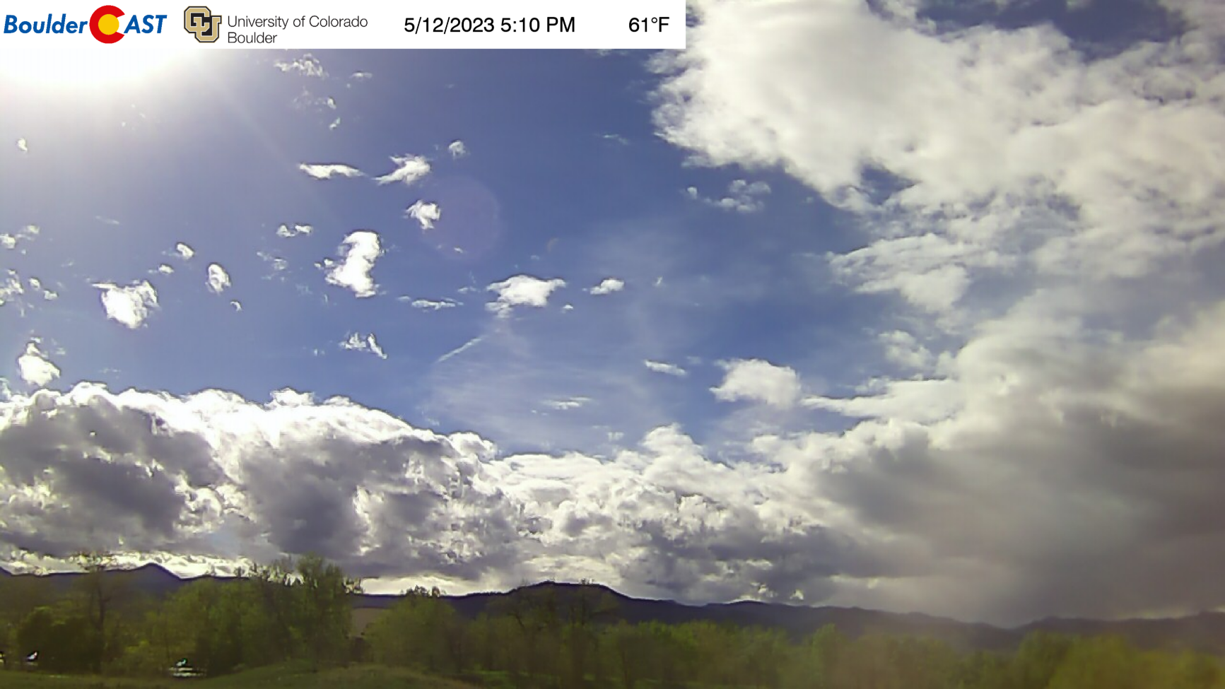
However, things rapidly improved during the morning hours with peeks of sunshine by lunchtime and the rain coming to an end in most locations by early afternoon. Whew! What. A. Week!
Summary
The Front Range landed in an absolute prime position for this slow-moving dynamic storm to pummel with rainfall. After coming through California and into the Four Corners region, the low intensified in southern Colorado and then moved like sloth to the northeast. This slow progression led to prime rainfall conditions lingering for some 36+ hours across the Front Range with a constant pipeline of Gulf moisture spewing directly into the Denver area. In most cases, rainfall rates were less than 0.25″ per hour, with just a few bursts of heavier precipitation in short-lived convective cells.
When it was all said and done, anywhere from 0.5 to 6.5″ of rain fell across the Front Range from this storm from around 40-45 hours of near-continuous rainfall. The rainfall analysis graphic below from the National Weather Service shows the spatial distribution of the rainfall nicely, though do keep in mind this ends at 6AM on Friday and many areas picked up ~0.5″ of rain after this.
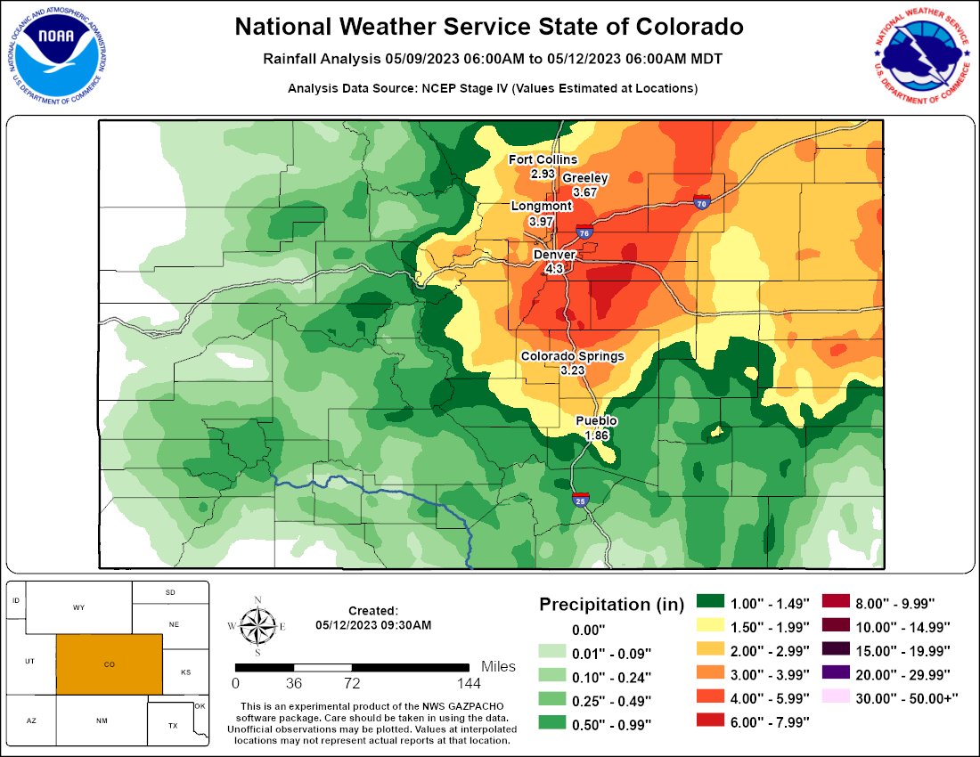
Totals were highest southeast of Denver, and lowest in the northwest around Boulder. For many locations around the Metro, this was the largest single storm dumping of precipitation since the 2013 Colorado Flood. While upslope certainly played a role in this event, at times there was downslope coming off the Foothills as the big low wobbled over southeast Colorado. This resulted in less intense precipitation in and near the Foothills which cut back on totals for Boulder and areas west and northwest. There were even a few 1-2 hour stints of completely dry weather in Boulder during the event, something that didn’t happen for areas further east.

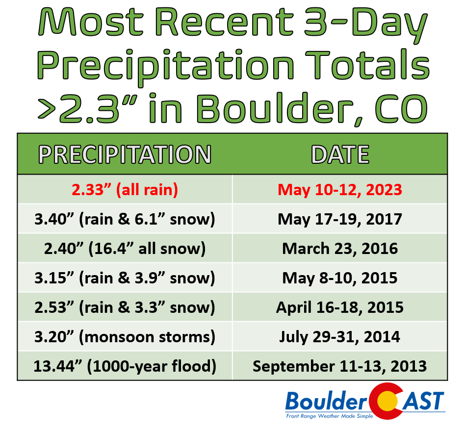
Officially, 2.33″ of rain fell in Boulder, while a staggering 4.40″ was recorded in Denver at the airport. For Denver this storm made a Top 8 (or better) rank for largest 1-, 2- and 3-day precipitation events. That 4.40″ in Denver accounts for approximately 30% of the city’s annual precipitation!
With the rain coming to an end, where does the recent rainfall rank in Denver's history?
Rain totals:
May 10 – 0.65"
May 11 – 2.92"
May 12 – 0.83"1-day total: 2.92" is ranked 8th highest
2-day total: 3.75" is ranked 3rd highest
3-day total: 4.40" is ranked 5th highest#COwx pic.twitter.com/KY9lbIpg78— NWS Boulder (@NWSBoulder) May 12, 2023
Despite being substantial, that 2.33″ rainfall total in Boulder is a lot less impressive that Denver, accounting for only about 10% of Boulder’s average annual precipitation — and furthermore it doesn’t have much ground to stand on historically. However, it does come in as Boulder’s largest precipitation event in about 6 years! Since the great 2013 Flood, there have been a total of five events which produced 2.3″ of precipitation or more. This was the first spring storm since that was an all-rain affair.
While some portions of the Mountains did receive a foot or more of fresh snow this week, this was a definitively warm spring storm by Front Range standards. You know very well that Denver and Boulder can see snow this time of year. Shockingly, this one was about 15 to 20°F too warm for snow across the lower elevations — it wasn’t even close folks so don’t feel like we somehow missed out on a bunch of snow! That just wasn’t the case this week. The Foothills are even more susceptible to late-season snow and this storm was even (mostly) rain up there!

Our greatest forecasting regret this week was letting the magnitude of the impending rain event Thursday into Friday get overlooked somewhat by the rare severe weather outbreak preceding it on Wednesday. Sometimes as meteorologists we get too focused on one round of impactful weather and shift effort away from the other. This has happened in the past with incoming winter storms overshadowing the pre-storm fire danger (e.g. Marshall Fire in December 2021). While the severe outbreak this week was rightfully our top priority, we can’t help but think this rain event flew under the radar a tad and may have caught more than a few people off guard! Ultimately, our weekly outlook post on Monday checked all the boxes it needed to and our medium-range forecast turned out quite well:
The deluge of moisture that fell across eastern Colorado this week will go a long way towards correcting the ongoing drought, even if there was a bit of “over-correction” in some spots that saw minor flooding or even some not-so-minor hail damage. The native grasses on the flatlands and hillsides alike will be turning green soon. It’s about damn time!


Go Premium, get all the perks.
Daily Forecast Updates
Get our daily forecast discussion every morning delivered to your inbox.
All Our Model Data
Access to all our Colorado-centric high-resolution weather model graphics. Seriously — every one!
Ski & Hiking Forecasts
6-day forecasts for all the Colorado ski resorts, plus more than 120 hiking trails, including every 14er.
Smoke Forecasts
Wildfire smoke concentration predictions up to 72 hours into the future.
Exclusive Content
Weekend outlooks every Thursday, bonus storm updates, historical data and much more!
No Advertisements
Enjoy ad-free viewing on the entire site.
Get BoulderCAST updates delivered to your inbox:
Enjoy our content? Give it a share!


You must be logged in to post a comment.