
Overnight severe storms produced tennis ball-sized hail in parts of eastern Boulder County, acting as an appetizer for what will unfold later today as the greatest risk of severe weather in years may develop across the Denver Metro area. Low clouds lingering during the morning may delay the severe weather ignition today, but huge hail, damaging winds and a few tornadoes are still in the cards for the afternoon and early evening hours for some area. After the severe weather threat diminishes, soaking rain becomes the story Thursday into early Friday with areal flooding possible.
A
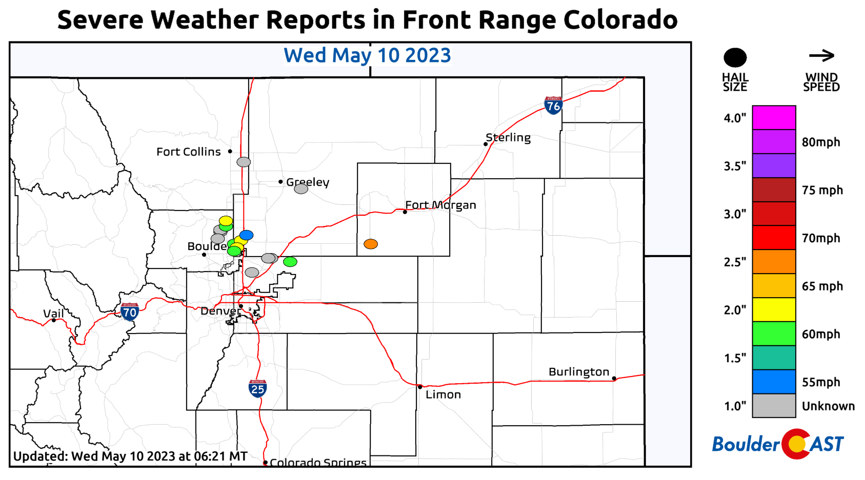
few rather sneaky late-night severe thunderstorms developed across the northern Denver Metro area overnight, including in portions of eastern Boulder County towards the midnight hour. Areas near Erie and Firestone reported hailstones up to tennis ball-sized. Parts of Boulder picked up small hail too, but it was nothing like what formed further east. There was also some minor flooding in areas that received more than 1″ of rain. We mostly just had a three-hour-long light show from all of the storms to the east. Things were basically quiet around Denver last night.

Here’s a look at the size and location of the hailstones that were reported overnight. As a reminder, you can always find this graphic over on our Front Range Severe Weather Reports page.
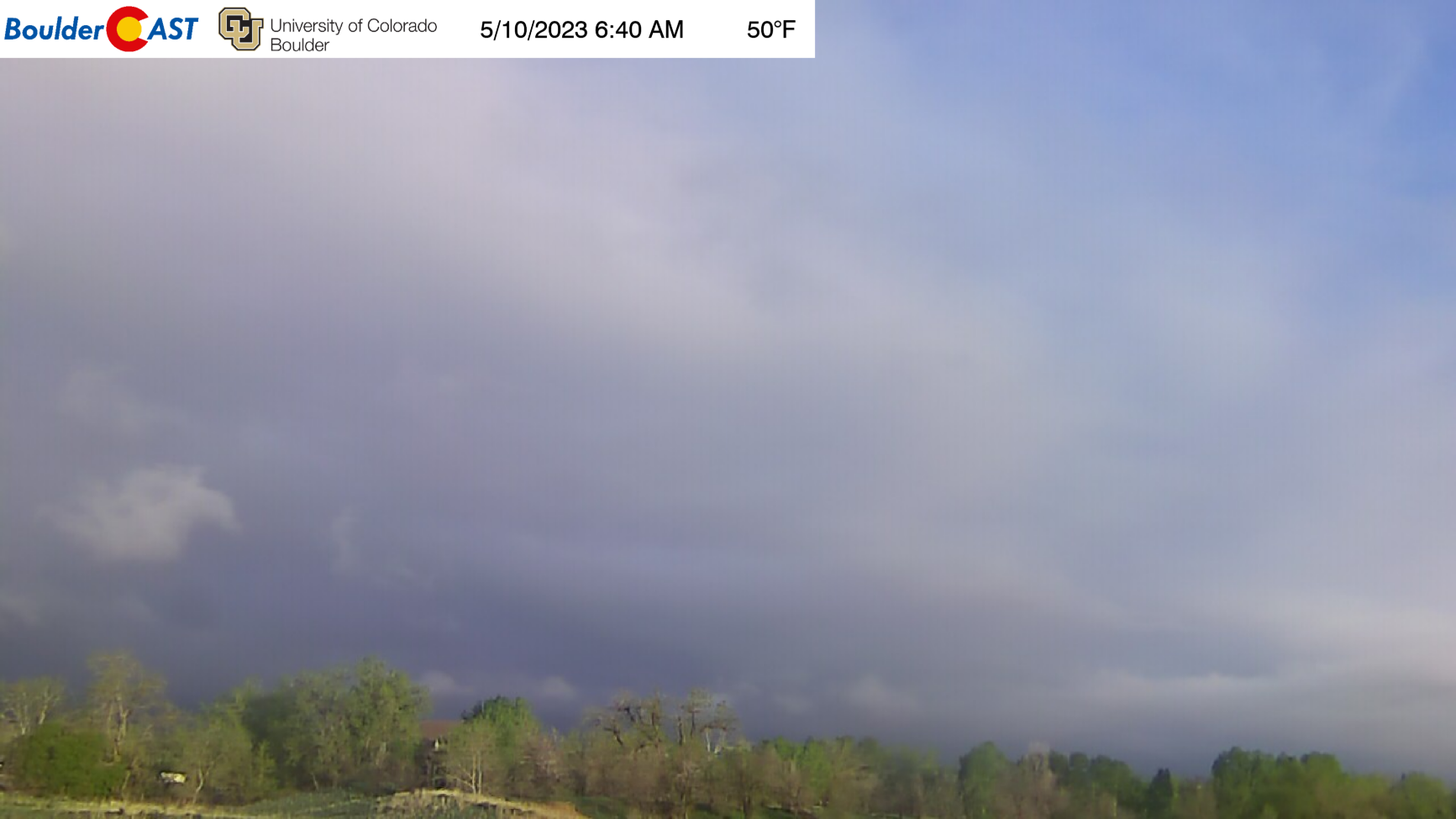
The situation today remains a grave one for the Front Range, despite the sense of security these morning stratus clouds may want to impose on us. Right now at least there are some patches of blue sky mixed in with the low clouds — though stratus will probably thicken a bit through the morning as easterly flow picks up.
All of the ingredients are coming together for a significant, albeit brief, severe weather outbreak across our area today:
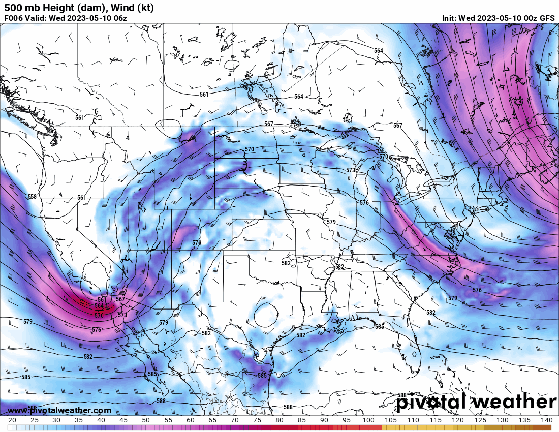
- The mid-level trough across Arizona will move eastward towards the Four Corners region, not only keeping winds aloft strong and southerly (give us that shear!), but also bringing some added lift into the mix for additional storm growth
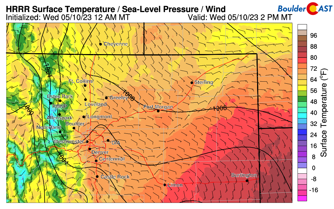
- Low-level moisture remains excessive thanks to the surge in from the east last night and the overnight rainfall. Dew points are in the upper 40s to lower 50s across eastern Colorado — exactly where we want them to be to support severe weather. When tornado chasing, we really try to get to where dew points are in the 50s. That is where the best action will be!

- Easterly upslope flow in the low-levels will continue through the day across the area, helping not only to provide weak lift into the terrain but also to pool the moisture westward into the Front Range. Easterly flow will also be a key component in helping provide directional shear to possibly spin up a few tornadoes.
- Instability will quite high today, reaching 1000-1500 J/kg this afternoon over much of the area. Upslope-driven low clouds lingering west of Interstate 25 may throw a wrench into things there, but storms will be able to blow up over the higher terrain first and then move in so the pesky clouds should be less of an issue, but we’ll see. Fingers crossed!

The only real change to the forecast compared to our thinking yesterday is that the ignition of the storms may be delayed due to the morning clouds and resulting slower warm-up. We’re hoping to see the last of the stratus clear out by early afternoon but that’s a tough call. Things should start to fire in the higher terrain of the Foothills and Palmer Divide by early to middle afternoon and then spread into the lower elevations by mid to late afternoon. Prime-time for severe storms appears to be from 3PM to 6PM in the Denver area. It’s that initial wave of supercells that develop over the higher terrain and spread onto the Plains that will be the strongest here — any of them will be capable of producing hail up to baseball size and wind gusts of 65+MPH. There could be a few tornadoes as well, though that would seem more likely east of Denver towards Kansas and Nebraska, though DIA is perhaps in the running too.

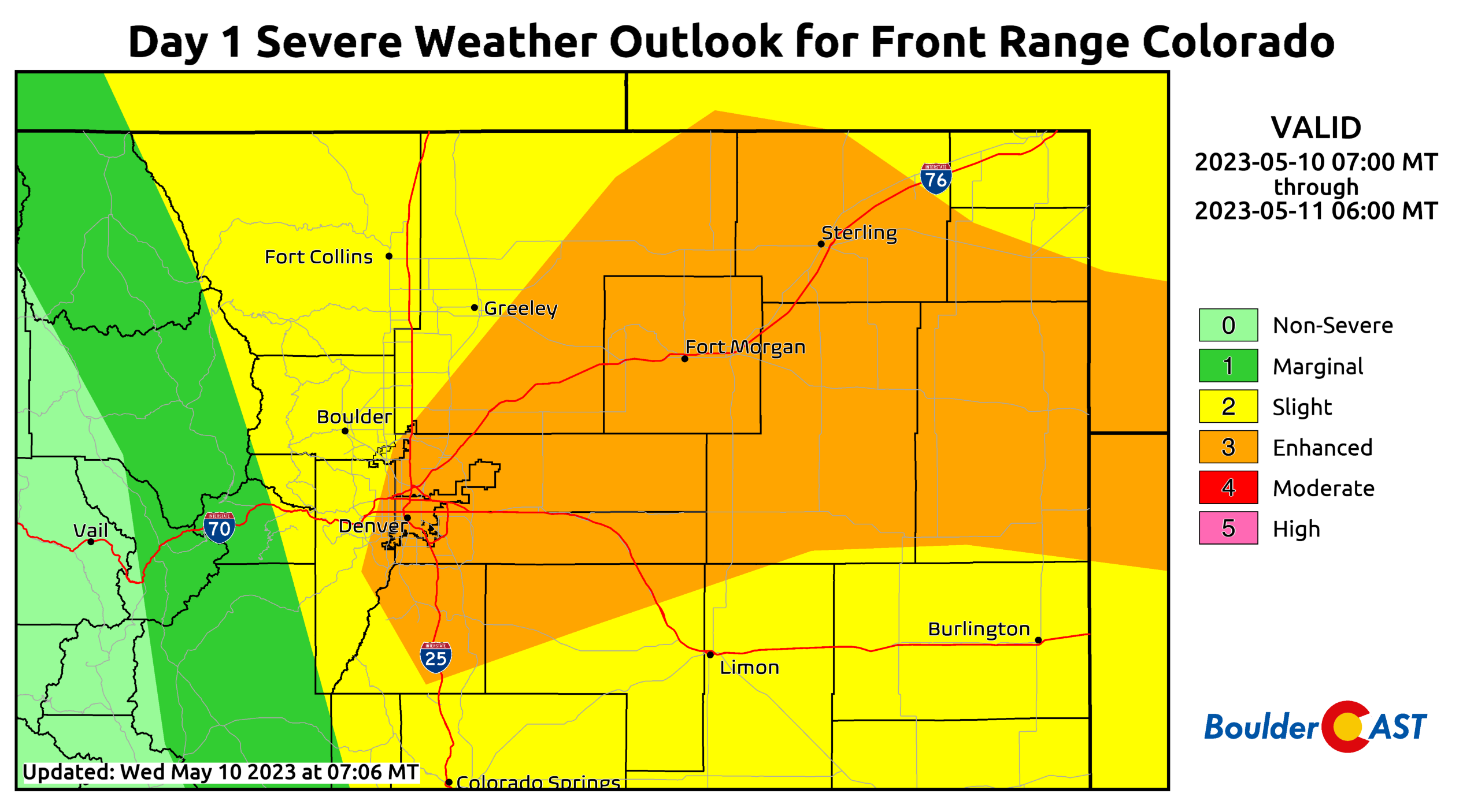
In other news, the Storm Prediction Center has “upgraded” portions of our area to an Enhanced Risk for severe weather today. As far as we’re aware, the city of Denver has never been included in this risk category since the inception of the SPC’s modern risk outlooks, definitely speaking to the rarity of today’s atmospheric setup. While Boulder is not included in this higher tier, the Slight Risk pushes west all the way to include the Continental Divide which also may be a first. The key message here: today’s severe threat is about as high as it gets in our area. Be prepared!
After 6PM the threat of severe weather will be reduced drastically in our immediate area (but continues on east and northeast of Denver into the evening), but additional rain and storms are expected to linger through the evening and overnight ahead.

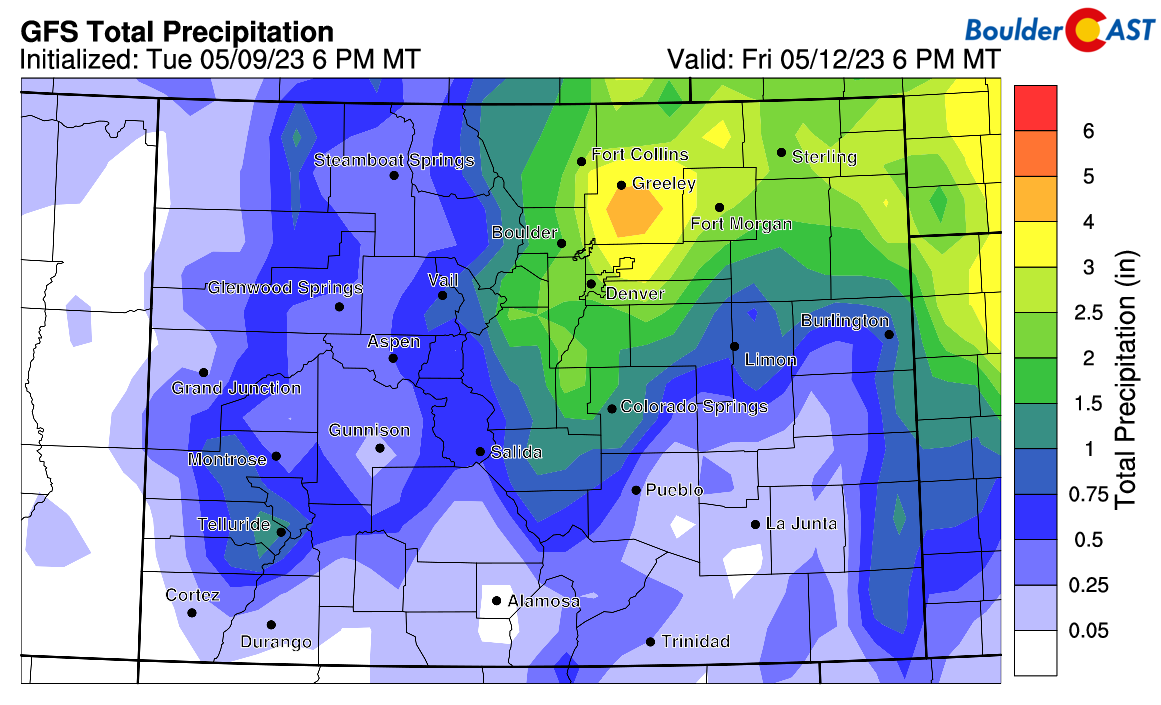
We’re in for a long stretch of soggy weather as the cut-off low pops out into eastern Colorado and basically stalls here until Friday afternoon. We’re still expecting a generous helping of 0.75 to 2″ of rain to fall across most of our area between now and Friday afternoon. With all of the thunderstorms thrown into the mix, it is possible localized areas see more than 2″. Today will offer convective/scattered storms, while Thursday will be more widespread upslope rain with some storms mixed in. Snow levels will remain generally above 9500 feet this week, though we could see some snow mix down to 8000 feet or so at times during the overnight periods. Areas along the Continental Divide above treeline will see 5-10″ of snow from this system.
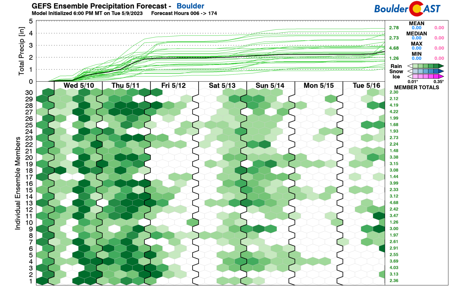
The GFS ensembles mean and median forecasts, a characterization of 30 different model runs, are both showing around 2″ of rain through Friday in Boulder. Bring it!
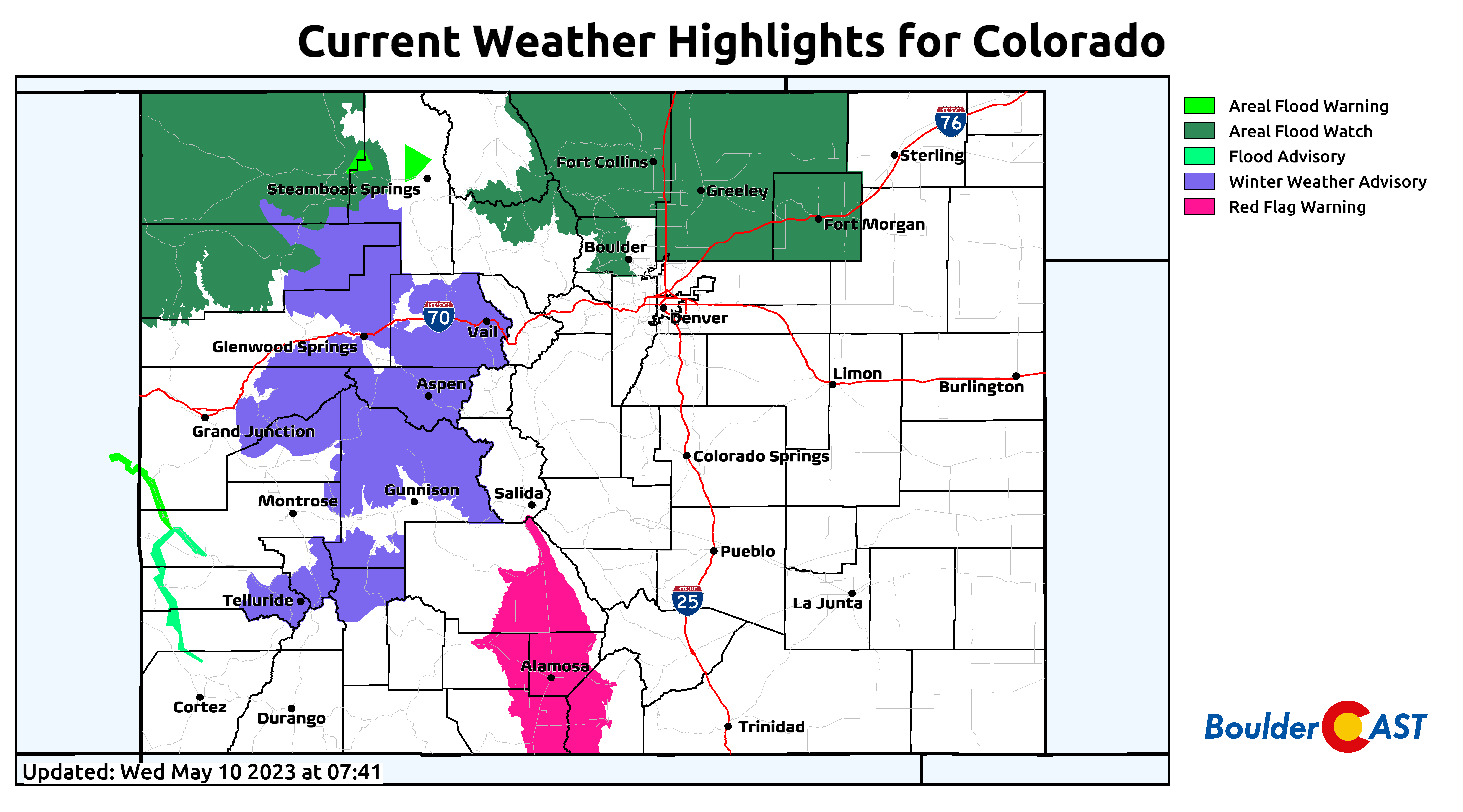
The National Weather Service has issued an Areal Flood Watch for a large portion of northern Colorado in effect into Friday. Overall — this is just what the doctor ordered for mid-May in a drought-stricken northeast Colorado! The flood risk that comes along with this beneficial moisture is just something we will have to live with…
Stay safe, protect your cars as much as possible, and good luck to our friends and colleagues chasing today — it should be quite the show!

Go Premium, get all the perks.
Daily Forecast Updates
Get our daily forecast discussion every morning delivered to your inbox.
All Our Model Data
Access to all our Colorado-centric high-resolution weather model graphics. Seriously — every one!
Ski & Hiking Forecasts
6-day forecasts for all the Colorado ski resorts, plus more than 120 hiking trails, including every 14er.
Smoke Forecasts
Wildfire smoke concentration predictions up to 72 hours into the future.
Exclusive Content
Weekend outlooks every Thursday, bonus storm updates, historical data and much more!
No Advertisements
Enjoy ad-free viewing on the entire site.
Get BoulderCAST updates delivered to your inbox:
Enjoy our content? Give it a share!


You must be logged in to post a comment.