Breezy conditions and chilly temperatures will kick off the week behind a departing winter storm which brought a thin blanket of snow to the Metro area last night. Highs below freezing on Monday will trend slightly warmer in the coming days, but with gusty winds remaining. The tail-end of the week will turn more active with a few chances at light snowfall. There are also signs in the extended that an Arctic airmass will ooze into the region during the upcoming weekend turning things even colder for us. Read on for more details
This week’s highlights include:
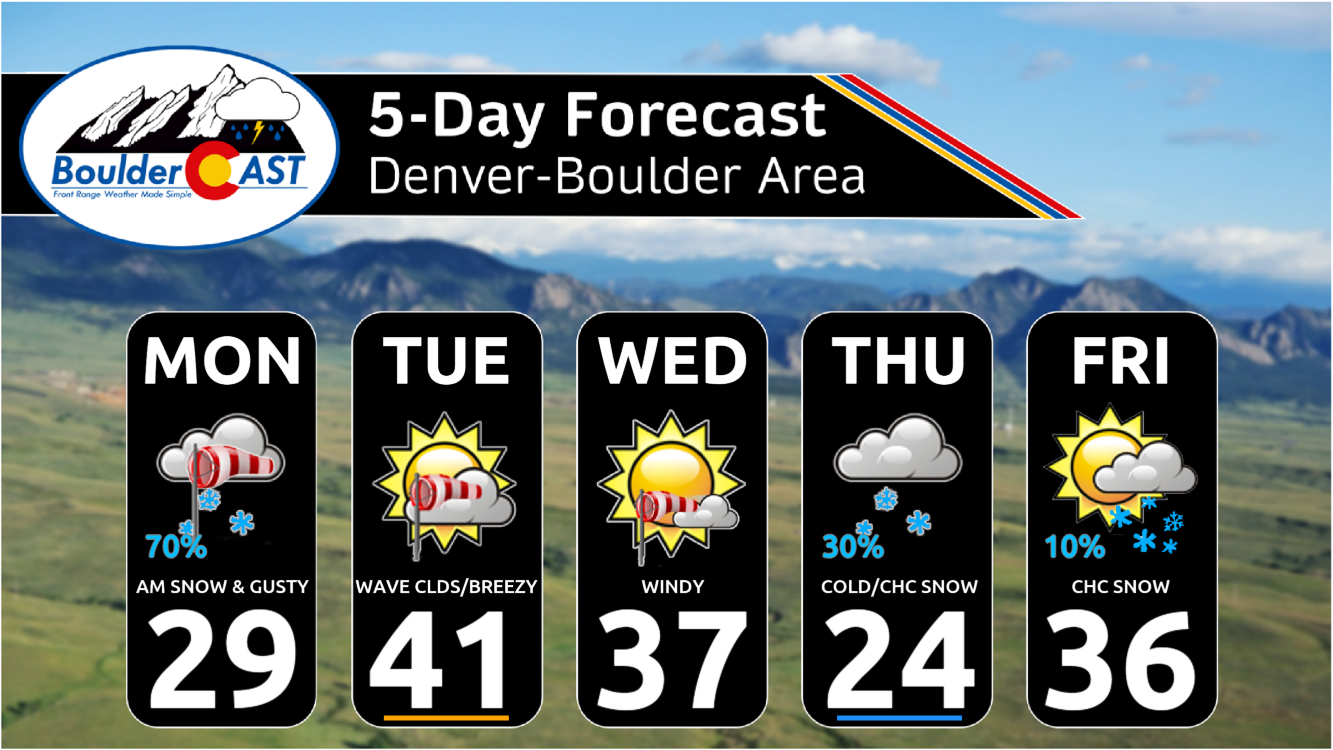
- Snow will taper off from north to south Monday morning as the system departs from Colorado — cold temperatures and gusty winds up to 40 MPH linger on Monday
- Below normal temperatures expected throughout the entire week
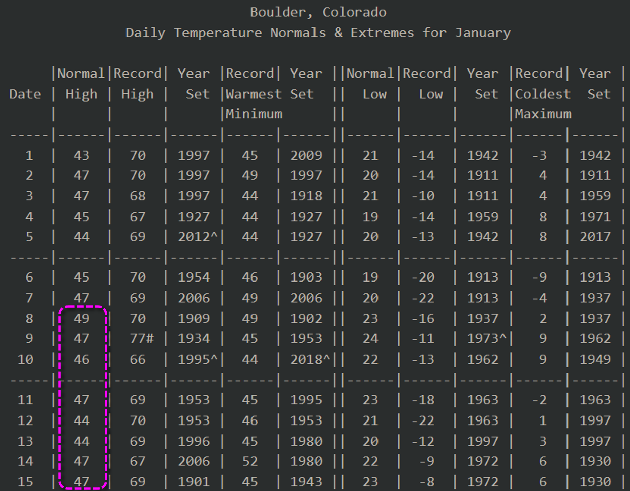
- Warmest day of the week will be Tuesday in the low to middle 40s and coldest days likely Thursday/Friday
- Breezy to windy Tuesday and Wednesday under downslope gusts of 20 to 50 MPH
- Watching a few systems mid to late week for a few minor snow chances but uncertainty abounds — widespread snow expected in the Mountains
- Watching a potential Arctic intrusion to the Front Range this weekend with highs possibly falling in the teens with below zero overnight lows
DISCLAIMER: This weekly outlook forecast is created Monday morning and covers the entire upcoming week. Accuracy will decrease as the week progresses as this post is NOT updated. To receive daily updated forecasts from our team, among many other perks, subscribe to BoulderCAST Premium.

Go Premium, get all the perks.
Daily Forecast Updates
Get our daily forecast discussion every morning delivered to your inbox.
All Our Model Data
Access to all our Colorado-centric high-resolution weather model graphics. Seriously — every one!
Ski & Hiking Forecasts
6-day forecasts for all the Colorado ski resorts, plus more than 120 hiking trails, including every 14er.
Smoke Forecasts
Wildfire smoke concentration predictions up to 72 hours into the future.
Exclusive Content
Weekend outlooks every Thursday, bonus storm updates, historical data and much more!
No Advertisements
Enjoy ad-free viewing on the entire site.
Staying breezy & cool into midweek
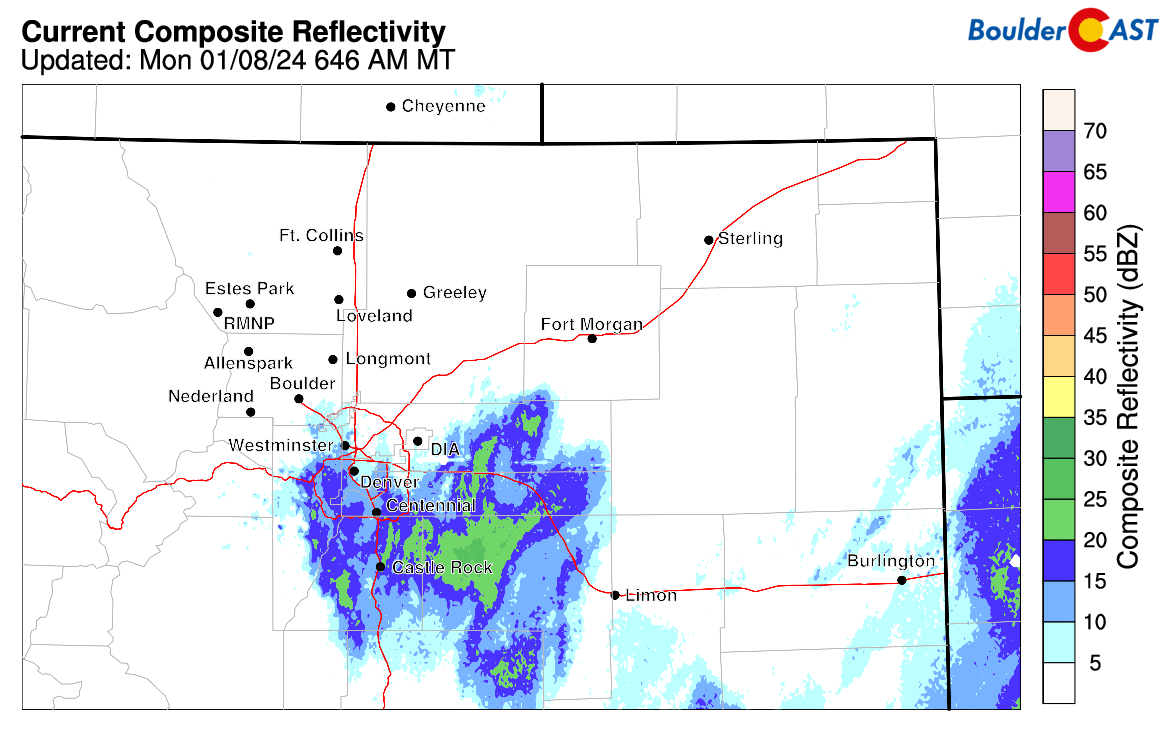
Widespread snow and wind overtook the entire Front Range Sunday night after midnight with most of us waking up to a windswept inch or two of snow Monday morning. Current radar (as of ~7:30 AM Monday) shows that almost all of the snow activity has sagged south of Interstate 70 where it will linger for a few more hours into midday or so. For the most part snowfall is light, but there are a few pockets of heavier snow east of DIA (dark green shading):
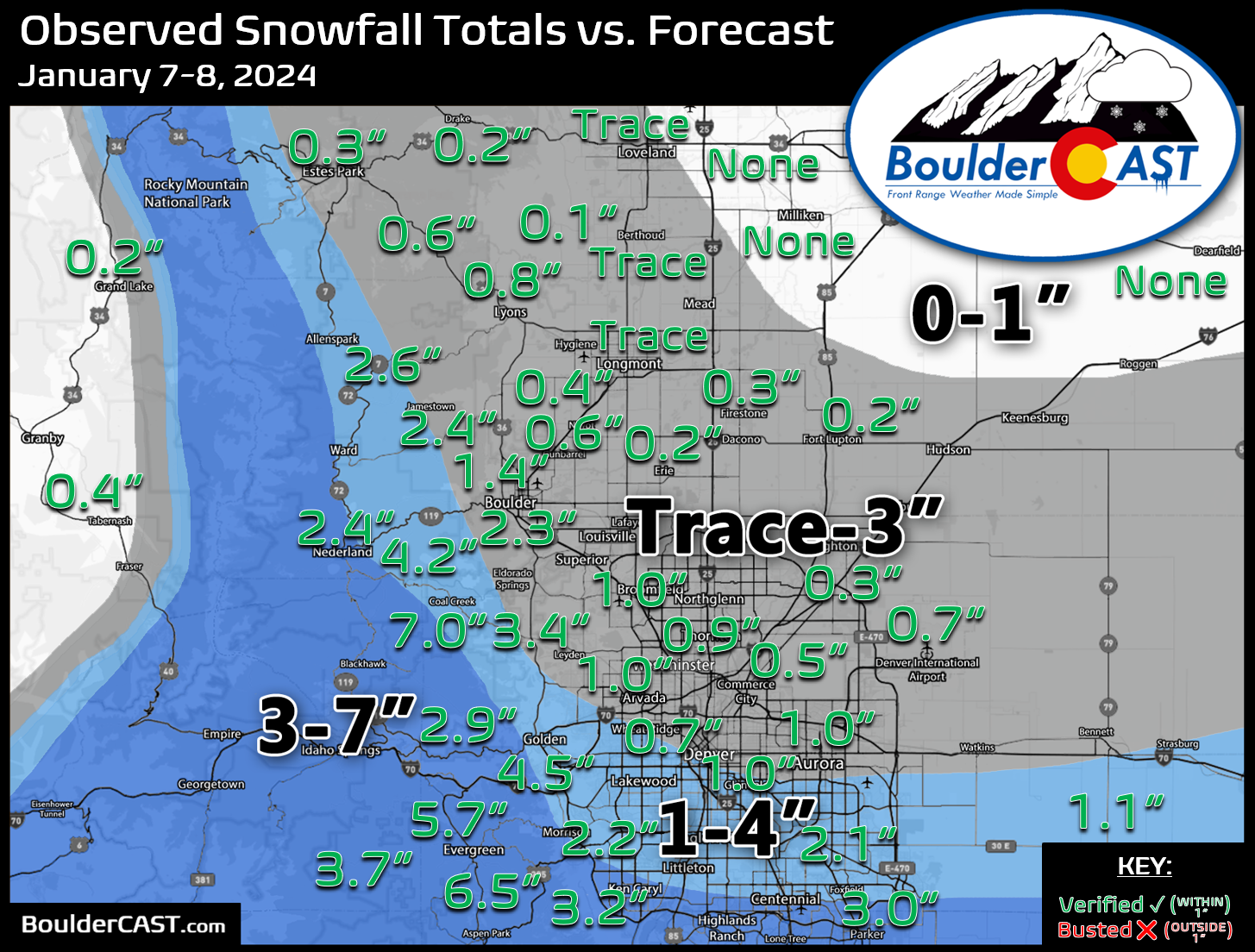
Snowfall amounts from this system should land as expected (within our forecast ranges) for most, though we will have to wait until later on to see the final totals (Updated! Storm total map added below).
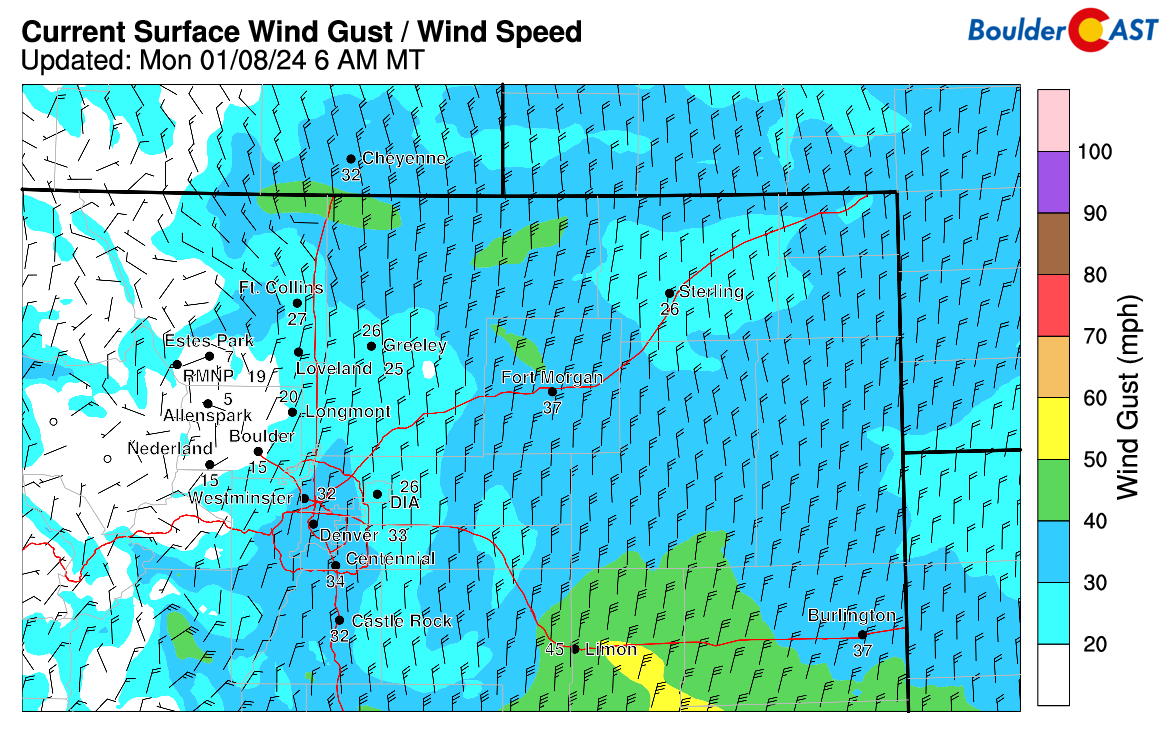
In addition, winds are blowing the fallen snow around out there — gusts across the Metro area are up to 35 MPH from the north:
A combination of the overnight snow that fell onto cold roadways and continued drifting snow this morning has led to slightly dangerous travel conditions. Things do not look great on the CDOT webcams right now.
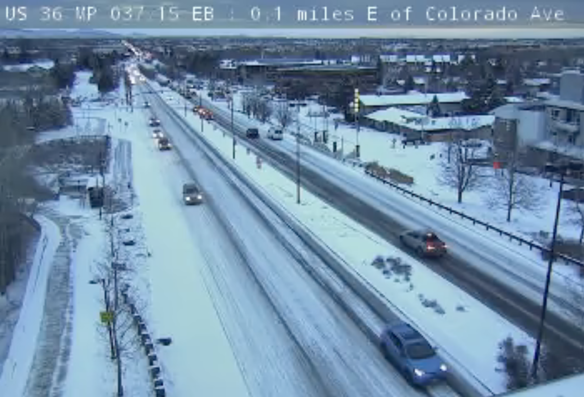
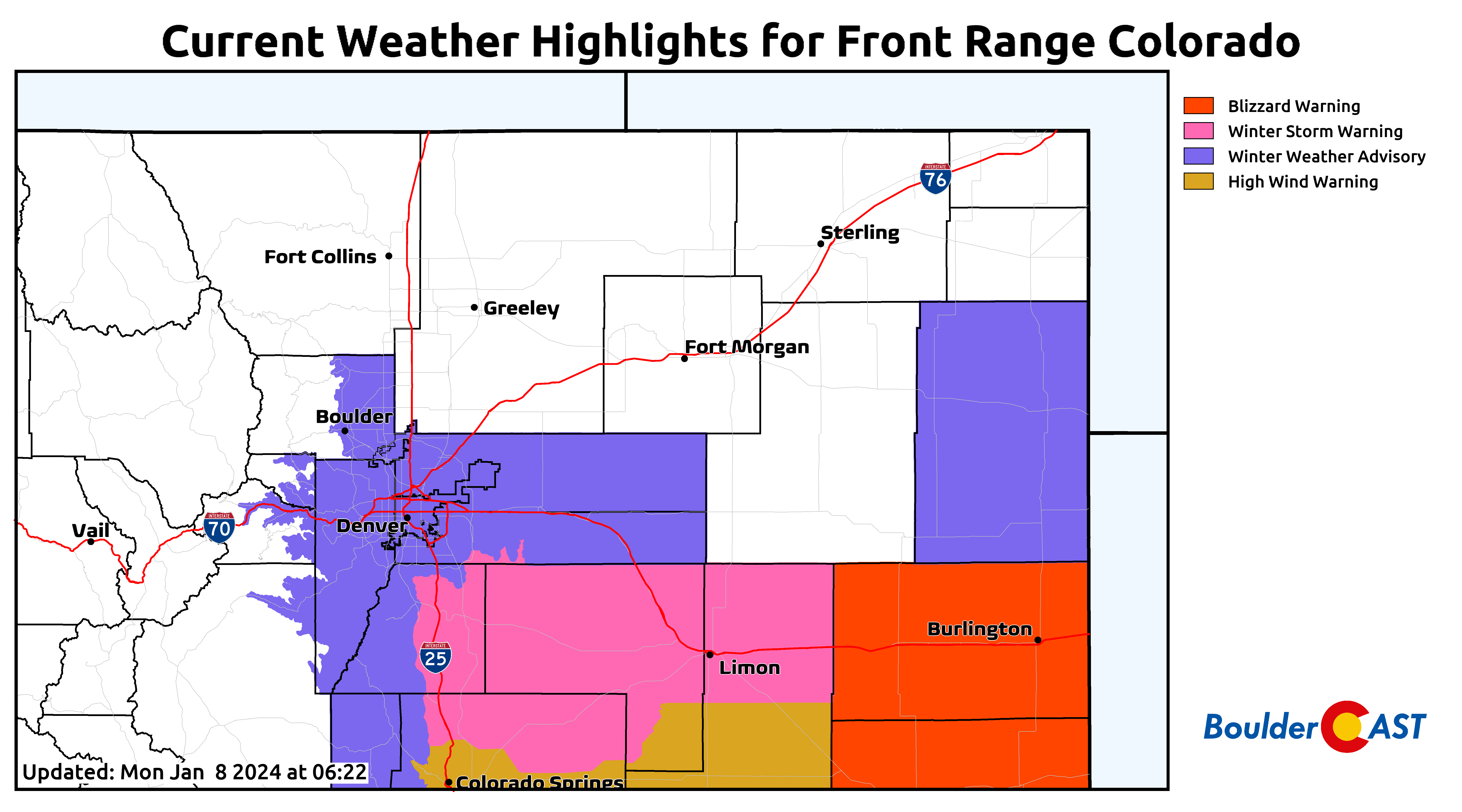
You might consider delaying your morning commute if possible to allow for some improvement — Winter Weather Advisories remain in effect for Boulder and Denver until 2PM Monday.
Now onto the weather for the rest of the week….
The area of low pressure that led to Monday’s snow will head east into central Oklahoma later on but will continue to bring gusty northerly winds into Monday afternoon on the Plains, especially from Denver eastward.
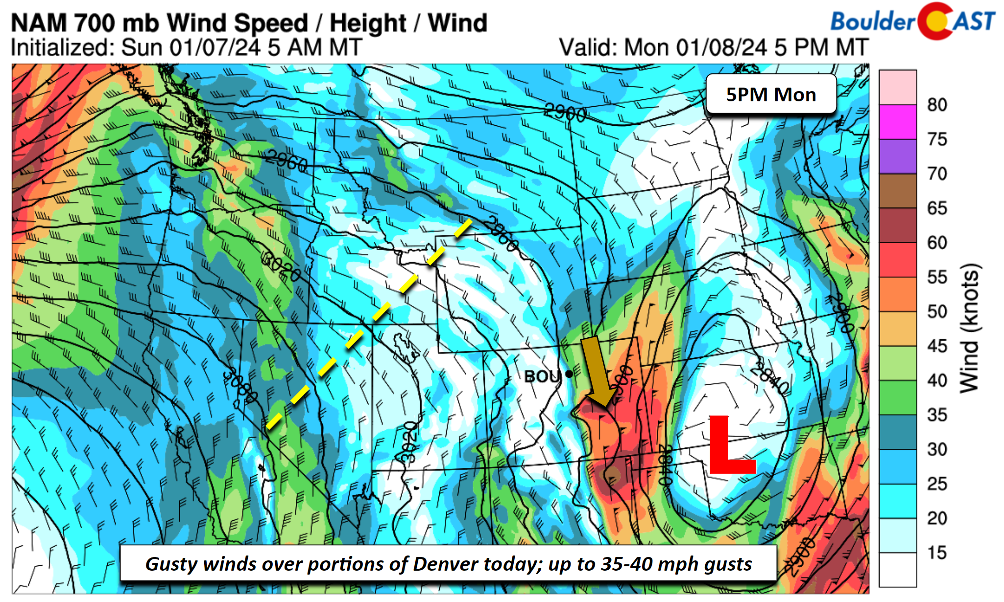
As mentioned already, morning light snow in portions of the Denver Metro area will exit by midday from north to south. An additional inch or so of accumulation is possible around Denver and nearby, while up to another 2-3″ of snow may fall across the far southern suburbs this morning. Monday’s highs will top out in the lower 30s with increasing sunshine. Drifting of snow will be favored as northerly winds gusting 30 to 40 MPH will stick around until early evening.
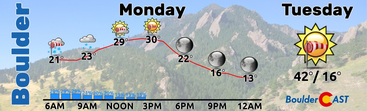
Our warmest day of the week will likely come on Tuesday. Aloft, ridging will set the stage for downslope flow and warm/gusty Chinook-ish winds. While the strongest winds Monday will be in Denver and lesser in Boulder, Tuesday will likely see the opposite unfold —- with gustier winds near Boulder and the Foothills. Highs should top out in the low to middle 40s on the Plains with gusts up to 30 MPH in Boulder and 20 MPH in Denver.
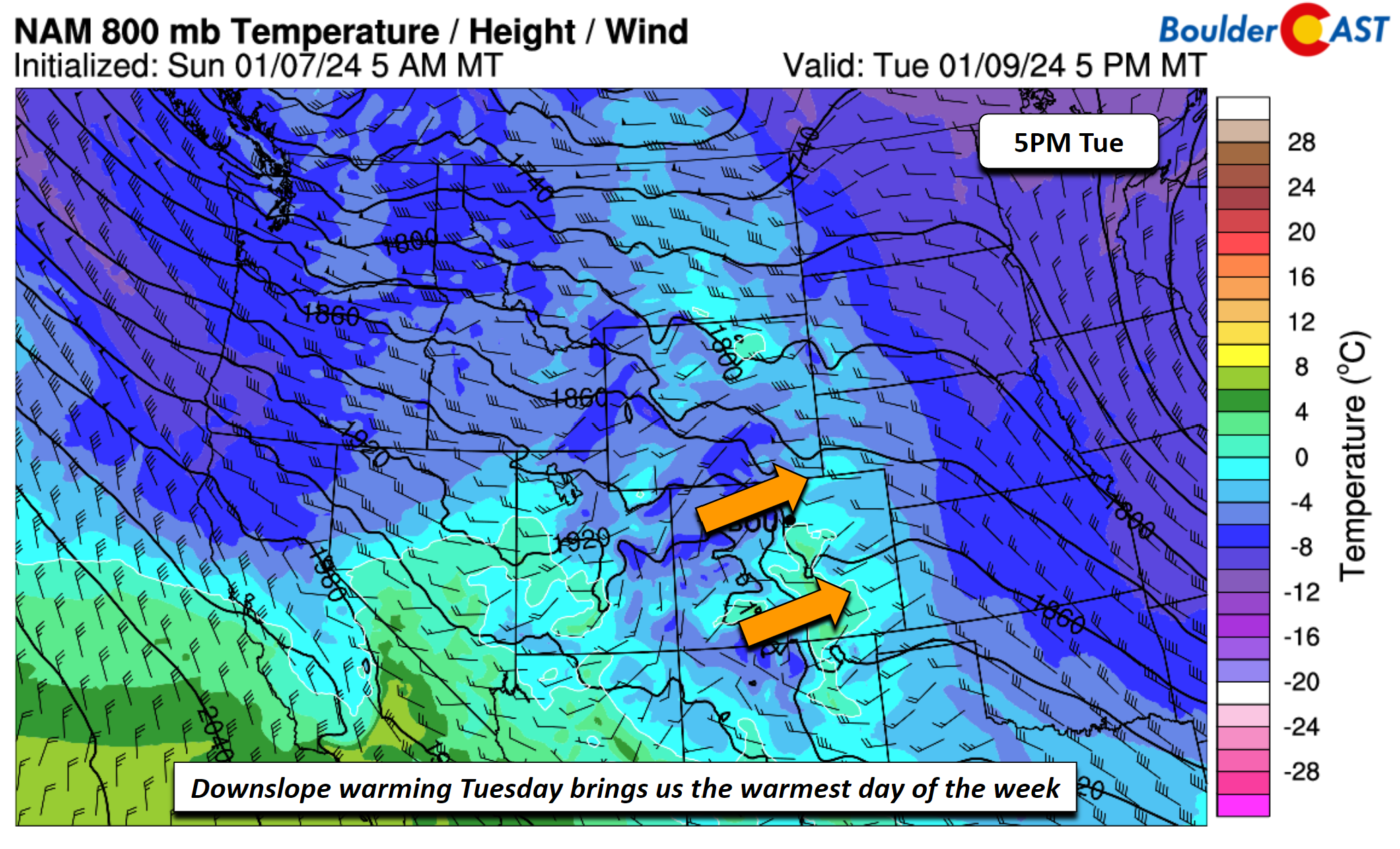
These temperatures in the lower 40s will still be below normal for this time of year, we should all appreciate them as later in the week things will turn exceptionally colder!
Late Tuesday night into midday Wednesday, a fast-moving northwest flow shortwave will track through the Centennial State. Barring any major changes in the guidance, the flow mainly will favor orographic snows in the higher terrain and northwest facing slopes along/west of the Divide. Highs on Wednesday for the Plains are likely to be in the upper 30s to near 40 degrees under a persistent westerly flow. We cannot rule out a stray light snow shower Tuesday night or Wednesday morning on the Plains, but the main impact looks to be yet again another gusty day with 30 to 50 mph gusts in Denver/Boulder as the shortwave tracks through.
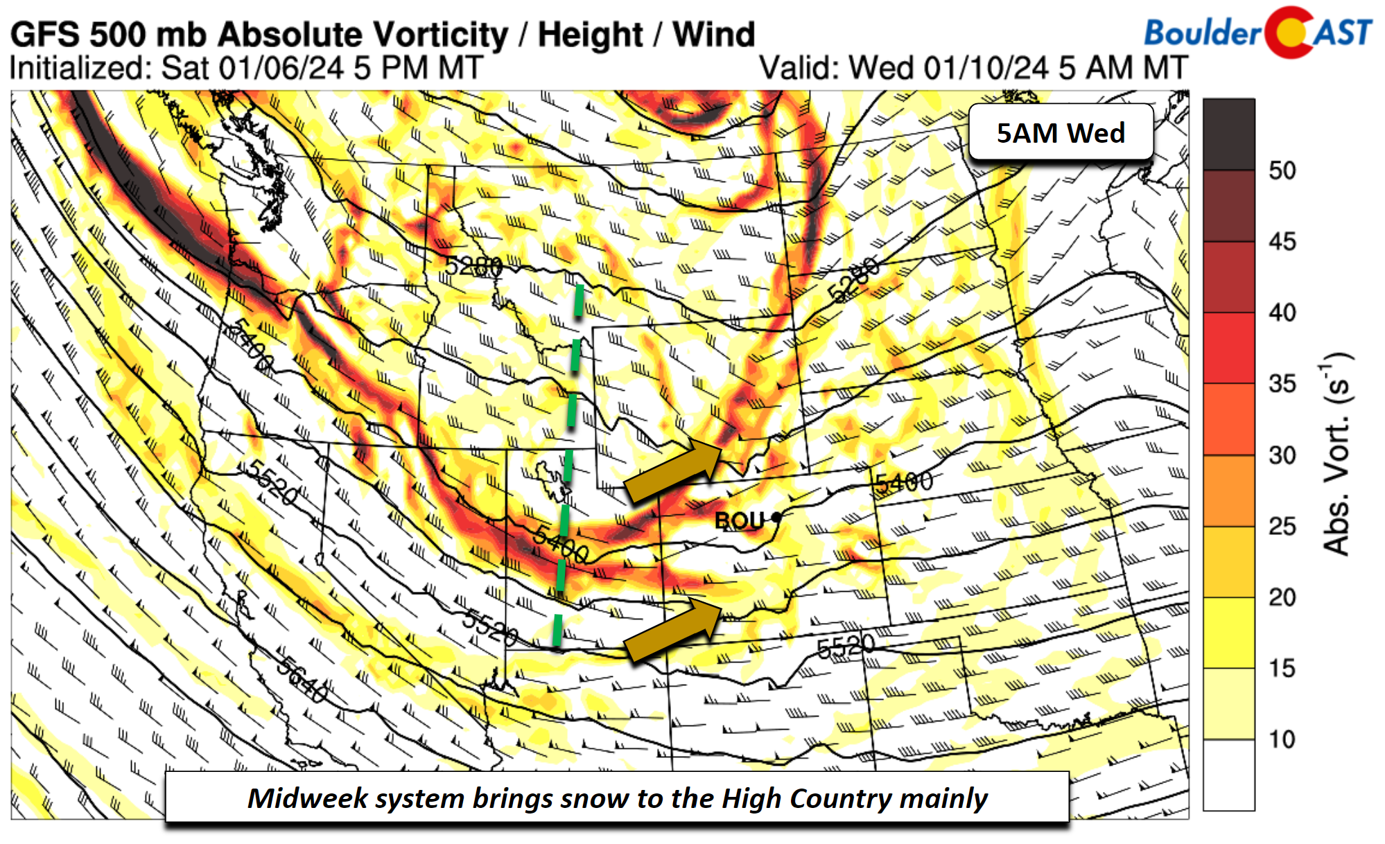
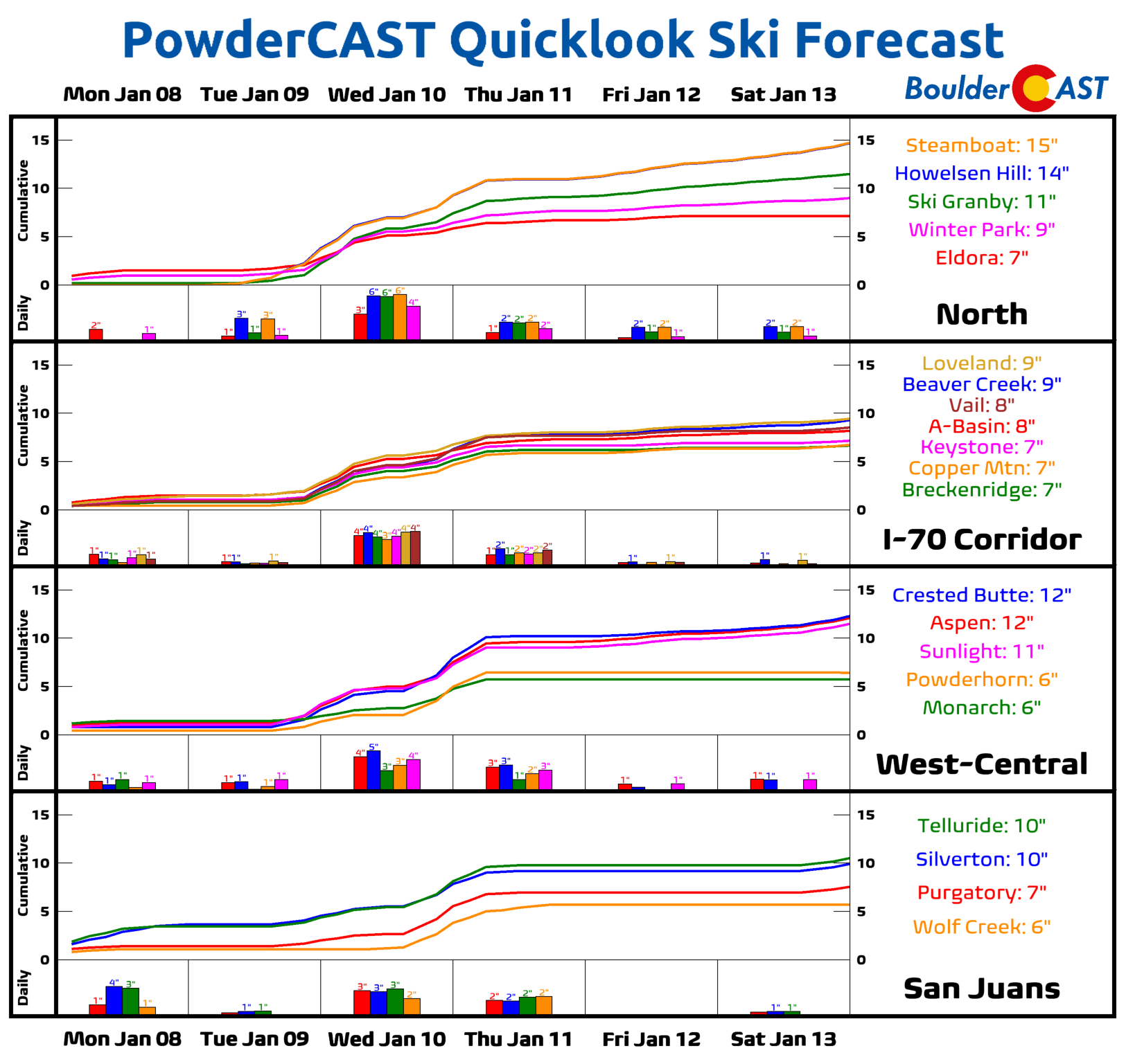
Mountain snow will be plentiful this week!
More active late-week with a potential Arctic intrusion
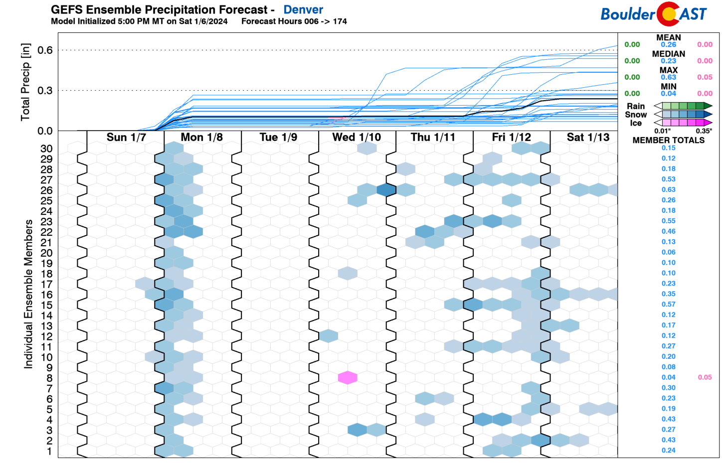
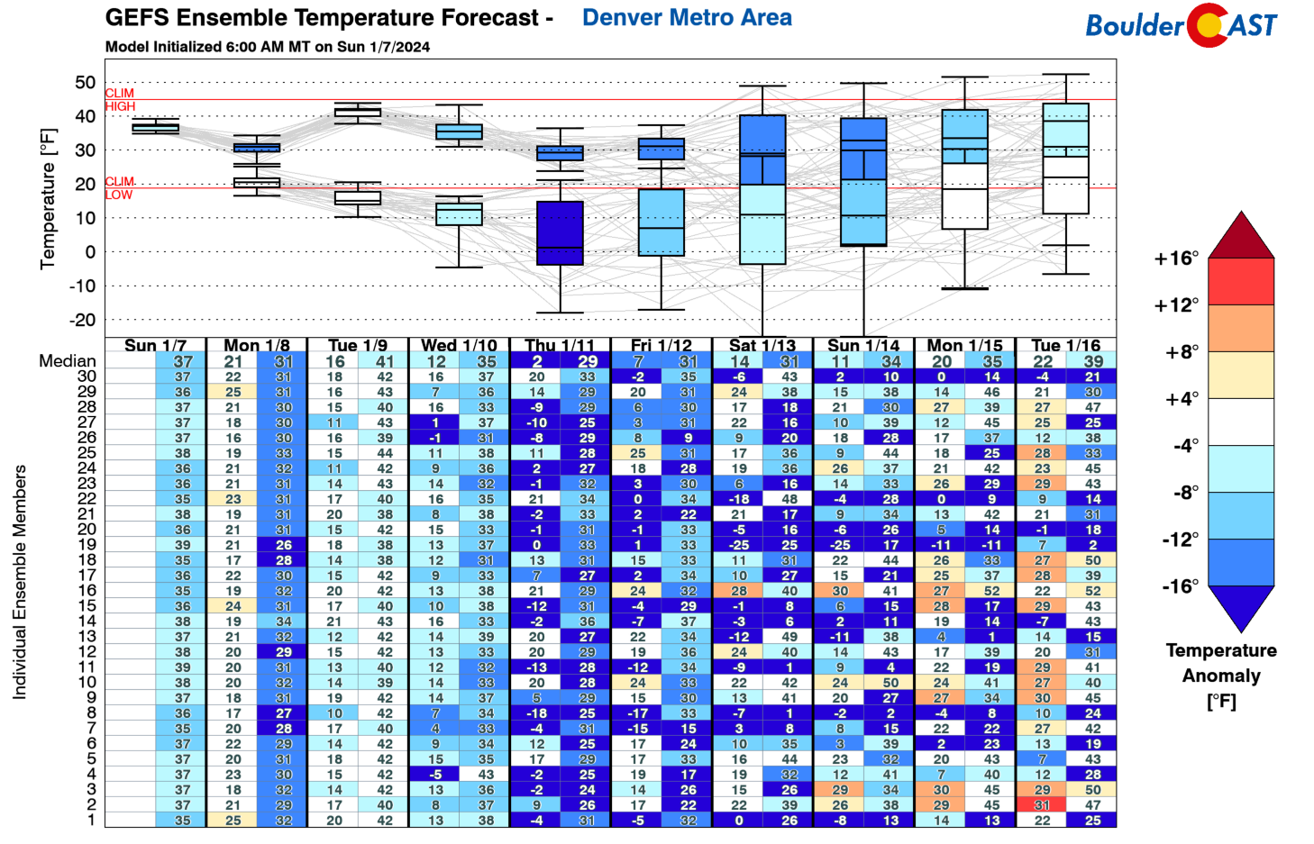
Several of the models, including the GEFS ensemble (shown below) depict several chances of snow late in the week or weekend, including Thursday, Friday, and possibly Saturday. Obviously it won’t snow every day this period, but it represents the uncertainty in the pattern which we will discuss next. Along with these precipitation chances, we are also monitoring the first real potential Arctic intrusion of the season.
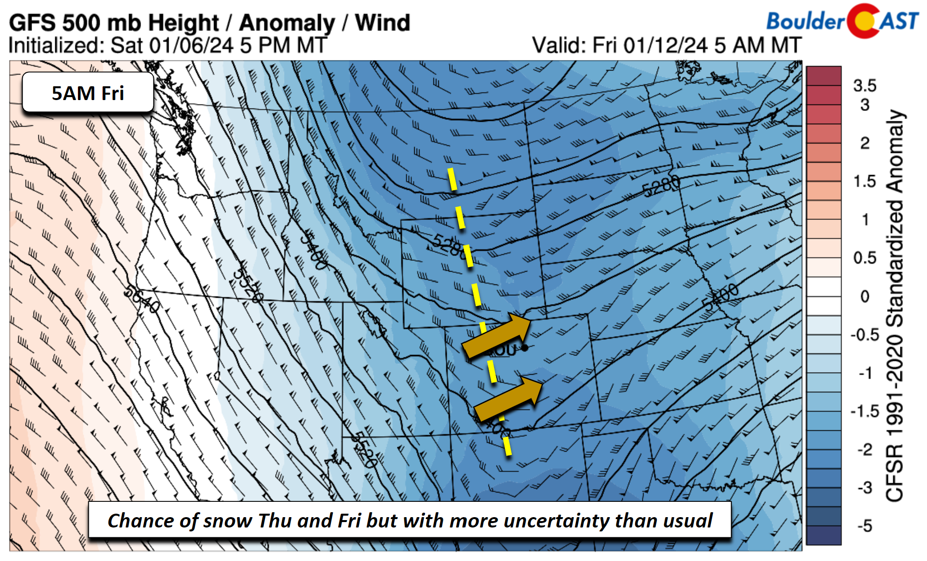
On Thursday into Friday, models show another approaching trough, this time in a more favorable position relative to Wednesday. A cold front will have likely moved through early Thursday, dropping our highs further below normal into the 20s. Guidance indicates an area of low pressure forms east of the Rockies Thursday afternoon/evening as it reaches the central Plains. There is some potential that as the system tracks east, upslope flow could favor lift for snowfall on the Front Range Thursday. But model spread is fairly high on where a snow shield, if any, may form. An additional cold front, this time Arctic, could arrive late Friday or Saturday, with another chance of snow or freezing drizzle. These chances will need to be monitored as we get closer.
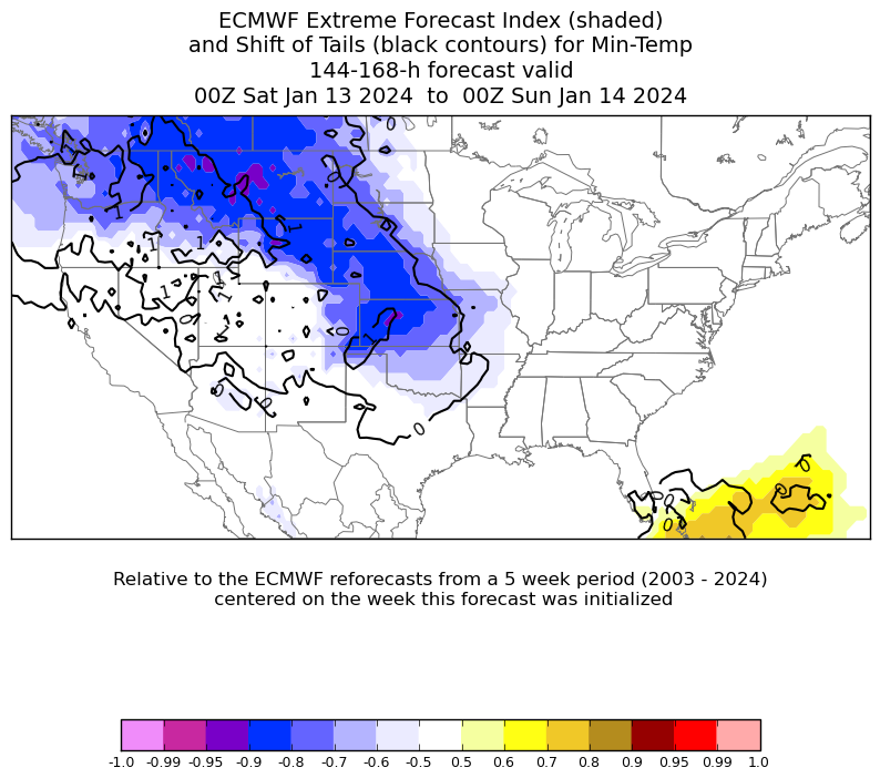
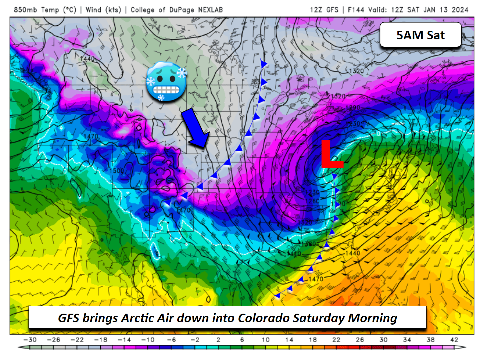
The second aspect to this late-week period is the threat of cold Arctic air, something we really haven’t seen to much of so far this winter. Several of the ECMWF ensemble members, depicted through the extreme forecast index below, show the potential for anomalously cold temperatures this weekend Saturday and Sunday. However, the Euro ensembles are still honing in on how far west the coldest air may get — whether it will remain bottled up in Montana or release southward into Colorado. On Friday, the spread in high temperatures among the guidance ranges from 15° to 35°F, a 20-degree spread all due to uncertainty in when or if an Arctic cold front may move in.
The GFS is the fastest to bring an Arctic cold front through, forecasting its arrival for late Friday with bitter cold air being well-entrenched by early Saturday.
The CMC/ECMWF models are about 24 hours slower, bringing the front through late Saturday night and getting well-entrenched by Sunday, with the coldest air over Montana.
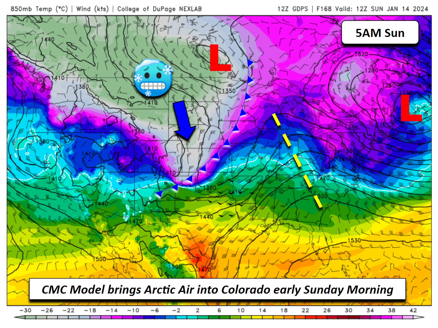
The gist of the previous discussion highlights the uncertainty in the Arctic air this weekend and our winter precipitation chances. The range in forecast highs among the ensemble data for Saturday and Sunday over Denver spans some 50°F, from a bitter cold high of 10° to as warm as 50! Where the Arctic air oozes and settles will be something we will watch closely as the week progresses.
In any case, enjoy the fresh dusting of snow Monday morning and the colder temperatures. We’ll likely be seeing more of both later in the week and into the weekend…
Get BoulderCAST updates delivered to your inbox:
Forecast Specifics:
Monday: Light snow ending by midday, then brisk and chilly with some drifting snow. Highs near 30 degrees for the Plains with low 20s in the Foothills. Gusty northerly winds of 30-40 MPH tapering off after dark.
Tuesday: Warmer, breezy, and partly cloudy with highs in the low to middle 40s for the Plains and low 30s in the Foothills. Westerly winds of 20-30 MPH are possible during the day.
Wednesday: Mostly sunny and windy. Highs in the upper 30s to around 40 in the Denver Metro and upper 20s in the Foothills. Westerly winds of 30-50 MPH possible.
Thursday: Mostly cloudy with a chance of snow and highs in the middle 20s for the Plains and upper 10s in the Foothills.
Friday: Partly to mostly cloudy with a slight chance of snow. Highs fairly uncertain but our current middle-of-the-road forecast calls for 30s in the Denver Metro and 20s in the Foothills.
DISCLAIMER: This weekly outlook forecast is created Monday morning and covers the entire upcoming week. Accuracy will decrease as the week progresses as this post is NOT updated. To receive daily updated forecasts from our team, among many other perks, subscribe to BoulderCAST Premium.
Go Premium, get all the perks.
Daily Forecast Updates
Get our daily forecast discussion every morning delivered to your inbox.
All Our Model Data
Access to all our Colorado-centric high-resolution weather model graphics. Seriously — every one!
Ski & Hiking Forecasts
6-day forecasts for all the Colorado ski resorts, plus more than 120 hiking trails, including every 14er.
Smoke Forecasts
Wildfire smoke concentration predictions up to 72 hours into the future.
Exclusive Content
Weekend outlooks every Thursday, bonus storm updates, historical data and much more!
No Advertisements
Enjoy ad-free viewing on the entire site.
Enjoy our content? Give it a share!


You must be logged in to post a comment.