
In the absence of any major storm systems approaching Colorado, this week will remain fairly quiet with primarily dry conditions. Temperatures will vary day-to-day however from the 30’s to the 50’s. We’re also watching a powerful jet that is expected to move overhead late in the week bringing widespread snowfall and blustery conditions to the Mountains.
Cooler behind a Monday morning cold front
We begin the week with two trough axes present across the western United States. The more substantial of the two is associated with a cut-off low pressure system in extreme southern California. The other trough axis stretches from the Dakotas into northeast Colorado.
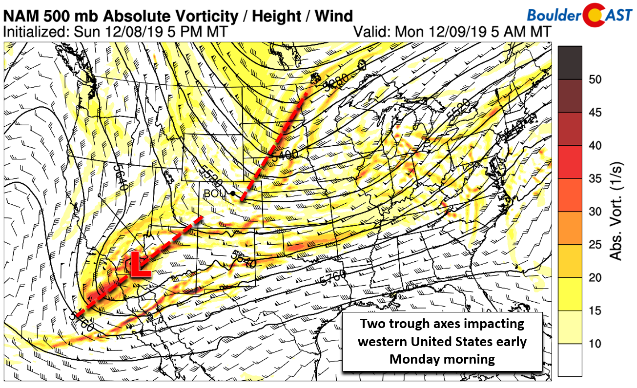
NAM 500 mb vorticity map for Monday morning
Both systems can be seen in the GOES-East water vapor satellite animation shown below.
GOES-East wator vapor satellite animation from Monday morning
The more northern trough has brought a cold front into the Denver Metro area overnight. As a result, the warm weather we had over the weekend will be replaced with cooler than normal conditions to start the week. Observations from BoulderCAST Station show the cold front moved through around 1:00 AM last night with some low clouds developing thereafter. The high temperature that occurred right at midnight (42°F) likely won’t be bested the rest of the day. Expect temperatures to only bounce back into the mid to upper 30’s by Monday afternoon under partly cloudy skies.

Monday morning temperature and dew point observations from BoulderCAST Station
As both trough axes move through on Monday, northwest flow will continue. This is upslope for most of central and northern Colorado’s mountain ranges. Additional snow accumulations will be light, up to 3″ before snow showers taper off Monday early evening. Storm total snowfall accumulations for most resorts will be 2-6″ (higher amounts across southwestern Colorado).
A warming trend through Wednesday
As the two early week troughs head eastward, a shortwave ridge will pass across Colorado Tuesday into Wednesday. This ridge is shown in the NAM 500 mb height anomaly forecast map below for Wednesday morning. This ridge will provide a nice break in the action with quieter conditions statewide and just clouds to be concerned with in the forecast. Look for highs in the 40’s on Tuesday and then lower to middle 50’s on Wednesday.

NAM 500 mb height anomaly forecast for Wednesday mid-day
As we annotated above, yet another series of weak troughs will be moving into the Rockies late Wednesday into Thursday. Neither will offer much moisture or energy as they move through our region. Models are indicating a weak cold front, however, with a timing currently slated for Wednesday evening or night (see below). This front will knock a few degrees off our high temperatures heading into the late-week timeframe, but at this point, we’re only seeing a tiny chance of rain/snow showers on Friday. We end the week with highs in the middle 40’s to lower 50’s under a mix of clouds and sunshine.

NAM 800 mb temperature and wind forecast map for Thursday morning. A cold front is indicated
A snowy and windy weekend ahead?
One thing to watch: a strong northwest-oriented jet streak will enter the picture Friday into the weekend and sit directly over Colorado. The positioning could change a little between now and then. With peak winds of 175+ MPH at its core and plenty of embedded moisture, this jet will create widespread snow and very blustery conditions across the Mountains and ski resorts this weekend. It doesn’t appear at this time that these winds will make it into the Metro area, but this could change in time.
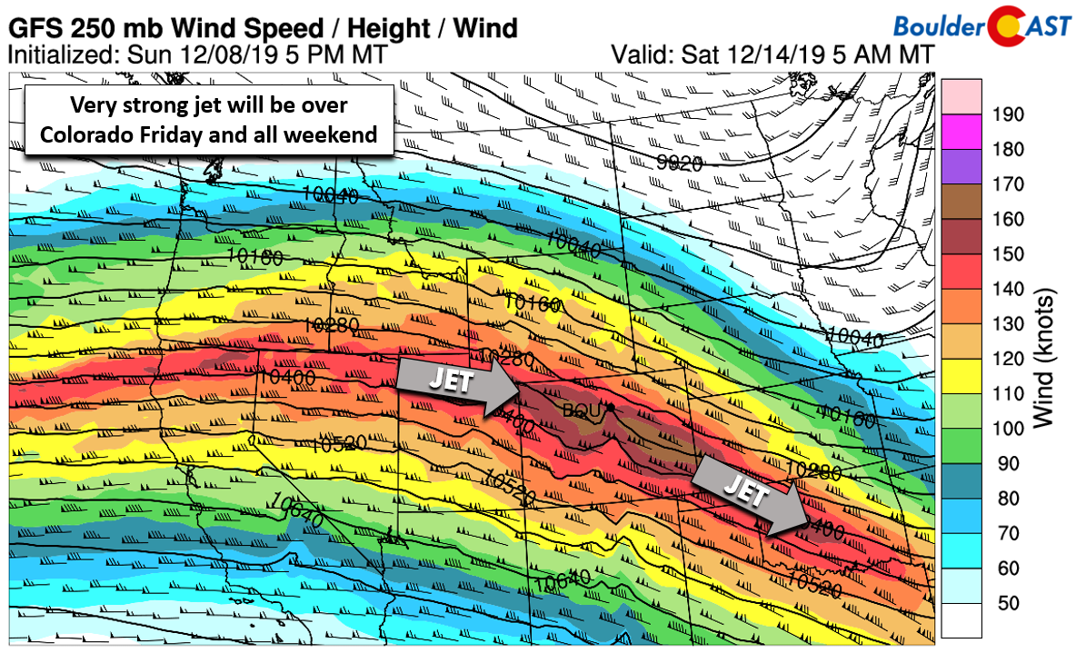
GFS 250 mb wind speed forecast for Saturday morning. A strong jet will be draped across Colorado
Forecast Specifics:
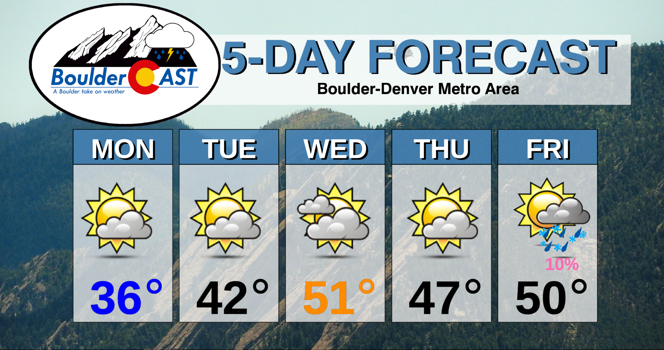
Monday: Partly cloudy and cooler, but dry. Highs in the middle to upper 30’s for the Plains and upper 20’s in the Foothills.
Tuesday: Partly cloudy skies with some wave clouds. Highs in the middle 40’s on the Plains and middle 30’s in the Foothills.
Wednesday: Mostly cloudy and warmer. Highs in the lower to middle 50’s across the Plains with lower 40’s in the Foothills.
Thursday: A mix of clouds and sun and cooler. Temperatures in the middle to upper 40’s for the Plains and middle 30’s in the Foothills.
Friday: Mostly cloudy with a slight chance of rain changing to snow showers during the day and evening. Light snow accumulations will be possible. Highs the 40’s for the Plains and 30’s in the Foothills.
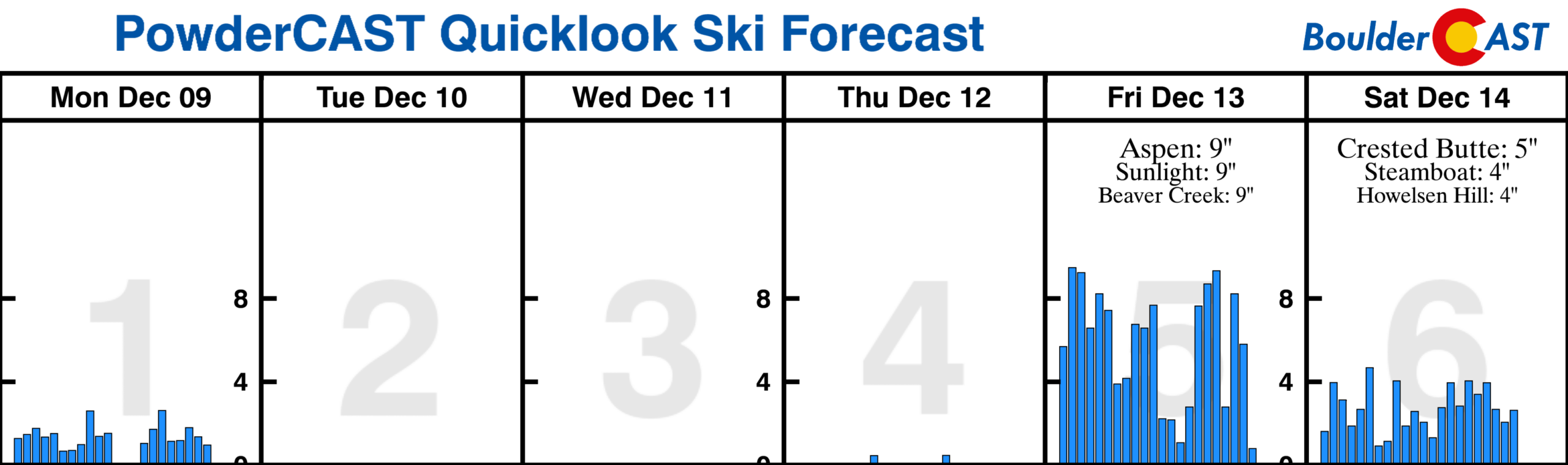
High Country: A quick-moving trough that clipped Colorado on Monday will facilitate a continuation of scattered snow showers across the Mountains through the day Monday with up to 3″ of additional accumulation. The weather becomes quiet Tuesday through Thursday as drier air and ridging overtake the state. However, Friday into the weekend a strong and moist jet will move over Colorado bringing the potential for moderate to heavy snowfall in the Mountains statewide with very windy conditions. Travel is likely to become difficult on many of the passes. Check our PowderCAST page for always-updated weather forecasts for all of Colorado ski resorts.
DISCLAIMER: This weekly outlook forecast is created Monday morning and covers the entire upcoming week. Accuracy will decrease as the week progresses as this post is NOT updated. To receive daily updated forecasts from our team, subscribe to BoulderCAST Premium.

.
Spread the word, share our forecast!


You must be logged in to post a comment.