


The atmosphere is gearing up for a busy stretch in Colorado, and this week’s forecast has a little bit of everything: a juicy monsoon plume to start, a sharp mid‑week dry‑out, and eventually a deep moisture surge tied to a tropical cyclone that could push the state’s moisture levels into rare territory. Whether that translates into meaningful rainfall east of the Continental Divide is the big question — and the answer hinges on timing, storm motion, and whether we can sneak in a well‑placed cold front or two. There’s plenty to watch this week for the Front Range. Let’s dig into the details.
This week’s highlights include:
- ☁️ Weekend recap: Thick monsoon cloud cover kept Boulder/Denver cooler with only light, uneven rainfall.
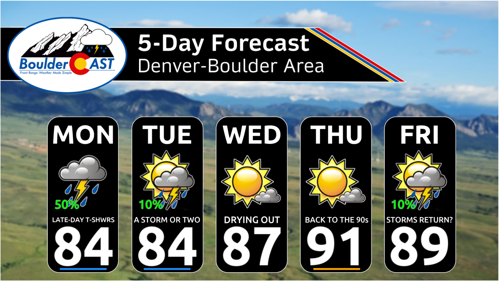
- 🌧️ Monsoon plume stays overhead Monday, delivering widespread clouds and scattered showers/storms with moisture near 160% of normal.
- 🌦️ Rainfall Monday–early Tuesday: Lower elevations trace–0.25″; higher terrain 0.25–0.5″+, with minimal flood risk thanks to fast storm motions.
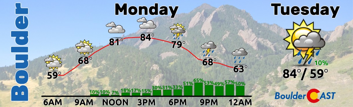
- 🌡️ Temperatures Monday: Mid‑80s under dense cloud cover, with rain chances lingering well into the night.
- 🌤️ Drying trend Tuesday: PWAT drops to ~120% of normal; isolated storms mainly over higher terrain.
- ☀️ Fully dry Wednesday–Thursday, with Boulder/Denver warming back close to 90 degrees.
- 🌀 Hurricane Marie moisture surge: Tropical transport may push PWAT toward ~180% this weekend — near historic September values.
- ⚠️ Weekend rainfall uncertain east of the Divide, but a cold front early next week could unlock upslope‑driven precipitation.
DISCLAIMER: This weekly outlook forecast is created Monday morning and covers the entire upcoming week. Accuracy will decrease as the week progresses as this post is NOT updated. To receive daily updated forecasts from our team, among many other perks, subscribe to BoulderCAST Premium.

Go Premium, get all the perks.
Daily Forecast Updates
Get our daily forecast discussion every morning delivered to your inbox.
All Our Model Data
Access to all our Colorado-centric high-resolution weather model graphics. Seriously — every one!
Ski & Hiking Forecasts
6-day forecasts for all the Colorado ski resorts, plus more than 120 hiking trails, including every 14er.
Smoke Forecasts
Wildfire smoke concentration predictions up to 72 hours into the future.
Exclusive Content
Weekend outlooks every Thursday, bonus storm updates, historical data and much more!
No Advertisements
Enjoy ad-free viewing on the entire site.
Drought Expands as Monsoon Fires Blanks
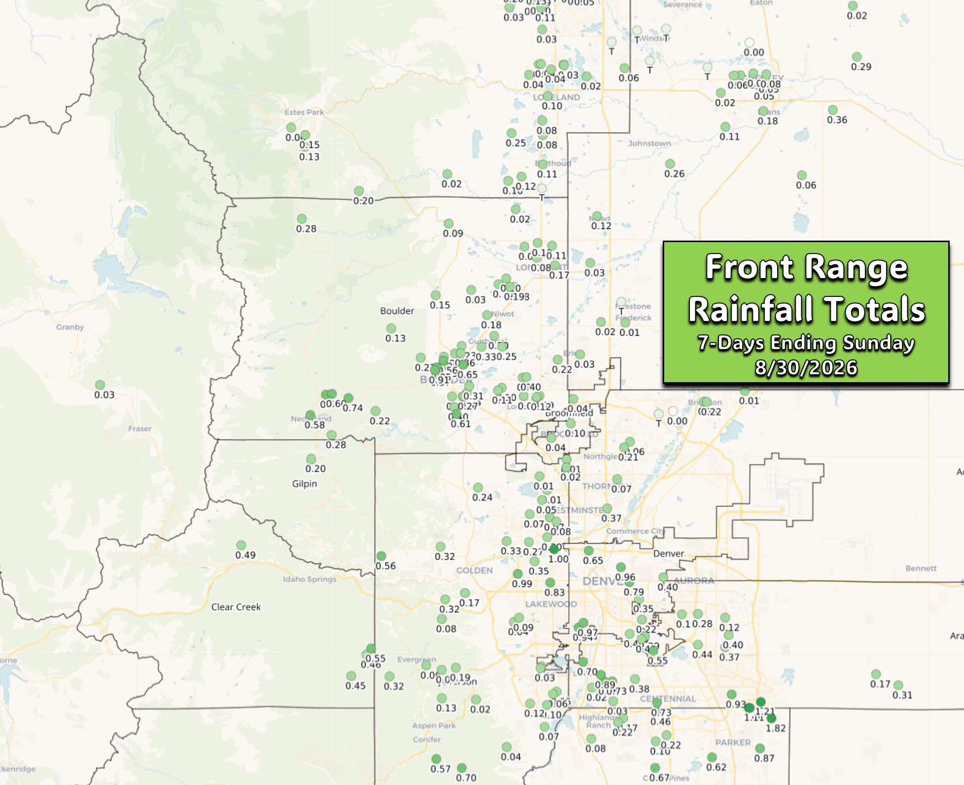
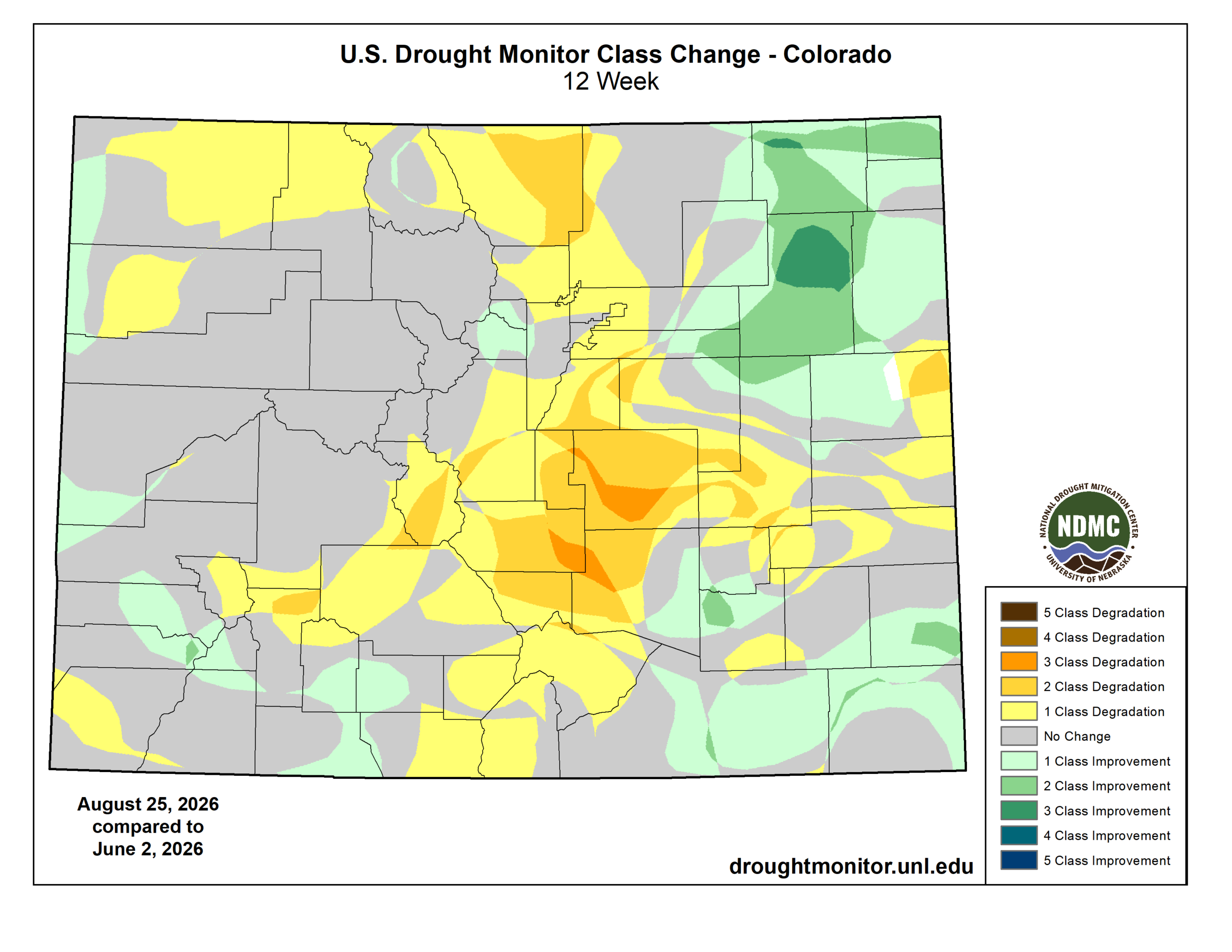
The monsoon has technically been here this summer… it just hasn’t done much for the Front Range. Over the last week, moisture has streamed overhead but rainfall has been wildly uneven — a few lucky pockets snagged close to an inch, while Boulder (0.29″) and Denver (0.10″) barely registered a splash.
With such meager totals this past week and all summer long, Severe to Extreme drought continues to tighten its grip across the Front Range and much of the High Country.
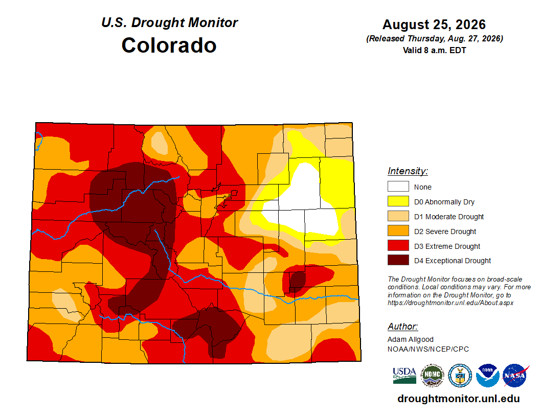
Since our spring wet season wrapped up in May, most of Colorado has slipped a category or two deeper into drought, except the perpetually soggy northeast corner where repeated heavy rain events have kept soils wet and happy.
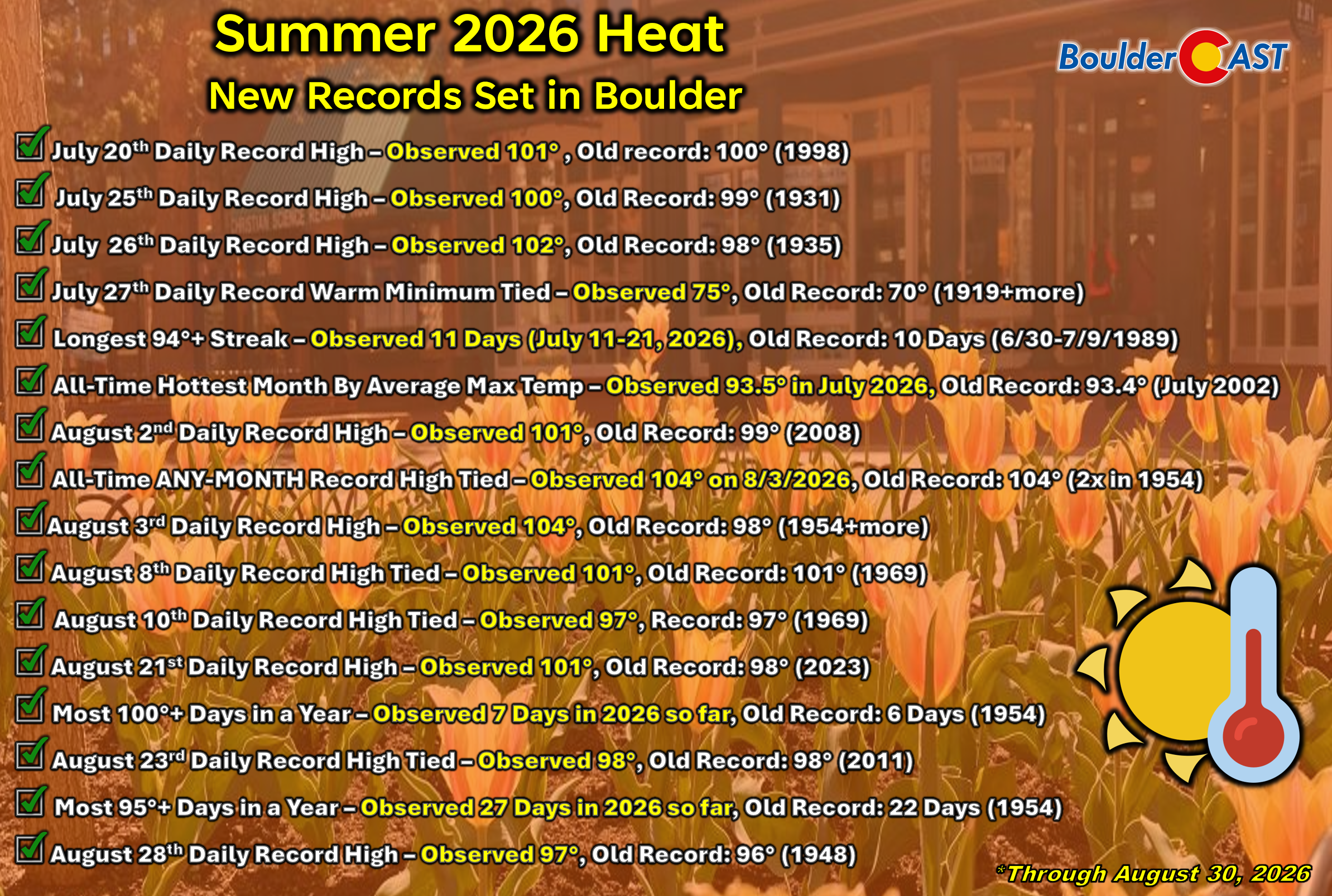
2026’s theme of an active summer monsoon pattern but with woefully feeble output alongside extreme warmth is something we discussed in great detail in our recent monsoon update. We highly recommend reading though that to catch up on how the summer has gone so far.
Monsoon Holds Position to Start the Week
Cloud lovers, this weekend was for you. Many neighborhoods saw only a few fleeting minutes of sunshine thanks to stacked wave clouds and disappointing monsoon storms drifting overhead. The upside, at least, is that temperatures stayed cooler.
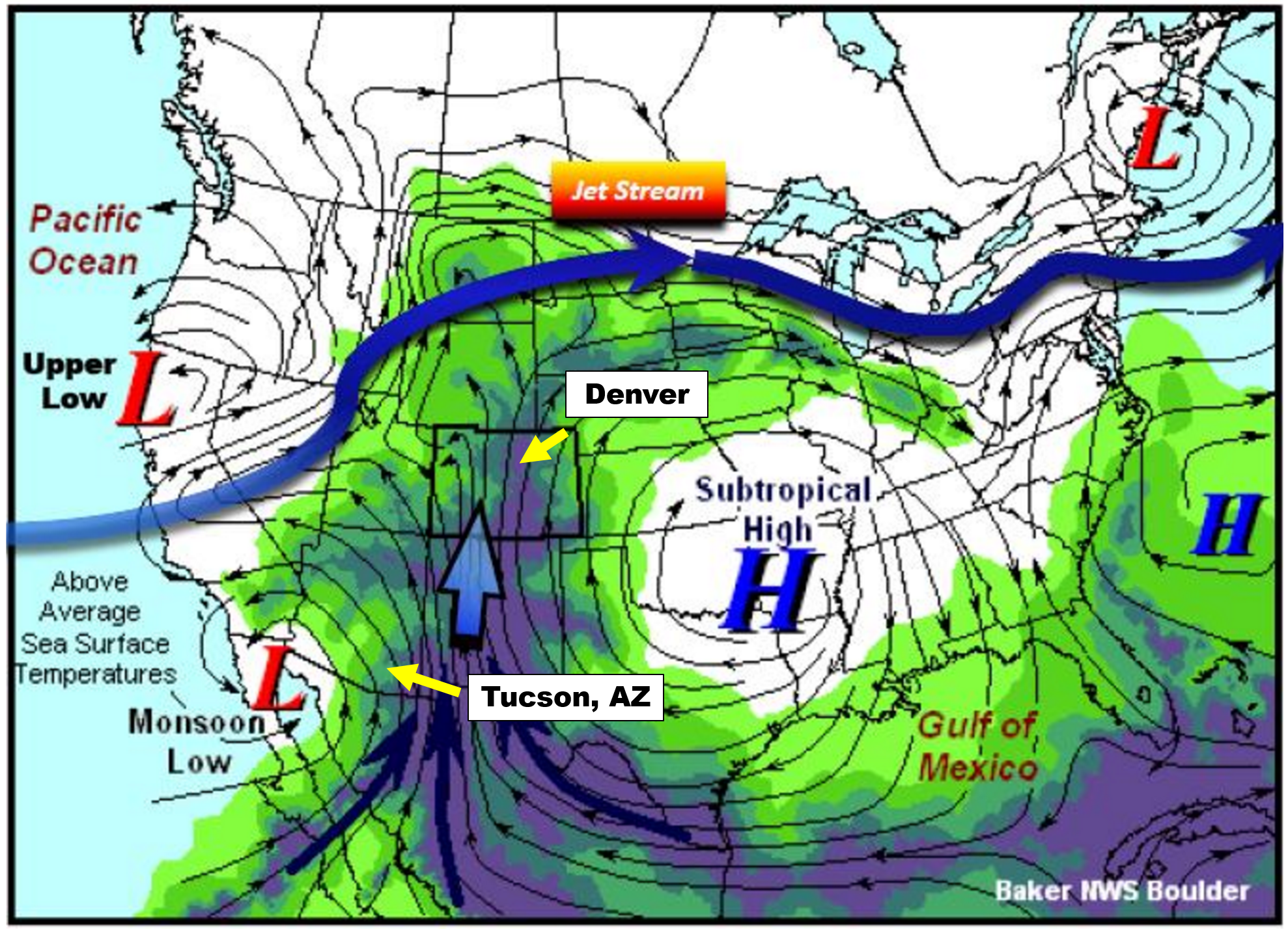
The culprit has been a classic monsoon setup — high pressure parked over the south‑central U.S., low pressure lingering over California and the Pacific Northwest, and a direct subtropical moisture plume stretched right across Colorado in between.
GOES-East water vapor animation early Monday showing the monsoon setup across the Southwest
This very much falls in line with the idealized monsoon setup depicted in the NWS graphic below.
Under this pattern, precipitable water (PWAT) values will surge to 200% of normal near the Four Corners Monday, with the Denver area hovering near 160%.
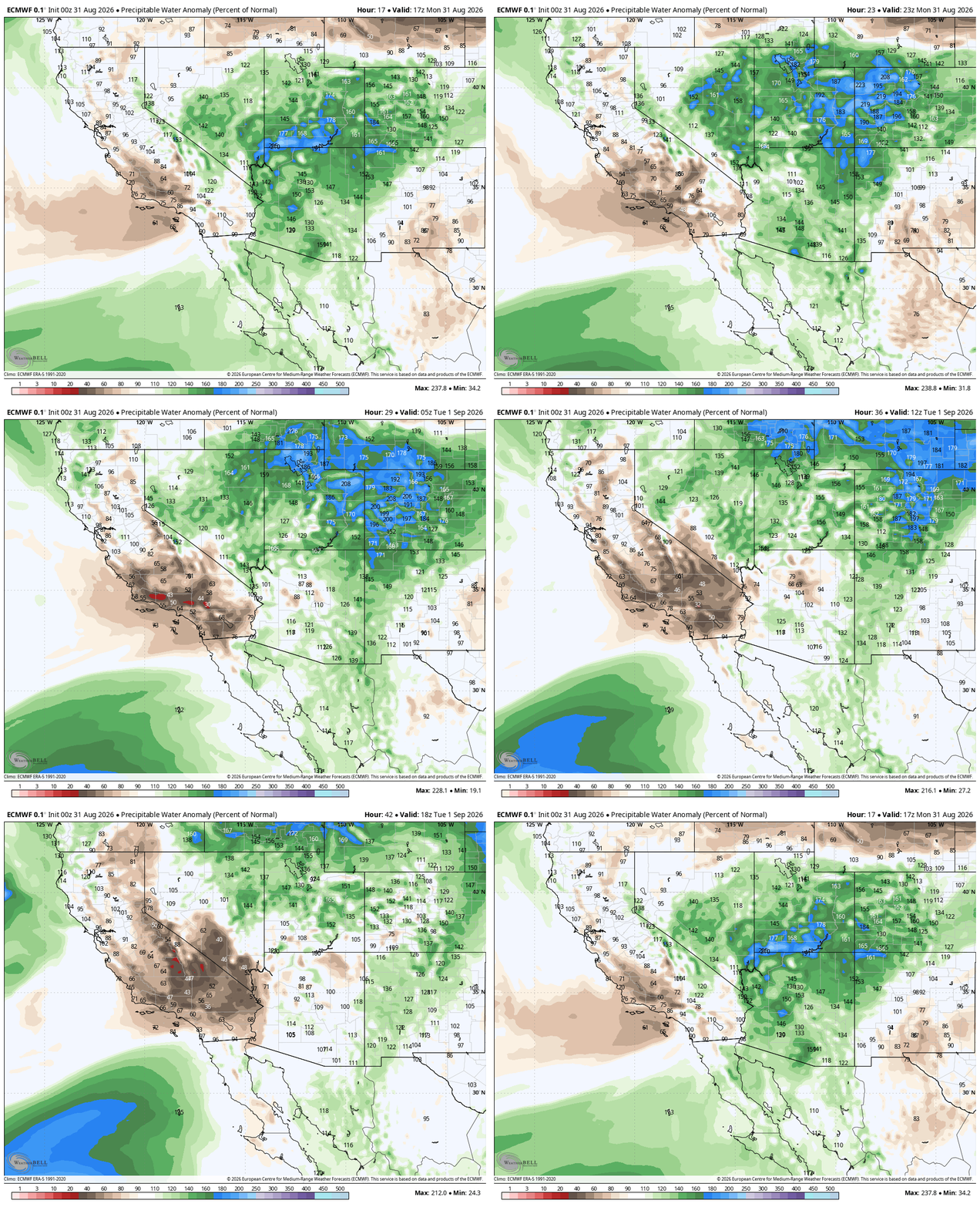
Euro forecast PWAT % of normal for Monday into Tuesday as the monsoon plume sits over Colorado
This moisture profile will support moderate to heavy rainfall, but storm motions will be quick from southwest to northeast, keeping the flood threat fairly low outside of regional burn scars.
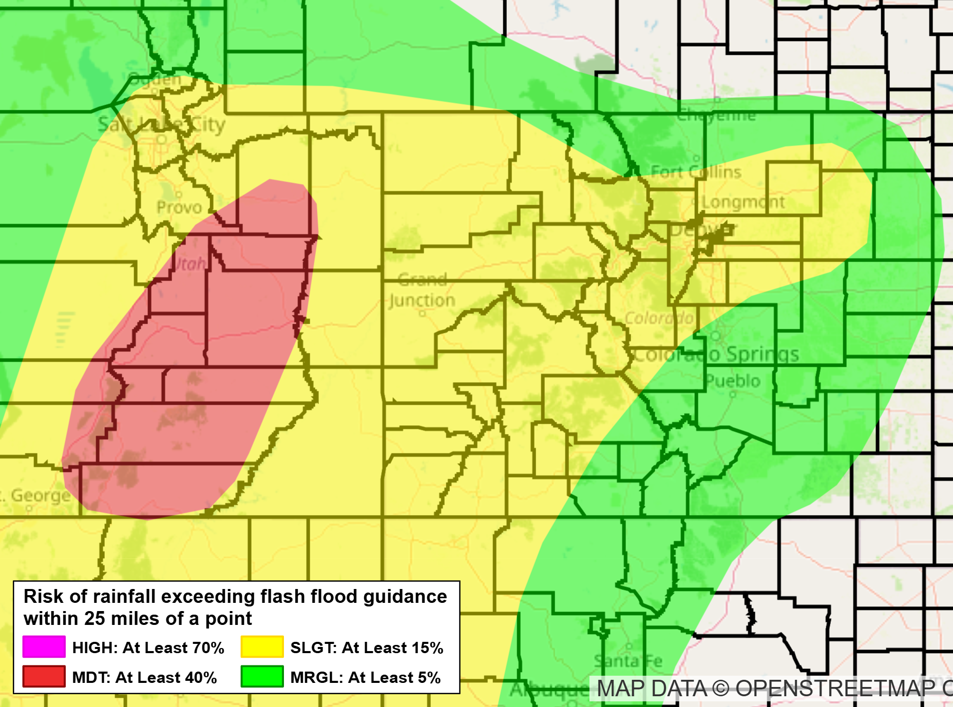
WPC Excessive Rainfall Outlook for Monday August 31 2026.
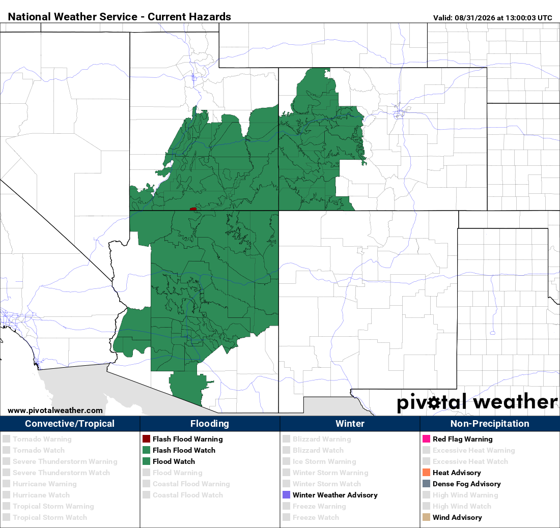
This isn’t the case further west where the deepest moisture resides and widespread Flood Watches are in effect for the threat of heavy rain from training thunderstorms.
Moisture will remain supercharged over the area through Tuesday morning, with spotty showers and a few storms remaining possible throughout Monday night into early Tuesday.
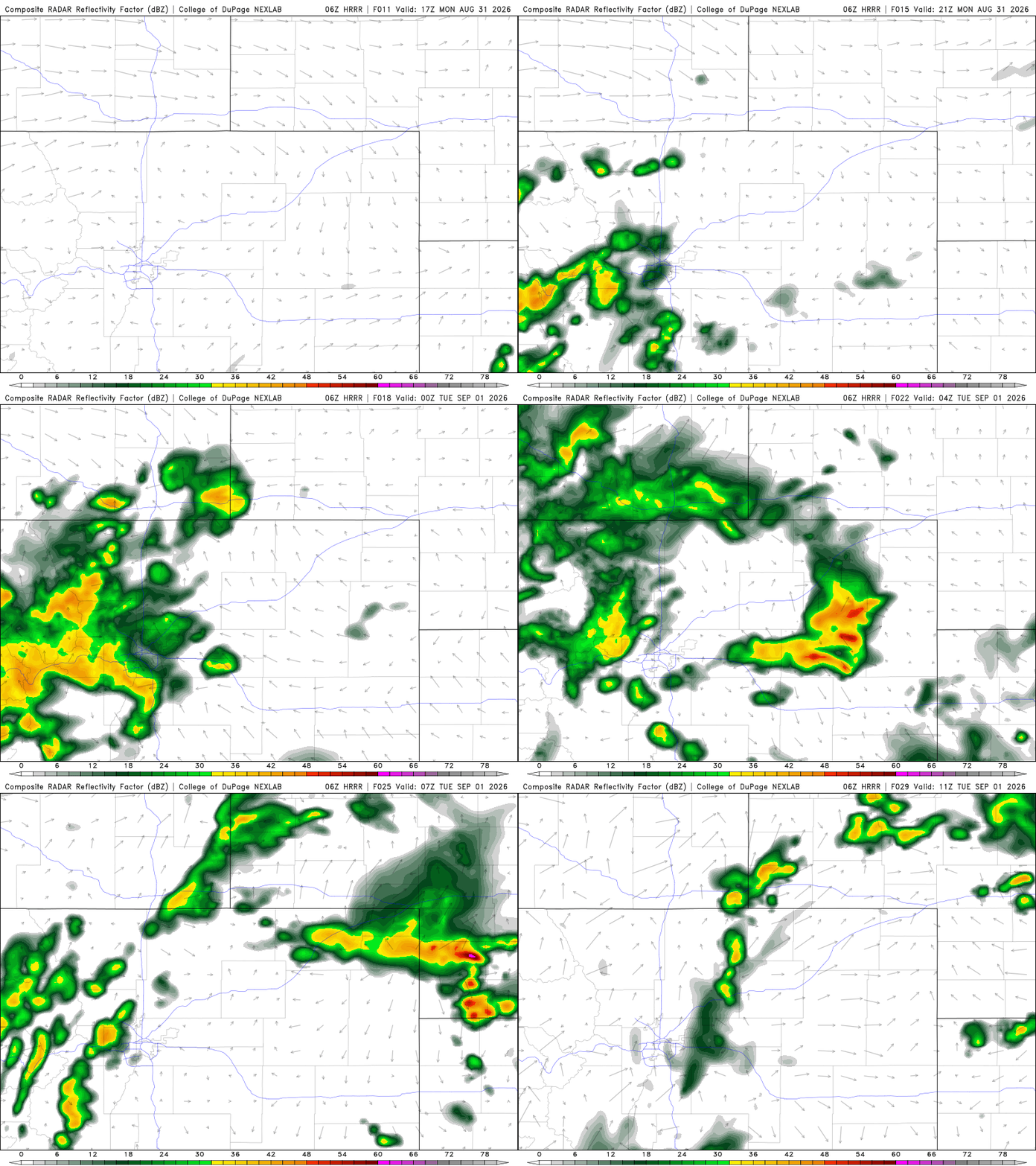
HRRR model-simulated radar animation for Monday into Monday night.
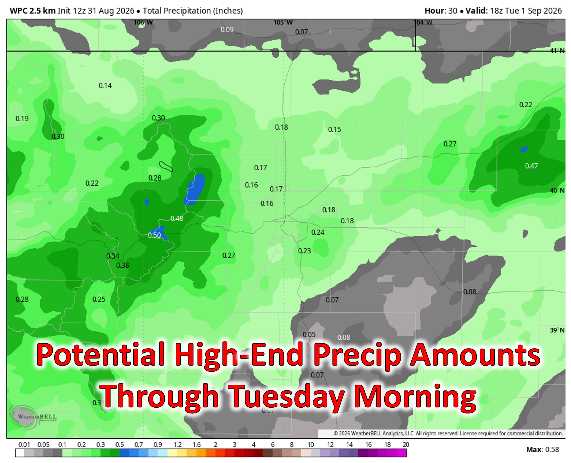
The Metro area should see a trace to 0.25″, while readers along and west of the Divide may land in the 0.25–0.5″+ range.
Under thick clouds, Monday’s high temperatures will reside slightly below normal in the low to middle 80s, with rain chances persisting well into the evening and overnight.
Drying Trend Tuesday Through Thursday
A notable drying trend kicks in Tuesday as drier southwest flow filters into the state. PWAT drops to ~120% of normal Tuesday, then near or slightly below normal by mid‑week. A few weak storms may still pop over the higher terrain, but Boulder and Denver should see isolated storms Tuesday and then dry conditions Wednesday and Thursday. Temperatures rebound from the mid‑80s to the lower 90s by late week.
Weekend Wildcard: Eastern Pacific Tropics
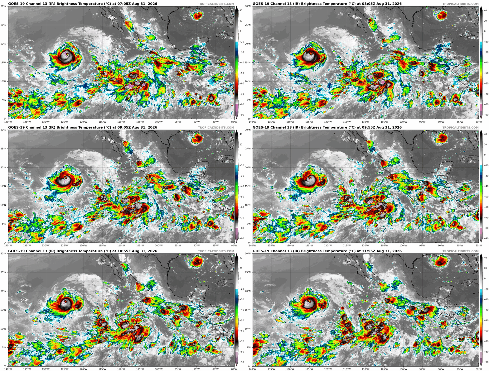
El Niño’s fingerprints are all over the eastern Pacific right now — the basin has been hyperactive for weeks with tropical activity, with multiple named storms swirling simultaneously and even undergoing Fujiwhara interactions. This week adds soon-to-be Tropical Storm/Hurricane Marie to the mix, joining major Hurricane Karina and Tropical Storm Lowell. Marie is expected to form very soon from the broad tropical wave located in the center of the GOES-West infrared satellite animation below.
Marie is the interesting one. Unlike Karina and Lowell, which are safely out to sea, Marie is expected to track along Baja and possibly near the California coastline.
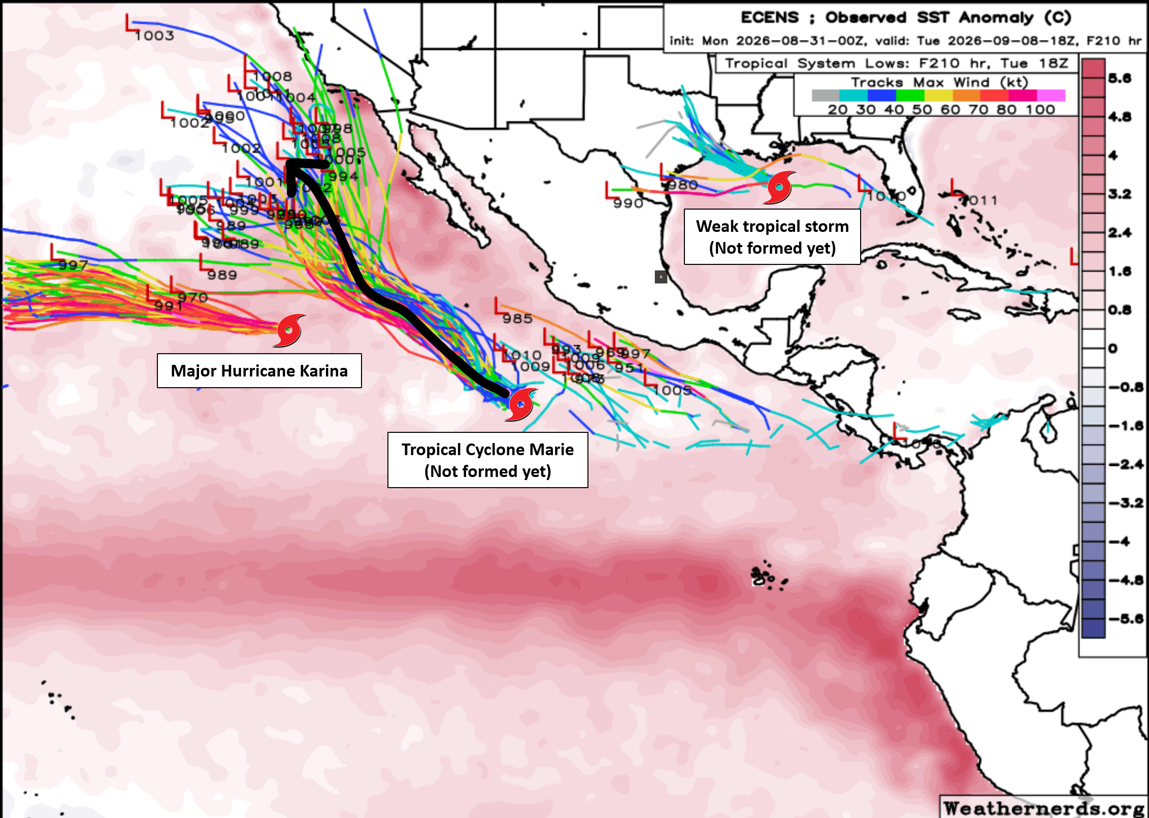
While a direct landfall of Marie remains highly improbable (though there are a few models showing this, like the GFS), indirect impacts through a hefty helping of tropical moisture transport to the western United States are likely.
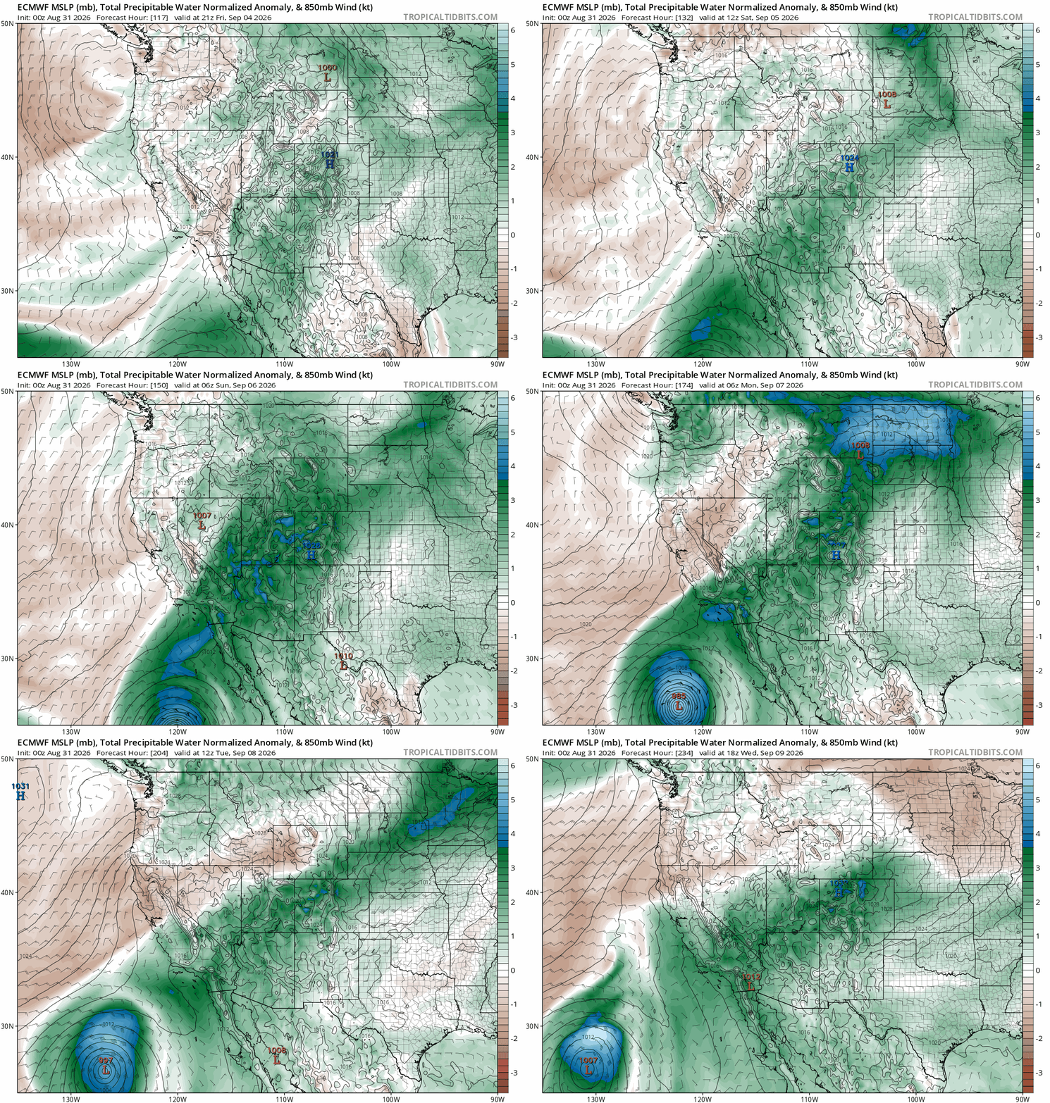
Moisture surges across Colorado for the weekend as Hurricane Marie rides up the Baja coastline.
As Marie slides north, deep tropical moisture will be siphoned into the Four Corners region, including the Front Range. Ensemble guidance already shows PWAT values in Denver surging toward 180% of normal this weekend — flirting with the record September values from the 2013 Colorado Flood. Much of this moisture may remain elevated in the atmosphere, meaning rainfall east of the Continental Divide is still questionable. But the setup is potent enough to warrant close watching.
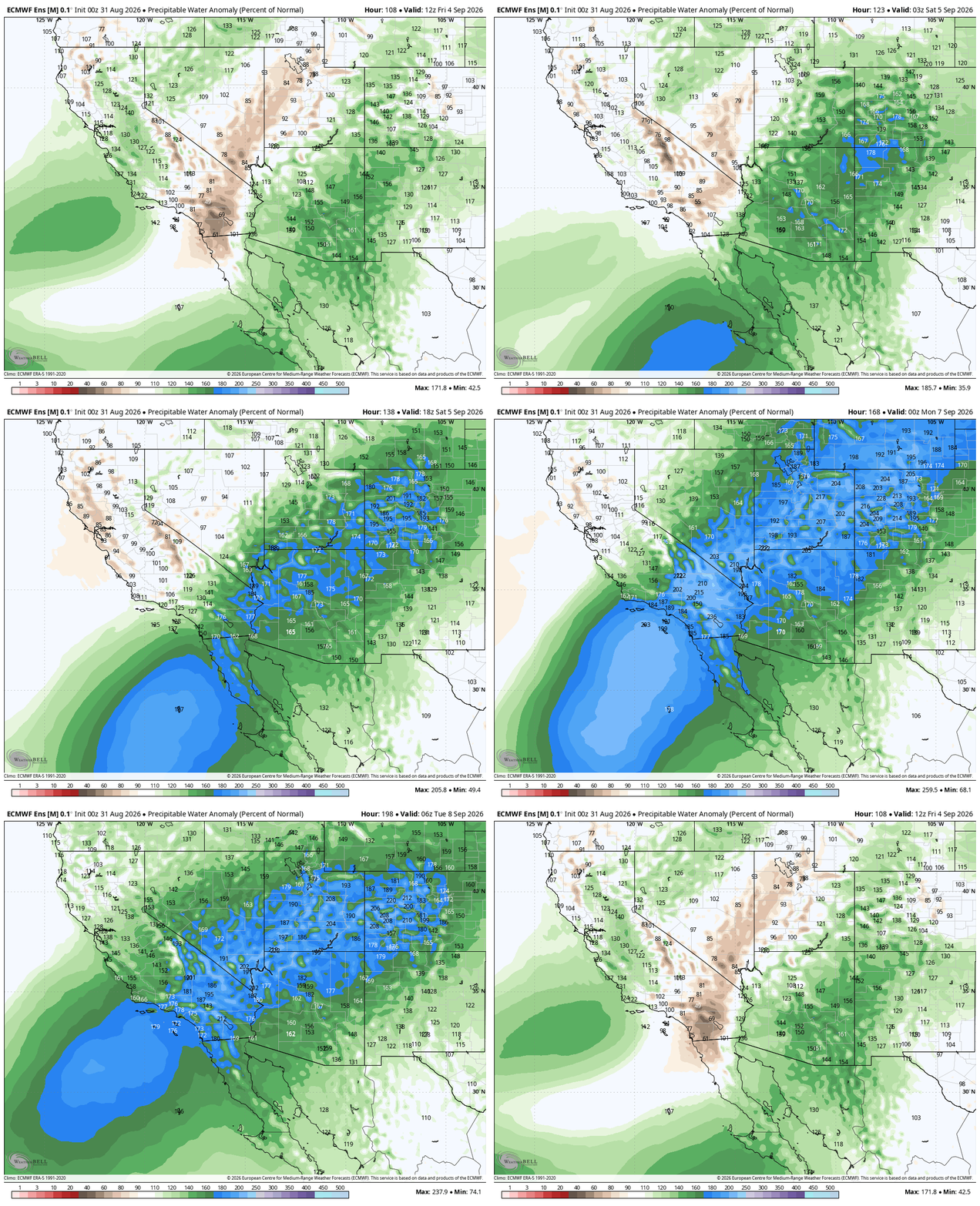
A closer look at PWAT % of normal for the weekend. 200%+ in western Colorado!
The first wave of tropical moisture may arrive as early as Friday with renewed late‑day storm chances. The extended forecast keeps the Denver area warm and potentially wet, though meaningful rainfall east of the Mountains depends heavily on whether we can sneak in a cold front to generate upslope and bring in low-level moisture. Models do hint at that possibility early next week, but the jury is still out.
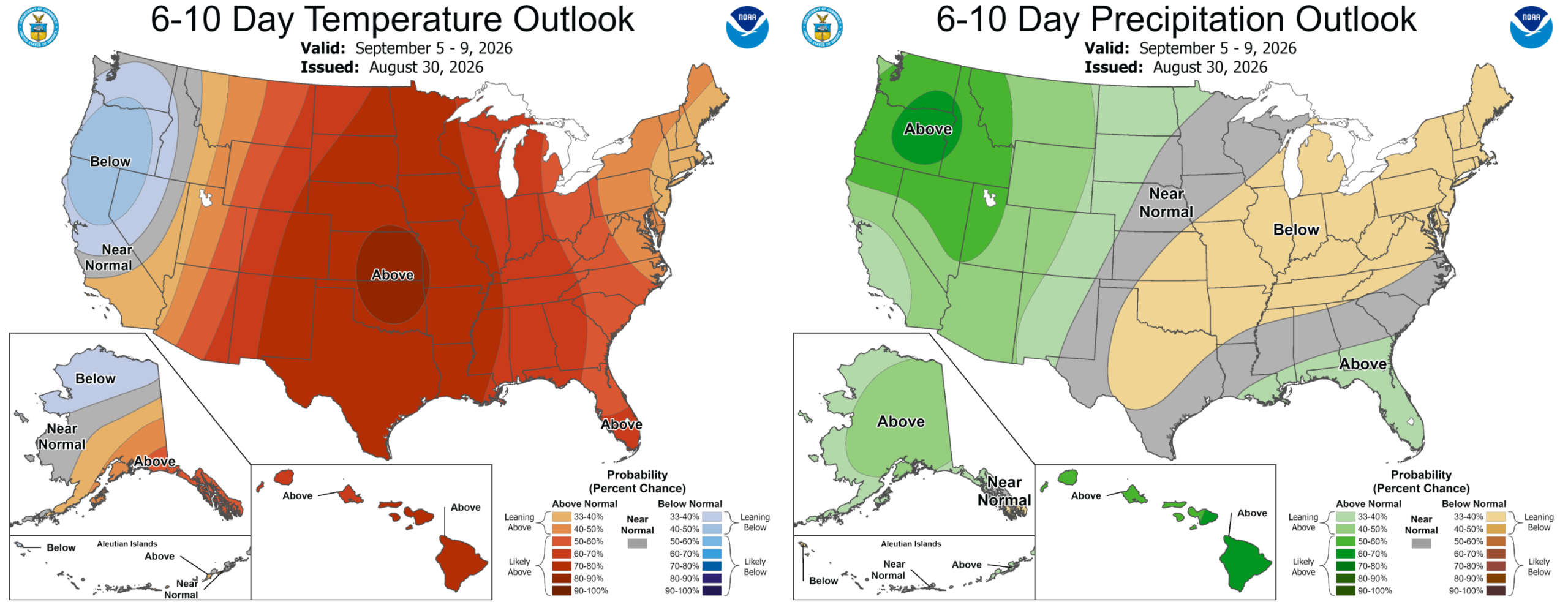
For now, our best shot at rain comes from Monday into Monday night — after that, we’ll be watching Marie’s moisture plume like hawks this weekend into early next week. Happy Monday!
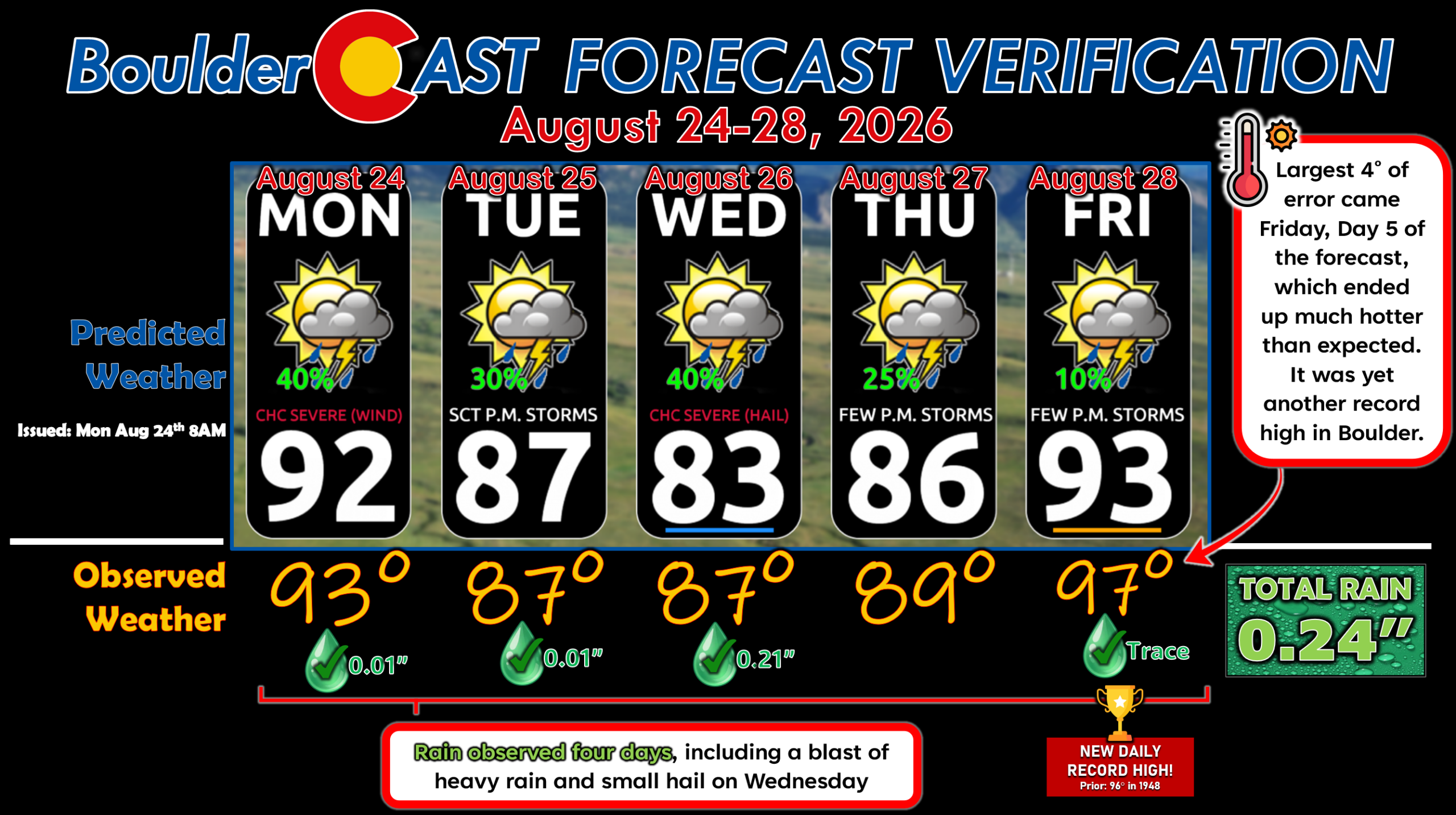
Forecast Verification: August 24-28, 2026 (Last Week)
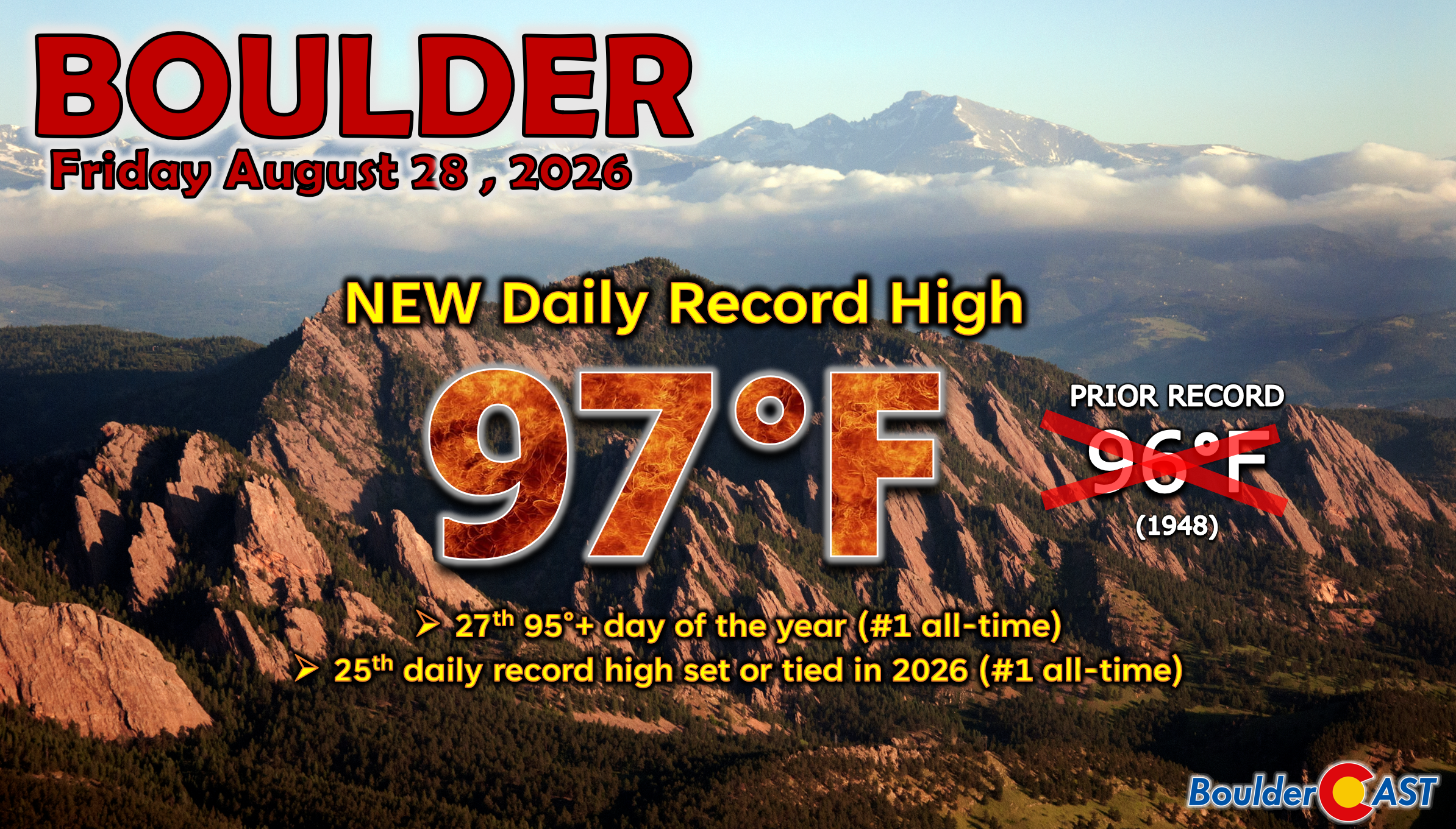
Boulder had four days with rain totaling 0.23″ last week. Our largest forecast temperature error of 4° on Friday was a new daily record high in Boulder, the 25th daily record temperature broken or tied in 2026 . All days were at or above normal. Bright side: there’s were only two days in the 90s last week? Winning!
DISCLAIMER: This weekly outlook forecast is created Monday morning and covers the entire upcoming week. Accuracy will decrease as the week progresses as this post is NOT updated. To receive daily updated forecasts from our team, among many other perks, subscribe to BoulderCAST Premium.
Go Premium, get all the perks.
Daily Forecast Updates
Get our daily forecast discussion every morning delivered to your inbox.
All Our Model Data
Access to all our Colorado-centric high-resolution weather model graphics. Seriously — every one!
Ski & Hiking Forecasts
6-day forecasts for all the Colorado ski resorts, plus more than 120 hiking trails, including every 14er.
Smoke Forecasts
Wildfire smoke concentration predictions up to 72 hours into the future.
Exclusive Content
Weekend outlooks every Thursday, bonus storm updates, historical data and much more!
No Advertisements
Enjoy ad-free viewing on the entire site.
Enjoy our content? Give it a share!











You must be logged in to post a comment.