A potent spring storm is lining up for the Front Range, and early signals point to a colder, wetter setup with the potential for impactful heavy, wet snow for everyone. We’ll dig into the details more deeply on Monday morning, but confidence is growing that this one could deliver both much‑needed moisture and heavy wet snow. Here’s a quick update on where things stand right now.

Page 13 of 577
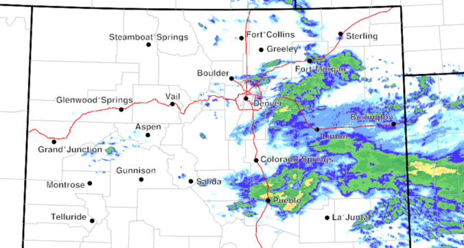
Rain is spreading across eastern Colorado this morning, with a broad, soggy setup still on track to bring rain and high‑elevation snow through the day to the Front Range. However, a continued southward shift in the storm track means precipitation totals around Denver and Boulder will likely fall short of earlier expectations. Nonetheless, a cool, gloomy day with plenty of showers still lies ahead, along with accumulating snow in the Foothills. Here’s the latest.
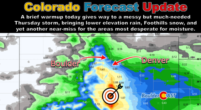
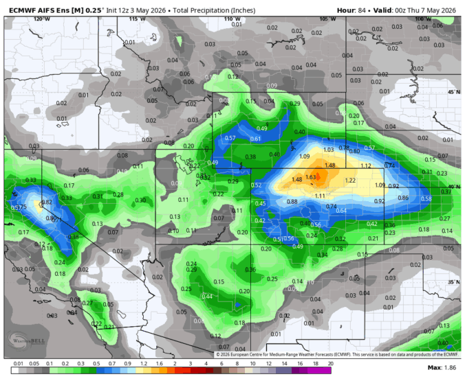
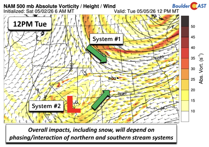
This brief lull in the action Wednesday morning won’t last long as the pattern is set to turn unsettled again in a hurry. A pair of poorly aligned disturbances is gearing up to bring the Front Range a long‑overdue dose of moisture — along with snow in the higher terrain. While the bullseye of heaviest precipitation is frustratingly expected to be south of our area again, a slew of marginal ingredients are coming together for what should be our most meaningful storm in months. We break down what to expect as we head into a soggy, colder, and in some cases, snowier end to the week.
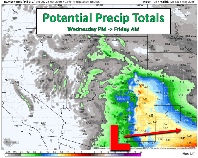
As April winds down, several moisture‑rich systems are lining up along the Front Range, each bringing a mix of clouds, cooler temperatures, rain, and Mountain snow. Most days the forecast is straightforward, but one late‑week setup has quite variable outcomes. If you want to know when the dreariest stretches will be, how much moisture we can realistically expect, and when warmer weather will return, read on for all the details.

Live View of Boulder

Current Conditions

Live Radar

Latest Smoke Forecast

Recent Premium Posts

BoulderCAST Daily – Wed 07/29/26 | Final Storm‑Filled Afternoon Before an Expanding Desert Southwest Heat Dome Takes Over
🌧️ Lingering Monsoon Moisture — Lingering Tap One last day of beneficial rainfall …
BoulderCAST Daily – Tue 07/28/26 | Front Range Primed for Widespread Thunderstorms as Monsoon Reloads
🌩️ Monsoon moisture surge — Deep moisture availability today, both aloft and at …
BoulderCAST Daily – Sun 07/26/26 | Record Heat Continues…
🔥 Heat Advisory Still in Effect — Near-record temperatures near‑100° this afternoon. 🌩️ …
3-Day Forecast

Trending Content

© 2026 Front Range Weather, LLC