A potent spring storm is lining up for the Front Range, and early signals point to a colder, wetter setup with the potential for impactful heavy, wet snow for everyone. We’ll dig into the details more deeply on Monday morning, but confidence is growing that this one could deliver both much‑needed moisture and heavy wet snow. Here’s a quick update on where things stand right now.
Good Sunday evening, everyone!
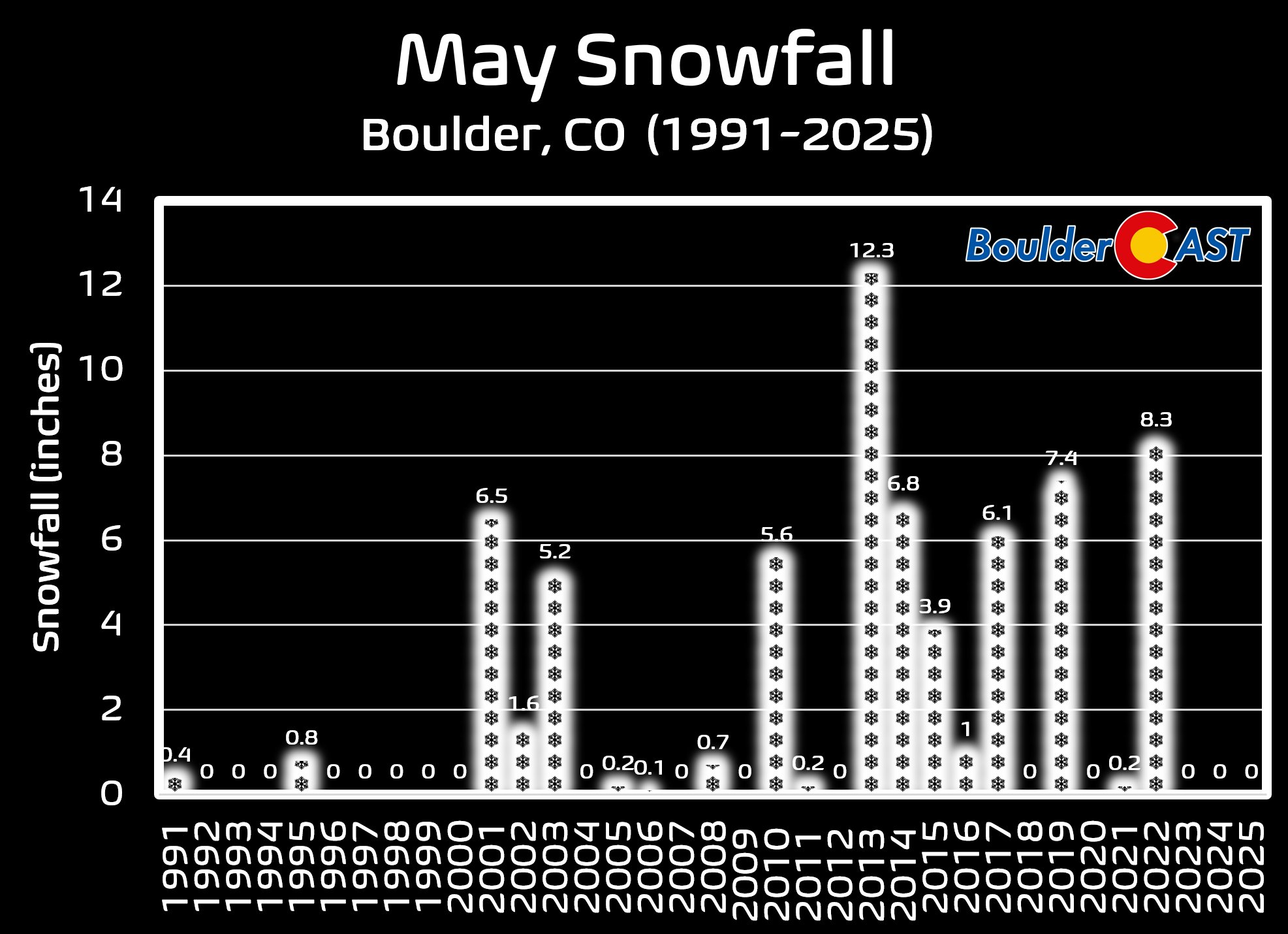
Quick update on the increasing likelihood for a wet and snowy spring storm moving into the Front Range late Monday through Wednesday morning.
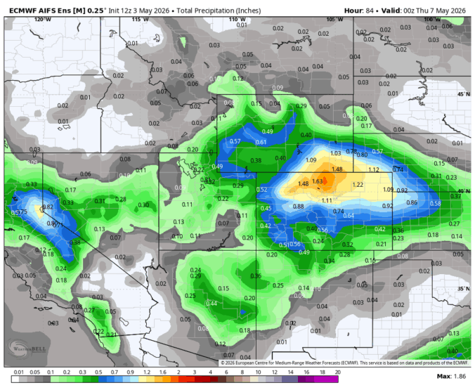
Models continue to advertise 0.75 to 1.75″ of moisture in north-central Colorado alongside cold enough air to turn rain to snow for the entire Boulder-Denver Metro area.
Exact snow levels and timing are still being worked out, but the general trend has been towards more precip and colder temperatures, with our confidence increasing that heavy wet snow is indeed on the way. Furthermore, the best overlap between lift and cold looks to occur during the overnight period which would help heavy wet snow accumulate on leafed out trees (6PM Tue -> Noon Wednesday biggest concern time), bringing power outages and some tree damage.

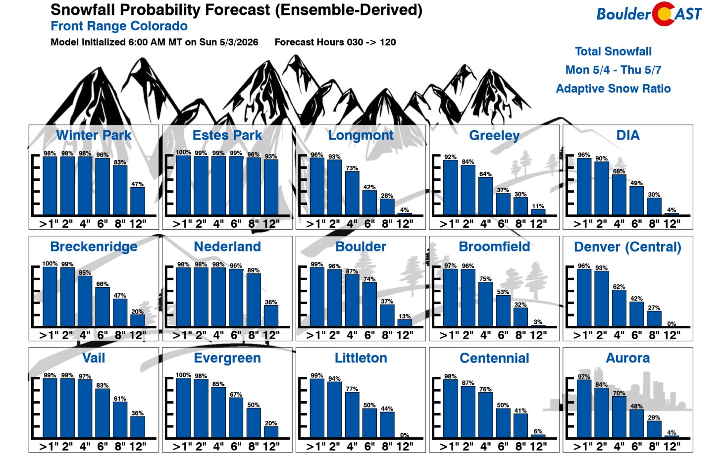
If you live in the Foothills above 7000 feet, you should be making plans for at least 8-16″ of spring snow, with higher-end totals of 2 feet not out of the question above 8000 feet.
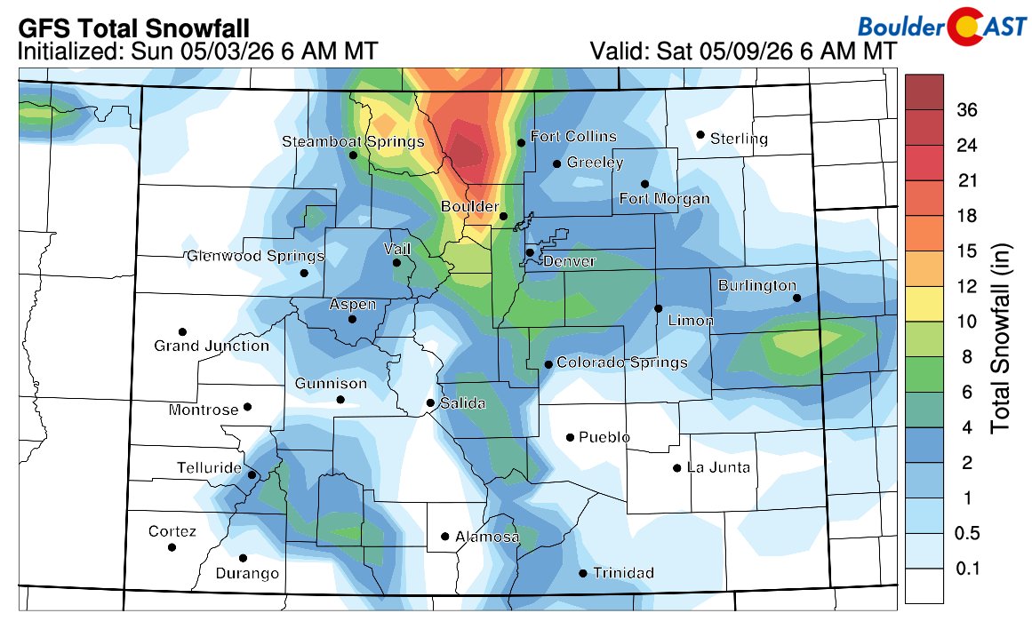
For the lower elevations, plan for a soggy Tuesday with rain changing to wet snow sometime during the day. Travel impacts will be minor during the day with the May sun, but slick/slushy roads and snow on the trees will become more likely as we head into Tuesday night. Accumulations are still pretty uncertain at this point, but we’re thinking several inches are likely, perhaps 2-6″ is where we are now. There are still some scenarios where we end up warmer and see less than that. Similarly, there are a few colder outcomes where 6-12″ dumps which would be crippling to our trees. This will need to be watched closely.
As for how cold it will get alongside the snow, that also remains somewhat uncertain. Below freezing temperatures are almost guaranteed with this event. Whether that means 30, 28 or 22 degrees is still unclear. Main concern will be Wednesday night if skies can clear we would see temps plummet way into the 20s. Tuesday night, though likely below freezing, will have wet snow falling and temps should stay 29-32 degrees.
That’s all for now. We’ll have a deeper dive into the storm Monday morning and hopefully more clarity on snow totals and temps so be sure to check back. Let’s hope this one holds together. This amount of moisture could do wonders, rain or snow! ❄️🤞


You must be logged in to post a comment.