
Shown below is our snowfall forecast map issued Thursday morning with actual storm totals overlaid. Green values indicate that our forecast verified to within one inch of the observed snowfall total. Red numbers did not. As you can see, booming snow totals were observed on the western side of the Metro area with 6-13″ having fallen in and near the Foothills, with less than 3″ for areas along as east of I-25.
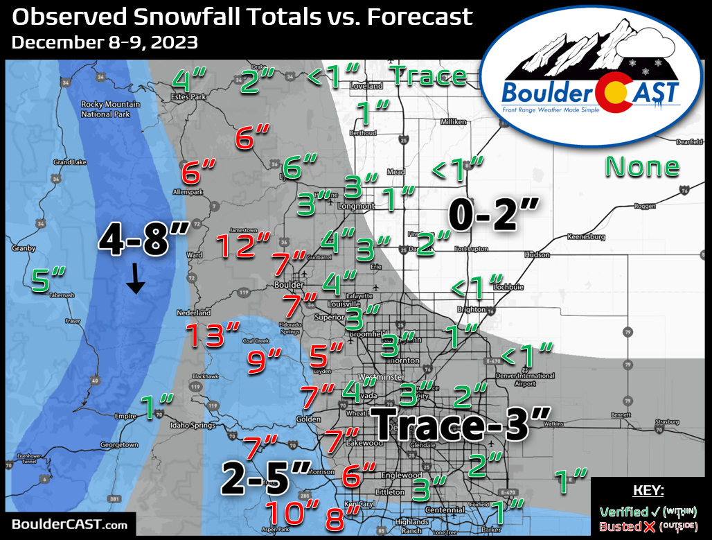
We knew the Foothills are would see the most snow from this one, but it really wasn’t apparent until the final hours that this storm could be a boomer. A burst of heavy snow Friday night put down 3-6″ in many areas in less than 2 hours pushing these locations past our weak forecast ranges.
A burst of heavy snow falling now. Haven't seen that in a while.. #cowx pic.twitter.com/uKQ3li48b5
— BoulderCAST Weather (@BoulderCAST) December 9, 2023
Officially Boulder recorded 7.5″ of new snow from this event, while Denver’s report from DIA was just 0.4″. At this still early juncture of the snow season, Boulder has more than double the seasonal snowfall as Denver.
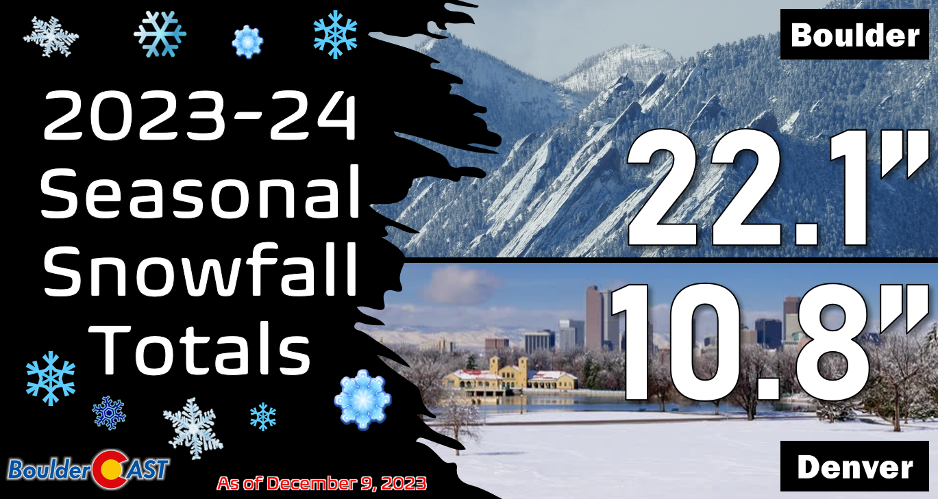
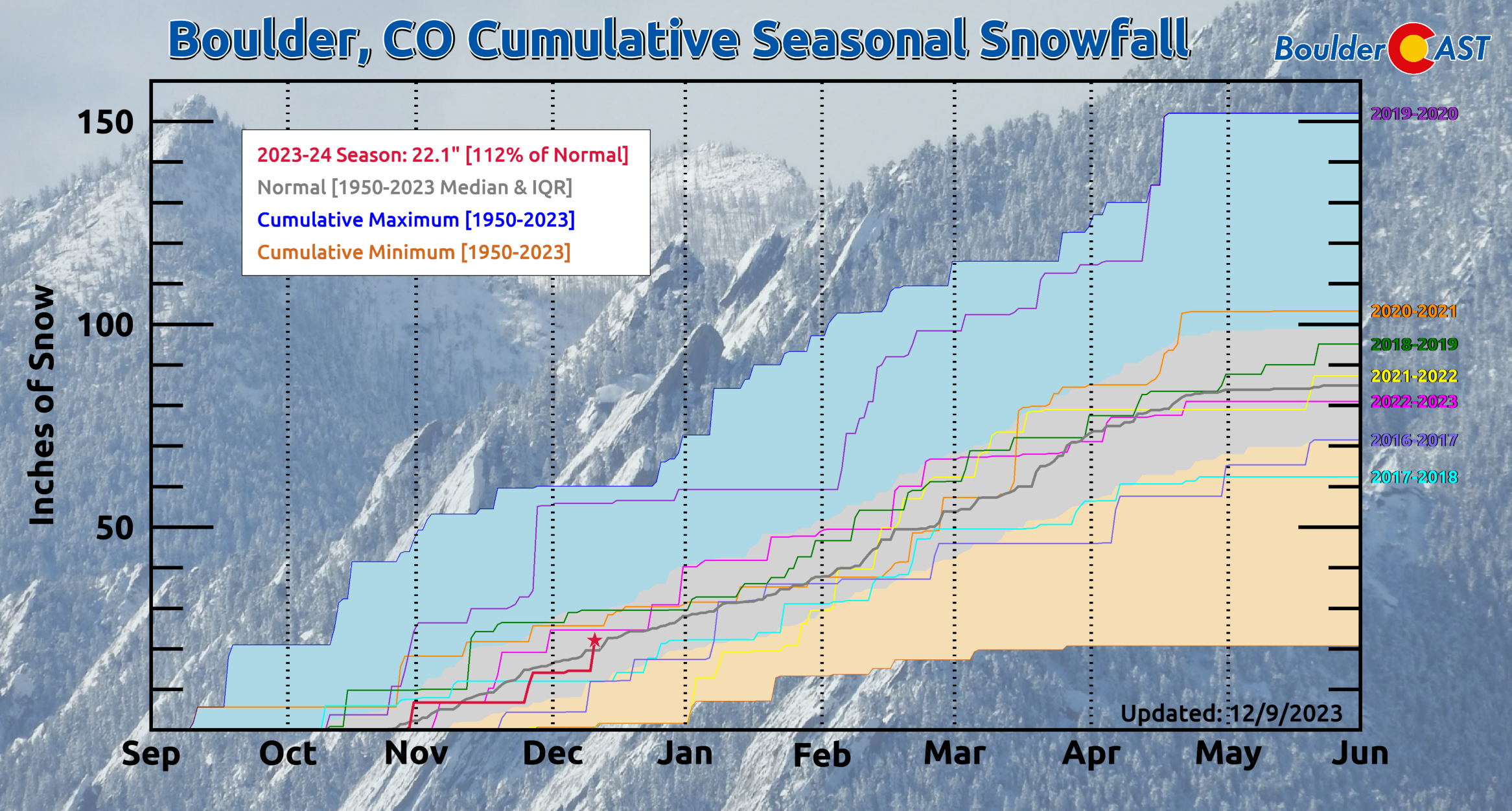
So…. the million dollar question: How far behind are we on snowfall this season? Well, in Boulder the answer is “We aren’t behind anymore!”. 22.1″ season-to-date is 112% of normal (median). Hooray!


You must be logged in to post a comment.