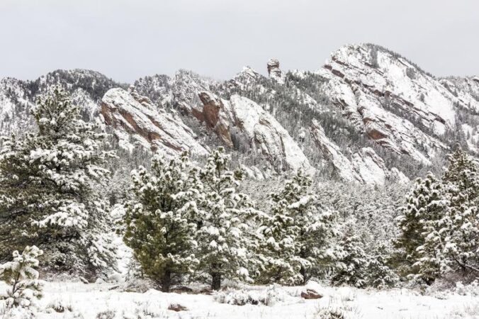
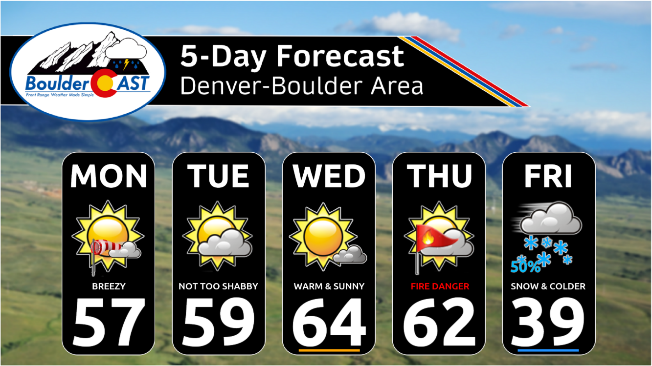
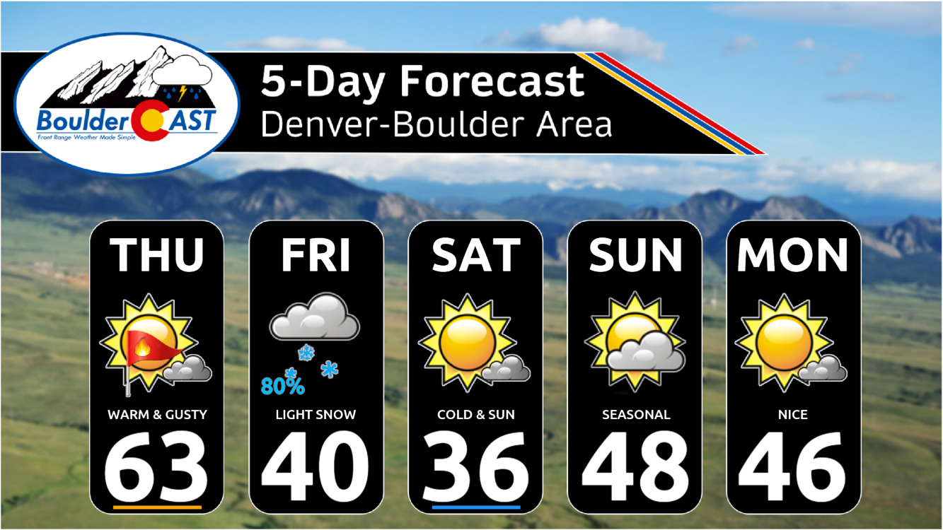
A dangerous downslope windstorm is about to unfold in the Foothills to the west on Thursday with gusts up to 90 MPH. It will be warm and gusty across the lower elevations as well, with a chance for very strong gusts in the usual windy spots like Boulder. A trough will move into the area on Friday turning our temperatures much colder with several chances for light snow. Read on as we discuss those powerful winds and the incoming snowfall.

Go Premium, get all the perks.
Daily Forecast Updates
Get our daily forecast discussion every morning delivered to your inbox.
All Our Model Data
Access to all our Colorado-centric high-resolution weather model graphics. Seriously — every one!
Ski & Hiking Forecasts
6-day forecasts for all the Colorado ski resorts, plus more than 120 hiking trails, including every 14er.
Smoke Forecasts
Wildfire smoke concentration predictions up to 72 hours into the future.
Exclusive Content
Weekend outlooks every Thursday, bonus storm updates, historical data and much more!
No Advertisements
Enjoy ad-free viewing on the entire site.
Thursday: Warm & windy, gusts up to 90 MPH in the Foothills
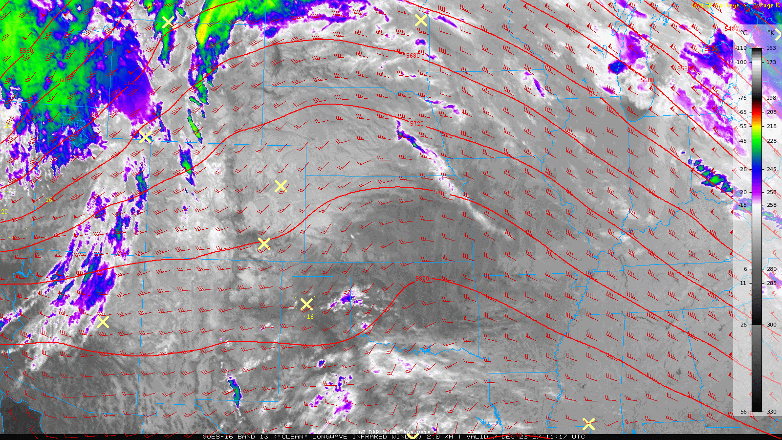
The ridge of high pressure which has kept things warm across the Front Range the last few days has shifted eastward with one last warm outing expected across the area under increasingly strong west-southwest flow aloft. GOES-East infrared satellite imagery this morning shows mostly clear skies across the region, but some moisture is working in from the southwest. This has spawned a few wave clouds over the Front Range and these will be around at times this morning and through the day. Overall, though, there will still be plenty of sunshine out there for our Thursday!
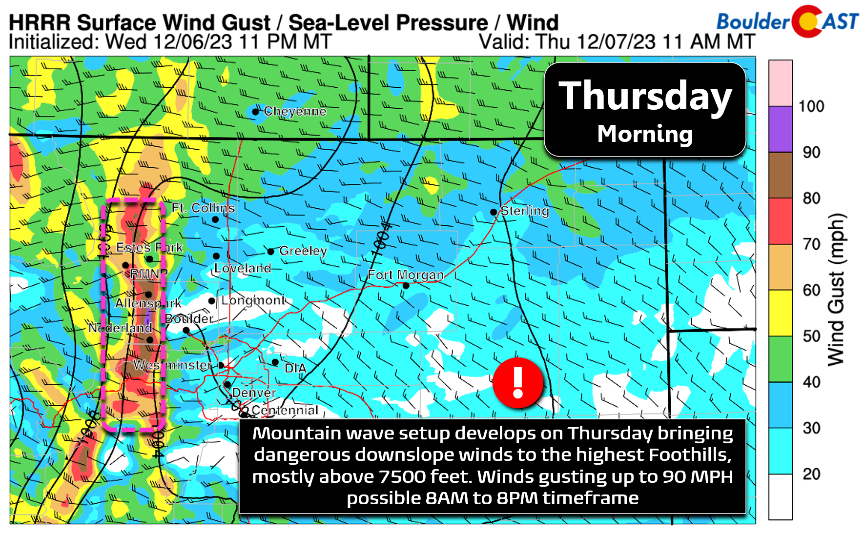
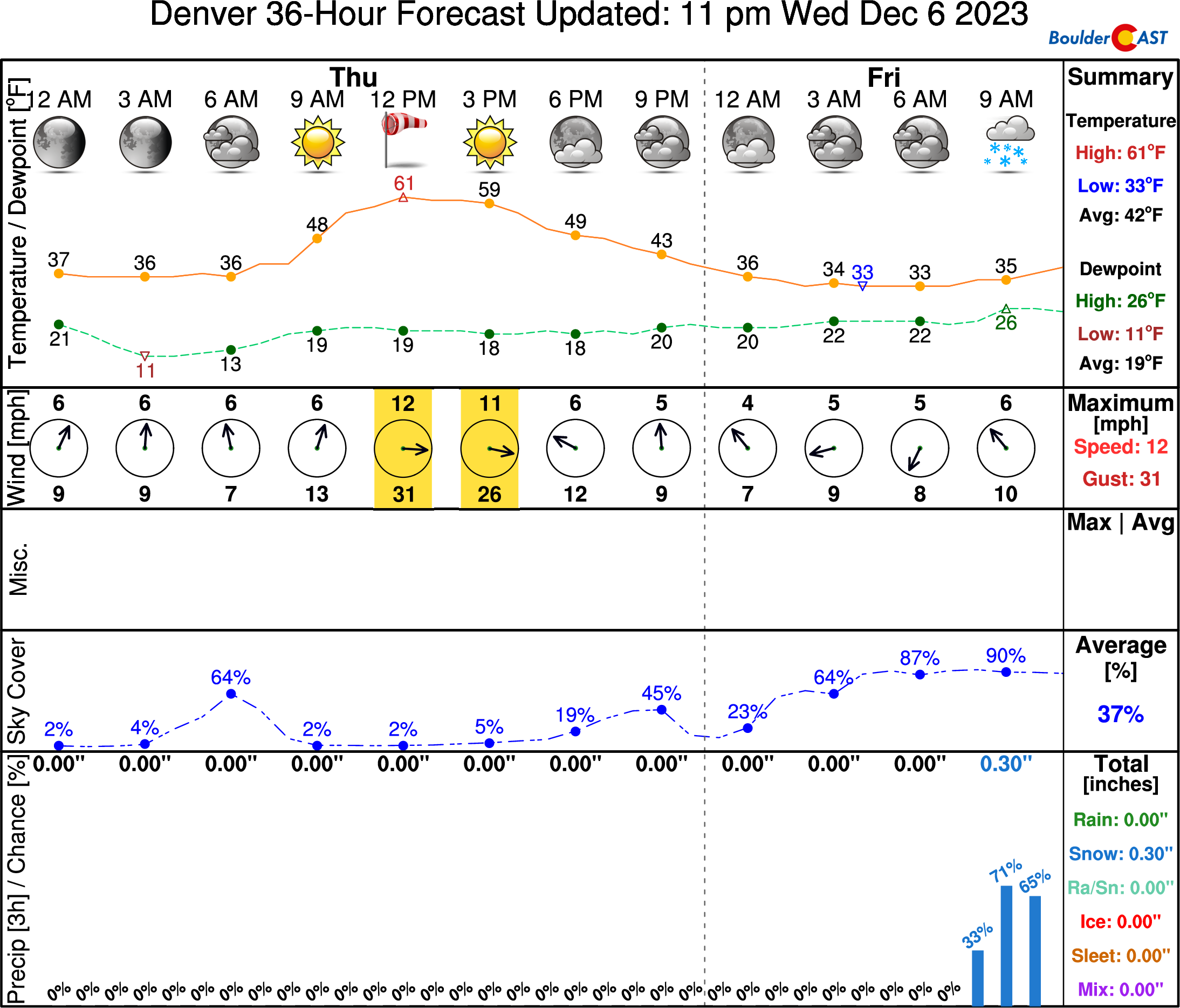
The main forecast concern for today is the mountain wave induced downslope windstorm set to unfold in the Foothills. Westerly winds are expected to ramp up rapidly through the morning with gusts up to 90 MPH possible from late morning into the afternoon when the wave peaks. The strongest gusts should remain generally above 8000 feet elevation.
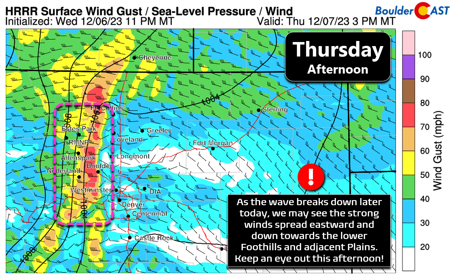
Across the lower elevations, it will certainly be less windy today than up in the higher terrain, but recent model runs have shown a slight eastward shift in the intense winds as the mountain wave breaks down late Thursday afternoon. 50 to 75 MPH gusts are now shown by the HRRR model to get uncomfortably close to Boulder during the afternoon. This particular model is the most bullish on wind speeds in the Boulder area overall, but it does spread some concern that there could be a few bursts of very strong winds making it into the city. In general, we expect sporadic gusts of 20 to 40 MPH today in the Metro area, but we won’t be surprised to see a few 55+MPH gusts in places like Boulder, Rocky Flats, Broomfield Airport, or the Leyden areas.
A High Wind Warning is in effect all of Thursday for the higher terrain, though the focus for this warning is geared towards the upper Foothills. Red Flag conditions won’t be widespread on Thursday — very dry but not windy enough across the lower elevations, and extremely windy in the Foothills but not dry enough — but the fire danger is certainly elevated given the weather conditions and relatively dry vegetation. Any wildland fire sparked today would lead to a bad situation, especially if this hypothetical blaze pops up in an area with hurricane force winds ongoing. Winds will retreat back into the higher Foothills Thursday evening before waning during the overnight.
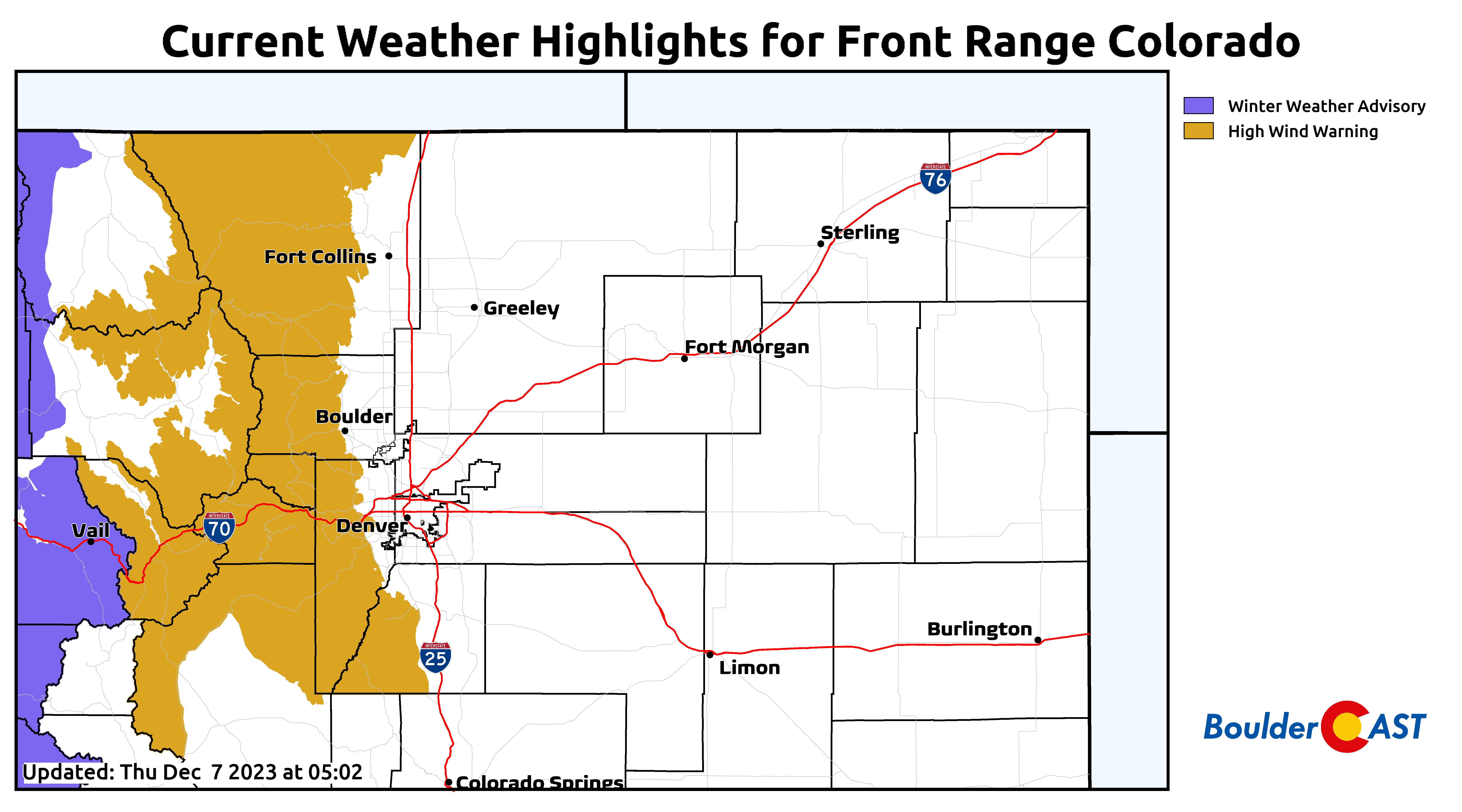
NowCAST has a high temperature in the lower 60s in Boulder and Denver today with mostly sunny skies interspersed with a few wave clouds at times — that’s about 15 degrees above normal for early December. The breezes will be most intense from late morning through late afternoon. This graphic also gives us a sneak peak at the changes headed our way with snow chances creeping into the forecast Friday morning…
Friday: Bouts of snow with much colder temperatures
We first let you know of Friday’s incoming snow/cold back on Monday in our weekly outlook. At the time, we were confident it would snow on Friday due to strong ensemble support — but that far out timing and snowfall amounts were still plenty uncertain, though we were leaning towards a lighter snowfall event due to the raw speed that the trough would be traversing our area.
Weekly forecast posted Monday 12/4/2023
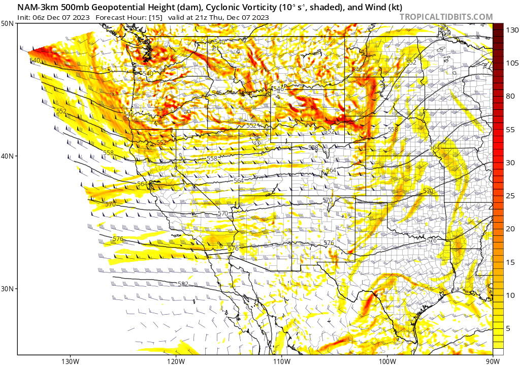
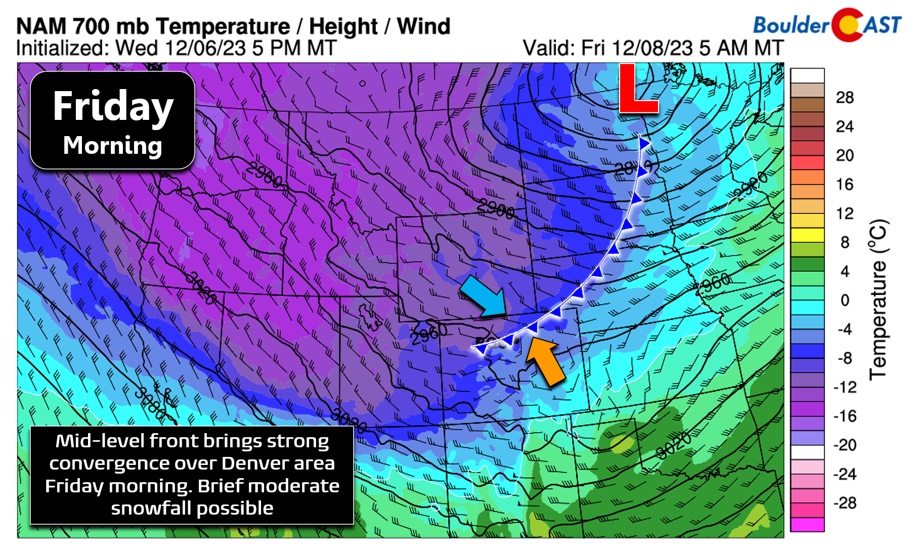
Fast forward three days later to now on Thursday — we have a slightly clearer picture of how things will unfold to end the week. Over the next 24 to 48 hours, a fairly disorganized trough of low pressure will drop into Colorado from the northwest. The trough, while unfortunately weaker than we would like, will propagate two separate pieces of energy across Colorado — each one offering up a chance of light snow for our area. Can you pick out the two separate shortwaves set to impact the Front Range in the 500mb vorticity animation below?
The first shortwave will arrive Friday morning along with a cold front from the north. This will produce minimal low-level upslope and there won’t be much moisture to work with either initially. However, models are indicating a brief period of convergence over the Denver Metro area associated with a mid-level cold front (shown below). These converging winds should produce a swath of snowfall across eastern Colorado.
Short-range models are indicating some banded snowfall associated with this front Friday morning, though recent trends keep this action mostly south and southeast of Denver — which is something we indicated might happen with this system. We’ll need to keep an eye on model trends as we get closer to the snow beginning early Friday — for now it looks like areas along and south of I-70 stand the best chance to see snowflakes Friday morning. Even if some snow does clip the Denver area during the morning, temperatures should be slightly above freezing and roadways will be starting off warm. Thus, no impacts are expected for the morning commute really.
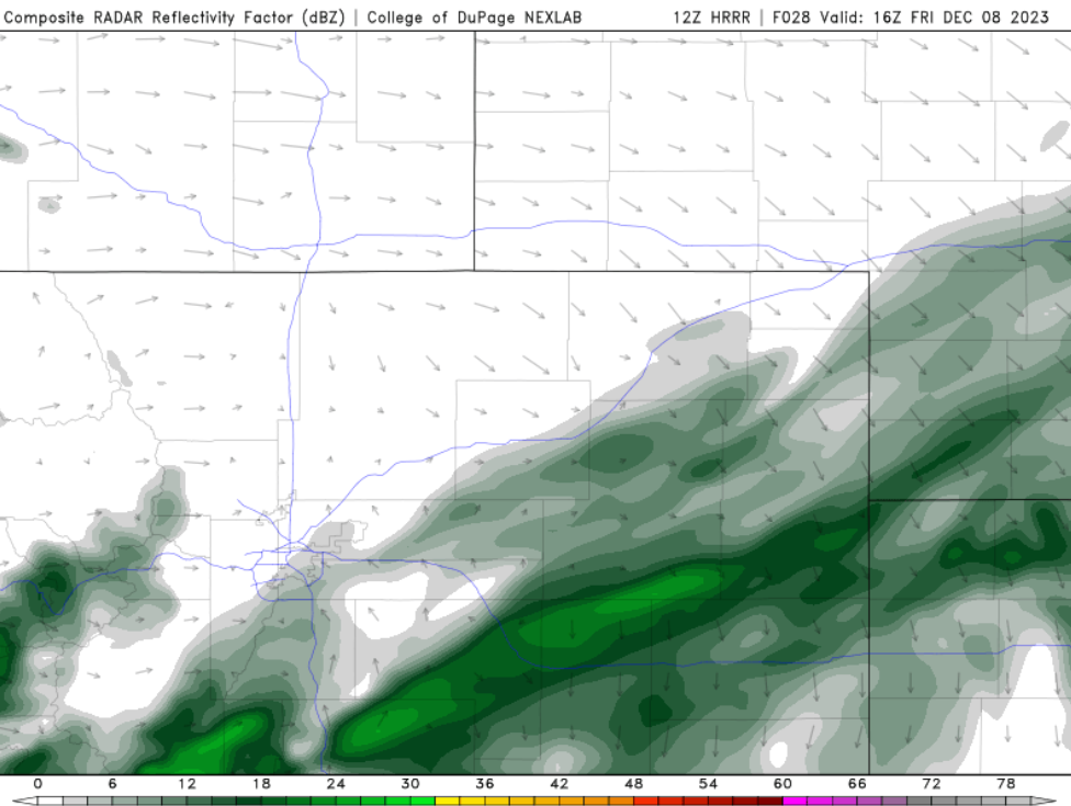
HRRR radar forecast for 9AM Friday morning showing snow bands lining up south/southeast of Denver
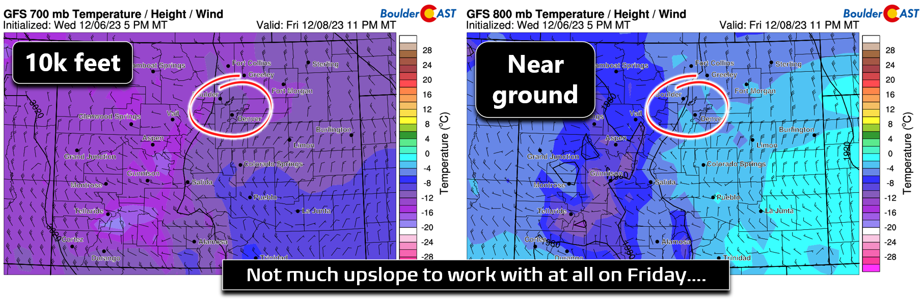
There will be dry period during the day Friday with chilly temperatures sticking around through the day. Highs will only be in the upper 30s to lower 40s. By early evening, the next shortwave will arrive to Colorado with a secondary, slightly stronger cold front backing into the area from the northeast. Models have really pulled away from the amount and depth of upslope we see with this system. There is now just the faintest hints of low-level upslope present Friday night. For the most part, flow will be northerly, perhaps at times north-northeasterly, which would favor areas south of Denver.
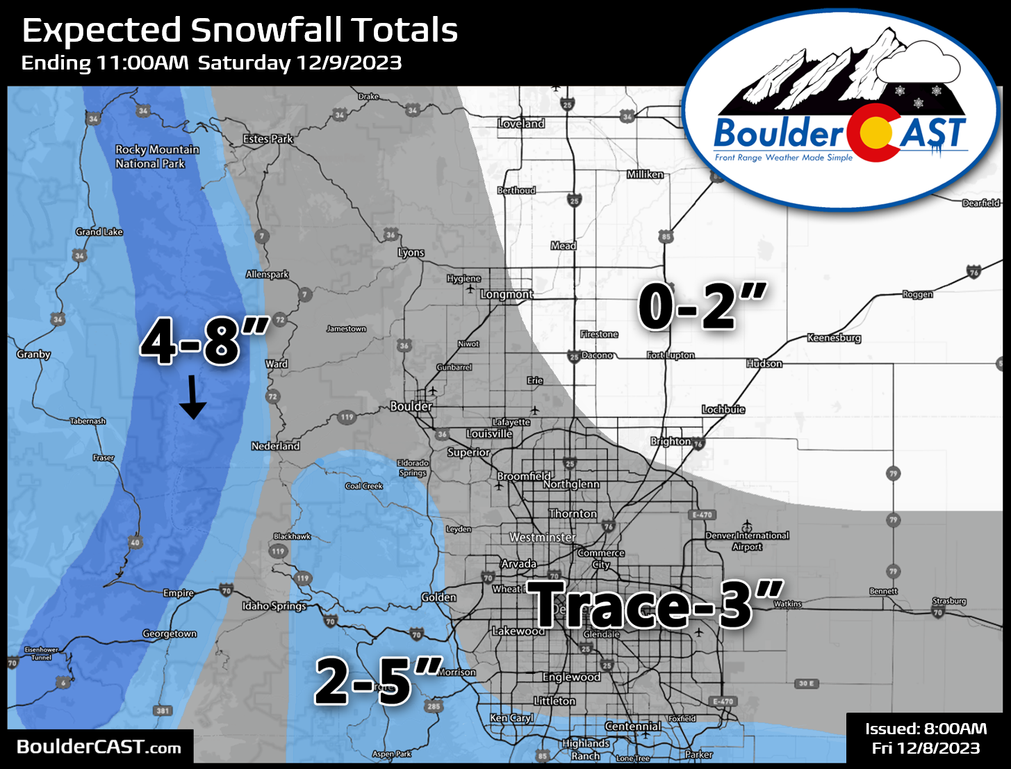
With just a weak shortwave and minimal upslope, most models keep this snow event as a less than 3″ affair for the entire Denver Metro area, with the exception being the bullish Euro model which seems too high in our opinion — it has 3-6″ for most of us. We’re going to lean away from the Euro model this time towards the rest of the guidance which is pretty consistent. Our snowfall forecast map for this event is shown below. The best chance of seeing several inches of accumulation is south of Denver across the Palmer Divide and along/west of the Continental Divide. Elsewhere, this should be a minor wintry event with several periods of light snow possible — Friday AM, then again Friday evening into Friday night — but ultimately they won’t amount to much. Travel impacts should be minimal, but watch out for some slick spots Friday evening/night, especially heading south out of Denver. Snow will be done for everyone after before sunrise on Saturday.
The cold weather won’t last too long with temperatures expected to warm back towards normal by Sunday and into early next week. Our next slight chance of (likely light) snow comes around Tuesday or so of next week .
That’s all we have for now. We’ll pass along timely updates on social media as needed and here if the need is substantial. Think snow and enjoy the end to the week!
Get BoulderCAST updates delivered to your inbox:


You must be logged in to post a comment.