Key Messages:
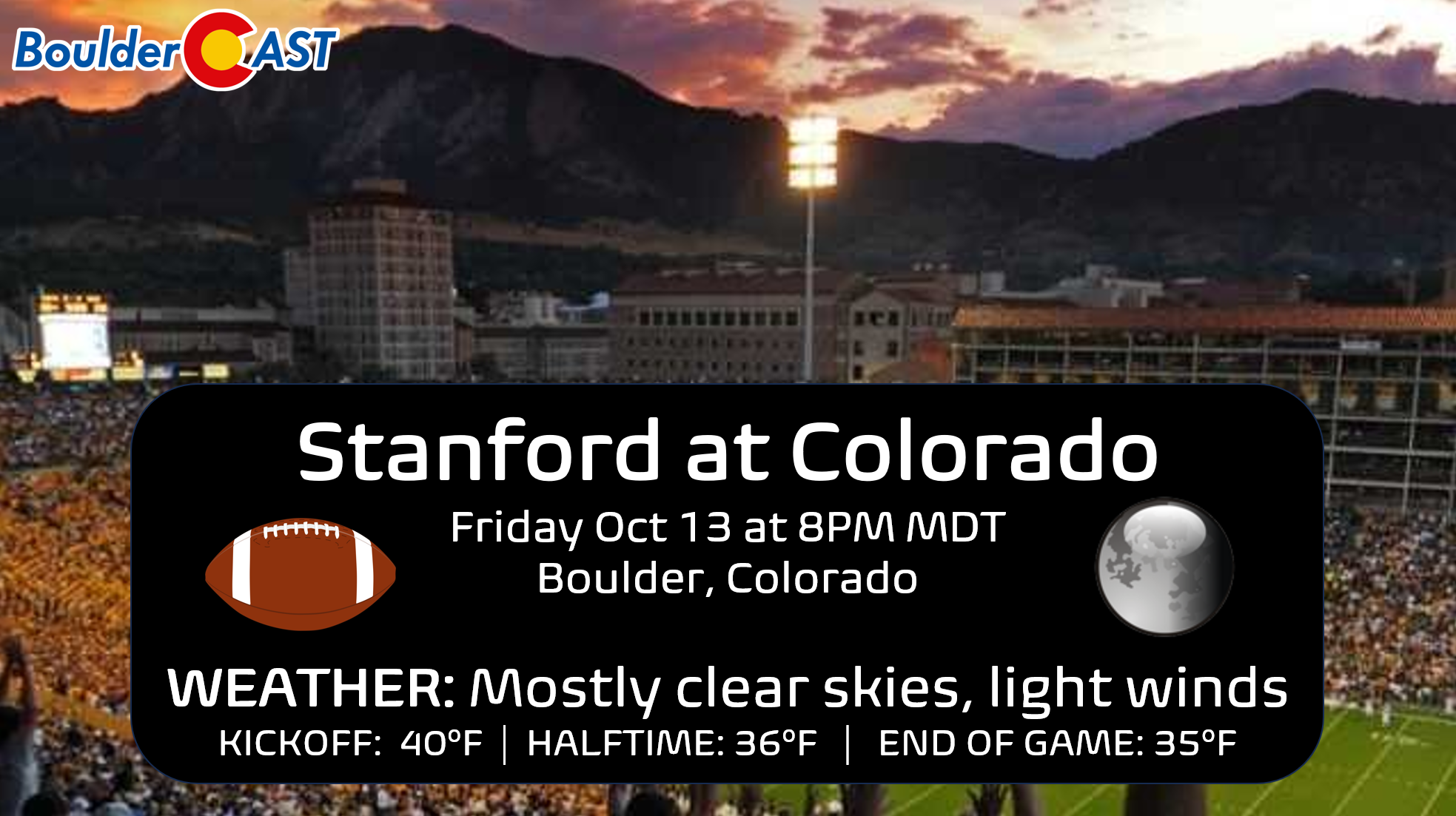
- The Colorado Buffaloes football game Friday night in Boulder begins at 8PM — there will be nice weather but cold with temperatures in the 30s throughout the game under clear skies
- The first hard freeze of the season is possible but is now looking less likely for the Metro area Friday night as high clouds will move in overnight
- The same clouds will be be around early Saturday morning, possibly impacting the view of the annular solar eclipse
Daily Forecast Updates
Get our daily forecast discussion every morning delivered to your inbox.
All Our Model Data
Access to all our Colorado-centric high-resolution weather model graphics. Seriously — every one!
Ski & Hiking Forecasts
6-day forecasts for all the Colorado ski resorts, plus more than 120 hiking trails, including every 14er.
Smoke Forecasts
Wildfire smoke concentration predictions up to 72 hours into the future.
Exclusive Content
Weekend outlooks every Thursday, bonus storm updates, historical data and much more!
No Advertisements
Enjoy ad-free viewing on the entire site.
A cold Buffs game Friday night!
If you are headed out to watch the Buffs battle Stanford at Folsom Stadium Friday night here in Boulder, be sure to dress warm! Though the weather will be quiet overall in the wake of the big departing storm we had yesterday, it will be a cold game with kickoff temperatures likely to be around 40 degrees, falling into the middle 30s as the game progresses. Of course this is not nearly as bad what COULD transpire this time of year, but nonetheless don’t get left out in the cold without proper attire!
Plan on temperatures in the mid to upper 30s, largely irrelevant light winds and mostly clear skies during the game.
A freeze is possible Friday night, but it’s not a guarantee for everyone
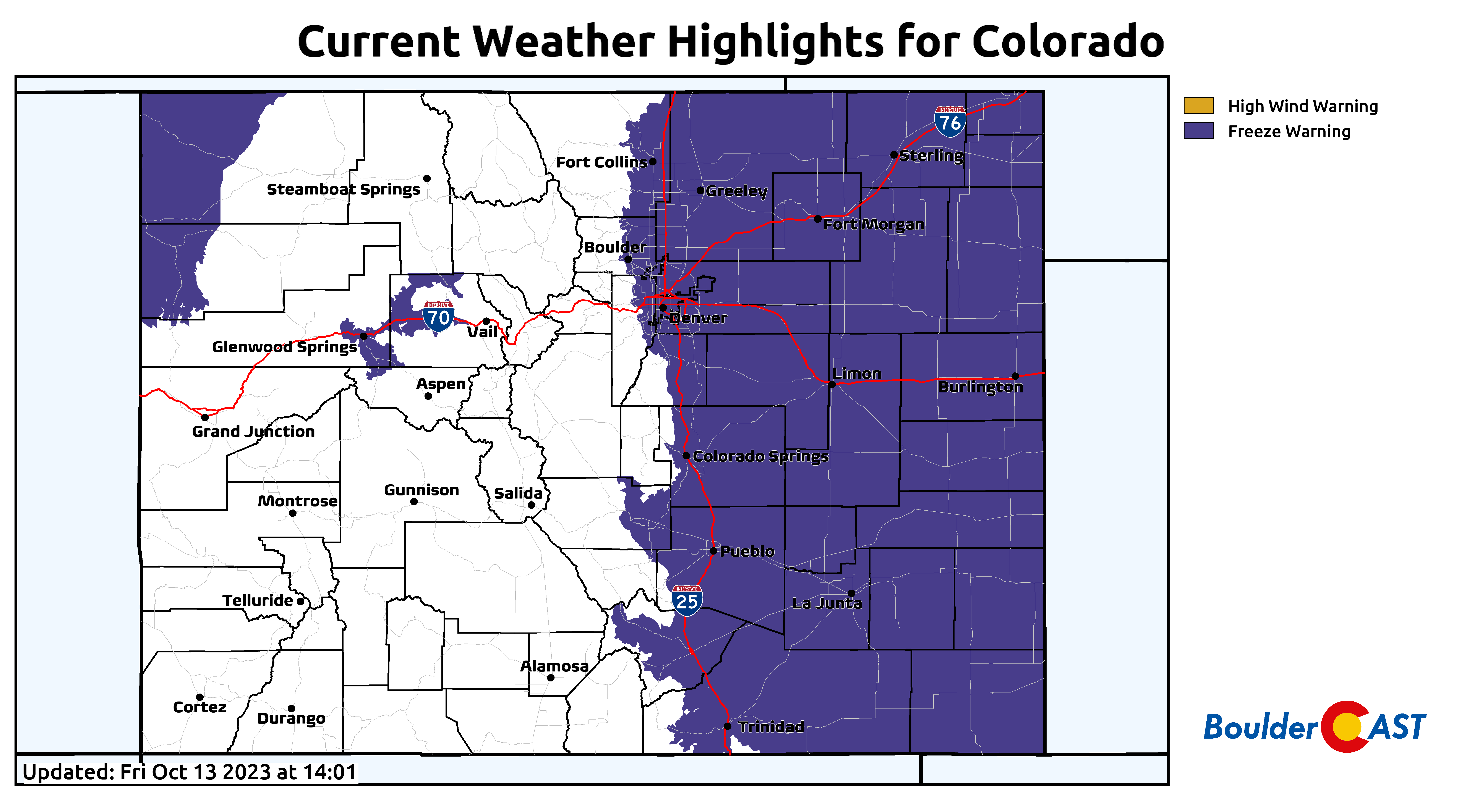
Despite Freeze Warnings being in effect for the entirety of eastern Colorado below 6000 feet elevation, it now appears less likely that a full-on freeze will occur Friday night in the Denver Metro area. Recent model runs have backed off somewhat on just how cold it will get Friday night into Saturday for us.
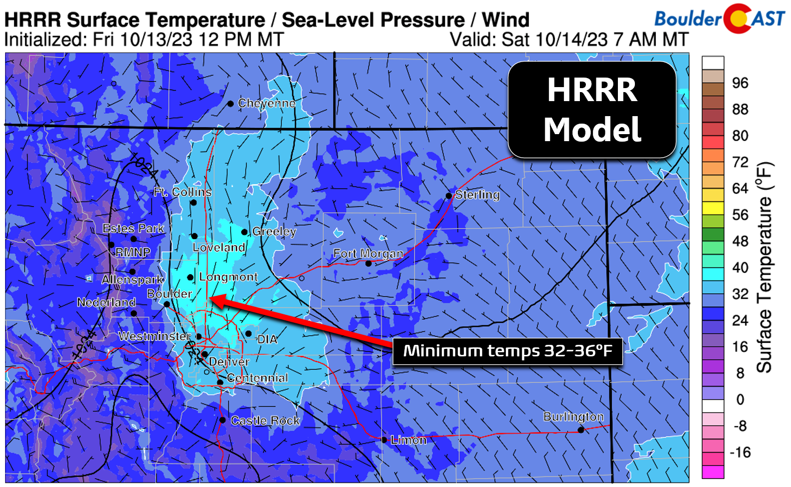
Below are the temperatures forecast for 7:00 AM Saturday from two short-range models which are both struggling to generate temperatures below the 32°F mark in the Denver Metro area. The HRRR model bottoms out between 32 and 36°F in most areas. This would be similar to the overnight low temperatures we saw Friday morning.
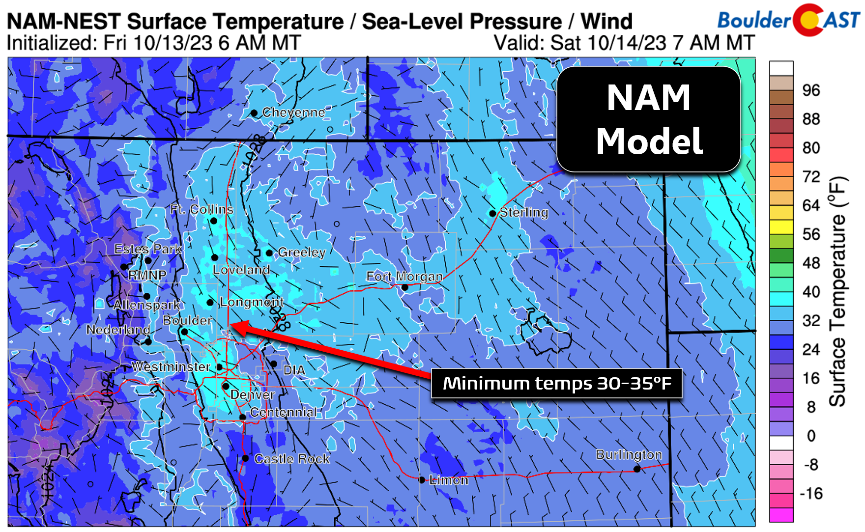
The NAM model is a tad cooler overall, but still it shows minimum temperatures ranging from 30 to 35°F, coldest in outlying and slightly higher elevation parts of the Metro area.
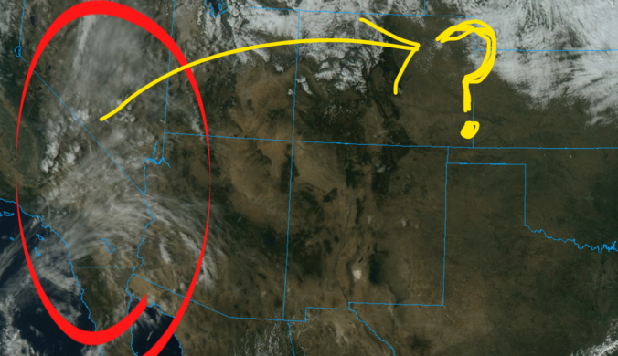
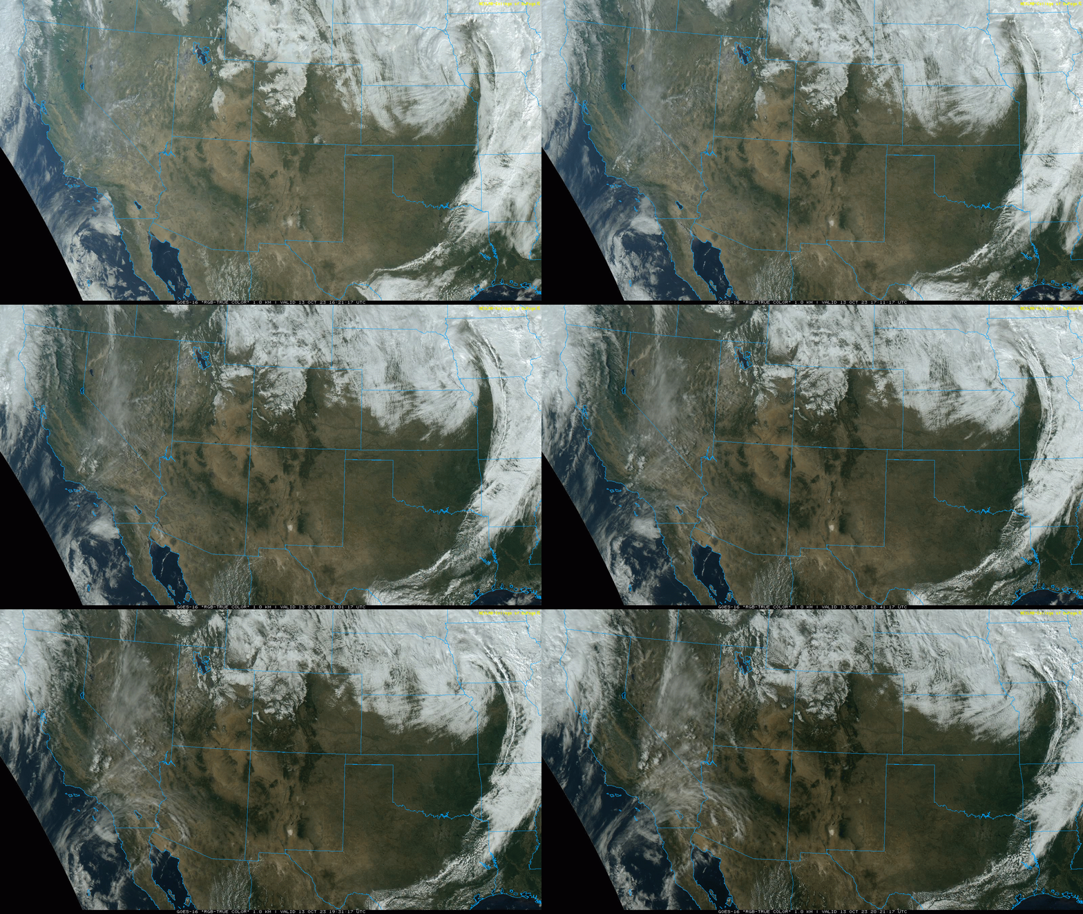
So why the sudden shift towards marginally warmer temperatures tonight? Well, it seems the models are starting to latch on better to a batch of mid and high-level clouds which just came ashore into California Friday afternoon. They are forecast to arrive into our area overnight, roughly around 3AM, and then linger into the morning hours. Though the clouds are higher up in the atmosphere and rather wispy, they will impact the amount of radiational cooling we see in the wee morning hours keeping us a couple degrees warmer overall. There may also be light winds coming off the terrain overnight (5-10 MPH at times) which would also have a warming effect. When the potential freeze was already so marginal, these few degrees of warming may end up making all the difference!
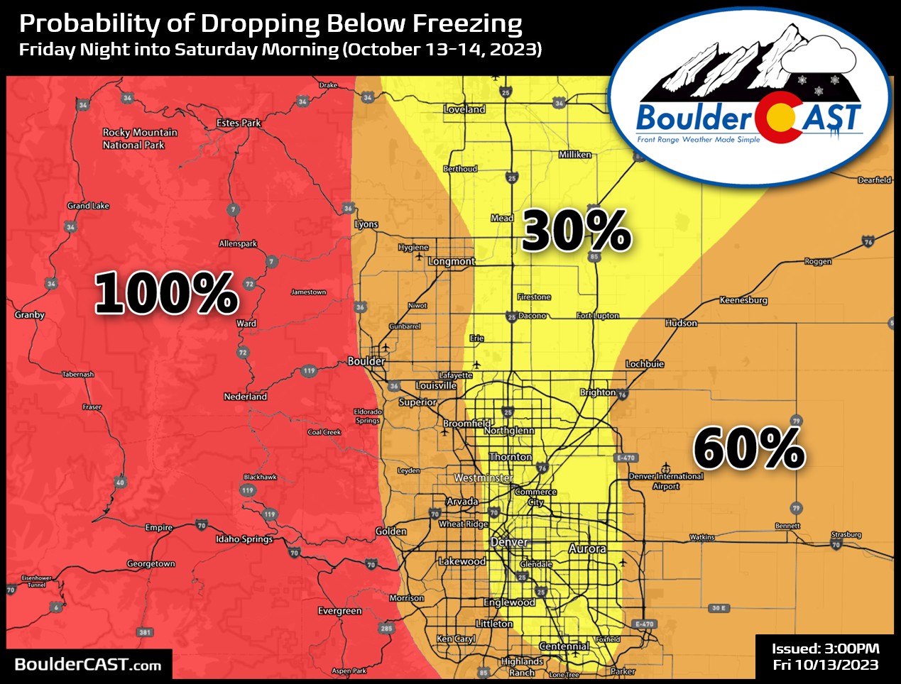
Overall the odds of a hard freeze Friday night into Saturday morning have decreased in time but don’t let your guard down fully. Yes, it does seem that a portion of the area may be spared a true hard freeze tonight…..with several hours of below freezing temperatures now seemingly less likely. However, it’s generally a coin flip or better for sub-freezing temperatures in most locations. Prepare as if there will be a freeze, but don’t be surprised if your location comes out okay!
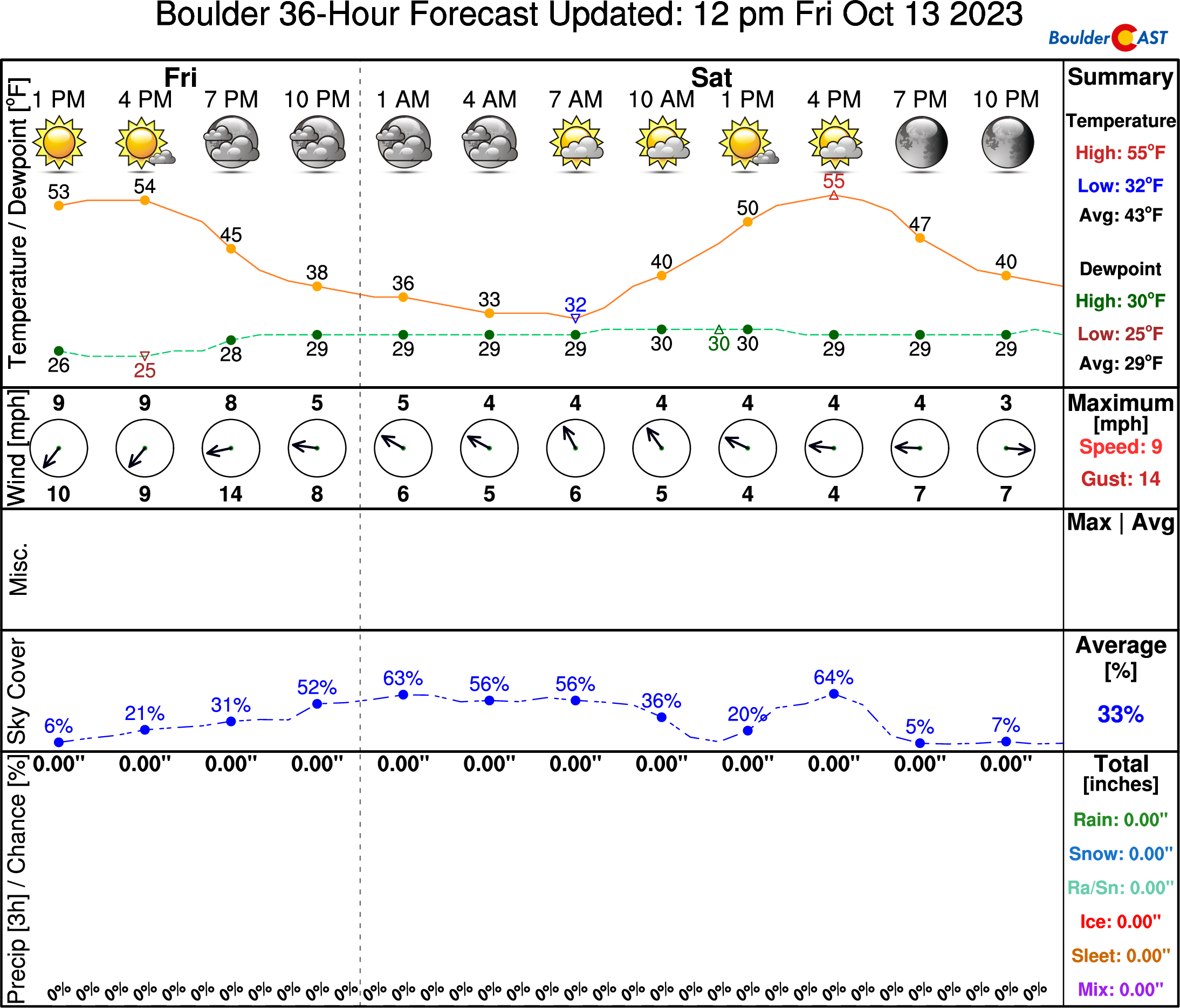
Our latest NowCAST forecast for Boulder has a minimum temperature Friday night of 32°F, freezing on the dot (and one degree colder than it was Friday morning).
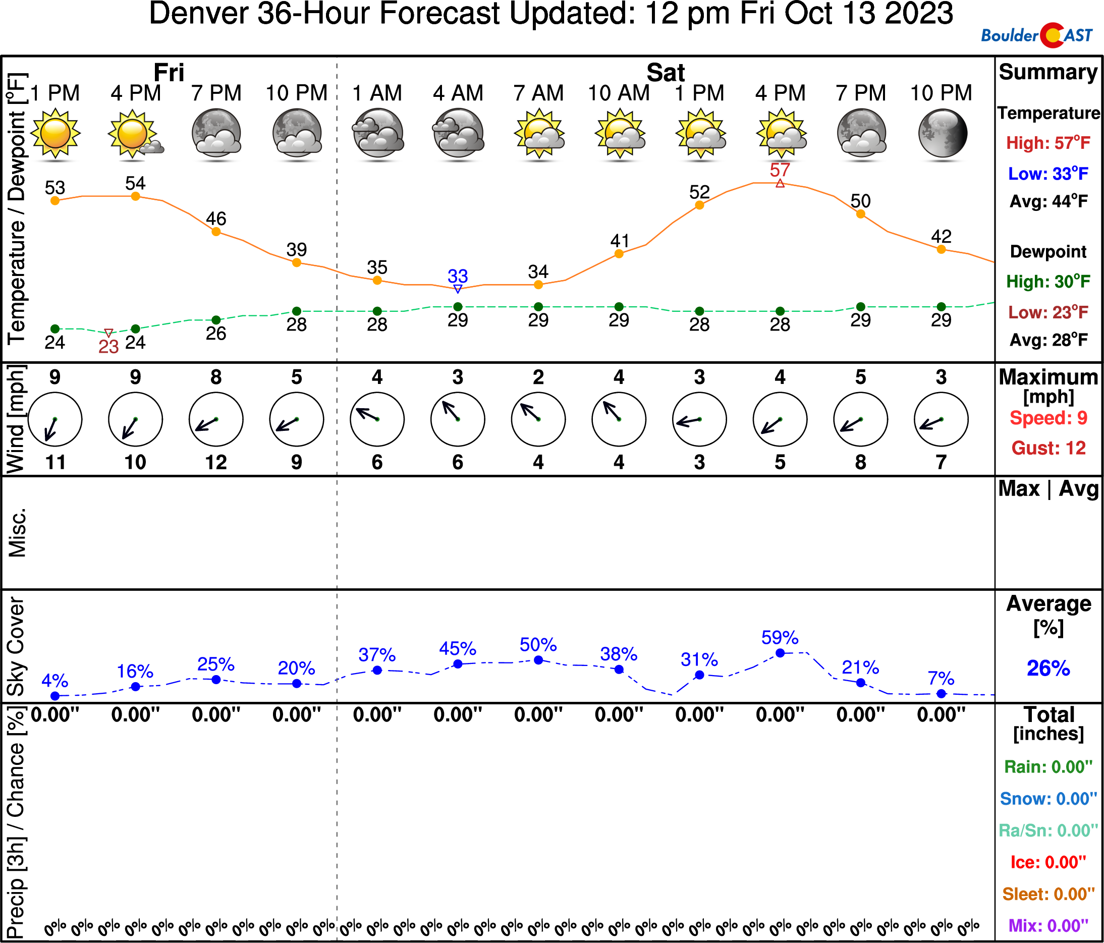
In Denver, it is a very similar 33°F:
Despite the odds of sub-freezing temperatures having waned somewhat, there will certainly still be frost everywhere tonight so plan accordingly! We also recommend draining or insulating any above ground and exposed pipes to combat any brief jaunts below freezing in your area. No need to fully blow out any irrigation systems as they will be fine for now, well-insulated at depth in the relatively warm soil. Not blowing things out is especially important as the week or two ahead look rather dry in our neck of the woods.
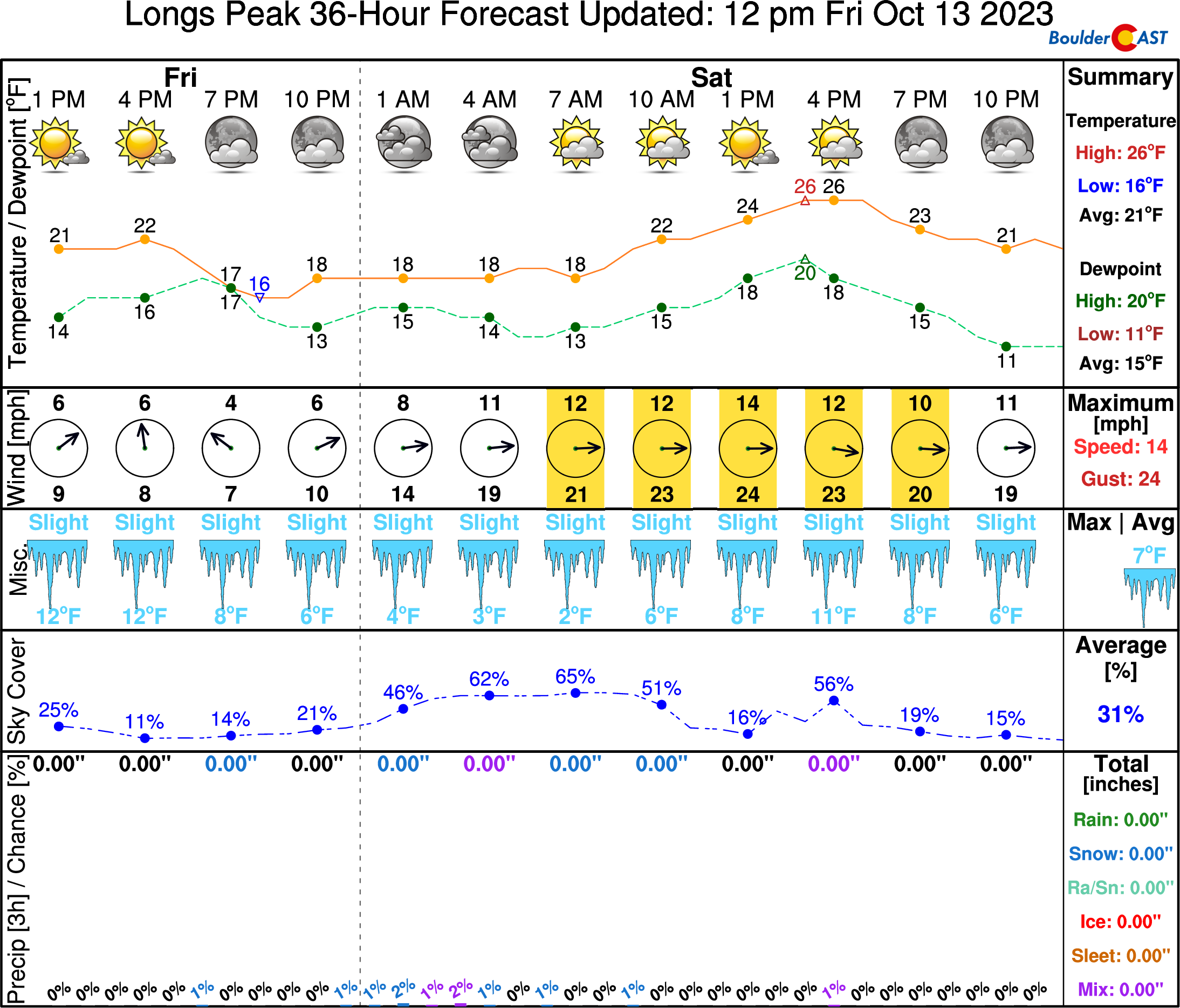
Of course, there is place that it will definitely be below freezing Friday night — the summit of Longs Peak!
Clouds may lessen the view of the annular eclipse Saturday morning
While not quite as spectacular as the total solar eclipse that we (almost) witnessed here back in August of 2017, a rare annular solar eclipse will be viewable from the Denver area Saturday morning as the Moon partially obscures the Sun for around a three-hour period:
- Eclipse Begins: 9:14 AM Saturday
- Peak Eclipse: 10:36 AM Saturday, with 85% of the sun obscured
- Eclipse Ends: 12:06 PM Saturday
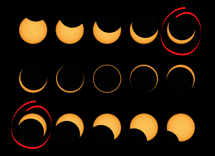
The best viewing for this eclipse this time is across far southwest Colorado where the complete annular solar eclipse will be visible like a ring of fire around the moon’s silhouette. Here in the Denver area, we’ll see just 85% of the sun get blocked out which would appear like the red circled views below — basically like a cookie with a large bite in it. Not quite as stunning as the real deal, but still something worth checking out nonetheless!
In any case, we should still be able to see something Saturday morning, regrades of how many of those wispy high clouds are still lingering during the morning hours. The clouds should be gone or at least be diminishing as the eclipse unfolds. Even if they aren’t, they will be wispy enough to be able to see the eclipse through them, at least intermittently. Enjoy and don’t forget this IMPORTANT REMINDER….it is not safe to look at this eclipse with the naked eye!
Get BoulderCAST updates delivered to your inbox:
Enjoy our content? Give it a share!




You must be logged in to post a comment.