
The first real storm of the season is heading towards Colorado, but unfortunately it will track too far north limiting the overall impacts to the Denver Metro area. While the Mountains are poised to receive plenty of snow from this system, the lower elevations will see just a little bit of rain alongside gusty downslope winds. In the wake of the storm, temperatures are expected to drop below freezing Friday night bringing an end to the growing season for many plants. Let’s take a look at the latest timing of the rain and snow and discuss the drastic change in temperatures headed our way!
Key Messages:
- The first strong storm of the season will move across the central Rockies in the coming days but its impacts in the Denver Metro area will be limited due to an unfavorable track
- Widely scattered thunderstorms are possible Wednesday afternoon and evening as we see one last warm day in the 70s
- Much cooler, gusty and overcast with light rain possible on Thursday for the lower elevations with heavy snow up to a foot possible in the Mountains
- The storm clears out Friday with sunshine returning but temperatures staying cool in the 50s
- As the storm exits, temperatures will drop to near or slightly below freezing Friday night into Saturday morning, possibly ending the growing season for many plants

Go Premium, get all the perks.
Daily Forecast Updates
Get our daily forecast discussion every morning delivered to your inbox.
All Our Model Data
Access to all our Colorado-centric high-resolution weather model graphics. Seriously — every one!
Ski & Hiking Forecasts
6-day forecasts for all the Colorado ski resorts, plus more than 120 hiking trails, including every 14er.
Smoke Forecasts
Wildfire smoke concentration predictions up to 72 hours into the future.
Exclusive Content
Weekend outlooks every Thursday, bonus storm updates, historical data and much more!
No Advertisements
Enjoy ad-free viewing on the entire site.
Swing and a miss!
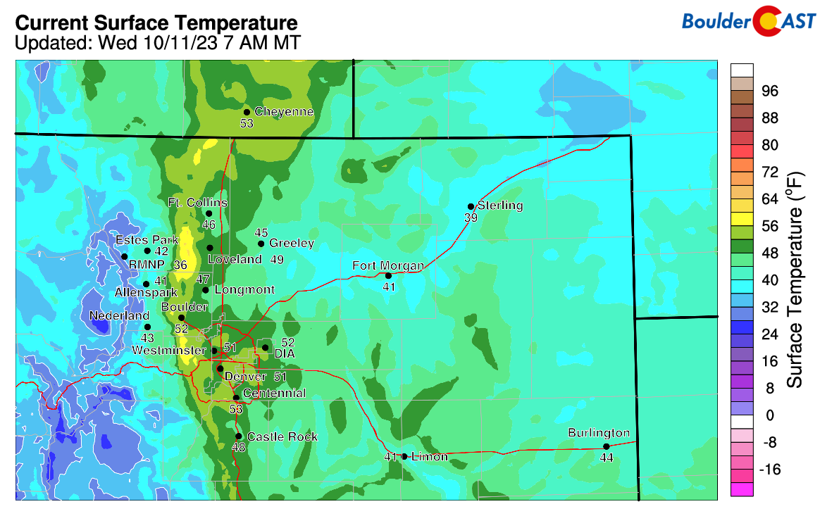
We’re starting out rather mild on this Wednesday morning with temperatures in the low to middle 50s across the Denver Metro area. This “warmth” is thanks to an uptick in downslope flow ahead of the approaching broad trough and also the development of lee wave clouds above the Front Range overnight.
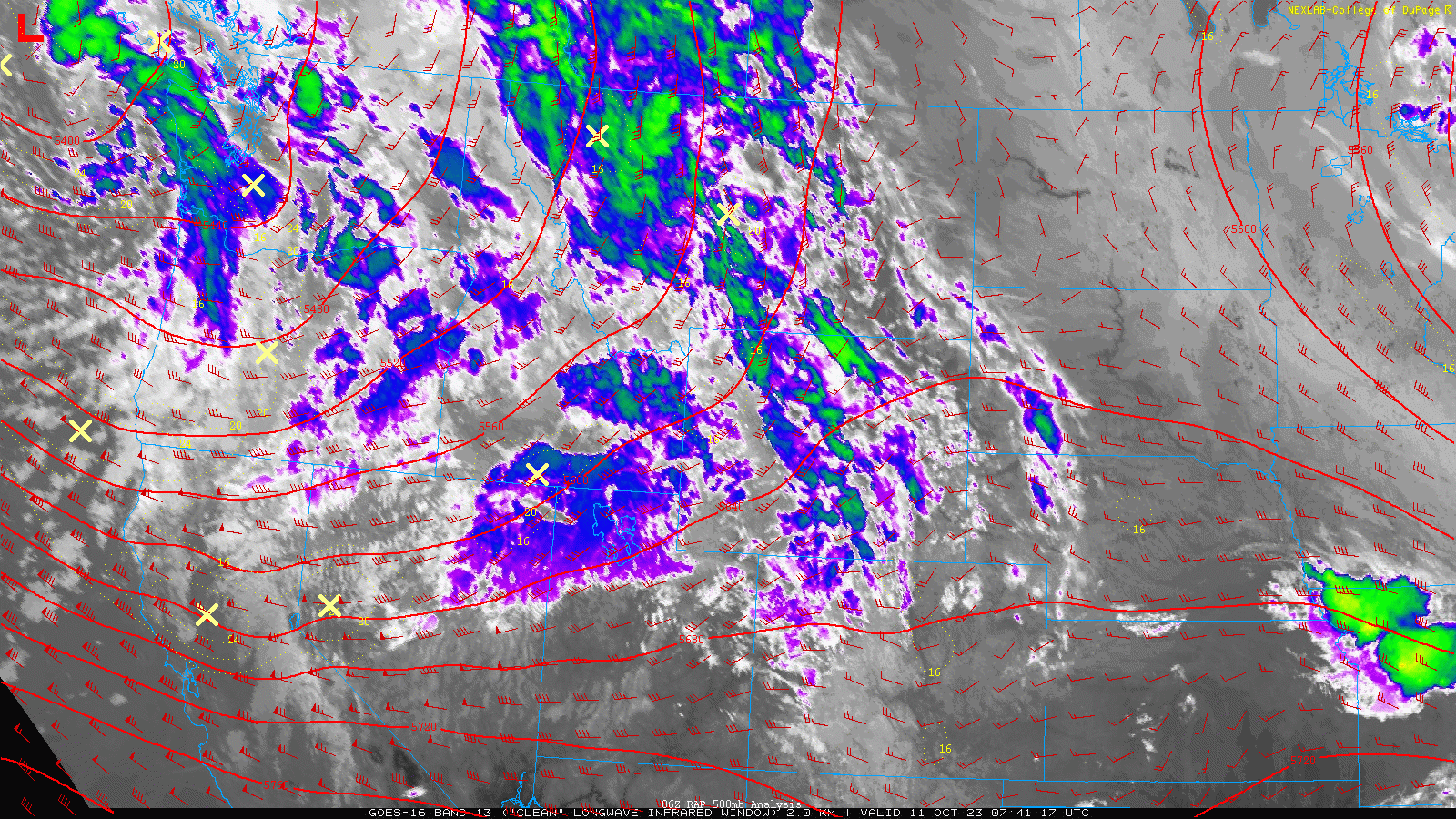
The approaching storm system and the wave clouds can be seen in the GOES-East infrared satellite animation from this morning below:
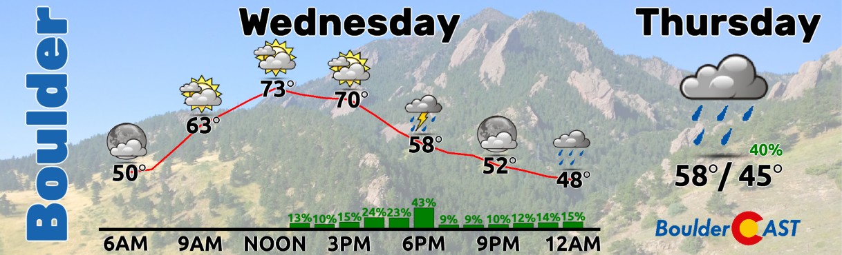
Through the day we will see lots of clouds passing through in the west-southwest flow, as well as the development of a few widely scattered thundershowers this afternoon and evening. The chance of rain in our area really isn’t exceptional on Wednesday due to the limited forcing and overall downslope flow, but keep an eye out this afternoon and evening ahead for some brief gusty showers here and there with a few rumbles of thunder mixed in. After the wonderful weather we had the last few days, high temperatures in the Metro area will be somewhat cooler under mostly cloudy skies only reaching the lower 70s on Wednesday, with perhaps middle 70s in areas that see more sunshine.
We now have good consistency in the models which have zeroed in on that more northern solution for the track of the approaching storm. The center of the closed low will move southeastward over the next 36 hours from Washington into Nebraska, passing almost directly over Cheyenne in the process. With this, the best easterly upslope flow will stay across Wyoming, with mostly just northwesterly downslope flow here in the Denver area.
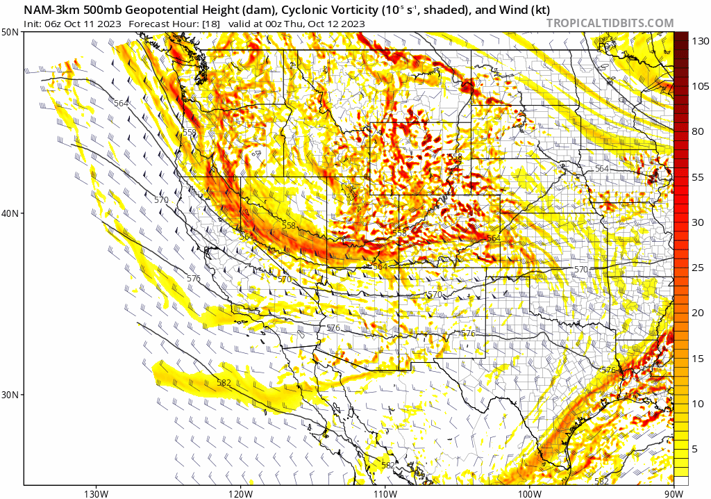
A better look at winds on Thursday around midday at 10,000 feet elevation are shown below, clearly indicating the downslope “problem” with the situation at hand. With this track and resulting wind field, we will have a tough time getting much precipitation as it passes, but there will be plenty of wind.
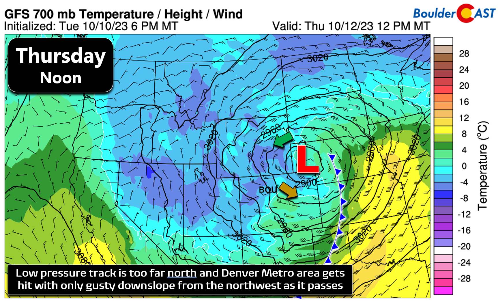
After the convective activity dies down late Wednesday evening, there will be a break in the action overnight. Thursday morning the chance of rain returns as the low pressure moves into position across southeast Wyoming. Still we are going to be under the gun of downslope during this time so we’re not too optimistic that our area will see much in the way of rainfall.
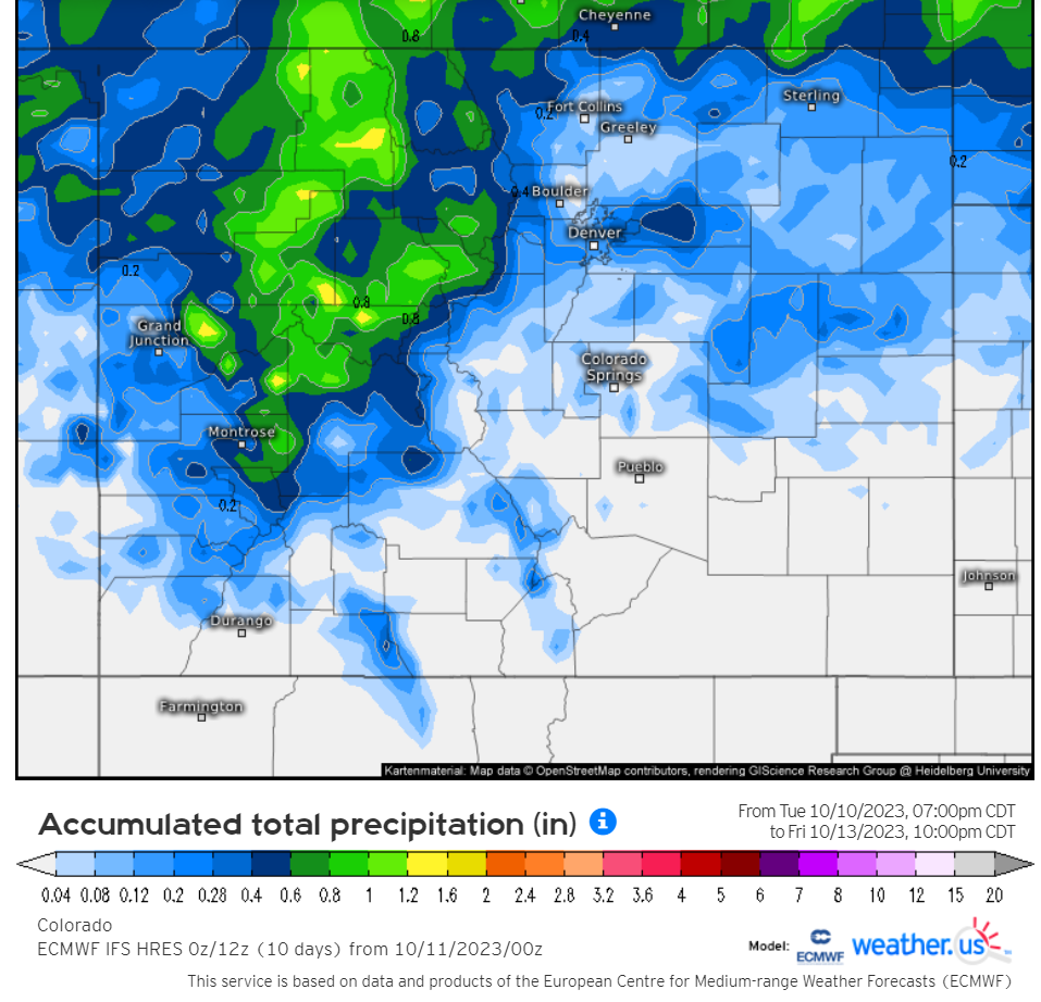
Overall models have backed off a tad on precipitation potential for our area the next few days as the northern track has been further fleshed out. Both the GFS and Euro (shown below) are indicating less than 0.25″ of rain for the entire Denver-Boulder area. Realistically we may very well end up below 0.1″. Amounts fall even further off the cliff for places south of Interstate 70.
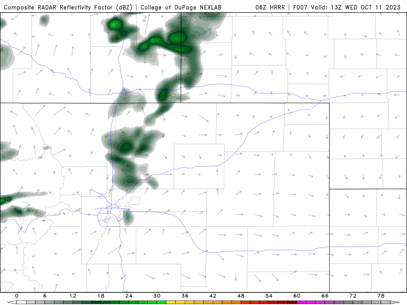
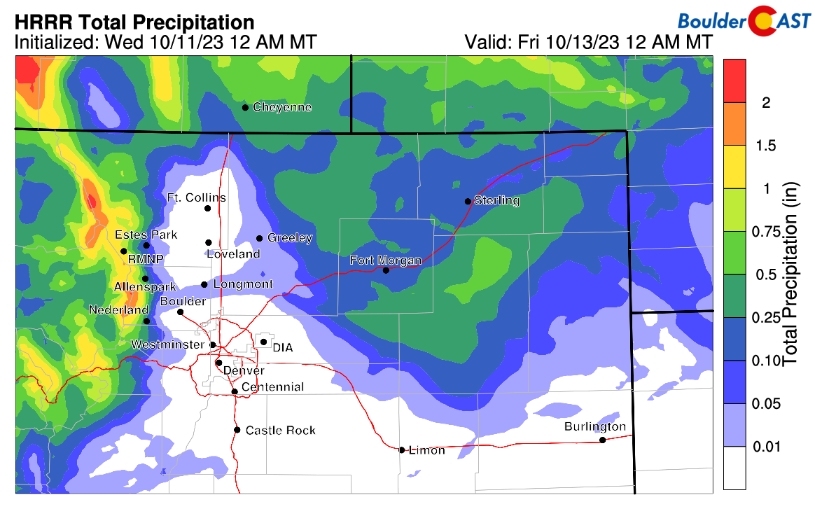
You really don’t want to know what the HRRR model is predicting for us now, but we’ll shown that anyways — yes it has barely a trace of rain for us at the moment!
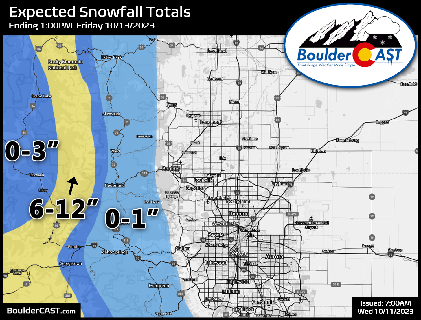
The more northern track will also limit how much cold air filters southward into Colorado. While it initially looked like there might be an outside chance of a few snowflakes mixing in for the lower elevations, that is definitely no longer the case. However, the same northwest flow that is spoiling the party in the Metro area will make for perfect conditions for orographic snow up in the Mountains. Areas along and west of the Continental Divide will see several inches of white stuff, with more than a foot possible in northwest flow-favored locations near Steamboat and Rocky Mountain National Park. This storm is probably the one that closes Trail Ridge Road for the season. There may be a tad of spillover along Peak-to-Peak Highway, but only an inch or so is expected there with perhaps up to 3″ just to the west, including for places like Indian Peaks. Plan on winter driving conditions if you are heading over the passes, especially on Thursday and Thursday night. Our snowfall forecast map for this wintry event is shown below covering all snow through Friday morning. Once again we reiterate, NO snow is expected for Boulder or Denver, or really anywhere below 7500 feet elevation. Thus, our 2023 First Snowfall Contest continues…
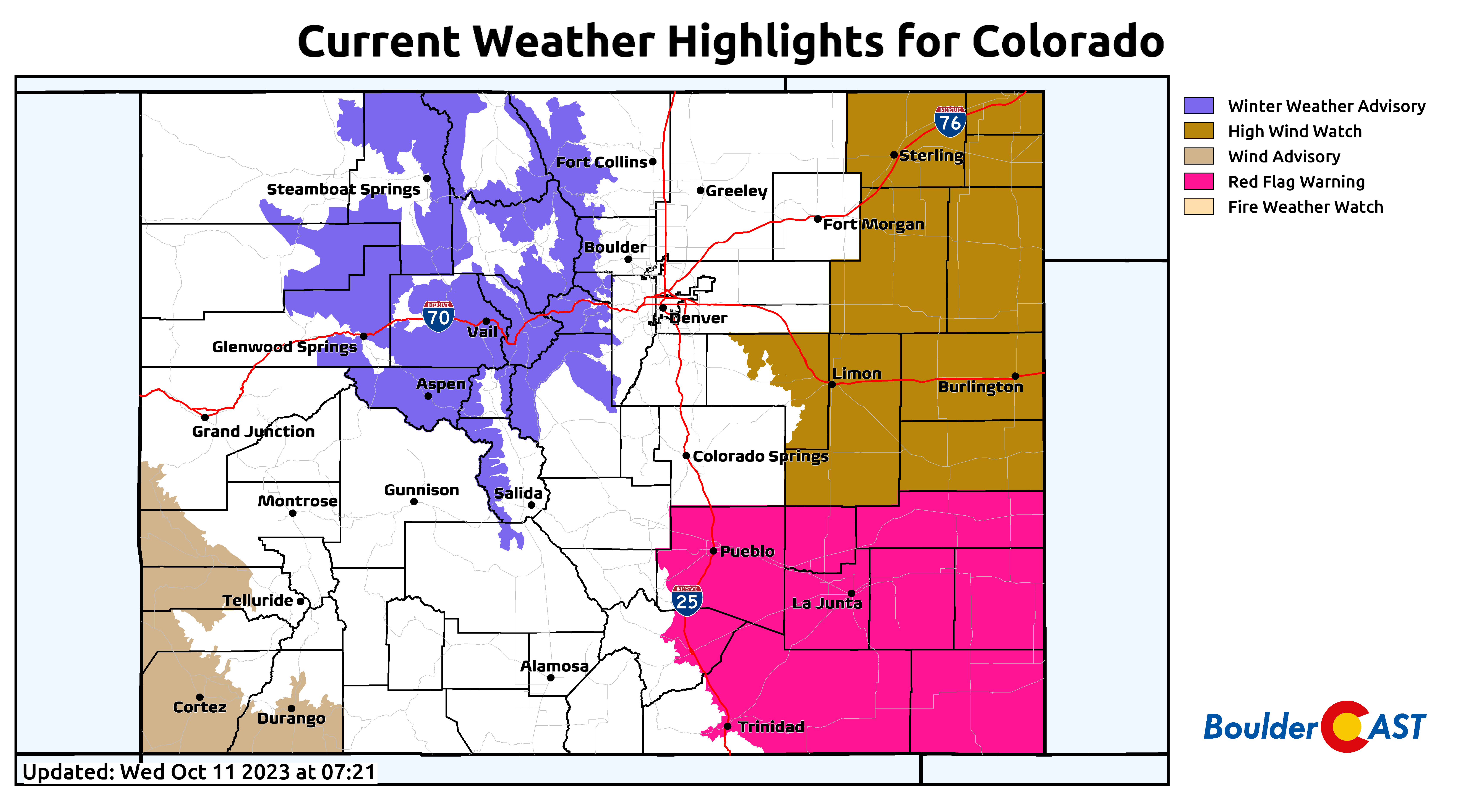
Winter Weather Advisories are in effect for the northern and central Mountains, with wind and fire-related highlights for the lower elevations to the east — this is a very typical threat setup for when a strong storm misses us just to the north.
As the storm departs the area on Friday, skies will clear out making for a sunny but cool end to the week for us with highs in the 50s. Depending on when the clouds vacate and if the winds die down, we could see some frost Friday morning, but that doesn’t look terribly likely right now. Friday night temperatures will for sure plummet under clear skies down towards and slightly below freezing across the lower elevations. Right now it looks like our area will bottom out between 29 and 33°F Friday night which would be enough to end the growing season for many plants. If you have a chance on Wednesday when it is still warm to partially or fully winterize your home and gardens, you should definitely take it!
Get BoulderCAST updates delivered to your inbox:
Enjoy our content? Give it a share!


You must be logged in to post a comment.