We provide a final forecast update as rain and snow descend on the Front Range with an updated snowfall forecast map.
Forecast is looking okay, though uncertainty remains
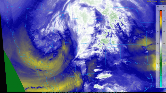
We had hoped that by this morning the models would have gotten their act together and actually agreed on a forecast for our region. However, that is definitely not the case. Here is what we are seeing now in the models:
- The GFS: The warmest and wettest model. Still projecting a minimum snow level of around 6,500 feet tonight. This predicts all rain for the Plains.
- The NAM: The coldest and driest model. The NAM brings snow levels down to encompass all of the Denver Metro area Friday night. However, it really likes the downslope solution into the region and barely produces any snow with all that cold air. What a waste!
- The Euro: The Euro is somewhere in between. It’s definitely colder than the GFS, but still temperatures would only be marginal for snow on the Plains. Liquid amounts are just slightly less than the GFS.
The net result, as you can see, is a bit of a forecasting conundrum, especially for “who gets what” in terms of snowfall. We still believe this will be a 0.5 to 1.0″ precipitation event for the Boulder area, with potentially higher amounts in the higher Foothills. Snow levels will thus be the main concern.
Here is our forecast timeline for the storm:
- All models agree that the Front Range will be locked into the dry-slot of the storm for much of the day Friday. Expect morning sun giving way to increasing thick clouds with temperatures reaching into the 50’s during the day.
- However, by late afternoon and early evening, showers and a few thunderstorms should begin to form across our region as the atmosphere moistens up and more favorable lift arrives. During this time, these heavier storm cells could produce brief heavy rain and snow across the region.
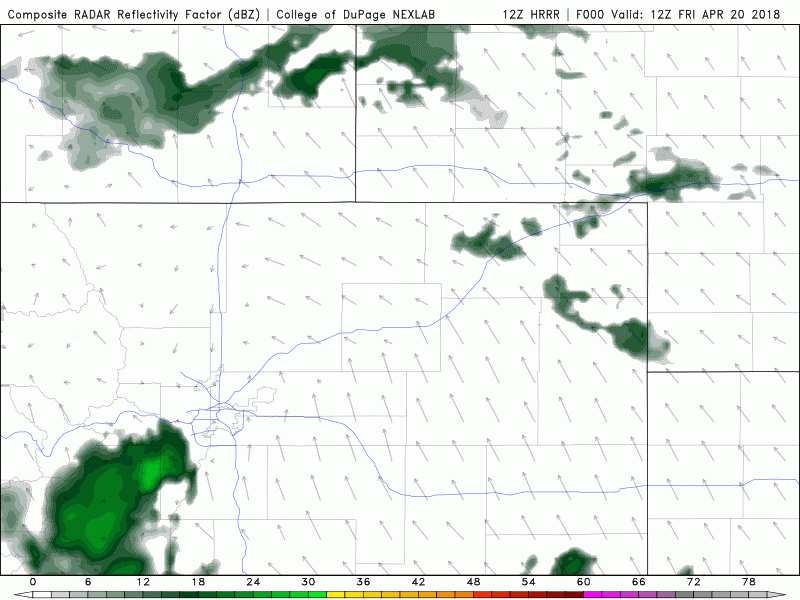
HRRR model simulated reflectivity for Friday through midnight.
- After the initial wave of heavier precipitation, we’ll switch to more of a light and persistent upslope event. Light precipitation will continue generally west of Interstate 25 through the night. Snow levels will initially be above 8500 feet, but as flow turns from southeasterly to northeasterly this evening, snow levels will drop down below 6500 feet by midnight.
- We do think the lower elevations have a chance to see very minor snow accumulations with rain mixing with snow through the night. Everything is still very warm and we don’t foresee accumulations exceeding an inch or two on grassy surfaces.
- Models do show precipitation continuing into Saturday afternoon as lingering upslope and wrap-around moisture push into the Front Range with the storm winding down. Snow levels will go back up again as the sun rises, so this will keep things rain in Boulder during the day with light snow in the higher Foothills.
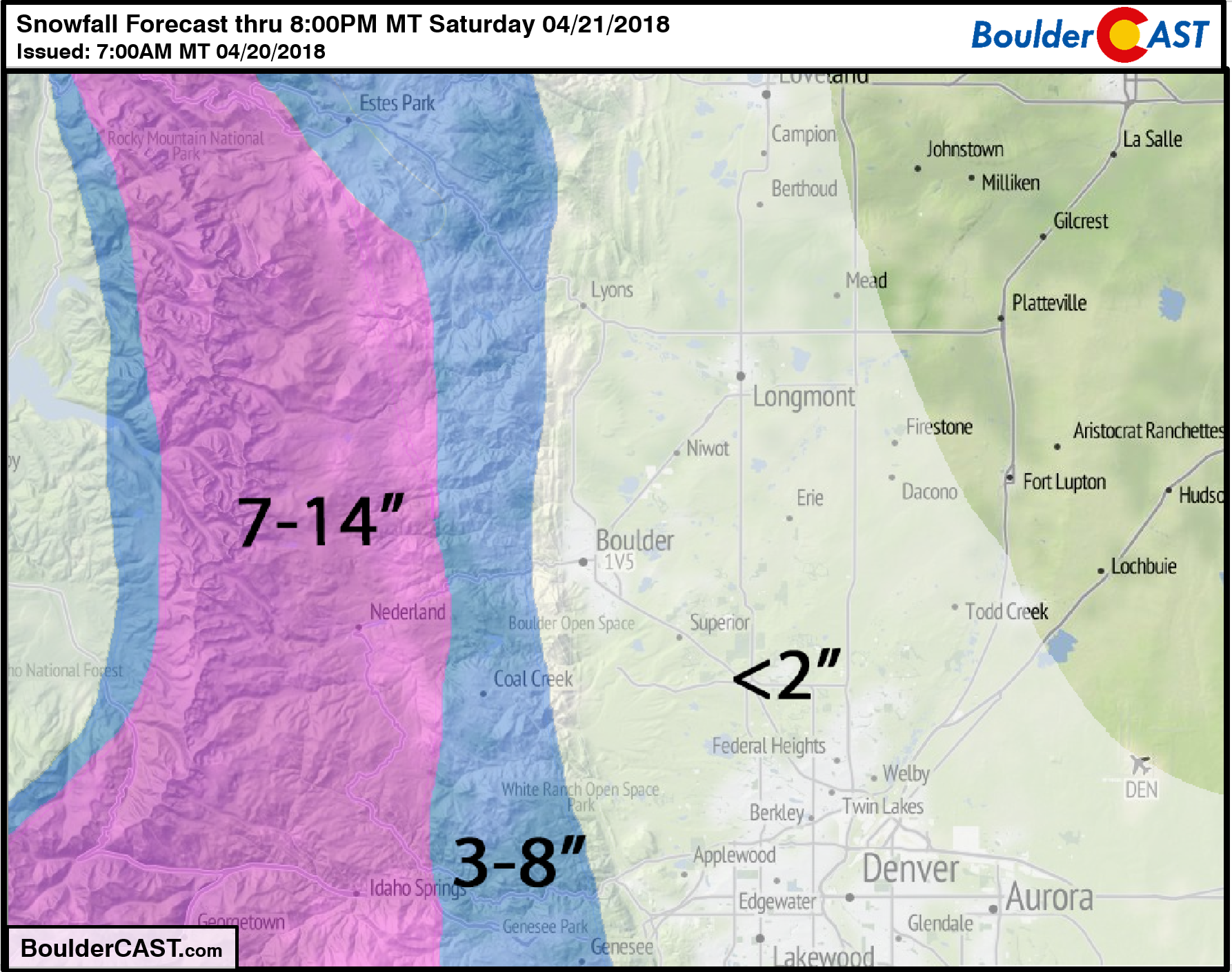
The largest uncertainty in snow amounts is for areas between 5500 and 7500 feet elevation where the temperature discrepancies in the models will matter most. Shown below is our updated snowfall forecast map. We have made only minor changes. This will be a 24-hour event for our area. Don’t expect the snow to fall all at once…this includes snowfall in the higher elevations all the way into Saturday evening.
The impacts across the lower elevations will be minimal, just gloom and chilly temperatures mostly. We don’t expect any travel concerns on the Plains. The moisture will benefit us all, though.
We’ll likely have an additional storm update out later today for our Premium members. Stay tuned!
Tropical snow?
It’s not just snowing in Colorado’s mountains today….Winter Storm Warnings are also posted for the summits of Mauna Loa and Mauna Kea on the Big Island of Hawaii. Despite being located well south of Miami, Hawaii is no stranger to snow. In fact, both of these volcanic peaks are higher than 13,600 feet elevation and normally have snow accumulation several times per year.

Active weather alerts for the southern portions of Hawaii.
A combination of a stalled remnant frontal boundary and deep moisture is contributing to flash flooding and heavy snow across our island state. The GFS precipitable water anomaly map below shows the spike in moisture across the region. NWS-Honolulu is forecasting 6-12″ of snow above 12,000 feet elevation by this evening.
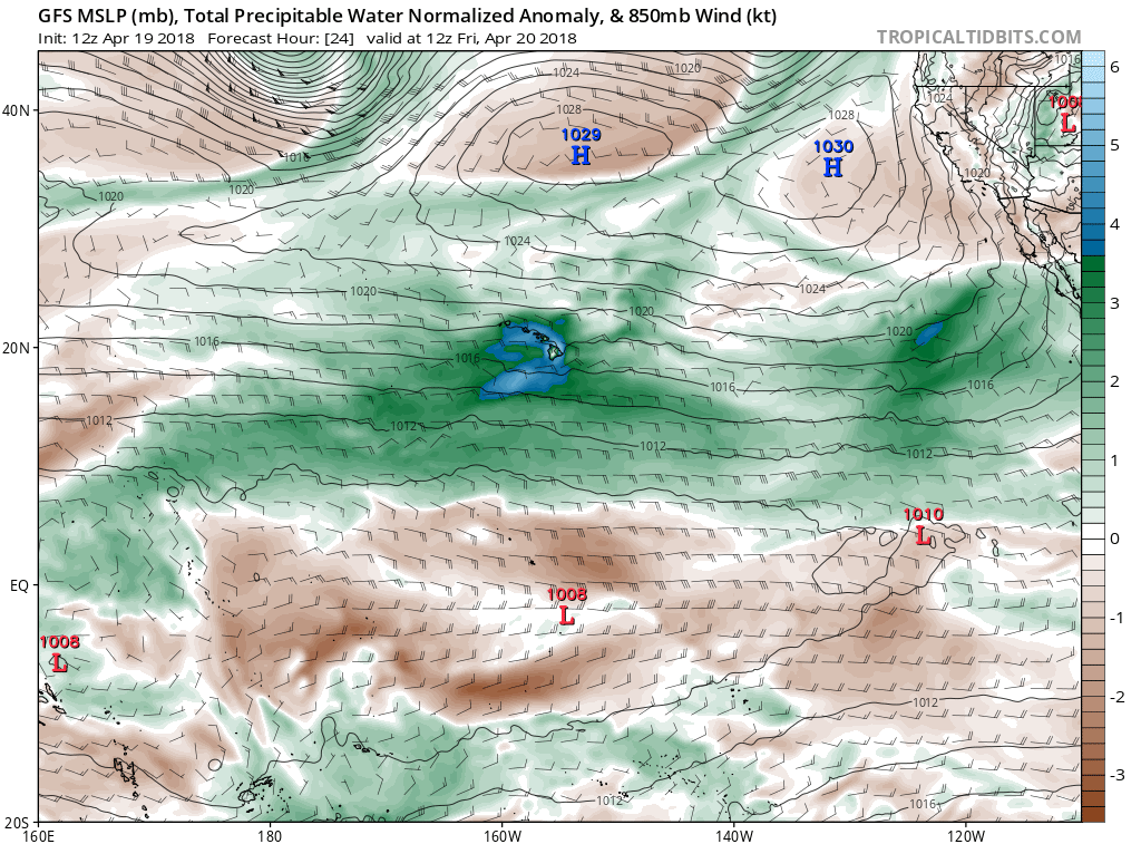
GFS pressure and precipitable water anomaly forecast map for the Central Pacific region this morning.
Hawaii truly is an amazing state from a weather perspective, don’t you think?

High altitude view (maybe from space?) of Hawaii after a recent snow storm on Mauna Loa and Mauna Kea.


You must be logged in to post a comment.