
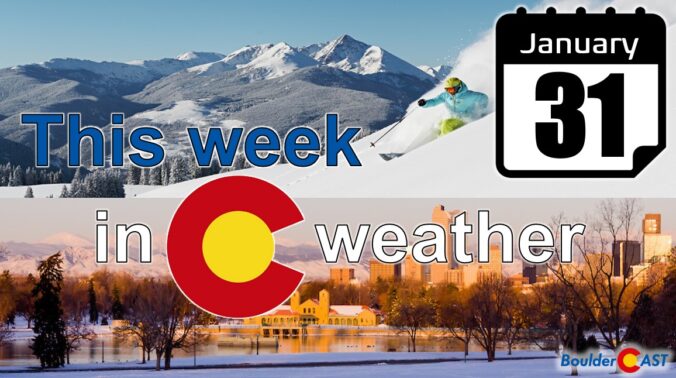
The tide may finally be starting to turn with the ongoing drought it seems. January 2022 was one of Boulder’s snowiest with two and a half feet of snowfall reported during the month. It was also the first month to conclude with colder than normal temperatures since May of last year. Here’s a quick and colorful graphical recap of our weather during January and how it relates to climatology.
Category: Winter Weather (Page 60 of 139)
These posts contain some discussion of the white stuff, whether it be mountain snow pack or a Front Range snowstorm.

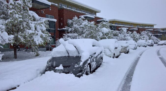
As of Wednesday morning, the heaviest snow is now behind us, but this snowstorm is not completely over and done with yet. We review the snow totals so far, discuss how much more to expect through the day, and take a look at what is shaping up to be the coldest night of the season ahead.
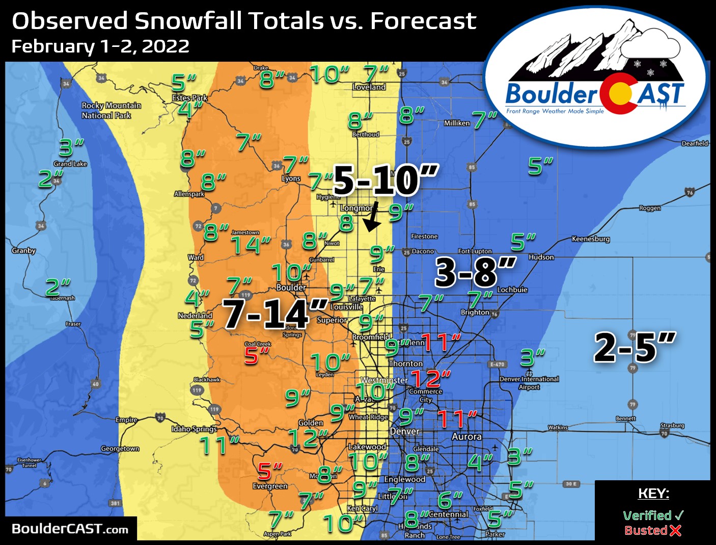
A slow-moving winter storm will impact the Front Range Tuesday through Thursday bringing accumulating snow and bitter cold temperatures to the entire area. We expect the most snow to fall in the city of Boulder and nearby Foothills with lower amounts in Denver. Nonetheless, travel impacts will be widespread and temperatures will bottom out below zero as the storm pulls away on Thursday. Let’s talk timing and look at our snowfall forecast map.
Premium Storm Update (2/1/22 7:00AM): Overnight model runs have increased our confidence that higher-end snow totals will occur with this system. Thus we are bumping up snow amounts a tad across the area. We discuss the model changes and some things that still need to be watched closely as the snow begins Tuesday afternoon. READ HERE
The final day of what has been a snowy January will be quiet across the Front Range, but that all changes for the start of February as a significant winter storm takes aim on the region. Upslope favored areas like Boulder could very well see close to a foot of snow this week while parts of Denver will see much less. Some of the coldest air of the season will be moving in as well. We give our current thoughts on the incoming storm and our preliminary snowfall expectations. Quiet weather returns late in the week and for the upcoming weekend.
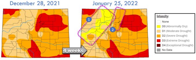
Adding in the few inches that fell on Thursday, Boulder has now notched nearly two feet of snowfall in the month of January, the most since 2014. This recent snow event was just one of many small winter storms to impact the Front Range in the weeks following the devastating Marshall Fire. Colorado has seen slight drought improvement, but there is definitely much more needed. In this update we discuss the recent snow totals, how January as a whole is shaping up, the locations that are seeing drought conditions improve, why La Niña will make further recovery more challenging and much more.
It’s already been Boulder’s snowiest January since 2014, but we’ll add to it on Thursday with another round of light snow moving into the area. We discuss the setup, timing, commute impacts and the expected snowfall amounts for the Front Range.
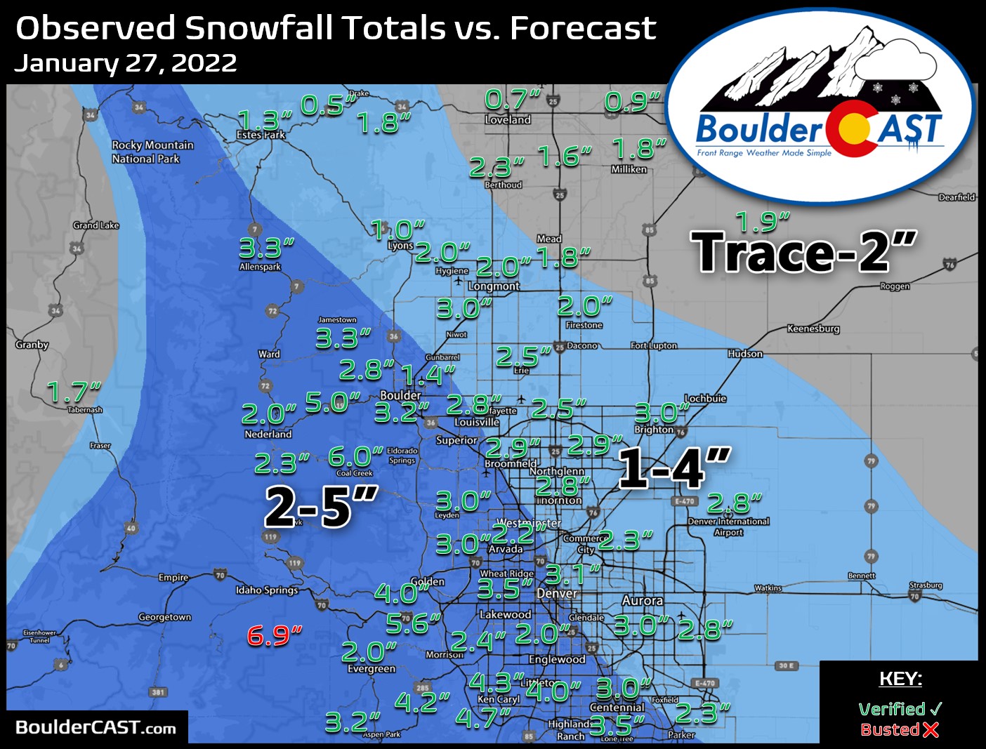
Premium Storm Update (1/27/22 6:00AM): We do a final check of the latest model runs which have all come into excellent agreement as snow begins to fall across the northern Front Range. We also discuss why some models were coming in lower yesterday. READ HERE

Live View of Boulder

Current Conditions

Live Radar

Recent Premium Posts

BoulderCAST Daily – Wed 06/03/26 | Scattered P.M. storms again as moisture peaks for the week
🌬️ Weak westerly flow aloft today with no major synoptic features nearby; only …
BoulderCAST Daily – Tue 06/02/26 | Storms Reload This Afternoon, But With Noticeably Less Bite
❄️ Monday delivered lots of hail to northeast Colorado, with one supercell tracking …
BoulderCAST Daily – Sun 05/31/26 | Dry and warm today but rain chances increase this week
🌦️ Overall dry and warm Sunday, though cannot rule out a very widely …
3-Day Forecast

Trending Content

© 2026 Front Range Weather, LLC
You must be logged in to post a comment.