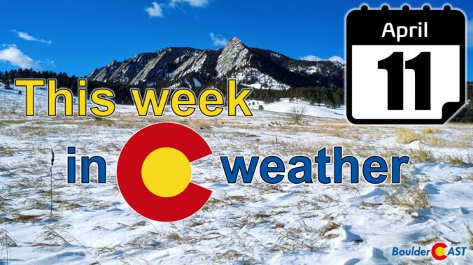
A strong storm system in the Pacific Northwest will intensify as it moves into the upper Great Plains and into Minnesota by midweek. This system will create periods of gusty winds, fire weather concerns, and frequent temperature swings for the Front Range, as well as heavy snowfall for the High Country. The same system may bring a few rain/snow showers Tuesday into Wednesday to the Denver Metro area, but these won’t amount to much. Read on for more details.
Category: Winter Weather (Page 56 of 139)
These posts contain some discussion of the white stuff, whether it be mountain snow pack or a Front Range snowstorm.

We’ve got a quick forecast update for you on this beautiful Friday afternoon. You probably have heard already, but it appears that snow will make a return to the Front Range next week— perhaps even in the form of a monster snowstorm if we play our cards right. Let’s take a look at this admittedly still uncertain forecast and what could potentially transpire next week across the area.
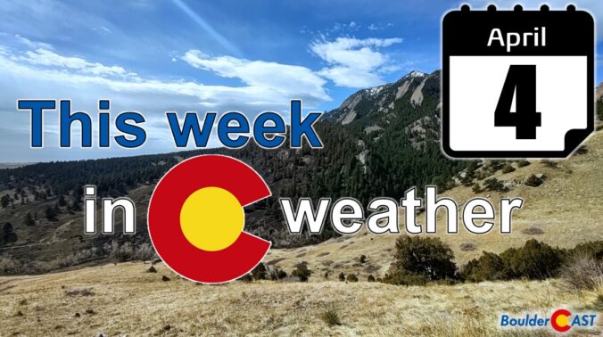
A strong low pressure system passing to our north will wrap in a potent jet stream to northern Colorado in the coming days. This will result in a period of Mountain snow, but to the east several days of strong downslope winds and high fire danger for the lower elevations. Read on for all the details of the weather week ahead.

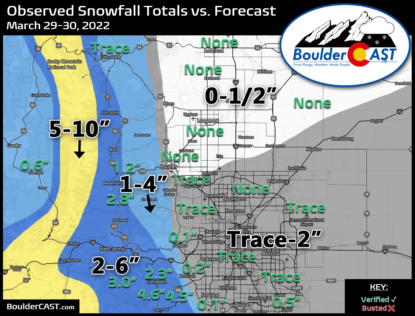
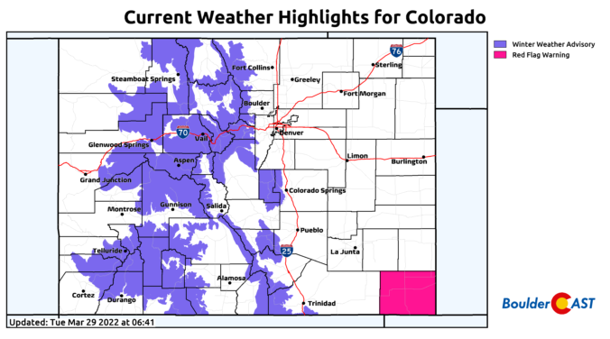
Though the weather pattern remained fairly active and snowy, March 2022 broke the short streak of months with above average precipitation in Boulder. The NCAR Fire, which sparked on the 26th, somewhat curbed the community’s positivity about the improving drought situation since the New Year. Here’s a quick and colorful graphical recap of our weather during March and how it relates to climatology.

⦁❶⦁ A wet storm system will spread rain, thunder and eventually some snow across the area today into tonight
⦁❷⦁ After highs in the 50s, a strong cold front blows through by early evening with tumbling temperatures and blustery northeast winds to 40 MPH
⦁❸⦁ Rain will change to snow during the mid to late evening, with that transition happening earlier in the Foothills and Palmer Divide
⦁❹⦁ Generally less than 1″ of accumulation is expected across the lower elevations, but several inches in the higher terrain

We start the week with near-record warmth with some locations reaching the lower 80s on Monday. That warmth vacates quickly come Tuesday with a strong storm system and associated cold front moving through. Rain and some thunder will change to wet snow Tuesday night. Another system approaches late in the week but its rain/snow potential looks much lower than the former storm. Read on for all the details of the weather week ahead.
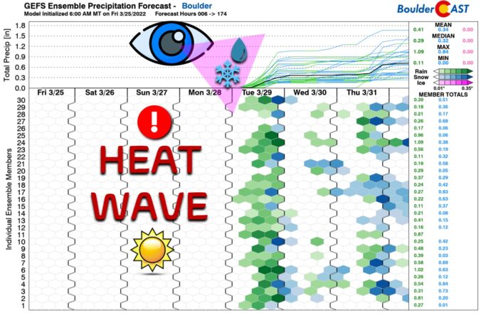
Absolutely gorgeous weather is taking shape for the weekend ahead with temperatures forecast to soar towards to the 80-degree mark in the Denver area. A few of these days could be record-setting for the region! As always, the warmth does have a planned expiration date as the next spring storm system will arrive around Tuesday with rain, snow and colder temperatures in tow.

Live View of Boulder

Current Conditions

Live Radar

Recent Premium Posts

BoulderCAST Daily – Wed 06/03/26 | Scattered P.M. storms again as moisture peaks for the week
🌬️ Weak westerly flow aloft today with no major synoptic features nearby; only …
BoulderCAST Daily – Tue 06/02/26 | Storms Reload This Afternoon, But With Noticeably Less Bite
❄️ Monday delivered lots of hail to northeast Colorado, with one supercell tracking …
BoulderCAST Daily – Sun 05/31/26 | Dry and warm today but rain chances increase this week
🌦️ Overall dry and warm Sunday, though cannot rule out a very widely …
3-Day Forecast

Trending Content

© 2026 Front Range Weather, LLC
You must be logged in to post a comment.