
⦁❶⦁ A wet storm system will spread rain, thunder and eventually some snow across the area today into tonight
⦁❷⦁ After highs in the 50s, a strong cold front blows through by early evening with tumbling temperatures and blustery northeast winds to 40 MPH
⦁❸⦁ Rain will change to snow during the mid to late evening, with that transition happening earlier in the Foothills and Palmer Divide
⦁❹⦁ Generally less than 1″ of accumulation is expected across the lower elevations, but several inches in the higher terrain
Do you want the latest BoulderCAST Daily forecast discussion delivered to your inbox every single morning? If so, join BoulderCAST Premium where we talk Boulder and Denver weather every single day.

T
he unseasonably warm stretch comes to an end today for the Front Range as a trough of low pressure moves in from the west. This morning’s GOES-East infrared satellite imagery shows a closed low pressure in southern California with deep southwesterly flow out ahead streaming moisture and clouds into Colorado. Even though we are still technically in the warm sector of the storm today (it’s certainly a mild morning!), these thickening clouds will put a lid on our temperatures — they are expected to top out only in the 50s.
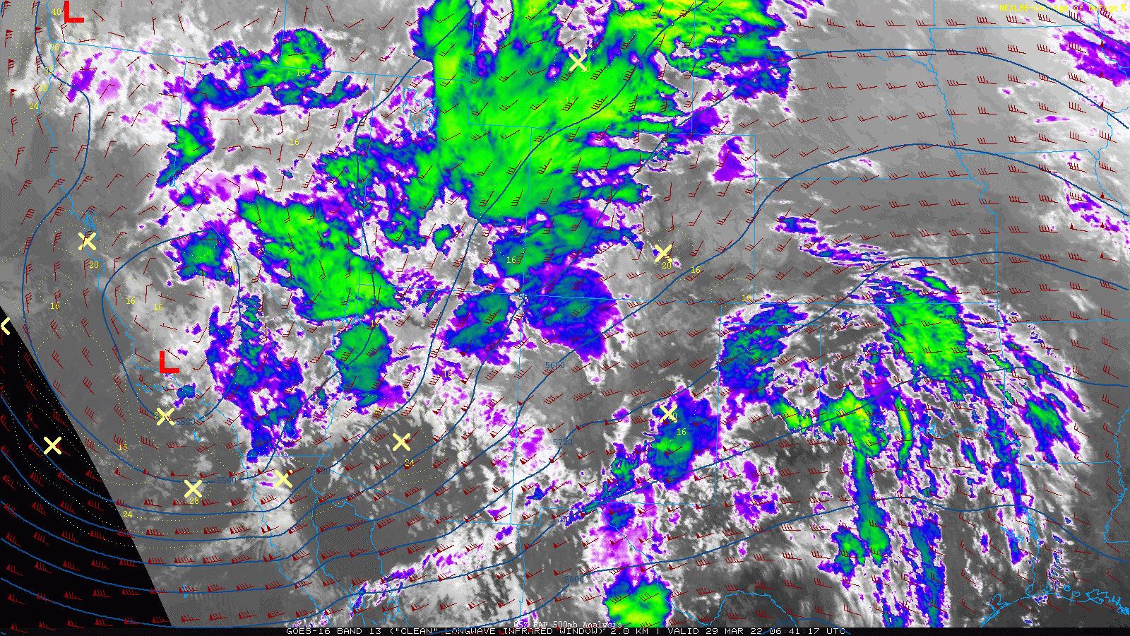
GOES-East infrared satellite animation from early Tuesday morning
The low pressure in southern California will move eastward across Arizona but will weaken by this evening. At the same time, a secondary low pressure is forecast form further north in extreme northeast Colorado near the Nebraska border during the afternoon. This is what we call a “Colorado Low”.
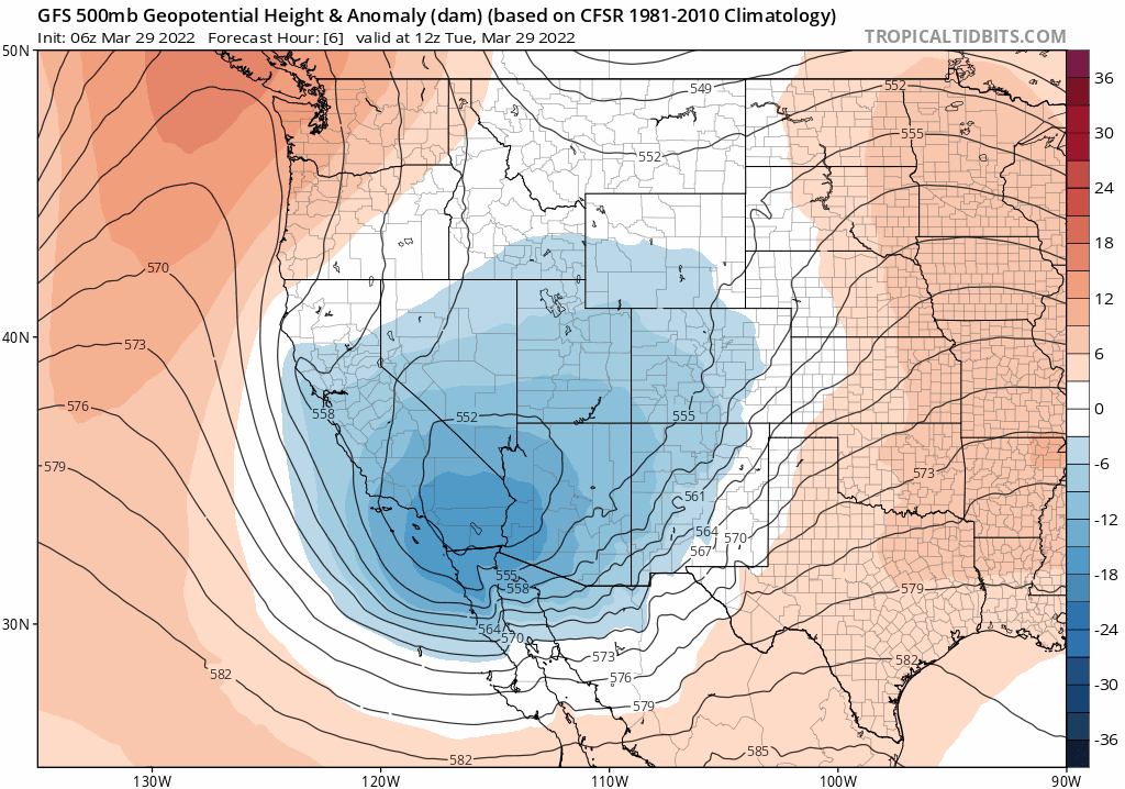
Southern track low weakens today but a new Colorado low develops closer to the Front Range
As this Colorado low deepens to our east, wrap-around upslope and a surge of colder air will get drawn in during the day and the evening spawning widespread showers across the area.
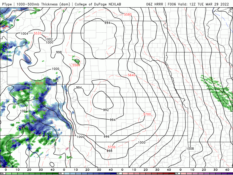
HRRR model-simulated precipitation type forecast animation from Tuesday morning into Wednesday morning
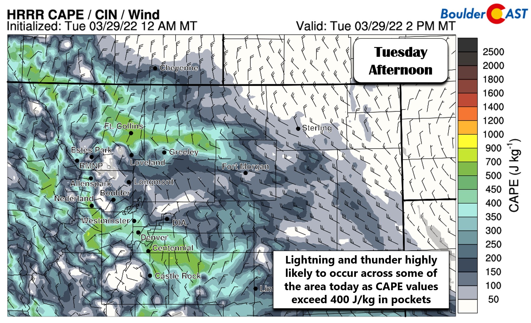
Additionally, the atmosphere will be flaunting some springtime instability this afternoon and evening which leads to high confidence that some rumbles of thunder will be observed across the Front Range today. CAPE values exceed 400 J/kg in spots this afternoon! Don’t be surprised to hear your first claps of thunder in 2022 today! Small hail will accompany any of the thunderstorms today as well.
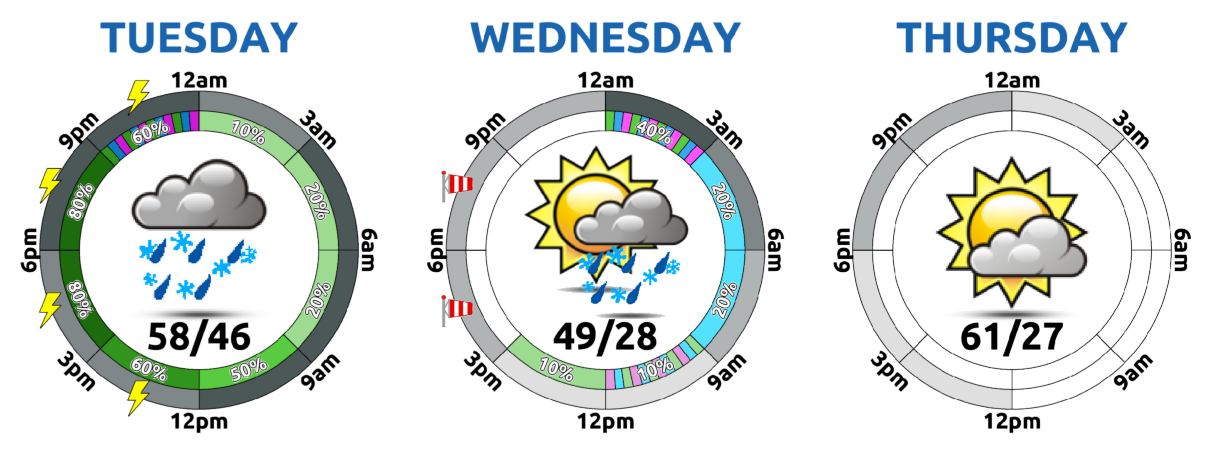
Rain will be possible in the Denver-Boulder area throughout the day, ramping up late morning and continuing into the evening. The main cold front currently is timed to arrive around the 4PM timeframe bringing rapidly dropping temperatures and gusty northeast winds up to 40 MPH. Most of the precipitation with this event will fall in the form of rain. The window for snow will be brief across the Boulder and Denver area — it really doesn’t get cold enough until the precipitation is almost over late this evening. In any case, the expected change-over timing is between 7PM and 11PM for the lower elevations. Under northerly low-level flow, areas from Boulder to Fort Collins will be warmest and the last to make that transition.
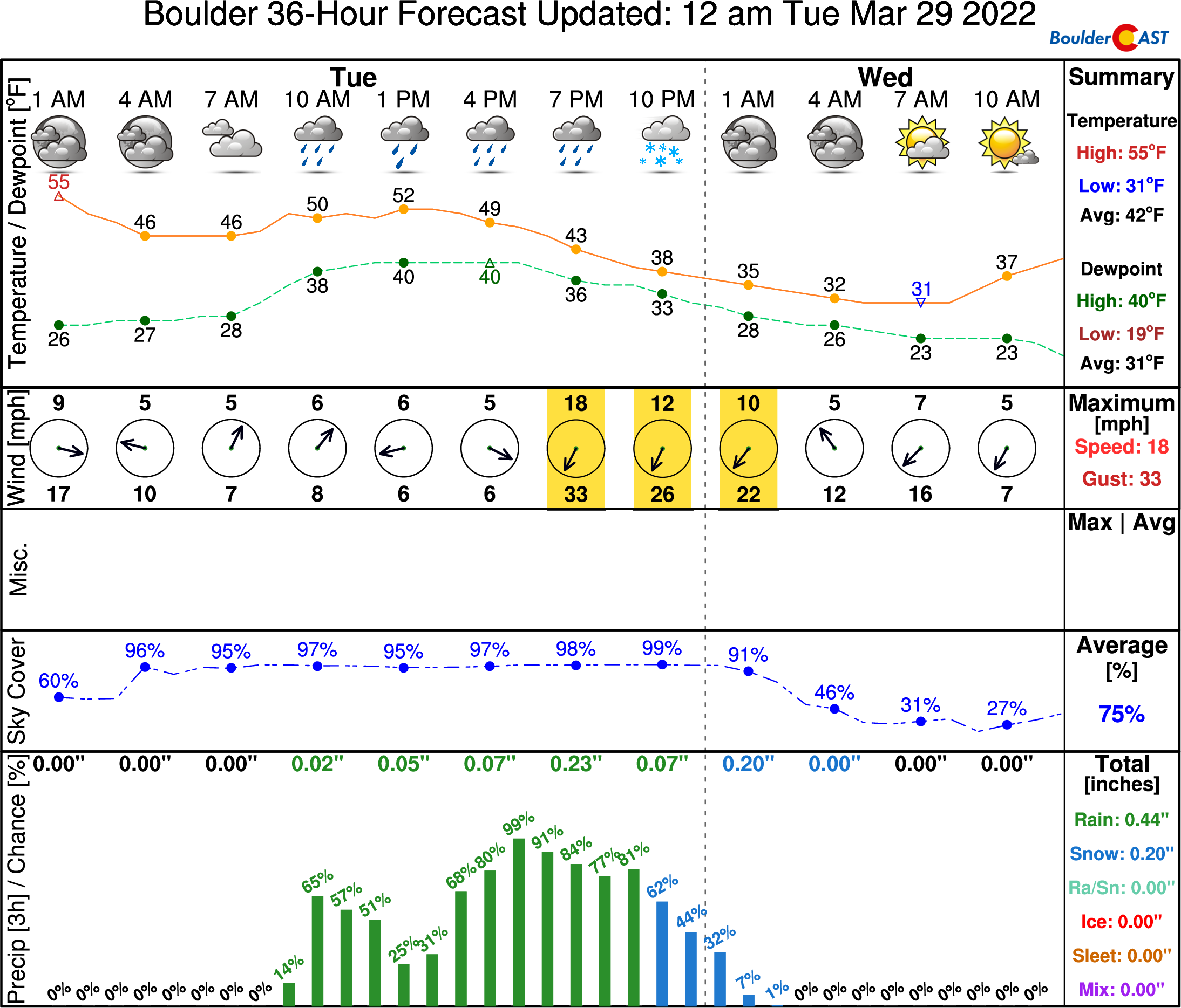
Because of the late change-over, the marginal near-freezing surface temperatures, and the very warm ground temperatures, we’re expecting minimal accumulation across the lower elevations — a dutsing to 1″ at most on the grassy surfaces. The higher elevations in the Foothills and Palmer Divide could see several inches of snow this evening with travel becoming difficult as strong winds combine with the falling snow. Our snowfall forecast map for the event is shown below. Clearly not a significant winter storm for the Plains, but watch out if you’re heading up Interstate 70 today or south over the Palmer Divide on Interstate 25 this evening!
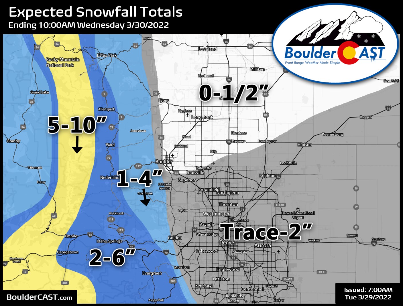
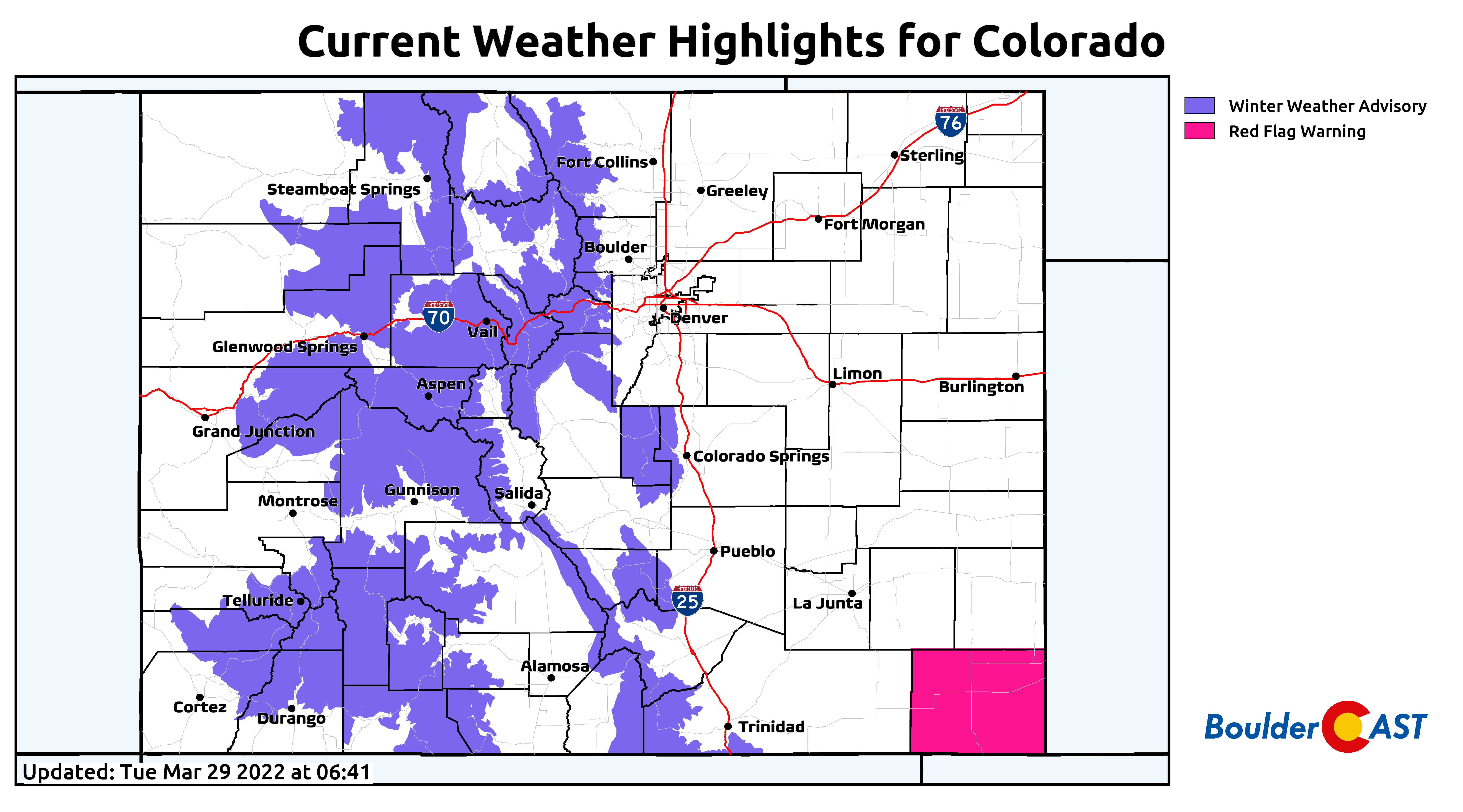
Winter Weather Advisories are posted for almost every single mountain range statewide. If you’re fixing to hit the slopes, tomorrow will be your day!
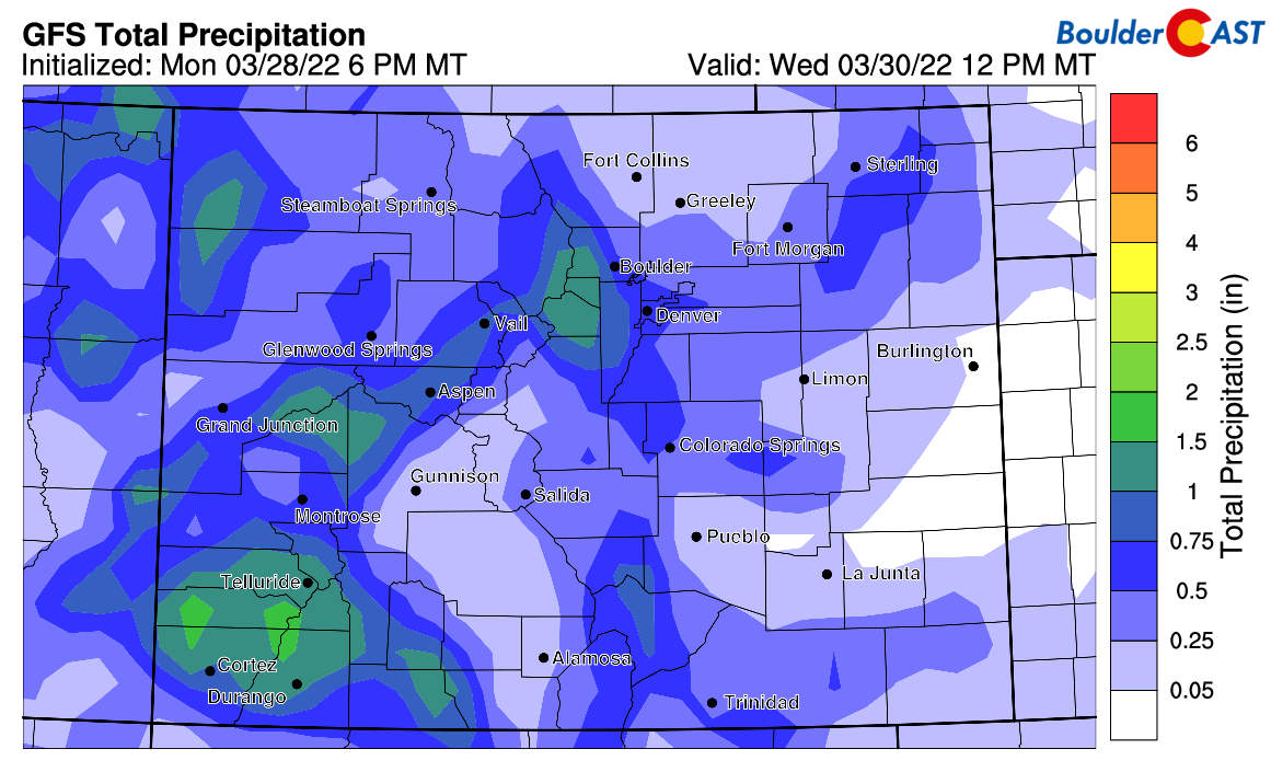
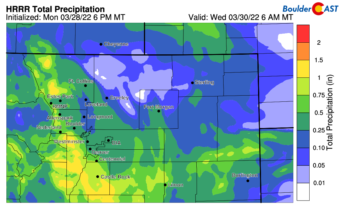
While this storm may not be a big snow producer for us, it will be packing plenty of juice. The GFS model is predicting a moisture bullseye of 1″ in the higher terrain west of town, with generally 0.25″ to 0.75″ falling in the Denver Metro area:
The short-range HRRR model is similar to the GFS with the 1″ bullseye noted over the Jefferson County Foothills (see below). Due to the convective nature of the showers through the day, locally higher rainfall totals will be possible. This storm should be a partial soaker for the higher terrain and nearby Metro area.
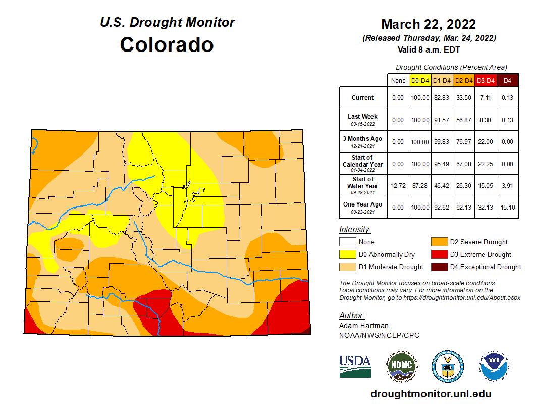
All this moisture is of course much appreciated. In lieu of the very wet and snowy start to 2022, the entire Denver Metro area was recently taken out of the drought classification and is now just “Abnormally Dry” according to the United States Drought Monitor. Today’s rain/snow will only further help the situation in the Front Range!
Lingering snow showers will come to an end for the most part after midnight tonight as winds shift to be northerly or even northwesterly across the area. Clouds and a slight chance of rain/snow showers will stick around through the day on Wednesday, but most of us will be predominantly dry. Highs on Wednesday will only be in the upper 40s with gusty north winds making for a chilly feel. Quiet and more seasonal weather returns Thursday with temperatures rebounding back into the lower 60s.
Remember, our daily forecasts are Premium content. Periodically, we open this forecast up to all of our readers. Today is one of those days!
Help support our team of Front Range weather bloggers by joining BoulderCAST Premium. We talk Boulder and Denver weather every single day. Sign up now to get access to our daily forecast discussions each morning, complete six-day skiing and hiking forecasts powered by machine learning, first-class access to all our Colorado-centric high-resolution weather graphics, bonus storm updates and much more! Or not, we just appreciate your readership!


You must be logged in to post a comment.