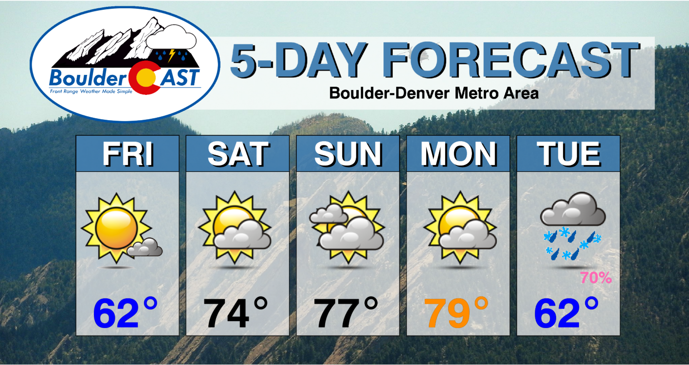
Absolutely gorgeous weather is taking shape for the weekend ahead with temperatures forecast to soar towards to the 80-degree mark in the Denver area. A few of these days could be record-setting for the region! As always, the warmth does have a planned expiration date as the next spring storm system will arrive around Tuesday with rain, snow and colder temperatures in tow.
At a Glance
- Friday is cooler behind a front, but it’s still downright sunny
- A ridge of high pressure will trek across Colorado through the weekend bringing beautiful and very warm weather
- Record high temperatures are possible across the Denver area, particularly Sunday and Monday as we close in on 80 degrees
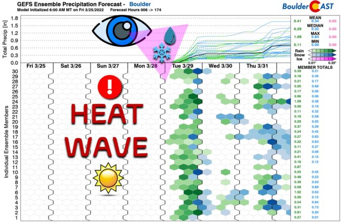
- The “heat wave” will come to an end on Tuesday with a Pacific storm moving in
- It’s still an evolving forecast, but expect a sizable cooldown with mostly rain Tuesday and Tuesday night and only a slight chance of a few snowflakes
Y
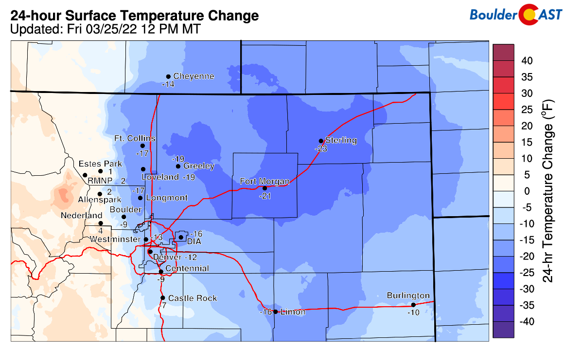
ou can hardly tell by looking outside, but a cold front clipped through overnight bringing cooler temperatures today and a batch of morning clouds which have already dissipated. Even with the sunny skies this afternoon, temperatures across northeastern Colorado are in the 40s to lower 50s. This is some 10 to 20 degrees colder than yesterday (see below). Despite this cooldown, we expect most areas will slowly climb into the 60s by the early evening. Not a half-bad Friday by late March standards… especially for the day following a cold frontal passage!
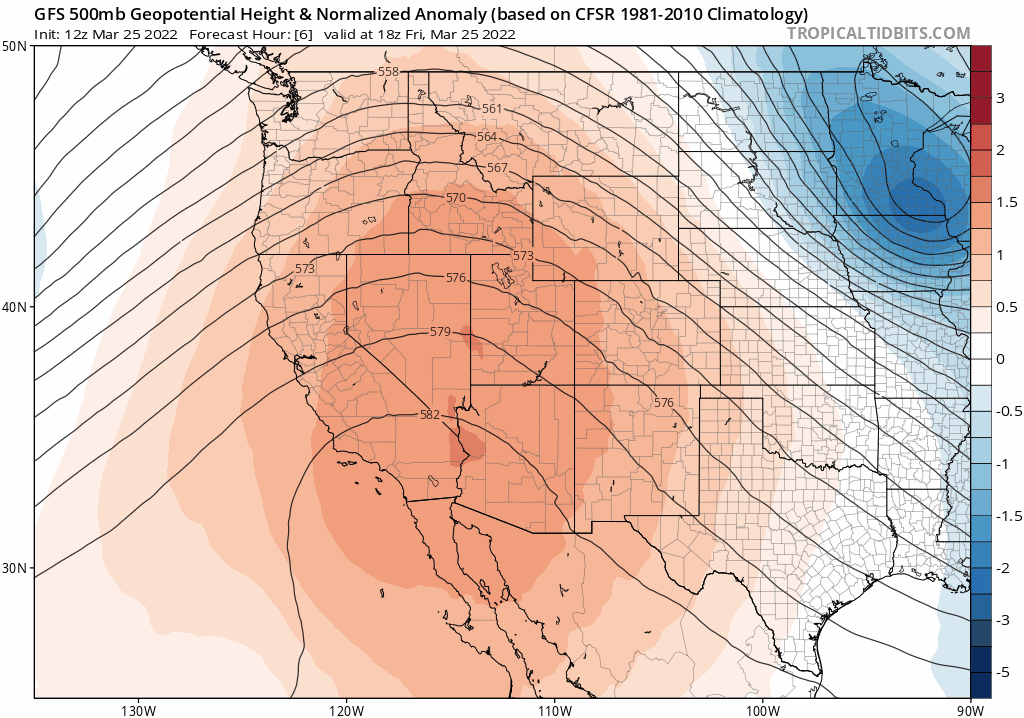
High pressure is currently situated across Baja California with a ridge axis extending northward into western Canada. The northwest flow over Colorado is modest but dry, helping to aid with the sunshine today.
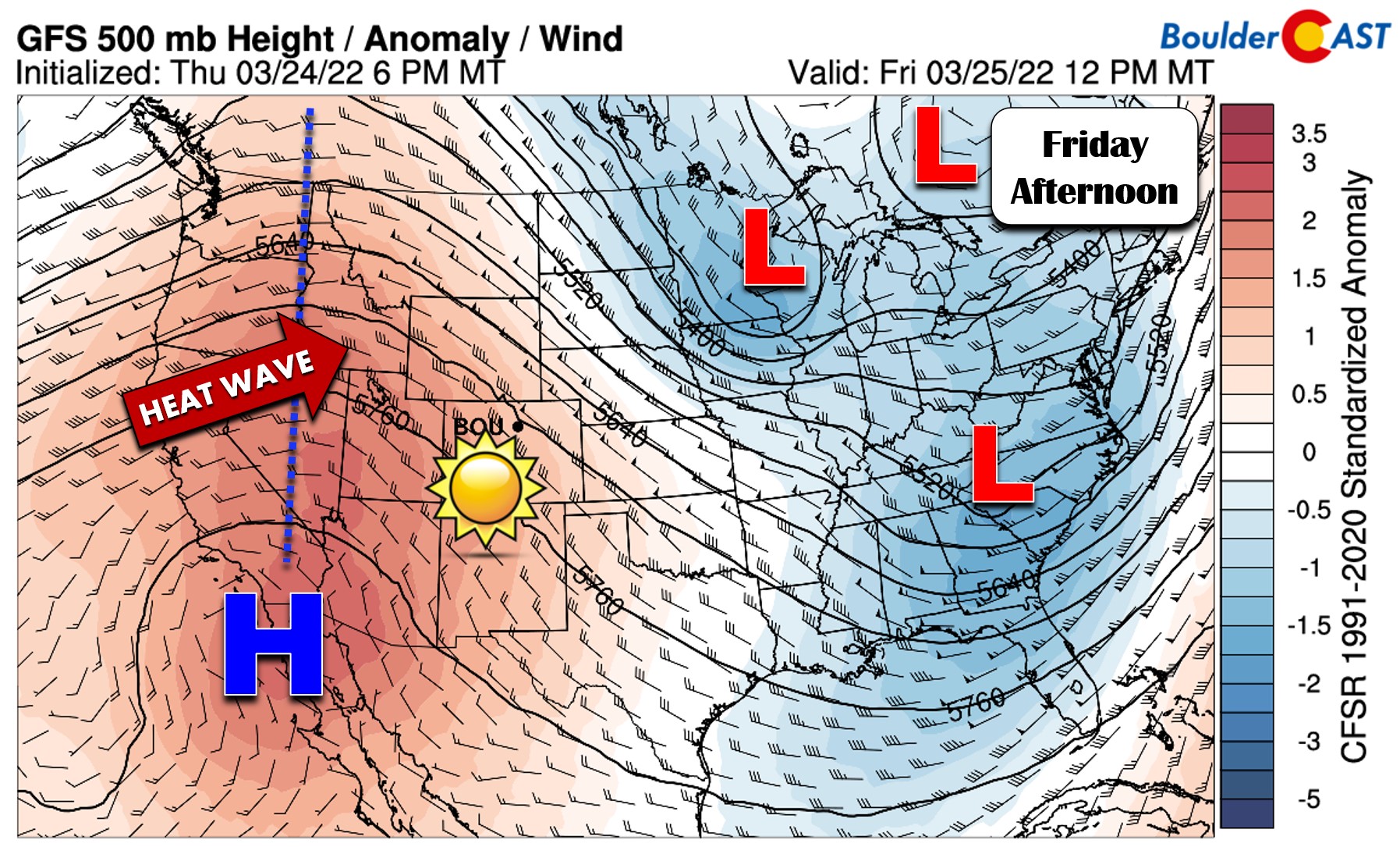
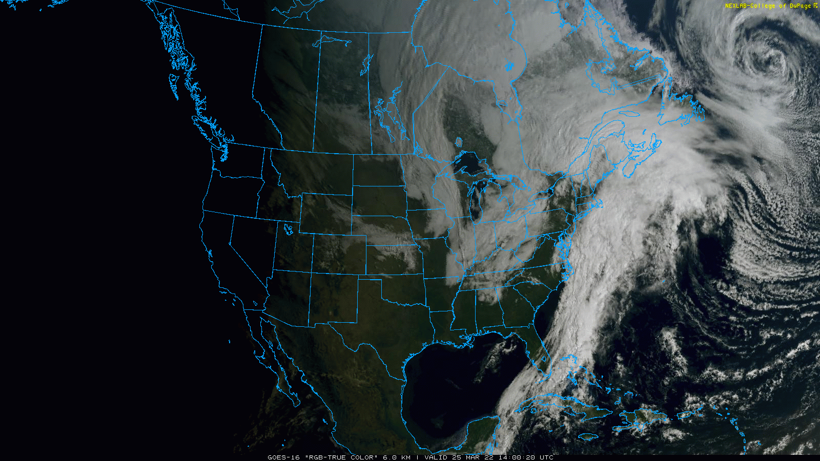
Note the abundantly clearly skies seen across the region from GOES-East this morning. Thank you, ridge!
This ridge of high pressure will not only dominate our weather pattern through the weekend ahead, it will bring the warmest weather yet in 2022 to the Front Range! The forecast animation below shows the well-defined ridge trekking slowly eastward through the upcoming weekend. By Monday evening (the end of the animation), the ridge will have exitted our immediate area into the Great Plains with our next major storm system coming ashore in California. More on that big shift in a moment.
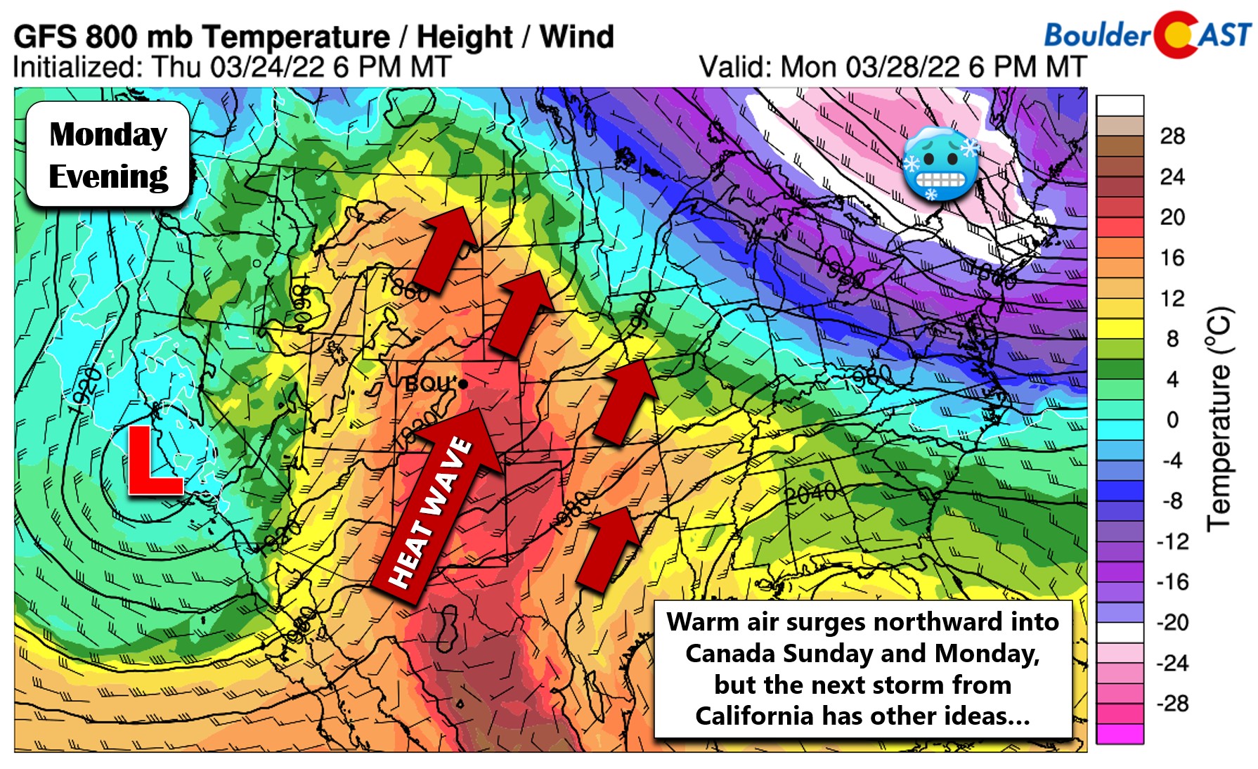
This amplified ridge pattern will allow us to tap into a significant fetch of southwest flow, especially Sunday and Monday. The 800mb temperature forecast for Monday is shown below. Look at the “bubble” of warm air in the center of the country! It’s flanked to the east by a downright frigid airmass in the Northeast and to the west by a cooler Pacific low pressure. This is telltale sign that spring is in full swing across the nation!
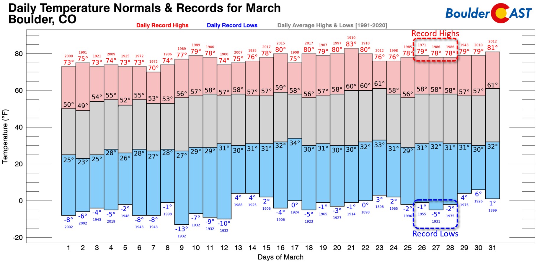
Expect our temperatures to soar in the coming days into the 70s with even hitting the 80-degree mark not out of the question. As it turns out, our record highs this time of year are in the upper 70s. On the opposite end of the spectrum, our record lows are still below zero! Late March is definitely one of the more extreme times of the year here…
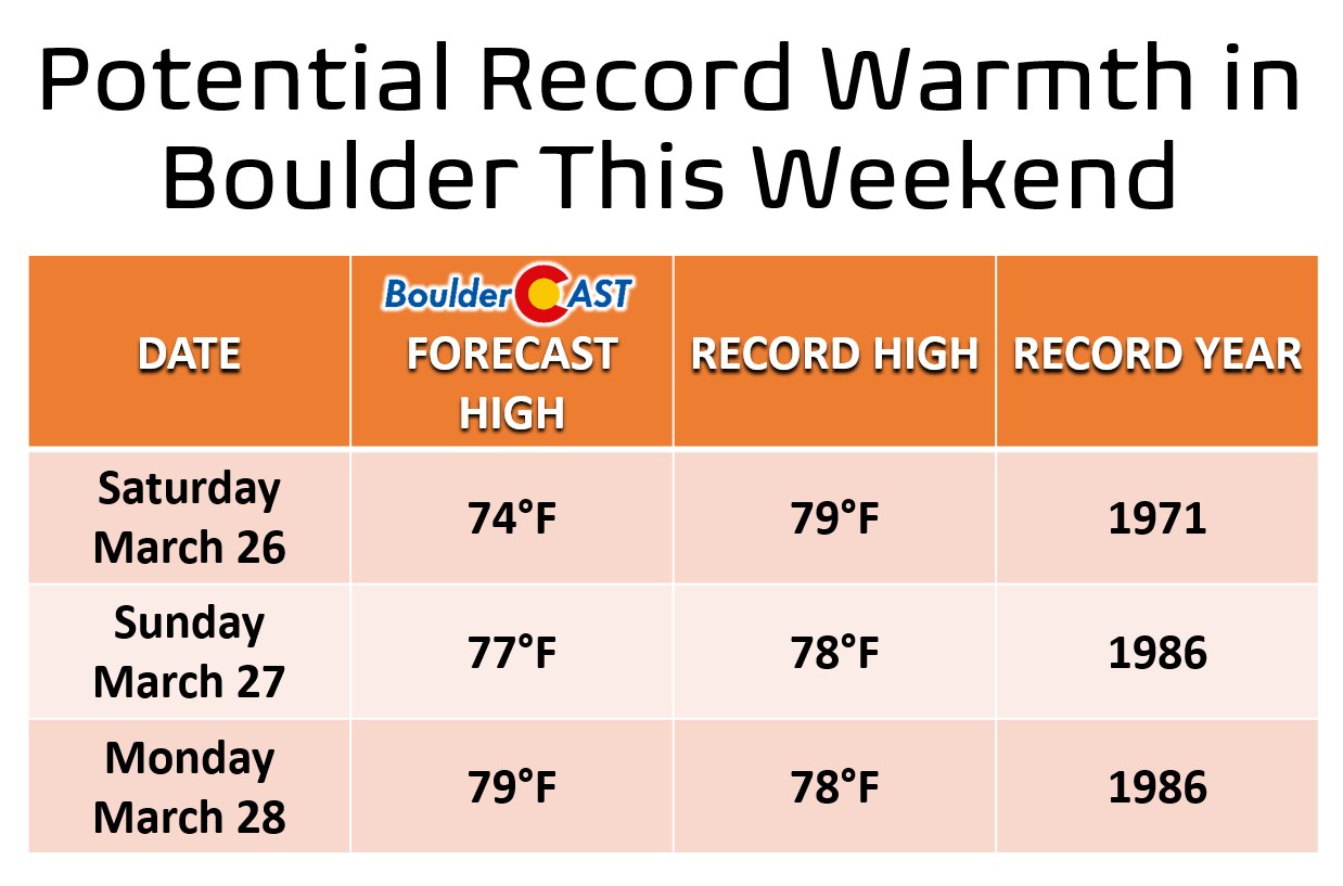
We actually have a good chance at notching new daily record highs this weekend. We’ll probably come in a few degrees short on Saturday, but our team is forecasting within a degree either way of the existing record highs both Sunday and Monday. We’re not quite looking for Boulder to hit 80 degrees either day, though (Denver is slightly more likely to do so). Sunday will have a good deal of high clouds around limiting solar heating. Monday will be sunnier but gustier possibly causing cooler air to mix down from higher up in the atmosphere. Also with the Pacific trough approaching Monday, we could see the airmass start to cool a tad, especially if the system moves in a little faster.
In any case, it will certainly be a gorgeous weekend ahead but things will turn messy again abruptly early next week.
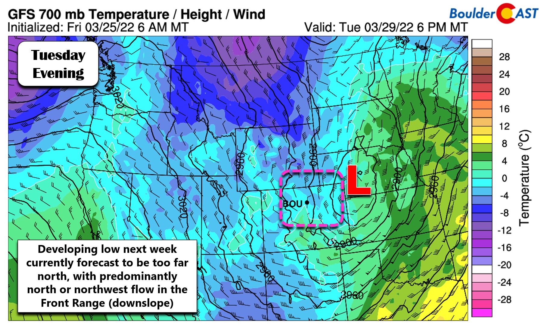
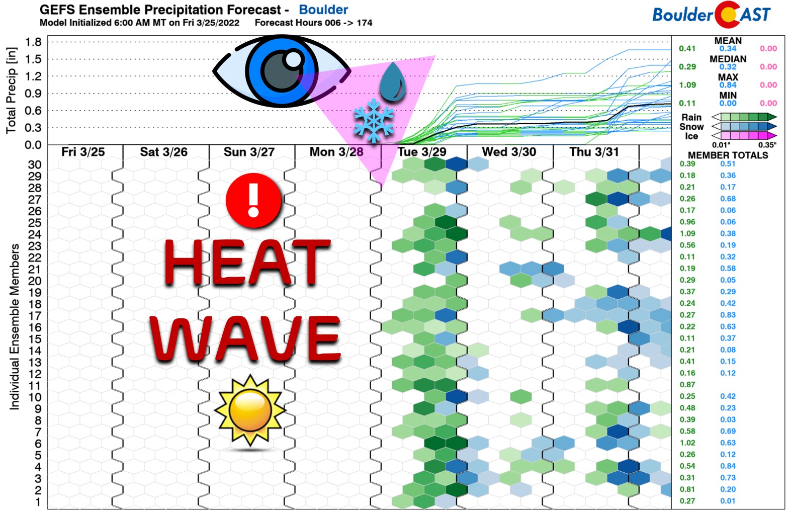
It’s too early to say what will happen for sure with the next system scheduled to move into Colorado from the west around the Tuesday timeframe, but overall weather model agreement is surprisingly good for the timing and trough trajectory. We know that a big cooldown will ensue and that there will be a decent chance of precipitation for the Front Range Tuesday and Tuesday night. At first glance temperatures appear to get cold enough on the backside of this storm for snow in Boulder and Denver, but the overall track is not favorable for precipitation to linger once the colder air arrives. Models mostly take the track of the low directly across Denver on Tuesday which would keep the required-upslope further north in Wyoming.
Even if this storm ultimately does produce some snowflakes, after several days flirting with the 80-degree mark, the chance of much snow accumulating from this event is low. At this juncture, we expect this to be a mostly a light to moderate rainfall event for us, with only a small chance of a little wet snow sticking on the grass towards the tail-end of things. The unsettled pattern will continue through much of next week, so there will likely be additional chances for more rain and snow in the days following.
That’s all for now. Make sure to take full advantage of Mother Nature’s generous offerings the next few days!
Get BoulderCAST updates delivered to your inbox:
We discuss Boulder and Denver weather every single day on BoulderCAST Premium. Sign up today to get access to our daily forecast discussions every morning, complete six-day skiing and hiking forecasts powered by machine learning, access to all our Front Range specific weather models, additional storm updates and much more!

Enjoy our content? Give it a share!


You must be logged in to post a comment.