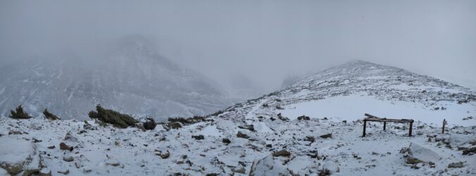
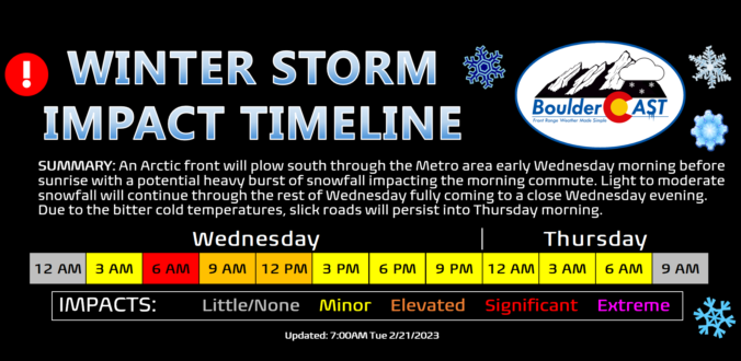
Category: Winter Weather (Page 47 of 137)

These posts contain some discussion of the white stuff, whether it be mountain snow pack or a Front Range snowstorm.

This Week in Colorado Weather: January 16, 2023

A major winter storm set to impact the Front Range Tuesday night through Wednesday. The heaviest snowfall will likely be focused east of Interstate 25 where up to 10″ could fall, with lesser amounts in Boulder and the Foothills. Another chance of light snow on Friday will round out a rather cold overall week for the Denver Metro area. Read on for our complete outlook of the week ahead, including our preliminary snowfall forecast map for the midweek snowstorm.

Continue reading

December 2022 Graphical Weather Review: A fickle month of fire, snow & historic cold!

December 2022 was a rather fickle month. Things started off somewhat warm and dry, and there was even a sizable wildfire just west of Boulder in the week leading up to Christmas. The weather quickly turned much colder and snowier for the holidays, including the coldest temperature reading in more than 30 years for the city. Here’s a quick and colorful graphical recap of our weather during December and how it relates to climatology.

Continue reading

BoulderCAST Daily – Tue 01/10/23 | Windy & warm today, colder with a chance of snow Wednesday

⦁❶⦁ A mountain wave will lead to widespread gusty winds today, strongest in and near the Foothills in excess of 50 MPH

⦁❷⦁ Mostly sunny on Tuesday with highs in the middle 50s

⦁❸⦁ A storm system races across the state on Wednesday, but develops in an unfavorable location too far north and east for Denver — snow chances are not great

⦁❹⦁ Much cooler on Wednesday in the 30s with a slight chance of snow showers — 0 to 1″ of accumulation possible on the grassy surfaces

Continue reading

This Week in Colorado Weather: January 9, 2023

Following a weekend of quiet weather, the week ahead will continue that trend of near normal temperatures under downslope flow — at least for a few more days. The Mountains will see two waves of snowfall Monday through Wednesday with more than a foot expected in some ranges and ski resorts. As for the Plains, a midweek system will produce a period of light snowfall as well, but only with low-end accumulations expected alongside cooler temperatures.

Continue reading

Winter Weather Update: 2023 commences with freezing drizzle and some snow (Updated)

Happy New Year! We’re starting off 2023 unsettled with more snow! There’s no holiday rest for us meteorologists here in the Front Range as yet another southern-track winter storm is knocking on the door. This one will unfold in two phases — the first being a period of freezing drizzle/snow showers Sunday night with a second phase of snow (some heavy) developing during the day Monday. In this forecast update we talk about timing, potential snowfall totals and the extended outlook for the rest fo the week.

Update (5PM 1/1/2023): Lowered snowfall amounts and updated snowfall map based on latest guidance. 

Continue reading

« Older posts Newer posts »