
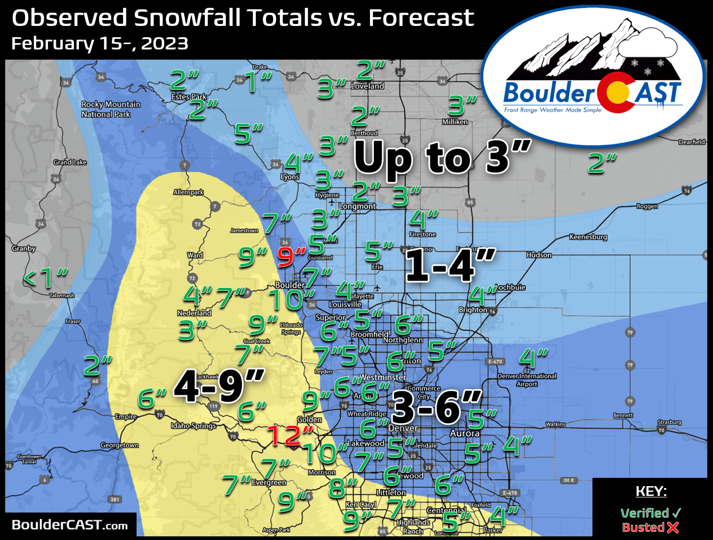
Shown below is our snowfall forecast map issued Tuesday morning with actual storm totals overlaid. Green values indicate that our forecast verified to within one inch of the observed snowfall total. Red numbers did not. This storm was a slight overproducer, mainly due to the enormous snow ratios which landed >20:1 in some places, especially around Boulder. The highest totals were in and near the lower Foothills of Boulder and Jefferson Counties where the best overlap of upslope and favorable temperatures for fluffy snow existed throughout the event. Officially, Boulder reported 10.6″ — the biggest snow event this season — while Denver reported 3.6″ at DIA. This was the first precipitation of the month for both cities.


You must be logged in to post a comment.