There will be two chances of snow to contend with this week, but neither will be much of a concern for us. A few flurries or snow showers are possible on Monday as a weak wave passes through. Later on, a stronger trough approaches with a cold front late Wednesday into Thursday, where colder temperatures in the 30s and gusty winds will be the primary impacts. Current indications of this mid-week system favor the better chance of snow in the High Country, but there could be a brief burst of snowflakes across the lower elevations as well. Read on for more details.
This week’s highlights include:
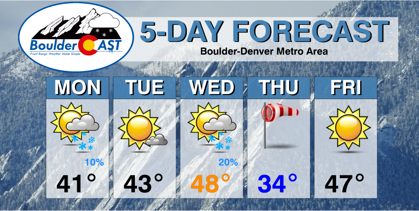
- Temperatures this week largely to hover around normal in the 40s, with the exception of Thursday which will be colder
- A passing trough brings spotty snow showers to the Plains Monday into Monday night — no accumulation
- A strong trough/cold front late Wednesday into Thursday could bring more snow, but current indications favor the better chance over the higher terrain
- Strong gusty winds possible Thursday behind a strong cold front as temperatures fall back into the 30s
- A warming trend ensues for Super Bowl Weekend, though we are watching for a more active pattern by early next week
DISCLAIMER: This weekly outlook forecast is created Monday morning and covers the entire upcoming week. Accuracy will decrease as the week progresses as this post is NOT updated. To receive daily updated forecasts from our team, among many other perks, subscribe to BoulderCAST Premium.

Temperatures near normal this week — except Thursday
Much of this week will feature highs in the 40s which is not that far from our normal this time of year. The one exception will be Thursday, where we are tracking a strong cold front and associated deep trough. We’ll discuss this more in a moment…
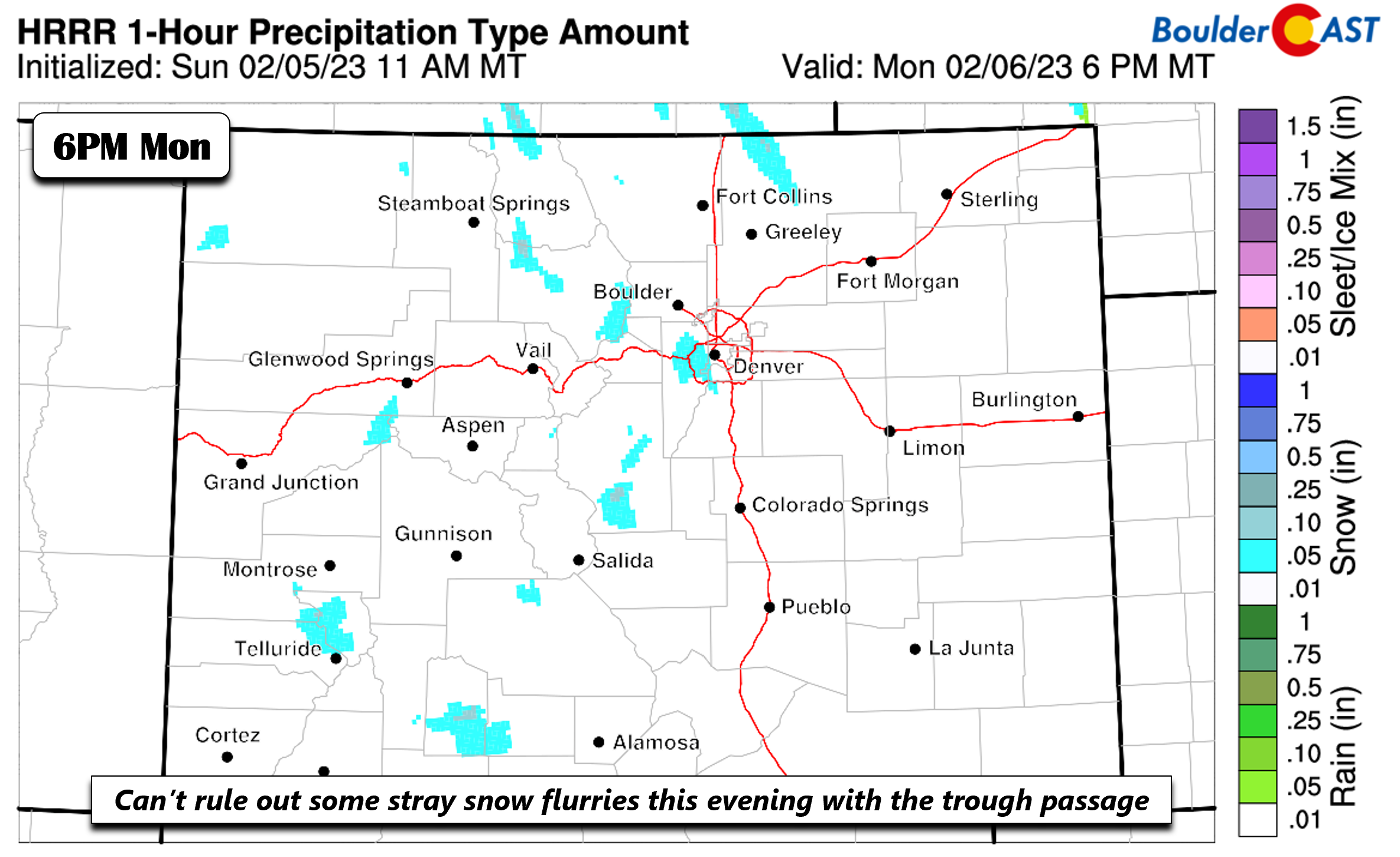
On Monday, a sheared shortwave trough stretching from the Dakotas into Arizona will slide south and east during the afternoon and evening. The main lift and orographics will be focused over the higher terrain.

A passing cold front behind this trough will favor cooler temperatures, about five or so degrees below normal in the lower 40s. As the trough passes through Monday evening, we can’t rule out some passing snow showers or flurries, but no accumulation is expected as temperatures will be on the warmer side at the surface.
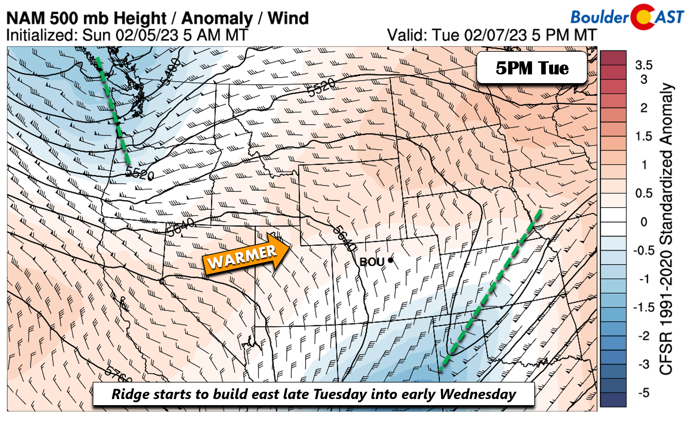
The trough slides east into Texas/Kansas by late Tuesday. Behind it, a quasi-zonal flow starts to build in from the west, with ridging over southern California. This will favor a warming trend into Wednesday, but Tuesday will still be cool in the low to middle 40s behind still lingering cold air advection. The warmer day will be Wednesday in the upper 40s to possibly 50 degrees reaching the Denver Metro area.
Watching a late-week system which brings colder temps, gusty winds, and possible snow
We are watching a stronger and deeper trough progged to move into our area Wednesday night into early Thursday. This trough will usher in colder air Thursday with highs in the 30s, but it could also bring some snow.
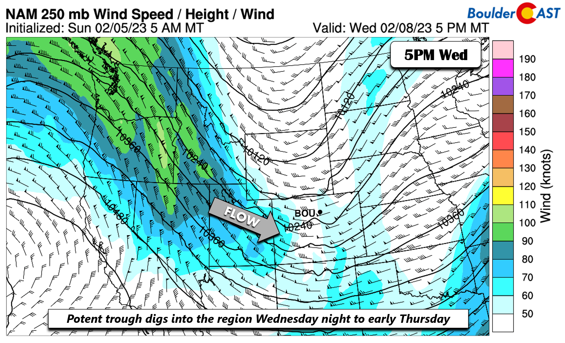
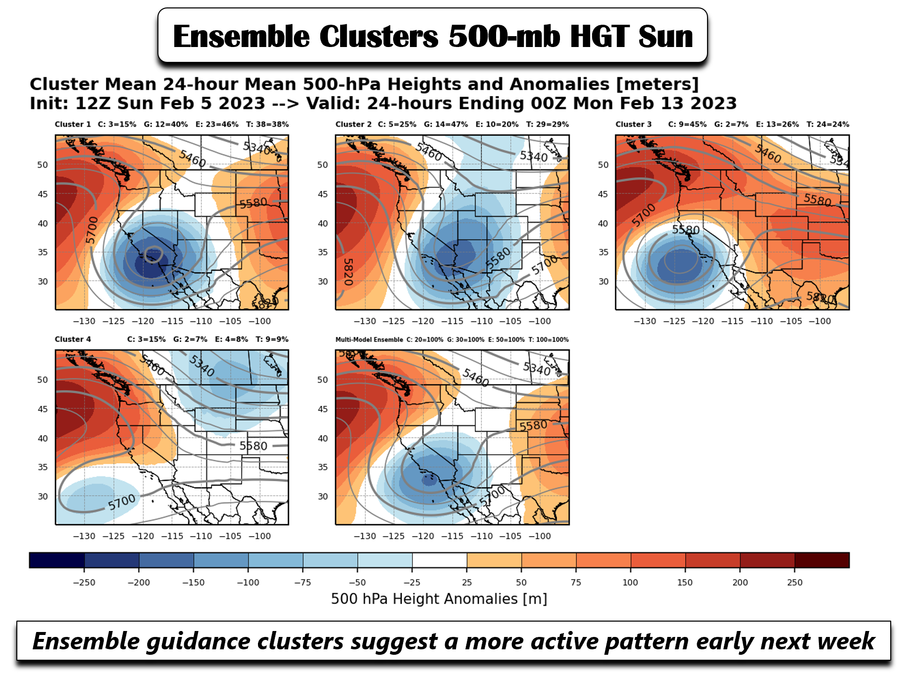
At this point in time, models and their respective ensembles indicate that the current track of this trough favors the best orographics and upslope over the High Country west of the Divide, seen below. The trough is still offshore so its track could change a tad in the coming days — thus it bears a watchful eye. As the trough passes east sometime Thursday, models do paint some snow on the back end as a surface low forms over eastern Colorado.
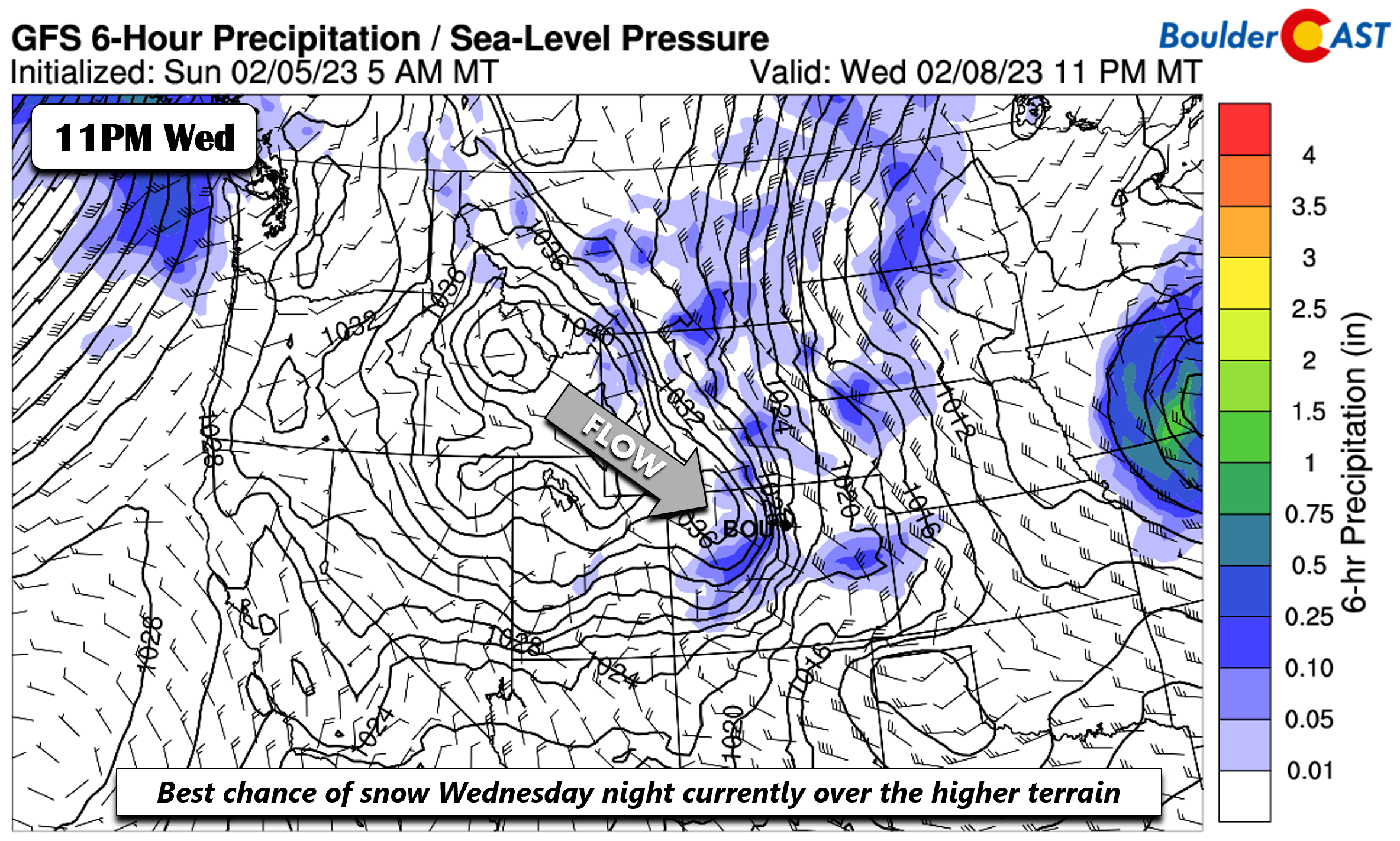
The GEFS and GFS, and also the Euro and Canadian show that the snow for this system largely bypasses the Front Range with the current track — thanks mainly to low-level dry air and downslope flow. However, if the trough takes a more westward track before trending east, it could be a different picture. Do check back, but for now we are not too concerned by this system with 1″ or less of snowfall expected.

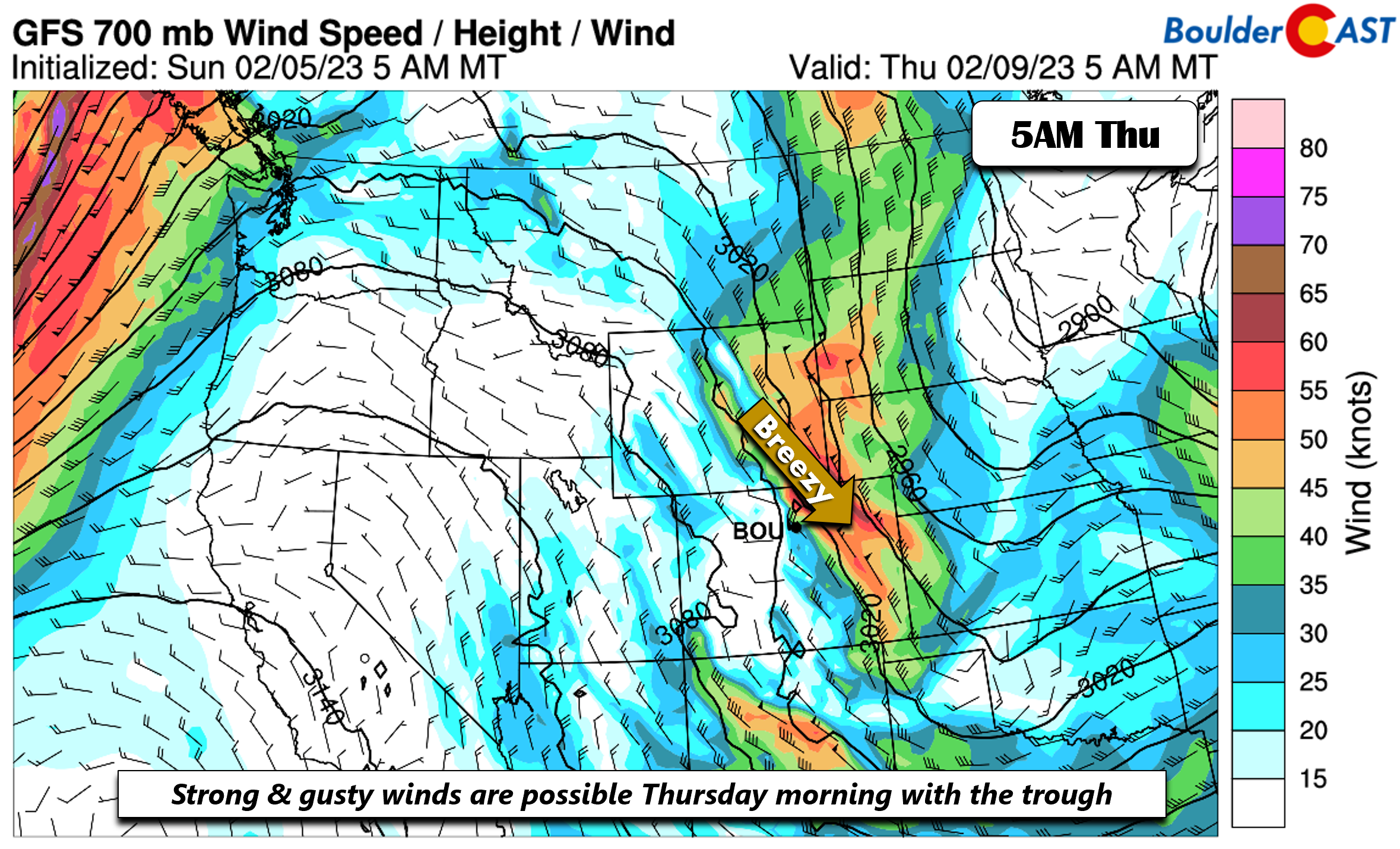
The current main impact from this trough will be colder temperatures and gusty winds for our Thursday. A potent cold front will move through early Thursday, with a strong northwest flow at the surface. Highs will return to below normal as a result in the lower to middle 30s.

In addition, a strong flow at ~5,000 feet off the surface, reaching speeds of 50+ MPH, is well indicated in the GFS. The ECMWF ensemble also shows the potential for anomalous wind gusts on the eastern Plains of Colorado. So in addition to the colder temperatures Thursday, wind chills will be noticeable under some downslope gusty winds of 30 to 40 MPH.
A drier & warmer Super Bowl Weekend
The GFS is faster to move the Thursday trough to the east, but overall all ensemble guidance shows a large and anomalous ridge building eastward late Friday into Saturday. If the late-week trough takes a slightly more west track before moving east, the ridge could be slower to build. Nevertheless, a warming and drying trend should take over by week’s end. Highs are expected to get back into the 40s by Friday.
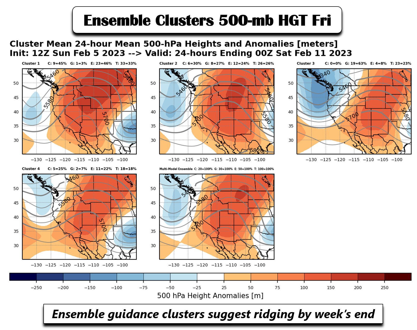
Ensemble clusters are more uncertain for the late-weekend period (Sunday into Monday). Before that, the ridge is expected to be in place through roughly most of Sunday. That should spell out a mild and dry Super Bowl for the most part. But ensembles do show a deep trough potentially lurking to our southwest late Sunday or early next week. There is a lot of spread as to how this trough evolves but current signs point to a more active pattern next week and a return chance of snow. Stay tuned.
Forecast Specifics:
Monday: Partly sunny with a chance of flurries or spotty snow showers during the afternoon and evening, but no accumulation expected. Highs cooler in the lower 40s for the Plains and lower 30s in the Foothills. Gusty northwest winds at times in the 15 to 25 MPH range.
Tuesday: Sunny and cool with highs in the low to middle 40s on the Plains and lower 30s in the Foothills.
Wednesday: Warmer with increasing clouds and breezy. Highs in the upper 40s to near 50 on the Plains and upper 30s in the Foothills. A chance of snow develops Wednesday night with light accumulations possible — most likely less than 1″.
Thursday: A slight chance of snow lingering in the early morning, then colder and breezy with highs in the lower to middle 30s for the Plains and middle 20s for the Foothills. Northwest winds could gust up to 40 MPH.
Friday: Sunny and trending warmer with highs in the middle to upper 40s on the Plains and middle 30s in the Foothills.
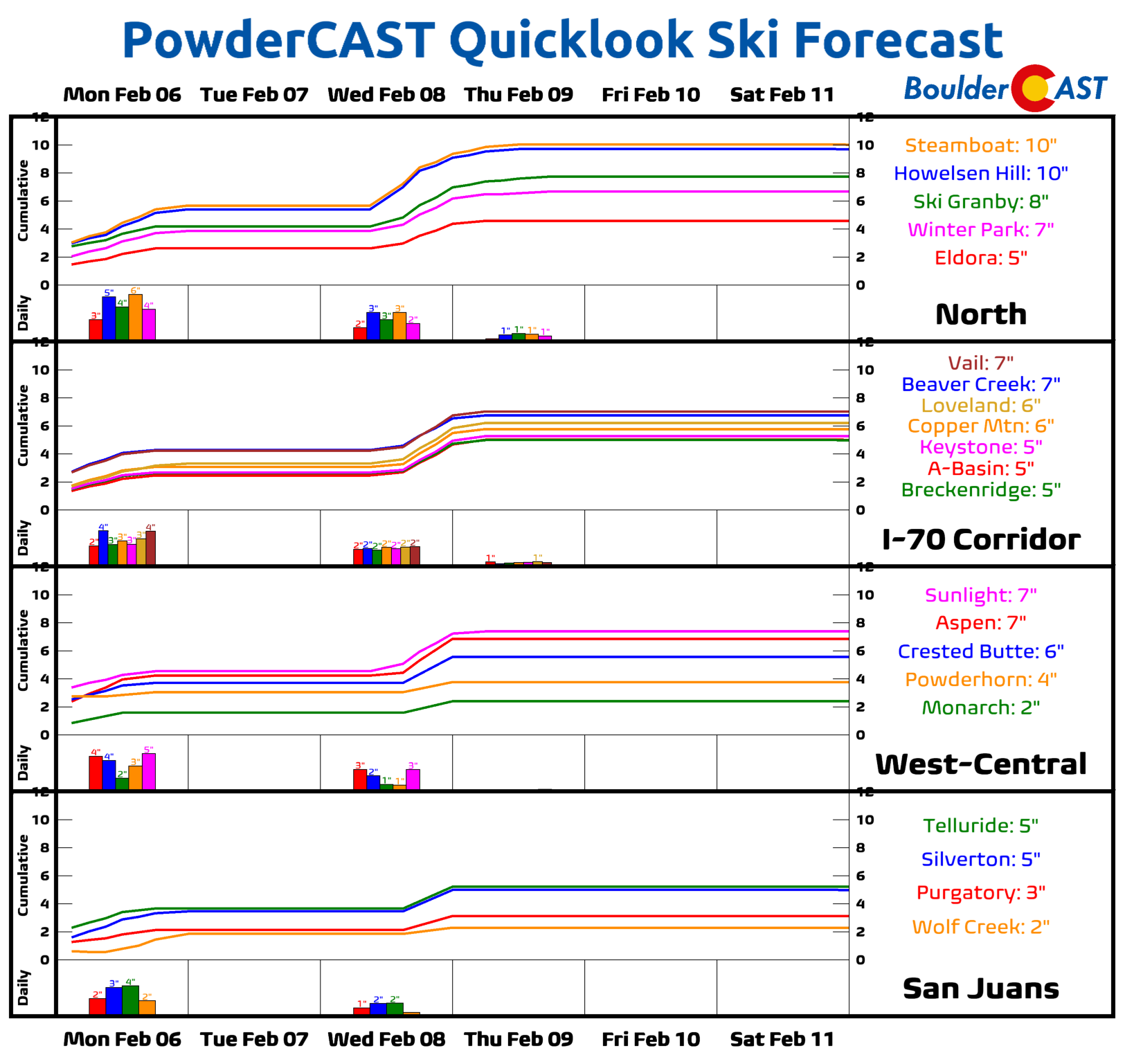
PowderCAST: Snow will be favored Monday into Monday night with a weak passing trough, as well as late Wednesday into Thursday evening with a deeper trough. 5 to 10 inches of snow are possible by the end of the week over the High Country and ski resorts.
Help support our team of Front Range weather forecasters by joining BoulderCAST Premium. We talk Boulder and Denver weather every single day. Sign up now to get access to our daily forecast discussion email each morning, complete six-day skiing and hiking forecasts powered by machine learning, first-class access to all our Colorado-centric high-resolution weather graphics, bonus storm updates and much more! Or not, we just appreciate your readership!
Spread the word, share the BoulderCAST forecast!


You must be logged in to post a comment.