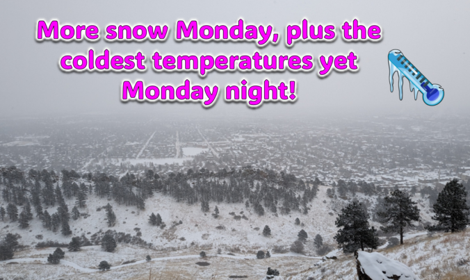
Just when you might have thought things were turning warmer, a secondary Arctic front and more snow will arrive to the Front Range on Monday. Additional snow accumulations and slick travel are expected during the day with the coldest temperatures we’ve seen yet developing Monday night. Let’s take a look at the latest as the ongoing Arctic blast delivers one final blow on MLK Day!
Category: Winter Weather (Page 29 of 134)
These posts contain some discussion of the white stuff, whether it be mountain snow pack or a Front Range snowstorm.
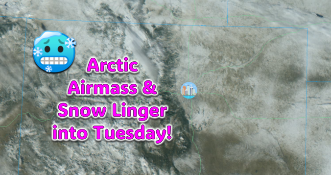
The Arctic air has arrived in the Front Range and it’s here to stay for several more days. We take a quick look at the overnight snow totals, the record low temperatures set already Saturday morning, and update you on the forecast for the rest of the weekend. More accumulating snow and even colder temperatures are on the way!
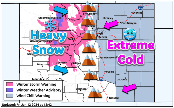
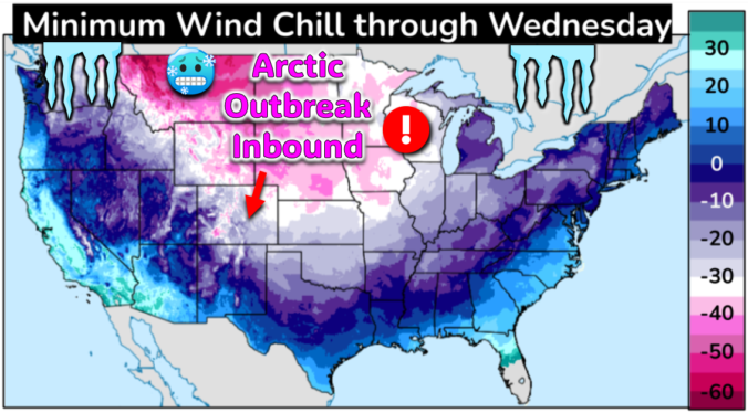
The most significant Arctic outbreak for the Front Range since 2022 is brewing! The initial cold front will blast through Friday early evening ushering in sub-zero wind chills which will persist all the way into at least Tuesday morning. While the extreme cold is all but certain at this point, the snowfall potential is a bit trickier of a forecast as there will be three separate chances for snow mixed into the polar plunge. However, the Mountains will be getting absolutely showered in powder. Let’s take a look at bitter cold and snowy forecast heading into the MLK holiday weekend.
Breezy conditions and chilly temperatures will kick off the week behind a departing winter storm which brought a thin blanket of snow to the Metro area last night. Highs below freezing on Monday will trend slightly warmer in the coming days, but with gusty winds remaining. The tail-end of the week will turn more active with a few chances at light snowfall. There are also signs in the extended that an Arctic airmass will ooze into the region during the upcoming weekend turning things even colder for us. Read on for more details
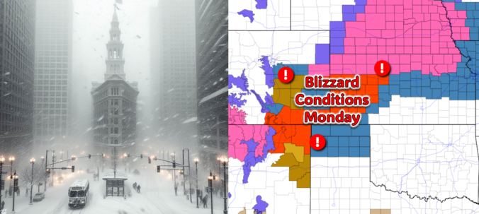
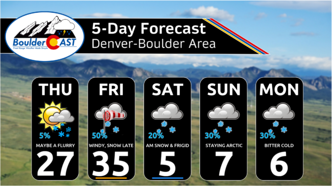
All is quiet on Sunday, but that will quickly change after midnight Sunday night! The third southern-track storm system in five days will take a more favorable track for the Front Range, leading to a period of snow and gusty winds in our area early Monday. While there is still some uncertainty in the exact outcome, we discuss the latest forecast including potential snow amounts and where blizzard conditions will unfold on Monday.
December 2023 was yet another warm month in Boulder, the same fate which has befallen four out of the last five months. Despite the lack of appreciable snow events, precipitation ended just a hair above normal for the month since December is typically one of our driest months of the year. Here’s a quick and colorful graphical recap of our weather during December and how it relates to climatology.

Live View of Boulder

Current Conditions

Live Radar

Recent Premium Posts

BoulderCAST Daily – Thu 01/15/26 | Fire Danger Today Before a Cold Front Tonight
🔥 Fire danger rising — Warm and windy today ahead of a strong …
BoulderCAST Daily – Wed 01/14/26 | A gorgeous Wednesday ahead of increasing fire danger & a stronger cold front tomorrow
🌬️ Weak front overnight — A weak cold front slipped through around 9:30 …
BoulderCAST Daily – Tue 01/13/26 | A thick blanket of high clouds won’t stop us from reaching the 60s again
☁️ Thick cloud deck overhead — Moisture streaming in aloft brings widespread mid‑ …
3-Day Forecast

Trending Content

© 2026 Front Range Weather, LLC