
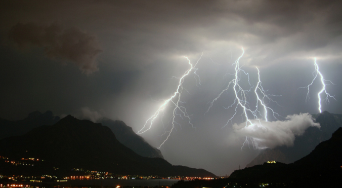
The North American Monsoon is responsible for pumping subtropical moisture into the southwestern United States every summer, moisture which ultimately supplies the fuel for Colorado’s daily summertime thunderstorms — rain we desperately need in the Front Range right now following months scarce precipitation and worsening drought. However, the arrival and intensity of the summer monsoon varies substantially from year to year, especially in our area. In this long-range outlook, we discuss the developing dire drought situation, the current state of the monsoon, what’s happening with El Niño, and what to expect for weather in the coming months across Front Range Colorado.
Category: Long-Range (Page 4 of 16)
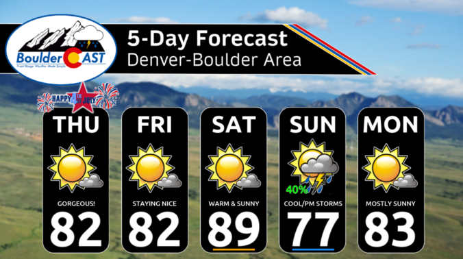
After our second snowy weekend in a row, things will stay quiet across the Front Range for much of the upcoming week with seasonal temperatures and lots of sunshine. However, that will change late-week as a quick-hitting Arctic cold front will surge south across the area. This front will likely be accompanied by at least a little bit of wintry precipitation, but the cold won’t stick around long at all. We also look ahead to several more devastating atmospheric river events set to slam California — their remnant moisture will likely spread into our Mountains to further bolster statewide snowpack. Read on for all the details.
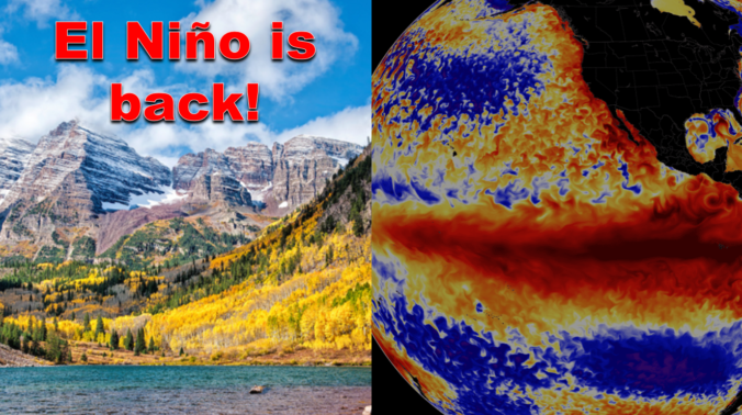
After enduring three consecutive La Niña winters, El Niño has taken over the globe once again intensifying in unusually rapid fashion. As of writing in mid-October, a strong El Niño is underway with impacts that will stretch globally in the months to come. We take a look at the current state of ENSO and what to expect from Mother Nature this winter across the Front Range lower elevations and Mountains.
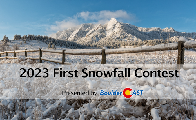
9th Annual BoulderCAST First Snowfall Contest
Are you eager for the first snow of the season? Have you already waxed your skis and purchased your Epic Pass? Our first big snow could be right around the corner! Mother Nature has been throwing wrenches into this annual contest the last few years making an accurate prediction for our first snowfall a monumental challenge! What’s in store for 2023? We provide a brief overview of Boulder’s first snowfall climatology and then pose a question…“When will Boulder’s first measurable snow occur this year?” Submit your guess for a chance to win an assortment of prizes. Those who get closest to the date and amount of our first snow win..
BOULDERCAST 2023 FIRST SNOW CONTEST ENTRY FORM
*Sorry but this contest is now closed to entries*
The Front Range has managed to ink out a cool and wet summer so far, but that wasn’t at all due to the monsoon. We discuss what has been causing the cool/wet weather of late and look ahead to when monsoon season may actually commence in Colorado. Spoiler alert: it’s sooner than you might think, but there’s a bit of a catch!
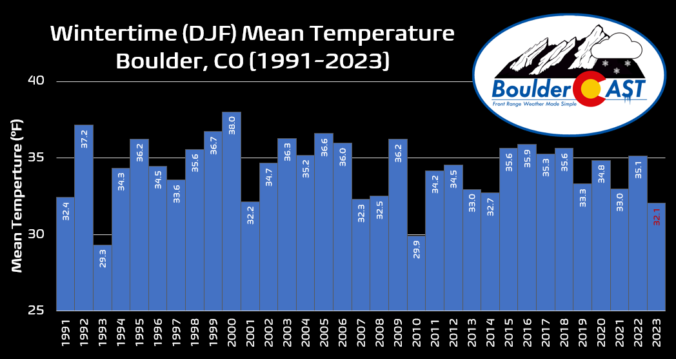
This winter has definitely felt longer and colder than any in recent memory. We review some temperature statistics to show that not only has it been an exceptionally cold winter overall, but the lack of any true warm days thrown into the mix made things feel even more extreme.
This week’s weather across the Front Range will be almost a carbon copy of last week. That is, dry and mild conditions holding through Wednesday before much colder temperatures and snow arrive on Thursday. At this time, the snow potential appears minor at best as a huge winter storm system takes an unfavorable track directly over our area. The bigger story will be the cold temperatures it ushers in and just how long they stick around afterwards. Read on for all the details.

Live View of Boulder

Current Conditions

Live Radar

Latest Smoke Forecast

Recent Premium Posts

BoulderCAST Daily – Sun 07/12/26 | Hot weather for a good chunk of the coming week
🥵 🔥 Heat for a good chunk of the week: Upper 90s through …
BoulderCAST Daily – Sat 07/11/26 | Here comes the heat!
🥵 Heat start today: Upper 90s start today and continue well into next …
BoulderCAST Daily – Fri 07/10/26 | The heat builds into the weekend
⛈️ Storms around today: A weak impulse of energy favors some isolated storms …
3-Day Forecast

Trending Content

© 2026 Front Range Weather, LLC