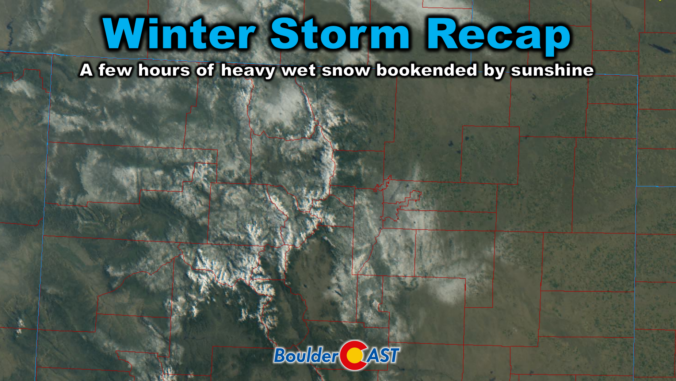
Friday delivered one of those classic Colorado curveballs. The storm showed up fashionably late, then hit harder than expected once it finally got going. It left behind a fast‑melting blanket of spring snow and cleared out almost as quickly as it arrived. In today’s update, we break down the wild midday burst of snow, take a look at how the forecast held up, and highlight why the real headline may have been what happened — or didn’t happen — after the flakes stopped.
Category: Forecast (Page 4 of 169)
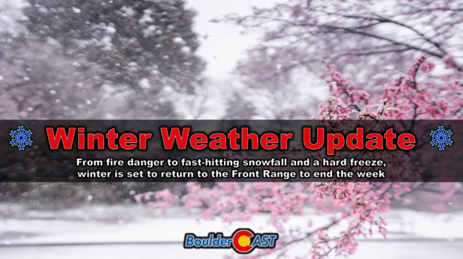
A sharp pattern shift is lining up for the Front Range to end the week, and it’s going to feel a lot different than the stretch of mild, breezy days we’ve been riding lately. Thursday brings one more round of elevated fire danger, but by tonight a much colder airmass barrels in and sets the stage for a quick burst of snowflakes Friday morning — followed by a hard freeze Friday night that may end up being the most impactful part of the whole event. Here’s what to expect as winter makes a brief, timely return to the Denver-Boulder area.
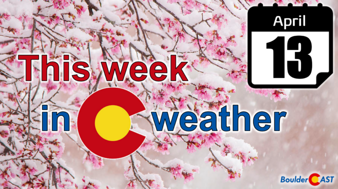
As we roll into mid‑April, the Front Range finally snaps back into an active pattern with fire danger, two storm systems, and even a shot at late‑season snow all packed into one busy week. From warm, windy days to Mountain snow and the possibility of flakes reaching the Denver–Boulder corridor by Friday, there’s a lot happening in the days ahead. Read on for all the details.
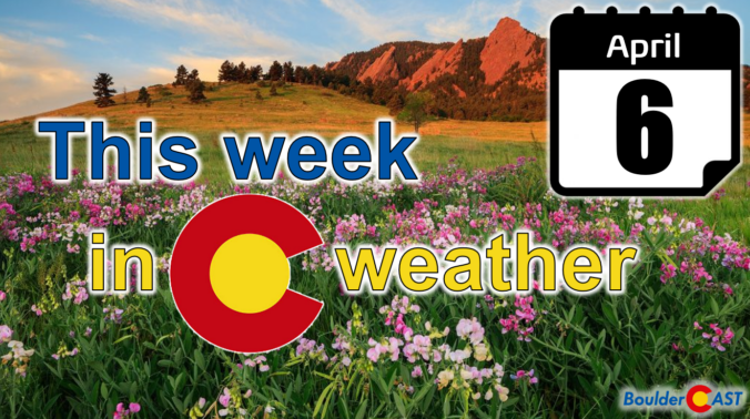
This week leans warm and deceptively calm across the Front Range, but there’s more going on under the hood than the mild afternoons suggest. A couple of brief cold fronts, a parade of passing shortwaves, and even a midweek fire‑weather setup all take turns shaping our pattern. Rain chances stay meager, frost may sneak in early Tuesday, and late‑week energy could stir up a few isolated showers. We break down what to expect—and what not to count on—in our latest weekly outlook.

March is supposed to bring hints of spring, not the kind of heat that rewrites the record books and eats away snowpack like it’s June. Yet here we are again, recapping another weekend of astonishing warmth, more broken records, and a dire Westwide snowpack situation that has become genuinely alarming. We walk through just how extreme the heatwave has been, why Colorado’s water outlook is now in uncharted territory, and what the coming early April pattern shift might (or might not) do to slow the damage that’s already been done. Let’s dig in.

As if last week’s record‑smashing heatwave wasn’t enough, the atmosphere has decided to double down this week. After a brief cooldown, we’re gearing up for another round of exceptional warmth—with Colorado’s snowpack plunging to levels more typical of early summer than March. In today’s update, we break down the new records already in the books, the alarming snowpack decline, and what to expect as a second pulse of historic warmth takes aim at the Front Range.
Wednesday’s remarkable 80° warmth marked the start of a stretch that’s far more reminiscent of early summer than mid‑March here in Colorado. An unusually strong ridge of high pressure is now locked over the region, setting the stage for several more days of exceptional heat with widespread record temperature destruction and increasing fire concerns. A brief cooldown will arrive over the weekend, but the broader pattern remains firmly tilted toward above‑normal temperatures the rest of the month, including a secondary heatwave already brewing for next week. Here’s a look at how this historic heatwave setup will unfold across the Front Range in the many days ahead.
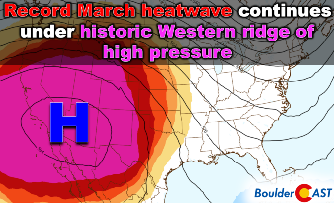
Colorado may be easing into the week on a calm, cool note, but the atmosphere has no intention of staying quiet — and the shift ahead isn’t the one you might expect. While a major storm system pounds the eastern half of the country, a powerful ridge is quietly taking shape off the West Coast, ready to drive an exceptional, record‑shattering March heatwave straight into the Front Range. With gusty downslope winds on the way and the strong likelihood of multiple all‑time records falling, this week is all about the heat. How hot will it get and when will the heatwave end? Let’s take a look.

Live View of Boulder

Current Conditions

Live Radar

Latest Smoke Forecast

Recent Premium Posts

BoulderCAST Daily – Sat 07/11/26 | Here comes the heat!
🥵 Heat start today: Upper 90s start today and continue well into next …
BoulderCAST Daily – Fri 07/10/26 | The heat builds into the weekend
⛈️ Storms around today: A weak impulse of energy favors some isolated storms …
BoulderCAST Daily – Wed 07/08/26 | The Front Range Has Broken Out of the Haze — Storms Fire After Noon
🌬️ Smoke has (mostly) cleared out: Westerly flow pushed the thick plume south/east, …
3-Day Forecast

Trending Content

© 2026 Front Range Weather, LLC