Category: Forecast (Page 23 of 161)

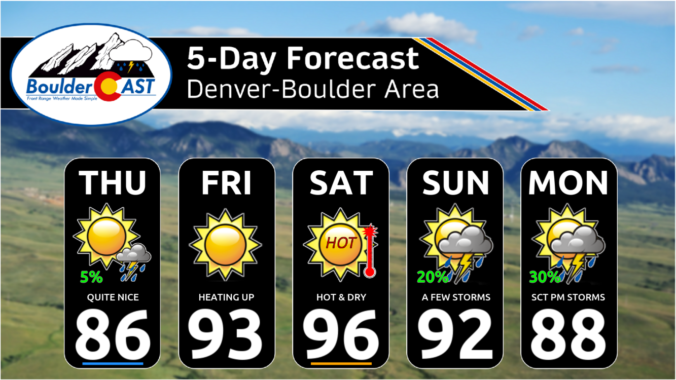
Rain chances in the Front Range will be front-loaded this week with a moist monsoonal flow in place. Temperatures will consequently hover near average in the 80s with plentiful clouds and storms developing each day, some of which could cause localized flash flooding. Rain chances will remain for the latter part of the week, but coverage lessens significantly as drier air is forecast to move in. We’ll also likely see the return to the 90s by week’s end. Read on for all the details.
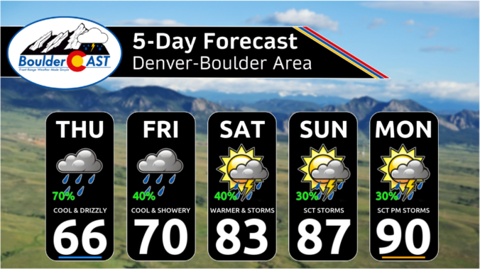
*Premium* This Weekend in Colorado Weather: The nineties are a thing of the past with showery & cool weather the next few days!
Our scorching hot, two-week-long heatwave will finally come to an end later this week, but not before we endure a few more days. A cold front is slated to arrive into the Denver area late Wednesday finally knocking us out of the 90s. This front will also come with an enhanced chance of rainfall, though monsoon moisture is still largely lacking. Despite daily chances for rain this week, our existing fires will continue to smolder and the risk of new fire ignitions remains uncomfortably high.
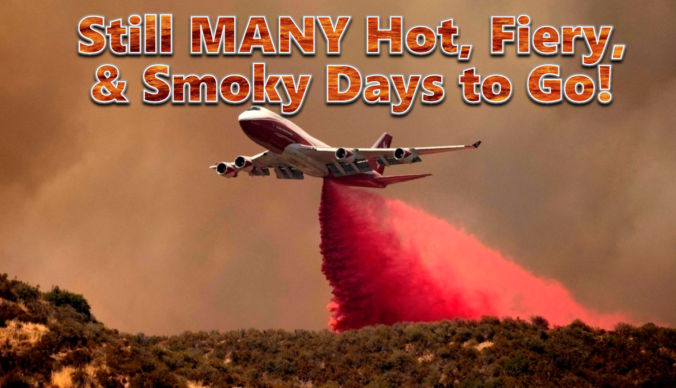
Heatwave & Wildfire Update: Exceptionally hot, dry and smoky conditions will remain across the Front Range at least through Monday with slow fire growth
Between the extreme heat, thick smoke and new wildfire ignitions, this week has been quite the disaster in the Front Range! Our fuels have been primed for weeks now and our team has been vocal regarding this inevitable outcome, but things unravelled much quicker than even we expected this week with something like ten wildland fires in the Front Range just since Monday, in total burning more than 9,000 acres of forest! The weekend unfortunately won’t offer much reprieve from the heat, fire or drought, but we are tracking a potential shift next week towards wetter and cooler conditions. We provide an update on the local fires, the ongoing heatwave, the widespread smoke, and when actual raindrops may return to the forecast.
Fortunately, as of last Friday afternoon, the wildfire smoke from Canada has cleared out of our area. However, this week will feature new weather challenges in Colorado, with the primary story being a brutally hot, dry and extended heatwave, with a secondary concern being the return of thicker smoke later in the week. Let’s take a look!
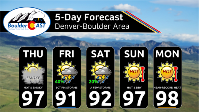
*Premium* This Weekend in Colorado Weather: Canadian smoke finally vacates the area on Friday! Unfortunately prolonged extreme heat will be its replacement…
After a cool and unsettled past several days, the week ahead turns much drier, notably hotter, and quite hazy with Canadian wildfire smoke engulfing the Front Range. Rain chances will be limited through the week as the monsoon stays largely suppressed. We will return to the 90s as early as Tuesday, perhaps nearing 100 degrees by week’s end. When is our best chance of rain, how hot will it get and when will our air quality finally improve? Let’s take a look!
© 2025 Front Range Weather, LLC

