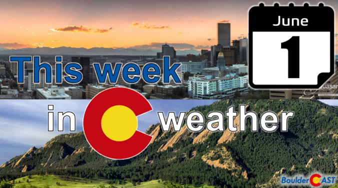
Spring’s grip on our wet season is loosening, and the atmosphere is starting to hint at the drier pattern ahead — but not before we squeeze out a few more days of spotty storm potential. This week brings a mix of low‑end daily rain chances, early‑week severe storms, and a slow warm‑up that could push us toward our first 90° reading of the year by the weekend. Read on as we break down what to expect as we ride out this transitional stretch of early June.
Category: Forecast (Page 2 of 169)
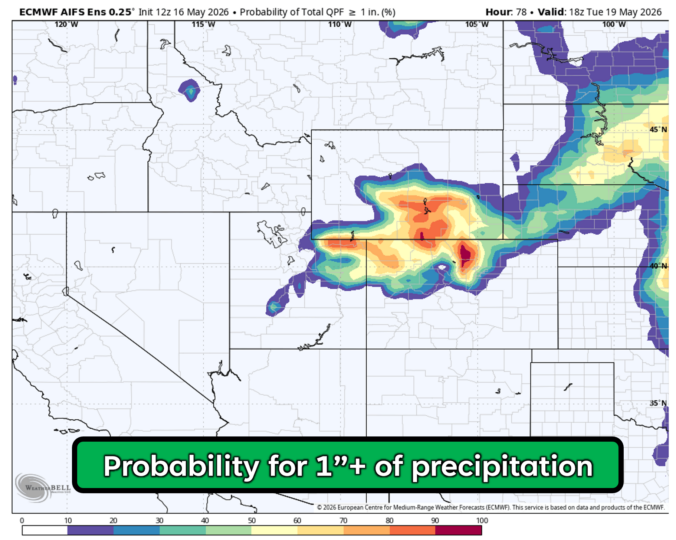
A slow‑moving Pacific storm settling in across the West will set the stage for a classic late‑May stretch along the Front Range — warm afternoons, building clouds, and hit‑or‑miss late day showers and thunderstorms. While no day looks like a washout, the pattern does get more interesting mid‑week as deeper moisture sneaks in and storm chances tick upward. We break down what to expect, which day carries the best shot at rain, and how temperatures will swing as the broader system drifts our way.
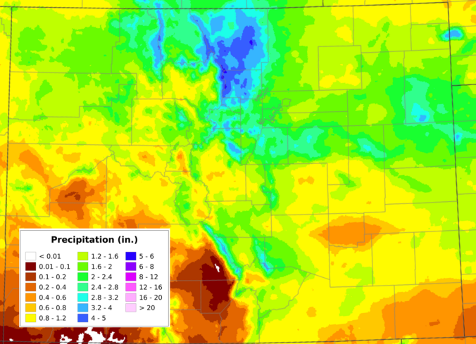
May has finally snapped the atmosphere out of its months‑long bone dry spell, and the Front Range is making up for lost time fast. A destructive early‑May snow event, followed by a second, well‑timed upslope system just ten days later, has pushed Boulder’s May precipitation total beyond everything we managed to scrape together through fall, winter, and early spring combined. We dig into what triggered the pattern reversal, how much moisture different parts of the region have banked, what this burst of wet weather actually means for our entrenched drought, and whether the upcoming Memorial Day weekend warm‑up signals a slide back toward a more aggressive drying trend.
After a devastating spring snowstorm barely more than a week ago, a slow‑moving May storm parked itself over the northern Front Range, wringing out 1–2 inches of moisture and dropping a fresh blanket of wet snow in the Foothills — all without giving the lower elevations any freezing temperatures. For mid‑May, that’s about as friendly as a storm of this size gets. And with the larger‑scale trough refusing to budge, we’re not done yet: this week will feature more daily shower chances through Friday before drier, warmer weather returns just in time for the holiday weekend. Read on for all the details.
A fresh surge of moisture, lift and colder air are flowing into the Front Range today, with rain, high‑elevation snow, and even a few rumbles of thunder unfolding before the storm finally winds down Monday evening. The highest terrain could quietly overachieve on snow, while the Boulder-Denver area stays mostly just rainy. We also check in on the declining chance for sub-freezing temperatures Monday night.
That quiet Sunday morning was lovely wasn’t it? But the sun is unfortunately gone as as powerful spring storm is digging into the West, already lighting up hazard maps from California to Montana to Kansas with snow, fire and wind warnings. For the Front Range, the approaching system will provide another round of widespread, soaking precipitation with the target once again on Boulder and Larimer Counties.
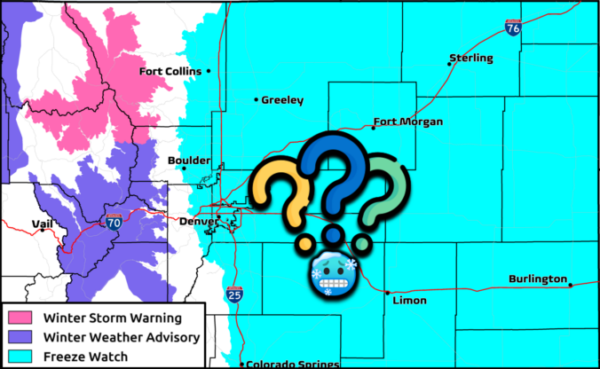
After a round of scattered showers and storms during the day Sunday, including some severe ones east of Denver, a more widespread precipitation shield will develop overnight and continue into Monday, with the Foothills grabbing accumulating snow and the lower elevations flirting with a few wet flakes as well. We break down the timing of everything, the most likely precipitation and snowfall totals, the post-storm freeze risk, and what this storm means for our ongoing drought.
Another moisture‑rich spring storm is lining up for the Front Range, and fortunately this one is coming in a tad warmer, but that doesn’t mean there won’t be snow. Here’s our latest quick thoughts on what to expect as this soggy system rolls in to end the weekend.
A warm, summer-like pattern is about to take over the Front Range in the middle of May. This week’s weather is driven by a robust mid‑level ridge anchored over the Desert Southwest, producing strong subsidence and a sustained warm anomaly across Colorado. A weak cold front on Tuesday will briefly cool us off, but its effect will be short-lived, with near-record heat building back in by midweek. Rain chances through the extended period remains quite low given the setup, but the late-week period is somewhat uncertain. We break down the dynamics driving this pattern and the implications it will have for the Denver–Boulder corridor through this warm, mostly dry stretch ahead.

Live View of Boulder

Current Conditions

Live Radar

Latest Smoke Forecast

Recent Premium Posts

BoulderCAST Daily – Sat 07/11/26 | Here comes the heat!
🥵 Heat start today: Upper 90s start today and continue well into next …
BoulderCAST Daily – Fri 07/10/26 | The heat builds into the weekend
⛈️ Storms around today: A weak impulse of energy favors some isolated storms …
BoulderCAST Daily – Wed 07/08/26 | The Front Range Has Broken Out of the Haze — Storms Fire After Noon
🌬️ Smoke has (mostly) cleared out: Westerly flow pushed the thick plume south/east, …
3-Day Forecast

Trending Content

© 2026 Front Range Weather, LLC