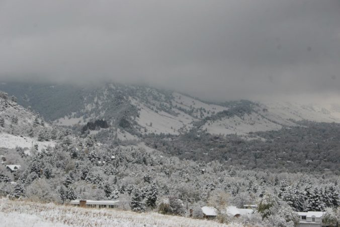
For many of you, this week’s blizzard will be one to remember for years to come. We take a look at the formation and evolution of what may have been the strongest storm in Colorado’s history. We also review the remarkable snow totals and wind gusts from across the region.
Category: Forecast (Page 111 of 169)

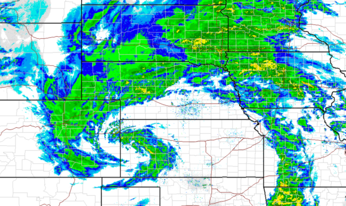
The arrival of our next winter storm is nearly upon us, but a lot of questions remain in the forecast, especially for the western portions of the Metro area. In this update, we discuss the timeline of the storm, lingering concerns about temperatures and downslope, where blizzard conditions will exist, and provide our snowfall forecast map.
A strong, spring-like snowstorm is taking shape for mid-week. In this week’s outlook, we discuss the weather before, during, and after the storm which will bring more than a foot of snow and blizzard conditions to portions of Colorado.
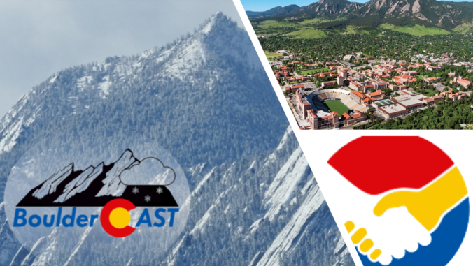
It’s with great excitement that we announce our new strategic partnership with CU Boulder. Read on for all the details, including a weather-focused interview with the campus team responsible for keeping CU’s outdoor areas safe and beautiful during all types of weather events.
Persistent westerly flow at the mid-levels of the atmosphere will allow the Front Range to warm up each day this week. This changes late Friday into Saturday when another cold front is set to push in from the northeast. We also discuss two minor chances of rain and snow during the week ahead.
It may seem odd to call 8 inches of snow in Boulder and 4 inches in Denver “disappointing”, but that is indeed our sentiment towards the prolonged winter storm that moved through over the weekend. All of the ingredients for snow came together in unison, including one of the coldest airmasses so far this winter and juicy moisture from an atmospheric river. We discuss why snow totals came in on the lighter side and the record-breaking cold air.
March is definitely coming in like a LION this year! We discuss the wintry forecast across the Front Range this weekend and provide our snowfall forecast map. Spoiler alert: BIG snow totals are possible in some areas alongside extremely cold temperatures for early March.
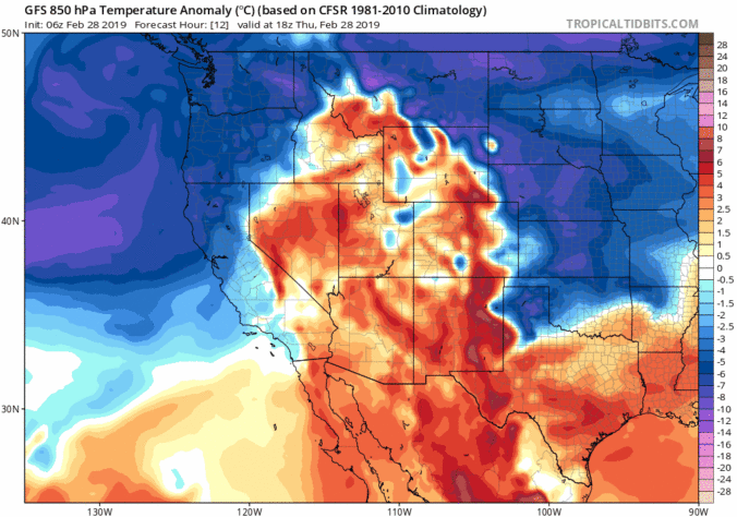
With Friday being the first day of March, spring is just around the corner! The first several days of the month will NOT look or feel like it, however. Another Arctic front is headed our way bringing potentially the coldest air so far this winter to the Front Range alongside widespread accumulating snowfall. We take a detailed look at the weather set-up this weekend and provide our preliminary snowfall forecast.

Live View of Boulder

Current Conditions

Live Radar

Latest Smoke Forecast

Recent Premium Posts

BoulderCAST Daily – Fri 07/17/26 | Hot and dry continues through the weekend
🥵 Heat tightens its grip this weekend — Ridge strengthens slightly over the …
This Weekend in Colorado Weather: Several More Scorching Days Ahead Before the Long‑Awaited Monsoon Pattern Arrives
☀️ Persistent heat continues — Low to mid‑90s through Saturday, spiking towards the …
BoulderCAST Daily – Wed 07/15/26 | The Ridge Rules the Rockies as Hot, Dry Pattern Holds Firm
🔥 Heat dome setup continues — A strong, stationary 500 mb ridge keeps …
3-Day Forecast

Trending Content

© 2026 Front Range Weather, LLC