Author: Ben Castellani (Page 133 of 301)
Ben grew up in southwestern Pennsylvania and holds both a bachelor's and a master's degree in Meteorology, the latter being from CU Boulder. His hometown received nearly three feet of snow from the Storm of the Century back in March of 1993, sparking his initial interest in impactful weather. Ben currently works on remote sensing and data analysis software at NV5 Geospatial Software in Boulder.
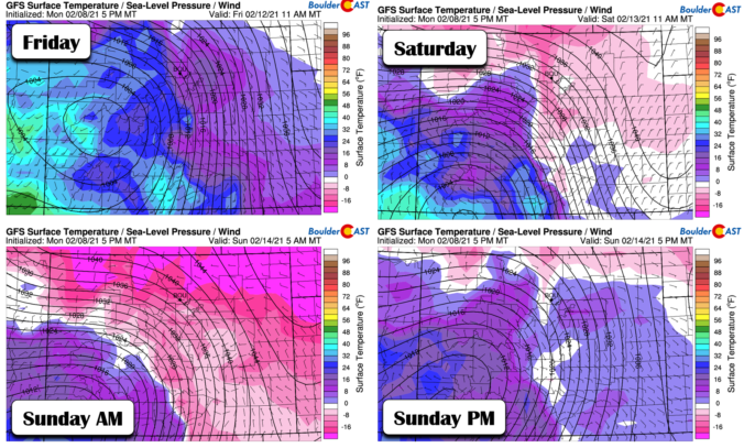

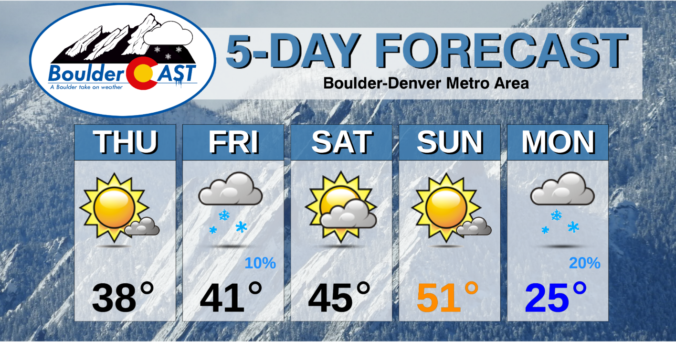
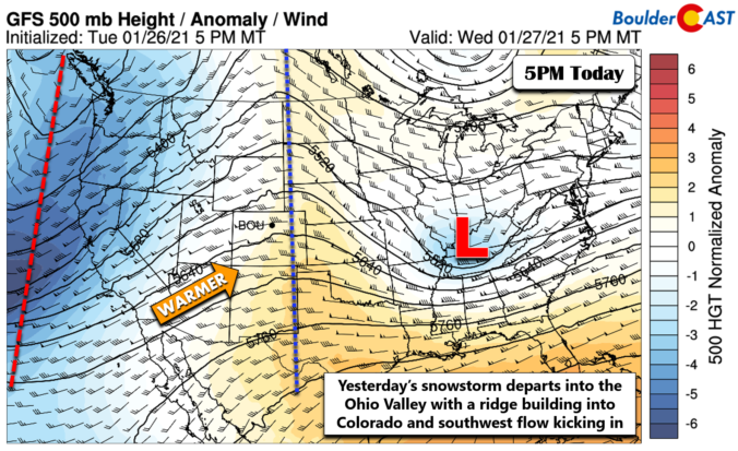
As of Monday morning, the Arctic airmass has spilled into the Front Range, but it won’t be staying for long! Boulder and Denver will be in and out of the frigid air much of the week ahead as the Arctic front wobbles back and forth. As such, some days will be more pleasant than others. While still somewhat uncertain, we are expecting the coldest air in years to inundate the region late in the week into the upcoming weekend alongside a chance of snow. Read on for our complete outlook of the upcoming week.

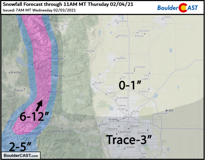
A strong jet streak moved across Colorado on the evening of February 3rd with a heavy band of jet-forced snow clipping only the far south and eastern portions of the Denver Metro area. Let’s take a look at the totals.

⦁❶⦁ Despite Phil’s wintery prediction earlier this morning, our temperatures will soar into the 60’s today and tomorrow
⦁❷⦁ A quick-hitting trough will bring a chance of snow to the Front Range Wednesday night
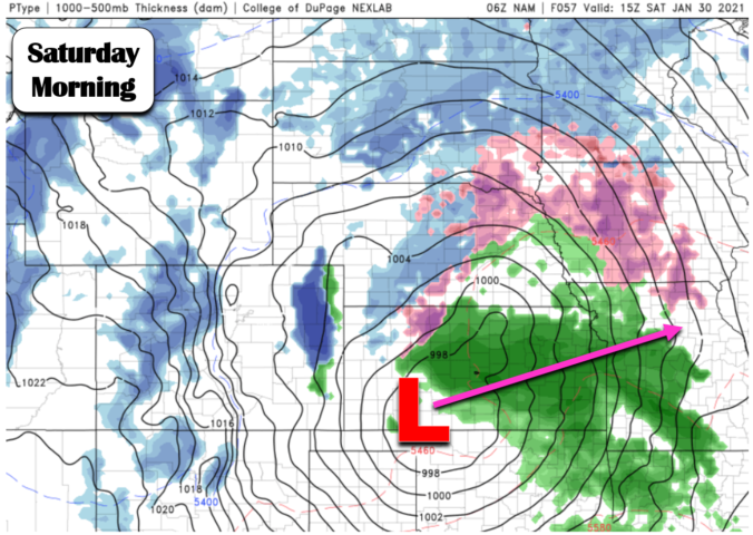
⦁❸⦁ Even with decent lift and a potent jet core overhead, downslope looks to be too much to overcome northwest of Denver with this system
⦁❹⦁ Expected accumulations are minimal, but as always forecasting jet snow is tricky so stay tuned!

Live View of Boulder

Current Conditions

Live Radar

Recent Premium Posts

BoulderCAST Daily – Fri 05/01/26 | Warming up this weekend
🌡️ Warming up this weekend, from the upper 50s-60 today to the upper …
BoulderCAST Daily – Tue 04/28/26 | Staying cool with a couple showers, the late-week storm is still the main event despite trending south
🌧️ Morning wave = main show, with light rain showers and Foothills wet …
BoulderCAST Daily – Sun 04/26/26 | Showers and some storms later today and this evening
🌧️ A wet afternoon and early evening, with showers and a few rumbles …
3-Day Forecast

Trending Content

© 2026 Front Range Weather, LLC