
A strong jet streak moved across Colorado on the evening of February 3rd with a heavy band of jet-forced snow clipping only the far south and eastern portions of the Denver Metro area. Let’s take a look at the totals.
Boulder and Denver both reported just a few raindrops and not even a trace of snow from this event. Of course, this was expected and well-highlighted in our forecast. The Foxfield/Parker area saw around 1″ of snow late Wednesday evening, with more like 3 to 8″ reported across the Palmer Divide from Castle Rock into Monument where the heavy snow band trained for a several hours.
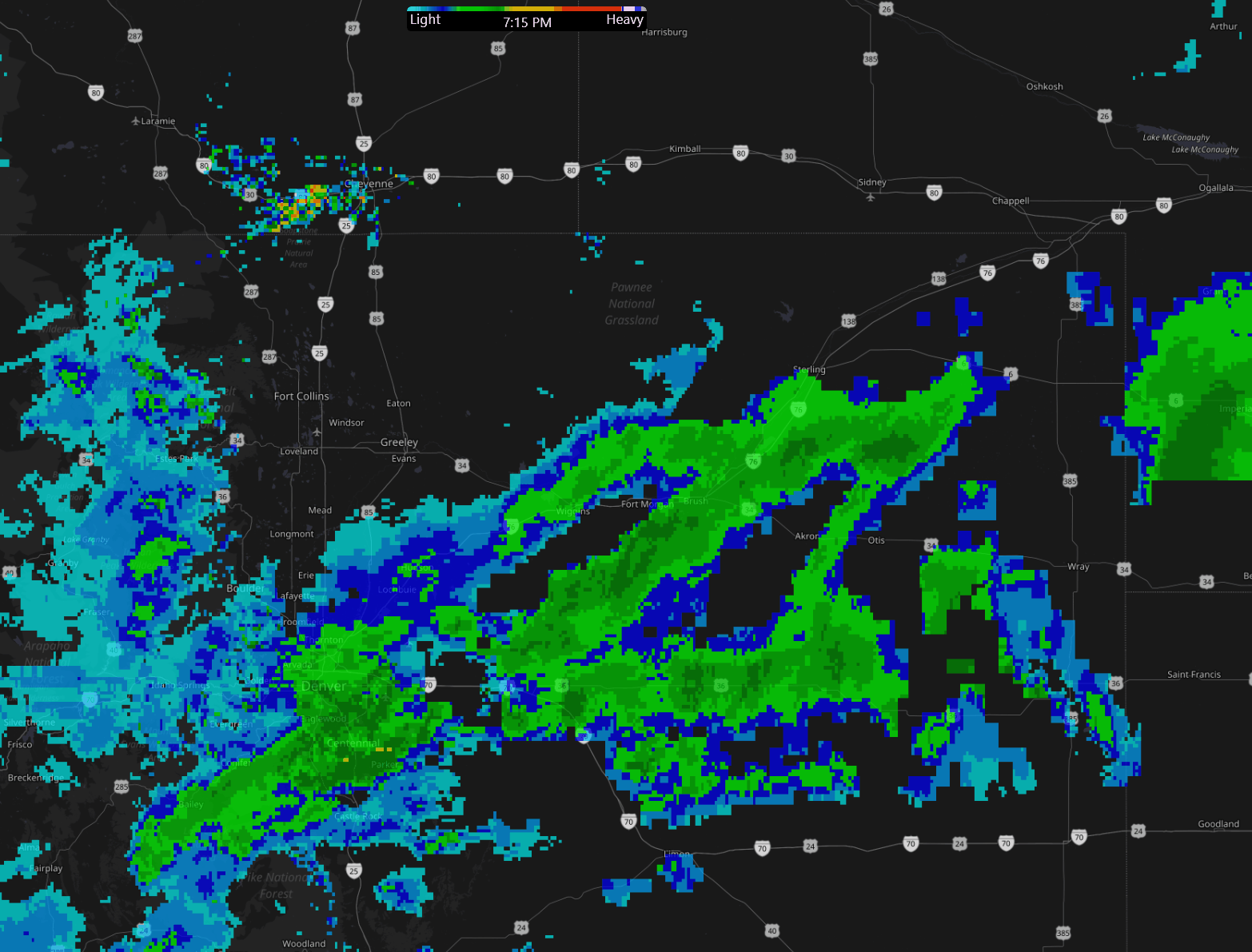
Radar animation from around 9PM on February 3, 2021 showing the heavy snow band.
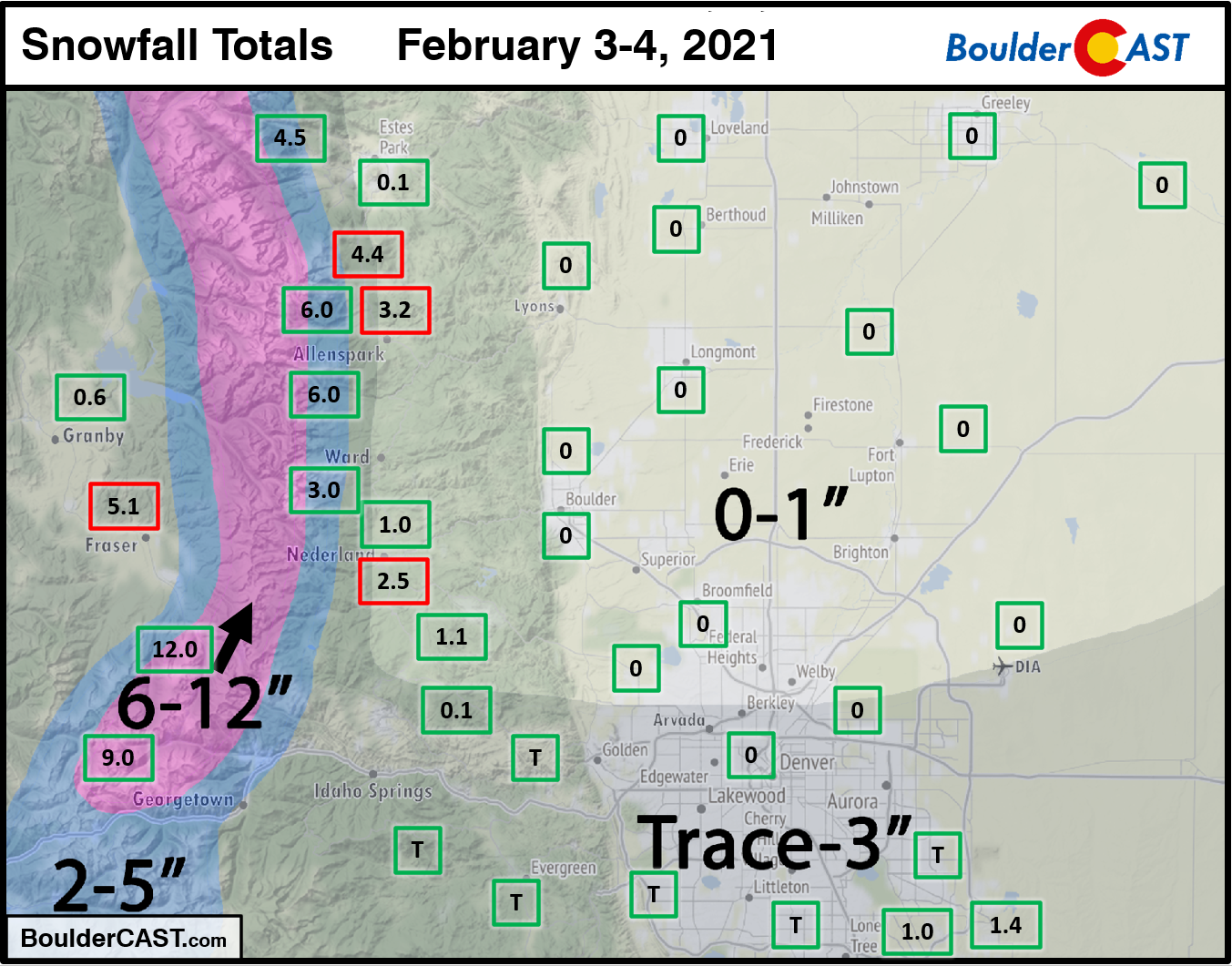
Shown below is our snowfall forecast map with actual storm totals overlaid in boxes. Green boxes indicate that our forecast verified to within one inch of the observed snowfall. Red did not.
Continue to 2020-2021 Winter Snow Summary


You must be logged in to post a comment.