
Author: Ben Castellani (Page 132 of 301)
Ben grew up in southwestern Pennsylvania and holds both a bachelor's and a master's degree in Meteorology, the latter being from CU Boulder. His hometown received nearly three feet of snow from the Storm of the Century back in March of 1993, sparking his initial interest in impactful weather. Ben currently works on remote sensing and data analysis software at NV5 Geospatial Software in Boulder.
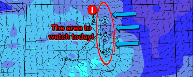
An intriguing weather setup is developing today that will bring a high likelihood of scattered heavy snow showers to the Front Range Wednesday afternoon and evening. The focus will be across the western Denver Metro area, but everyone stands a chance at some snow. We discuss potential snowfall amounts and the impacts to the Wednesday evening commute.

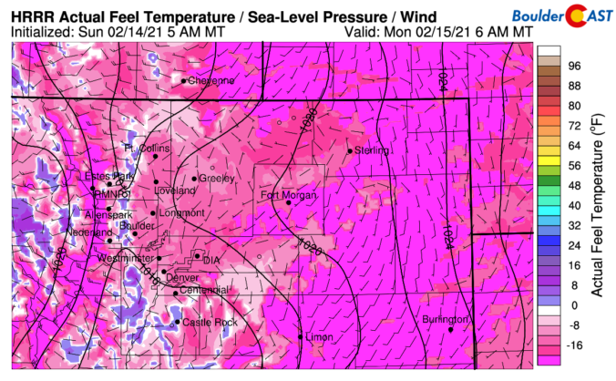
Snowfall amounts over the last few days were largely disappointing across the Denver Metro area, mostly coming in below expectations. We discuss what happened to all the snow, look ahead to the coldest temperatures which are still to come and discuss why Sunday night will actually be warmer than last night in some locations.
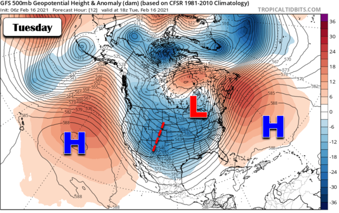
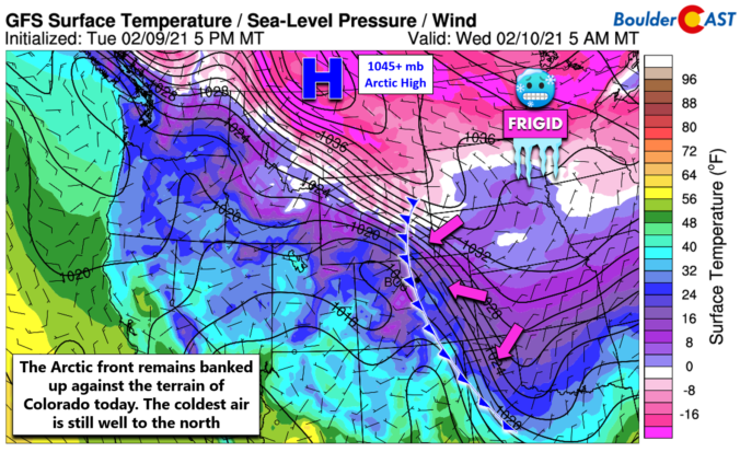
It’s certainly busy in the weather world this weekend as the coldest air in years arrives to eastern Colorado alongside several chances for light snow. The weather models have largely come into agreement regarding what will transpire in the coming days and thus our forecast confidence is growing. We discuss just how cold it will get, the timing on those snow chances and give our preliminary snowfall forecast for the region. Let’s take a look.


Live View of Boulder

Current Conditions

Live Radar

Recent Premium Posts

BoulderCAST Daily – Fri 05/01/26 | Warming up this weekend
🌡️ Warming up this weekend, from the upper 50s-60 today to the upper …
BoulderCAST Daily – Tue 04/28/26 | Staying cool with a couple showers, the late-week storm is still the main event despite trending south
🌧️ Morning wave = main show, with light rain showers and Foothills wet …
BoulderCAST Daily – Sun 04/26/26 | Showers and some storms later today and this evening
🌧️ A wet afternoon and early evening, with showers and a few rumbles …
3-Day Forecast

Trending Content

© 2026 Front Range Weather, LLC