Author: Ben Castellani (Page 134 of 301)
Ben grew up in southwestern Pennsylvania and holds both a bachelor's and a master's degree in Meteorology, the latter being from CU Boulder. His hometown received nearly three feet of snow from the Storm of the Century back in March of 1993, sparking his initial interest in impactful weather. Ben currently works on remote sensing and data analysis software at NV5 Geospatial Software in Boulder.
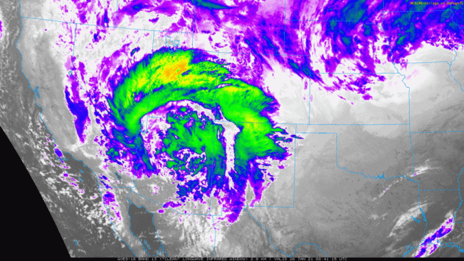
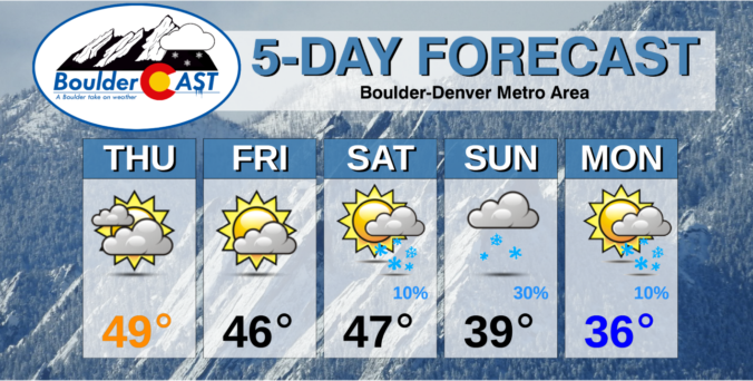
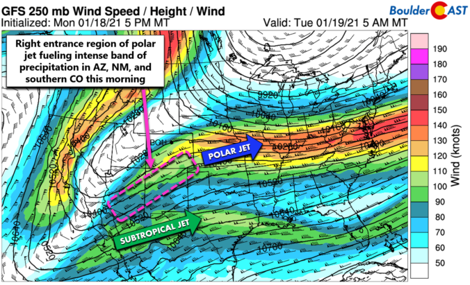
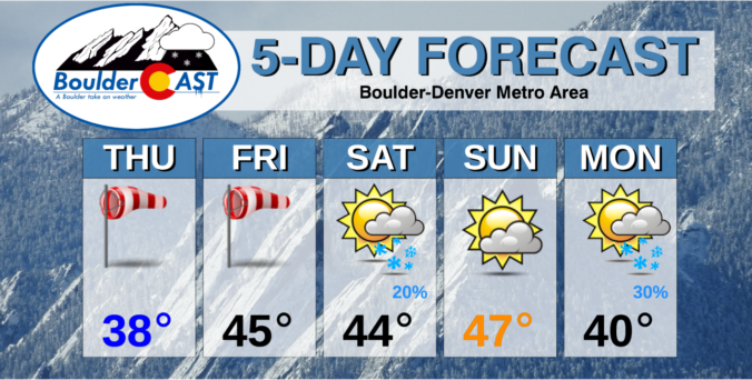
Winter weather returns to the entire Front Range Monday and Tuesday with light snow on the table for the area. We discuss factors contributing to the early week snow and provide our snowfall forecast map. By mid-week, the pattern will shift abruptly and we could be talking 60 degrees come Friday. Read on for our complete outlook of this week’s weather.

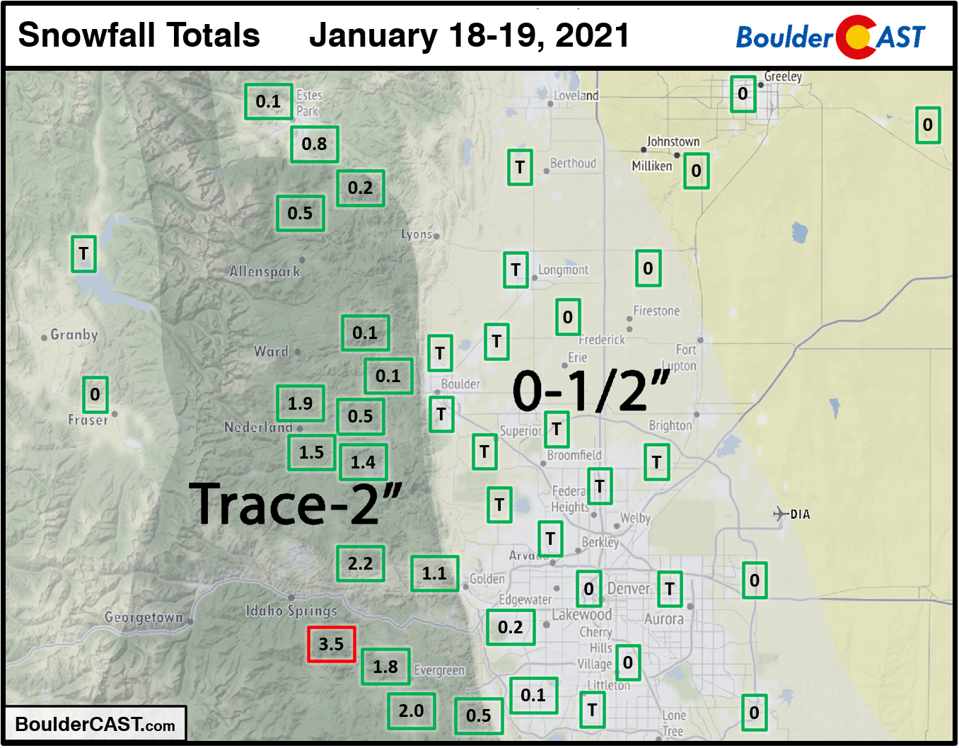
A few light snow showers impacted the Denver Metro area on Martin Luther King Jr Day afternoon and into the overnight. Only the very far southwestern suburbs had any snow stick. Boulder and Denver both reported just a trace of snow. A few inches were observed in the Foothills of Boulder and Jefferson Counties.
Shown below is our snowfall forecast map with actual storm totals overlaid in boxes. Green boxes indicate that our forecast verified to within one inch of the observed snowfall. Red did not.

Live View of Boulder

Current Conditions

Live Radar

Recent Premium Posts

BoulderCAST Daily – Fri 05/01/26 | Warming up this weekend
🌡️ Warming up this weekend, from the upper 50s-60 today to the upper …
BoulderCAST Daily – Tue 04/28/26 | Staying cool with a couple showers, the late-week storm is still the main event despite trending south
🌧️ Morning wave = main show, with light rain showers and Foothills wet …
BoulderCAST Daily – Sun 04/26/26 | Showers and some storms later today and this evening
🌧️ A wet afternoon and early evening, with showers and a few rumbles …
3-Day Forecast

Trending Content

© 2026 Front Range Weather, LLC
You must be logged in to post a comment.