As of Sunday afternoon, skies are sunny and Round #1 of our Arctic Blast is in the books. This wave, which was always more about the white stuff than the extreme chill, delivered several fluffy inches of snow to the entire area, even over a foot in parts of Boulder County. Despite how nice it looks outside now, we are closely tracking Round #2 arriving Sunday evening into Monday with even colder air and another pulse of fluffy snowfall. Let’s take a look.
At a Glance
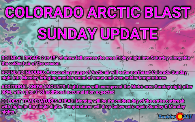
- Round #1 Recap: 2 to 15” of snow fell across the area Friday night into Saturday alongside the coldest air of the season.
- Round #2 Inbound: A secondary surge of Arctic air will enter northeast Colorado Sunday night into Monday bringing another round of snow and even colder temperatures
- Additional Snow Sunday Night: Light snow will overspread the Metro area Sunday night after 8PM, with up to 3” of additional accumulation expected
- Coldest Air Still to Come: Monday will be the coldest day of the entire outbreak with highs in the single digits. Temperatures will drop below zero again Sunday & Monday nights.
Daily Forecast Updates
Get our daily forecast discussion every morning delivered to your inbox.
All Our Model Data
Access to all our Colorado-centric high-resolution weather model graphics. Seriously — every one!
Ski & Hiking Forecasts
6-day forecasts for all the Colorado ski resorts, plus more than 120 hiking trails, including every 14er.
Smoke Forecasts
Wildfire smoke concentration predictions up to 72 hours into the future.
Exclusive Content
Weekend outlooks every Thursday, bonus storm updates, historical data and much more!
No Advertisements
Enjoy ad-free viewing on the entire site.
ROUND #1 RECAP: Fluffy snow blanketed the region Friday night!
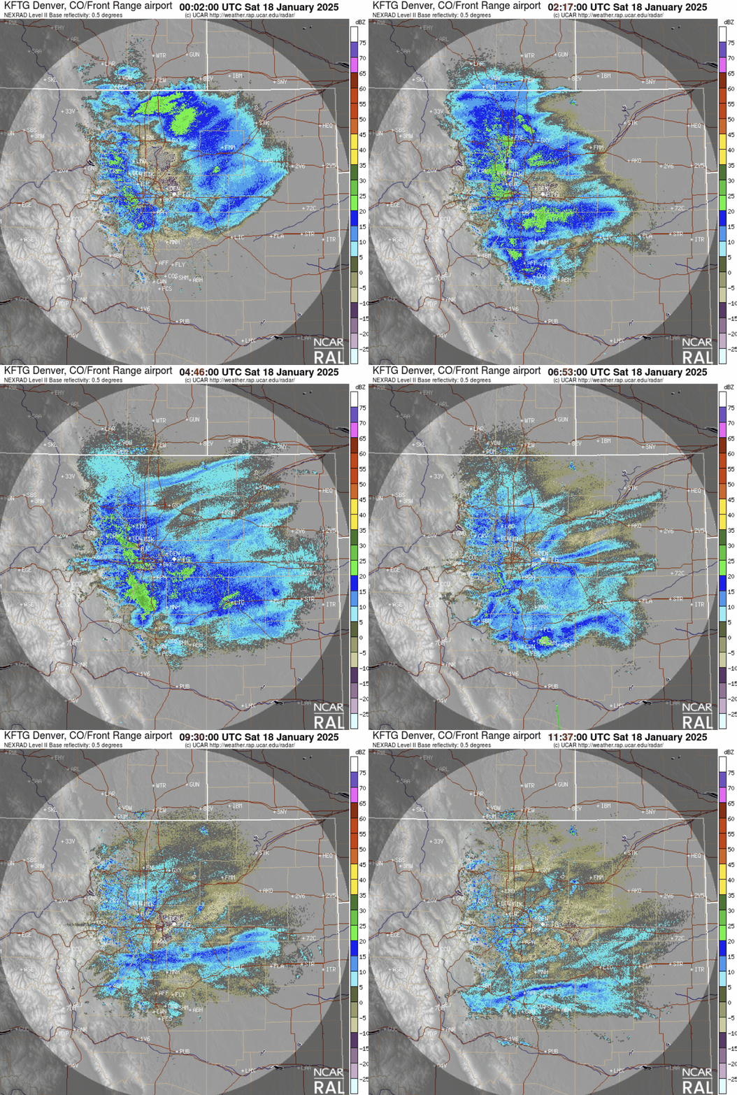
Snow began quickly as the bitter cold air oozed into the Front Range Friday afternoon, with light snow lingering in many areas for upwards of 24 hours into Saturday afternoon and evening. The best ingredients— including lift from the passing trough, frontal forcing, weak jet energy, and deep but weak upslope flow — came together only briefly during the first half of Friday night for a few hours and spawned pockets of heavier snow with rates around 1″ per hour. As Friday night wore on, the forcing dissipated leaving behind mostly just shallow and meager 5 MPH upslope banking up against the terrain and light snowfall rates less than 0.5″ per hour. The radar animation below runs from 5PM Friday near the onset of the snow through 5AM Saturday. The end of animation would indicate that snow was about to wrap-up in the Metro area, coming to an end from north to south, but that couldn’t be more false as the shallow upslope kept light snow going in many areas for another 12 hours past this animation’s conclusion. Much of this light snow was forming and falling below the lowest radar beams, so it’s essentially invisible to the radar.
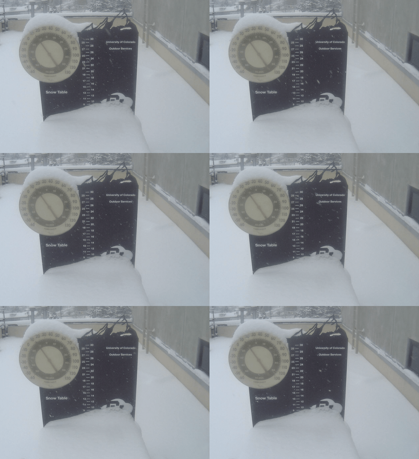
By sunrise on Saturday, anywhere from 2 to 15″ of fluffy snow had fallen across the region, including a solid 8 inches in Boulder. Below was the view from CU campus just after sunrise on Saturday. Light snow continued through the day, amounting to another 1 to 3 inches in most areas before coming to an end fully Saturday evening.
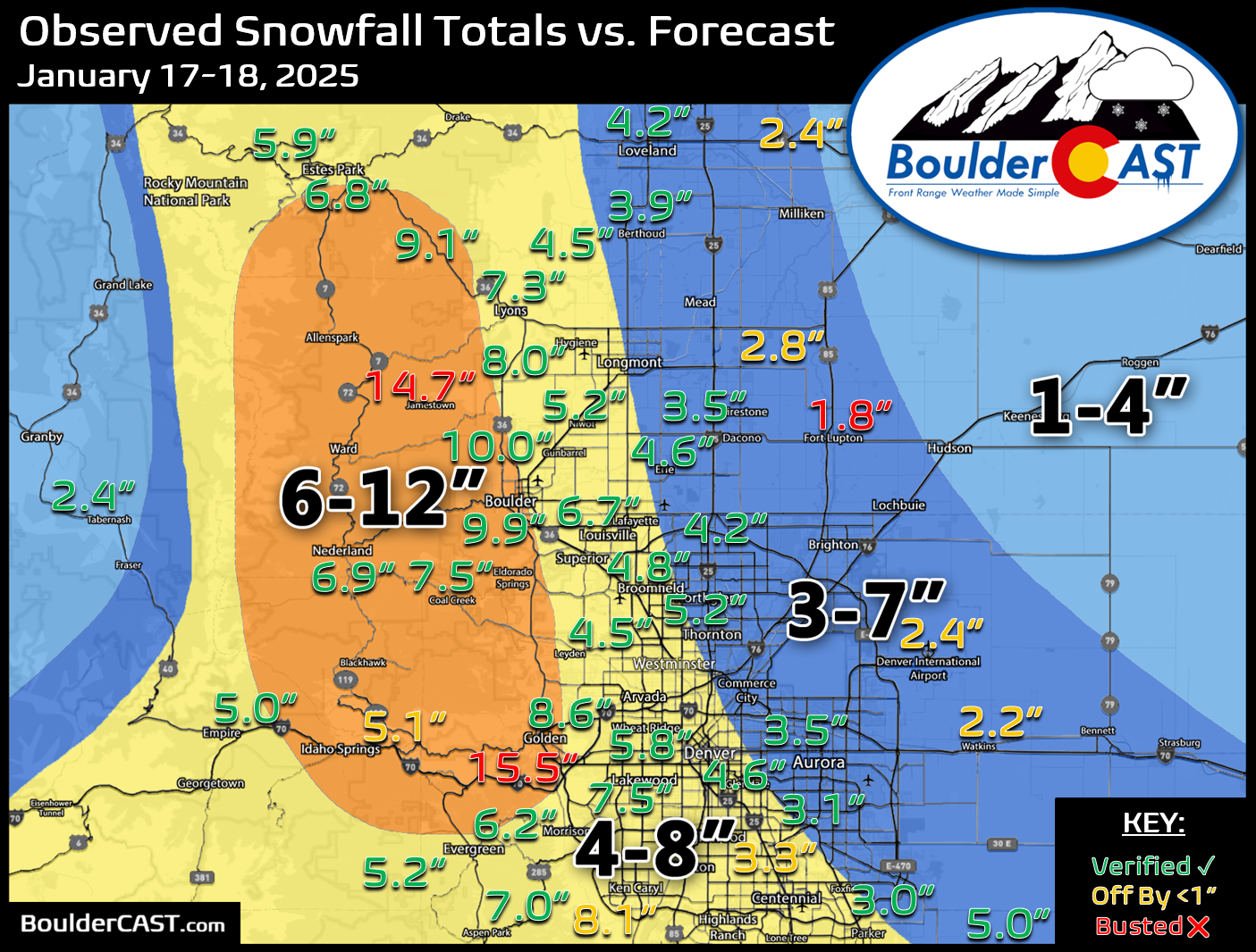
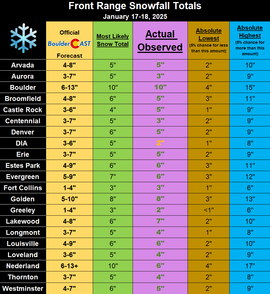
Our snowfall forecast map is shown below with actual storm total numbers overlaid. Green values indicate our forecast verified, Yellow values mean the observed total was just outside our forecast (within 1″), while Red was a busted forecast. In general, most areas received their projected amount of snowfall from this event, though a few eastern spots came in a tad lower than forecast. We’re particularly happy with the good verification of the 6-12″ forecast zone that included Boulder and a chunk of the nearby Foothills. There were even at least two locations in that zone which received more than 14″ of snow!
Our “Most Likely Snow” amounts were nearly perfect across the board, though a few places definitely came in a couple inches lower than expected, though still generally within the bounds of our overall forecast range.
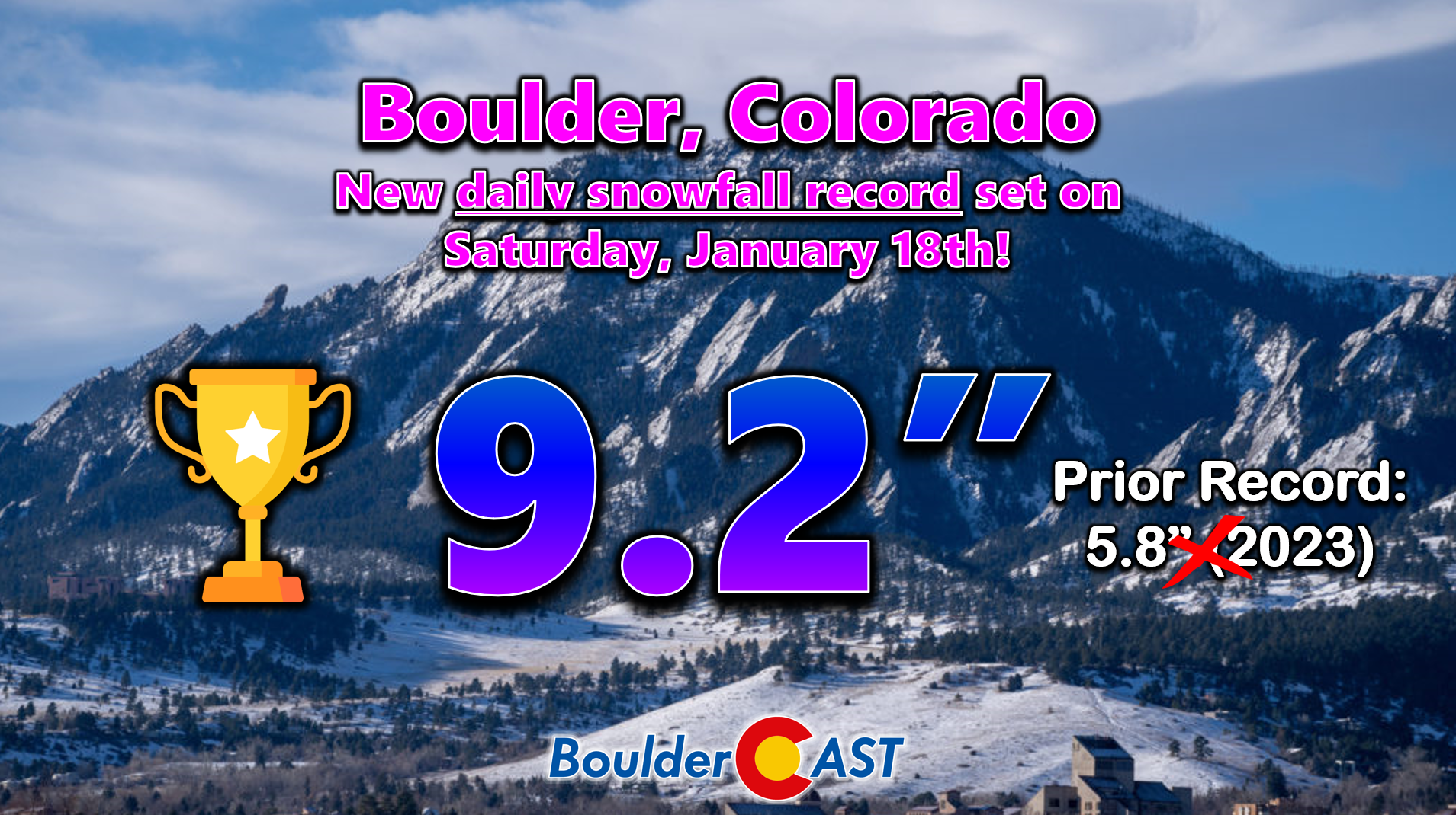
Officially Boulder recorded 9.9″ of snow from this event making this our biggest snowstorm of the season. 9.2″ of that snow fell within the climate period for January 18th which set a new daily snowfall record for the date. The prior record was 5.8″ notched just two years ago. Do you remember that storm? It was a totally different beast than what is transpiring this weekend!
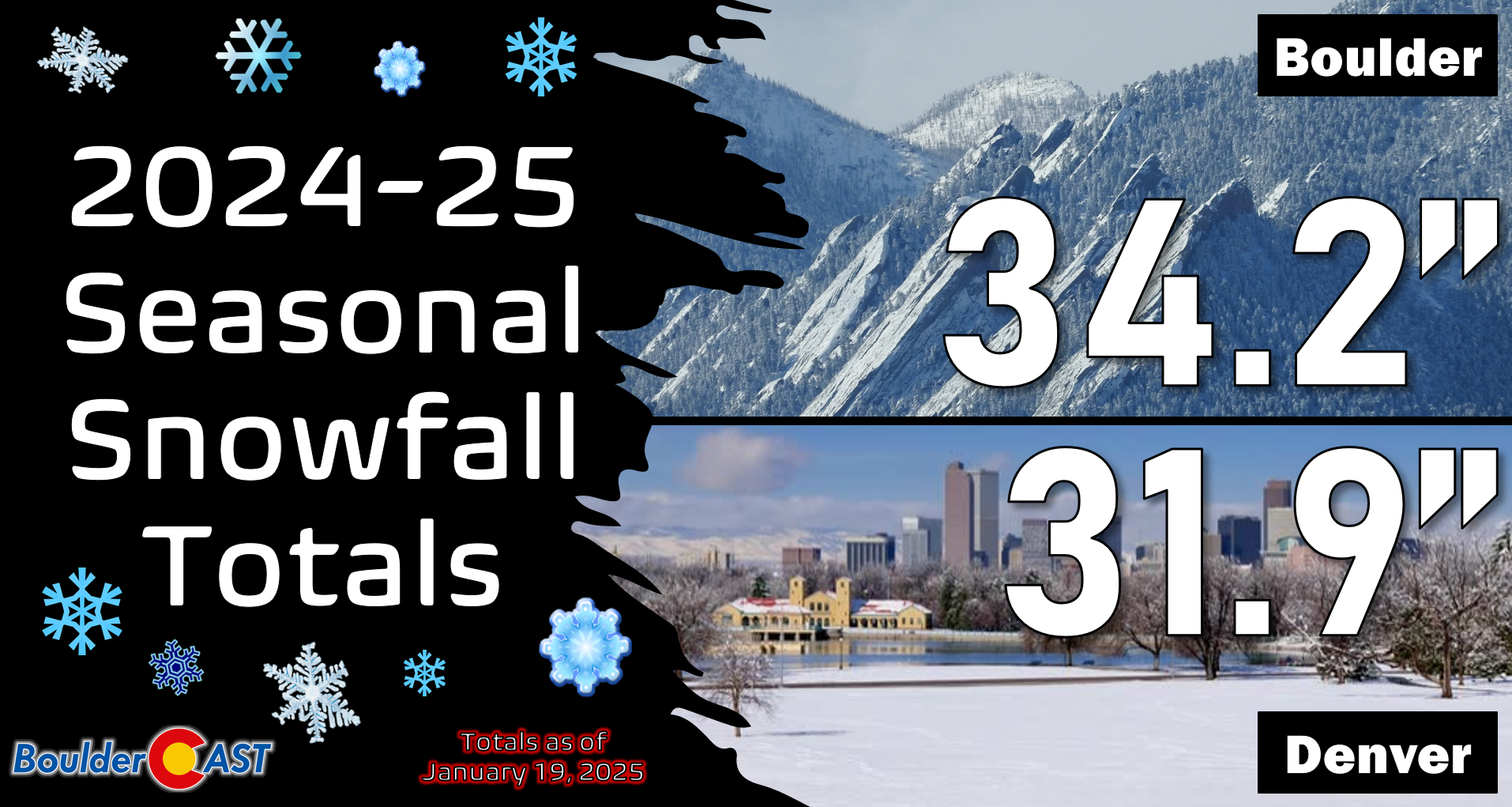
Downtown Denver saw close to 5 inches from Round #1, but the official climate station for the city at Denver International Airport only received 2.4″, one of the lowest amounts in all the lands. After months of holding onto a narrow seasonal snowfall lead, Denver has now been passed by Boulder, something that was inevitably going to happen sooner or later. Both cities have received just shy of three feet of snow this winter, below normal in both cases.
The first round of snow yesterday was also accompanied by the coldest air of the season — though our warm autumn and early winter periods set a very low bar to clear. Prior to this weekend, the coldest temperature observed in Denver was 6°F occurring just about a week ago. Temperatures dropped 17 degrees colder than that this morning reaching -11°F at DIA! This came as skies cleared over fresh snowpack through the overnight period. We don’t yet have the official low temperature in Boulder Sunday morning, but we definitely got below zero and the prior coldest temperature of the season was just 8°F. Yes, the entire Front Range dropped below zero Sunday morning — the Mountains, Plains and Foothills alike!
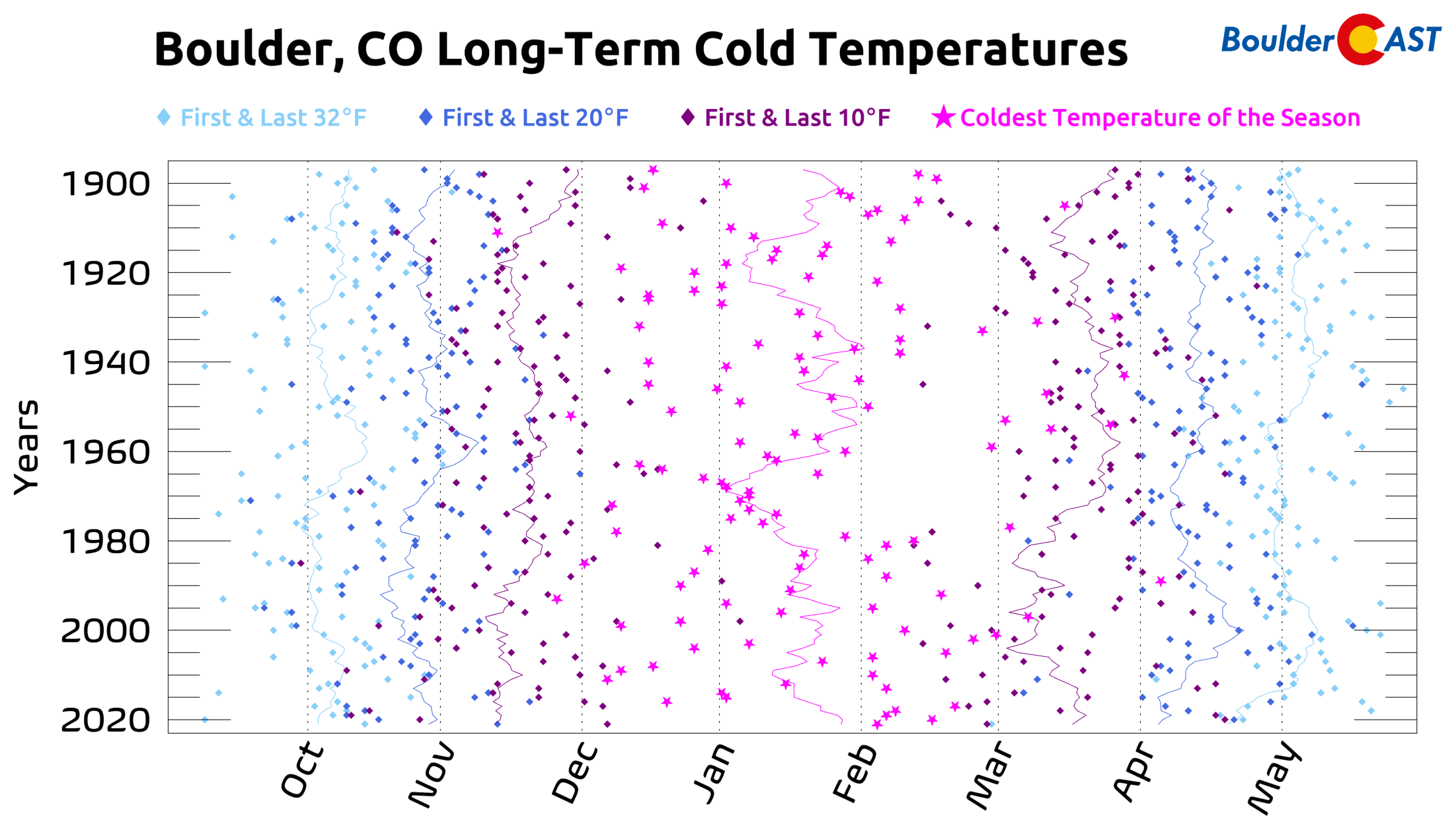
Temperatures in the Boulder-Denver area generally plummeted to between zero and -15°F — definitely cold but nothing too out of the normal for this time of year. January is when we most often see our coldest temperatures, though sometimes our coldest temperatures each winter can occur in the adjacent months.
Round #2 Forecast: Light snow and an even colder airmass arrive Sunday night
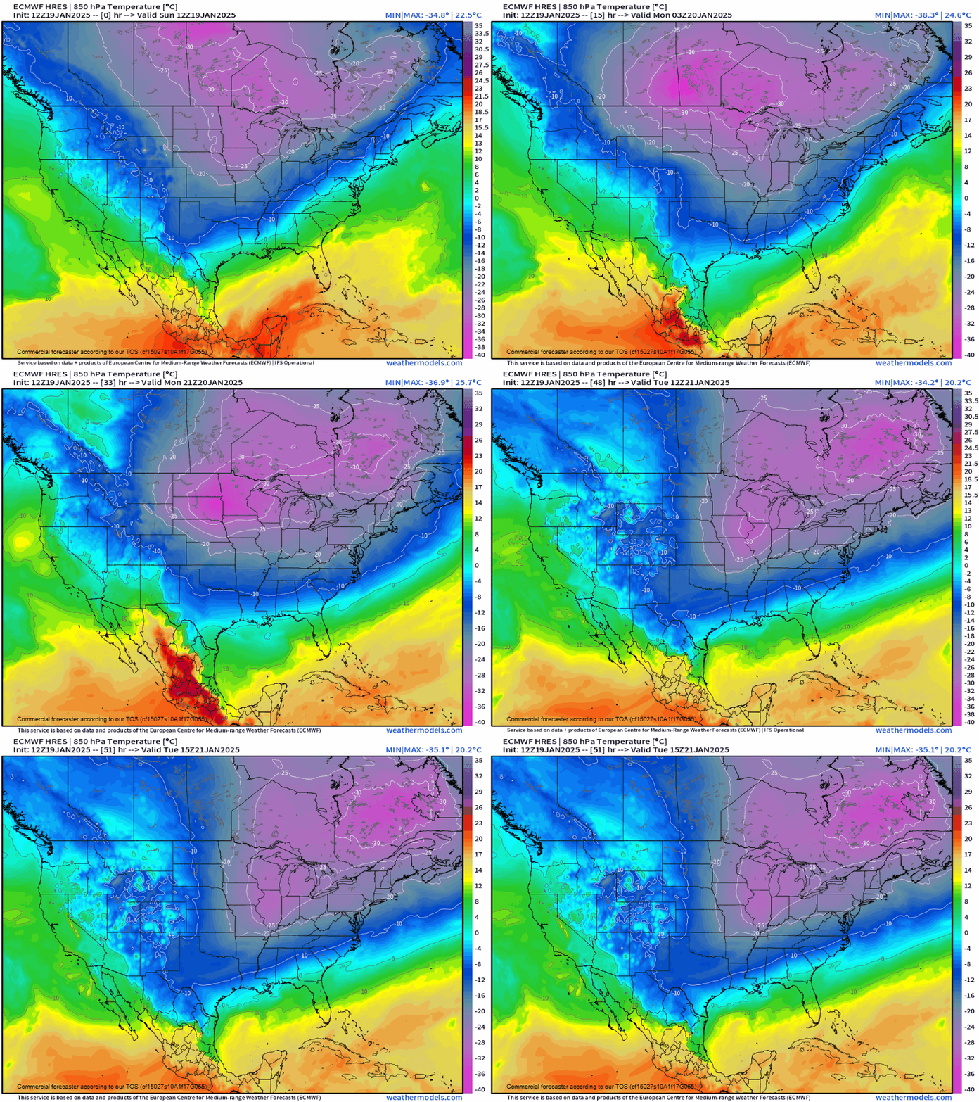
As detailed in our last broader update posted on Thursday, this weekend’s Arctic Blast was set to arrive in two distinct waves. The first Friday into Saturday was to be more snow but not as cold, while the second was expected to be colder but with less snow. That still remains our general thought as we dive head-first into another collision course with an even colder Arctic airmass Sunday night into Monday. Fortunately models have backed away their absolute coldest solutions in recent runs, with the main core of the frigid air just glancing northeast Colorado Sunday night through Monday:
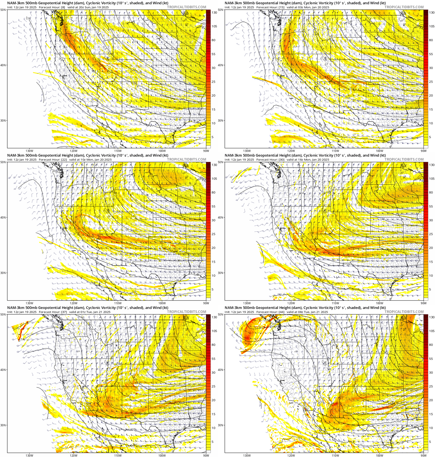
Once again there will be a weak shortwave dropping in with this cold air from the north-northwest. However, this energy will mainly stay west of Colorado in Utah and Nevada, though we will still see weak forcing across our area late Sunday night.
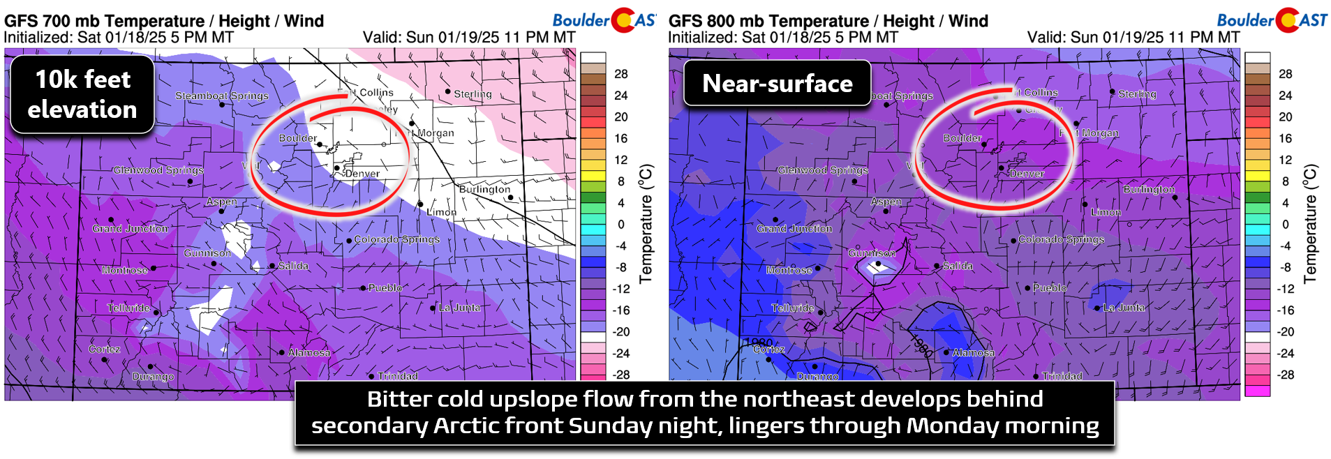
A combination of this passing shortwave and the surge of Arctic air producing weak upslope will lead to another round of snow Sunday evening into Monday for the entire area. Once again, the upslope signature is barely detectable at the 700mb level (below left), with the best upslope staying in the lower atmosphere below 8000 feet elevation, a very common situation when an Arctic airmass only clips northeast Colorado.
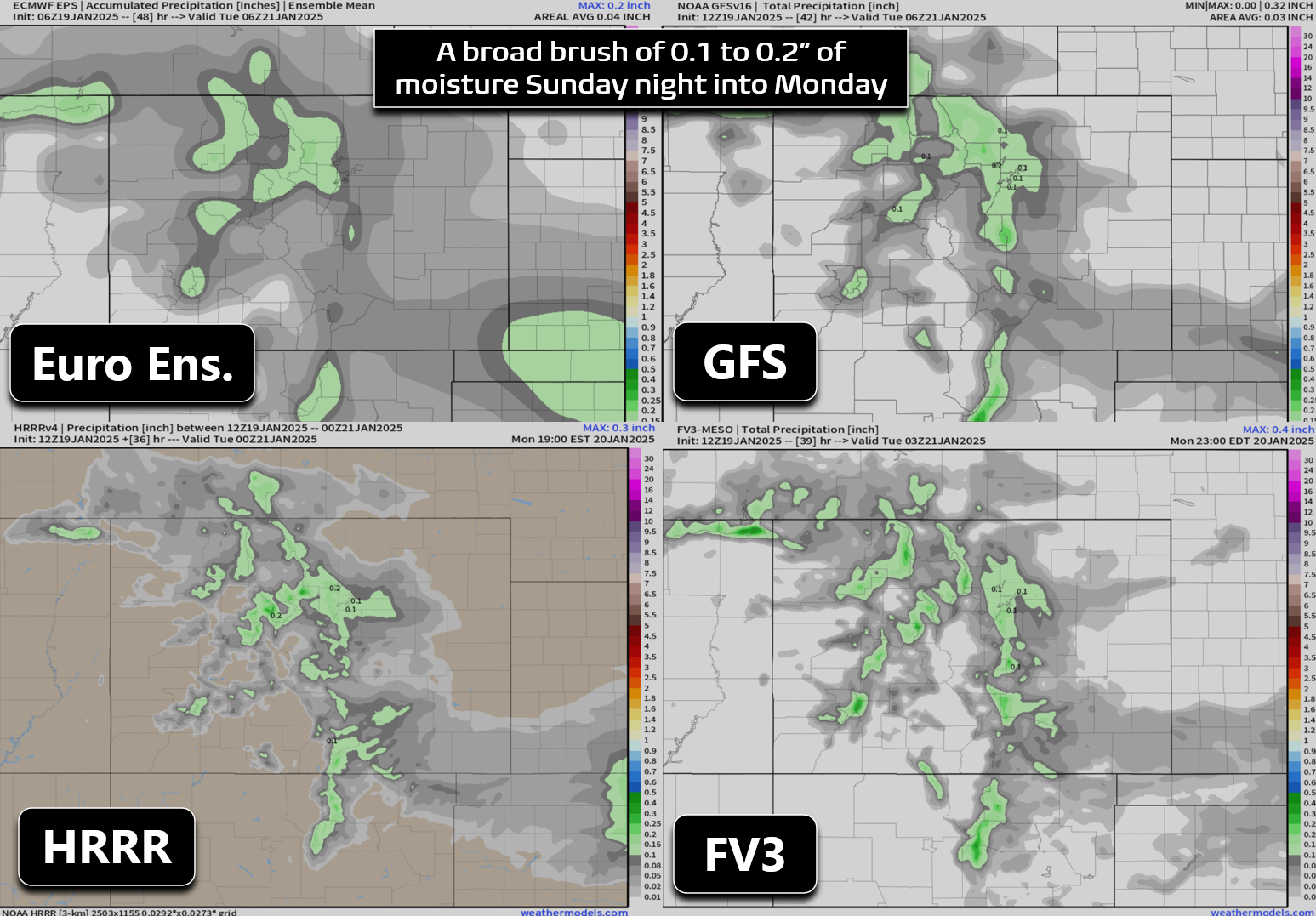
This upslope pattern will once again favor the far western Metro area and the lower Foothills. However, there’s not a lot of forcing here so we’re not going to see anywhere near the amount of snow we did with Round #1. Models have been very consistently producing a widespread 0.05 to 0.2″ of precipitation with this secondary Arctic surge, with areas southwest and west of Denver favored to see the higher end of that range, including around Boulder. Snow ratios will again be pretty high, around 15:1 for this event with temperatures actually being too cold to support the fluffiest snow ratios Sunday night.
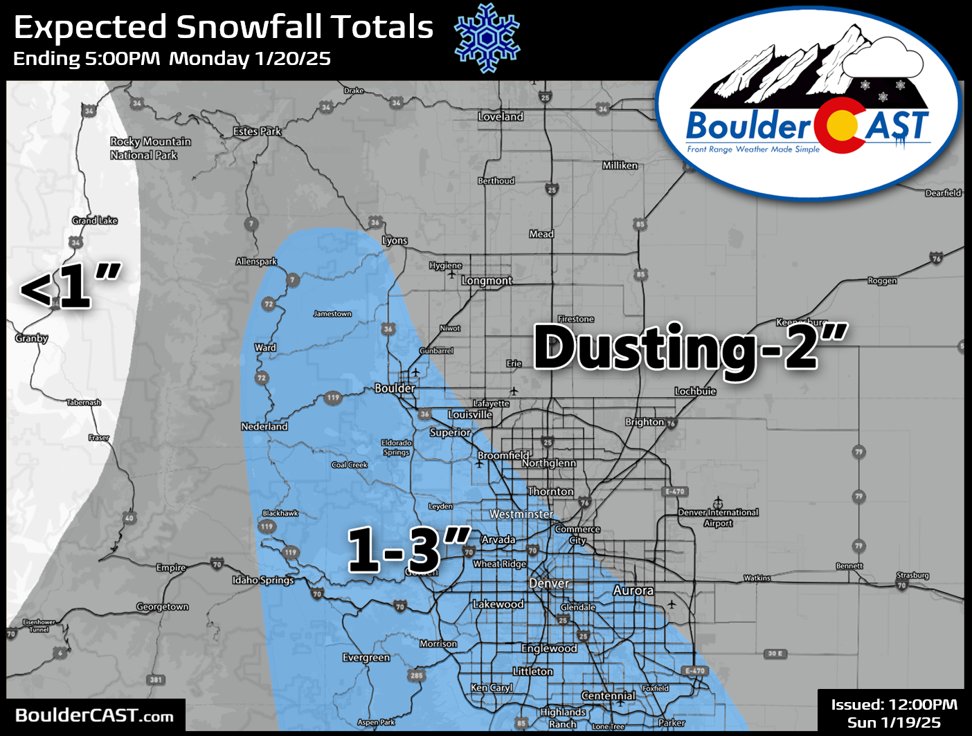
Our snowfall forecast map for Round #2 Sunday evening into Monday is shown below. In general we’re looking at a dusting to 3″ across the entire area, with the best chance to see a couple fluffy inches from Boulder southward in and near the lower Foothills.
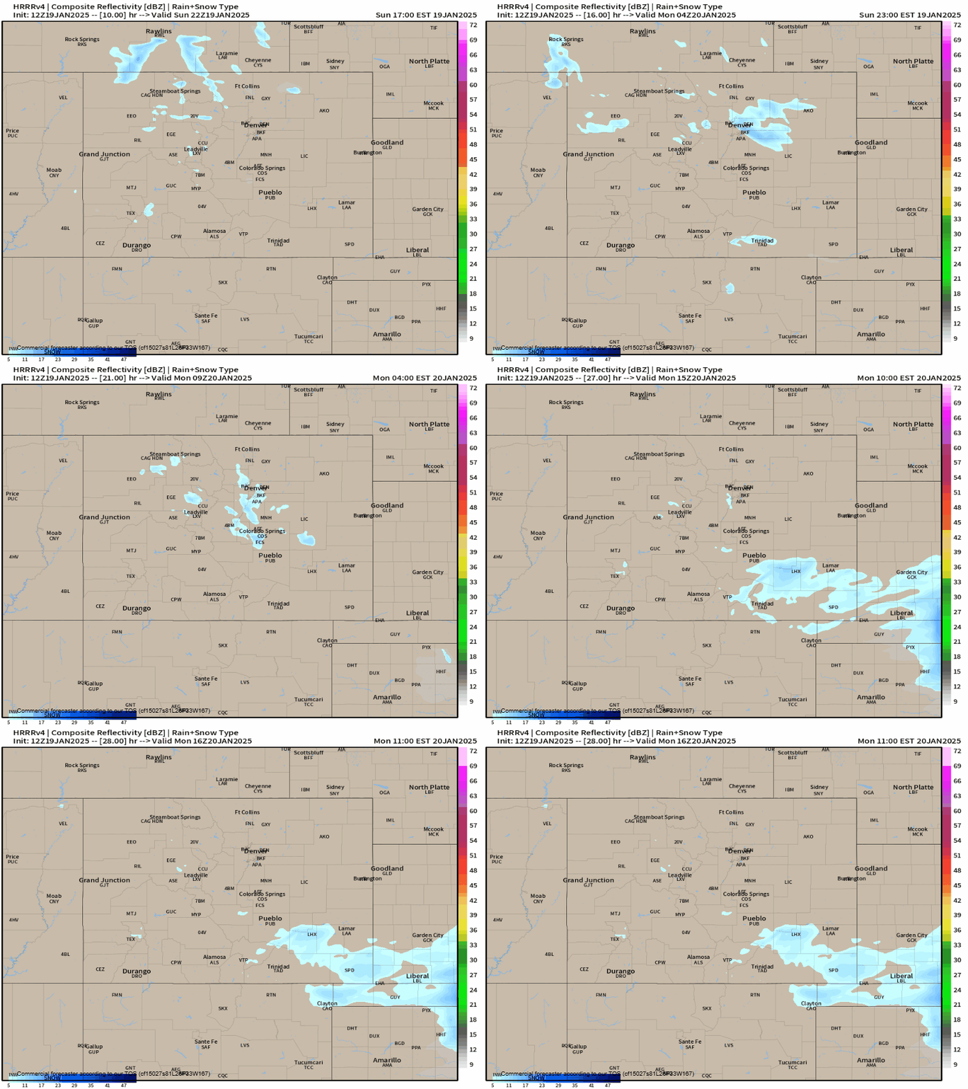
The latest runs of the HRRR short-range model show light snow developing late this evening across the Metro area, roughly around 8PM or so, with very light snow lingering into early Monday morning. The timing alone could create some slick spots for the Monday AM commute. However, since Monday is a federal holiday roadways shouldn’t be as cluttered — unless your heading up to the slopes, that is!
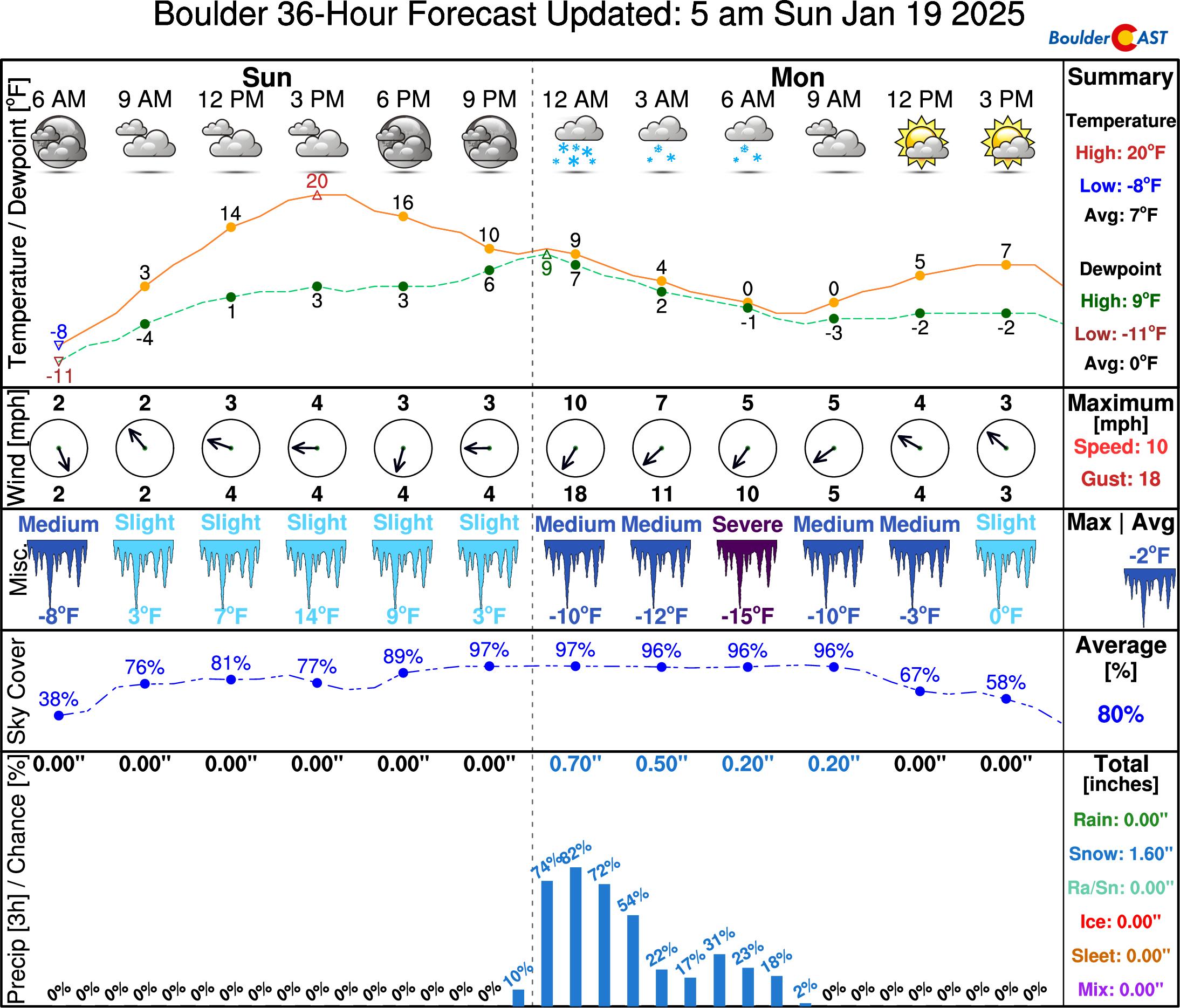
Temperatures will drop further Sunday night as the next surge of Arctic air moves in. As the snow falls, temperatures will drop from the single digits Sunday evening down below zero by sunrise Monday. Snow should wrap up pretty quickly in the morning with partly cloudy skies by Monday midday. It won’t be warming up much, though, with expected highs only in the single digits. Monday night may end up being a bit warmer, despite clearing skies and fresh snow. The Arctic airmass really starts to vacate the region during this time and warmer air may work in from the west via downslope. There will probably be a mixbag of temperatures Monday night across the Front Range, with warmer readings well above zero in and near the Foothills, with perhaps very cold -10 to -20° readings in the river valleys, like near Greeley and Longmont.
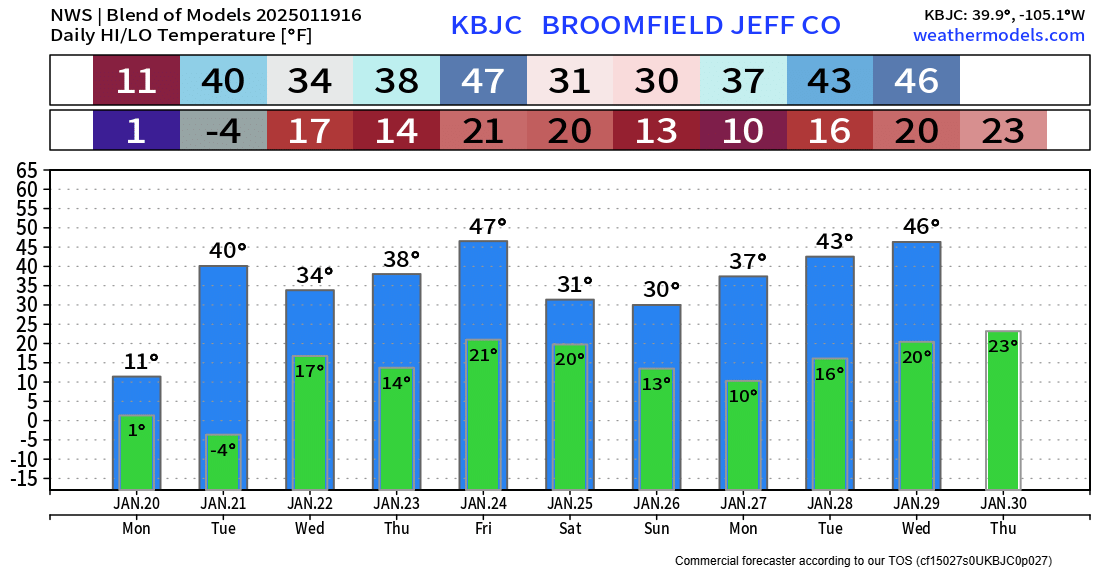
Temperatures will warm up considerably heading into Tuesday afternoon, possibly even getting close to 40 degrees, as downslope flow fully evicts that cold, dense Arctic air. Temperatures the rest of the extended will remain generally below normal in the 30s to 40s.
We’ll talk more Monday morning in our usual weekly outlook about the upcoming weather in greater detail! Be sure to follow us on Twitter, Bluesky, Facebook, and Threads for impromptu weather updates in the coming days as this Arctic outbreak continues, or subscribe to get notified of our long-form updates here.
By the way, about 50% of our readers claimed to be looking forward to this weekend’s Arctic Blast? 48 hours into the ordeal, we do wonder if you still feel that way!?
Are you ready for the arrival of REAL winter this weekend in Colorado? 🥶☃️ #Cowx
— BoulderCAST Weather 🏔️❄️ (@BoulderCAST) January 17, 2025
Get BoulderCAST updates delivered to your inbox:
Daily Forecast Updates
Get our daily forecast discussion every morning delivered to your inbox.
All Our Model Data
Access to all our Colorado-centric high-resolution weather model graphics. Seriously — every one!
Ski & Hiking Forecasts
6-day forecasts for all the Colorado ski resorts, plus more than 120 hiking trails, including every 14er.
Smoke Forecasts
Wildfire smoke concentration predictions up to 72 hours into the future.
Exclusive Content
Weekend outlooks every Thursday, bonus storm updates, historical data and much more!
No Advertisements
Enjoy ad-free viewing on the entire site.
Enjoy our content? Give it a share:





You must be logged in to post a comment.