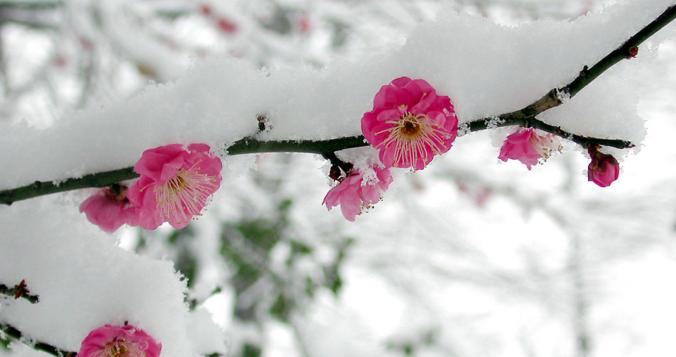
We hope you enjoyed the taste of summer as temperatures soared into the 70s and 80s the last several days because we will be paying for that warmth in short order as much colder temperatures and snowflakes take over the Front Range to end the week. A tricky forecast is set to unfold over the area Friday into Saturday with rain changing to wet spring snow for everyone. Up to 10″ could fall in the higher Foothills communities with even slushy accumulations on the table for the Denver-Boulder area. Let’s discuss the latest on the approaching winter storm.

Go Premium, get all the perks.
Daily Forecast Updates
Get our daily forecast discussion every morning delivered to your inbox.
All Our Model Data
Access to all our Colorado-centric high-resolution weather model graphics. Seriously — every one!
Ski & Hiking Forecasts
6-day forecasts for all the Colorado ski resorts, plus more than 120 hiking trails, including every 14er.
Smoke Forecasts
Wildfire smoke concentration predictions up to 72 hours into the future.
Exclusive Content
Weekend outlooks every Thursday, bonus storm updates, historical data and much more!
No Advertisements
Enjoy ad-free viewing on the entire site.
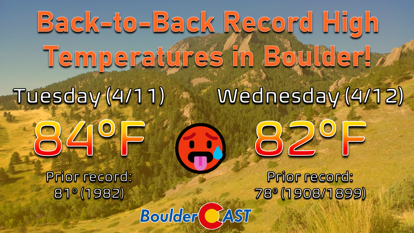
he focus of our weather discussions this week has definitely been the ongoing “heatwave” and with good reason. Most cities across the Front Range obliterated multiple long-standing warm-weather records by more than five degrees in some cases — some of the records shattered date back more than 115 years! Boulder set new record high temperatures both Tuesday and Wednesday with plenty of degrees to spare, as well two warm overnight low temperatures Tuesday night and Wednesday night. Essentially four consecutive warm temperature records were broken in Boulder this week (including two highs, two lows).
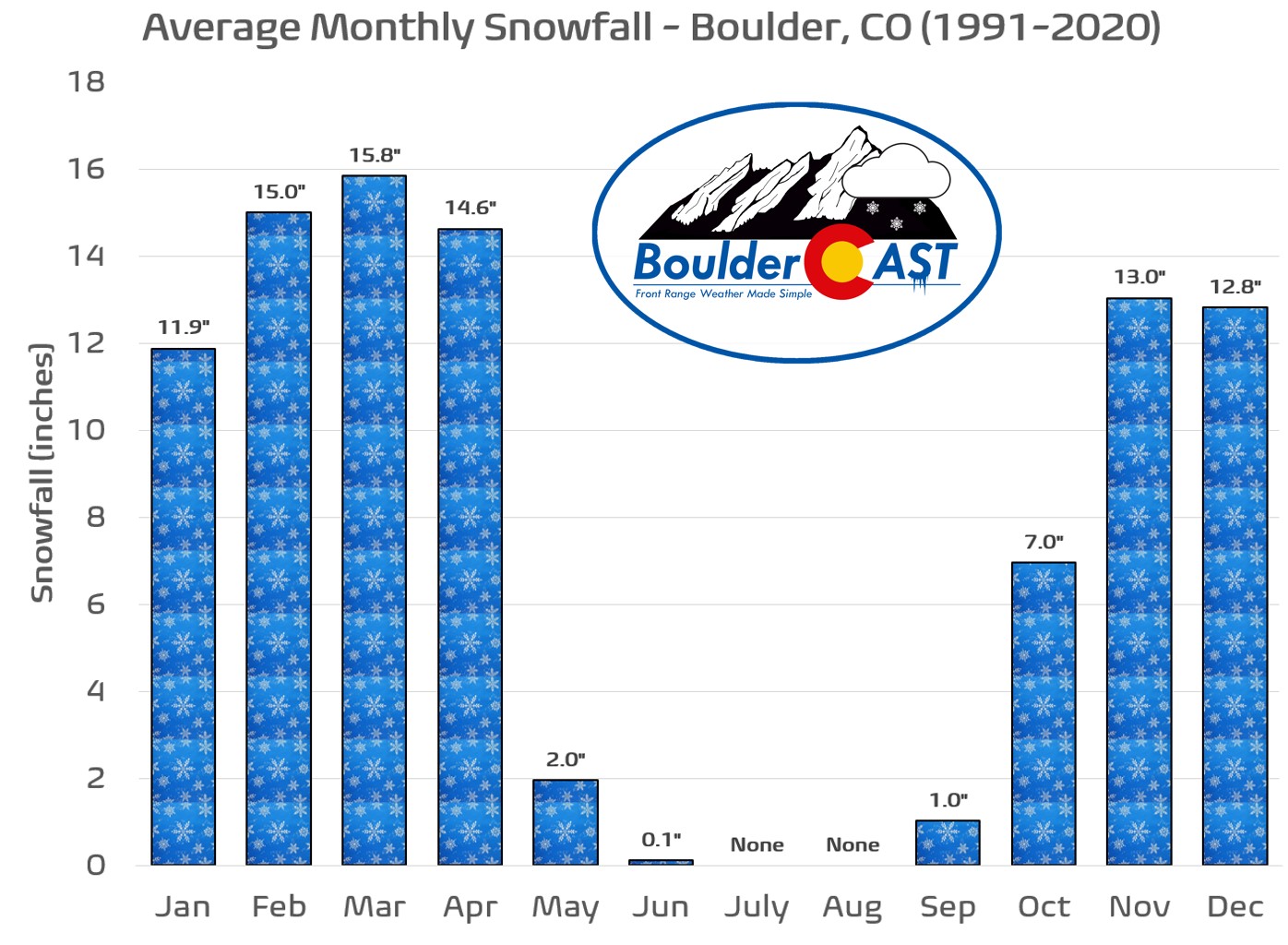
In the back of our minds, we all knew that temperatures this warm for this long in the middle of April would definitely have some type of eventual wintry consequences — and that is exactly what will unfold to end the week. After all, April is our third snowiest month of the year!
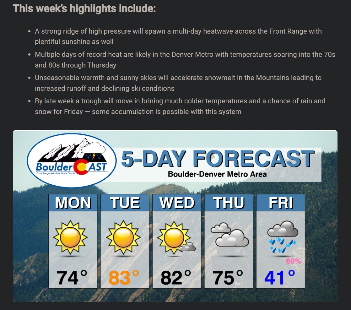
The incoming storm system has been looking rather impressive in the weather models for a solid week now — though the intensity has declined as time went on and the storm morphed from a juicy cut-off low into a more progressive, open wave trough. Back on Monday when we issued our weekly outlook, we included a rare 60% chance of precipitation on Friday, which at the time was still five days out in the forecast. A forecast that bold is usually equivalent to a meteorological “pie in the sky” in such an arid climate, but we were confident in something wintry unfolding late in the week! Thus, this snow should be no surprise to our readers.
This afternoon will be the last hurrah of warmth for the week, one which has found most of eastern Colorado under Red Flag Warnings with near-critical fire danger present. You probably didn’t notice, but there was a decent batch of lofted smoke passing through the area this morning from fires burning all the way down in Mexico!
Lofted smoke passing over the Front Range this morning originating from fires burning in the Mexican state of Sonora #COwx pic.twitter.com/IjgfRdREnx
— BoulderCAST Weather (@BoulderCAST) April 13, 2023
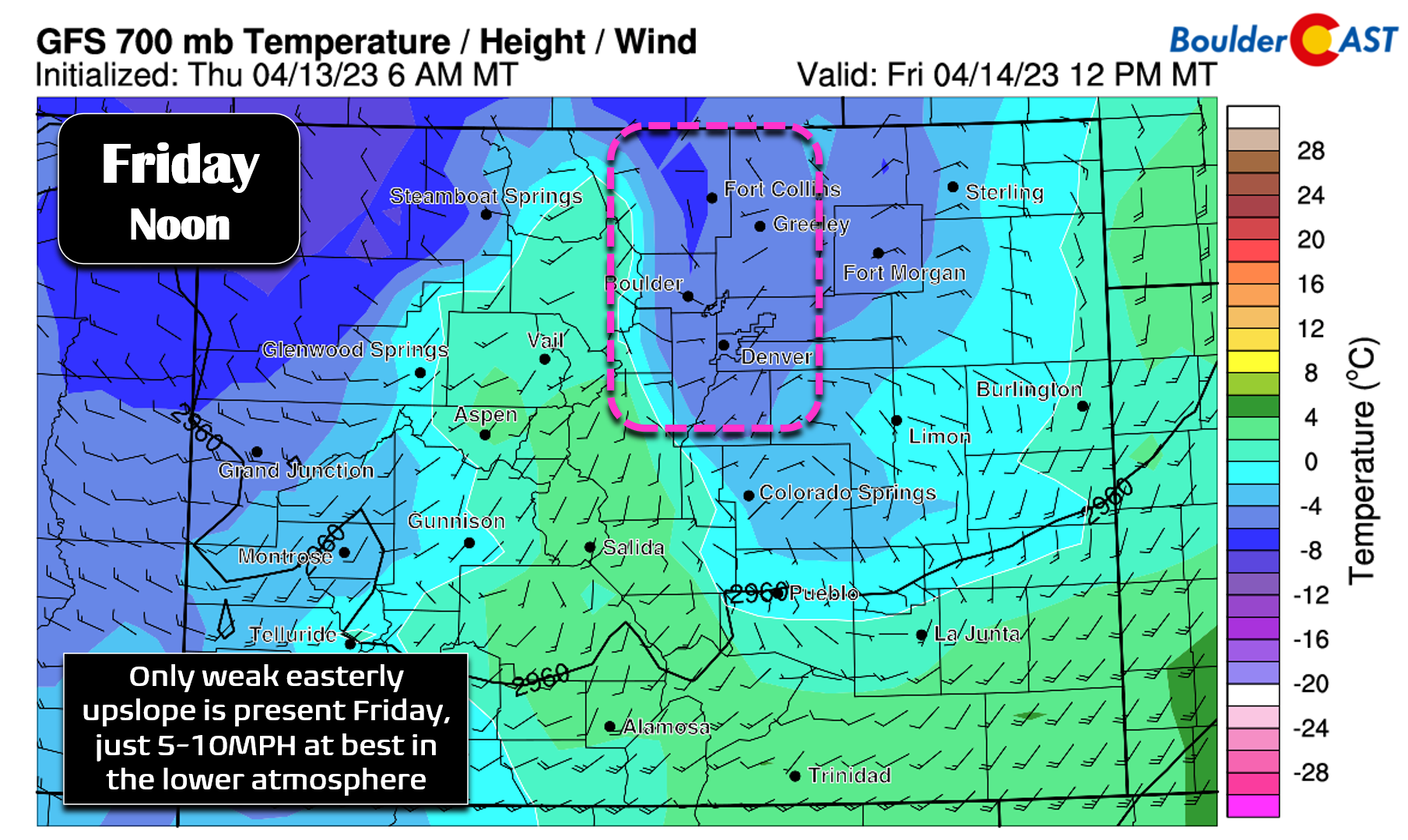
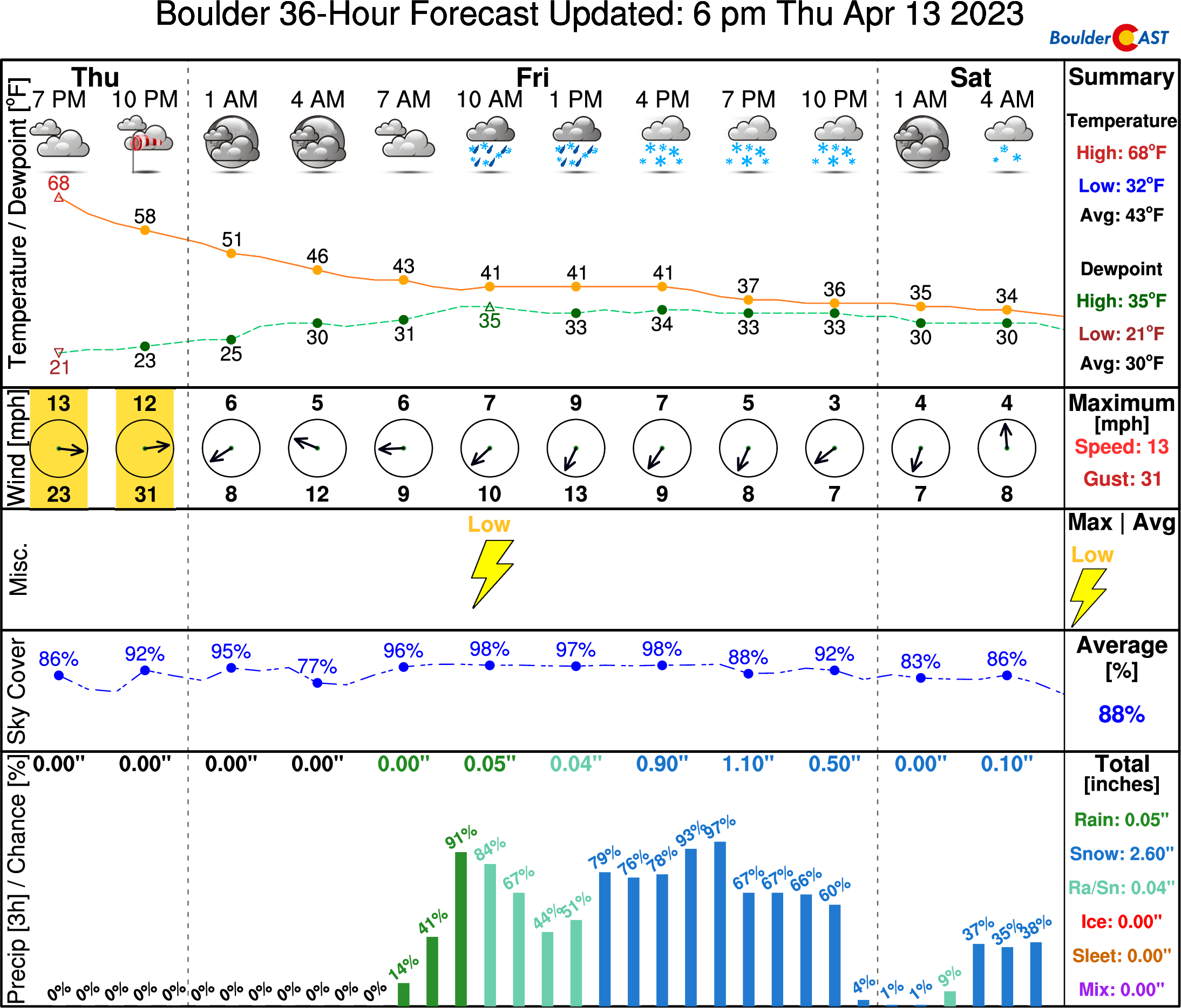
Change begins steadily after sunset Thursday as the first in a pair of cold fronts will arrive later in the evening, followed by another reinforcing front early Friday morning. As is so often the case here, this storm will bring together the needed ingredients for April precipitation in the Front Range — upslope, the jet stream, decent moisture, and cold air — all stirred together with a pinch of springtime instability! This setup will make for an overall soggy or snowy Friday, depending on your elevation!
Latest model guidance paints the Front Range with 0.5″ to 1.0″ of liquid between Friday and Saturday, with almost all of that coming before midnight Friday night. The bullseye is generally on western Boulder and southwestern Larimer Counties which could see localized moisture dumps greater than 1″.
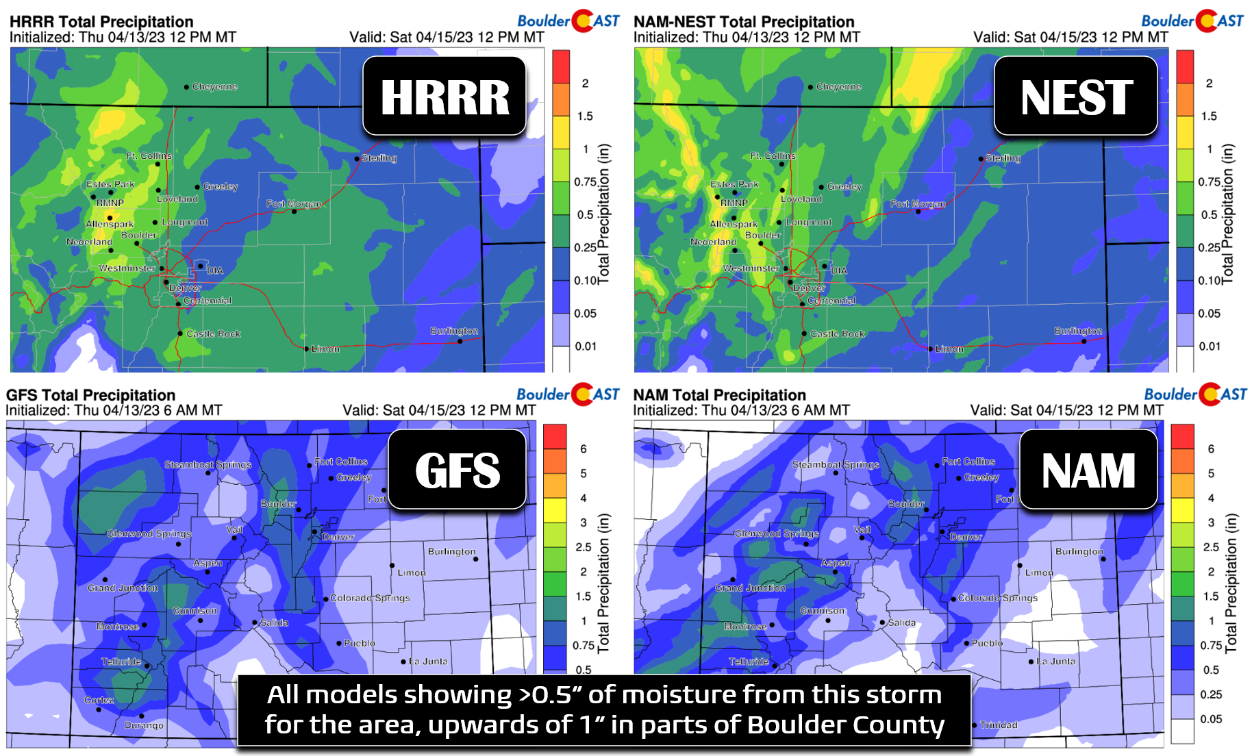
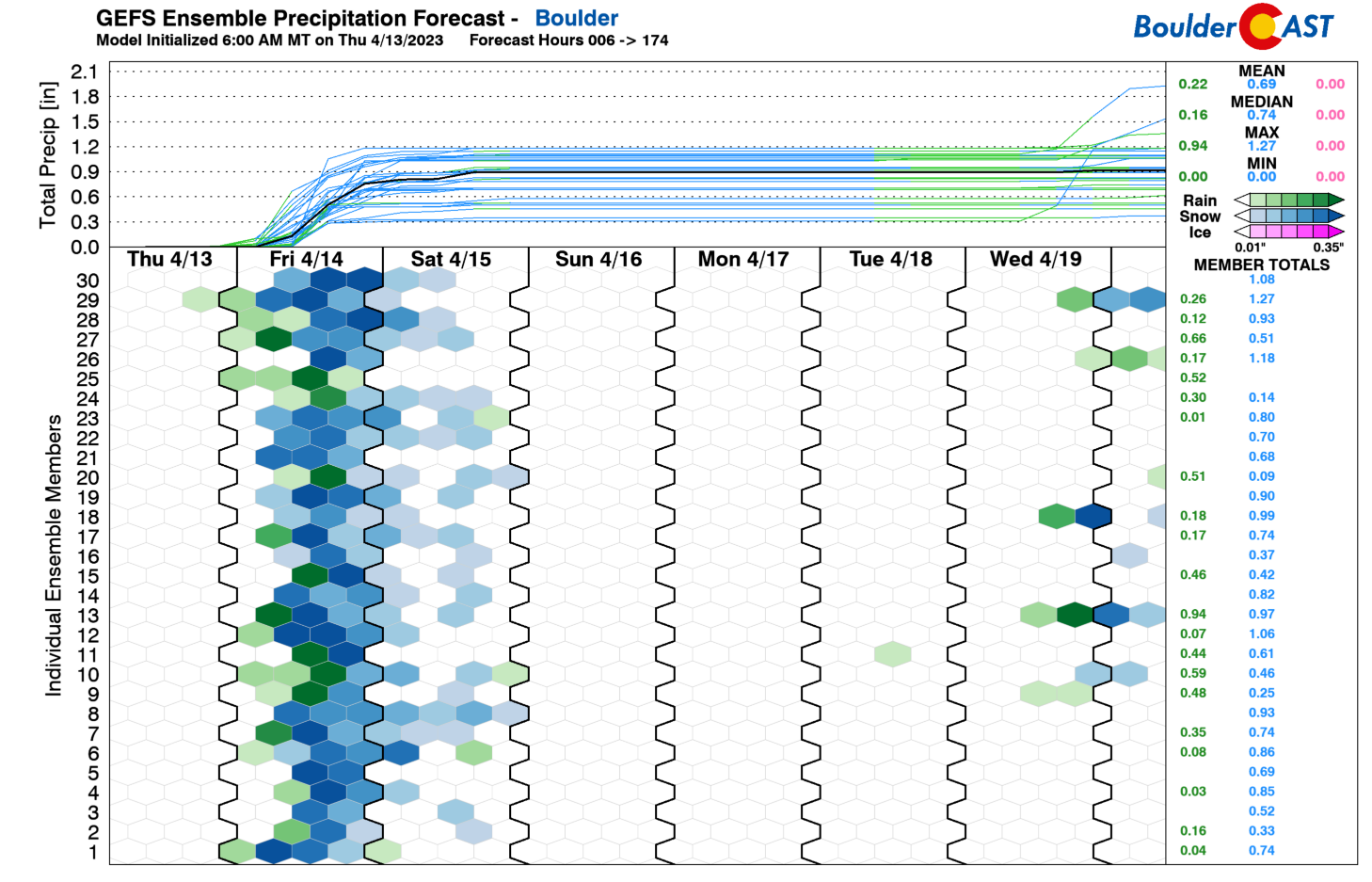
However, the convective aspect of this system makes pinpointing exact precipitation amounts a bit tricky as some models can overdue convection this time of year. The good news is that the ensembles are generally also onboard for a solid helping of 0.5 to 1.0″ of moisture for the area. The GFS ensembles (shown below) actually point towards closer to 1″ of moisture in Boulder — wow, wouldn’t that be great?! This graphic also highlights a colder nature of the GFS in general with more than two-thirds of that predicted precipitation falling in form of wet snow instead of rain.
Models have been trending colder with this precipitation event over the last few days. The GFS is currently running the coldest, with temperatures starting out in the middle 40s around sunrise on Friday and only falling from there into the low to middle 30s through the day with almost all of the precipitation landing in the form of snow — even for Boulder and Denver. The European model has cooled off in its recent solutions, but still it’s running quite a bit warmer with midday temperatures on Friday getting close to 50 degrees across the lower elevations and rain being the dominant precipitation type during the day (with snow in the higher Foothills). In reality, the eventual truth here is probably somewhere in the middle…with some rain early on in the morning and then a mix of rain/snow during the day trending to all snow by late afternoon and evening on Friday.
Temperatures are definitely the biggest challenge with this system, especially with the bulk of the precipitation coming during the day Friday which means accumulation will be battling its most robust trifecta of opponents the entire time:
- Above freezing air temperatures
- Warm ground temperatures
- The pesky mid-April sun angle
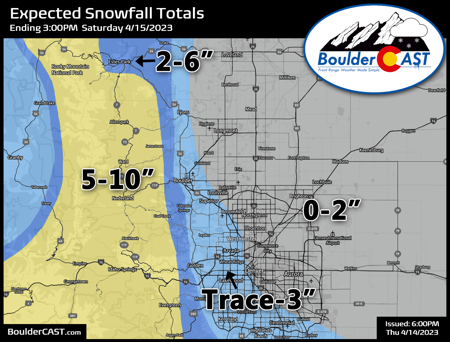
After several days of record-shattering heat this week, determining how much snow falls versus what sticks will be quite the challenge, even in the Foothills were we are much more confident for heavy accumulating snow! Taking the models at face value, there could be anywhere from 0 to 10″ of snow on Friday, given the uncertainty in temperatures, timing, and moisture dump. Our snowfall forecast map for the event is given below covering all snow through Saturday morning. This is what we believe is the most likely snowfall accumulation for the region despite the noted uncertainty. This will be an almost all-snow event above 7500 feet elevation where up to 10″ of snow is expected, with locally more than 12″ possible. The lower Foothills from 6000 to 7500 feet elevation should expect 2-6″. Finally, us Flatlanders can expect a trace up to 3″, with the higher totals coming in and near the Foothills and especially for areas above 5500 feet elevation. That would include Golden, Rocky Flats, Centennial, Littleton, Superior, and western Boulder. This lower elevation snow will mainly be confined to grassy surfaces, landscaping, cars and of course the patio furniture.
Overall expect generally just wet roads across the lower elevations due to the record warm temperatures this week. Our Winter Storm Impact Timeline below highlights the period from Friday afternoon into early Saturday morning as the one to watch for travel impacts, whether it be from a little slush on the roadways Friday night or the big fat snowflakes falling and restricting visibility. It probably goes without saying, but travel will be worst in the Foothills and into the Mountains along and east of the Continental Divide with this event.

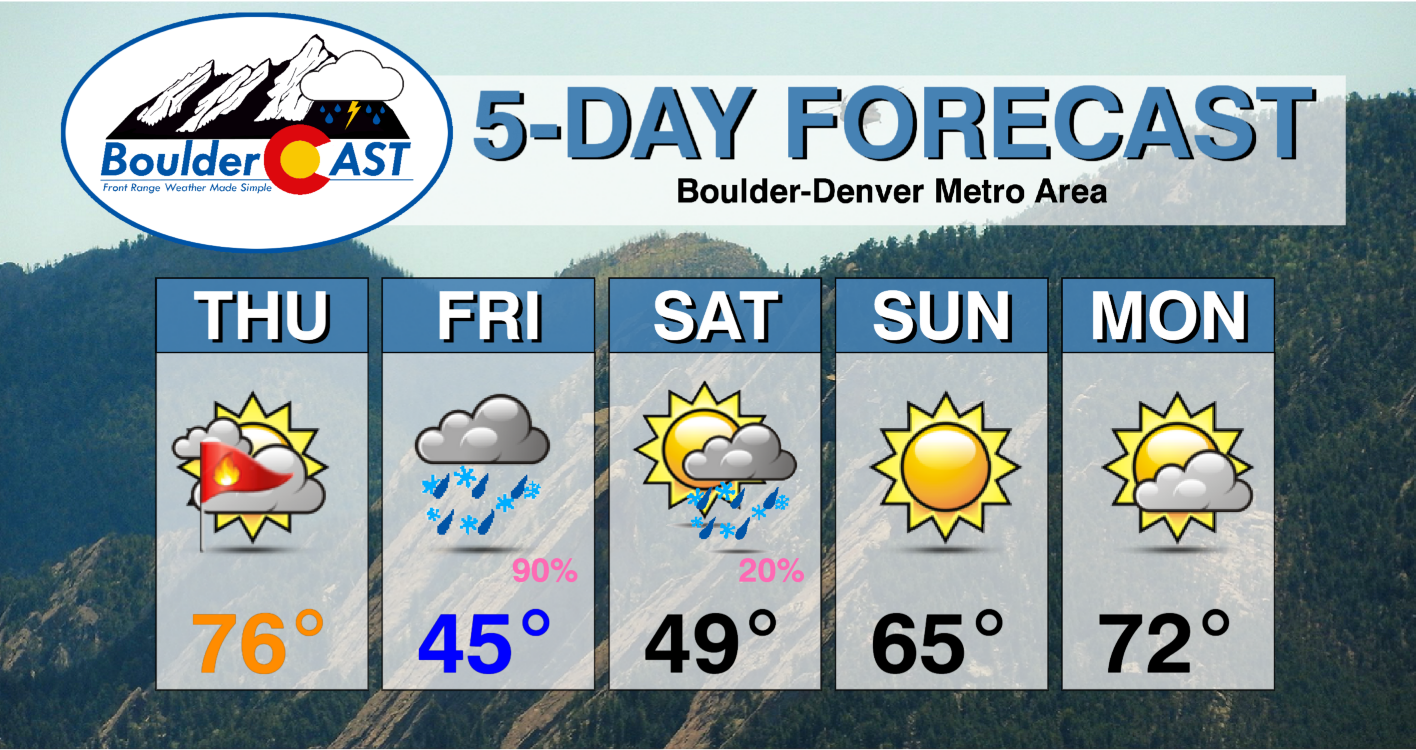
Saturday will stay chilly and unsettled with a slight chance of popcorn rain/snow showers developing from lingering instability. Things quiet down and warm back above normal quickly heading into Sunday and early next week.
We’ll post one final discussion on the impending rain/snow via a Premium Storm Update early on Friday morning as rain and snow commence across the area. As always, enjoy what will surely be yet another glorious episode of springtime weather in the Front Range!
Get BoulderCAST updates delivered to your inbox:
Enjoy our content? Give it a share!


You must be logged in to post a comment.