


After more than a week of relentless heat, the Front Range is finally heading into a pattern change — but not before we break a few records and squeeze out one more day near 100°. This week will bring a notable shift: true monsoon moisture is poised to surge over the Continental Divide, storm chances finally return and temperatures finally ease… at least for a moment. We break down what’s driving this stubborn heat, when the storms arrive, and why flash-flood concerns may quickly replace heat and fire danger as Colorado’s primary weather story.
This week’s highlights include:
- 🔥 Heatwave length > intensity: Boulder breaks its 94°+ streak record as the Front Range continues to endure a long, grinding stretch of heat.
- 🌡️ Monday stays scorching: Highs near 100° with continued ozone alerts and only a small chance of a weak late‑day storm.
- 🌬️ Ridge finally shifts: The hot dome slides east midweek, opening the door for true monsoon flow to reach the Front Range.
- 🌧️ Monsoon moisture surges: Storm chances increase Tuesday–Friday, peaking Wednesday–Thursday with near‑record atmospheric moisture over Denver at times.
- ⚠️ Flash‑flood risk rises: Recent burn scars — more than 200,000 acres statewide — will become highly vulnerable as deep moisture arrives.
- 🏔️ High Country storms erupt: Expect widespread afternoon convection along the peaks; hikers should start early.
- 🌤️ Temps cool briefly: Highs dip into the middle 80s–low 90s midweek before warming again this weekend.
- 💨 Smoky skies Tuesday: Initial cooldown Tuesday will unfold alongside a cold front laden with smoke from Oregon fires.
- 📈 Heat returns late July: Long‑range guidance favors above‑normal temperatures July 25–29, though persistent monsoonal flow should keep storm chances around.
DISCLAIMER: This weekly outlook forecast is created Monday morning and covers the entire upcoming week. Accuracy will decrease as the week progresses as this post is NOT updated. To receive daily updated forecasts from our team, among many other perks, subscribe to BoulderCAST Premium.

Go Premium, get all the perks.
Daily Forecast Updates
Get our daily forecast discussion every morning delivered to your inbox.
All Our Model Data
Access to all our Colorado-centric high-resolution weather model graphics. Seriously — every one!
Ski & Hiking Forecasts
6-day forecasts for all the Colorado ski resorts, plus more than 120 hiking trails, including every 14er.
Smoke Forecasts
Wildfire smoke concentration predictions up to 72 hours into the future.
Exclusive Content
Weekend outlooks every Thursday, bonus storm updates, historical data and much more!
No Advertisements
Enjoy ad-free viewing on the entire site.
The Heatwave That Just… Won’t… Quit
What we flagged early on has played out almost perfectly: the intensity of this heatwave was never the headline — the longevity was. So far nine straight days of 94°+ heat across Boulder and Denver without a single record high or even a 100° reading, yet the cumulative strain has been the real story. Sunday, July 19th delivered the peak of the stretch: 99° in Boulder, 98° in Denver.
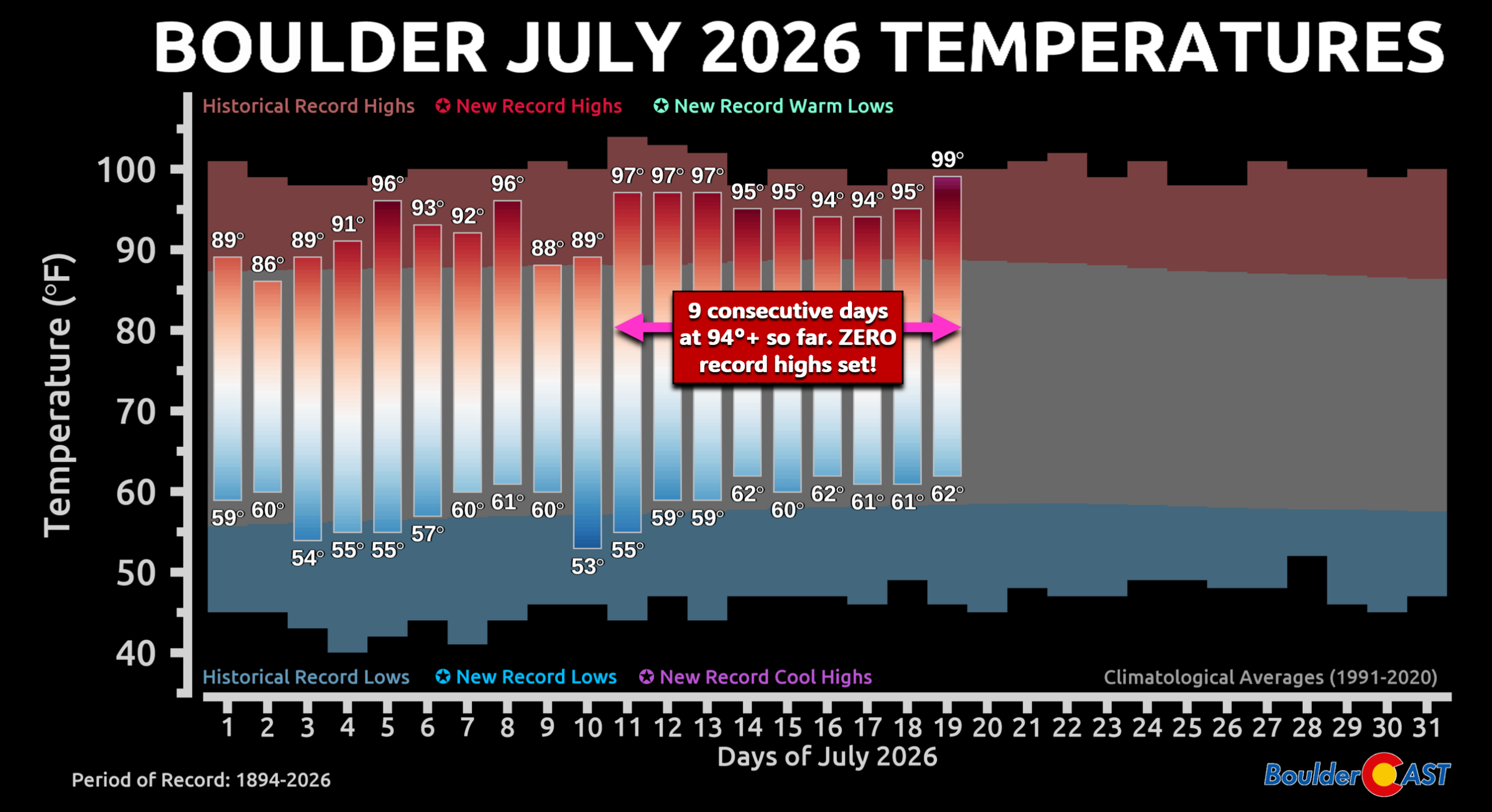
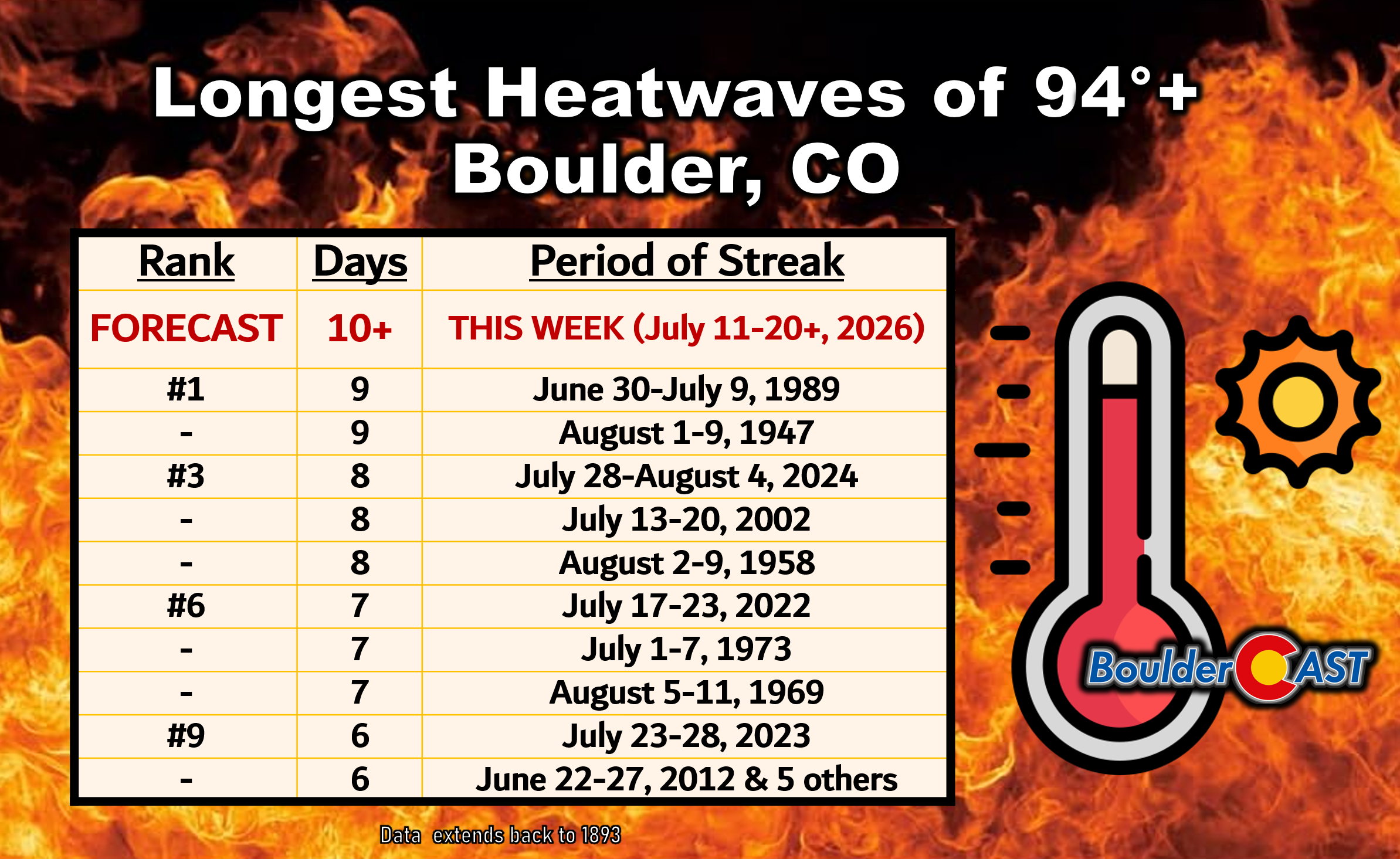
Even without record highs, Boulder’s ongoing run of nine consecutive 94°+ days now ties the all‑time record. Monday will almost certainly push us past it, establishing a new benchmark for duration-based mediocre heat in the city.
Heat Advisory Rolls into Monday
The weekend’s heat simply rolls forward. The upper-level ridge remains parked over eastern Colorado, keeping the atmosphere hot, dry, and largely capped. A narrow plume of monsoon moisture sits just west of the Divide — close enough to spark a stray late-day shower, but not enough to meaningfully break the heat.
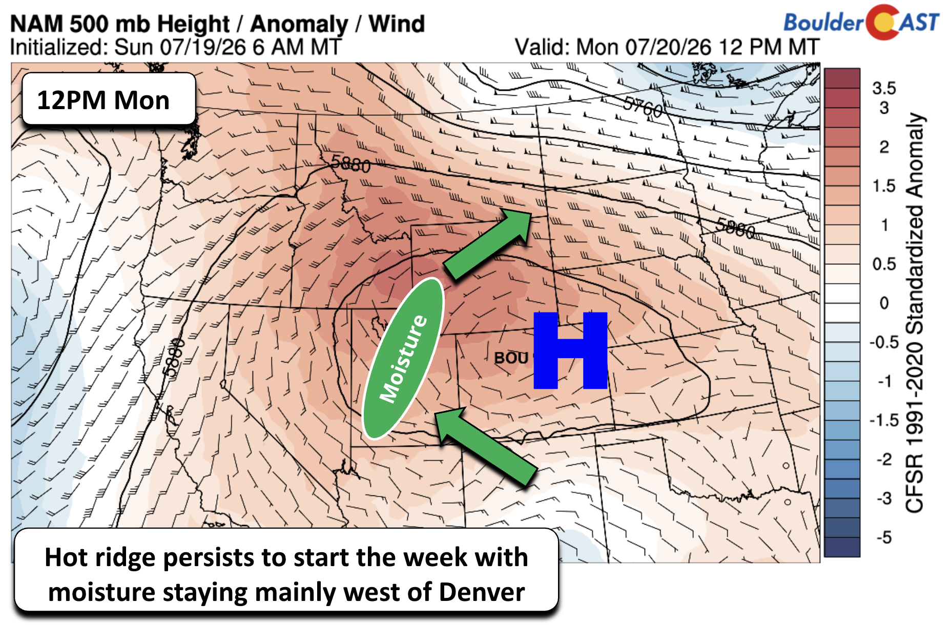
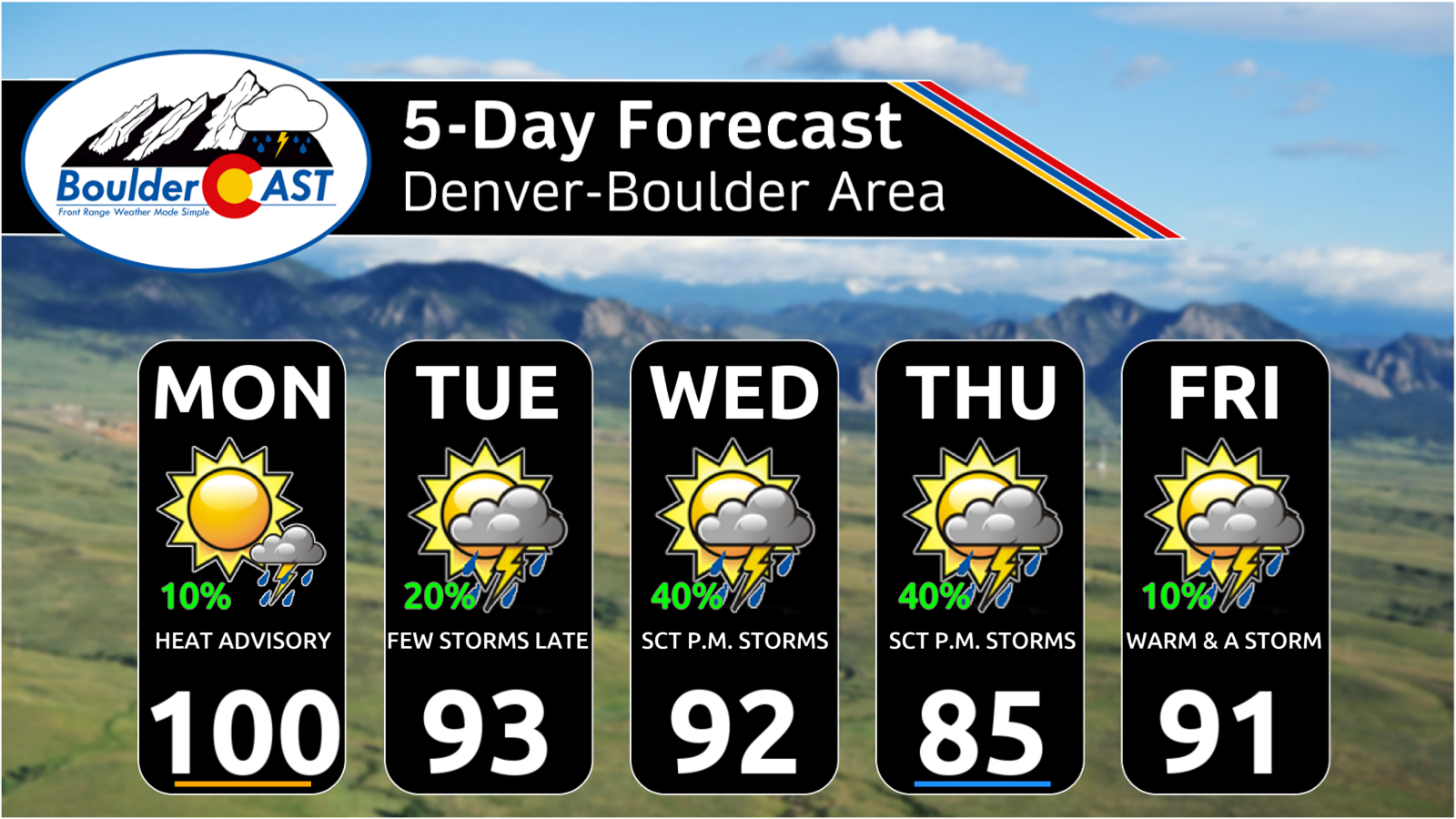
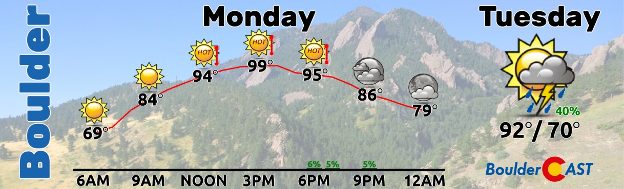
High temperatures Monday will land very close to where they did on Sunday in the upper 90s. Some factors lend to slightly warmer readings — continued sunshine, warmer starting temp in morning, warmer overall airmass — while others could have a net cooling effect, mainly the increased risk for storm clouds and cool outflows coming off the terrain late in the day. Overall, we’re forecasting a high of 99 to 101° for the Metro area on Monday with just a 10% chance of a weak late-day thunderstorm or shower from 4PM to 10PM. Any decaying storms coming off the terrain could produce gusty winds to 40 MPH.
Meanwhile, ozone-related Air Quality Alerts continue for a 10th straight day, paired with our second consecutive Heat Advisory.
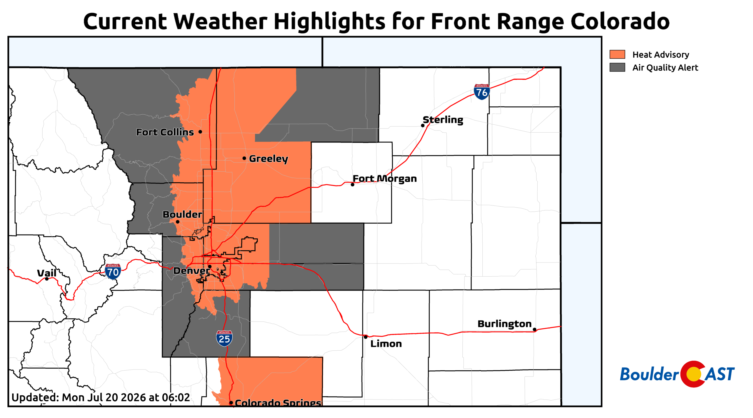
Try to minimize outdoor exposure from Noon–6PM, especially if you fall into a heat‑sensitive group. Hydrate aggressively and take breaks indoors.

Monsoon Moisture Finally Breaks Through Midweek
We’ve been hinting at this for weeks, and the pattern is finally aligning: true monsoon moisture is set to breach the Continental Divide beginning Tuesday!
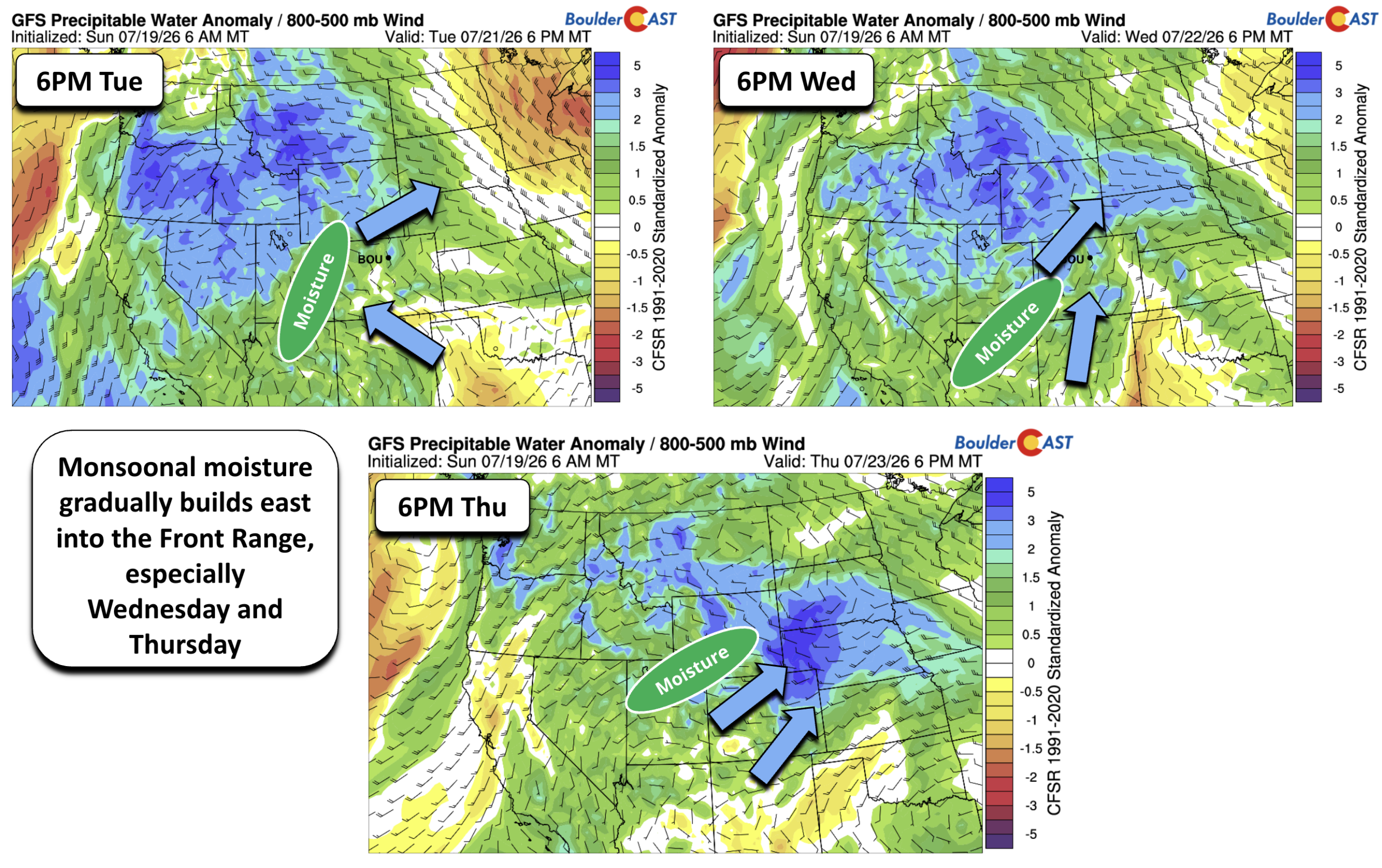
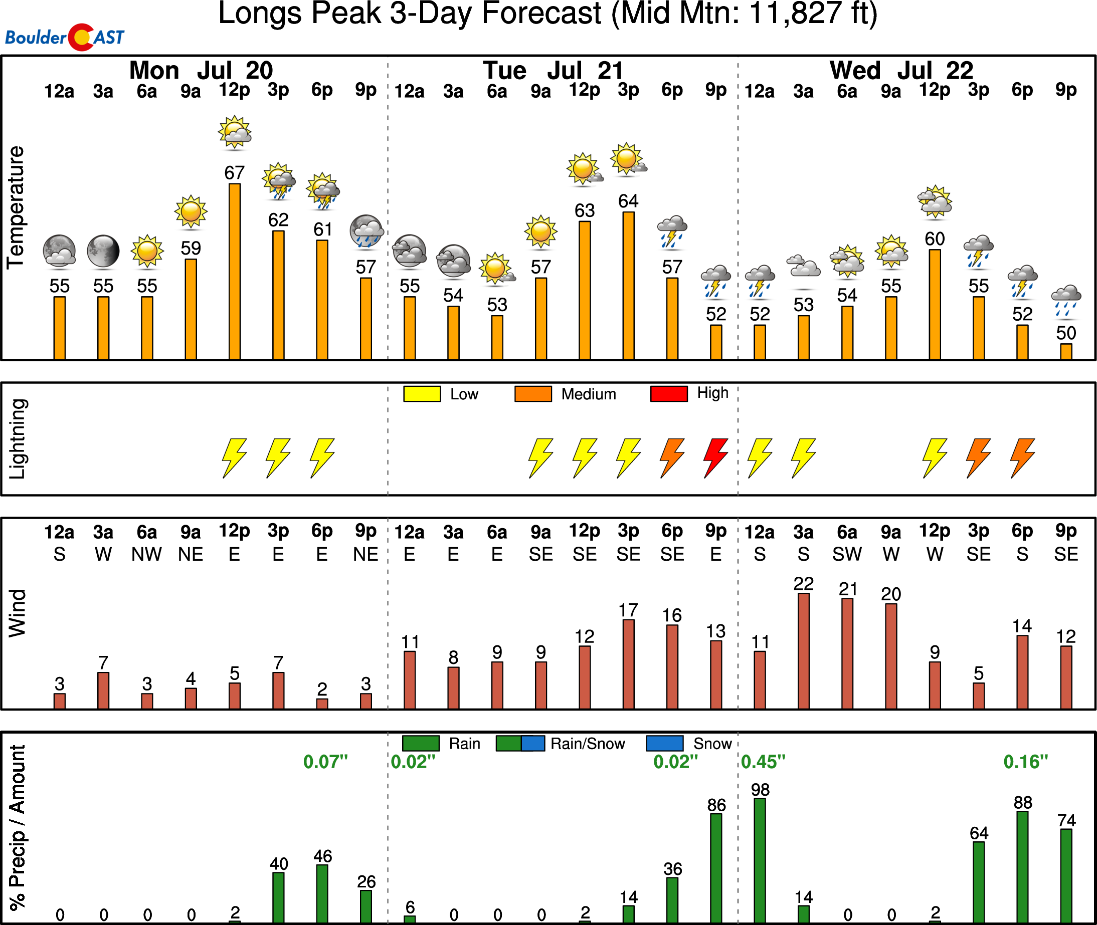
Model guidance — including the GEFS — shows a steady increase in precipitable water (PWAT) values Tuesday through Thursday. The highest confidence for widespread rainfall sits on Wednesday and Thursday, though daily storm chances will exist from Tuesday through Friday (and beyond).
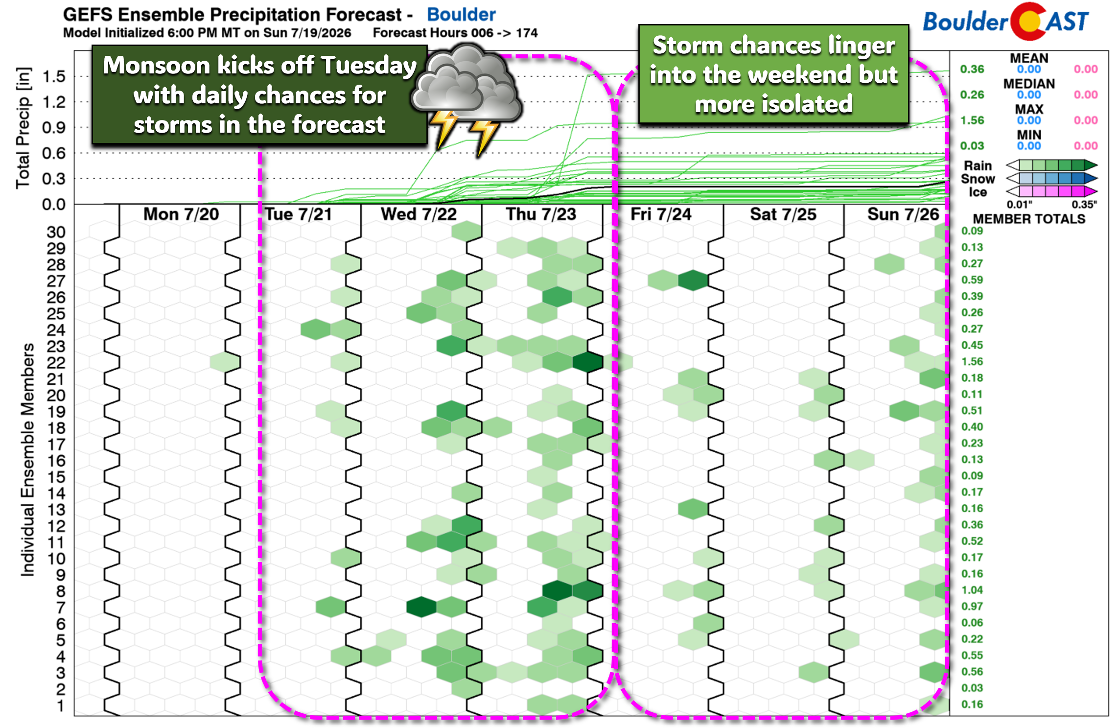
Why now? The very stubborn ridge plaguing the area will shift east into Texas/Oklahoma by midweek, opening the door for deep southwest flow.
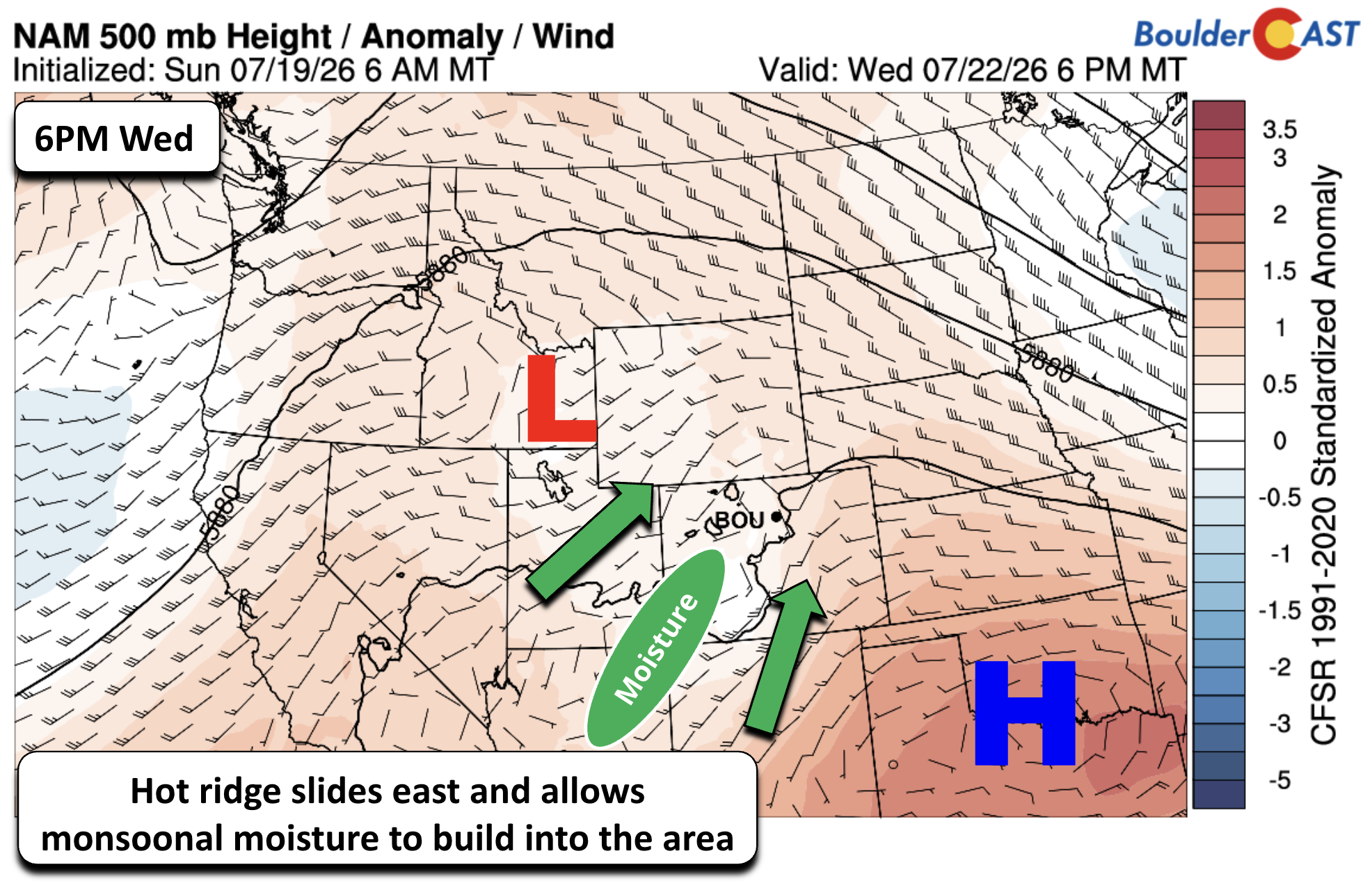
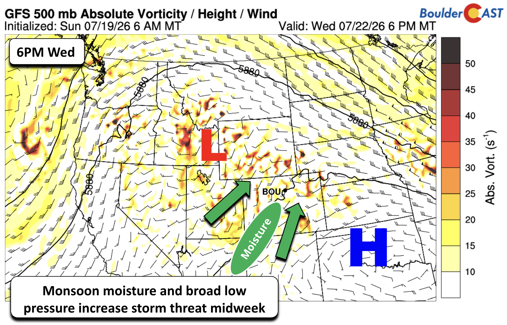
At the same time, a broad mid‑level weakness will develop over Idaho–Utah–Wyoming, adding lift and enhancing storm coverage statewide. We are currently not outlooked for severe weather at this time, but isolated strong downbursts are possible Wednesday–Thursday as moisture deepens.
PWAT anomalies will flip dramatically: below-normal values erode, replaced by well‑above‑normal moisture streaming in from Arizona, the Four Corners, and the Great Basin. By Thursday, PWAT near Denver could approach record territory — a classic monsoon signature.
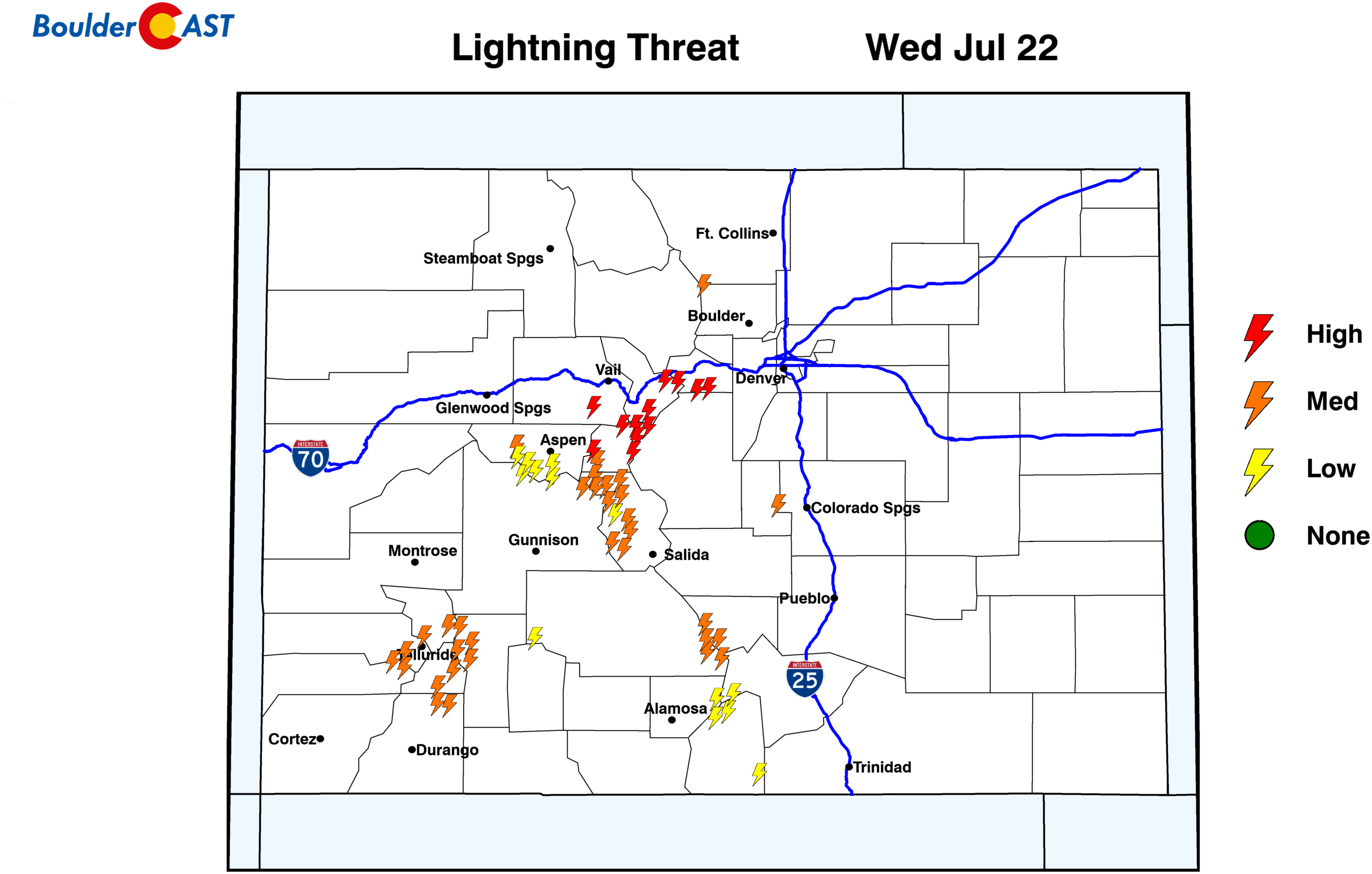
Those hiking this week will want to start very early to avoid the widespread convection along the peaks tied to the enhanced valley breezes.
Flash Flooding Risk Rises for the Burn Scars
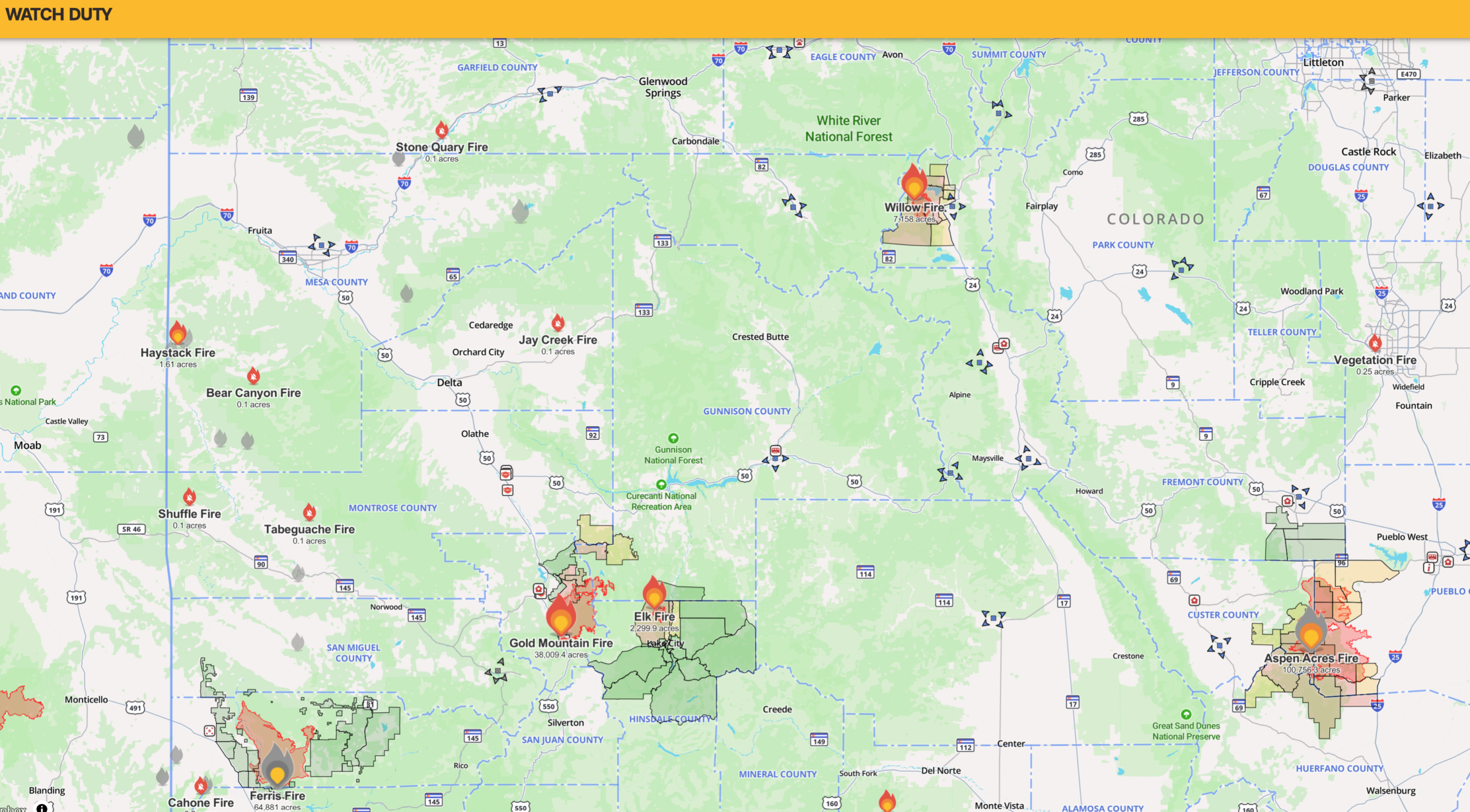
Brand new fire burn scars are the biggest concern this week. More than 200,000 acres have burned across Colorado in recent weeks, creating highly vulnerable terrain.
Key burn areas to monitor include:
- Aspen Acres — 100,800 acres, 61% contained, 800+ structures destroyed
- Ferris Fire — 64,900 acres, 83% contained
- Gold Mountain Fire — 38,000 acres,13% contained
- Willow Fire — 7,200 acres, 37% contained
- Elk Fire — 2,300 acres, 0% contained
Any slow-moving monsoon storms that form over these scars could trigger dangerous runoff very quickly. If you live downstream from any new burns, stay weather aware this week and the rest of the summer. Your life may depend on it.
Temperatures Ease Midweek — But With It Comes Smoke
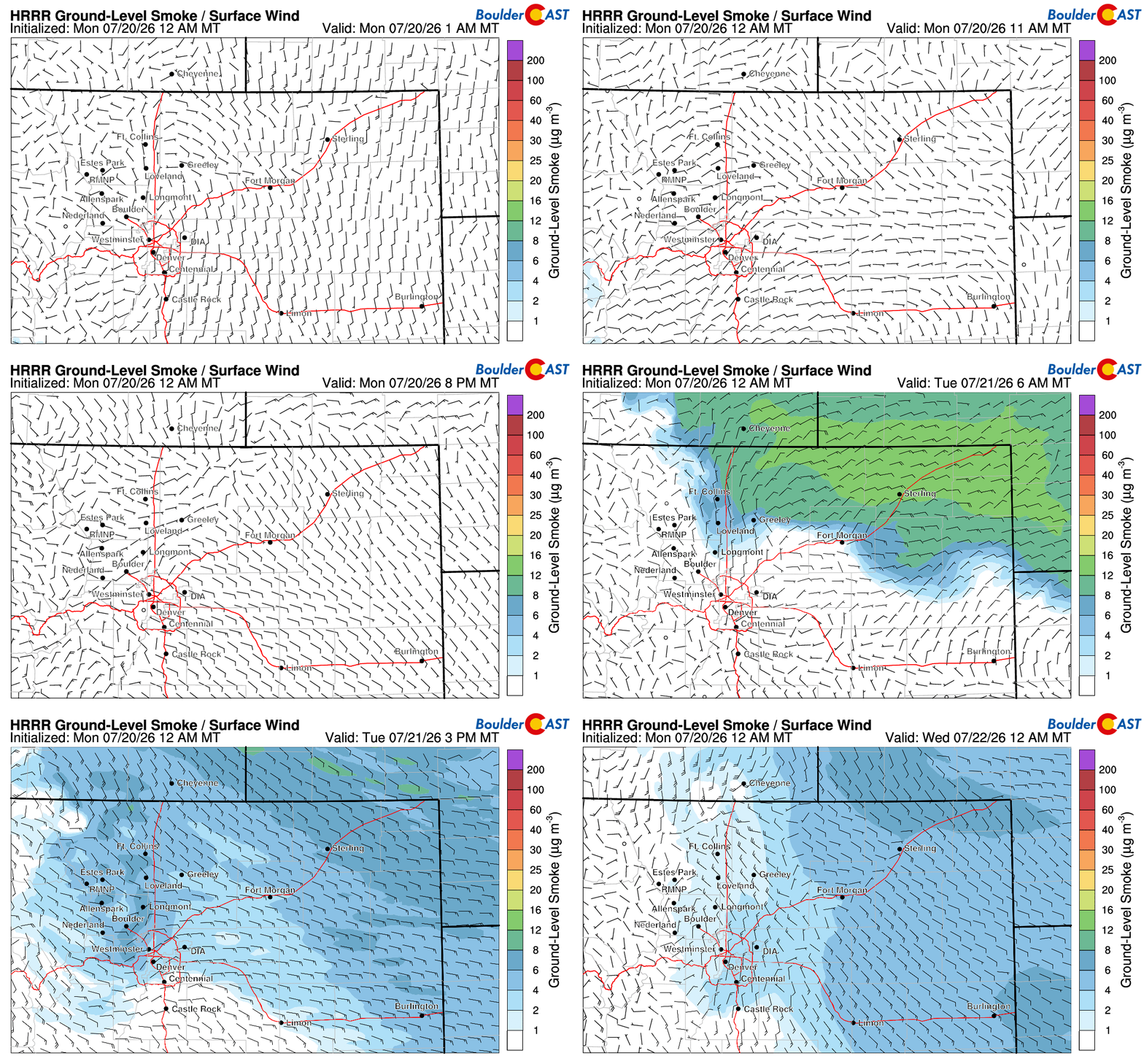
Those aforementioned storm chances Tuesday onward will knock our highs back into the middle 80s to lower 90s, coolest on Thursday. The first step in Tuesday’s cooldown comes courtesy of a morning backdoor cold front, sliding in from the northeast and briefly knocking temperatures down. Unfortunately, that same front will also usher notable smoke back into the Front Range, with the bulk of it tied to a large cluster of ongoing fires in Oregon, supplemented by additional smoke from major fires in Washington and western Canada.
After the midweek cooldown, a modest warm-up returns Friday into the weekend as monsoon flow briefly relaxes.
Even with the cooldown, we remain near or slightly above climatological normals through most of the extended.
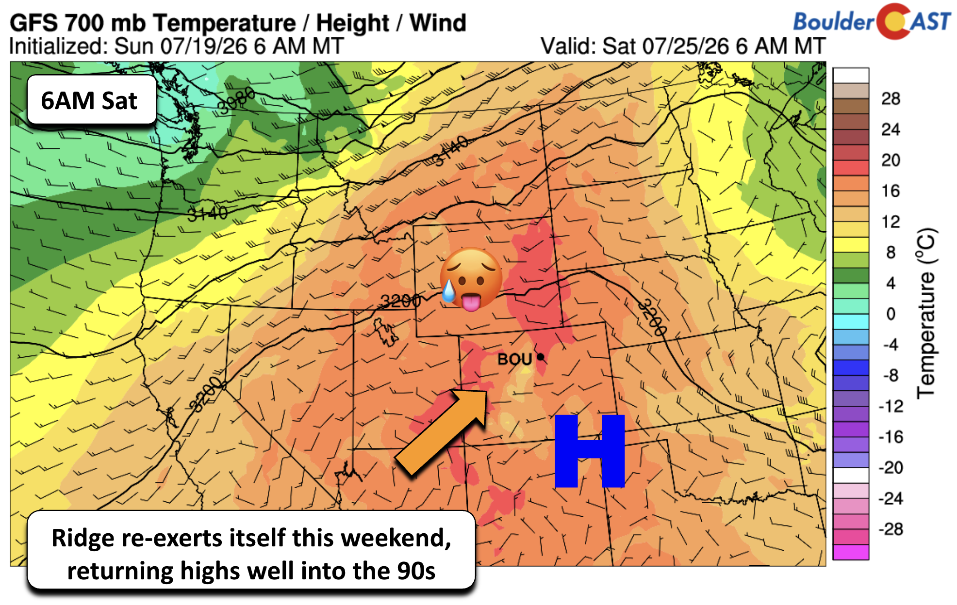
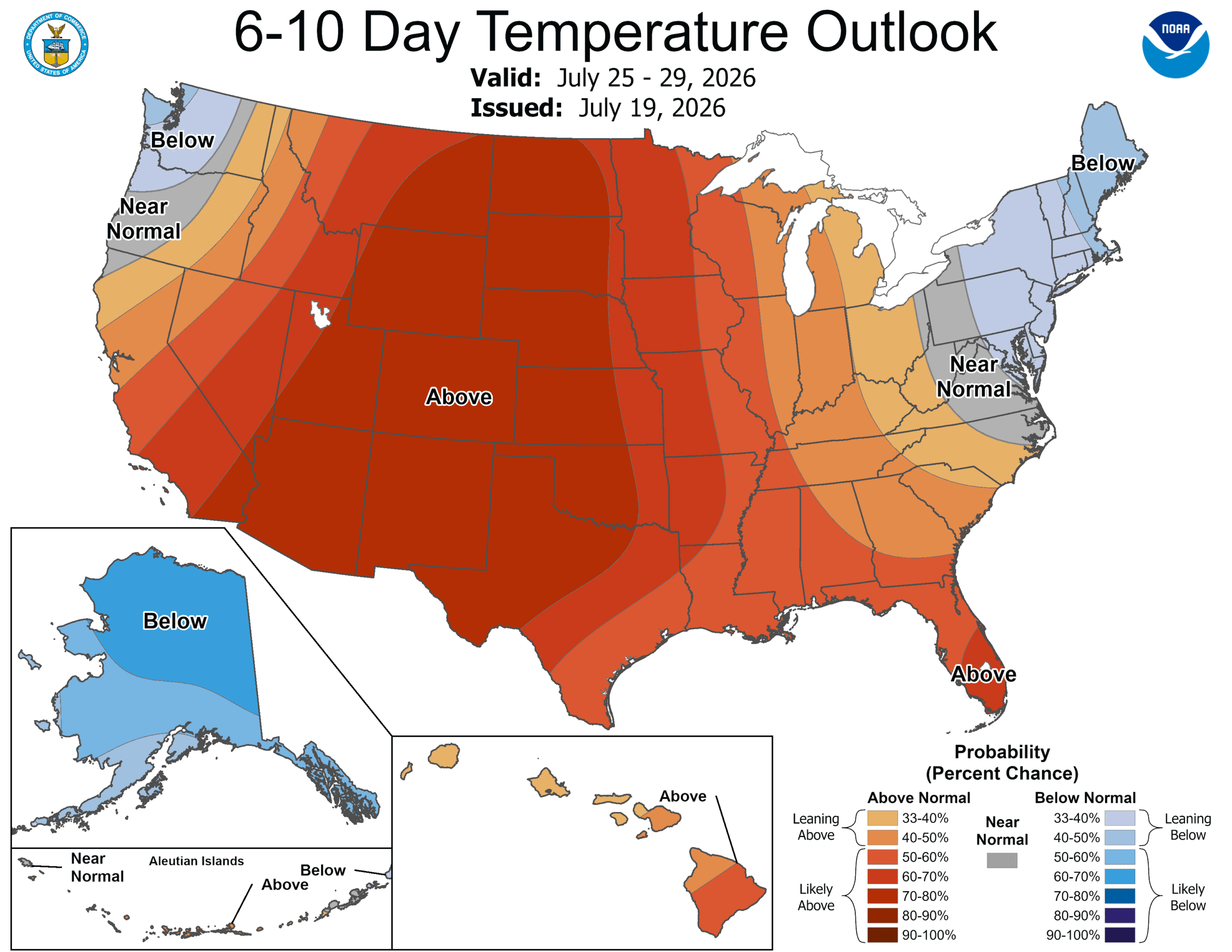
The relief from the heat looks short-lived. The Climate Prediction Center highlights a renewed push of above-normal temperatures for July 25–29, as the ridge rebuilds westward again.
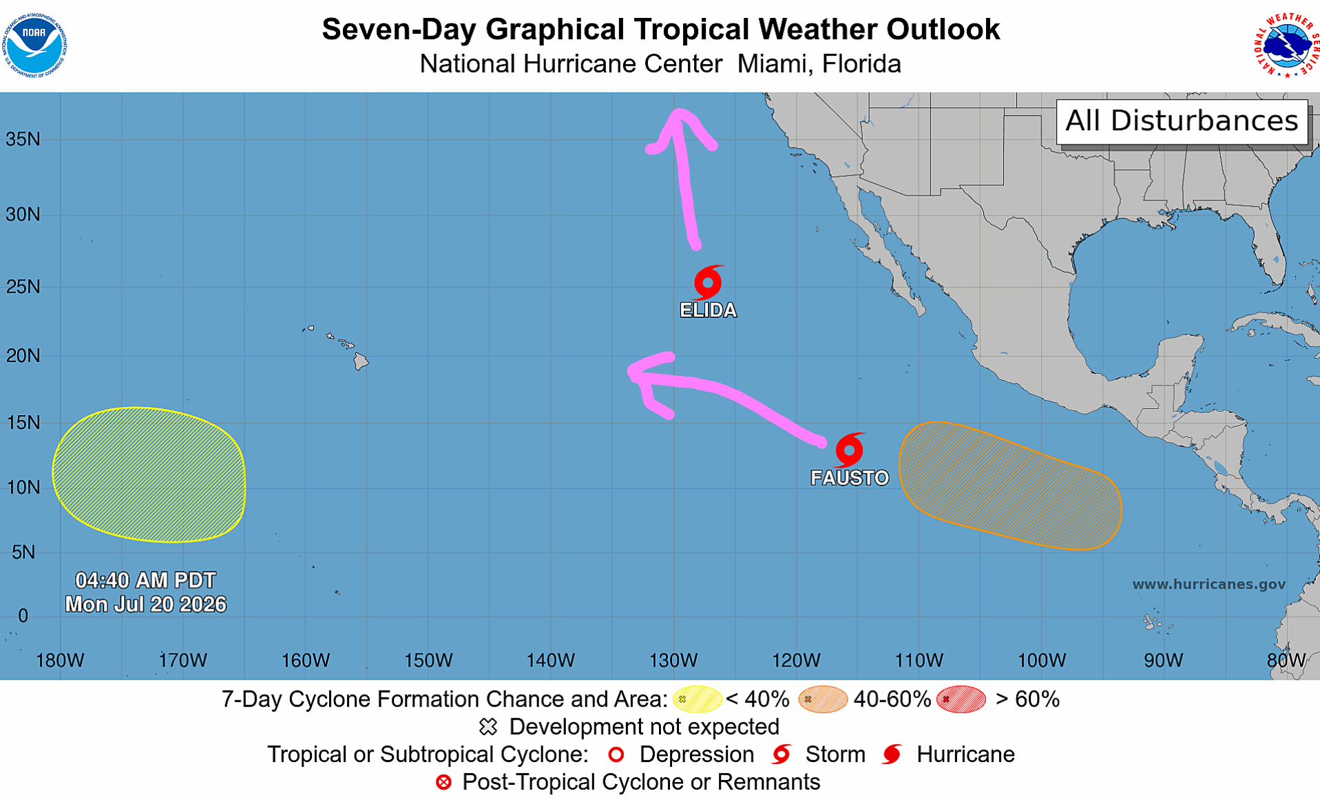
The position of the ridge will fortunately still allow for monsoonal moisture to supply storm chances through the weekend, though the signals are mixed. We’ll also need to keep an eye on the tropical eastern Pacific which looks to remain extremely active in the weeks ahead, feeding off the very warm waters of an already strong El Niño. The tropical cyclones could supply additional moisture injections to the Four Corners region, including the Front Range if we play our cards right.
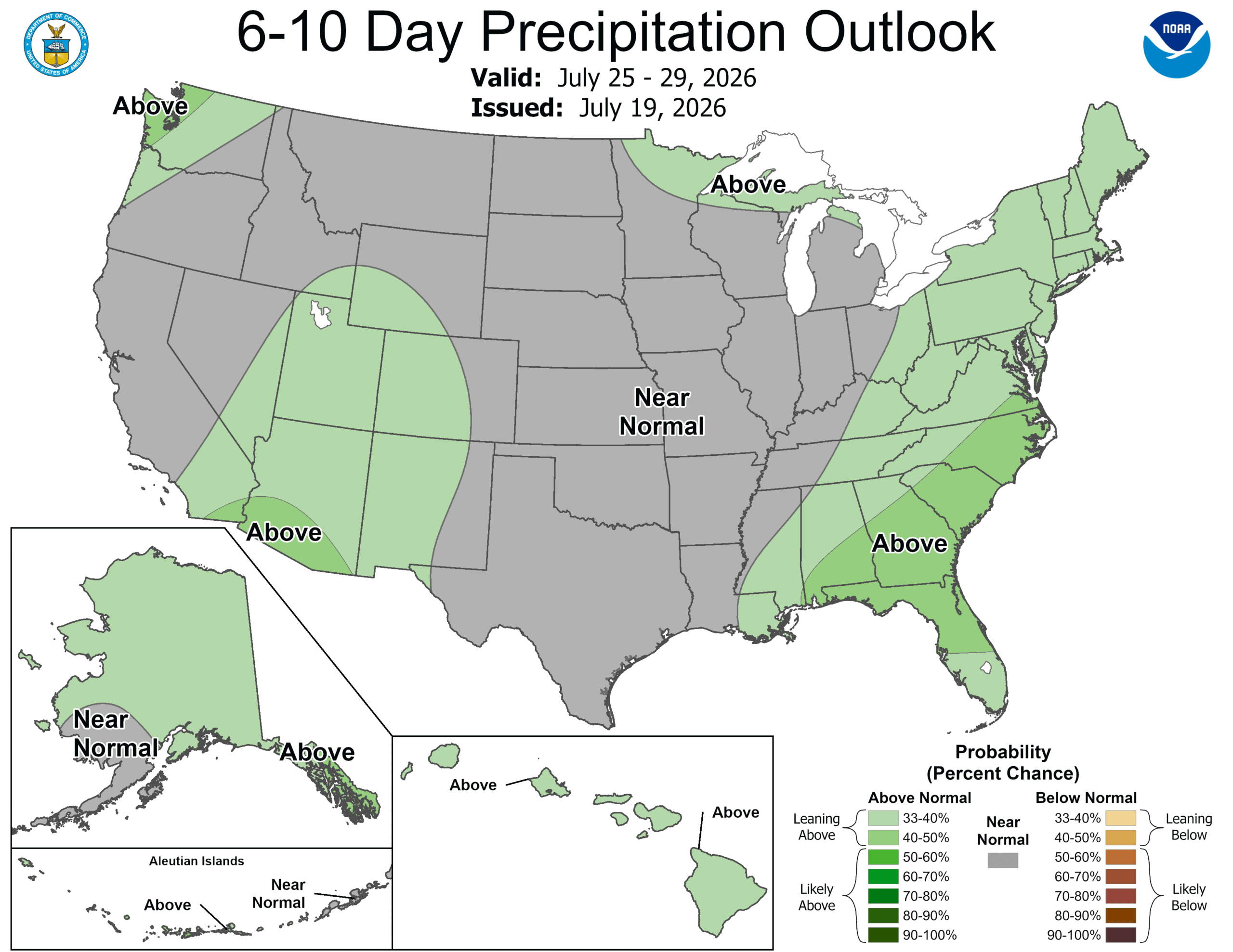
The CPC leans slightly toward above-normal rainfall, with the best storm chances favoring the High Country and Desert Southwest.
Bottom Line
Relief finally arrives midweek as true monsoon moisture spills over the Divide, bringing higher storm chances — and a real flash‑flood threat over recent burn scars — Wednesday and Thursday. Temperatures dip into the middle 80s and lower 90s for a few days before warming again this weekend, with long‑range guidance already hinting at a return to above‑normal heat heading into late July. Hopefully some of our area can cash in on the deep moisture overhead this week, but as always, results will be variable due to the fickle nature of monsoon thunderstorms. Enjoy!
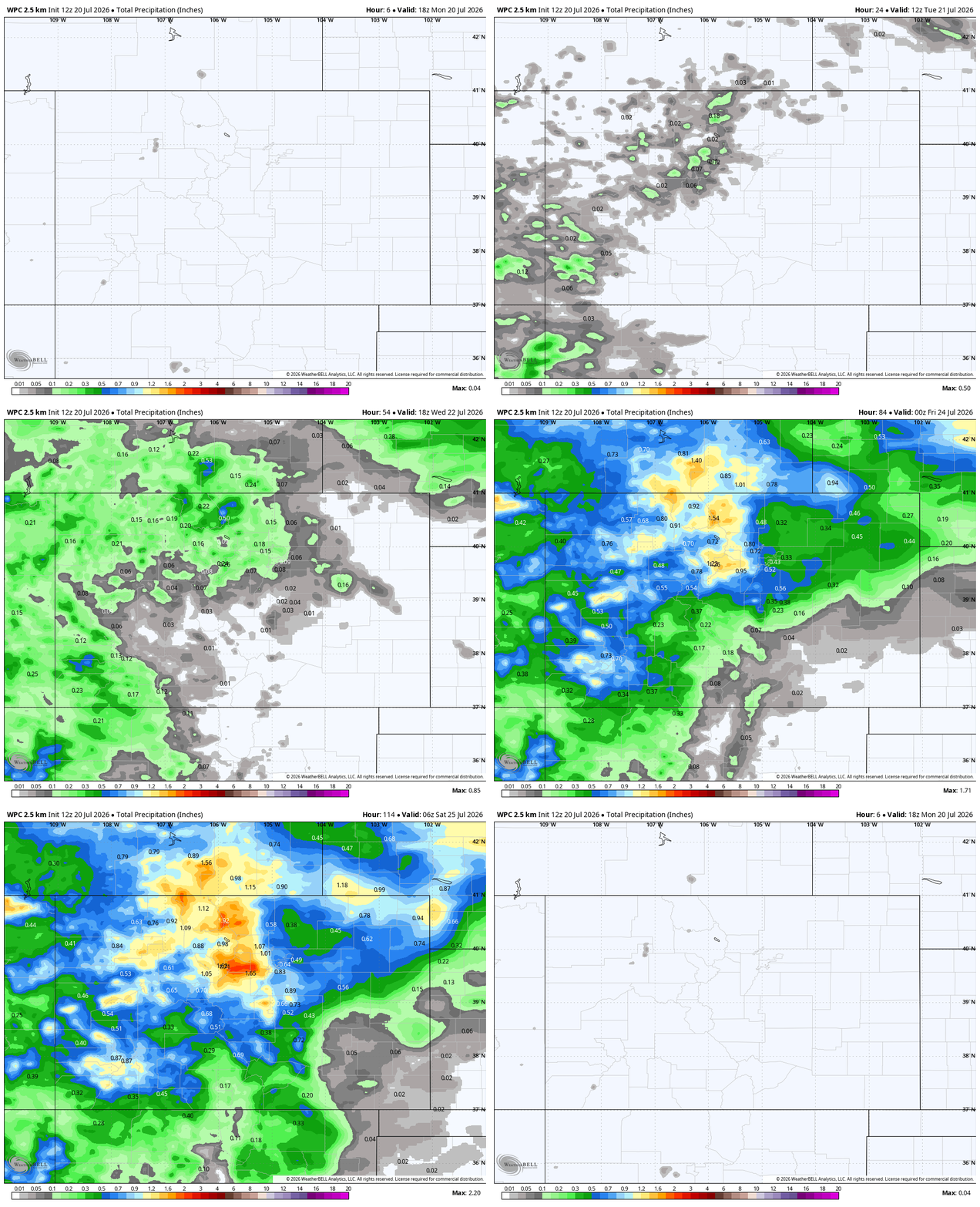
Precipitation forecast from the Weather Prediction Center through the week.
Forecast Specifics:
Monday: Hot with just an outside shot of a storm. Highs in the upper 90s to near 100 on the Plains and upper 80s in the Foothills.
Tuesday: Increasing chance of afternoon and evening storms with highs in the low to mid 90s on the Plains and mid 80s in the Foothills.
Wednesday and Thursday: Scattered showers and storms in the afternoon and evening. Cooler highs in the middle 80s to around 90 for the Plains and upper 70s in the Foothills.
Friday: A slight chance of afternoon and evening storms. Otherwise warm in the low to middle 90s for the Plains and near 80 in the Foothills.
Weekend: Trending back to hot weather with a continued chances of afternoon and evening storms. Highs in the mid 90s for the Plains and lower 80s in the Foothills.
DISCLAIMER: This weekly outlook forecast is created Monday morning and covers the entire upcoming week. Accuracy will decrease as the week progresses as this post is NOT updated. To receive daily updated forecasts from our team, among many other perks, subscribe to BoulderCAST Premium.
Go Premium, get all the perks.
Daily Forecast Updates
Get our daily forecast discussion every morning delivered to your inbox.
All Our Model Data
Access to all our Colorado-centric high-resolution weather model graphics. Seriously — every one!
Ski & Hiking Forecasts
6-day forecasts for all the Colorado ski resorts, plus more than 120 hiking trails, including every 14er.
Smoke Forecasts
Wildfire smoke concentration predictions up to 72 hours into the future.
Exclusive Content
Weekend outlooks every Thursday, bonus storm updates, historical data and much more!
No Advertisements
Enjoy ad-free viewing on the entire site.
Enjoy our content? Give it a share!












You must be logged in to post a comment.