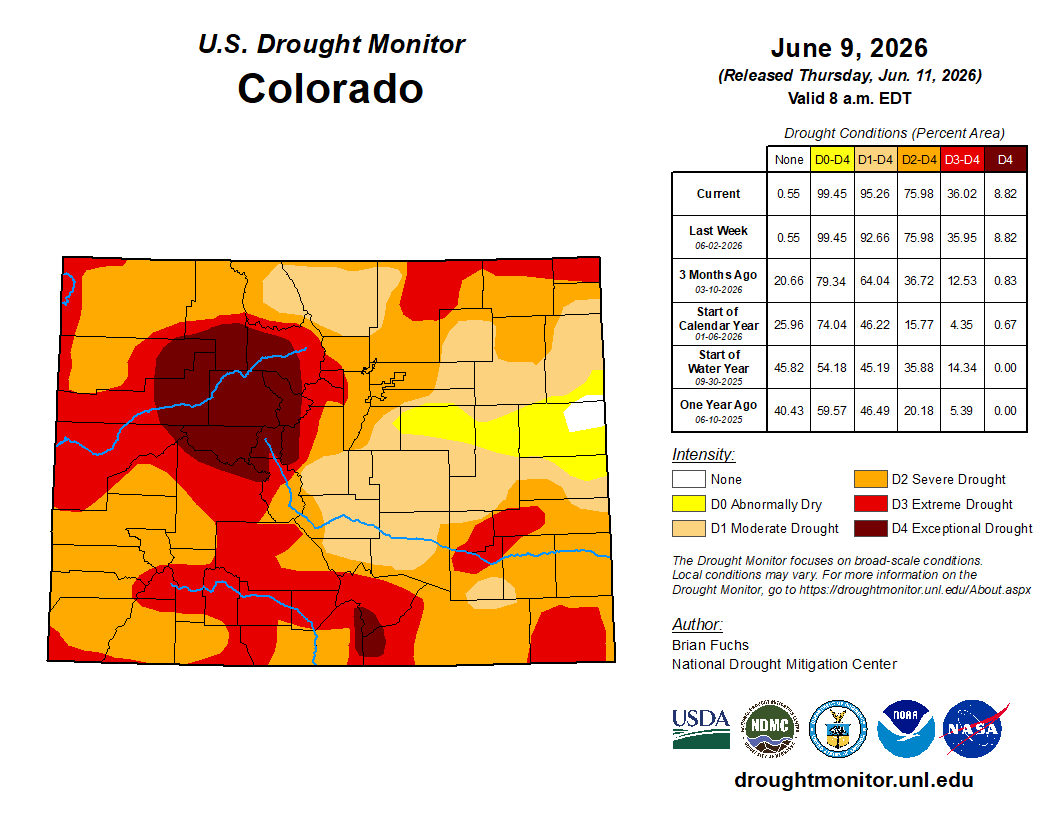
A western heat dome is gearing up to push the Front Range toward its hottest stretch of the season so far, with downslope winds and fire‑weather concerns building right alongside it. A weak front will try to break the heat later in the week, but largely fail as temperatures rebound into the 90s quickly by Friday and the weekend. As our spring wet season has now come to an end, storm chances remain woefully low throughout the extended leading to further drought intensification statewide.
This week’s highlights include:
🌡️ Heat builds into midweek as a strong ridge expands east, pushing Boulder from near‑normal Monday warmth into the 90s by Tuesday.
🥵 Wednesday is peak heat, with mid to upper 90s likely with many cities approaching daily record highs.
🔥 Fire danger spikes Tuesday/Wednesday across western and central Colorado, though recent the green‑up will keep the Boulder–Denver corridor lower‑risk.
📉 Brief reprieve in heat late week: A largely dry cold front ushers a return to the 80s Thursday, but it is short-lived.
☀️ Low 90s return Friday–Saturday as the ridge reasserts itself over the region.
🌦️ Limited shower/storm chances: An overall dry pattern unfolds this week, but meager rain chances are set to return by Friday and the weekend.
DISCLAIMER: This weekly outlook forecast is created Monday morning and covers the entire upcoming week. Accuracy will decrease as the week progresses as this post is NOT updated. To receive daily updated forecasts from our team, among many other perks, subscribe to BoulderCAST Premium.

Go Premium, get all the perks.
Daily Forecast Updates
Get our daily forecast discussion every morning delivered to your inbox.
All Our Model Data
Access to all our Colorado-centric high-resolution weather model graphics. Seriously — every one!
Ski & Hiking Forecasts
6-day forecasts for all the Colorado ski resorts, plus more than 120 hiking trails, including every 14er.
Smoke Forecasts
Wildfire smoke concentration predictions up to 72 hours into the future.
Exclusive Content
Weekend outlooks every Thursday, bonus storm updates, historical data and much more!
No Advertisements
Enjoy ad-free viewing on the entire site.
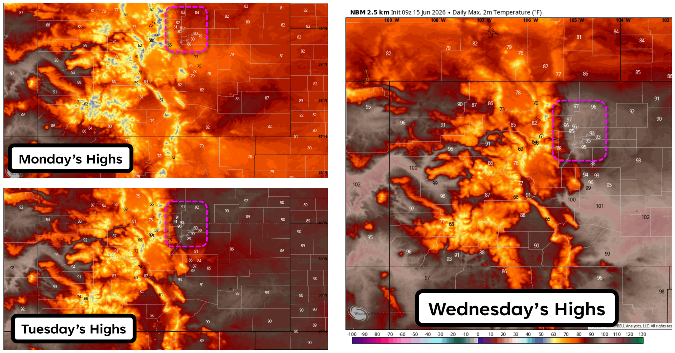
Heat builds into midweek
Aseasonably warm start to the week will quickly give way to a more consequential heat surge across the Front Range. Monday’s highs near 80°F occur under northwest flow aloft as Colorado sits downstream of a West Coast heat dome. That positioning will keep us on the cooler fringe of the ridge—for now. Monday will be the relative “cool outlier” of the entire week.
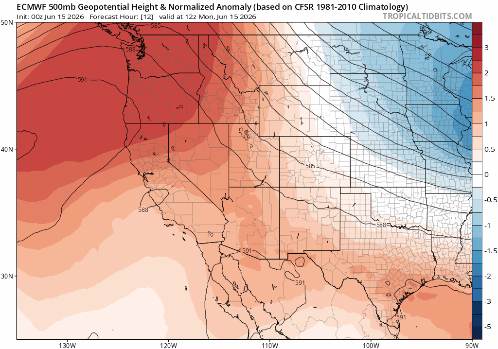
By Tuesday, the core of the hot, dry airmass over the Desert Southwest will expand north and east. What is seasonable Monday will surge well above normal Tuesday, with Boulder climbing into the lower 90s.
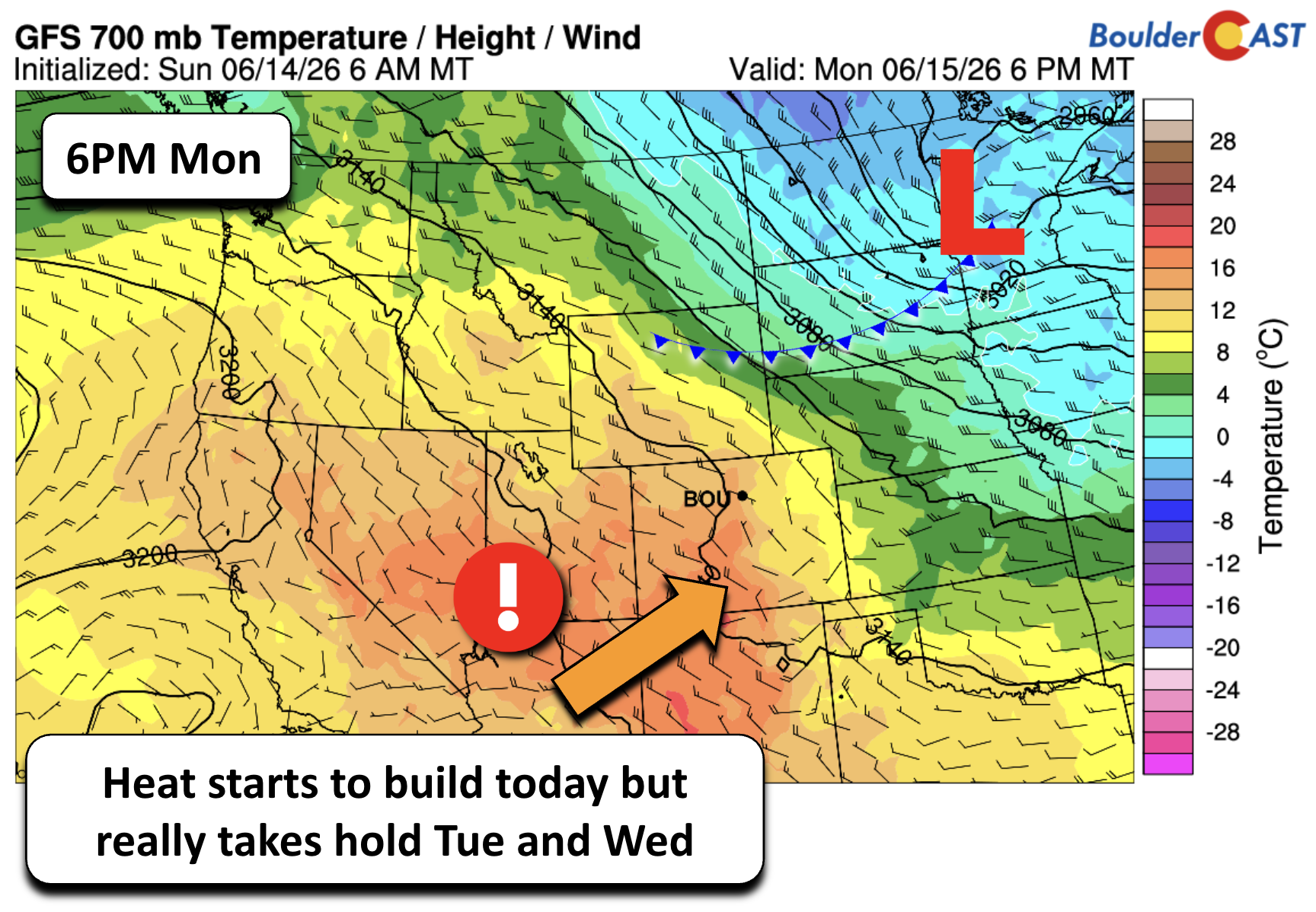
The peak of the heat arrives Wednesday as the hottest air shifts directly into Colorado ahead of a moisture‑starved cold front sliding south from Wyoming and Nebraska. Mid‑level thickness values and 700 mb temperatures will support mid to upper 90s across the Denver Metro area.
Boulder’s June 17th daily record of 99°F (set in 2021) is within reach, though current guidance keeps us just shy.
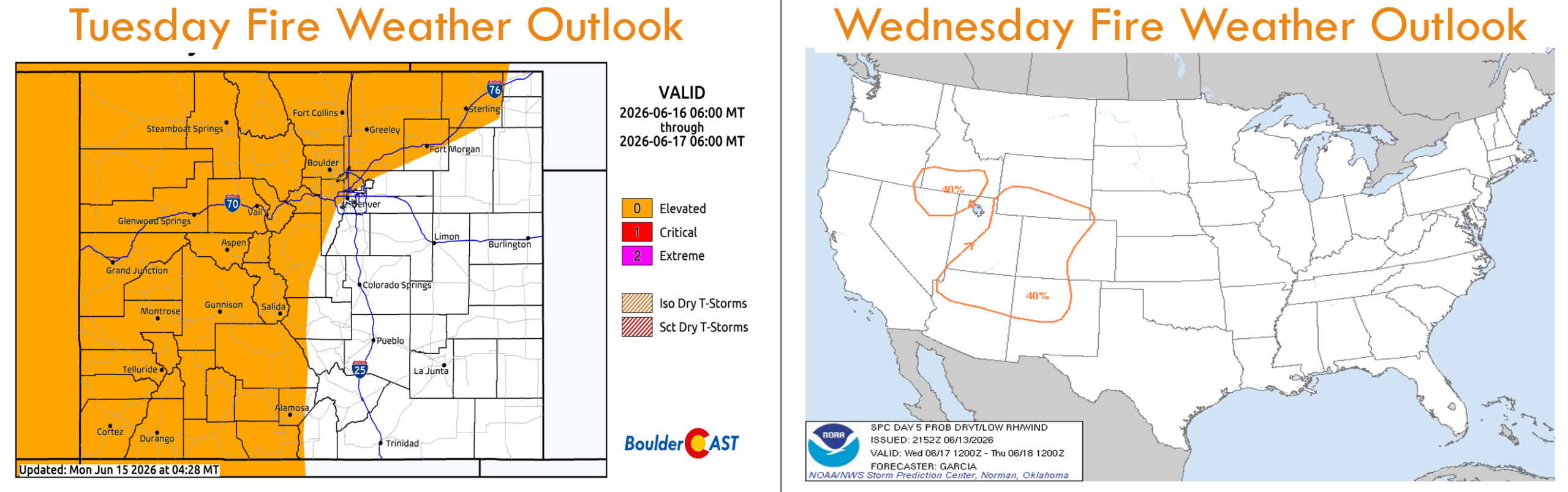
Hot, dry, and gusty Tuesday & Wednesday
The midweek pattern is not simply hot—it’s hot, dry, and windy, a classic fire weather cocktail for early summer.
A strengthening northwesterly downslope gradient will enhance surface warming and produce gusts of 20–35 MPH, strongest Wednesday afternoon. This will align well with a corridor of critically low humidity spreading over a large portion of Colorado.
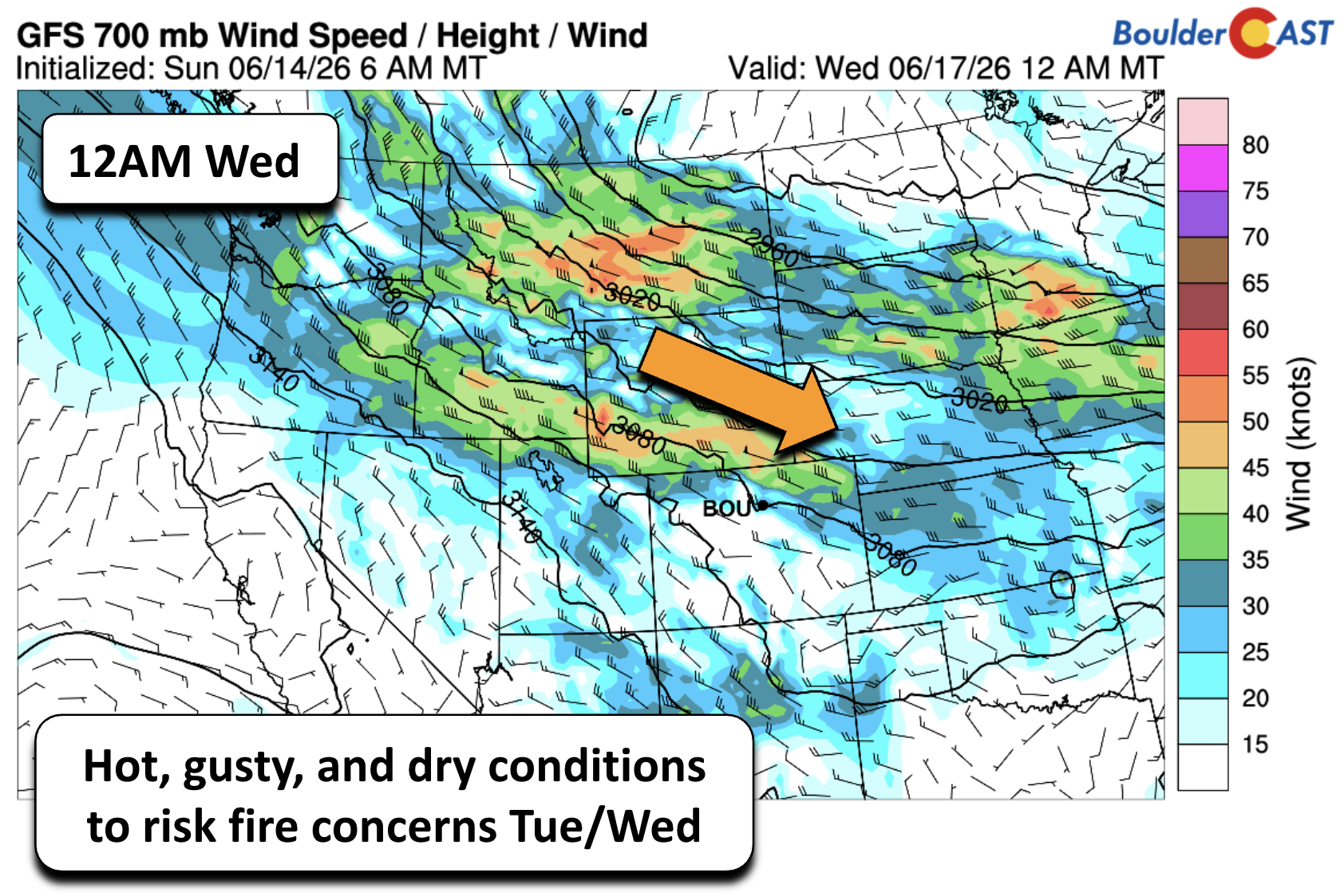
The NOAA Storm Prediction Center highlights much of the state for elevated fire weather conditions both days. While recent green‑up across the Boulder–Denver corridor should keep local fuels less receptive—likely preventing Red Flag issuance in our immediate area—the Mountains and high valleys remain more vulnerable and are likely to be under Red Flag Warnings both days.
Brief late‑week relief
A weak, mostly dry cold front arrives Wednesday evening, delivering a noticeable cooldown for Thursday. Highs are set to fall 10 to 20°F compared to Wednesday, landing in the lower to middle 80s. After the midweek heat, Thursday will feel dramatically different despite still being technically warmer than normal as well.
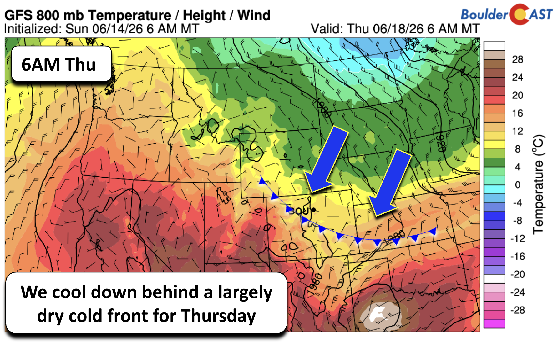
The cooldown will be short‑lived. A ridge rebuilds quickly, actually translating across Colorado late in the week.
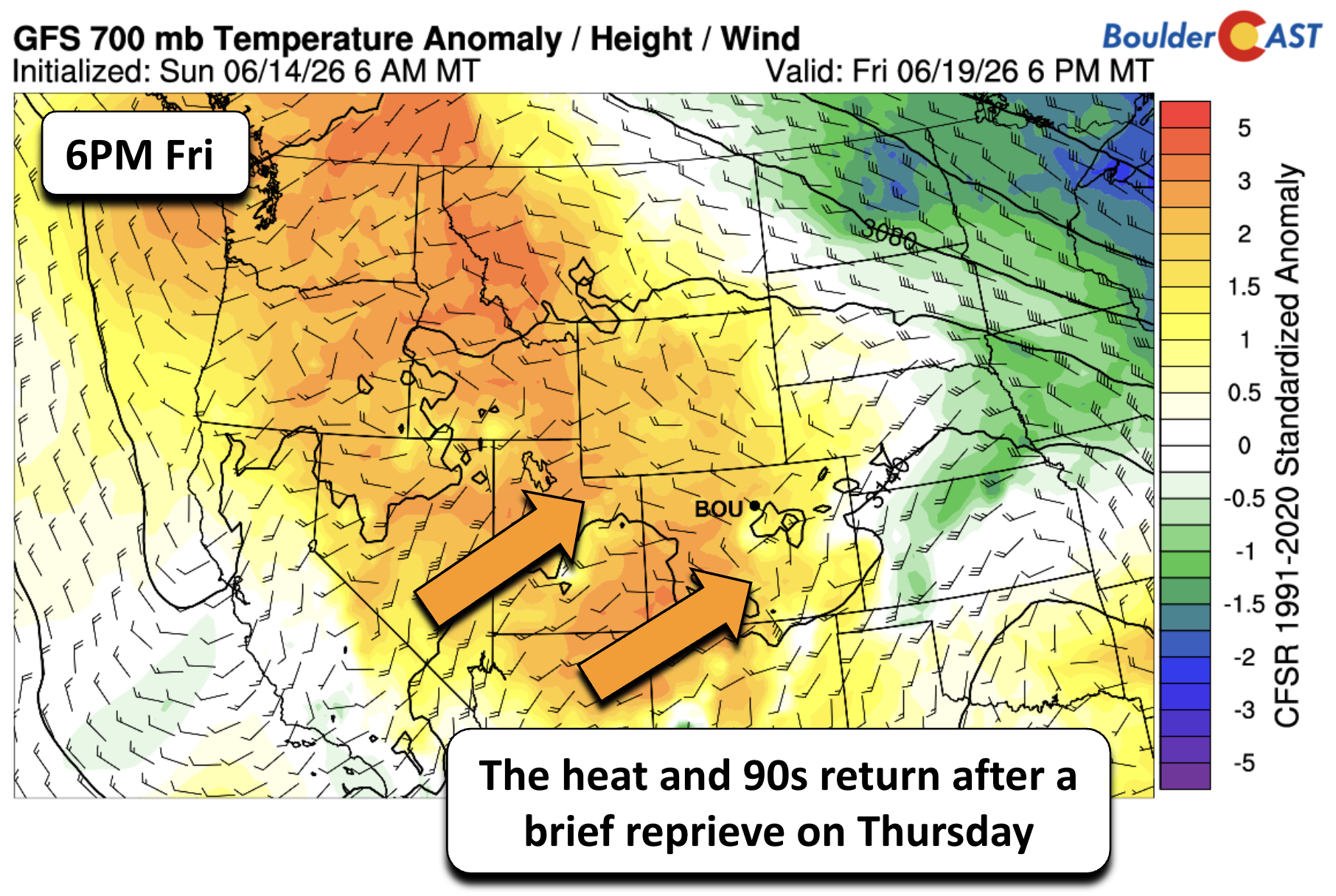
This will push our temperatures back into the 90s for Friday and Saturday (at least).

Storm chances: limited, but not zero
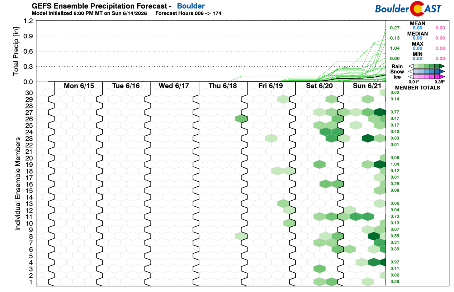
Convective prospects remain muted for most of the week due to a serious lack of moisture. The best window appears to be Friday, when ensemble guidance hints at a developing trough to our west. That setup will begin to draw moisture northward—enough to potentially support isolated afternoon and evening storms.
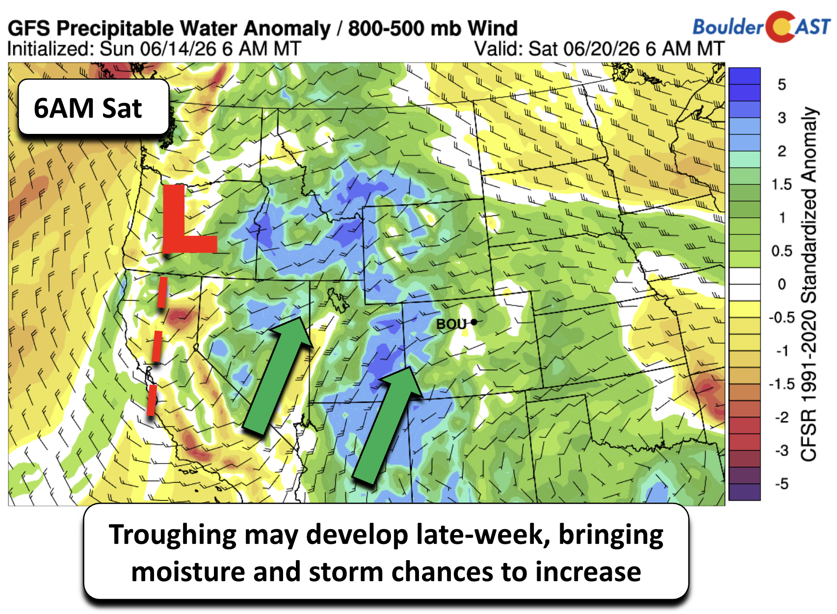
The overall pattern this week strongly favors suppressed storm activity, though we’ll likely see at least the return of low-end storm chances come Friday and especially into the weekend.
Bottom Line
As we move through the week, the broader pattern continues to signal a classic early‑summer tug‑of‑war: strong Western ridging repeatedly trying to reassert itself and brief backdoor frontal intrusions offering only temporary relief. All the while moisture struggles to gain a foothold along the Front Range. It’s safe to say our spring wet season has officially come to an end.

Until a more organized Western trough or a genuine monsoonal push materializes, heat and dryness will remain the dominant themes for us, with only modest hints of change showing up late in the week.
We’re watching those weekend signals closely, but for now, expect the warmth to keep on winning while the drought keeps on intensifying.
Forecast Specifics:
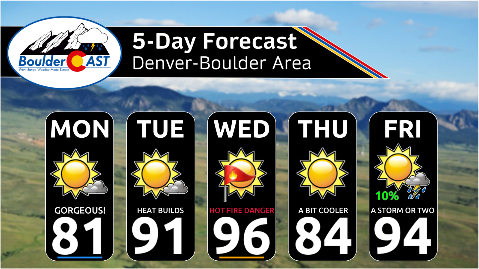
Monday: Highs in the lower 80s on the Plains, with upper 60s in the Foothills under mostly sunny skies
Tuesday: Trending warmer near 90° on the Plains and upper 70s in the Foothills. Red Flag Warnings may be issued under gusty winds of 15-30 MPH in some areas.
Wednesday: Hot and gusty with near-record highs up and down the Front Range. Highs in the mid to upper 90s for the Plains and middle 80s in the Foothills. Red Flag Warnings may be issued under a breezy winds of 20-35 MPH.
Thursday: A brief reprieve from the heat with low to middle 80s on the Plains and low 70s in the Foothills.
Friday: Heating back up again with a potential return to near-critical fire danger. Highs will land in the lower 90s on the Plains with upper 70s in the Foothills. Storm chances also get introduced for the afternoon and evening, though coverage is expected to be isolated at best.
DISCLAIMER: This weekly outlook forecast is created Monday morning and covers the entire upcoming week. Accuracy will decrease as the week progresses as this post is NOT updated. To receive daily updated forecasts from our team, among many other perks, subscribe to BoulderCAST Premium.
Go Premium, get all the perks.
Daily Forecast Updates
Get our daily forecast discussion every morning delivered to your inbox.
All Our Model Data
Access to all our Colorado-centric high-resolution weather model graphics. Seriously — every one!
Ski & Hiking Forecasts
6-day forecasts for all the Colorado ski resorts, plus more than 120 hiking trails, including every 14er.
Smoke Forecasts
Wildfire smoke concentration predictions up to 72 hours into the future.
Exclusive Content
Weekend outlooks every Thursday, bonus storm updates, historical data and much more!
No Advertisements
Enjoy ad-free viewing on the entire site.
Enjoy our content? Give it a share!


Leave a Reply
You must be logged in to post a comment.