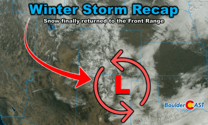
Winter finally showed up in style this week along the Front Range. After a sluggish start to the season, our first true snowstorm delivered nearly 18 hours of steady flakes, painting Boulder, Denver, and much of Colorado in white. But this wasn’t just a simple upslope event—there were some fascinating atmospheric twists that kept the snow machine running longer than expected. We review the storm setup and snowfall totals which greatly favored the western side of the Metro area including Boulder.
What You Need to Know
- 🌨️ Storm timing & evolution: Snow began around midnight Tuesday and continued uninterrupted through early Wednesday evening, with radar showing multiple signals fueling the snow beyond just upslope flow.
- 📡 Atmospheric setup: Strong upslope tied to a frontal boundary kicked off the storm, followed by weaker but persistent easterly flow plus diffluence aloft, frontogenesis, and broad lift from the trough sustaining snowfall.
- ❄️ Snow character: Temperatures in the mid–upper 20s produced heavy, wet snow early, transitioning to lighter, fluffy dendrite‑rich snow later.
- 📊 Totals versus forecast: Boulder received 9.1″, Denver 4.3″; western suburbs all topped 5″+, east of I‑25 saw 1–5″. Forecast verification was strong overall.
- 🔥 Fire risk reduced: Precipitation totals up to 1″ has reduced the risk of wildland fires regionwide, helping to create separation between this year and the leadup to the Marshall Fire in 2021.
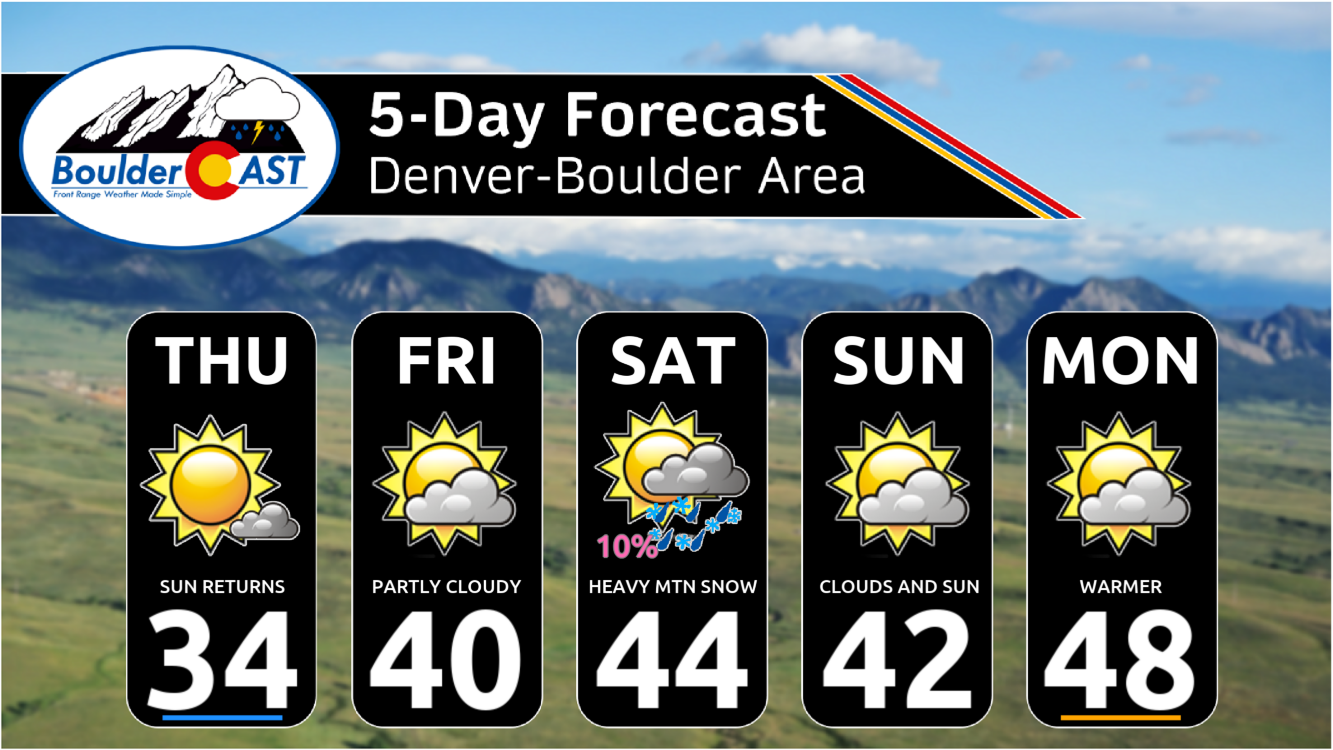
- 🔮 Outlook: Boulder and Denver will stay dry for 5–7 days due to downsloping, but the Mountains are set to receive 1–3 feet of snow this weekend into early next week. Difficult travel lies ahead up there at times.
Snow is back, and sure it is beautiful!
Right on cue, the snowflakes kicked off around midnight Tuesday night across the Front Range, and once they started, they didn’t let up until Wednesday evening. Nearly 18 hours of steady snowfall blanketed the region, and the radar animation tells the story beautifully—capturing the storm’s most intense 12-hour stretch.
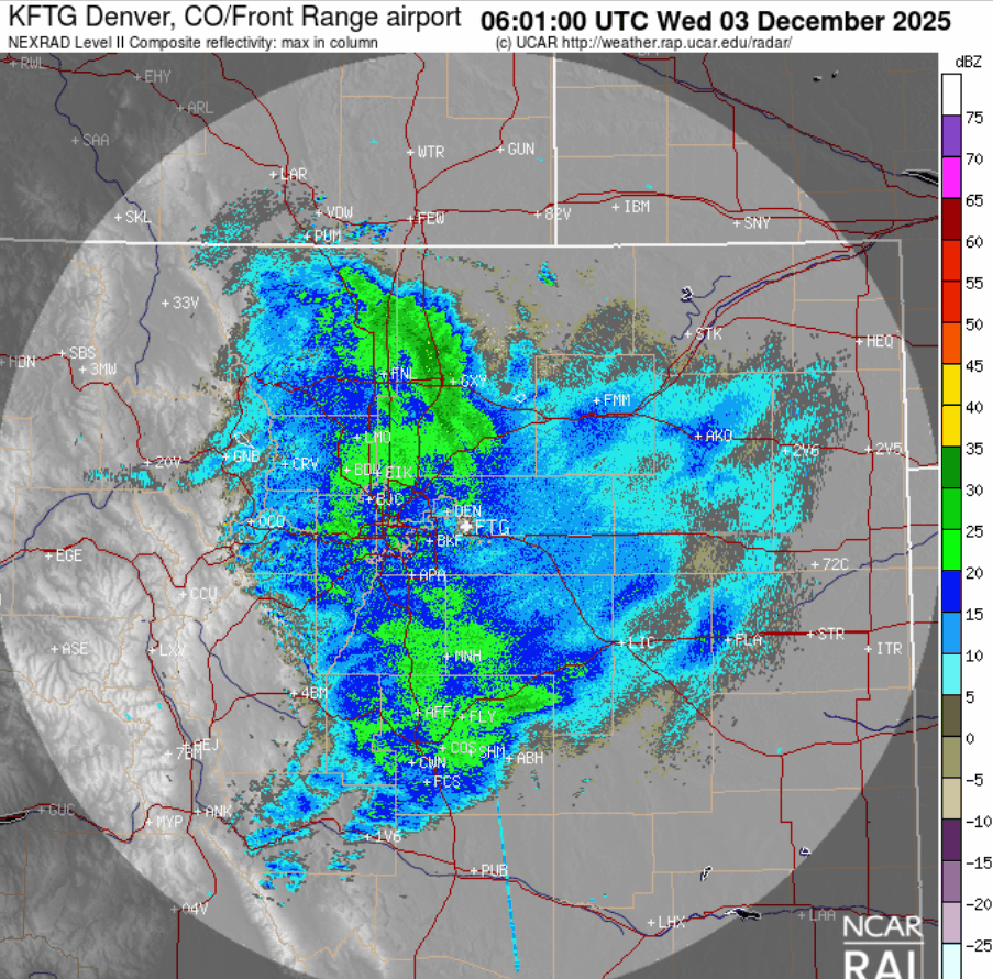
Radar animation from 1AM to 1PM on Wednesday
What’s fascinating here is that upslope flow wasn’t the only player in the game. Sure, some of the heavier bursts initially tracked east-to-west into the terrain, but as the storm evolved, you can clearly see other pulses of energy sliding north-to-south and even west-to-east. That’s a sign that multiple atmospheric ingredients were mixing together to keep the snow machine running.
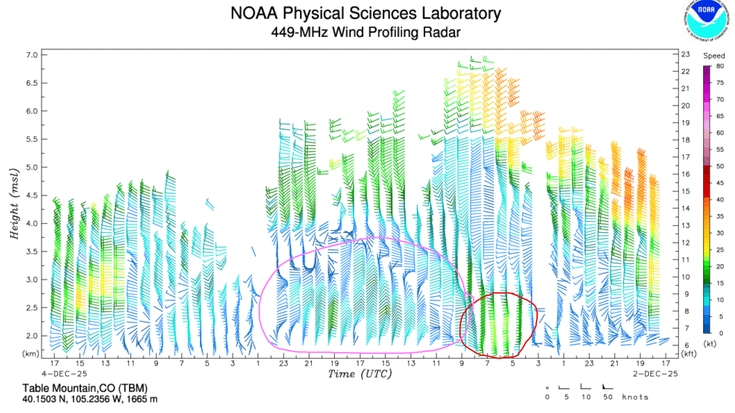
Data from the Longmont wind profiler backs this up. The red circled section highlights the strongest upslope surge, tied to a sharp frontal boundary right at the onset of the storm near midnight Tuesday night. That’s when intense snow bands really blasted up against the terrain. But this intense upslope only lasted a few hours. Afterward, a weaker—yet deeper—easterly flow lingered for another 12 to 16 hours (shown in the pink circled area). That persistent flow helped sustain the snowfall long after the frontal punch had passed.
Interestingly, the cold storm system itself tracked well west of Colorado—far from the “ideal” path for big Front Range snow.
But other atmospheric features stepped in to keep things going:
- Diffluence aloft spread the air and encouraged lift.
- Slow-moving frontogenesis
- Weak trough lift added just enough broad upward motion.
Together, these subtle but important dynamics prolonged the light to moderate snow through Wednesday.
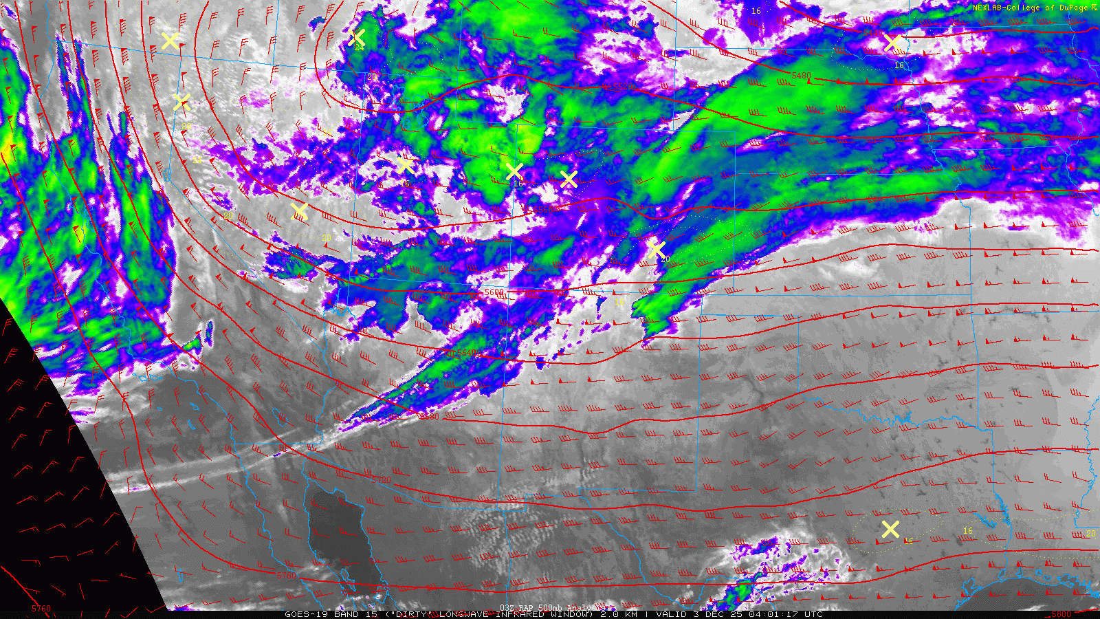
The result? A fresh, sparkling blanket of snow across Boulder, Denver, and much of Colorado—visible even from space!
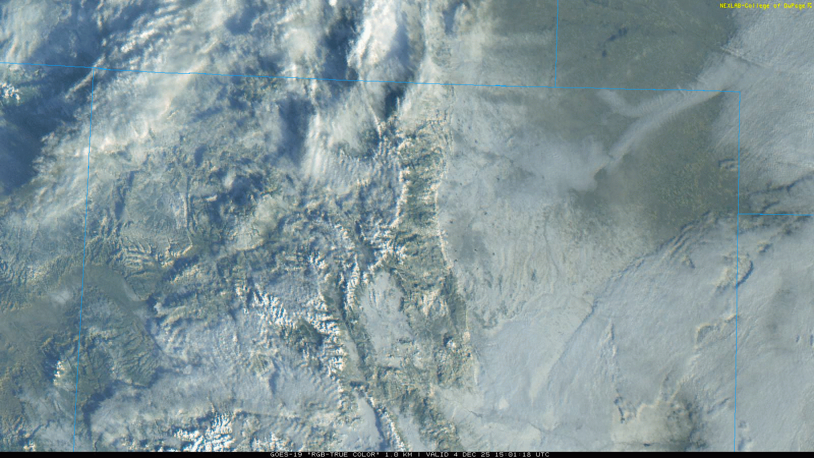
Snowy GOES-East visible satellite imagery from Thursday morning, with Colorado showing off its fresh white blanket
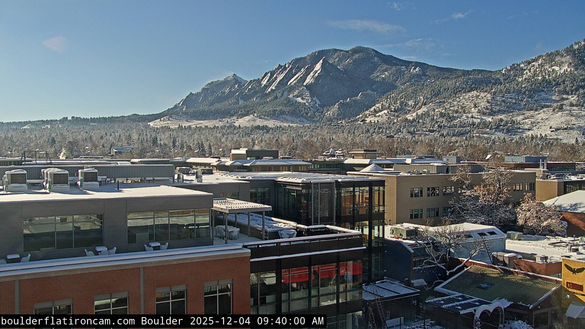
On the ground, the Flatirons look especially magical under their nascent white dusting (though we’ll admit we’re probably biased).
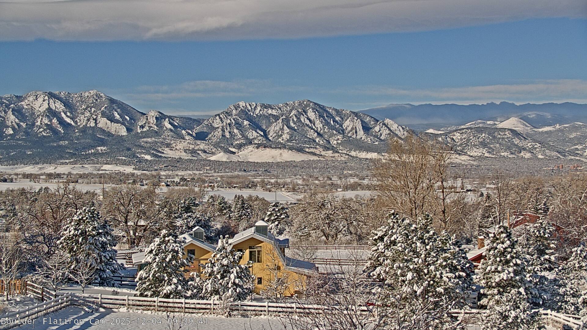
Temperatures hovered in the mid-to-upper 20s during most of the storm. The first few inches were heavy, wet snow—perfect for snowmen-making but brutal for shoveling. By the end, though, the storm transitioned to fluffier dendrite-packed snow, giving us that classic powdery finish.
When it was all said and done, after 18+ hours of continuous snowfall for most of our area, totals were impressive to say the least, especially after such an abysmal start to our snow season and this being our first real snowstorm.
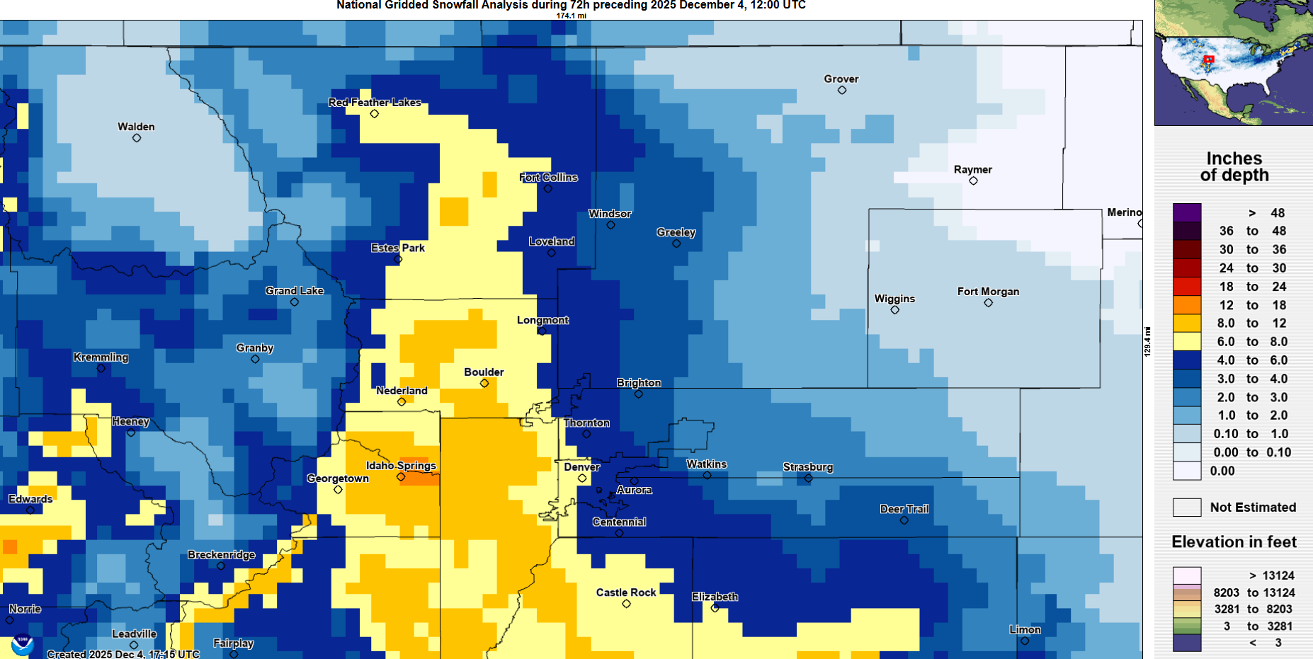
The BoulderCAST snowfall forecast map issued Tuesday morning is shown below with storm totals overlaid. Green values indicate our forecast verified, Yellow values mean the observed total was just outside our forecast, while Red was a busted forecast (more than 1″ off). The western suburbs piled up the most snow — universally reaching over 5 inches west of Interstate 25, with the highest totals in and near the Foothills of Jefferson and Boulder Counties. Totals of 1 to 5 inches occurred to the east of Interstate 25. Overall, we’re happy with how our forecast played out. We nailed the timing and impacts pretty well too—always a win in the tricky world of Colorado snowstorms.
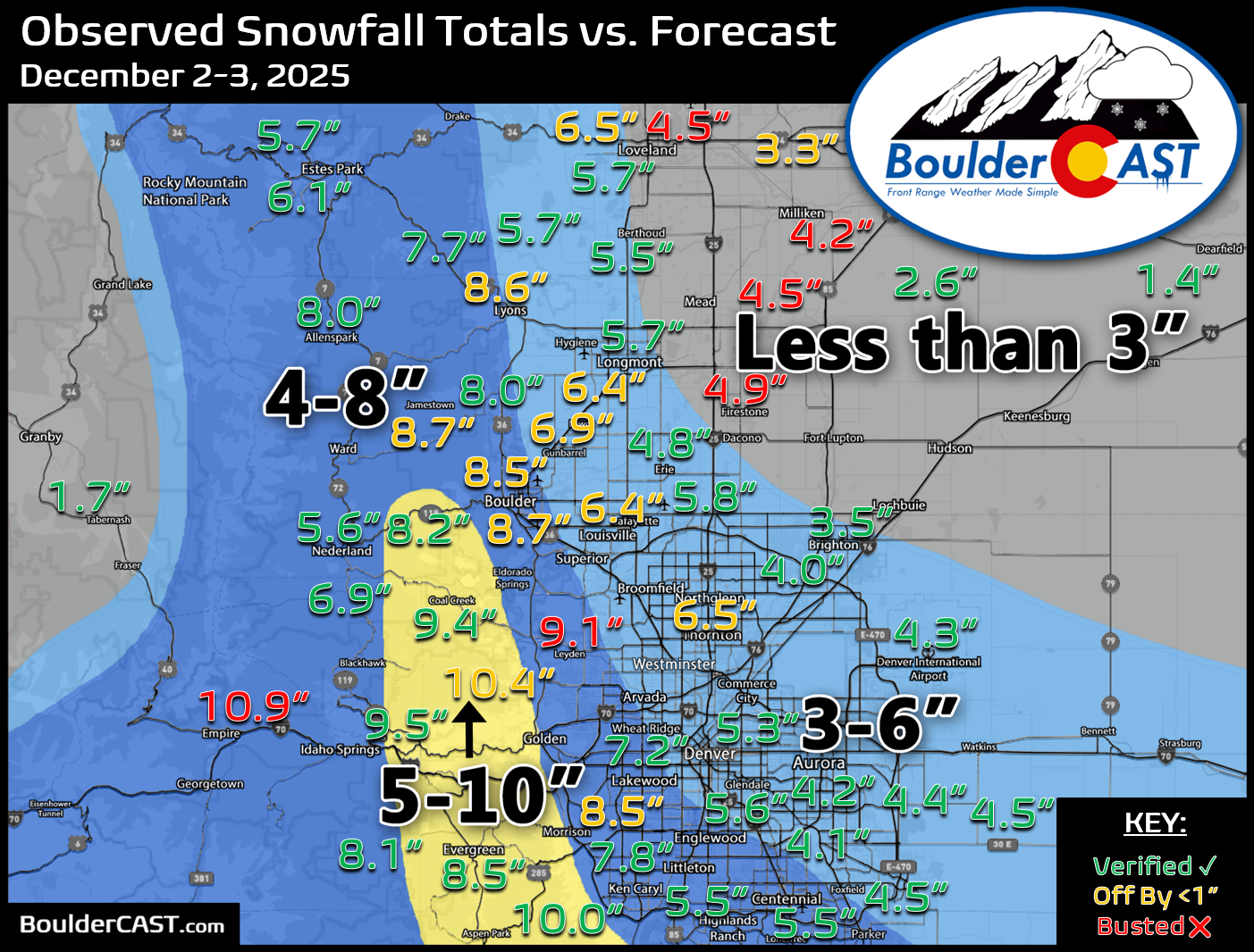
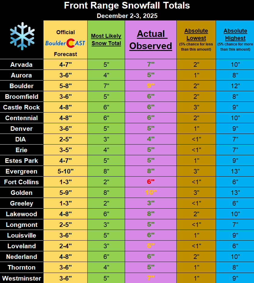
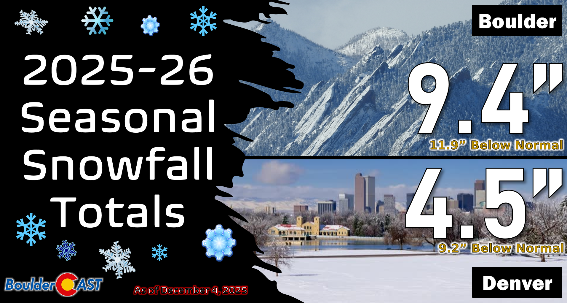
Officially, Boulder received 9.1″ of snow from this storm, while Denver (DIA) recorded 4.3″. Despite this storm’s success, the broader snow season is still lagging quite a bit. We’ve got deficits to make up as winter progresses, so this storm was more of a morale boost than a season-saver. By the way, you can find a recap of all the winter storms so far in the 2025-2026 snow season HERE.
The moisture content from this storm was just as impressive as the snowfall itself. Across the Front Range, liquid equivalents ranged from 0.25″ to 1.00″—a huge boost for an area that’s been exceptionally dry this fall. Boulder alone picked up 0.66″ of water.

Precipitation totals from the event (early onset rain + melted snow equivalent)
To put that in perspective, December is typically one of our driest months, and this single event has already delivered ~80% of our normal December moisture—and we’ve still got nearly the entire month ahead of us.
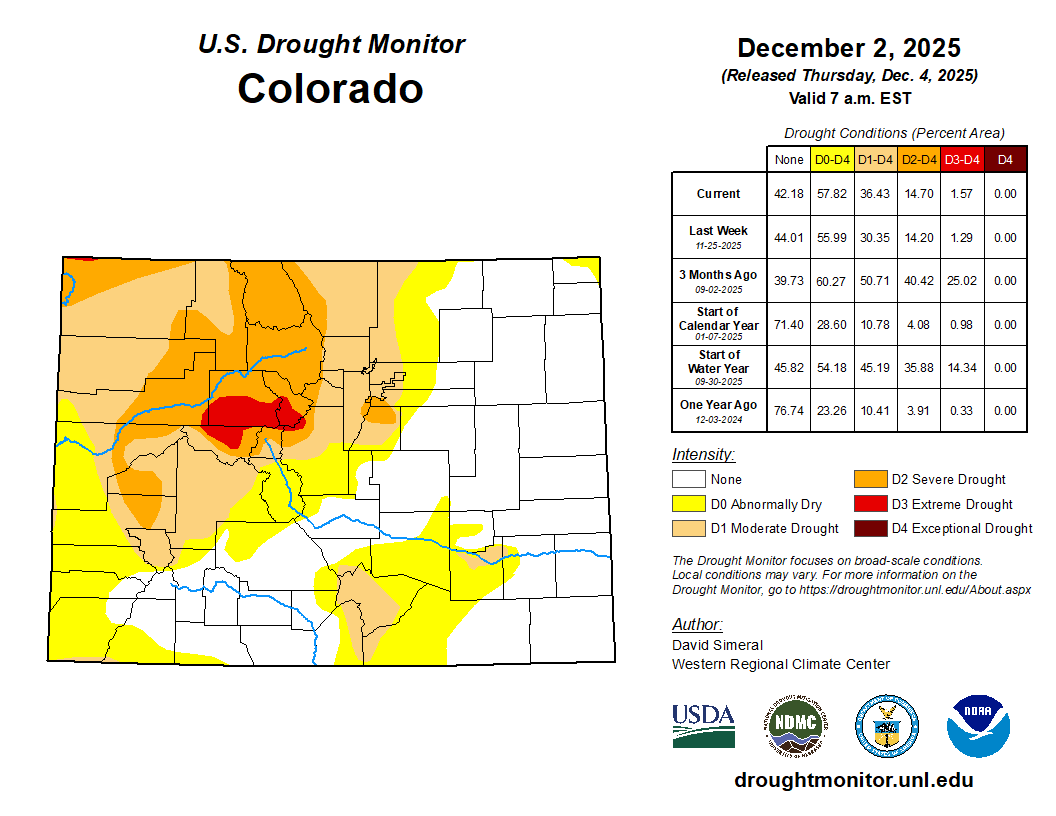
Before this storm, conditions were starting to look eerily similar to late 2021 in the lead-up to the Marshall Fire. But three-quarters of an inch of water this week has changed the trajectory. The heavy, wet snow not only blanketed the landscape but also pressed down the tall grasses and soaked vegetation that was a tinderbox just days earlier. As a community, we can breathe a collective sigh of relief knowing this storm helped reduce fire risk in a very tangible way. We’ll have to wait and see if this storm was enough to reduce or remove the current drought that is plaguing the Boulder-Denver area. The drought map below does NOT include any part of our recent snowstorm.
While this was a great, belated start to our snow season, let’s hope the snowy momentum continues into the Holidays and New Year…
Looking ahead
If you’re craving more snow in Boulder or Denver, you’ll have to be patient. The next 5 to 7 days look dry thanks to downsloping northwest flow. However, the Mountains are about to get buried—expect 1 to 3 feet of snow this weekend with widespread travel impacts. Temperatures across the lower elevations will stay chilly in the 30s and 40s, which is pretty typical for early December.
Spread the word, share our crazy Colorado weather:

Go Premium, get all the perks.
Daily Forecast Updates
Get our daily forecast discussion every morning delivered to your inbox.
All Our Model Data
Access to all our Colorado-centric high-resolution weather model graphics. Seriously — every one!
Ski & Hiking Forecasts
6-day forecasts for all the Colorado ski resorts, plus more than 120 hiking trails, including every 14er.
Smoke Forecasts
Wildfire smoke concentration predictions up to 72 hours into the future.
Exclusive Content
Weekend outlooks every Thursday, bonus storm updates, historical data and much more!
No Advertisements
Enjoy ad-free viewing on the entire site.


Thanks for the great reporting! I, like y’all, was have eerie Déjà vu of 2021, and it wasn’t pleasant. This storm was a wonderful relief!
Yeah we’re in much better shape now than we were a few days ago. It’s been a tough fall. Let’s hope we can follow up with one or two decent snow events before the end of the year to keep it going!
Thank you for pointing out the difference this year compared to 2021.
Thanks for reading!