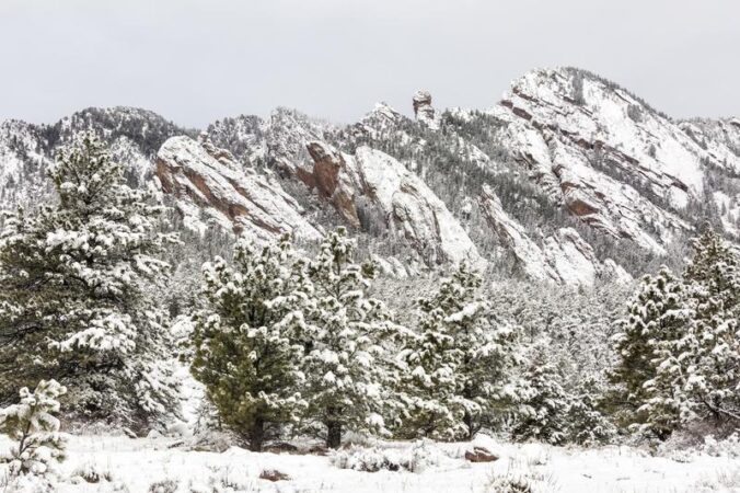
Snow began earlier that expected Thursday morning making for three consecutive tricky commutes across the Denver Metro area. Light snow continued almost continuously for 24 hours leading to a slow but steady accumulation reaching several inches of snow across the Front Range, with up to a foot in some upslope-favored locations. Let’s take a look at the snow totals and the beautiful weather that lies ahead for the weekend.
Our snowfall forecast map for the event issued early Thursday morning is shown below with storm totals overlaid. Green numbers indicate our forecast verified to within 1″. Red did not. As you can see, anywhere from 2 to 12″ of snow fell across the entire area with fairly decent forecast verification overall.
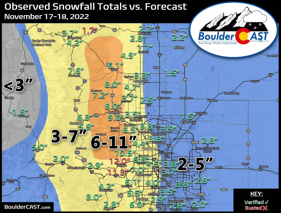
The heaviest dumping of fluff occurred in the Foothills of Jefferson and Boulder Counties, particularly around Golden which received the most snow out of anywhere in the Front Range. This focus of the heaviest snow in the lower Foothills and immediately adjacent Plains was a key discussion point of our forecast — this happens when upslope is relatively shallow and is unable to reach the highest terrain.
What conditions cause Boulder to get more snow than Nederland and higher Foothills in an event like this (outside of localized banding)? Upslope being shallow! Current upslope over the area is only about 2700 feet deep (below pink line), or up to 8000 feet elevation #COWx pic.twitter.com/bvD91ZJABY
— BoulderCAST Weather (@BoulderCAST) November 17, 2022
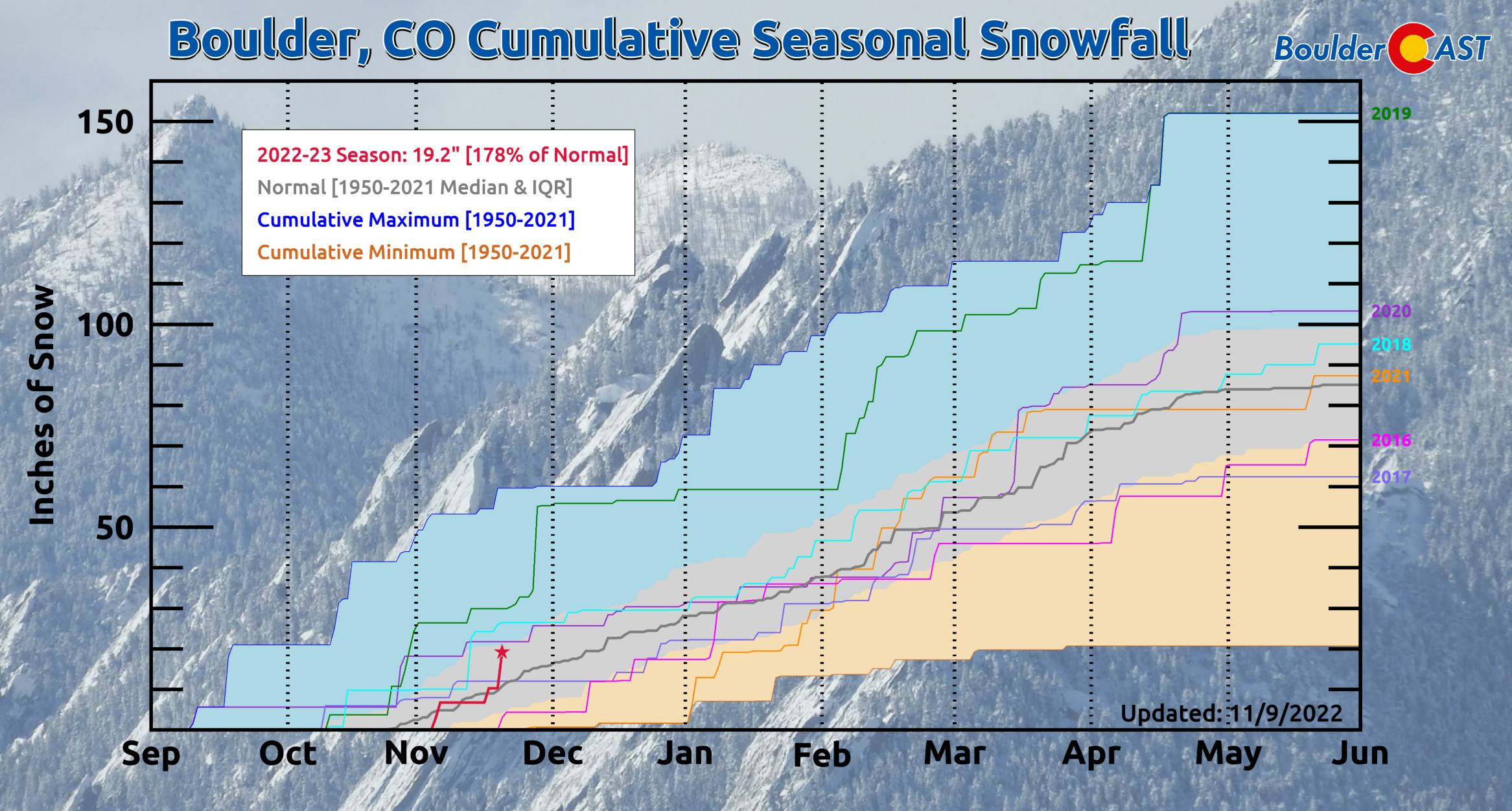
Officially, Boulder reported 8.9″ of snow from the event, while Denver (DIA) received only 2.8″. This brings the seasonal totals to 19.2″ and 9.2″, respectively — values that are indeed above normal in both cities!

Here’s a look at how snowfall has tracked through the season so far in Boulder. We’re currently sitting about 80% above normal — a great place to be so early in the season!
Snow has already come to an end this morning with skies clearing quickly from north to south. It will remain unseasonably cold on Friday with the Arctic airmass entrenched across the area. Highs will only reach the middle 20s.

Things warm up about ten degrees each day for the weekend ahead with heaps of sunshine. Enjoy it!


You must be logged in to post a comment.