
Last night’s quick-hitting snowstorm hit with a bang in the southwest Denver Metro area and southern Foothills, with locally heavy snowfall up to 20″ falling in parts of Jefferson County. Elsewhere, snow amounts fell well in-line with our forecast, including some Front Range cities not receiving a single snowflake! We review how the storm unfolded, the snow totals from across the region and look ahead to the remarkably warm and sunny weather about to take center stage.
Big things sometimes come in small packages!
Back in Monday’s weekly outlook we first discussed the potential for a late-week snow event across the Front Range, but at the time, assumed it would be another meager and quick-moving system coming across central Rockies with just minor impacts on the Front Range — like so many similar-tracking storms before it this winter. Models were all over the place being so far out — that much spread in the guidance rarely materializes into anything significant in time. However, by Wednesday morning, things were starting to look at lot more interesting for the late-week snow event. Some of the short-range models were beginning to generate 6 to 12″ of snow for the entire Metro area, with Boulder at the epicenter in some cases (like this HRRR snow forecast below). Global models and ensembles started to come around as well, but not completely, which led a lot of doubts in our eyes for what exactly would transpire Thursday night.
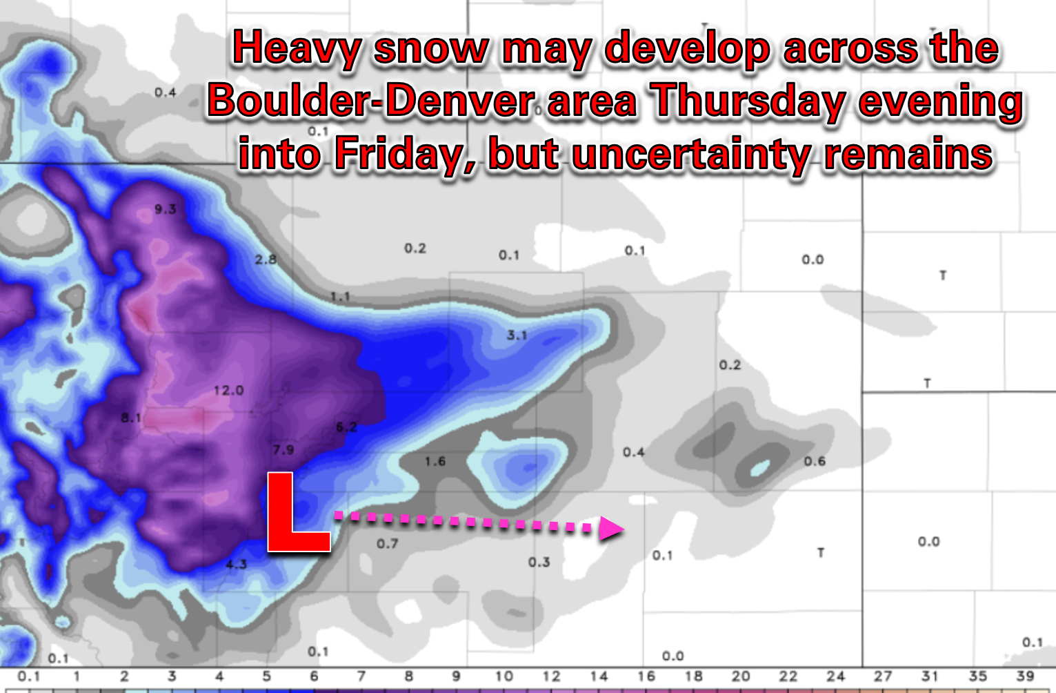
By Thursday morning, all of the models were sticking to their guns and it was clear a significant snow event was about to unfold for PARTS of the Metro area. However, due to the petite nature of the storm and the primary low pressure system tracking a bit further south, Boulder would now be mostly on the outside looking in, with heavy snow projected in the Foothills along and south of Interstate 70. Mother Nature giveth and Mother Nature taketh away!
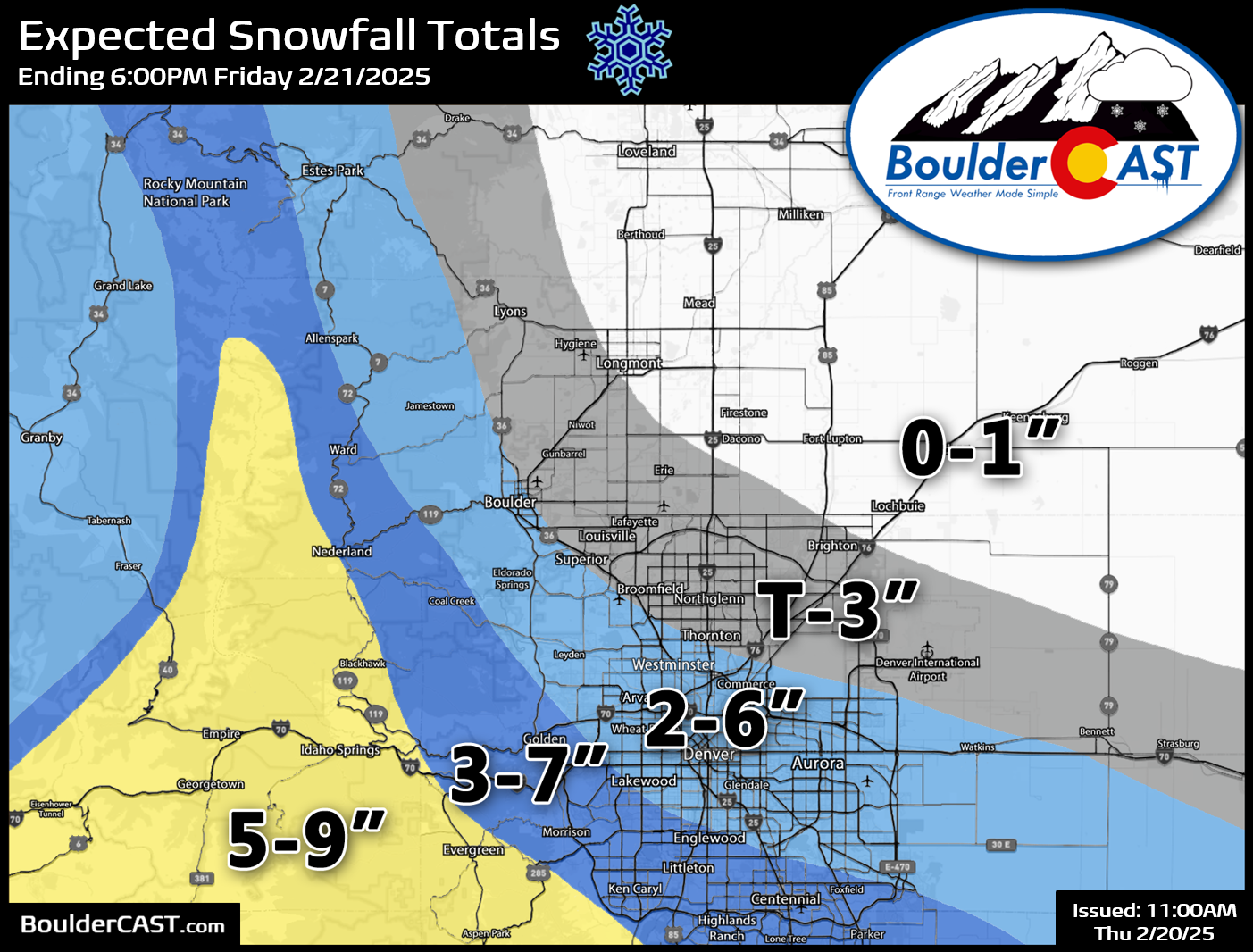
We issued our snowfall forecast map Thursday morning, with the expectation that there would be an impressive gradient in snowfall totals from southwest (a lot of snow) to northeast (next to no snow) in the Front Range. Little did we known just how exceptional that gradient would turn out to be!
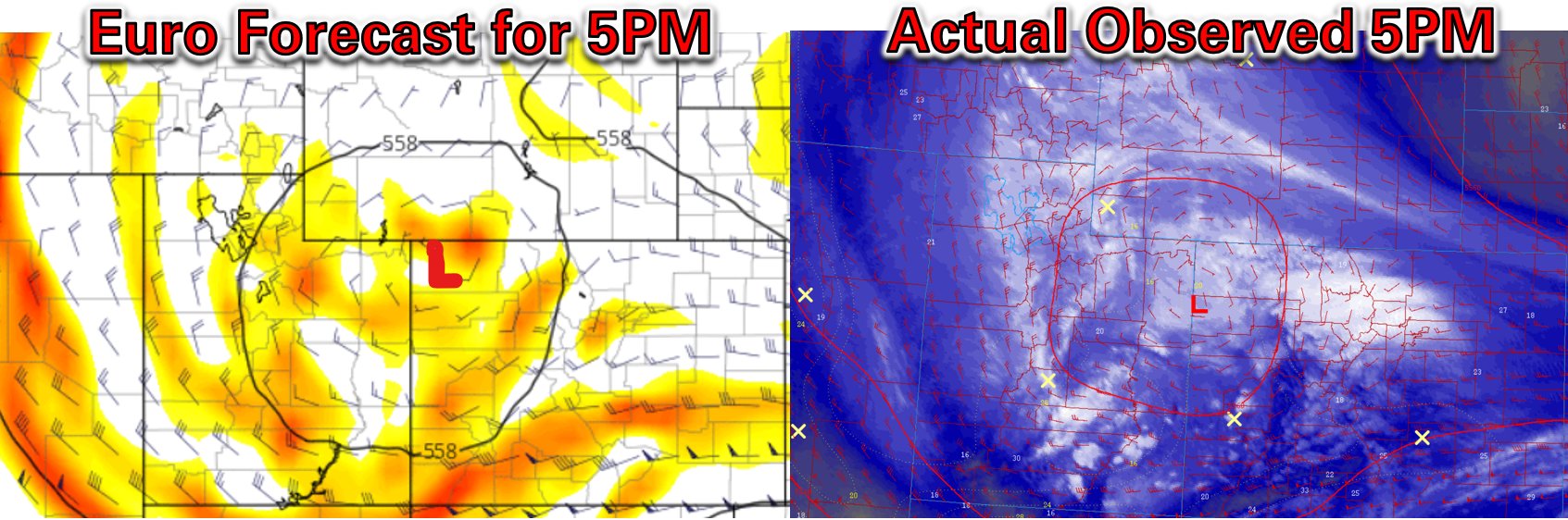
The Pacific low pressure came across Salt Lake City Thursday morning before passing perfectly south of Denver Thursday evening and night, as shown in the GOES-East water vapor animation below. The original low pressure weakened in NW Colorado before transitioning its energy to a newly forming low southeast of Denver early Friday morning. Look at all that upslope (easterly) flow coming into the Front Range! This uniquely petite but strikingly intense mid-level low pressure made for quite the challenging forecast!
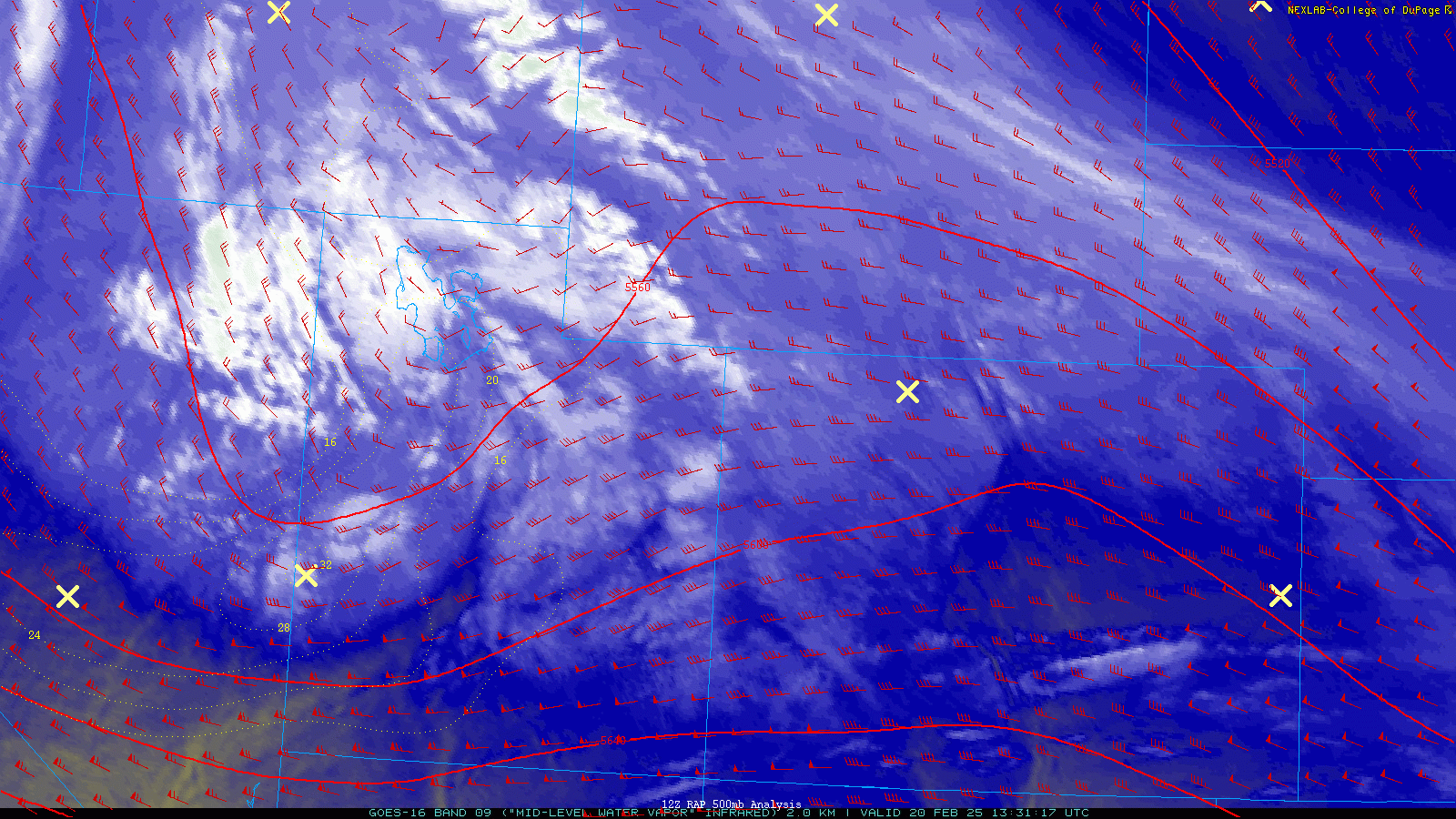
The storm system ended up generating an explosion of heavy snow throughout the southwest Metro area last night, aided by favorable upslope flow, instability in the mid-levels of the atmosphere and strong lift associated with concentrated pockets of vorticity rotating around the parent low pressure. Note the impressive amount of dark green (heavy) snow bands throughout the duration of the event overnight in the 12-hour radar animation below. These areas were experiencing snowfall rates of 1 to 2″ per hour, if not more in some cases. Boulder missed out on most of this banding, but we did pick-up a few short-lived heavier bursts at times.
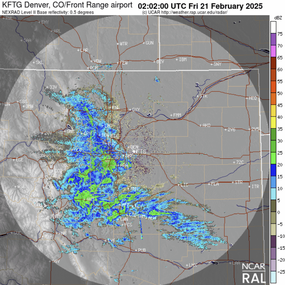
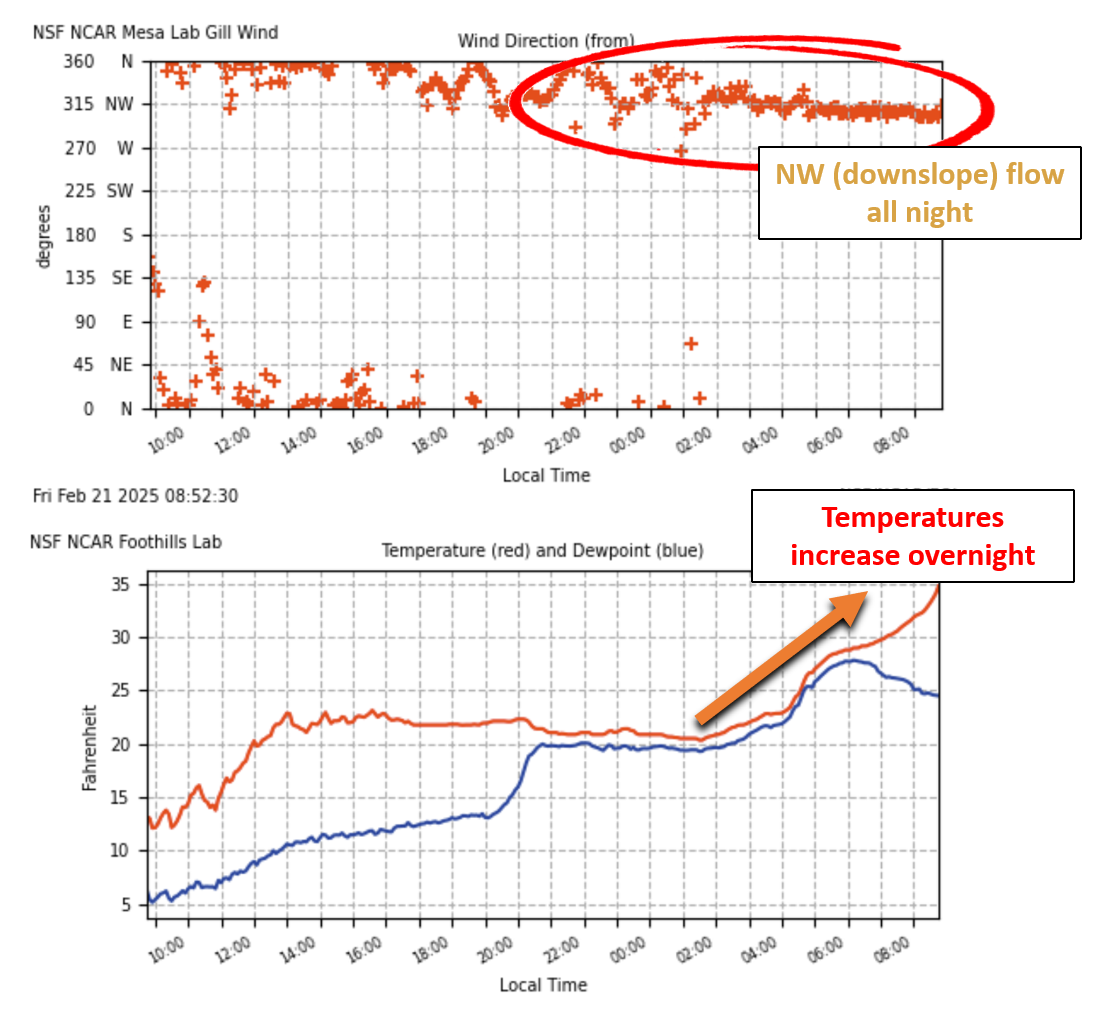
Throughout the night, Boulder was also fighting weak downslope flow coming off the Foothills which had a warming and drying effect, furthering limiting the snowfall we were able to see from this particular storm. Just twenty miles south, winds were much more cooperative overnight as the snow totals will reveal…
Our snowfall forecast map is shown below with storm totals overlaid. Green values indicate our forecast verified, Yellow values mean the observed total was just outside our forecast (within 1″), while Red was a busted forecast. Overall, our forecast was spot on for most of the area, including largely getting the sharp gradient in snow amounts correct. However, its hard to ignore the big elephant in the room — the booming 10 to 20″ dumping on the southwest side of the Denver Metro area into the Foothills. This region was pummeled by slow-moving or even stationary bands of heavy snowfall much of the evening and night. Keep in mind this event only lasted 12 to 16 hours for the area at most from the first flakes to the last. Snow totals of 12-20″ equate to an average snowfall rate greater than 1″ per hour for the entire event!
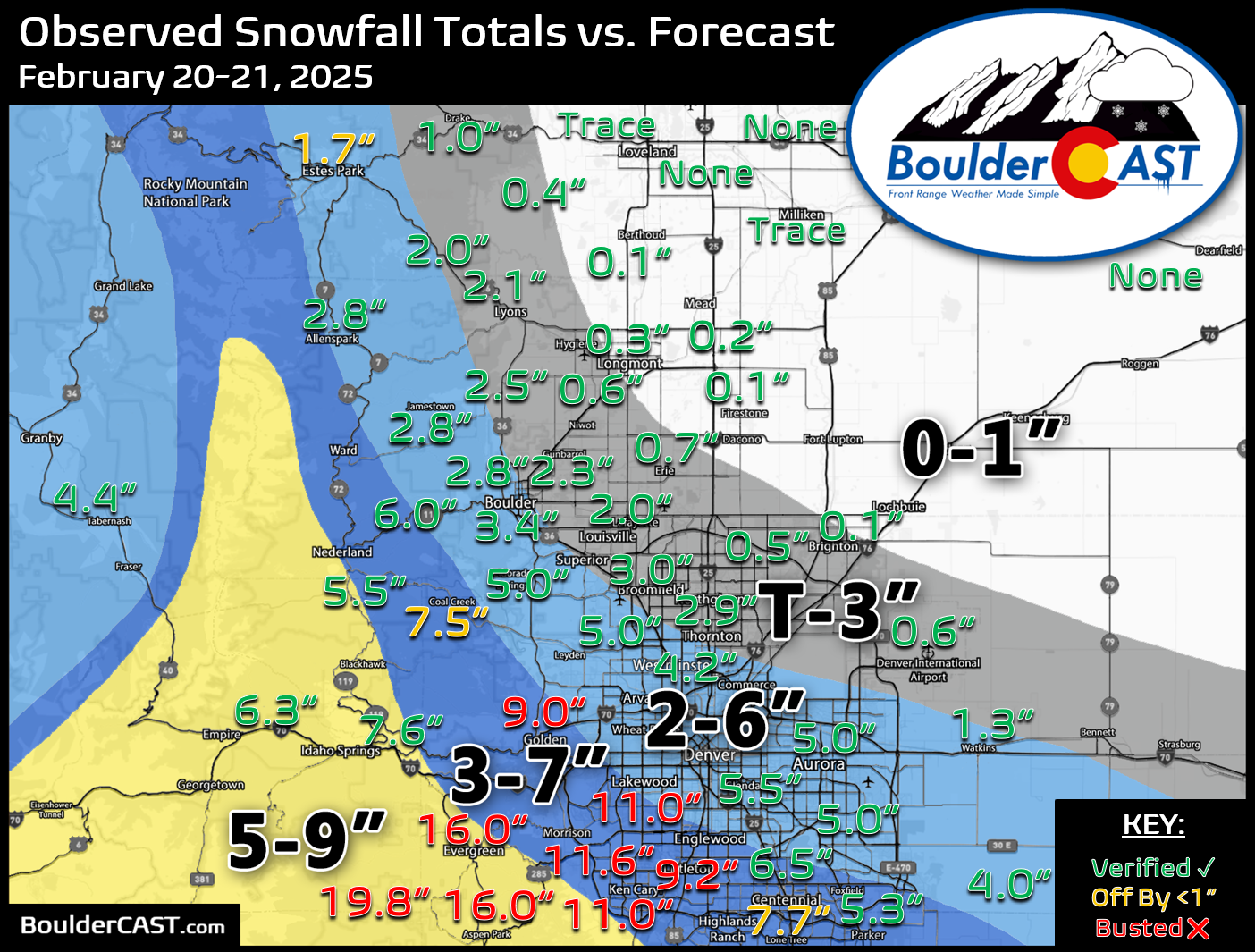
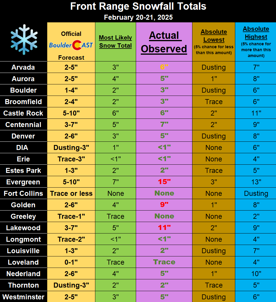
In the end, most cities ended up with their projected snow amounts, though there were a few boomers on the southwest side of town obviously. As you can see in the table below, Lakewood, Golden and Evergreen had totals that were above even the highest 5% of guidance. When this happens, it’s not something that can really be forecasted at all ahead of time. There were a few convection-allowing models (CAMS) that did show some big 20″ totals, but those are generally overdone.
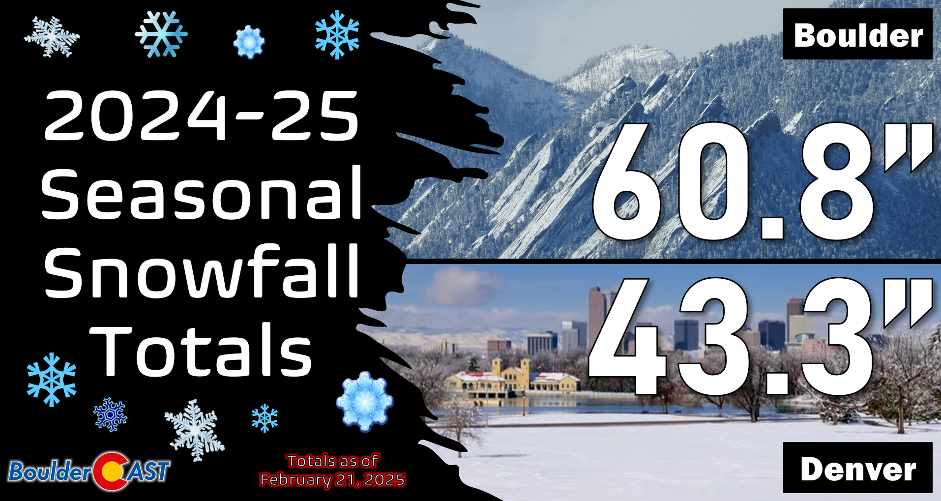
Officially, Boulder received 3.4″ of new snow from this event, while Denver (DIA) recorded 0.6″. Seasonally this brings Boulder over the 60″ mark, while Denver is still at 43″. You can find a recap of all the winter storms so far in the 2024-2025 snow season HERE.
As of writing Friday morning, the skies are starting to clear to the east. It is only a matter of time until sunshine quickly takes over.

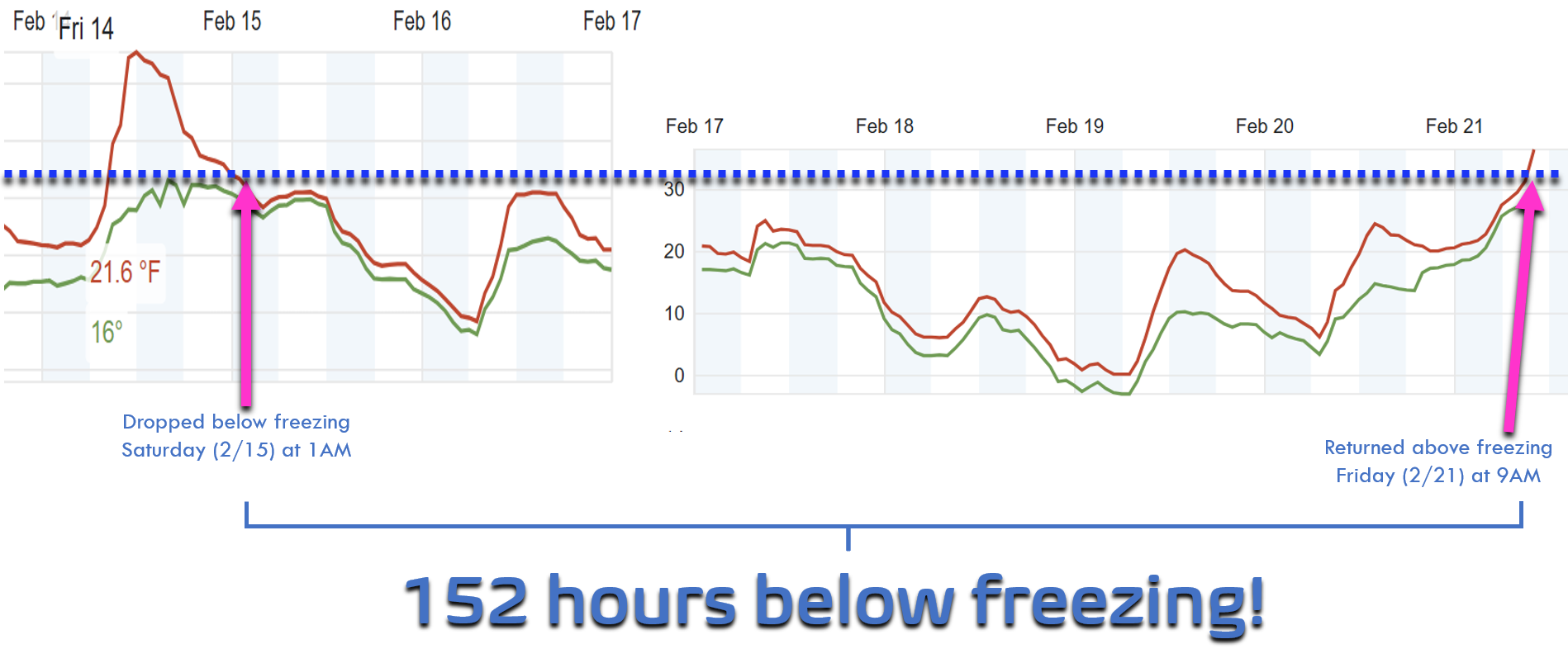
The Arctic airmass is long gone at this point with temperatures already shooting up Friday morning above freezing in Boulder for the first time since last Friday night, some 152 hours ago. This is a lengthy cold stretch indeed, but nowhere near record territory. Boulder experienced a sub-freezing streak of ~280 hours (12 days) back in January of 1929!
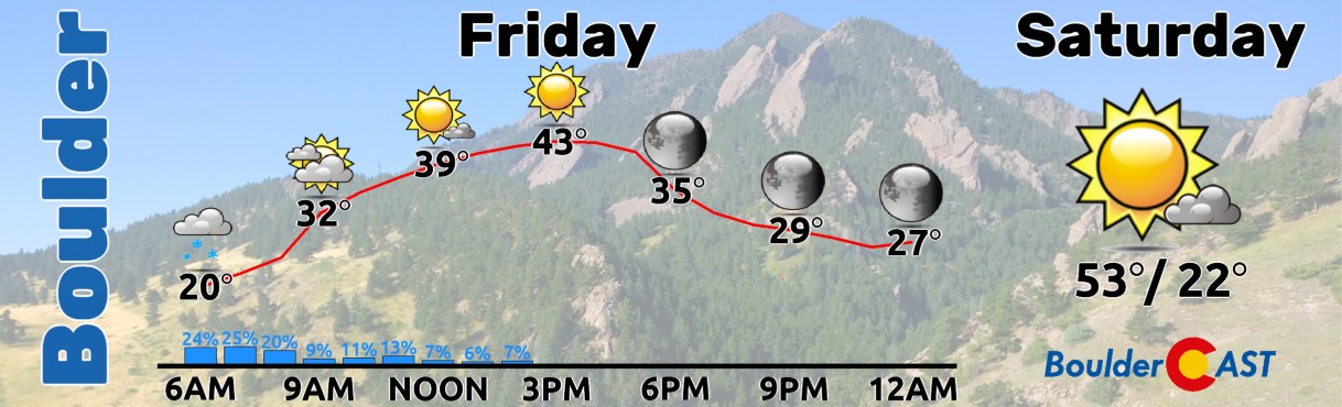
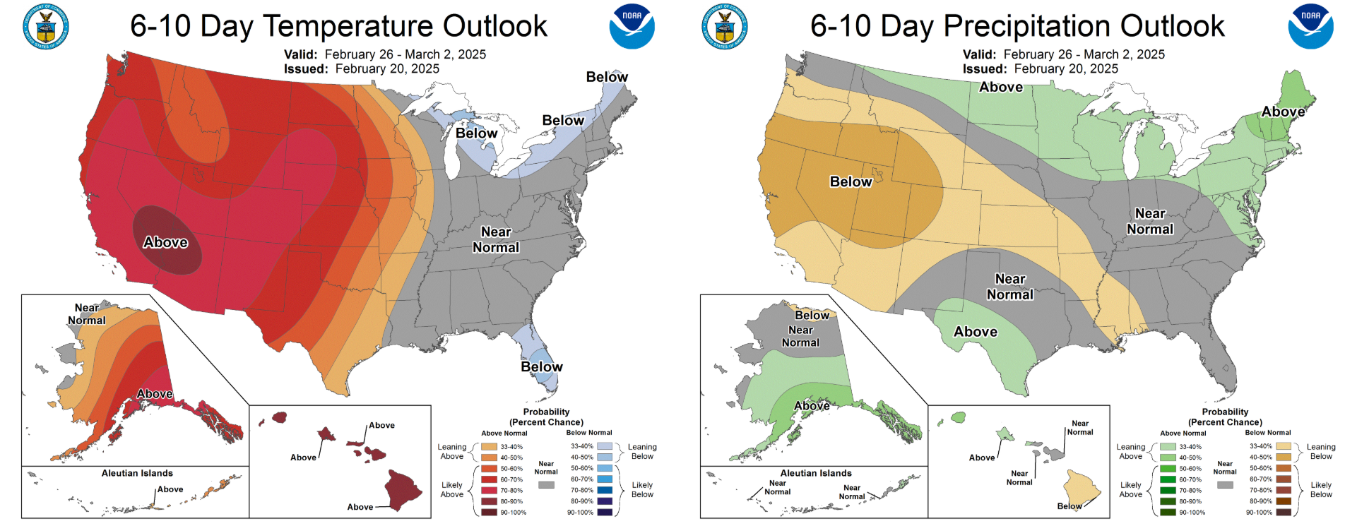
For those of you tired of the cold and snow, we have good news — this should be the last of the white stuff we see for quite some time as our pattern is shifting towards warmer and sunnier conditions throughout the extended. We’re on a collision course with the 40s Friday afternoon with rapidly decreasing clouds and snow melting just as fast.
Enjoy the beautiful end to the week, as well as the sunny and warm weekend ahead!
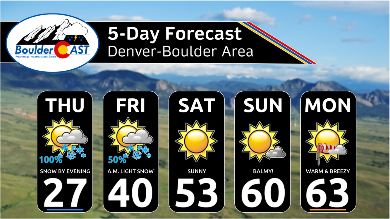
We’ll be back Monday with our regularly scheduled weekly outlook (spoiler: it’s gonna be warm & sunny to end February). That’s all for now. Time to go play in the snow…
Get BoulderCAST updates delivered to your inbox:

Go Premium, get all the perks.
Daily Forecast Updates
Get our daily forecast discussion every morning delivered to your inbox.
All Our Model Data
Access to all our Colorado-centric high-resolution weather model graphics. Seriously — every one!
Ski & Hiking Forecasts
6-day forecasts for all the Colorado ski resorts, plus more than 120 hiking trails, including every 14er.
Smoke Forecasts
Wildfire smoke concentration predictions up to 72 hours into the future.
Exclusive Content
Weekend outlooks every Thursday, bonus storm updates, historical data and much more!
No Advertisements
Enjoy ad-free viewing on the entire site.
Enjoy our content? Help us out and give it a share:


You must be logged in to post a comment.