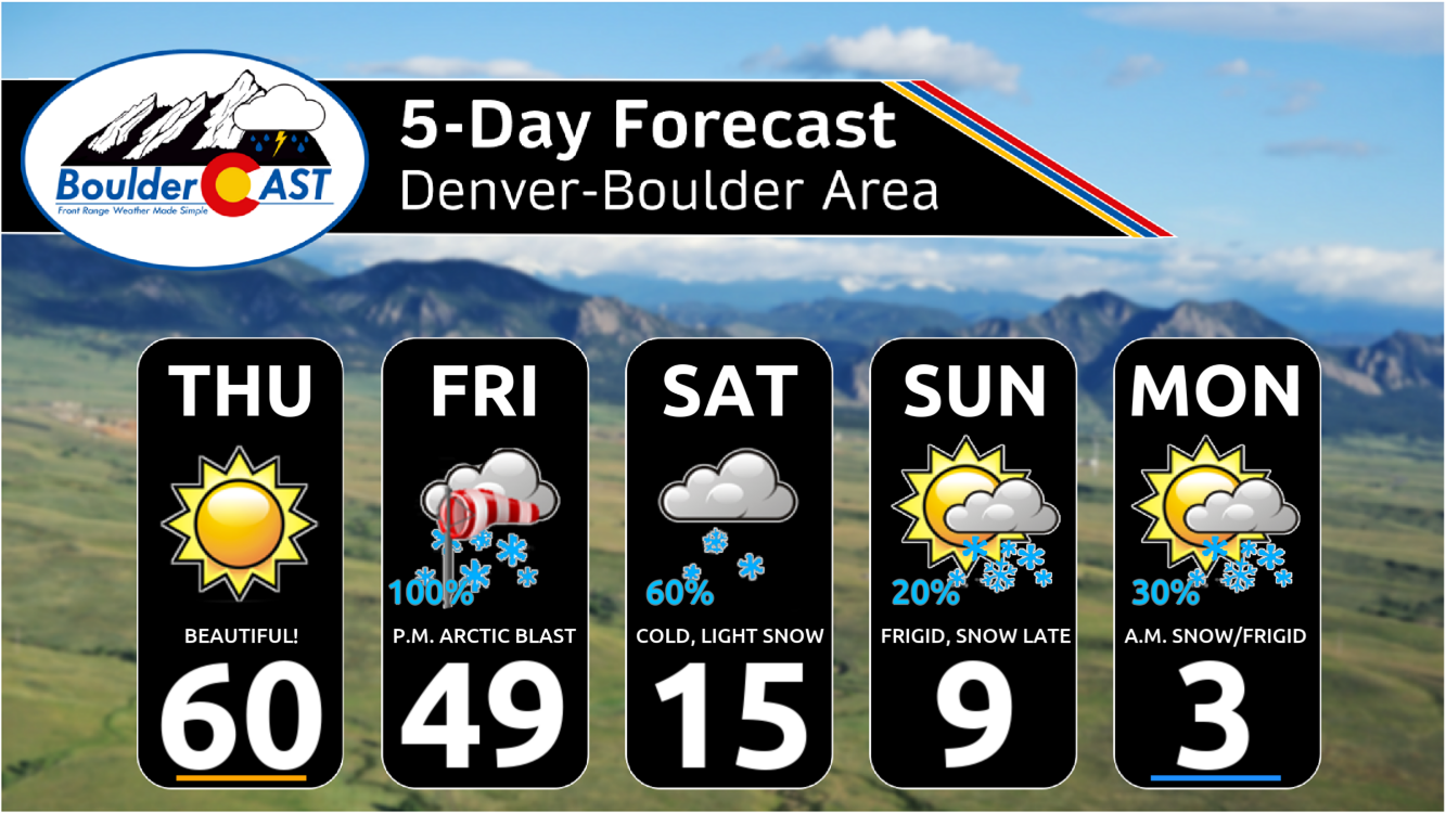
The first major Arctic blast of the season is set to arrive Friday afternoon, bringing a dramatic drop in temperatures and widespread snowfall to Boulder and the Front Range. Expect temperatures to plummet from the 60s on Thursday to the single digits by Saturday morning, with several inches of fluffy snow blanketing the area. The bitter cold will linger through Tuesday, with temperatures below freezing for nearly 100 hours and below 15°F for around 72 hours. Read on for the latest details on what will definitely be a frigid and snowy MLK Day weekend across most of Colorado!
At a Glance
- Arctic Blast Arrival: The first major Arctic blast of the season will arrive into Colorado Friday afternoon into early evening, bringing a significant drop in temperatures alongside widespread snowfall.
- Snowfall Forecast: Light fluffy snow is expected to fall across the area late Friday into Saturday, with 2-6 inches in Denver and 4-10 inches in Boulder and the lower Foothills. Another round of light snow may fall Sunday
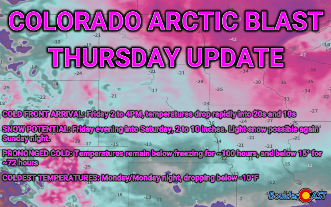
- Prolonged Bitter Cold: Frigid temperatures will linger from Friday evening through Tuesday — we’ll be below freezing for nearly 100 hours and below 15° for ~72 hours. Plan now for this long-duration cold!
- Worst of the Cold: The coldest temperatures of the entire event are expected to occur Monday (highs just above zero degrees) and Monday night (lows in the negative teens)
UPDATE Fri 1/17/25 8AM: We have bumped up snow totals a tad based on the latest model data. This post includes the latest graphics and amounts. For detailed discussion of these changes, see our Premium Storm Update HERE.
Daily Forecast Updates
Get our daily forecast discussion every morning delivered to your inbox.
All Our Model Data
Access to all our Colorado-centric high-resolution weather model graphics. Seriously — every one!
Ski & Hiking Forecasts
6-day forecasts for all the Colorado ski resorts, plus more than 120 hiking trails, including every 14er.
Smoke Forecasts
Wildfire smoke concentration predictions up to 72 hours into the future.
Exclusive Content
Weekend outlooks every Thursday, bonus storm updates, historical data and much more!
No Advertisements
Enjoy ad-free viewing on the entire site.
Colorado’s first Arctic blast of the season!
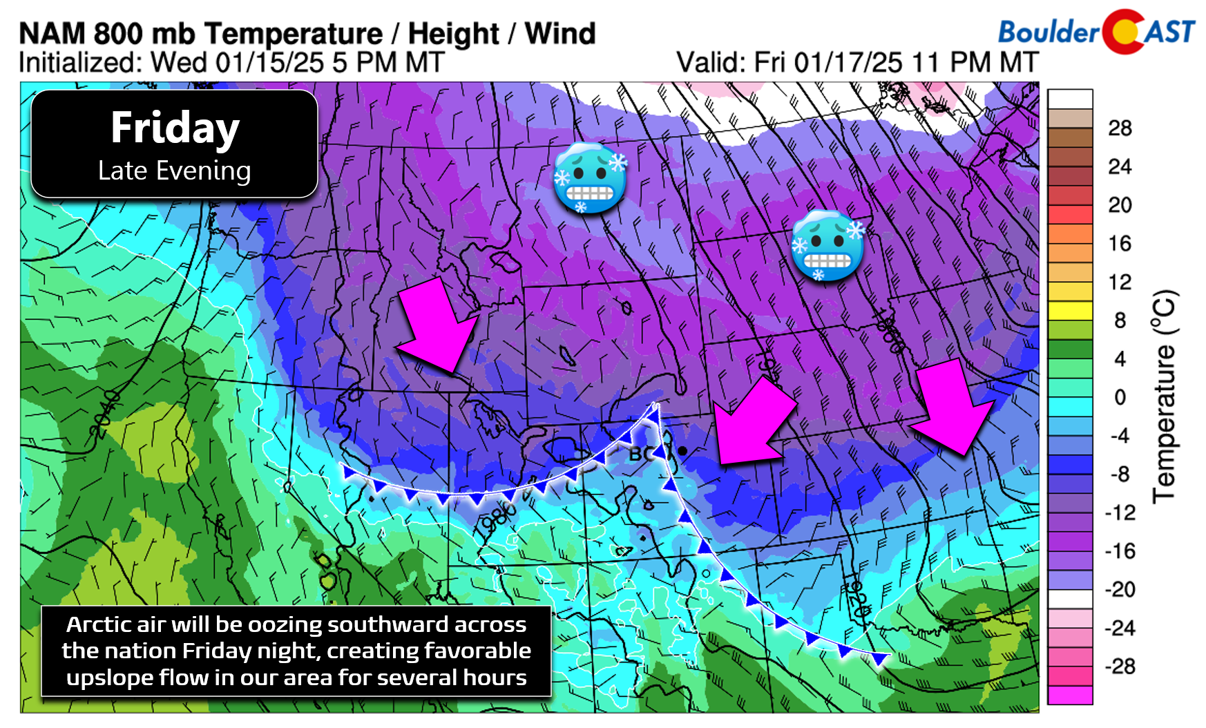
The highly-advertised blast of Arctic air is making its way south through parts of western Canada right now and remains on-track to pour into the continental United States Thursday night and through the weekend ahead, eventually reaching all the way down to the Gulf Coast and Florida (see animation below). Models have been remarkably consistent all week long in regards to the timing of the Arctic airmass plowing into northeast Colorado — they’ve pretty much been targeting Friday afternoon for days now, something we echoed in our weekly outlook early on Monday. This timeline still remains intact for us — our best forecast at this point is for the initial blast of cold air to race into the Denver Metro area between 1PM and 4PM on Friday.
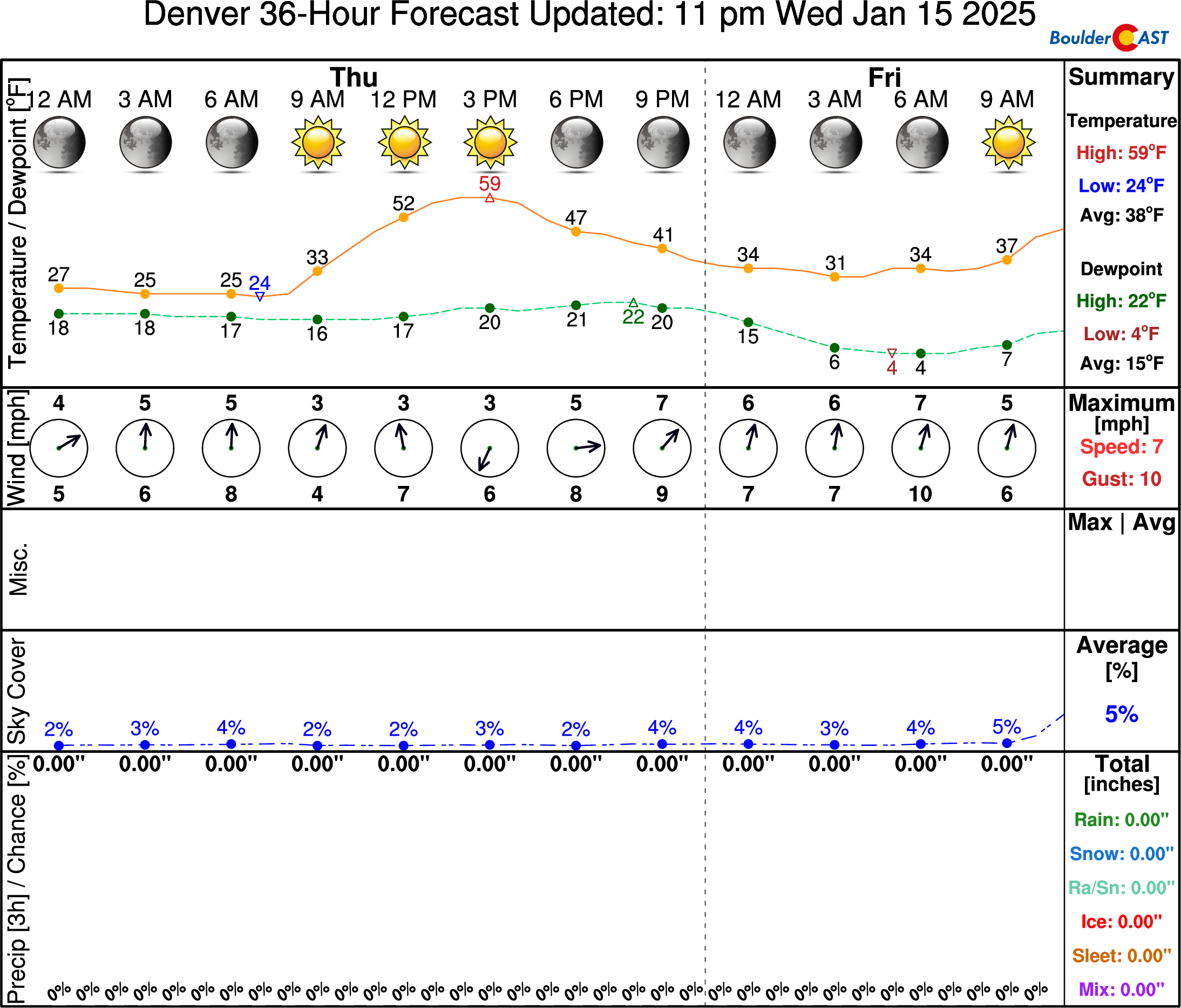
Between now and then, however, we’ve got weather of a different kind to deal with! Thursday will offer the beloved “warm before the storm” we can usually count on — this time with limited amounts of wind, good news considering the fire danger that would incite across the drought-stricken Front Range…
High temperatures will reach well above normal by Thursday afternoon to around the 60-degree mark across the lower elevations — easily our warmest day so far in 2025. This is so warm, in fact, that January 16th’s record highs could be challenged in some parts of the Front Range on Thursday. The existing record values to beat are 71°F in Boulder (1974) and 64°F in Denver (1923). We’re in for a long and very cold stretch of days ahead — it would be wise to take full advantage of Thursday’s beautiful weather if you are able!
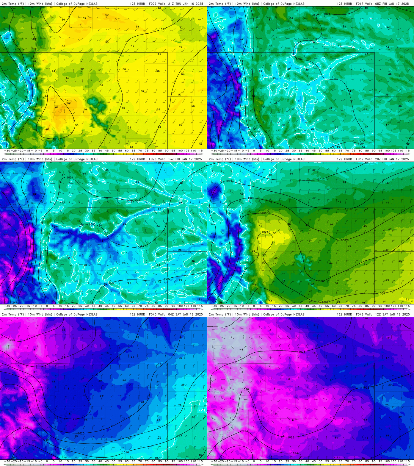
Big changes begin to unfold on Friday! The early part of the day will actually be deceivingly mild with highs in the 40s to lower 50s for most of us. As mentioned, things will take a sharp turn during the afternoon hours as the Arctic front surges southward into the Front Range. Temperatures will fall rather quickly behind this front into the 20s and teens, with gusty north-northeast winds making it feel even colder! The HRRR surface temperature animation below runs from Thursday’s springlike afternoon in the 60s, past the frontal blast Friday afternoon, and ends with bitter cold readings Saturday morning in the single digits — a temperature drop of more than 50 degrees in just 36 hours.
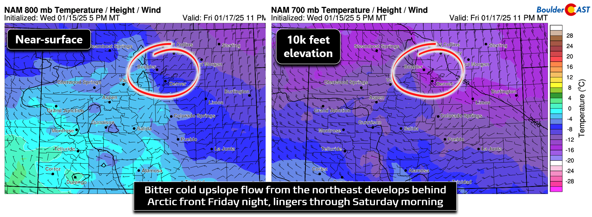
Immediately following the Arctic frontal boundary, conditions turn favorable for light fluffy snow to overspread to entire area, mostly the result of the frigid Arctic air slowly banking up against the terrain east of the Continental Divide. However, there will be some weak forcing from the passing trough, the front itself, and possibly some mild interaction from the right-entrance region of the overhead jet stream. Upslope of very cold air is definitely the main factor here, though.
Unfortunately, models have backed off somewhat in regards to the upslope we see Friday night — with shallower, less intense upslope now being favored for an overall shorter period of time. The upslope looks to barely reach up to ~10,000 feet elevation Friday night, and it really only lasts for about 12 hours over the Metro from Friday afternoon until about sunrise on Saturday. The direction from the northeast and even east at times will favor Boulder County, though! During this window of upslope, we can expect widespread light snow to be falling with snowfall rates generally less than 0.5″ per hour. Winds will flip to downslope aloft quickly by Saturday morning, but the near-surface layer will hold onto an easterly component quite a bit longer into Saturday evening. While the Denver area will probably see most of their snow wrap-up during the morning hours, areas in and near the lower Foothills (e.g. Boulder) could see light snow continue to fall much of the day under this setup.
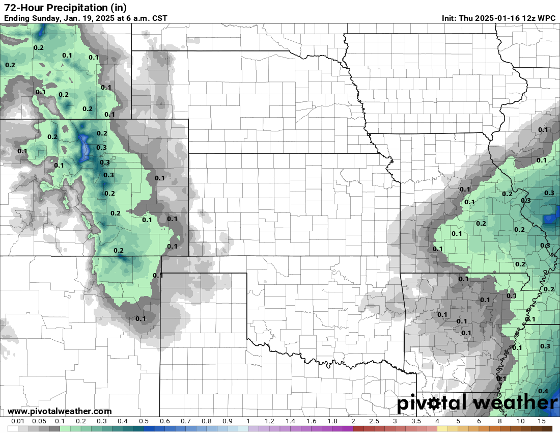
Moisture amounts we will wring out Friday afternoon into Saturday won’t be that impressive — don’t forget that Arctic air is not only extremely cold, but also extremely dry. With upslope now looking less promising, it’s no surprise that precipitation forecasts have also declined somewhat for us. In general we’re expecting most of the Metro area to receive 0.2 to 0.3″ of moisture, with perhaps 0.4 to 0.5″ in and near the lower Foothills.
One benefit of the frigid airmass will be favorable growth conditions for dendrites, at least Friday evening into early Saturday. These type of snow crystals, shown in the graphic below as letters G, J, and K, accumulate quickly on the ground with lots of air mixed into the snowfall. Dendrites require fairly cold temperatures in the cloud layer above to form and grow. Often conditions will either be too cold or two warm, leading to other types of crystals that accumulate in a denser fashion.
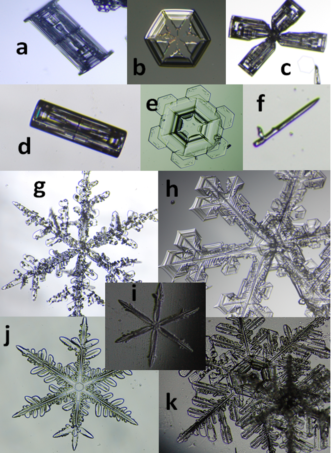
Assorted snow crystals photographed in Greenland. Shown are (a) capped column, (b) hexagonal plate, (c) bullet rosette, (d) hollow column, (e) stellar plate, (f) needle, (g) stellar dendrite, (h) sectored plate, (i) simple star, (j) radiating dendrite, and (k) fernlike stellar dendrites.
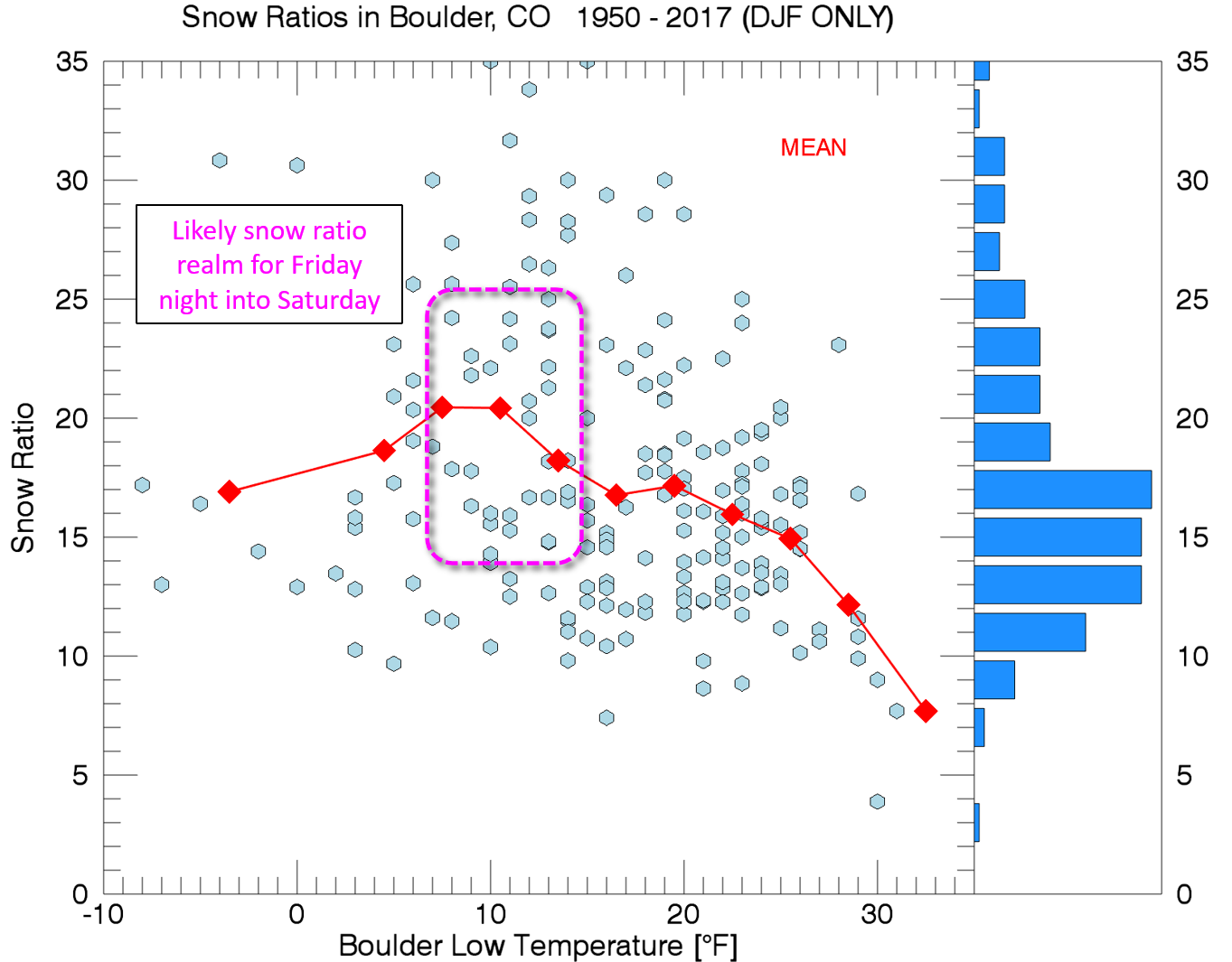
Friday night’s temperature profile aloft looks excellent for dendrites to form! Even just based on Boulder’s climatology of snow ratios and observed low temperatures, we would expect a snow ratio around 20:1 Friday night into Saturday. That is, the amount of snow will be 20 times the amount of moisture that falls!
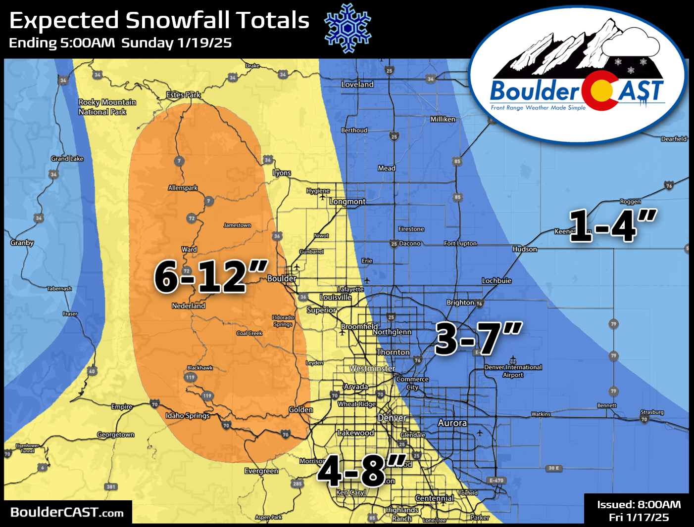
Thus, that lower-end amount of moisture will add up to several inches of snow across the entire area — likely 3-8″ in much of Denver, but more like 6-12″ in Boulder and the lower Foothills. Our snowfall forecast map for the event is shown below covering all snow through Saturday night (Updated as of 1/17/25 8AM). Boulder County communities between 5500 and 8500 feet elevation are most favored for the highest totals from this event!
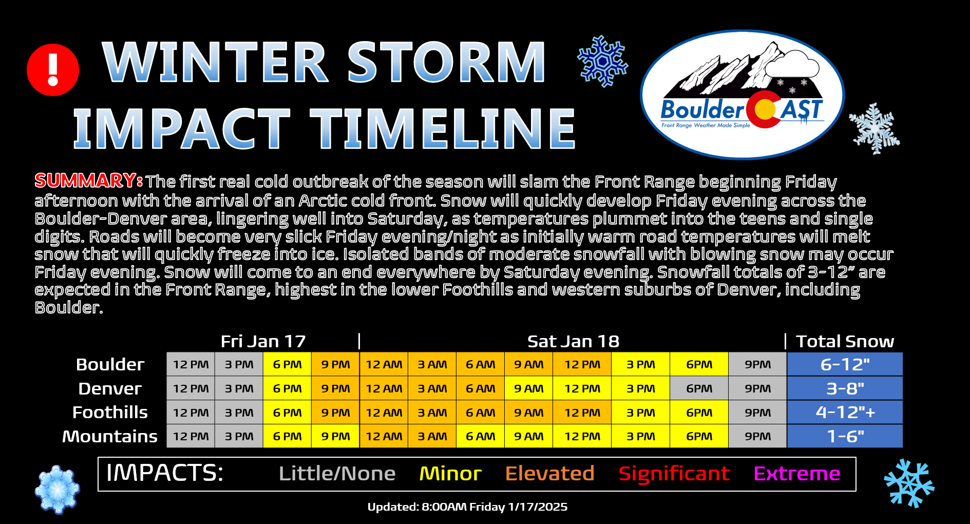
Travel impacts will be widespread Friday evening into early Saturday as the snow falls across the entire area (timeline below updated Friday 1/17/25/ 8AM). Considering temperatures will be in the 60s Thursday and even quite mild Friday morning, there may initially be a period of melting snow on the roadways that will quickly freeze during the evening, leading to even more treacherous conditions out there. The commute window Friday evening will be on the cusp of travel deterioration — leave a little early if possible as snow will probably be commencing around that time (4-7 PM Friday). We of course recommend not traveling Friday evening and night, but we’re sure the roadways will be crammed with cars and heaps of accidents helping to further inflate auto insurance rates for all Coloradans, even the smarter ones that stay home when roads are ice rinks!
The bigger, or at least equally important, story this weekend will be the bitter cold temperatures — the coldest air we’ve seen here since almost exactly one year ago in January of 2024!
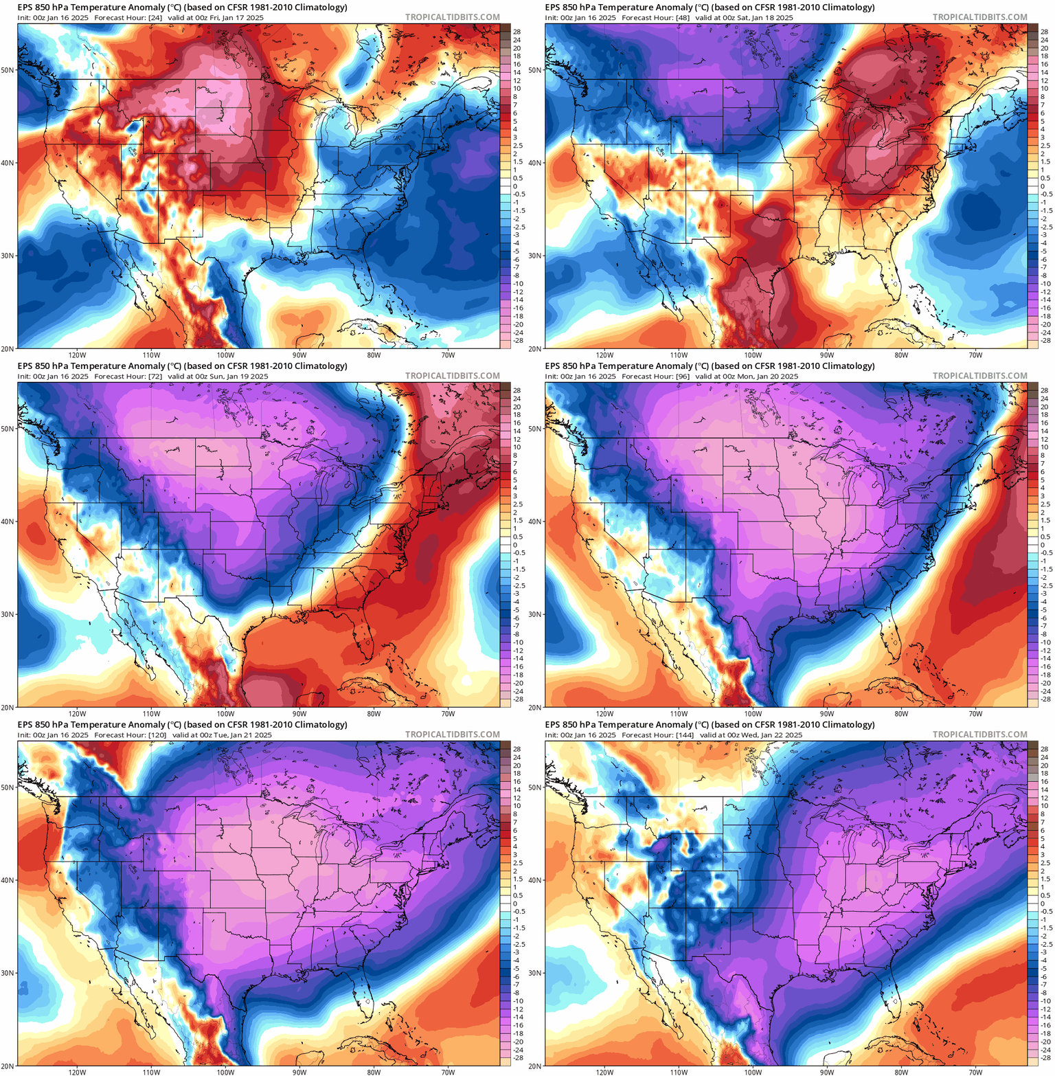
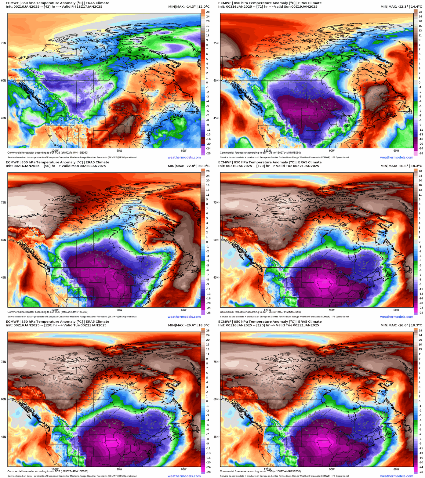
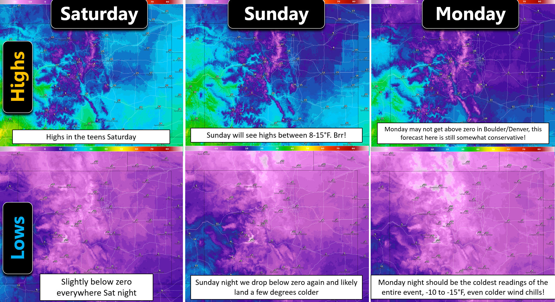
Highs on Saturday will be in the teens across the lower elevations, with single digits in the Foothills. Saturday night will be our first of several dips below zero as skies clear with fresh snowpack on the ground — most areas should land in the negative single digits Saturday night. Sunday will see highs only make it into the single digits in the Metro area before falling again below zero Sunday night. There is still some uncertainty for the back-half of this Arctic outbreak, mostly stemming from how directly northeast Colorado will get hit by a secondary surge of Arctic air Sunday night. The Euro low-level temperature anomaly forecast animation below shows the two pulses of very cold air working southward out of Canada. The more certain one late Friday into Saturday, and the more ambiguous one late Sunday into Monday.
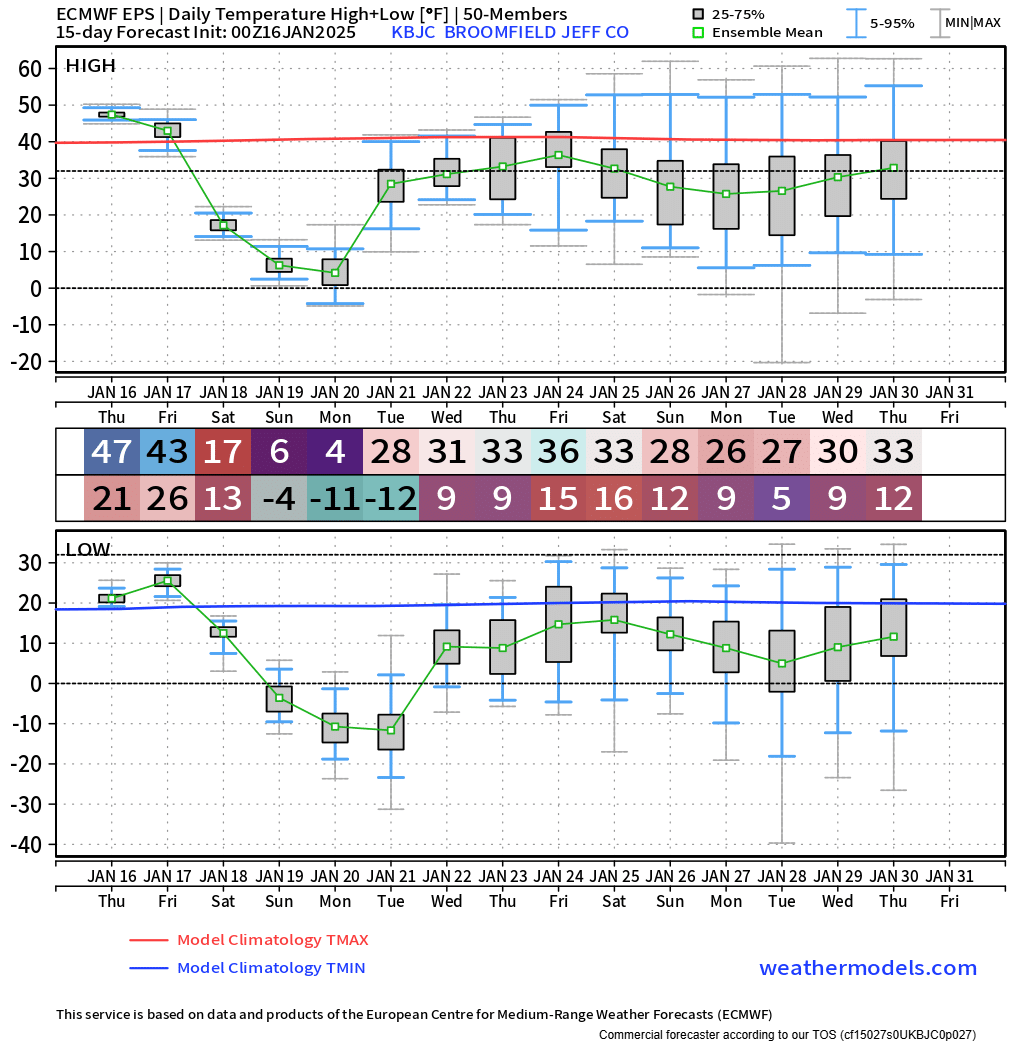
The general model trend though has mostly been for the secondary push to fully make it into our area Sunday night, paving the way for the coldest temperatures of the entire event on Monday (highs right around zero degrees) and Monday night (lows falling to -10°F or colder). This seems reasonable. Right now about 25% of European ensemble members have a negative high temperature on Monday in Boulder and Denver. Some may areas drop below -15°F Monday night — most likely somewhere in the South Platte River Valley well north and northeast of Denver. The secondary surge of Arctic air Sunday evening/night will likely be accompanied by another round of light snow — not nearly as much as Friday night’s event, but probably 1-2″ type of storm. This will make things slick once again for the Monday morning commute, though the fact that Monday is a federal holiday should help on that front.
Here’s a look at how high and low temperatures may land regionally this weekend into early next week. These forecasts are model blends from the National Weather Service, but in our opinion, are still situated a bit too warm throughout the event. They aren’t that far off though. The key message here is that a long-duration, very cold stretch lies ahead for Boulder and Denver (and really all of Colorado except the far Western Slope). Temperatures will be below freezing for nearly 100 hours (Friday early evening until midday Tuesday), and likely below 15°F for something like 72 hours. The absolute coldest readings probably won’t occur until Monday and Monday night!
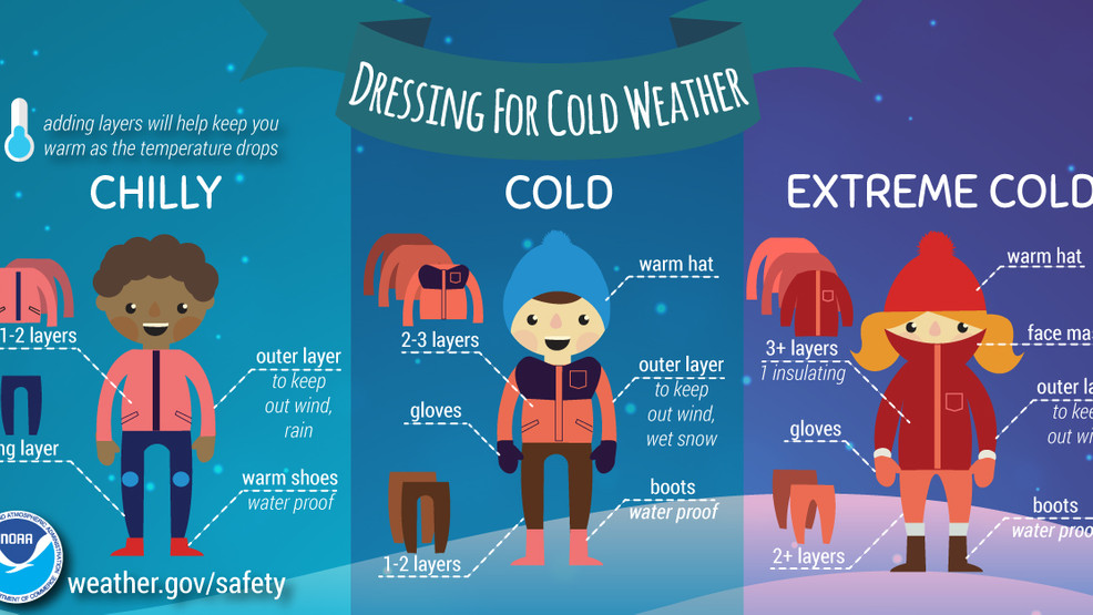
Remember to dress appropriately this weekend. A few extra layers can go a long way in these temperatures!
Alright — that was a lot to get through, but you’ve made it through our entire forecast discussion! Stay tuned for more and be sure to follow us on Twitter, Bluesky, Facebook, and Threads for impromptu weather updates in the coming days as this Arctic outbreak unfolds, or subscribe to get notified of our long-form updates here. We’ll also be back Friday and Saturday morning’s with additional Premium Storm discussions diving deeper into the latest model data. Stay warm!
Get BoulderCAST updates delivered to your inbox:
Daily Forecast Updates
Get our daily forecast discussion every morning delivered to your inbox.
All Our Model Data
Access to all our Colorado-centric high-resolution weather model graphics. Seriously — every one!
Ski & Hiking Forecasts
6-day forecasts for all the Colorado ski resorts, plus more than 120 hiking trails, including every 14er.
Smoke Forecasts
Wildfire smoke concentration predictions up to 72 hours into the future.
Exclusive Content
Weekend outlooks every Thursday, bonus storm updates, historical data and much more!
No Advertisements
Enjoy ad-free viewing on the entire site.
Enjoy our content? Give it a share:




You must be logged in to post a comment.