Have you noticed the drop in visibility across the Front Range over the last few days? This haziness is actually smoke from the 11,000+ acre Tinder Fire currently burning in central Arizona. This may only be a foreshadow of things to come later this summer as parts of southwestern Colorado and the Four Corners region have recently shifted into the most severe drought classification. We provide an update on the situation and take a look at snowpack statewide.
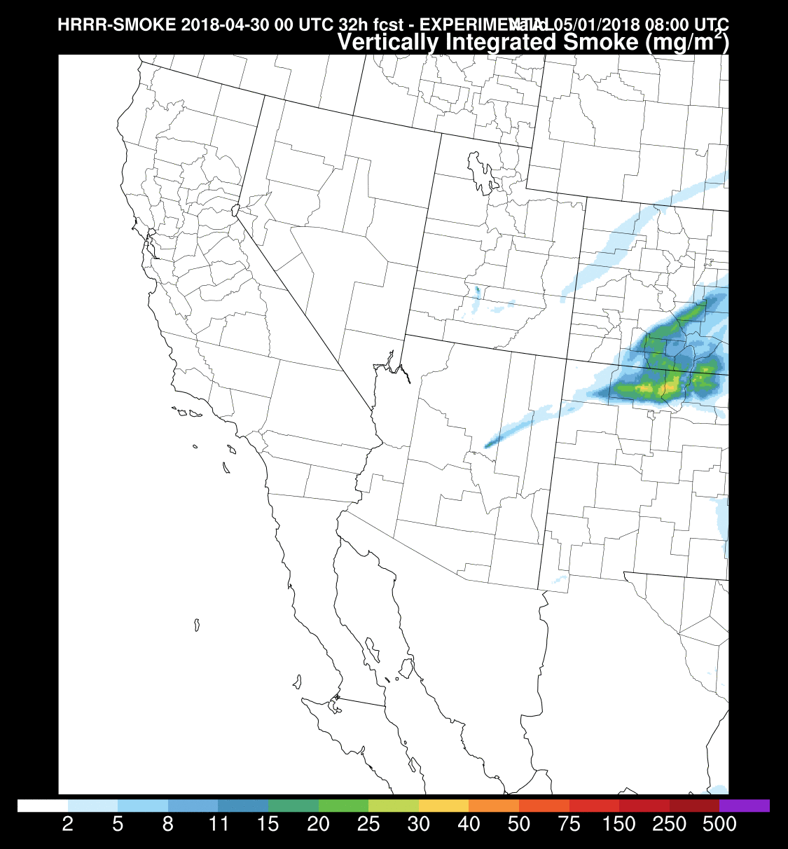
HRRR-Smoke vertically-integrated smoke forecast for Tuesday morning (May 1st). You can trace the plume of smoke across Colorado back to the source, the Tinder Fire in central Arizona.
Drought update
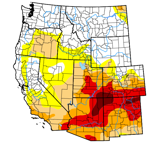
It wasn’t long ago that the entire Denver Metro area was experiencing a mild drought. The good news is that a near-average winter, at least precipitation-wise, has provided temporary relief from the drought across NORTHERN Colorado. Unfortunately, the same cannot be said for the SOUTHERN tier of the Rocky Mountain state, where drought has only intensified through the winter. The area near the Four Corners region has recently progressed into the worst drought classification that can be issued by the United States Drought Monitor…a category they call “exceptional”.
The table below on the right shows the areal percent of Colorado contained in each drought category. One year ago, only 9% of the state was in a drought….today, that number is 68%. More astonishingly, 31% of the state is experiencing advanced drought (categories “extreme” or “exceptional”).
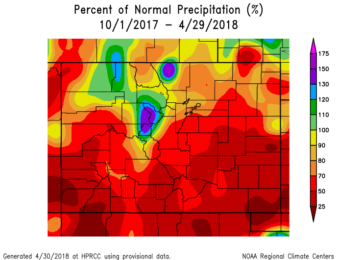
It’s no wonder that drought has overtaken the southern part of the state. Since the beginning of the water year (October 1, 2017), rain and snow have been very hard to come by, with precipitation totals less than half of normal being widespread. This lengthy stretch of dry weather has led to the perilous predicament at-hand for southern Colorado.
The snowpack map for the state looks as you might expect….a stark separation between north and south. The southwestern region has absolutely critical snowpack levels at the moment…just 14% of normal for this time of year. The San Juans are nearly barren of snow already….and the Animas River, which flows from the San Juans through the city of Durango, has been setting records for low flow rates daily for more than two months now.
Contrarily, further north, the South Platte River Basin which serves the Denver Metro area, sits at 79% of normal as of May 1st. Snowpack in the South Platte River Basin has actually tracked close to, but generally just below, normal through the winter. So yes…while our nearby snowpack is slightly sub-par, it is not a major concern at this time for us.
Locations to our south and west will be facing a harsh fire season ahead. This includes southern Colorado, Utah, Arizona, and New Mexico. These areas are encompassed by near total drought coverage. California has been getting a lot of drought media coverage lately, but a series of atmospheric river events in 2018 have abolished the worst of the drought from the Golden State.
As we transition into the summer months, the predominant atmospheric flow into our region will turn southwesterly. Even if we’re lucky enough to avoid the wildfires spawning close to home, we’ll surely suffer the fate of smoky skies as a result of the parched landscape burning to our south and west. Remember what the skies looked like back in the summer of 2012? We may not be far from that this year the way things are shaping up…
We’ll discuss our outlook for the month of May in a post later this week, though admittedly, we’re far from confident drought conditions will improve…
.
Subscribe to receive email notifications for BoulderCAST updates:
We respect your privacy. You can unsubscribe at any time.
.
Share this drought update:
.





You must be logged in to post a comment.