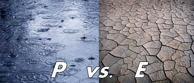
On a basic level, you’re likely familiar with the terms precipitation and evaporation. However, their relationship to one another is more important than you may think for Colorado. We explain this relationship and why it has major impacts on our plant life, population sustainability, drought potential, and even feeds back into our every day weather.
Precipitation is comprised of rain and snow that falls to Earth’s surface from the clouds.
Evaporation is the change in phase of liquid water from the Earth’s surface to water vapor in the atmosphere.
Arguably, precipitation and evaporation are the two most important components of the water cycle!
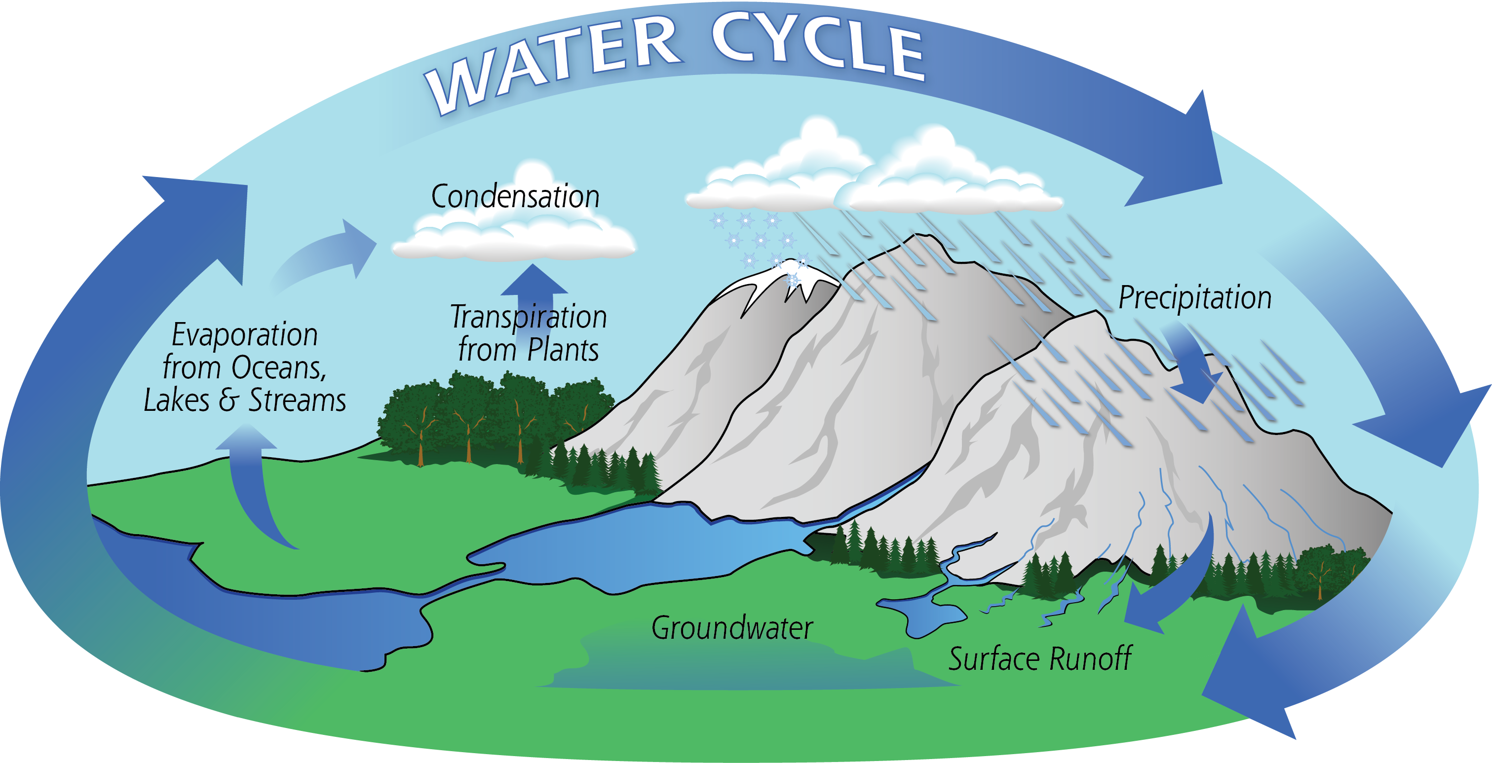
NOTE: Transpiration is simply the evaporation that occurs directly from the leaves of vegetation (see the diagram above). Sometimes you will hear evaporation and transpiration combined into a single term, called “evapo-transpiration.” In our discussion below, this distinction isn’t important, so we’ll be lumping both together into EVAPORATION!
–
How large of a population can be sustained by the local water resources without major geoengineering? Can a specific crop grow without profit-cutting irrigation? Why are maple and oak trees not native to the Denver Metro? These are all questions whose answers lie in the relationship between evaporation and precipitation.
To get a better understanding, let’s first take a look at average annual precipitation across the USA:
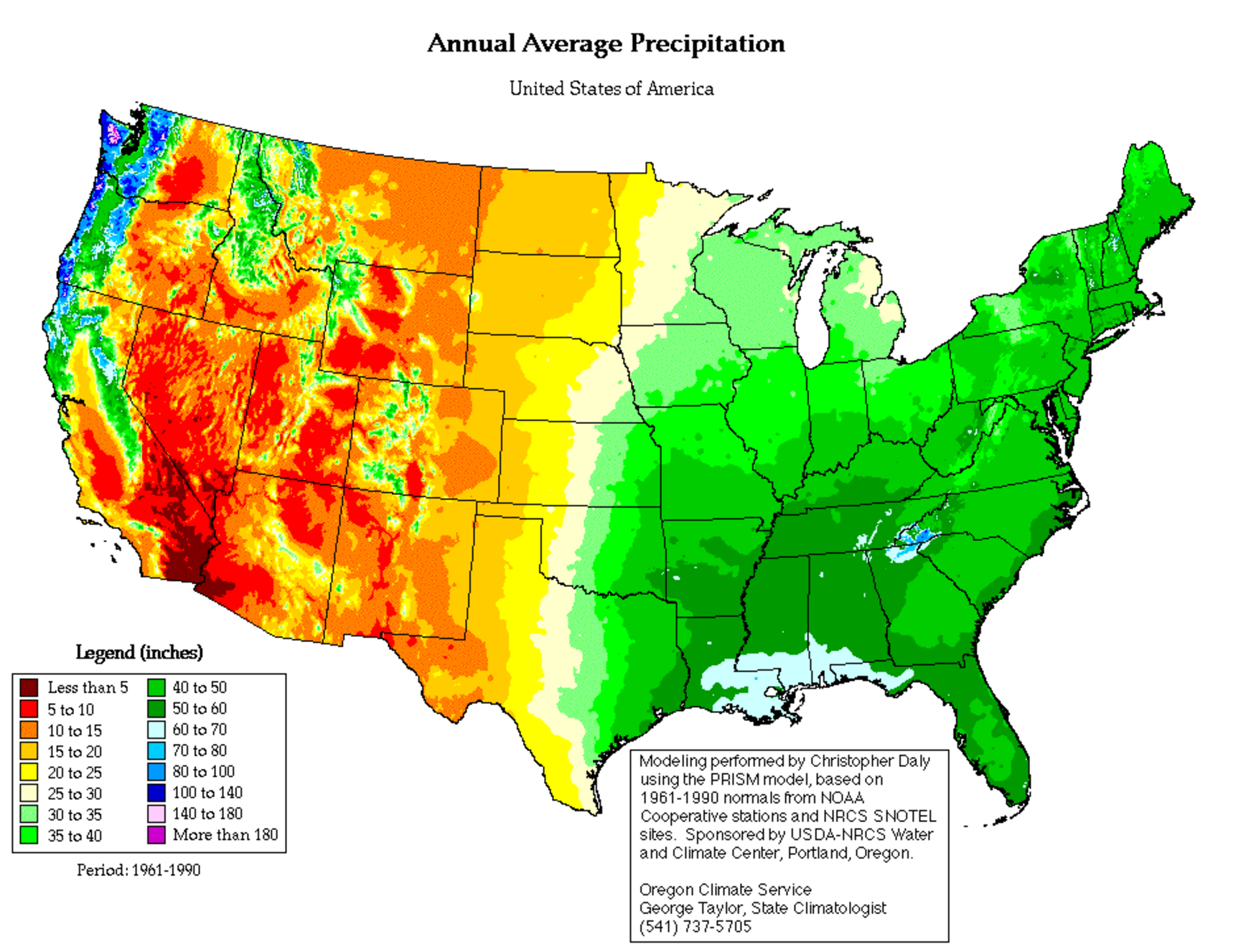
Notice how wet the eastern United States is, and just how dry the west is. The abundance of precipitation in the east is the result of moisture availability from the Gulf of Mexico and frequent storms year-round. We’re drier in the west due in large part to topography. The coastal Pacific northwest is the wettest region in the country. That moisture wants to propagate eastward, but it encounters many mountain ranges downwind across Nevada, Utah, and Colorado. These mountain ranges “squeeze out” the moisture. As a result, the Front Range is quite dry, averaging 10 to 20″ of annual precipitation. Denver gets around 15″, while Boulder receives closer to 20″ (thanks upslope!). Look closely and you’ll see that the higher peaks of the Colorado Rockies receive 40 to 60″ of precipitation annually! This is very important…more on this later…
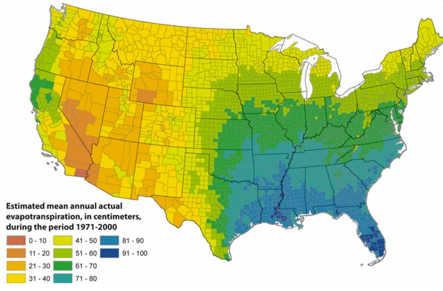
Now let’s look at (estimated) evaporation. The southeast Unites States has the highest amount of evaporation, while the southwest has the lowest. The units here are centimeters, but the story is the same. Evaporation across the Denver Metro area ranges from 31 to 50 centimeters per year, which equates to 12 to 20″. This is roughly equal to our precipitation.
Many factors contribute to a region’s yearly evaporation, including:
- Temperature: Evaporation requires energy (heat). Warmer temperatures support greater rates of evaporation.
- Relative humidity: The amount of net evaporation from the surface into the air depends on the relative humidity of the air itself. You can imagine that it would take a glass of water much longer to “disappear” in a soupy Florida atmosphere compared to the Arizona desert.
- Vegetation: As we outlined earlier, plants contribute to evaporation through transpiration. This is important because foliage increases the available surface area for evaporation (all the leaves of a tree have more evaporation that the tiny space a tree trunk consumes on the ground). Furthermore, the roots of a plant can pull water from deeper below the surface to be evaporated.
- Precipitation Amount/Frequency: Obviously the amount of evaporation will depend on the amount of precipitation. You can’t evaporate water that doesn’t exist in the first place!
The map of evaporation above includes all of these factors averaged over an entire year. This is a little hard to conceptualize. To assist, check out the table of data below which shows monthly average pan evaporation for various locations across Colorado. Pan evaporation is a measure of how much evaporation there would be if the amount of available water was unlimited. Essentially it is a quantification of evaporation only depending on the temperature and relative humidity of each city.
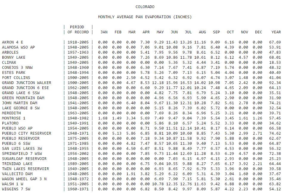
Evaporation is the highest during the summer months when temperatures are the warmest, and ceases in the winter months when daily average temperatures are below freezing and water doesn’t technically evaporate. The greatest annual pan evaporation occurs in Grand Junction, the warmest and most “desert-like” city on the list. The lowest value is at Climax (which is quite cold at an elevation of 11,300 feet).
So returning to our map of evaporation above, the west has less evaporation than the east mainly because it is much drier…there is less available water. The southeast has higher evaporation than the northeast because it receives slightly more precipitation but is also warmer. And despite the Oregon and Washington coastlines being the wettest in the country, the evaporation there is proportionally smaller due to frequent fog (high relative humidity) and cooler temperatures.
It’s even more interesting to look at the ratio of evaporation to precipitation. Where this ratio is less than one, there is more precipitation than evaporation. Where it is greater than one, like eastern Colorado, evaporation exceeds precipitation (uh-oh!). In fact, the Front Range is one of just a few places in the country with a water deficit.
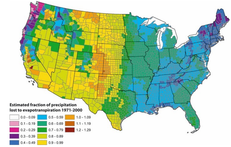
Ratio of Evaporation to Precipitation (Sanford and Selnick 2013)
How is it even possible that evaporation can exceed precipitation here? We haven’t visited the other components of the water cycle, but for our region and much of the inter-mountain west, the transport of run-off precipitation through rivers is very important. Notice that Colorado’s mountains have ratios ranging from 0.5 to 0.8…precipitation exceeds evaporation there and creates a surplus. All this water must go somewhere. Snow melt and run-off funnels into streams and rivers that flow eastward onto the Plains, providing water to areas that desperately need it. Farmers use it to irrigate crops, cities store it in reservoirs, and vegetation nearby to the rivers soaks it up. Any way you look at it, snowmelt and run-off from the mountains eventually contributes to evaporation across the lower elevations.
Colorado’s abundant mountain precipitation is what sustains the explosive population of the Front Range. Legal rights to this water was a key motive for which rural northeast Colorado voted to form their own state a few years back. It’s the very reason the city of Boulder owns and diligently protects the Arapaho Glacier. Water is a precious, life-sustaining resource. Climate change poses a challenge to our already arid region. It’s expected to get warmer everywhere and the Southwest U.S. is the only sector of the country projected to become statistically drier as Earth’s temperature rises. Yes, it’s reasonably apparent that precipitation in eastern Colorado is fighting a loosing battle with evaporation. It’s only a matter of time before we all suffer defeat…
.


You must be logged in to post a comment.