The day of giving thanks and eating delicious food is nearly upon us, and whether you are ready or not, so too are the snowflakes which will make a return to the entire Front Range beginning Thursday afternoon and evening with snowflakes staying in the forecast into Saturday. Temperatures will also plummet well below freezing the next few days. We discuss the timing of the snow, the expected snowfall totals for everyone and when travel may be most impacted.
Update (Thu 11/23 7AM): Ensembles have cut back on snow amounts by about 20%, so we’ve decreased snow amounts accordingly. The biggest snow totals from this storm are still expected to be around Boulder, with much lower impacts elsewhere in the Metro area.

Go Premium, get all the perks.
Daily Forecast Updates
Get our daily forecast discussion every morning delivered to your inbox.
All Our Model Data
Access to all our Colorado-centric high-resolution weather model graphics. Seriously — every one!
Ski & Hiking Forecasts
6-day forecasts for all the Colorado ski resorts, plus more than 120 hiking trails, including every 14er.
Smoke Forecasts
Wildfire smoke concentration predictions up to 72 hours into the future.
Exclusive Content
Weekend outlooks every Thursday, bonus storm updates, historical data and much more!
No Advertisements
Enjoy ad-free viewing on the entire site.
Snow spreads into the area Thursday evening
The “warm before the storm” never seems to disappoint here in eastern Colorado and today was certainly no exception to that rule. Most of us got well into the 60s with even some lower 70s noted Wednesday afternoon across the Denver Metro area
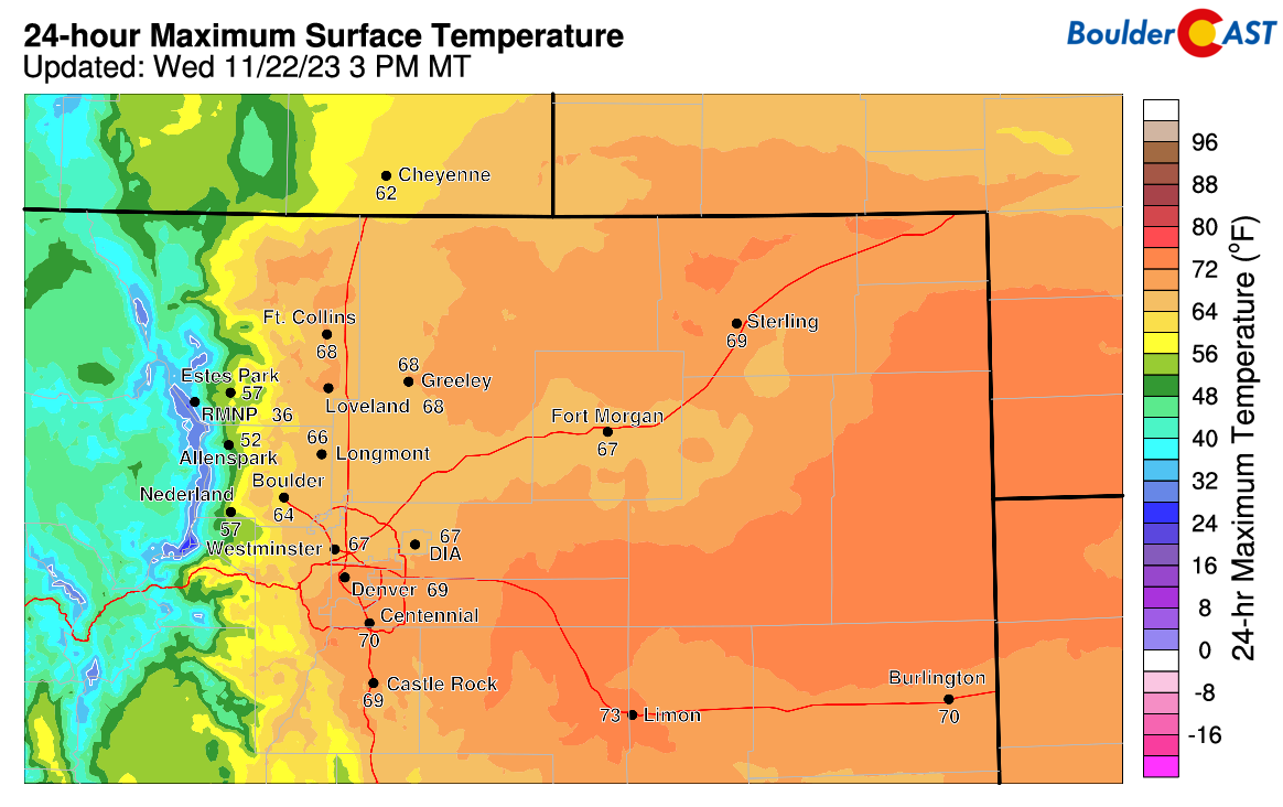
Observed high temperatures on Wednesday were very warm in northeast Colorado!
Things will be drastically changing as we head into the Thanksgiving holiday, however, as a slow-moving and cold trough enters the picture from the northwest — in the process knocking some 30 degrees off our temperatures and ushering in late-day snow. We’ve been discussing this storm system all week long on BoulderCAST Premium as it approached with high confidence that it would indeed produce a round of winter weather for us Thursday evening into Friday. The exact snowfall forecast has been in a state of flux all week, with models waxing and waning on potential amounts and thus the impact it would have on holiday travel. However, the ensembles have been locked in nicely leading to our high confidence in the snow/cold for the last several days.
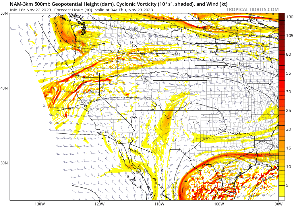
With the storm now just coming ashore into British Columbia as of Wednesday evening, we are getting a clearer picture of things as models merge into even better agreement. The key aspects of this winter storm remain largely unchanged:
- It’s plenty cold enough for this to be an all snow event with flakes beginning to fly during the afternoon or early evening on Thursday
- It’s a fairly weak and disorganized storm overall, but its large size and slow movement will prolong the duration of the cold/snowy impacts across Colorado
- Weak and somewhat shallow upslope will be the primary forcing mechanism for snow, keeping the greatest snowfall totals in and near the Foothills
- Due to largely southeasterly winds with this event, upslope will favor Larimer and Boulder Counties, with the highest totals expected between 6000 and 8000 feet elevation in the Foothills where upslope will be most pronounced
- Denver (and much of the Metro area) will see considerably less snow than the Boulder area
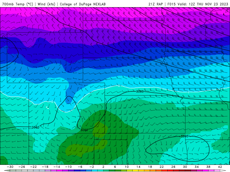
RAP forecast animation of temperatures and winds at 700mb level Thursday morning into Friday night. Pay attention to the direction of winds in the Front Range!
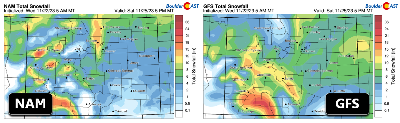
Over the last 24 hours we’ve seen models bump up their snowfall amounts with this system, specifically right over Boulder and the adjacent Foothills — a response to the favorable upslope and high snow ratios. Notice the GFS/NAM derived snowfall forecasts below which show a narrow wedge of heavier snow stretching northward from Boulder into Wyoming.
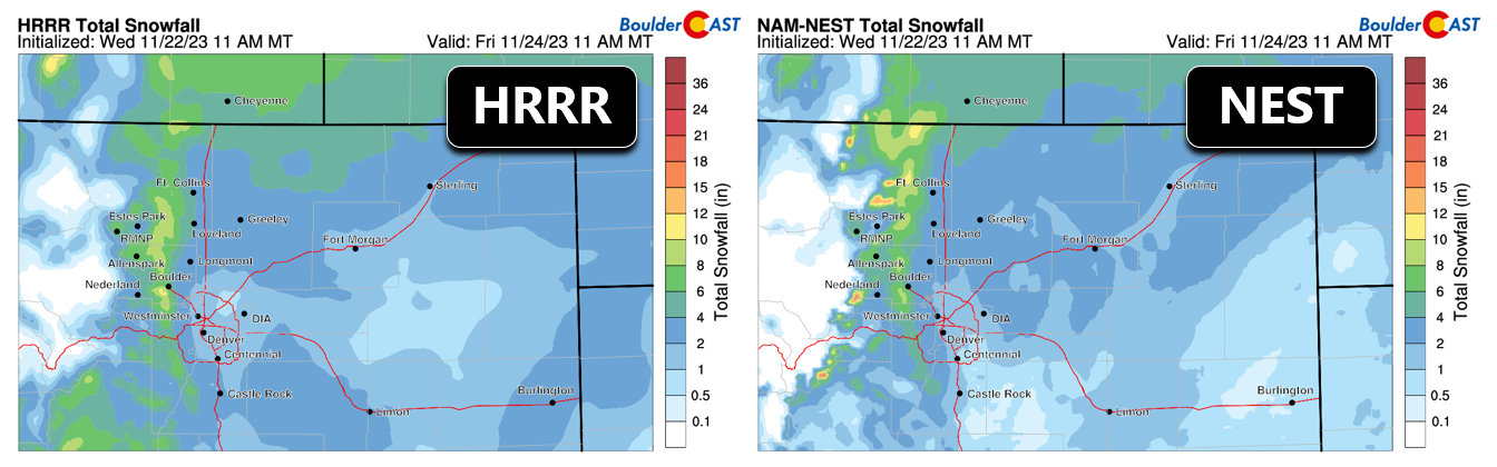
Short-range models show the very same lanky sliver with higher clarity, a typical distribution when shallow upslope is the main game in town.
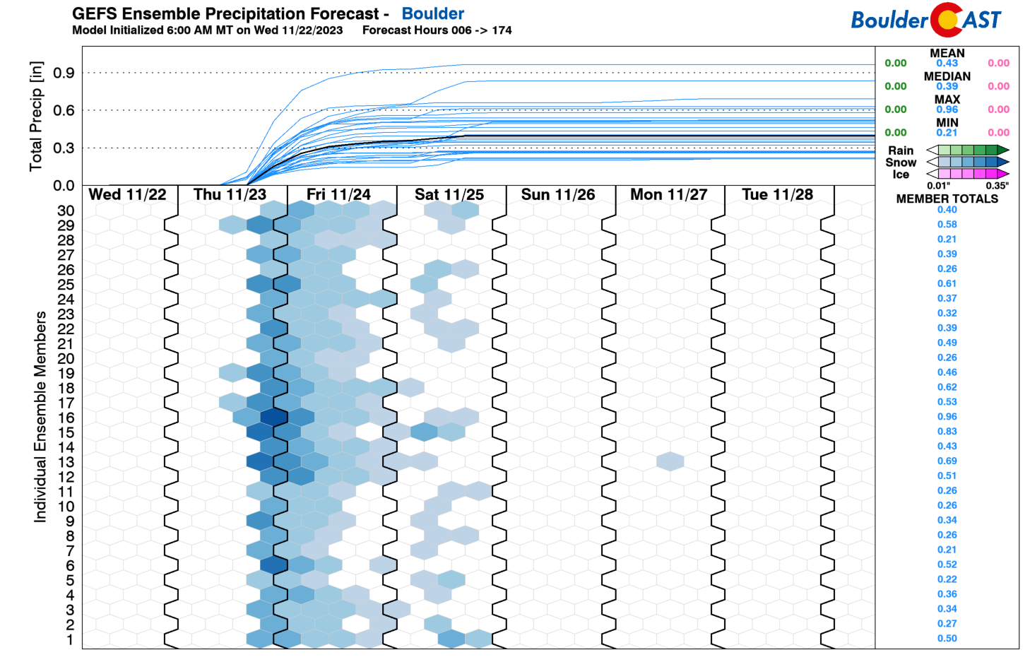
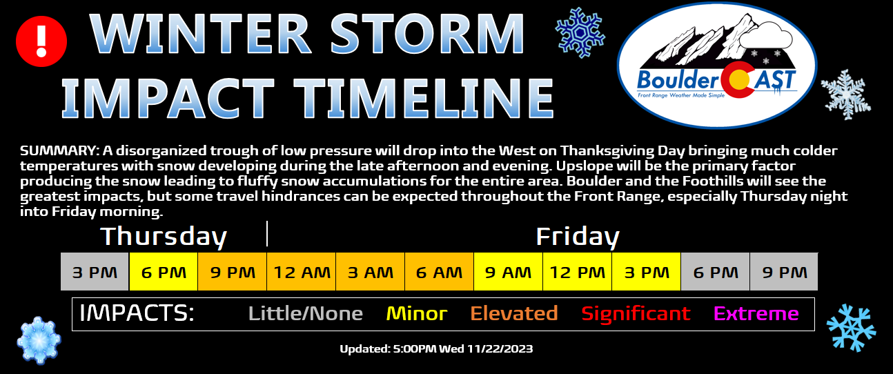
The heaviest snowfall is expected to fall Thursday evening into Friday morning. At some point models show the upslope tapering off later on Friday. This should put a pause on the snowflakes for most of the area (though it still may linger in the Foothills). Notice the break in the snow indicated by almost all the GFS ensemble members below. A secondary chance of snowflakes will follow on Saturday but that won’t accumulate much, likely at most an inch.
Our snowfall forecast map for this event is shown below. This covers all snow falling through Saturday evening. However, we do foresee ~80% (or more) of the accumulation occurring Thursday evening into Friday morning. We are expecting a respectable 4-10″ of fluff to fall in the Boulder area and the nearby Foothills. For areas further east away from the terrain, anywhere from a dusting to 5″ is expected.
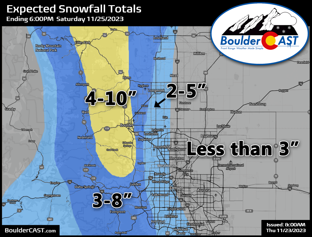
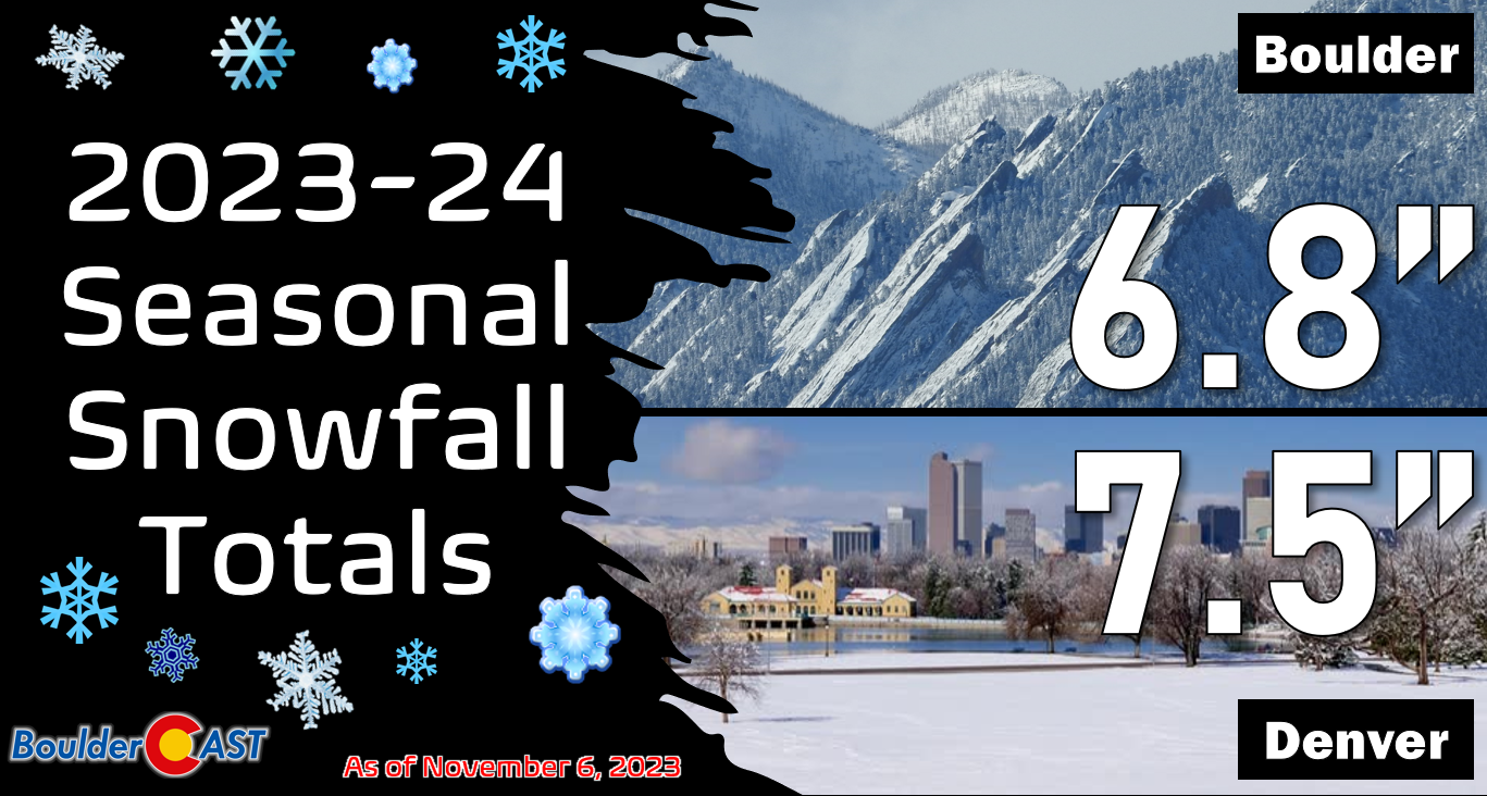
This should definitely be the storm that allows Boulder to take back its normal seasonal snowfall lead over Denver….
As for travel impacts, most of Thanksgiving Day should be fine. Some snow may begin to develop as early as the afternoon in the northern Front Range, but the more moderate impacts should hold off until later in the evening. Snow will decrease in coverage and intensity on Friday with improving travel conditions.
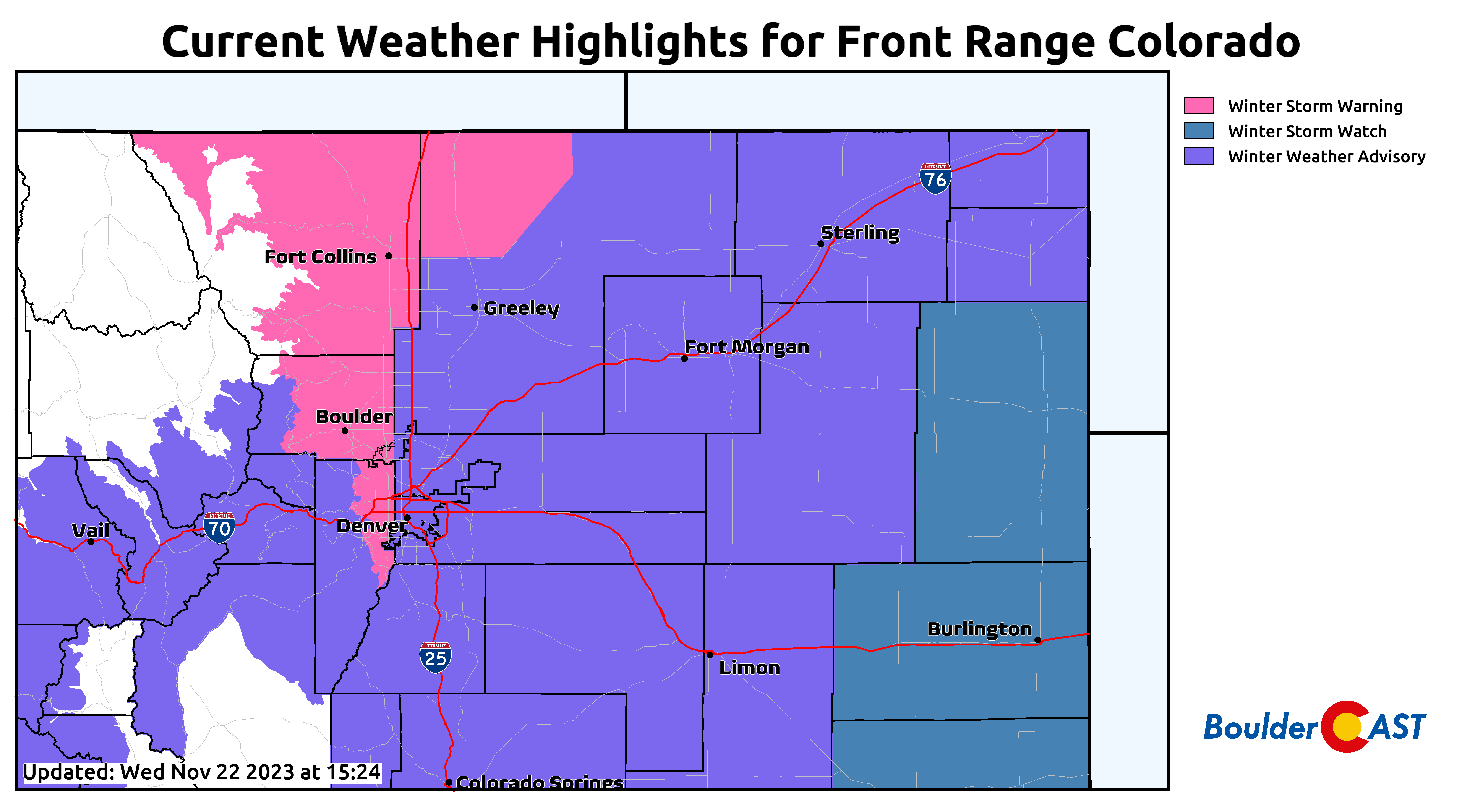
A Winter Storm Warning has been issued for Boulder and Fort Collins, and the nearby Foothills — that goes into effect at 4PM on Thursday. A Winter Weather Advisory has been issued everywhere else (though many eastern/southeastern areas will barely see any snow and in our opinion really shouldn’t be included in the Advisory).
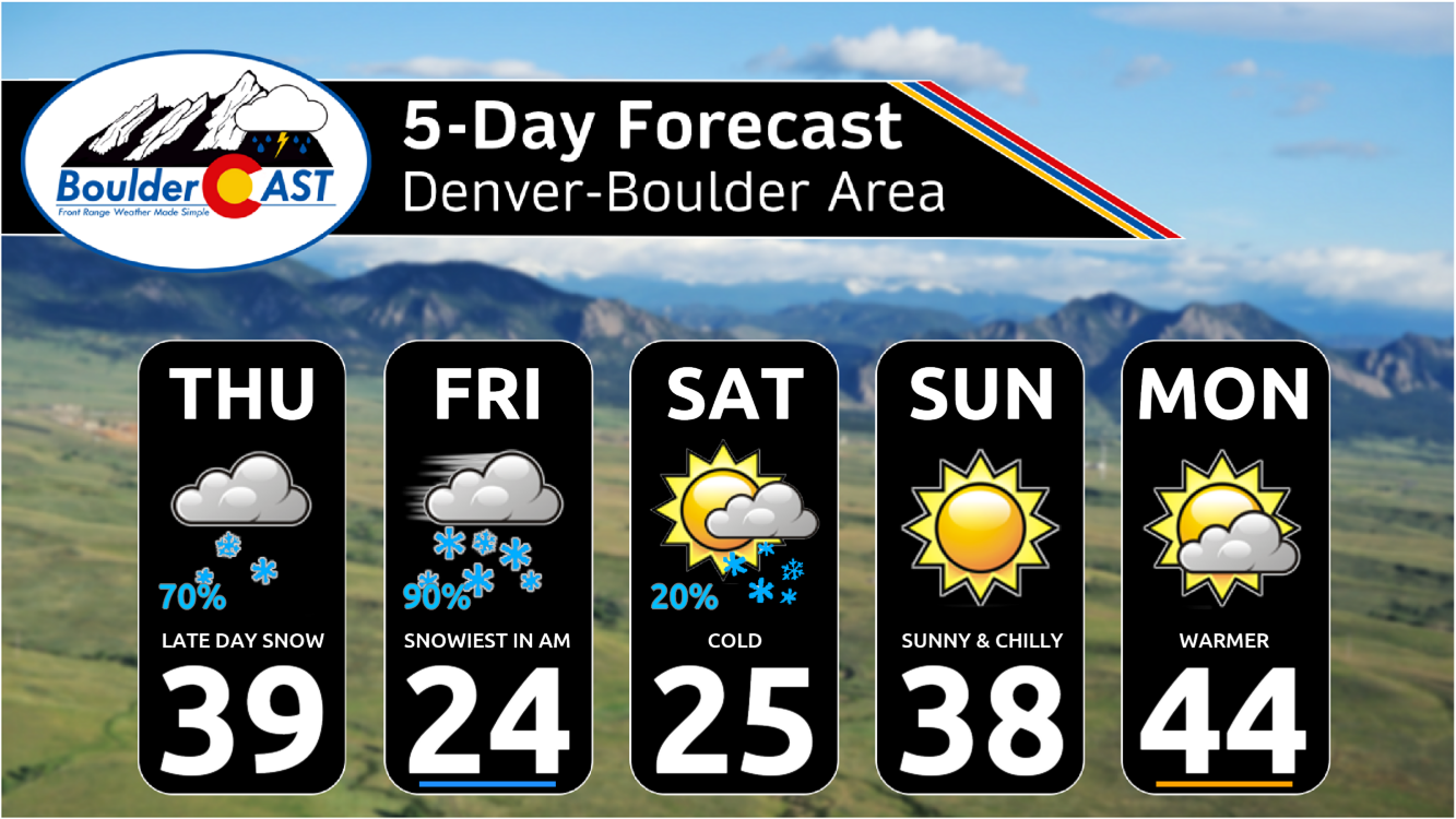
High temperatures on Thanksgiving will be in the upper 30s. It will be even colder Friday and Saturday with highs in the 20s. Overnight lows will be in the teens with single digits in the Foothills. Another taste of winter is indeed on the way!
That’s all we have for now. We’ll pass along timely updates on social media as needed and via an additional Premium Storm Update on Thanksgiving Day. Think snow!
From the entire BoulderCAST team, we wish you a safe and joyous Thanksgiving with your friends and family alike!
![]()
Get BoulderCAST updates delivered to your inbox:


You must be logged in to post a comment.